


Chapter 2 of The Kansas River Corridor--Its Geologic Setting,
Land Use, Economic Geology, and Hydrology
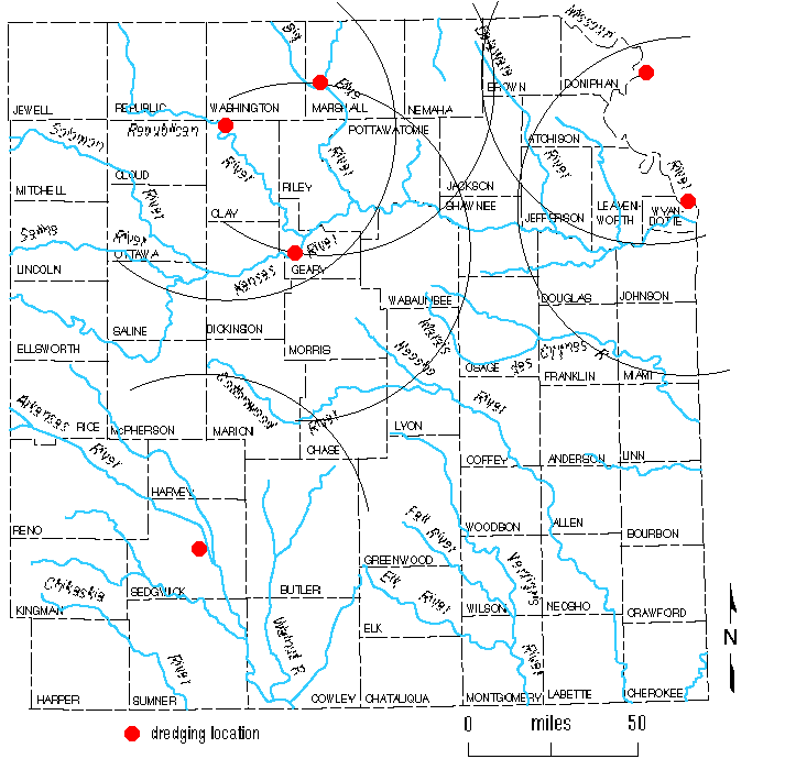
Larger version of Figure 2.8
FIGURE 2.8--Map of eastern Kansas with arcs of 50-mile
(80-km) radius from existing operations other than the Kansas River.
Back to chapter 2...
Kansas Geological Survey, Kansas River
Corridor Study
Electronic version Jan. 13, 1998.
Comments to webadmin@kgs.ku.edu
The URL for this page is HTTP://www.kgs.ku.edu/Publications/KR/kr_fig2-8.html