


Chapter 1 of The Kansas River Corridor--Its Geologic Setting,
Land Use, Economic Geology, and Hydrology
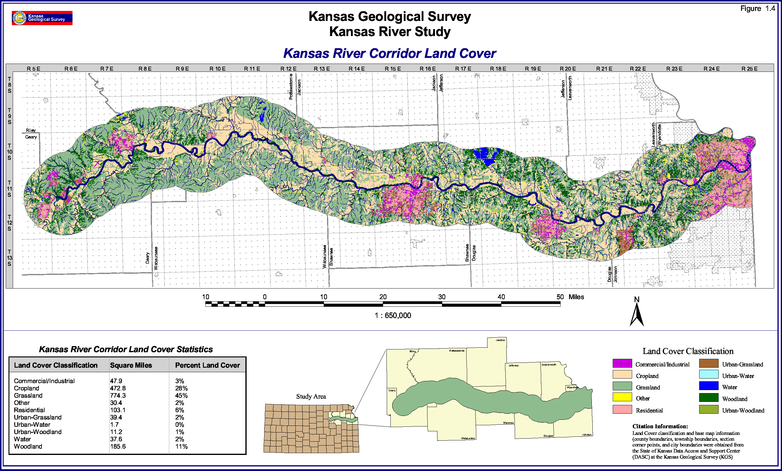
Figure 1.4--Large Version
FIGURE 1.4--Land-cover map and statistcs for the Kansas River corridor.
Please use your browser's "Back" command to return to the page you were
viewing.
Kansas Geological Survey, Kansas River
Corridor Study
Electronic version Jan. 13, 1998.
Comments to webadmin@kgs.ku.edu
The URL for this page is HTTP://www.kgs.ku.edu/Publications/KR/kr_fig1-4L.html