


Chapter 1 of The Kansas River Corridor--Its Geologic Setting,
Land Use, Economic Geology, and Hydrology
Figure 1.1--Large Version
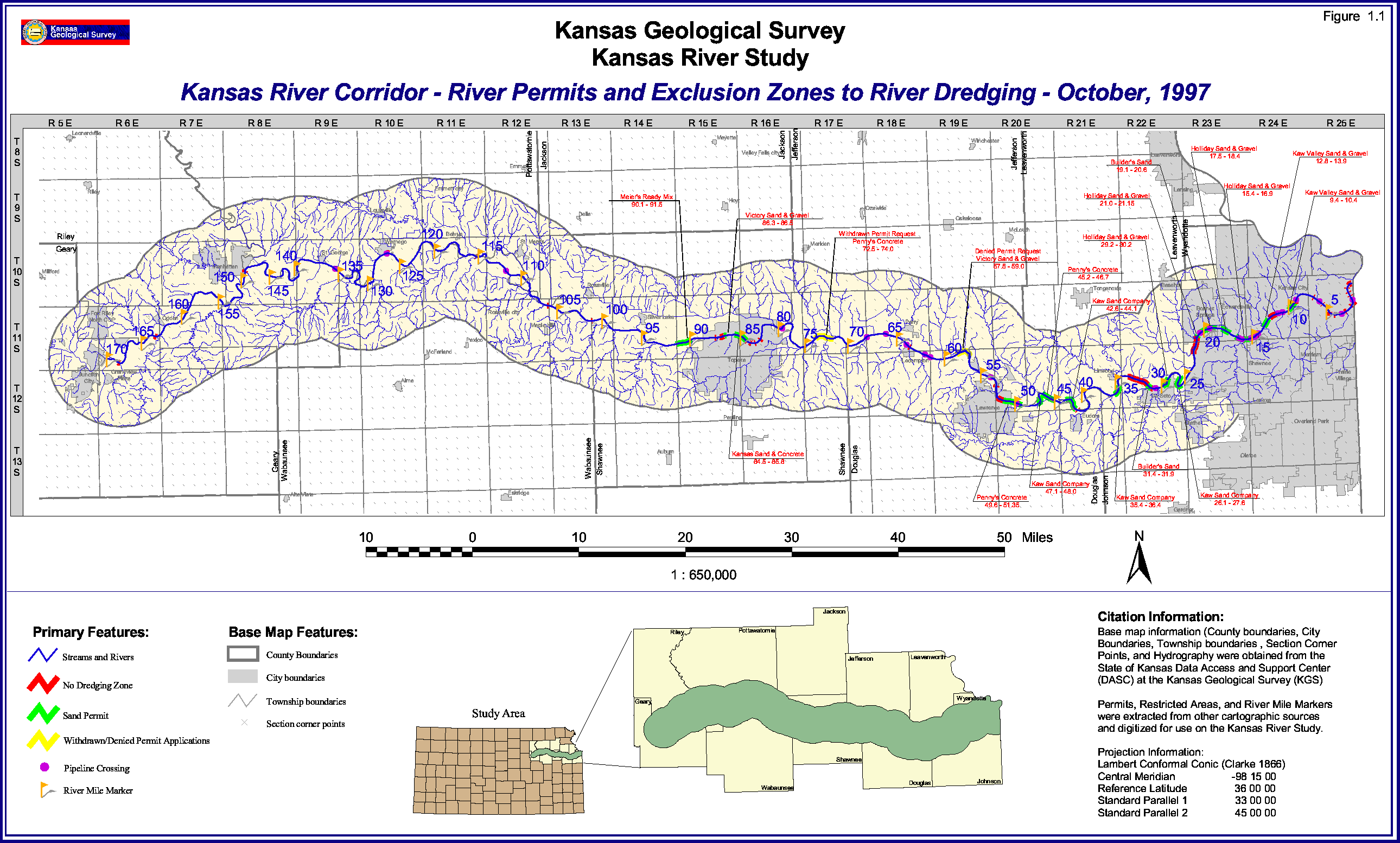
FIGURE 1.1--Map of part of northeast Kansas showing the Kansas River
corridor; Kansas River dredging permits and dredging exclusion zones as of October 1997;
pipeline crossings; river miles measured from the mouth of the Kansas
River; drainage in and around the corridor; and counties, cities, and towns.
Please use your browser's "Back" command to return to the page you were
viewing.
Kansas Geological Survey, Kansas River
Corridor Study
Electronic version Jan. 13, 1998.
Comments to webadmin@kgs.ku.edu
The URL for this page is HTTP://www.kgs.ku.edu/Publications/KR/kr_fig1-1L.html