![]()
Prev Page--Military Significance || Next Page--Plates
Appendix—Explanation of Maps
A map is a representation, to scale, of a portion of the earth's surface. There is an almost endless variety of maps, depending upon the purpose for which the map is intended—land maps, railroad maps, geologic maps, etc. Almost any good map is of some value for military purposes. However, special maps, commonly designated military maps, are used by all armies in the field. A military map is one which shows accurately all the features of the country which are of military significance. Besides towns, villages, rivers, railroads, and such features as are commonly shown on a good map, the military map must show the character of the ground, hills, valleys, and plains.
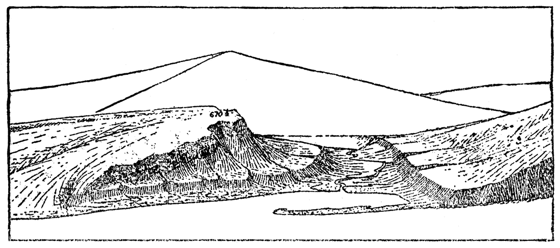
Figure 34—Ideal landscape with gentle and steep slope.
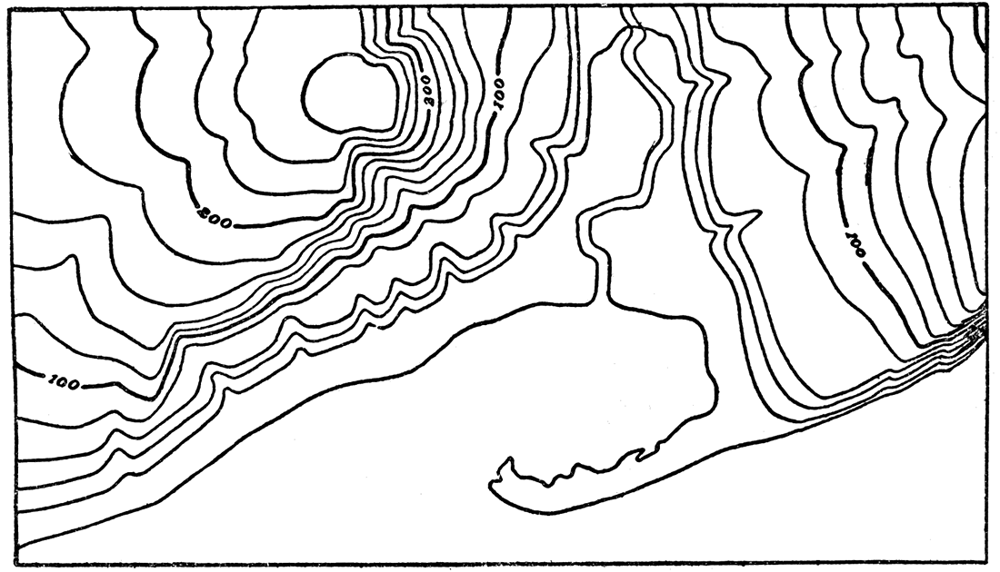
On American military maps the surface features are shown by means of lines, called contours. On the ground a contour is an imaginary line which passes through points that have the same altitude above sea level. Therefore, one who follows a contour goes neither up hill nor down, but always on a level. The contour lines on a military map, as in Plate I, show not only the shapes of the hills, bluffs, and valleys, but also their elevation above sea level. The line of the seacoast itself is contour O. The contour 20 feet above sea level would be the shore line if the sea were to rise 20 feet. Where contour lines are far apart, as on the bottom lands of Kansas river, or the tops of the upland divides, they show that the land is nearly flat, for it is necessary to go a considerable horizontal distance to move 20 feet vertically. Where contour lines are crowded close together, as along the river bluffs (Plate I and Plate VII), they represent a steep slope.
Figure 35—Model of the ideal landscape shown in Figure 34.
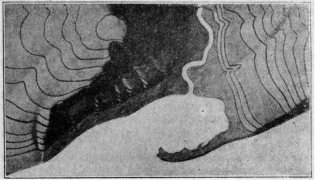
The manner in which contour lines express altitude, form and slope, is shown in Figures 34 to 36. The sketch, Figure. 34, represents a river valley between two hills. In the foreground is the sea with a bay that is partly enclosed by a hooked sandbar. On each side of the valley is a terrace into which small streams have cut narrow gullies. The hill on the left terminates abruptly at the valley in a steep scarp. Its surface slopes down gradually on the side away from the scarp, forming an inclined tableland, which is traversed by a few shallow gullies. On the map each of these features is indicated beneath its position on the sketch by contour lines.
Figure 36—Contour map of area shown in Figure 34. The contours are widely spaced on gentle slopes and close-crowded on steep slopes.
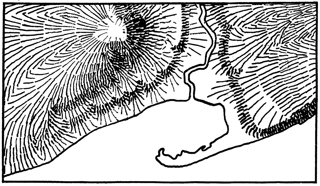
Official maps of the French military staff; Carte de France de l'Etat-major, represent surface features by down-slope lines or hachures, which are drawn short, heavy and close-set for steep slopes; long, fine and open-spaced for gentle slopes. A hachured map of the landscape shown in Figure 34 is given in Figure 37.
Figure 37—Hachure map of area shown in Figure 34. The direction of slope is indicated by the direction of the lines, the steepness of slope by the weight and crowding of the lines. Hachure maps are employed by the French genera) staff.
On the map of the Camp Funston region (Plate I) one inch represents approximately one kilometer of horizontal distance, and the map is divided by cross-ruled squares into quadrangles one kilometer each way. The scale of the map, 1:40,000, shows that one unit on the map equals 40,000 horizontal units on the ground, as, one inch on the map equals 40,000 inches on the ground.
Prev Page--Military Significance || Next Page--Plates
Kansas Geological Survey, Geology
Placed on web Feb. 12, 2018; originally published 1918.
Comments to webadmin@kgs.ku.edu
The URL for this page is http://www.kgs.ku.edu/Publications/Bulletins/4/05_maps.html