![]()
Prev Page--Contents || Next Page--Geography
Introduction
Kansas River valley has been studied from Kansas City to Kiro, near Topeka, and this investigation was begun in the summer of 1951 to extend the study upstream to Wamego. This investigation was made and the report was prepared to fulfill the requirements of a Doctorate thesis at the University of Kansas.
The increased use of ground water for irrigation in Kansas River valley from Kiro to Wamego has made it desirable to investigate the quantity, quality, and availability of ground water. This study was made to evaluate the present ground-water supply and to serve as a guide for future ground-water development.
Location and Extent of the Area
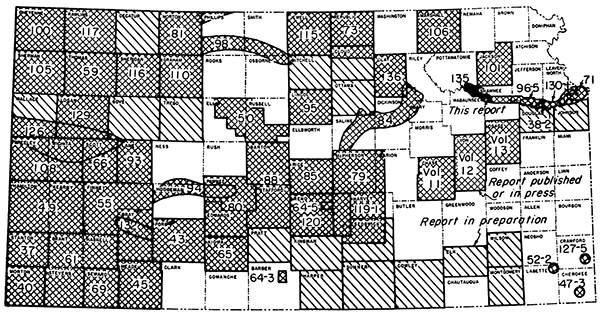
The part of Kansas River valley described in this report extends from the east boundary of Range 14 East near Topeka to the west boundary of Range 10 East near Wamego, a distance of 30 miles. The north and south limits of the area are governed by the geology and drainage (Fig. 1). The drainage area of Kansas River in the western part of Shawnee County, in the eastern part of Pottawatomie County, and in the northeastern part of Wabaunsee County was studied. A total of about 280 square miles was mapped; the main valley floor contains approximately 140 square miles.
Figure 1-Index map of Kansas showing area described in this report.
Previous Investigations
The stratigraphy of the Pennsylvanian rocks in the Kansas Valley region was described by Moore (1936, 1949), and their distribution is shown on the geologic map of Kansas (Moore and Landes, 1937). The Upper Pennsylvanian and Lower Permian rocks have been reclassified by Moore and Mudge (1956). The outcropping rocks of Pennsylvanian and Permian age in Pottawatomie County were mapped by Glenn Scott of the U. S. Geological Survey during 1948 and 1949, and this map will be published in a circular describing the construction materials of that county.
The first mention of glaciation in Kansas was by Hay (1892). He described some of the glaciated areas and recognized the southern limit of the ice advance in Kansas as coinciding with the bluffs along the south side of Kansas River valley in Wabaunsee County. Haworth (1894) explained the glacial gravels composed of flint or chert as deposits derived from local limestones. Because these gravels were poorly sorted, he concluded that water had acted on them only slightly, if at all. A study of the glacial boulders by Swem (1896) showed that 75 percent of them are 1 to 3 feet in diameter and composed of Sioux Quartzite. The quartzite shows little weathering, whereas granite boulders are deeply weathered.
Smyth (1896) described a well-defined boulder belt extending from the southeastern comer of Shawnee County northwestward to Shunganunga Creek, thence west northwest, which in Pleistocene time temporarily dammed Kansas River south of Wamego. Later, Smyth (1898) described a series of possible lakes formed by damming of Kansas Valley by glacial ice. Kaw Lake was the greatest of these, extending from Wabaunsee westward to Salina.
Todd (1911, 1918, and 1920) described and mapped Pleistocene deposits in eastern Kansas. He interpreted the age of the topographically high chert gravels to be Pliocene, concluding that they were overridden in places by the advancing ice. He recognized some major drainage changes and pointed out that most drainage ways have been deepened since retreat of the ice front.
Schoewe (1922, 1930, 1938, 1939) described many glacial deposits and mapped the location of glacial striae in eastern Kansas. The glaciated area of Kansas was remapped, and revised borders were delineated along the west and south of the territory.
By means of mineralogical and grain-size analysis of glacial sediments in the vicinity of Manhattan, Hamed (1938) concluded that field observations were not conclusive in establishing the origin of parent material of soils. Lill (1946) reported illite, a clay mineral, in glacial sediments, particularly in Marshall and Washington Counties, which lie to the west of the area of this report.
The first major attempt to correlate the nonglacial sediments of Pleistocene age in the central Great Plains with the glacial sediments was that of Frye, Swineford, and Leonard (1948). This correlation was based on petrographic and paleontological evidence. Frye and Leonard (1949) described the stratigraphic sequence in northeastern Kansas. Buried soils separating loess deposits were formed mainly during the interglacial stages. Frye (1949, p. 482) pointed out that fossil soils are perhaps the most usable lithologic criterion for stratigraphic correlation and classification of Pleistocene sediments in Kansas.
A subsurface reconnaissance of glacial deposits in northeastern Kansas was made by Frye and Walters (1950). That study disclosed a sag in the bedrock floor across southern Marshall and Nemaha Counties that was interpreted as a possible post-Nebraskan, pre-Kansan erosional feature. Their cross sections indicate that the surface traversed by the glaciers had less relief than the present surface.
Frye (1951) pointed out that all evidence seemed to indicate that interglacial intervals were times of soil formation and that glacial intervals were times of soil destruction or burial. The stratigraphic sequence in Kansas shows five major and several less distinct soil-forming intervals. The soils formed during these intervals, from oldest to youngest, are the Afton, Yarmouth, Sangamon, and Brady buried soils, and modern surface soil. The definition, description, and correlation of late Pleistocene loesses are included in a paper by Frye and Leonard (1951). The considerable difference between the early and late Pleistocene sediments throughout the state was pointed out.
Davis (1951) studied the gravels in the terrace deposits in Kansas River valley between Topeka and Lawrence. He concluded from the lithology that four principal gravels can be recognized: (1) pre-glacial gravels, (2) glacial outwash of Kansan age, (3) gravels from Kansas Till, and (4) gravels of Illinoian to Recent age. A report of the Pleistocene stratigraphy of Kansas by Frye and Leonard (1952) gives a history of the unit names and their present usage. Their report includes a summary of the Pleistocene geology of Kansas and a reconnaissance map that shows the areal distribution of Pleistocene sediments. The geology and ground-water resources of Kansas River valley between Lawrence and Topeka were described by Davis and Carlson (1952), who proposed the names Menoken, Buck Creek, and Newman for terraces along Kansas River.
Methods of Investigation
The geology of the area was mapped on aerial photographs having a scale of about 3 inches per mile and transferred to a base map (Pl. 1). Reconnaissance trips were made into adjacent areas to aid in comprehension of the regional geology. Rocks of principal interest in this study were those belonging to the Pleistocene Series. The sedimentary rocks of Pennsylvanian and Permian age were grouped into convenient units for mapping and for showing their relation to the Pleistocene sediments.
Wells were inventoried, and the depths to water, depths of wells, and other useful information are summarized in Table 7. Samples of water were collected from 15 wells, and chemical analyses of them were made by the State Board of Health (Table 4). The locations of wells inventoried, the depths to water, and the water-table contours are shown on Plate 2.
Information for three geologic cross sections (Pl. 3) was obtained from test drilling by the Federal and State Geological Surveys. Idealized geologic sections showing stages of development of Kansas River valley are given in Figure 4. Logs were prepared after examination of cuttings in the field, supplemented by microscopic examination of selected cuttings in the laboratory.
Samples of gravel were collected from various deposits in the, area, and the size distribution of constituent particles was determined by mechanical analyses. The material retained on the 4-millimeter sieve was studied further to determine its composition, as was done by Davis (1951) to differentiate gravels of four different ages.
Well-Numbering System
The well-numbering system used in this report gives the location of wells according to General Land Office surveys and according to the following formula: township, range, section, 160-acre tract within the section, and 40-acre tract within the quarter section. If two or more wells are in the same 40-acre tract, the wells are numbered serially according to the order in which they were inventoried. The 160-acre and 4O-acre tracts are designated a, b, c, and d in a counterclockwise direction beginning in the northeast quarter. Below are two examples illustrating the well-numbering system:
| Well number | General Land Office description |
|---|---|
| 10-12-20bc | SW NW sec. 20, T. 10 S., R. 12 E. |
| 9-14-6da | NE SE sec. 6, T. 9 S., R. 14 E. |
Acknowledgments
Much information was received from R. Hofenstein, Alma, E. J. Jungmann, Topeka, A. O. Caylor and A. W. Hoerman, Manhattan, and G. Cox, Clifton, well drillers in the area. Special thanks are due Joe Campbell, Clyde Rodgers, and Louis Smith for use of irrigation wells on their farms for aquifer tests.
The manuscript of this report has been reviewed critically by several members of the Federal and State Geological Surveys; by Robert V. Smrha, Chief Engineer, and George S. Knapp, Engineer. Division of Water Resources, Kansas State Board of Agriculture; and Dwight F. Metzler, Chief Engineer, and Willard O. Hilton, Geologist, Division of Sanitation, Kansas State Board of Health.
Prev Page--Contents || Next Page--Geography
Kansas Geological Survey, Geology
Placed on web June 16, 2014; originally published March 1959.
Comments to webadmin@kgs.ku.edu
The URL for this page is http://www.kgs.ku.edu/Publications/Bulletins/135/02_intro.html