![]()
Prev Page--Stratigraphy || Next Page--Economic Geology
Structural Geology
By structure the geologist means the arrangement of the various rock units in the earth's crust. The rocks of this area were deposited for the most part under water and upon surfaces that were nearly level. Since their deposition the rocks have been uplifted and tilted. The deformation of the rock beds took place probably over a long period of time, although the first uplift and tilting occurred relatively soon after the deposition of the muds, animal remains, and sands which now compose the indurated rocks.
The rock units as described in the first part of this report are layers of different thicknesses. Each rock layer or stratum is overlain by a younger stratum, and the whole in Wyandotte County dips to the north of west, so that anyone unit which occurs at a certain elevation in the eastern part of the area is at a much lower elevation in the western part. The land surface is not parallel to the dipping rock layers, but is inclined to the east, which accounts for the cropping out of the older rocks in the eastern part and the younger ones in the western part of the area. This dip of the rock layers to the north of west is prevalent over all of eastern Kansas and parts of neighboring states, and is the structural condition known as the Prairie Plains monocline. In Wyandotte County the general or regional dip is about ten feet to the mile.
The area is occupied by a series of small folds in which the rock layers are bowed upward into arches or "structures" which are called anticlines, and into down-folds which are called synclines. These local structures in places dip as steeply as fifty or more feet to the mile. Such an anticline extends nearly across the county from southwest to northeast, from near Bonner Springs to sec. 25, T. 10 S., R. 23 E., the Maywood anticline. Another conspicuous up fold is near Morris on the north side of Kansas river and probably extends into Johnson County. The Morris anticline brings the Winterset limestone high above the flood plain of the river and has a dip of nearly forty feet to the north and northwest within a quarter of a mile. This series of folds is perhaps of economic importance in this and neighboring counties.
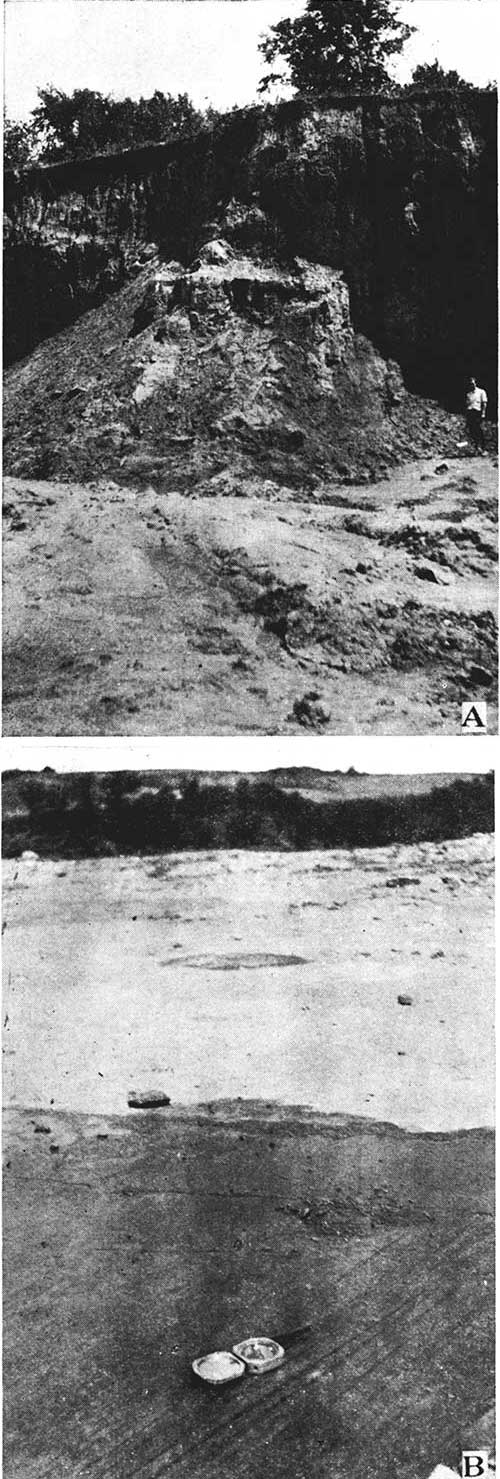
Plate XXIII--A, Loess along Missouri river bluff near the foot of Fifth street, Kansas City, Kan. B, Glacial pavement on Argentine limestone at Boyn's Quarry, NE sec. 25, T. 10 S., R. 24 E.
The structural map included in this report was prepared from field observations made with a Paulin altimeter. The map is accurate insofar as it shows all of the more pronounced structural features, including the local folds, the Maywood and Morris anticlines and others. The structure is shown on the map by the usual method of drawing contour lines through points of equal elevation on the surface of the given rock bed. The upper surface of the Argentine limestone is the datum plane. The contour interval or the difference in elevation as represented by two adjacent contour lines in ten feet.
Relation of the attitude of rock beds to the occurrence of oil and gas. Most geologists are of the opinion that oil and gas, as found in the earth, have originated from organic matter which was buried along with the other materials which have been changed into rocks. The organic materials may have been either plants or animals or perhaps both. When one sees the vast quantity of fossil shells, such as are so common in rocks in Wyandotte County, he does not deny the possibility that such organisms contribute to the formation of oil or gas.
Commercial accumulations of oil and gas are generally found in more or less minute openings in rocks buried some depth below the surface. Porous rocks are generally the best "oil sands," but they are not in all cases sandstones. Since oil and gas are lighter than water they will rise to the surface, and since gas is lighter than air it will escape into the atmosphere if free to do so. As water occurs almost everywhere in the rock openings, it is necessary that something prevent the upward trend of the lighter materials if oil and gas are to accumulate in natural reservoirs. It is believed that oil and gas, if present, will be forced upward by ground water in a dipping bed of porous rock until stopped by some obstruction. Hence, if a bed of sandstone containing water, oil and gas lies under a bed of impervious shale, and is arched into a dome or an anticline, the gas will accumulate below the impervious shale at the crest of the upfold, the oil will collect a little farther down, and the water will remain in the lower parts of the sandstone. For reasons stated above the petroleum geologist looks for anticlines in his quest for the location of new fields. There are several other types of structure which are favorable for the accumulation of gas and oil, some of which may be detected by the scientific investigation of the surface conditions. Cox, Dake, and Muilenburg give a concise explanation of the favorable structure. [Cox, G. H., Dake, C. L., and Muilenburg, G. A., Field methods in petroleum geology, pp. 3-12.] It is worthy of note that considerable accumulation in eastern Kansas has taken place in irregularly shaped buried layers of sandstone. Such structural conditions are known as "shoestrings" and cannot readily be detected by surface observations.
A considerable quantity of natural gas has been produced in Wyandotte County. There is little doubt that the accumulation of these materials has been to some extent controlled by structure, and it is hoped that the descriptions and identification of rock strata, as well as the more general structural features as described and illustrated in this section, are of value to petroleum geologists in locating whatever deposits of gas and oil exist undiscovered below the surface of the county.
Prev Page--Stratigraphy || Next Page--Economic Geology
Kansas Geological Survey, Geology
Placed on web Feb. 25, 2014; originally published May 1935.
Comments to webadmin@kgs.ku.edu
The URL for this page is http://www.kgs.ku.edu/General/Geology/Wyandotte/04_struct.html