![]()
Prev Page--Contents || Next Page--Stratigraphy
Geography
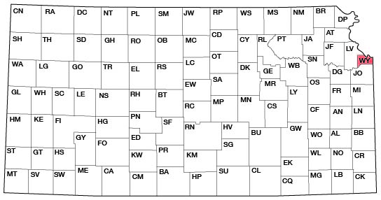
Wyandotte is one of the northeastern-most counties of Kansas. It is roughly triangular in shape, and lies principally between Missouri and Kansas rivers. It is bounded on the north and west by Leavenworth county, on the north and east by Missouri river; on the east by Jackson county, Missouri; and on the south by Johnson County and Kansas river. Although Wyandotte County has the largest population of any in Kansas, it is the smallest county in the state, having an area of about 143 square miles.
Figure 2--Index map of Kansas showing location of Wyandotte County.
History and Development
[The writers have drawn freely upon the work of Dr. F. W. Blackmar, Kansas, A Cyclopedia of State History, 1912, for this section.]
The early history of Wyandotte County is inseparable from that of the settling of the first town in the area, Wyandotte, which with several other communities is now called Kansas City, the state's largest city, with a population of nearly 125,000.
When whites first visited northeastern Kansas, the country was in the possession of the Kaw or Kanza tribe, whence came our name for the river and indirectly for the state and city. It is tradition that the ancestors of these Indians had separated from the Omaha, or upstream people, who had come here from the region of the Ohio and Wabash rivers. The separation is supposed to have taken place at the mouth of Kansas river, and the tribe was prevented from extending beyond the present northern boundary of Kansas by the Iowa and Sauk tribes, who had already received firearms from white traders in the north. The Kanza people had probably not been in contact with civilization. The Kanza tribe occupied twenty or more villages along the rivers before they were settled at Council Grove in 1847. They were removed to Indian Territory in 1873. The Delawares had been assigned a reservation "in the fork of the Kansas and Missouri rivers" in 1829, and in 1832 they were given land including the present Wyandotte, most of Leavenworth and Jefferson, and some of Jackson and Shawnee counties. The Wyandots, the last Indians to hold land in Wyandotte County, did not come until 1843.
In their exploration of Missouri river the French reached as far north as the mouth of Kansas river early in the eighteenth century, and soon there were numerous couriers des bois in the region of what is now greater Kansas City. These Frenchmen were in contact with an Indian tribe to whom they gave the name Kaw. The name Kanza is the most widely accepted designation of this tribe as used by the people themselves before contact with the French. Lewis and Clark were within the area of the present Wyandotte County in 1804. In 1812 the Chouteau brothers built a trading post on the north bank of Kansas river. They were the first permanent white settlers. Missionaries who established a mission among the Delawares in 1831, and built a church in 1832, were the second whites to settle permanently. This first church was erected at the site of the present village White Church, on United States highway 40, some eight miles west of Kansas City.
The Wyandots came from Ohio in 1843. They were a civilized people and the institutions which they established were as good or better than those of the white frontiersmen. They purchased land from the Delawares where the city of Wyandotte was later built, and a settlement was at once established. Their interpreter, J. W. Armstrong, built the first house of the settlement in 1843 and the following year he established the first free school. Of the seven stockholders of the town company which founded Wyandotte, three were Wyandots. The first sale of lots took place in 1857 and a post office was established the same year. In 1858 a town government was granted and Wyandotte was established. The area in which the town was built was then a part of Leavenworth county. Wyandotte County was established the next year from the southeastern part of Leavenworth county and that portion of Johnson County lying north of the township line between townships 11 and 12 south and east of range 23 east.
Several other towns have merged with Wyandotte to form the present Kansas City. Armstrong, an early settlement on the north side of Kansas river and south of Wyandotte, was soon absorbed by the latter. Quindaro was north of Wyandotte. Armourdale, north of Kansas river, still has its identity, as to a greater degree have Argentine and Rosedale south of the river. The business districts of these last two are quite distinct from that of Kansas City proper. Rosedale was the last city to be annexed, the merger taking place 1922.
The conflict over slavery affected Wyandotte soon after its birth. The Methodist Church was soon divided, causing it to lose its hold upon the Indians, with the result that drunkenness and disorder became prevalent. The first temperance society in Kansas was founded among the Indians and a log jail was built at Wyandotte. When the gold rush to California began in 1849, thousands passed through the county. The Chouteau trading post and other business institutions flourished. Many Mormons in their westward migration also passed through.
In 1859 a constitutional convention meeting in Wyandotte framed the constitution under which Kansas was admitted to the Union. Like other early eastern Kansas towns, Wyandotte suffered much during and immediately after the Civil War. The city and county were represented in many Kansas regiments.
The growth of the remainder of the county has been rapid and several other towns have developed simultaneously with greater Kansas City. Bonner Springs is in the southwest corner of the county on the north bank of Kansas river, seventeen miles west of Kansas City. The town was originally called Tiblow and soon developed into a banking center for that part of Wyandotte County. Edwardsville is on the north side of Kansas river about thirteen miles west of Kansas City. Muncie, a small village, is on the same side of the river about eight miles from Kansas City. Turner, another small village, is seven miles west of Kansas City on the south side of Kansas river. Maywood and White Church are small hamlets in the western part of the county on United States highway 40. A few miles west of the northwestern part of Kansas City is the village of Welborn, and a little farther west is the little hamlet, Bethel. Wolcott is a village in the northern part of the county, eleven miles northwest of Kansas City. Pomeroy, a few miles southeast of Wolcott, has now nearly lost its identity due to the shifting of local traffic from the railroad to the highway. Nearman is a little village on the Missouri Pacific Railway a few miles northwest of Kansas City.
According to the 1930 census the population of Wyandotte County is 141,211. The population of Kansas City, Kan., is 121,857.
Industries
Agriculture, including truck-farming, is the important industry of the rural part of Wyandotte County. Truck-farming and fruit-growing are largely confined to the loess-covered eastern part of the county and to the Kansas river valley. The western part of the county is largely devoted to dairying and to general farming. A considerable percentage of the rural population is employed in greater Kansas City. The chief industries of Kansas City, Kan., are, in order of relative importance: meat-packing, flour-milling, manufacture of soap, structural steel, repair and construction of railroad cars, oil-refining, druggists' preparations, and the manufacture of ice cream. In 1927 the total value of the city's manufactured output was $304,000,000. This is forty-four percent of the entire manufactured output of Kansas. Approximately sixty-six percent of this is from the meat-packing industry.
Transportation
The Atchison, Topeka, and Santa Fe Railroad crosses the county from east to west along the south side of Kansas river. This road enters Kansas City by way of Argentine. Paralleling the Santa Fe are the tracks of the Union Pacific, which are on the north side of the river. Trains of the Chicago, Rock Island and Pacific also pass over the Union Pacific tracks. The Missouri Pacific Railway passes along the northeastern side of the county along Missouri river. The Chicago Great Western trains also use the Missouri Pacific tracks. The Saint Louis and San Francisco Railroad crosses the southeast corner of the county and enters Kansas City by way of Rosedale. The Missouri, Kansas and Texas trains use these tracks. The proximity of Kansas City, Mo., lends the rail facilities of that city to Wyandotte County and to Kansas City, Kan., so that the county has by far the best shipping facilities of the state. The service of the Kansas City and Northwestern Railroad, which formerly traversed the county from east to west, has been discontinued for some time and the tracks have been removed. An electric railroad operating between Kansas City, Mo., and Olathe in Johnson County crosses the southeast corner of Wyandotte County. Another enters the Rosedale area from the west, operating a short distance into the suburban district of Johnson County. An electric line from Lawrence parallels the Union Pacific tracks along the north side of Kansas river. Another operates between Kansas City and Leavenworth. Kansas City, situated at the confluence of Missouri and Kansas rivers, will benefit, as will all of Wyandotte County, by the river improvement now being conducted by the federal government. Steam and electric railroads are shown on the map showing areal geology.
There were fifty-eight miles of hard-surfaced roads in the county's rural area in 1930. Almost all of the others are all-weather roads. Much concrete pavement is now being laid and many of the side roads are concrete. Four United States highways enter Kansas City, Kan. These are paved across the county and beyond. A recent survey of the State Highway Department indicates that approximately 6,500 vehicles pass over the highways entering Kansas City, Kan., each day. Automobile stage lines operate from Kansas City in all directions. Kansas City, Kan., has one of the country's leading airports. Passenger-carrying planes of several companies operate on regular schedules to various parts of the United States.
Climate
Over a period of twenty-four years the mean annual precipitation in Kansas City, Mo. (adjacent to Wyandotte County), has been 37.28 inches. In Leavenworth, just north of Wyandotte County, for a period of eighty-six years the mean annual precipitation has been 34.30 inches. The annual mean temperature in Kansas City, Mo., based on long records is 53.2 degrees F. The mean for January, the coldest month, is 26.2 degrees F., and for July, the hottest month, is 77 degrees F. Over a period of twenty-four years the length of the growing season (from last to first killing frost) in Kansas City, Mo., ranged from 164 to 216 days.
Elevations
Geologists and engineers working in Wyandotte County will find the bench marks described below easy to locate. Elevations are based upon mean sea-level datum.
| Location and description of bench mark. | Elevation, Feet |
|
|---|---|---|
| Kansas City: | ||
| Top of rail on Union Pacific R. R. bridge over Kansas river | 578.31 | |
| Culvert 3.87, Union Pacific R. R., X on north end, wall east side | 755.15 | |
| Culvert 4.03, Union Pacific R. R., X on north end, wall east side | 756.14 | |
| Culvert 5.92, Union Pacific R. R., X on north end, wall east side | 764.42 | |
| Bridge 6.87, Union Pacific R. R., X on west backwall south side | 757.76 | |
| Argentine station, Santa Fe R. R., west end stone sill west door in north side of depot | 753.62 | |
| Argentine station, Santa Fe R. R., top northeast corner concrete base first semaphore west of depot | 753.35 | |
| Kansas City University, south end lowest step, entrance to Wilson Hall | 947.17 | |
| Turner: | ||
| Signal tower, Santa Fe R. R., northeast corner concrete door sill north end | 771.12 | |
| Crossing bell, Santa Fe R. R., mile post 7 plus 6215, northeast corner of the concrete base | 763.24 | |
| Muncie: | ||
| Bridge 9.63, Union Pacific R. R., X on east abutment north wing wall | 776.28 | |
| Bridge 11.38, Union Pacific R. R., X on east back wall north end | 762.40 | |
| Bridge 13.42, Union Pacific R. R., X on north end wall east end | 771.84 | |
| Morris: | ||
| Bridge 100B, Santa Fee R. R., square cut in top of northwest corner parapet east abutment | 767.92 | |
| Edwardsville: | ||
| Bridge 14.66, Union Pacific R. R., X on north end wall east end | 774.84 | |
| Holliday: | ||
| Water tank, Santa Fe R. R., base of tank | 762.36 | |
| Semaphore, Santa Fe R. R., top of concrete base of first semaphore west of signal tower | 764.57 | |
| Forest Lake: | ||
| Culvert 16.28, Union Pacific R. R., X on north end wall east corner | 778.85 | |
| Bonner Springs: | ||
| Signal No. 171, Union Pacific R. R., X on south side of signal foundation. (About 1,200 feet east of A. T. & S. F. crossing) | 789.50 | |
| Bridge 19.87, Union Pacific R. R., X on east backwall north end | 782.93 | |
| Loring: | ||
| Depot, Union Pacific R. R., B. M. on southwest corner west side foundation of depot | 786.74 | |
| On U. S. highway 40: | ||
| Cement floor at gas pump, Standard Oil filling station, two tenths of a mile east of SW cor. sec. 34, T. 10 S., R. 24 E. | 1,151 | |
Numerous other bench marks in this area are described in Bulletin 571 of the United States Geological Survey. However, many of these are gone because of changes in cultural features. For general elevations the topographic map of the Kansas City quadrangle, published by the United States Geological Survey, should be consulted.
Topography
The topographic features of Wyandotte County are in the main produced by the two major streams, Missouri and Kansas rivers, and their tributaries, the surface being deeply dissected. The rocks of this region, as in adjoining parts of the state, consist of beds of limestone, shale, and sandstone, dipping gently to the northwest. The relief is not unlike that of adjacent areas, the maximum difference of elevation being approximately 320 feet, ranging from less than 740 feet above sea level at Missouri river on the east to about 1,060 feet on the upland of the western part. of the county. The stream pattern is typically a dendritic one, with occasionally a suggestion of a trellis pattern in the tributaries of Kansas river. The course of Kansas river across the county appears to be controlled largely by the attitude of the underlying rocks, as can be seen by referring to the accompanying structural map of Wyandotte County.
The land surface consists of rolling upland occupying the divide between the two rivers, and a relatively large area occupied by the stream valleys. The county lies just within the boundary of the Glaciated Plains and presents the topographic features of early maturity, modified but slightly by the Pleistocene glaciation.
As a result of the proximity of the two rivers, which bound the county on three sides, the uplands are restricted to a comparatively narrow divide, which in general is somewhat closer to the Missouri than to Kansas river. This is especially true in eastern Leavenworth county where the divide swings northward with Missouri river, and the tributaries to the Missouri are shorter than the southward flowing streams.
Part of the uplands are modified by thick deposits of loess and drift, especially in the eastern and northern parts of the county adjoining Missouri river, where the surface presents the rolling aspect typical of many loess-covered regions.
The area covered by the valleys of the two rivers and their principal tributaries includes a considerable part of the county. The flood plain of Missouri river ranges from two to more than three miles in width adjoining the county, while that of Kansas river averages slightly over a mile, being somewhat narrower than in many areas to the west of Wyandotte County. High bluffs rise above the flood plains of both rivers.
The exposed strata control the configuration of the valley walls, the limestone beds forming terraces and the shale beds producing more or less gentle slopes. In general, the distinct benches are formed by the Dennis, Westerville, Drum, Argentine (in particular), Plattsburg and Stanton limestones. The remainder of the limestone and sandstone beds are either too thin or not sufficiently resistant to produce distinct terraces.
In a few places alluvial terraces occur along tributaries of Kansas and Missouri rivers, principally along those of Kansas river. The tributaries to Missouri river within the area are relatively short and have correspondingly high gradients. The streams following into Kansas river may be divided into two categories, those having a low gradient, a wide open valley, and a broad plain; and those having a relatively high gradient, narrow, steep valley, and no flood plain. Streams of the former class include Big Stranger creek, Wolf creek, and Little Turkey creek on the north side of Kansas river, and Wakarusa creek, Kill creek, Cedar creek and Mill creek on the south side of the river. These streams have terraced valley walls in places and wide flood plains, into which in some cases' the streams are now actively cutting. Kill creek, for example, near De Soto, Johnson County, is now cutting its bed for a considerable distance in solid rock, whereas the alluvial terraces indicate that the valley was previously filled to a considerable depth and is now being excavated again. Several causes may be considered in seeking the origin of these stream terraces. Among other agencies may be listed (1) regional uplift resulting from the ice retreat, (2) climatic change with consequent change in the amount of precipitation, (3) and recent cultivation of the soil producing a corresponding increase in the surface runoff. It seems probable that the last of these agencies could produce many of the alluvial terraces observed in northeastern Kansas.
Prev Page--Contents || Next Page--Stratigraphy
Kansas Geological Survey, Geology
Placed on web Feb. 25, 2014; originally published May 1935.
Comments to webadmin@kgs.ku.edu
The URL for this page is http://www.kgs.ku.edu/General/Geology/Wyandotte/02_geog.html