Kansas Geological Survey, Open-file Report 2002-54
Back to paper...
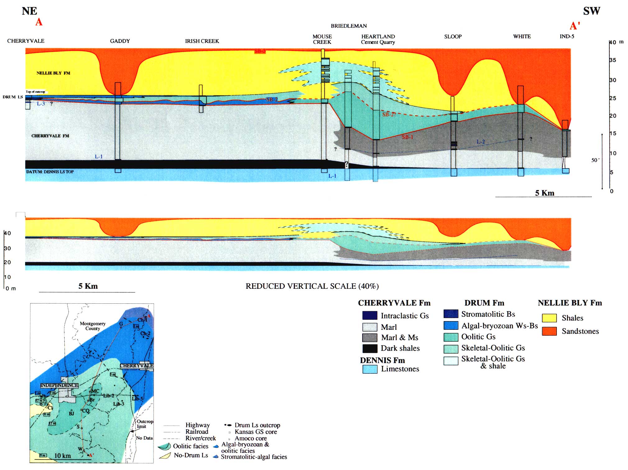
Figure 3--Cross section of the Drum and associated strata in the southeastern Kansas study area (see map). Note that the lower cross section is the same as the upper cross section by at a reduced vertical scale. Map shows location of cross section and distribution of Drum facies. Modified from Gomez-Perez et al. (2000).
Kansas Geological Survey, Geology
Placed online Sept. 4, 2007; OFR from 2002.
Comments to webadmin@kgs.ku.edu
The URL for this page is http://www.kgs.ku.edu/Publications/OFR/2002/OFR02_54/fig3.html