![]()
Prev Page--Contents || Next Page--Geography
Introduction
Purpose and scope of the report
During the summers of 1950 and 1951 separate studies were made by us of the geology and ground-water resources, of parts of Kansas River Valley between Lawrence and Topeka. These studies were sponsored by the State Geological Survey and were used to fulfill thesis requirements at the University of Kansas. The data collected for these two investigations have been combined in this report. Cooperative investigations of ground-water resources in Kansas were initiated in 1937 and this report conforms to the general procedures followed in the state-wide program. The cooperative investigations are carried out by the U.S. Geological Survey and the State Geological Survey of Kansas in cooperation with the Division of Sanitation of the State Board of Health and the Division of Water Resources of the State Board of Agriculture.
For many years there has been an increase in the use of ground water for industrial and municipal purposes in the Kansas River Valley in the vicinity of both Lawrence and Topeka. Owing to the constantly increasing demands for ground water in this area, it is necessary to have an adequate knowledge of the quantity and quality of the available supply, where and how additional supplies can be obtained, and what measures may be necessary to safeguard their continuance. These studies were made to guide future ground-water development and to better evaluate present ground-water problems.
Location and extent of the area
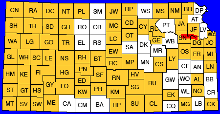
The area covered by this report is in northeastern Kansas and includes the southern part of Jefferson County, the northwestern part of Douglas County, and the east-central part of Shawnee County (Fig. 1). It is approximately 9 miles wide and parallels Kansas River between the eastern edge of Lawrence and the community of Kiro which is 4 miles west of Topeka. It has an area of slightly more than 300 square miles.
Figure 1--Index map of Kansas showing area covered by this report arid areas for which cooperative ground-water reports have been published or are in preparation.
Previous investigations
The stratigraphy of Pennsylvanian rocks in eastern Kansas has been described by Moore (1936, 1949) and the distribution of these rocks has been shown on the State geologic map (Moore and Landes, 1937). More recently Lins (1950) described and mapped the Tonganoxie sandstone which is an important aquifer in the vicinity of Lawrence.
Todd (1909, 1911, 1923) mapped the glacial border in Kansas and described a number of Pleistocene drainage pattern changes. Schoewe (1930) remapped the glacial border south of Kansas River. A petrographic study of clayey soils developed on till and high terraces along Kansas River was made by Hoover (1936). Frye and Walters (1950) have made a subsurface reconnaissance of glacial deposits in northeastern Kansas,
Ground-water investigations in eastern Kansas were made by the Kansas Emergency Relief Committee in 1934 and by the Works Progress Administration in 1936. The work consisted primarily of locating gro,und-water supplies and constructing community wells in upland areas. Typewritten reports summarized the work in many of the counties including Douglas County, but no reports were prepared f or Jefferson and Shawnee counties. A ground-water study of the Kansas River Valley in the vicinity of Lawrence was made by Lohman (1941). Fishel (1948) made a ground-water study of the Kansas River Valley in the vicinity of Kansas City.
A hydrologic study of Kansas River has been made by the Corps of Engineers, U.S. Army (Wyman, 1935).
Methods of investigation
The geology of the, area was studied and mapped (Pl. 1) during the summer and fall of 1950. Wells were inventoried and auger holes dug during six weeks in the spring and summer of 1950. The altitude of the measuring points of wells in the valleys and the ground surface at test-hole and auger-hole locations were measured with a plane table and alidade. Elevations of some measuring points on upland wells were determined from topographic maps and other elevations were measured by an altimeter. Location of wells inventoried, type of wells, depth to water, and ground-water contours are shown in Plate 2.
Information for three geologic cross sections (Pl. 3) was obtained by drilling 19 test holes through the water-bearing formations with the hydraulic rotary drilling machine owned by the State Geological Survey of Kansas. The drilling was, done, during the summer of 1950 by William T. Connor and Lawrence Gnagy. Logs were prepared by us in the field and were later supplemented by microscopic examination of the well cuttings.
Samples of water from 15 wells in the area were collected by us in November and December 1950 and were analyzed by Howard Stoltenberg, chemist in the Water and Sewage laboratory of the Kansas State Board of Health.
The base map of the area used in Plates 1 and 2 was compiled from aerial photographs, U.S. Geological Survey topographic maps, and from county maps prepared by the State Highway Commission of Kansas. The geology was mapped in the field at a scale of 2.64 inches to the mile.
Well-numbering system
The well and test-hole numbers used in this report give the location of wells according to general land office surveys and according to the following formula: township, range, section, 160-acre tract within that section, and the 40-acre tract within that quarter section. If two or more wells are located within a 40-acre tract the wells are numbered serially according to the order in which they were inventoried. The 160-acre and 40-acre tracts are designated a, b, c, and d in a counterclockwise direction, beginning in the northeast quarter. Below are given two examples illustrating the well-numbering system.
| Well number | General land office description |
|---|---|
| 11-15-12ab | NW NE sec. 12, T. 11 S., R. 15 E. |
| 12-17-2cd | SE SW sec. 2, T. 12 S., R. 17 E. |
Acknowledgments
Appreciation is expressed for the friendly cooperation of the citizens of Topeka, Lawrence, and the surrounding communities. Well drillers, city engineers, industrial engineers, and individual owners gave freely of their time and knowledge. Among the industries supplying much useful information were the Westvaco Chemical Company; John Morrell and Company; Hill Packing Company; Beatrice Foods, Inc.; Atchison, Topeka, and Santa Fe Railway Company; and the Kansas Power and Light Company. Jungman Bros. of Topeka, J. S. Holmes of Lawrence, and Layne-Western Company of Kansas City gave generously of information concerning wells which they have drilled in the area.
Special thanks are due Ralph Button who allowed a test hole to be drilled on his property and Frank Baird who gave permission for his irrigation well to be used as an observation well.
Prev Page--Contents || Next Page--Geography
Kansas Geological Survey, Geology
Placed on web April 10, 2012; originally published June 1, 1952.
Comments to webadmin@kgs.ku.edu
The URL for this page is http://www.kgs.ku.edu/Publications/Bulletins/96_5/02_intro.html