Kansas Geological Survey, Bulletin 90, Part 6, originally published in 1951
Next--Letters D through O...

Originally published in 1951 as Kansas Geological Survey Bulletin 90, Part 6. This is, in general, the original text as published in 1951. The information has not been updated. An Acrobat PDF version (7.6 MB) is also available.
Geologic structures, numbering 161, in Kansas that have received names are listed and defined. Some of them are discussed briefly.
A working definition of "geologic structures" is formulated with some difficulty. In the language of some people, geologic structures embrace geologic entities formed by diastrophism, sedimentation, and vulcanism, and even erosion. Thus included as geologic structures are land forms that are the result of sedimentation, elevation, and erosion; ore bodies; stratigraphic units; and igneous masses; in fact all forms that are present in the earth's crust. In this sense, structural geology is almost or quite as broad as is geology itself. Most geologists, however, use the term in a more exclusive way and geologic structures commonly are said to include elements that owe their form to folding or faulting in the earth's crust. In this sense, also, structures might mean many things and the continents and ocean basins would be regarded as great structures and there would be many structural elements of decreasing magnitudes. Here, however, structural elements are considered in the restricted sense (those of importance in reference to the geology of Kansas); hence they are mostly of relatively small size.
There may be some difference of opinion regarding the exact meaning of the terms folding and faulting but it is sufficient here to state that as the terms are used in this paper they necessarily do not mean results of deep-seated earth movements. On the other hand some of the Kansas "structures" are the effects of irregular compaction of sediments above buried hills or subsidence of strata following solution and removal of underlying rocks. They resulted from movements that affected a relatively shallow part of the earth's crust. Some of the "structures" may be cogenetic with the rocks--that is, sediments accumulated on slopes of hills that are now buried. Most of the features listed in this index, however, are geologic structures, in as narrow a sense as would be entertained by anyone.
Only inasmuch as this paper lists, defines, and discusses briefly the Kansas structures that have received published names during little more than half a century (but mostly during the last 30 years), should it be regarded as a discussion of the structural geology of Kansas. It is true that the major structures, which constitute the "framework" of the State (Figs. 1 and 2), are known fairly well, but only a fraction of the smaller structures have received formal designations and are included here. The density of structural names (Table 1) is only in part a reflection of the irregularity of the attitude of rock layers in various parts of Kansas. It is more an indication of areas that have been studied more closely. In part it reflects the attitude of many geologists toward giving names, for many anticlines and other structures in Kansas have been mapped and described but not named in published reports. Many privately held maps show named anticlines, domes, and synclines, comparable to many that are listed in this paper, but names on unpublished maps cannot be included here. Furthermore, it is well known that many, perhaps the majority, of Kansas oil fields lie above structural domes and anticlines, but only in comparatively few instances have the geologic structures been named formally in published reports.
In practical applications the structure of rock layers ranks with their physical character in importance. It is well known that structure plays an important role in oil and gas accumulation; it is scarcely less important in ground-water geology. Rock structure, even though not of great magnitude, has bearing on mining, quarrying, and other operations that involve removal or penetration of rocks. In consequence the structural geology of Kansas has interest for many people.
Kansas geologic structures may be divided roughly into classes called major and minor and that classification is used to some extent in this index. Because of the widespread and significant disconformity that separates rocks of Pennsylvanian age from older divisions, it is also convenient to classify some structures as post-Mississippian, segregating them from more ancient structures. In discussions of the structures listed in this paper some emphasis is placed on their age classification.
The structures listed in this paper are those that have received definite names in a published report. Most of the names are geographic. Good usage of structural terms should entail place names and priority and wide usage should have the same weight in naming structures as they do in naming rock formations. There has been considerable carelessness in this respect, and in cases where structures have received more than one name, priority and usage are cited. Indefinite geographic limitations to the application of names, especially along the lengths of anticlines or anticlinal trends, is another source of confusion.
There are many examples in the literature of a single structural element having received two or more common names in conjunction with or without the same geographic name. A segment that shows evidence of positive or rising movements may be called an arch, an anticline, a dome, or an uplift; and those that are relatively depressed are called synclines, troughs, or basins. According to the thinking of some geologists, the terms anticline, syncline, and related terms such as geanticline, geosyncline, and anticlinorium are technical terms with more restricted meanings than are ascribed to dome, arch, or basin or other common English names. Seemingly some geologists place rather definite restrictions on the more common names and use, for example, arch to designate a feature that separated sedimentary basins. In general, however, no such discrimination seems to have been exercised by most of the authors who have named Kansas geologic structures.
It seems unnecessary to include a glossary of terms here as meanings are; reflected in the definitions and discussions under each listing.
Purpose of the report--In general the purpose of this paper is twofold: to present the incomplete picture of structural conditions in Kansas as they are shown by the structures that have received names, and to have for reference a lexicon of named geologic structures in Kansas.
Figure 1 shows locations of major pre-Mississippian structural provinces in Kansas and locations of some minor structures that exemplify the ancient structural grain of the State. Figure 2 shows locations of post-Mississippian structural provinces and of some of the more important minor structures that affect Mississippian and younger rocks.
Figure 1--Sketch map of Kansas showing locations of major pre-Mississippian structural provinces and locations of some minor structures that exemplify the ancient structural grain.

Figure 2--Sketch map of Kansas showing locations of post-Mississippian structural provinces and locations of some minor structures that affect Mississippian and younger rocks.

Table 1 is a list of minor structures by counties.
Acknowledgments--Thanks are expressed to Dr. R.C. Moore, Dr. J.C. Frye, and Mr. Wallace Lee who have read and given valued suggestions concerning this paper.
Table 1--Finding list of more or less minor structures in Kansas (listed by counties). Numbers in parentheses refer to numbers in the text and on the figures.
| County | Structures | |
|---|---|---|
| Allen | Mildred dome (97) | |
| Anderson | Mildred dome (97) | |
| Barber | Northern basin shelf (105) | |
| Barton | Beaver hill (15) | Krier hill (86) |
| Beaver Northwest hill (16) | Prusa hill (118) | |
| Breford hill (24) | Prusa North hill (119) | |
| Kraft-Prusa structure (85) | Rush rib (127) | |
| Butler | Augusta anticlines (8) | Hegberg syncline (76) |
| Bancroft syncline (9) | Lincoln syncline (88) | |
| Beaumont anticline (14) | Oil Hill dome (108) | |
| Bishop syncline (18) | Otto-Beaumont anticline (109) | |
| Boyer dome (23) | Ralston syncline (122) | |
| Burns dome (26) | Ramsey syncline (123) | |
| Chelsea dome (33) | Robinson dome (125) | |
| Chesney dome (38) | Shumway dome (137) | |
| Dunkle syncline (53) | Theta syncline (147) | |
| Elbing anticline (54) | Walnut syncline (153) | |
| El Dorado anticline (55) | Wilson dome (157) | |
| Fowler syncline (67) | Whitewater nose (161) | |
| Hammond syncline (74) | ||
| Chase | Cedar Creek syncline (28) | Diamond Creek province (51) |
| Cottonwood province (42) | Elmdale dome (60) | |
| Chautauqua | Longton ridge (89) | |
| Cherokee | Commerce trough (40) | Lawton trough (87) |
| Cow Creek anticline (44) | Miami trough (96) | |
| Joplin anticline (83) | Ozark uplift (113) | |
| Clark | Ashland basin (6) | Northern basin shelf (105) |
| Ashland-Englewood basin (7) | ||
| Comanche | Northern basin shelf (105) | |
| Cowley | Beaumont anticline (14) | Otto-Dexter anticline (110) |
| Dexter anticline (49) | Rainbow anticline (121) | |
| Dexter-Otto anticline (50) | Redbud dome (124) | |
| Graham anticline (71) | Slick-Carson dome (139) | |
| Otto-Beaumont anticline (109) | Winfield anticline (160) | |
| Crawford | Pittsburg anticline (116) | |
| Decatur | Cambridge anticline (27) | Norcatur "high" (104) |
| Darton's arch (47) | ||
| Dickinson | Abilene anticline (1) | Barneston arch (10) |
| Elk | Longton ridge (89) | |
| Ellis | Fairport-Natoma anticline (61) | Russell rib (129) |
| Pfeifer anticline (115) | Stockton anticline (144) | |
| Ellsworth | Ellsworth-Kanopolis anticline (59) | Russell rib (129) |
| Geneseo uplift (69) | Wilson-Burns element (158) | |
| Finney | Finney basin (62) | Shallow Water basin (135) |
| Ford | Bazine anticline (13) | Meade basin (94) |
| Gove | Alanthus dome (3) | Darton's arch (47) |
| Cambridge anticline (27) | Hell Creek structure (77) | |
| Greenwood | Beaumont anticline (14) | Virgil anticline (151) |
| Otto-Beaumont anticline (109) | ||
| Hamilton | Syracuse anticline (145) | |
| Harvey | Halstead-Graber trend (73) | Voshell anticline (152) |
| Harvey-Reno County basin (75) | ||
| Hodgeman | Bazine anticline (13) | Beeler anticline (17) |
| Jefferson | McLouth anticline (90) | McLouth North anticline (91) |
| Johnson | Morris anticline (99) | |
| Kingman | Cunningham dome (46) | |
| Leavenworth | Ackerland anticline (2) | McLouth anticline (SO) |
| Linn | Mound City dome (99) | |
| Logan | Elkader dome (56) | Twin Buttes anticline (149) |
| Hell Creek structure (77) | ||
| McPherson | Conway syncline (41) | McPherson anticline (92) |
| Geneseo uplift (69) | Voshell anticline (152) | |
| Halstead-Graber trend (73) | Wilson-Burns element (158) | |
| Marion | Bluff City anticline (20) | Florence-Urschel fold (63) |
| Burns dome (26) | Wilson-Burns element (158) | |
| Elbing anticline (54) | ||
| Marshall | Abilene anticline (1) | Irving syncline (81) |
| Barneston anticline (10) | ||
| Meade | Crooked Creek fault (45) | Jones Ranch basin (82) |
| Fowler fault (66) | Meade basin (94) | |
| Mitchell | Salt Creek structure (131) | Tipton anticline (148) |
| Montgomery | Cherryvale anticline (37) | Coffeyville anticline (39) |
| Morton | Keyes dome (84) | |
| Nemaha | Brownville syncline (25) | Table Rock anticline (146) |
| Humboldt fault (80) | ||
| Ness | Bazine anticline (13) | Beeler anticline (17) |
| Norton | Norcatur "high" (104) | |
| Osborne | Fairport-Natoma anticline (61) | |
| Pawnee | Pawnee rib (114) | |
| Phillips | Central Nebraska basin (32) | Stockton anticline (144) |
| Pottawatomie Brownville syncline (25) | Table Rock anticline (146) | |
| Pratt | Cunningham dome (46) | |
| Reno | Conway syncline (41) | McPherson anticline (92) |
| Harvey-Reno County basin (75) | ||
| Rice | Ellsworth anticline (58) | Geneseo uplift (69) |
| Riley | Abilene anticline (1) | Barneston anticline (10) |
| Rooks | Russell rib (129) | Stockton anticline (144) |
| Rush | Rush rib (127) | |
| Russell | Fairport-Natoma anticline (61) | Pfeifer anticline (115) |
| Gorham structure (70) | Russell rib (129) | |
| Scott | Hell Creek structure (77) | Shallow Water basin (135) |
| Scott basin (133) | ||
| Sedgwick | Bluff City anticline (20) | Valley Center anticline (150) |
| Sheridan | Cambridge anticline (27) | Darton's arch (47) |
| Stevens | Hugoton trough (79) | |
| Trego | Rush rib (127) | |
| Wabaunsee | Alma anticline (4) | Davis Ranch anticline (43) |
| Wallace | Bat anticline (12) | Stockholm dome (143) |
| Bone syncline (21) | Weskan anticline (154) | |
| Seisgood dome (134) | Western anticline (155) | |
| Sharon Springs anticline (136) | Willow Creek anticline (159) | |
| Smoky syncline (140) | ||
| Wilson | Fredonia dome (68) | Silver City dome (138) |
| Woodson | Neosho Falls dome (103) | Silver City dome (138) |
| Rose dome (126) | ||
| Wyandotte | Maywood anticline (93) | Morris anticline (98) |
Abilene Anticline (1) |
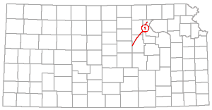 |
This is a rather pronounced anticlinal fold west of and nearly parallel to the Nemaha anticline. Locally it is quite marked in outcropping rocks of early Permian age.
According to Barwick (1928, p. 179): "The Abilene anticline is another fold of considerable size trending slightly more east than the granite ridge. The McPherson gas field has recently been discovered upon it." The Nemaha anticline is the "granite ridge" of the sentence above.
Barwick (1928, fig. 1) showed the Abilene anticline extending from northern Kingman County to southwestern Marshall County. Seemingly in the light of present available data the southward extension of the Abilene anticline as shown by Barwick is too great. In summarizing deformation at the end of Mississippian time Lee, Leatherock, and Botinelly (1948, p. 136 and fig. 2C) wrote: "The prominent Abilene anticline on the northeast side of the Salina basin is recognized in the surface rocks in Riley County and extends southward into Dickinson County. It resembles the Nemaha anticline in that the beds dip steeply on its southeastern side and very gently to the northwest. Not very many subsurface data are available on the Abilene anticline. . . . The Abilene anticline is interrupted on the south by the Salina basin syncline." Lee and his associates showed that the Voshell anticline farther south is approximately in the same trend with the Abilene anticline, but the two probably are not connected. These two folds as the names now are recognized are the Abilene fold named by Barwick. Furthermore seemingly the Barneston anticline of Marshall County and neighboring parts of Nebraska is also continuous.
The name Ackerland anticline is used for a small domelike structure in western Leavenworth County. It contains the Ackerland oil and gas pools.
The name Ackerland was first used as a structural term by Lee and Payne (1944, p. 74). A structural map (Lee and Fayne, 1944, pl. 2) indicates the structure by contours on outcropping Pennsylvanian rocks. The axis extends from the southern part of sec. 1, T. 10 S., R. 20 E. to sec. 35, T. 9 S., R. 20 E.
An elongated dome in the southern parts of Ts. 14 and 15 S., Rs. 26 and 27 W., Gove County, has been called Alanthus. It was interpreted from dips read on outcropping rocks.
This structure was named by Lupton, Lee, and Van Burgh (1922, p. 79, pl. 5). According to a map accredited to Van Burgh the axis of the fold as suggested by dip observations extends in a nearly north-south line from near the Cen. sec. 36, T. 14 S., R. 27 W. to the north part of sec. 24 of the same township and range. The structure was regarded as a minor dome on the Black Hills arch (also listed on this index) by the geologists who reported it.
Alma Anticline (4) |
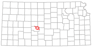 |
The name Alma anticline has been coined recently to designate an anticlinal fold in Wabaunsee County.
According to Smith and Anders (1951, p. 35): "Approximately 9 miles east of the crest of the Nemaha anticline, and parallel to it, lies the axis of a similar structure very much smaller in detail which in this report wilt be called the Alma anticline. . . . While the amount of structural relief on the Precambrian surface of the Nemaha anticline is in the neighborhood of 2,000 feet, the amount of closure on the Alma anticline is only about 100 feet on the top of the Viola." Elsewhere Smith and Anders state that the Alma anticline extends the length of Wabaunsee County and reaches into Lyon County on the south and into Pottawatomie County on the north; and that the Davis Ranch anticline, which contains the Davis Ranch oil pool (producing from the Viola) is a part of the Alma anticline.
It is to be noted that the Alma anticline may actually consist of two or more en echelon folds. It is situated in the broad trough that lies east of the Nemaha uplift and which has been regarded as the deepest part of the Forest City basin in Kansas and the southern extension of the Brownville syncline of southeastern Nebraska.
Anadarko Basin (5) |
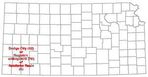 |
The Anadarko basin lies north of the Wichita Mountains and west of the Nemaha-Oklahoma City and Pauls Valley uplifts in Oklahoma and extends northwestward flanking the buried Amarillo Mountains across the Oklahoma panhandle into southwestern Kansas. Relatively thick sections of Mississippian and Pennsylvanian rocks in southwestern Kansas have led to the use of the terms Dodge City basin and Hugoton embayment for that part of the basin extending into Kansas.
The Anadarko basin was shown to extend into Kansas several years ago when Clifton (1926) published a map showing the deepest part of the Kansas portion as being in Comanche County. His map employs structural contour lines spaced at 250-foot intervals drawn on "base of the red rock," presumably of middle Permian age. Recently Wheeler (1947, p. 41, fig. 1) defined the Dodge City embayment as a geological province of the Anadarko basin and as an embayment-like area extending from Oklahoma into Haskell County, Kansas. According to Wheeler (1947, p. 38): ". . . the Anadarko Basin came into existence as a subdivision of a much larger southern Oklahoma geosyncline and was further modified during Pennsylvanian and Permian times to create additional combinations of structure and stratigraphy . . ." More recently the Kansas area has been referred to by Maher and Collins (1949) as the Hugoton embayment of the Anadarko basin.
The structural names Dodge City and Hugoton are discussed elsewhere in this paper.
A lowland area in Clark County is called the Ashland basin. It was first described by Haworth (1897, pp. 21-22) who believed that it probably is the result of stream erosion, but later Johnson (1901, pp. 711-712, 722-724) expressed the opinion that solution and collapse were important factors.
The Ashland basin was well described by Smith (1940, p. 139) as a broad lowland area about 12 miles wide and about 500 feet below the High Plains level. He also attributed the formation of the basin to probable collapse following solution.
The name Ashland-Englewood basin has been used for the same structure.
A large basin in southern Clark County that may be interpreted as structural as well as a physiographic basin has been called Ashland and later Ashland-Englewood.
According to Frye (1950, pp. 5, 7): "The Ashland-Englewood basin in southern Clark County is an area of coalescing partly filled and dissected depressions. In areal distribution the basins, or sinkholes, or sinks are sharply localized east of a prominent fault in central Meade County." And "The extensive Ashland-Englewood lowland . . . is the largest solution-subsidence feature in Kansas topography."
The terms North Augusta and South Augusta are used frequently to designate the two prominent parts of the Nemaha anticline that contain the Augusta oil pools. Rocks of early Permian age crop out in the area and as elsewhere along the axis of the Nemaha uplift, the deeper abrupt folding is reflected but less sharply in surface rocks.
According to Berry and Harper (1948, p. 216): "The surface structure is characterized by a narrow anticline having a north-south axis at North Augusta and a broader northeast-southwest anticline at South Augusta. A narrow northeast-southwest trough passes through the city of Augusta and separates the two structures. Surface closure amounts to approximately 40 feet on the north structure and 60 feet on the south structure. Rate of dip is approximately the same on the east or reverse side of the structure as on the west or normal side."
The Augusta anticline, like the El Dorado dome and the Elmdale dome, are higher parts of the major uplift and are much more prominent in older rocks than in surface Permian beds. There probably are large faults, especially along the east side of the South Augusta structure. As elsewhere along the Nemaha uplift, the principal movement occurred after deposition of Mississippian rocks and before accumulation of Pennsylvanian sediments, which lie on a surface of eroded Mississippian and older formations.
The Bancroft syncline is a shallow minor synclinal element of the El Dorado anticline, Butler County, a prominent structural feature of the Nemaha anticline.
This structure was named by Fath (1921, p. 72): "This shallow downfold, trending northwesterly from sec. 4, T. 26 S., R. 5 E., to sec. 30, T. 25 S., R. 5 E. . . . separates the Shumway and Boyer domes from the Oil Hill dome."
Barneston Anticline (10) |
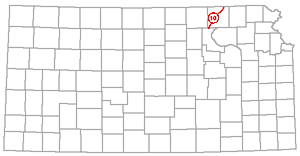 |
The name Barneston anticline is used for a somewhat conspicuous anticline in outcropping rocks in southern Nebraska and northern Kansas. It enters central Marshall County at the Kansas-Nebraska line and is the northern extension of the Abilene arch.
According to Condra and Upp (1931, p. 10): "A second major structure, described in Nebraska as the Barneston anticline, and in Kansas as the Abilene arch, although quite deeply eroded along its west border, does not expose the Pennsylvanian beds except in a small area at Blue Rapids, Kansas." At the time of publication of the above statement the top of the Eskridge shale was regarded as the top of Pennsylvanian beds; hence the reference to Pennsylvanian exposure.
The position of the Barneston arch is shown crossing the Kansas-Nebraska line by Condra and Reed (1943, fig. 2). The axis of a syncline previously called Irving (Condra and Upp, 1931, p. 10) is shown a short distance east of the arch. It should be noted that some published maps, based on pre-Pennsylvanian areal geology, show the Nemaha anticline extending into the western part of Riley County and including the Barneston arch (Moore and Jewett, 1942; Jewett and Abernathy, 1945; Jewett, 1949). However, there the Irving syncline is strongly expressed in outcropping rocks and in the distribution of Mississippian limestone beds (Lee, Leatherock, and Botinelly, 1948, pl. 8) and hence the Barneston is separated from the larger Nemaha structure.
Barton Arch (11) |
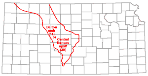 |
The names Barton arch and Central Kansas uplift are applied to the same major post-Mississippian structural province.
The Barton arch (originally called Russell arch and later known as the Central Kansas uplift) was named by Barwick (1928, p. 177): "The name Barton is here suggested for the broad pre-Pennsylvanian and probably in part pre-Mississippian high in Ellsworth, Rice, Barton, Russell, and near by counties. The presence of Ordovician strata directly underneath the Pennsylvanian in Russell County has been demonstrated by Udden (1926) and Twenhofel (1927). This arch is in line with the Chautauqua arch and is separated from it by a gentle saddle."
The Barton arch is now regarded as an important post-Mississippian structure of different grain than that of the ancestral uplift of the same area, which is called Ellis arch. Evidence of the post-Mississippian origin of this main uplift is found in the tilted and erosion-truncated margins of Mississippian strata on its flanks and the absence of the Mississippian in the central high parts. Older Pennsylvanian rocks also are missing from higher parts of the Barton arch, but overlap of younger beds led to its ultimate burial. The structure was described in detail by Koester (1935), who preferred the name Central Kansas uplift introduced by Morgan (1932).
A. R. Denison (1926) was the first geologist to mention in print the existence of the broad structural feature that is now called the Barton arch; and Udden (1926) demonstrated the occurrence of Ordovician rocks in Russell County at comparatively shallow depths. Twenhofel (1927) a little later showed that Ordovician rocks underlie a large area in that part of Kansas. Denison called the structure the Russell arch, but his name was not generally used by other geologists.
Great amounts of oil and gas have been obtained from pools on and on the flanks of the Barton arch. Accumulations in places are in Pennsylvanian rocks and elsewhere in older beds just below the overlapping Pennsylvanian sediments.
The Bat is a small anticline in Wallace County. According to Elias (1931, p. 200): "The main structural highs, which constitute the Willow Creek structure, are Western anticline on the west, Seisgood dome on the north, and Bat anticline on the south." The Willow Creek anticline is in T. 13 S., Rs. 41 and 42 W. and is a part of a larger structure that has been called Weskan anticline.
Bazine Anticline (13) |
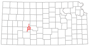 |
The term Bazine anticline is applied to an anticlinal fold in Ford, Hodgeman, and Ness Counties. It is discernible in Cretaceous rocks.
The Bazine anticline was named by Moss (1932, pp. 40, 42): "The regional dip of the Cretaceous strata in this general area is about 10 feet per mile slightly east of north, This structural slope has two northeastward-trend- ing anticlines superimposed upon it in Ness and Hodgeman counties. One of these, here named the Beeler anticline, . . . . and the other, here named the Bazine anticline, is in the eastern part of the two counties." And, "This anticline enters Hodgeman county from Ford county a little east of the Jetmore meridian and trends slightly east of north, passing between Jetmore and Hanson. North of here it makes a slight eastward swing and then trends nearly due north, passing just east of Bazine." And, "The Bazine anticline is apparently a southward extension of the Stockton anticline."
Beaumont Anticline (14) |
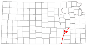 |
One of several anticlinal folds that have been mapped in Greenwood County is called Beaumont. The name is applied also to a trend of anticlines extending from Virgil in northeastern Greenwood County to southeastern Cowley County.
According to Bass (1936, p. 59): "The monocline has superposed on it numerous anticlines, anticlinal noses, synclines, structural basins and terraces, the most prominent of which is the Beaumont anticline that extends from the southwestern part of T. 29 S., R. 8 E., slightly east of north to sec. 32, T. 26 S., R. 9 E., thence northeast toward Eureka." The "monocline" in the quotation is the Prairie Plains monocline, listed elsewhere in this index. There are other anticlines in the same general trend as the Beaumont as Bass used the name, and the same name has been used for the larger fold. According to Ver Wiebe (1930, p. 211); "In Greenwood County . . . there is a very pronounced anticlinal ridge over 70 miles long which is called the 'Beaumont anticline.' It has a reverse dip of nearly 100 feet in places and is well marked all along its trend." Maps published by Moore and Landes (1927, figs. 61, 69, and 75) show the Beaumont anticline extending from Virgil in Greenwood County to southeastern Cowley County.
Attention is called to the previously published map of surface structures in Greenwood and parts of Butler, Chase, Wilson, and Woodson Counties (Bass, 1936, pl. 7) and to the discussion of the Otto-Beaumont anticline in this index.
McCoy and Keyte (1934, pp. 298-301, fig. 4) discussed the Beaumont anticline (restricted) in relationship to oil accumulation. Their cross section of the fold shows Mississippian limestone with undiminished thickness on the crest of the anticline and they pointed out that structural adjustment did not take place during the hiatus that preceded Pennsylvanian deposition but that growth took place during the time of accumulation of Cherokee beds and later, Clark and Cooper (1927, p. 24, pl. 1) showed that the Beaumont anticline extends into Oklahoma where it is called Ponca.
The name Beaver was given by Walters (1946, p. 671) to a buried hill of Precambrian quartzite in the northwestern part of T. 16 S., R. 12 W., Barton County. The structure overlying the hill is regarded as a part of the larger Kraft-Prusa structure, in the Barton arch and Ellis arch area.
Beaver hill and five other buried hills of Precambrian rocks in the same area were named by Walters and their geologic history was discussed and diagrammed in detail by him (Walters, 1946; Walters and Price, 1843). Inasmuch as these hills underlie arched strata of Pennsylvanian age and older rocks are gently arched on their flanks, they are regarded as geologic structures.
The Beaver oil field lies above the buried hill of the same name.
A buried hill of Precambrian rock in the northwestern part of T. 16 S., R. 12 W., Barton County, which is a part of the Kraft-Prusa structure, is called Beaver Northwest hill, from the name of the oil field which lies above it.
Like five other buried hills of Precambrian quartzite, named by Walters (1946, p. 671) and described by Walters and Price (1948), Beaver Northwest hill is regarded as a geologic structure because overlying Pennsylvanian strata are gently arched and older rocks are arched on the flanks.
Beeler Anticline (17) |
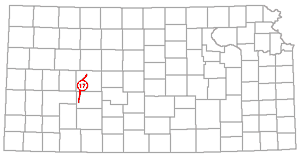 |
Beeler anticline is the name of a fold revealed in Cretaceous rocks in Ness and Hodgeman counties.
The Beeler anticline was named by Moss (1932, p. 40): "The regional dip of the Cretaceous strata in this general area is about 10 feet per mile slightly east of north. This structural slope has two northeastward-trending anticlines superimposed upon it in Ness and Hodgeman counties. One of these, here named the Beeler anticline, follows the west side of the two counties . . ." and "This anticline is the most prominent structural feature in the area. From available data the structure apparently trends due north along the west side of Hodgeman County and into Ness County as far as Beeler. Here it bends to the northeast and trends toward Ransom."
The Bishop syncline is a secondary synclinal fold on the El Dorado anticline, Butler County.
The Bishop syncline was named by Fath (1921, p. 72): "Located in a direct line with the axis of the Hammond syncline, and also possibly genetically related to it, is another depression. . . in sec. 23, and into SW sec. 13, T. 26 S, R. 4 E."
The El Dorado anticline and its parts were mapped by Fath (1921, pl. 1) by means of 10-foot contour lines with the Fort Riley limestone (early Permian) as datum.
The broad arch extending southeastward from the Black Hills to Cambridge, Nebraska, and thence southward to the Smoky Hill Valley in Kansas shown by Darton (1905, 1918) was referred to by Lupton, Lee, and Van Burgh (1922, p. 77) as the Black Hills arch. The term Black Hills arch has never come into common use but the segment south of Cambridge, Nebraska, has long been known as the Cambridge arch.
Lupton, Lee, and Van Burgh (1922, p. 78) reported: "This broad arch is registered here [Smoky Hill River Valley] and has developed on it numerous minor anticlines and domes with their axis in general parallel to the axis of the broad arch."
Structures in the Smoky Hill River Valley in Gove and Logan Counties, Kansas, to which Lupton, Lee, and Van Burgh (1922) applied names which are listed in this index are Twin Buttes dome, Chalk Creek dome, Elkader anticline, Hell Creek anticline, and Alanthus dome. Lee (personal communication) has pointed out that inasmuch as these areas, in the absence of datum beds, were mapped on the basis of low dips in brittle Niobrara chalk, the structure contours which were sketched from the dips in an attempt to visualize the import of the dip readings do not necessarily reflect the structural features with accuracy.
Bluff City Anticline (20) |
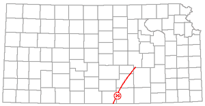 |
The name Bluff City anticline has been given to an anticlinal trend in the Sedgwick basin, extending in a direction south-southeast from southwestern Marion County to southwestern Harper County or farther.
The name Bluff City anticline was applied by Barwick (1928, p. 179, fig. 1): "The Bluff City anticline, which approximately parallels the Abilene anticline, extends from the Florence-Urschel field in Marion County through the Elbing field in northwest Butler County to Bluff City in southeast Harper County." Presumably Barwick regarded the fold as one prominent in subsurface rocks.
The Florence-Urschel and Elbing structures are listed elsewhere in this index. Attention is called to maps showing the structures that contain the Florence, Elbing, and other oil pools by Thomas (1927, figs. 1-3; 1929, figs. 1-3). As stated by Ver Wiebe (1938, p. 143), the Valley Center oil field may be regarded as being on the Bluff City structure.
The Bone syncline is a small synclinal fold in western Wallace County. It is discernible in outcropping Cretaceous rocks.
This name was applied by Elias (1931, p. 200): "The northern closure of the structure [Willow Creek anticline] lies in the divide between Willow creek and Schoolhouse draw. A deep and comparatively sharp syncline was found here at the heads of the several northern tributaries to Willow creek. This syncline was named the Bone syncline after Bone draw, which is at the east end of the syncline."
Bourbon Arch (22) |
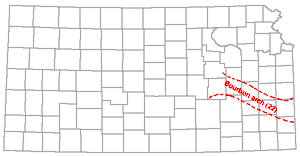 |
The Bourbon arch is a low post-Mississippian structure that separates the Forest City and Cherokee basins.
The Bourbon arch was named by Moore and Jewett (1942, fig. 8). It was shown as separating the two basins and extending from Bourbon County to Morris and Chase counties, and was described briefly: "A low structural divide separates the Forest City basin in the north from the Cherokee basin in the south." The axis of the structure was shown earlier by Lee (1939, pl. 2) as an "anticlinal divide," and later Lee (1943, p. 85) described it: "A broad low structural divide (the Bourbon arch) of Mississippian rocks that separated the Forest City and Cherokee basins trends vaguely toward the northwest across Bourbon, Allen, and Coffey counties, Kansas. . . ." Still later Lee and Fayne (1944, p. 61) wrote: "The Forest City basin and the Cherokee basin were at first separated by a broad flat arch (Lee, 1939, pl. 2, p. 24), which will be referred to as the Bourbon arch. This arch extended northwest from Bourbon County, Kansas, and was approximately parallel to the Chautauqua arch which is not known to have been active at this time."
The thickness of Mississippian limestones increases from 300 feet or less on the Bourbon arch to more than 450 feet in Miami County, on the north, and to more than 350 feet in southern Allen and Bourbon Counties on the south (Lee, 1939, pl. 1). This may be interpreted as indicating excessive erosion on the arch before deposition of Pennsylvanian beds. Pennsylvanian sedimentation seemingly began earlier in the Forest City basin than in the Kansas part of the Cherokee basin and for a while during accumulation of basal Pennsylvanian beds, the Mississippian limestone on the Bourbon arch remained exposed. There is evidence from higher outcropping rocks that later in Pennsylvanian time this area was one of meeting and overlap of sediments from southerly and northerly directions.
The name Boyer dome has been applied to a part of the El Dorado anticline, Butler County, which is a pronounced "high" on the Nemaha anticline.
The Boyer dome was named by Fath (1921, p. 68): "The Boyer dome is a quadrilateral-shaped area centering along the boundary of sections 8 and 17 of T. 26 S., R. 5 E. . . . and covering most of sections 7, 8, and 17, and extending into sections 5, 6, 9, 16 and 18 of the same township . . . This is about 20 feet higher than the Shumway dome. Its closure [in outcropping rocks] also is correspondingly greater, amounting to about 50 feet."
A buried hill of Precambrian quartzite at the southeastern end of the Kraft-Prusa structure in the Ellis and Barton arch area of the Central Kansas uplift is called Breford hill (Walters, 1946, p. 671). It is in the western part of T. 17 S., R. 10 W. and the eastern part of T. 12 S., R. 11 W., Barton County. The Breford oil field lies above the buried hill.
The Breford hill and five other buried hills of Precambrian rocks were described and diagrammed by Walters (1946) and by Walters and Price (1948). Sedimentary beds are arched above and on the flanks of the crystalline rock hills and they and the overlying rocks are regarded as geologic structures.
Brownville Syncline (25) |
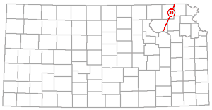 |
Brownville syncline is the name of the syncline that lies east of the Table Rock anticline in southeastern Nebraska, better known in Kansas as the Nemaha anticline.
According to Condra (1927, p. 14): "Dr. G.L. Smith, of Iowa, proposed the name Brownville Syncline for a trough in the vicinity of Brownville, Nebraska. This syncline extends past Nemaha City and probably to or beyond the Big Nemaha Valley. It lies east of the lowest part of the east flank of the Table Rock Anticline." Later Condra and Upp (1931, fig. 1) showed the Brownville syncline extending southward in Kansas into southeastern Pottawatomie County where it is now recognized as the deepest part of the Forest City basin.
In northern Kansas the syncline east of the Nemaha anticline is expressed in the outlier of Permian rocks extending from northern Nemaha and Brown counties southward to Kansas River (Moore and Landes, 1937; Jewett and Abernathy, 1945, pl. 1). This is a part of the synclinal area east of the Nemaha anticline extending across the state. The syncline is especially pronounced east of the higher parts of the uplift, as the Elmdale dome, Burns dome, and El Dorado anticline. The name Walnut syncline has been given to the trough bordering the El Dorado anticline on the east.
A local "high" on the Nemaha anticline, with its crest near Burns in southeastern Marion County, is known as the Burns dome.
The Burns dome was named by Prosser and Beede (1904, p. 5): "South of the Cedar Creek syncline is the Burns anticline, the crest of which is about 200 feet or more above the trough of the syncline. The axis of this fold seems to extend more nearly east and west than does that of the syncline. The highest point of this anticline is about 3 miles southeast of Burns. It extends over a considerable area east and south of Burns, but is hardly as large as the Elmdale dome."
After the Burns dome was discovered and named by Prosser and Beede who were able to study its expression only in outcropping rocks, bore holes have revealed the structure as a conspicuously high part of the Nemaha anticline. Attention is called to cross sections and maps showing subsurface conditions in the structure by Thomas (1927, figs. 1-4; 1929, figs. 1-4). Lee, Leatherock, and Botinelly (1948, pls. 6-8) showed the crest of the subsurface dome in the central part of T. 23 S., R. 5 E.
Koester (1935, p. 1419) proposed the name Wilson-Burns element for a series of structural "highs" including the Burns dome and several others along a northwesterly line extending to eastern Russell County.
Cambridge Anticline (27) |
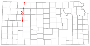 |
The Cambridge anticline, in northwestern Kansas, sometimes is called Darton's arch. Its axis extends from northeastern Lane County northward, passing along the east border of Decatur County into Nebraska.
According to Bass (1923, p. 83, pl. 7): "The most pronounced feature shown in Kansas on the structure map . . . , as well as on Darton's maps of 1905 and 1918, is the Cambridge anticline, more generally known as Darton's arch, the axis of which trends northward through the eastern edge of Decatur county into Nebraska." It is discernible in the subsurface in Dakota beds, and is represented en the map as a rather broad northward-plunging anticline.
Darton (1918) surmised that his Cambridge anticline was connected with the distant Chadron anticline in northwestern Nebraska. Fuenning (1942) demonstrated the correctness of this hypothesis. Condra and Reed (1943) applied the name Cambridge arch to the anticline that crosses Nebraska from Cambridge northwestward to the border of the Black Hills where it lies east of the main axis of the Black Hills uplift.
A synclinal fold separating two domes on the Nemaha anticline, in Chase County, is called the Cedar Creek syncline.
The Cedar Creek syncline was named by Prosser and Beede (1904, p. 5): "Roughly joining the Elmdale dome on the south is the Cedar Creek syncline, the lowest point of which is near the bed of Cedar Creek, just west of Wonsevu. This syncline approaches a basin in form, but its longer axis is directed a little east of north from the locality just mentioned, and it is nearly as low as Coon Creek north of Wonsevu. The depth of this depression is about 200 feet. The folding here is such that the rocks often lie parallel with the surface, so that a stratum of limestone may be seen cropping out all the way from a head of the ravine to its mouth."
Prosser and Beede (1904) gave the name Cottonwood province to a part of the Nemaha anticline in the Cottonwood Falls quadrangle and recognized the Elmdale dome, Cedar Creek syncline, and Burns dome as parts of the larger structure. At that time it was not known that the Nemaha anticline extended across the State and beyond.
Central Kansas Arch (29) |
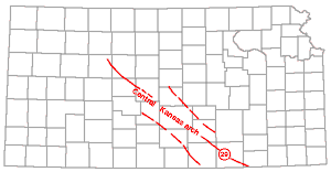 |
The name Central Kansas arch, designating the combined pre-Mississippian elements, Ellis and Chautauqua arches, was coined by Rich (1933, p. 796, fig. 2).
Rich used the names Central Kansas uplift and Chautauqua arch in the sense of several authors as names of component parts of the arch. In the paragraph above Ellis is used instead of Central Kansas because it is believed to be the better term to designate the pre-Mississippian structure that was ancestral to the younger Central Kansas or Barton arch. Rich's (p. 796) definition of Central Kansas arch is: "As here used, the term 'Central Kansas arch' is made to include the whole of the uplifted arc here described. Its eastern end has been called the Chautauqua arch by Barwick . . . and its dome-like up-bulge in Barton, Rush, Ellis, and the adjoining counties , . . the Central Kansas uplift by Morgan . . . . "The lower, compound saddle along the arch between these features has, so far as known to the writer, remained unnamed."
The name Chautauqua-Barton arch was used in the same sense by McClellan (1930) as Central Kansas arch was used by Rich.
Because the names Barton and Central Kansas had been used previously for the uplift in central Kansas whose pre-Mississippian grain differs from its post-Mississippian grain, Moore and Jewett (1942) proposed the name Ellis arch for the ancestral structure.
Central Kansas Uplift (30) |
 |
The name Central Kansas uplift has been used widely to refer to a major post-Mississippian structural uplift and its ancestral structure in north-central Kansas. Although at present this name is more commonly used than the name Barton arch, the latter name for the same structure has priority and should be accepted as the preferred term. The name Barton arch is listed in this index and the important structural province that it signifies is discussed there. The name Central Kansas uplift was first published by Morgan (1932, p. 483) and the structures were discussed in much detail by Koester (1935).
Actually the structure referred to here was previously called Russell arch (Denison, 1926) and if priority is observed Russell should be preferred over Barton or Central Kansas. The argument advanced by some geologists that Denison (1926) and Barwick (1928), who coined the earlier names, did not have a complete conception of the structure has little significance in regard to the choice of names.
It may be observed that although it was recognized that the strike of anticlinal folds in pre-Pennsylvanian rocks in the area differs from the axis of the uplift as a whole, several geologists used the terms Barton arch and Central Kansas uplift for both the pre- and post-Mississippian structure. However, Moore and Jewett (1942, pp. 485-486) gave the name Ellis arch to the ancestral uplift.
The need for two names is made clear from details observed by Morgan (1932, p. 483): "Its present form is believed to be caused by Caledonian folding or emergence in a direction parallel to the Precambrian grain followed by Appalachian or Hercynian folding normal to the grain."
The name "ancestral Central Kansas uplift" appears on a map by Lee, Leatherock, and Botinelly (1948, pl. 5) for the structure that also is called Ellis arch. It is discussed under that name in this paper.
The name Central Nebraska basin is used by the Nebraska Geological Survey for a post-Cretaceous basin whose axis extends across Nebraska and enters eastern Phillips County, Kansas, about 40 miles east of the axis of the Cambridge arch.
The position of the axis of the Central Nebraska basin in northern Kansas is shown by Condra and Reed (1943, fig. 2). In Kansas the Central Nebraska basin may be regarded as a more or less minor structure complimentary to the Cambridge anticline and affecting Cretaceous and older rocks. Its position is immediately east of the Barton arch or along the west flank of the Salina basin.
The Chelsea dome is a part of the El Dorado anticline. Butler County, which is a prominent "high" on the Nemaha anticline.
The Chelsea dome was named by Fath (1921, p. 71): "This elongated structure may be termed a minor anticline .... The long axis of the dome extends from the center of sec. 35, T. 24 S., R. 5 E., to the center of sec. 8, T. 25 S., R. 6 E. . . . . The altitude of its crest, referred to the top of the Fort Riley limestone, exceeds 1,390 feet and its closure amounts of more than 40 feet."
Fath (1921, pl. 1) showed the location and size of the Chelsea dome along with other parts of the El Dorado anticline on a structural geologic map of the El Dorado oil and gas field.
Chautauqua Arch (34) |
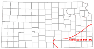 |
The name Chautauqua arch is applied to the Kansas and Oklahoma parts of the ancestral Ozark uplift. It is a major pre-Mississippian structural element.
The Chautauqua arch was named by Barwick (1928, p. 177): "The Chautauqua arch is here suggested as a name for the pre-Mississippian extension of the Ozark uplift along the Kansas-Oklahoma line."
In the Chautauqua arch area Chattanooga shale and Mississippian limestones overlie the eroded surface of rocks of early Ordovician age. On its flanks rocks of the Simpson group and younger were beveled before the deposition of the Chattanooga shale. The pre-Chattanooga outcrop of St. Peter sandstone (Simpson) extending from southwestern Sedgwick County northwestward to southeastern Miami County may be regarded as the boundary of the Chautauqua arch area in Kansas (Moore and Jewett, 1942, fig. 7: Jewett and Abernathy, 1945, fig. 3; Jewett, 1949, fig. 11; 1950, fig. 7).
In pre-Mississippian time the Chautauqua-Ellis axis or the Central Kansas arch divided the North Kansas and Southwest Kansas basins. Dipping pre-Mississippian beds on the north flank of the Chautauqua arch comprise a structure known as the Ozark monocline.
The name Chautauqua-Barton arch has been used to designate the pre-Mississippian structure that separated the North Kansas and Southwest Kansas basins.
According to McClellan (1930, p. 1550): "The real structural backbone of Kansas is a much larger and broader feature, the Chautauqua-Barton arch, which extends from the Ozark uplift in a northwesterly direction through Chautauqua, Barton, and Norton counties." Rich (1933, p. 796, fig. 2) used the name Central Kansas arch for the same major structure. As explained elsewhere in this paper the name Ellis arch is used to designate the ancestral Barton arch or Central Kansas uplift, hence for the Barton arch as the term is used in the quotation from McClellan. The pre-Mississippian structural grain in the area is different from the post-Mississippian grain; hence the name Ellis is deemed to be more acceptable. It may be noted, however, that probably in pre-Mississippian time the Ellis arch was low and distinctly subordinate in structural relief to the Chautauqua arch.
Cherokee Basin (36) |
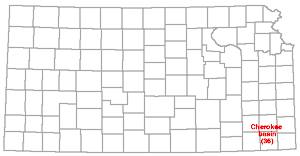 |
The extension of the McAlester basin from Oklahoma into southeastern Kansas commonly is called the Cherokee basin. Seemingly the name Pryor, as listed elsewhere in this index, has been used in the same way. Because of extensive usage and priority, Cherokee is the preferred term.
According to common usage, the Cherokee basin in Kansas is regarded as lying west of the Ozark uplift, east of the Nemaha anticline, and south of the Bourbon arch, a low positive element that until middle or late Cherokee time separated the Cherokee basin on the south and the Forest City basin on the north and which perhaps was an area in which sediments from the north and south met and overlapped in much of middle and late Pennsylvanian time.
A structure that has been observed in outcropping rocks of Missourian age in northeastern Montgomery County is called the Cherryvale anticline.
The name Cherryvale anticline was used by Moore and Boughton (1921, p. 13): ". . . there is a well-defined fold in the vicinity of Cherryvale, and a somewhat smaller fold east of Coffeyville," and ". . . between the Coffeyville and Cherryvale antic'ines there is another small fold, southwest of Liberty," and "The Cherryvale oil and gas district is situated on a broad anticline."
The Coffeyville structure is listed in this index. The fold near Liberty, Montgomery County, seemingly has not received a name.
The Chesney dome is a part of the El Dorado anticline, in Butler County. The El Dorado anticline is a local elevation of the Nemaha anticline.
This structure was named by Fath (1921, p. 69): "It centers in the SE sec. 21, T. 25 S., R. 5 E. . . . and extends into the adjacent quarter section. . . . The closure . . . probably does not exceed 20 feet." The Chesney dome is somewhat elongated along a line extending from the northwest to the southeast.
The name Coffeyville anticline is applied to a domelike structure discernible in surface beds in southeastern Montgomery County.
The Coffeyville anticline was named by Moore and Boughton (1921, p. 13): ". . . there is a well-defined fold in the vicinity of Cherryvale, and a somewhat smaller fold east of Coffeyville. . . . and between the Coffeyville and Cherryvale anticline there is another small fold . . ." Later Foster (1929, p. 49) described the Coffeyville structure: "The Coffeyville structure can be worked from surface limestone beds. It is a gently dipping dome with about 40 feet of closure. Subsurface contours on the Oswego limestone, Mississippian limestone, and 'Siliceous' limestone, respectively, show the position of the apex of the dome farther and farther west with depth."
The Coffeyville (Ordovician) oil pool, sec. 17, T. 35 S., R. 17 E., Kansas, and sees. 15 and 16, T. 29 N., R. 16 E., Oklahoma, is in the Coffeyville dome, as described by Foster.
A synclinal fold that has been observed in basal Pennsylvanian beds in southern Cherokee County and neighboring parts of Oklahoma is reported to have been called Commerce trough (Pierce and Courtier, 1938, p. 55) but is more commonly known as Miami trough. The term Miami trough is listed in this index.
Conway Syncline (41) |
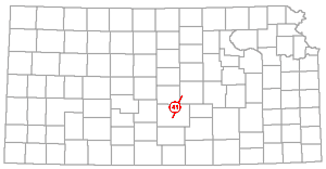 |
The Conway syncline is a synclinal fold in McPherson and Reno Counties lying between the Voshell anticline and the Central Kansas uplift.
According to Koester (1935, p. 1421): "The lowest part of the Salina basin from a structural standpoint is demonstrated by the contours in Mitchell County. The low area west of the McPherson anticline, or Voshell trend, here named the Conway syncline, is evident in western McPherson County and northeastern Reno County."
The term Cordilleran basin is used to designate a large late Paleozoic structural province in western central North America including all of Kansas.
An example of usage of the term Cordilleran basin is by Ver Wiebe (1930a, p. 767): "The continental segment, Monzonia . . . formed the western border of the Cordilleran basin, while on the northwest lay Laurentia, on the east Ozarkia, and on the southeast Llanoria." According to Ver Wiebe (1930a, fig. 1) the ancestral Rocky Mountains in Colorado lay in the central part of the basin which includes Kansas in its eastern part.
The name Cottonwood province has been applied to a conspicuous part of the Nemaha anticline, as it is expressed in surface rocks in the Cottonwood Falls quadrangle, in Chase, Marion, and Butler Counties.
This name was first used for a structural element by Prosser and Beede (1904, p. 5): "This is a local series of small folds extending from near Strong to the southwest corner of the quadrangle. There are three of these folds. the Elmdale dome, the Cedar Creek syncline, and the Burns anticline."
Prosser and Beede named the northern part of the Nemaha anticline in the Cottonwood Falls area the Diamond Creek province. Although they did not know that the anticlines they recognized are in a series that extends across Kansas and beyond, it is to be noted that these--Cottonwood and Diamond Creek--are the first names that were given to the structure now known as the Nemaha anticline, and if strict priority were observed there would be some basis for using one of these names for the regional structure.
The name Cow Creek has been applied to a small anticlinal fold in Cherokee County.
According to Smith and Siebenthal (1907, p. 9): "West of the mouth of Cow Creek there is a short and rather sharp anticline in the Cherokee formation. Commencing in the SE sec. 10, T. 33 S., R. 25 E., it extends west of north to the SE sec. 33, T. 32 S., R. 25 E., a distance of a little over 2 miles. The eastern limb of this anticline is much the steeper, having dips of 35° to 40°, while those of the western limb vary from slight angles up to 10° or 12°." From mapping by Pierce and Courtier (1938, pl. 5) this may be interpreted as the southwestern limit of the Lawton trough.
The Crooked Creek fault has affected outcropping Tertiary and Quaternary rocks in central Meade County.
Frye and Schoff (1942, fig. 1) and Frye (1950, fig. 2) reported that the Crooked Creek fault has a strike slightly east of north, that the first movements along the fault took place at the close of middle Pliocene time, and that together with movements along the Fowler fault, a short distance to the east, they formed the ancestral Meade basin.
The structure in Kingman and Pratt Counties that contains the Cunningham oil and gas pools is known as the Cunningham dome.
The Cunningham dome was thoroughly described by Rutledge and Bryant (1937). It was discovered by core drilling and has 25 feet of closure on the Cimarron anhydrite (Stone Corral) and 30 feet of closure on the base of the Wellington at a depth of about 1,500 feet. The map shows more than 100 feet of closure on the Lansing limestone. The axis of the dome extends from the central part of sec. 20, T. 27 S., R. 10 W., to the southeastern part of sec. 25, T. 27 S., R. 11 W. The crest of the dome on the Lansing rocks (Pennsylvanian) is nearly directly below the crest in the Permian beds about 400 feet below the land surface.
Rutledge and Bryant (1937, p. 515) believe that the first important movement that produced the Cunningham structure took place at the time of Wichita orogeny at the same time that the Barton arch, Nemaha anticline, Voshell anticline, and other anticlines were uplifted. The initial uplift was judged to have amounted to at least 220 feet inasmuch as that amount of Mississippian limestone is absent from the top of the dome. The next period of structural growth is said to have been post-Lansing pre-Douglas. About 40 feet of Pennsylvanian beds seemingly were removed during or following that growth period. Minor movements are believed to have preceded the last period of growth in post-Cretaceous time. According to Ver Wiebe (1938, p. 70) there is evidence of faulting in pre-Pennsylvanian rocks on the east side of the structure.
Kansas Geological Survey, Geology
Placed on web July 15, 2005; originally published in 1951.
Comments to webadmin@kgs.ku.edu
The URL for this page is http://www.kgs.ku.edu/Publications/Bulletins/90_6/index.html