Kansas Geological Survey, Bulletin 70, Part 3, originally published in 1947 || Back to Report...
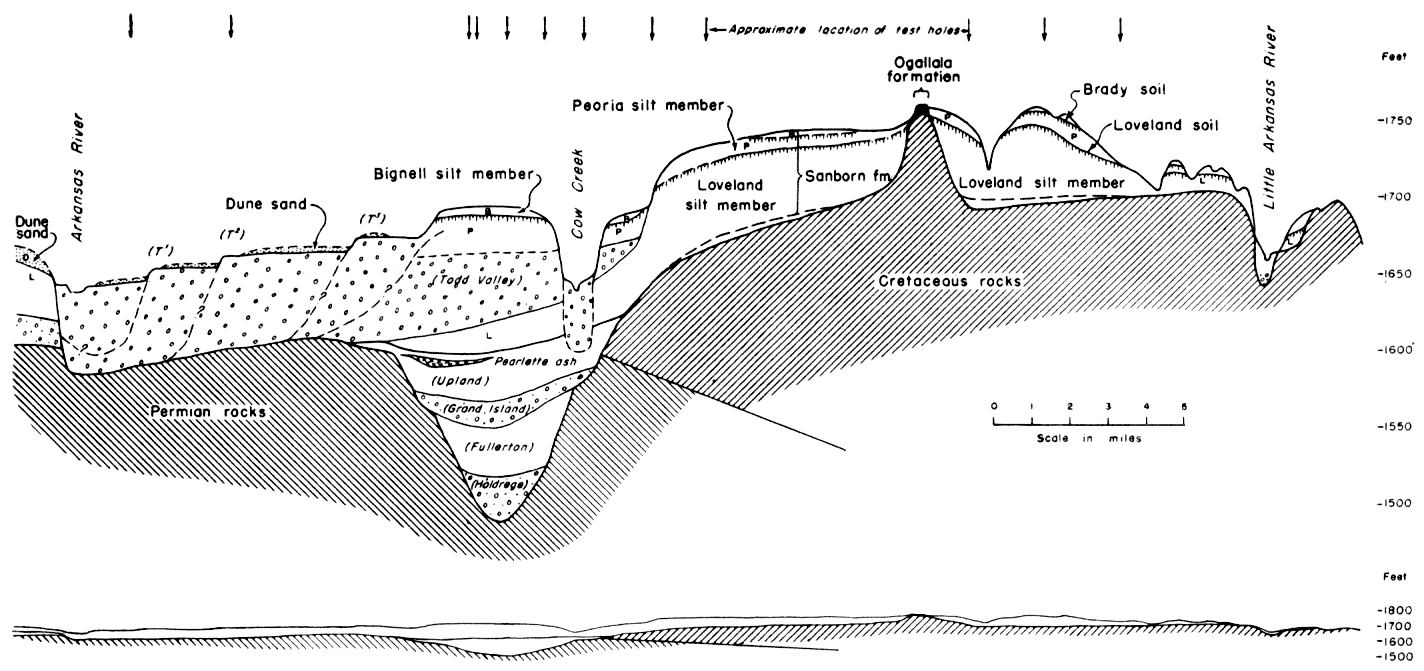
Fig. 1--Generalized north-south cross section through the Pleistocene deposits in central Rice County, Kansas. Based on logs of test holes drilled by the Geological Survey and on surface data. The relation of the Sanborn formation and its several members to the bedrock topography, Ogallala formation, and early Pleistocehe deposits is shown. Names shown in parentheses for pre-Sanborn Pleistocene units represent tentative correlation with named formations of the Nebraska classification. The ratio of vertical to horizontal scale is 200 to 1, and in the reduced cross section below, it is 20 to 1.
Kansas Geological Survey, Geology
Placed on web June 8, 2007; originally published in 1947.
Comments to webadmin@kgs.ku.edu
The URL for this page is http://www.kgs.ku.edu/Publications/Bulletins/70_3/fig1.html