![]()
Resources
Asphalt
The total value of the petroleum asphalt produced in Kansas each year amounts to many thousands of dollars. The exact figures may not be disclosed because there are less than three producers. In this state asphalt is derived from crude petroleum by distillation and constitutes an important product of refining.
Exposures of asphaltic sandstone have been reported at various localities in southeastern Kansas where the Cherokee shale (Pennsylvanian) outcrops. These asphalt deposits have been formed by the seepage and partial evaporation of oil from sands in the Cherokee. In few cases is the deposit sufficient in size to be of commercial importance.
Cement
The cement production in Kansas in 1925 amounted to $10,861,506. That figure is only exceeded by those for petroleum, zinc, and coal. Since 1916 the cement industry has more than doubled. The yearly values for the past ten years are given below:
| 1916 | $4,613,609 |
| 1917 | $5,271,721 |
| 1918 | $4,219,203 |
| 1919 | $5,467,284 |
| 1920 | $8,649,157 |
| 1921 | $7,253,944 |
| 1922 | $8,138,268 |
| 1923 | $10,868,590 |
| 1924 | $9,900,647 |
| 1925 | $10,861,506 |
| $75,243,829 |
There is an almost unlimited quantity of materials in Kansas suitable for the manufacture of Portland cement. Good Portland cement requires comparatively pure limestone and shale free from large amounts of magnesia. Most of the shale deposits of the state and many of the limestone formations are excellent cement-making material.
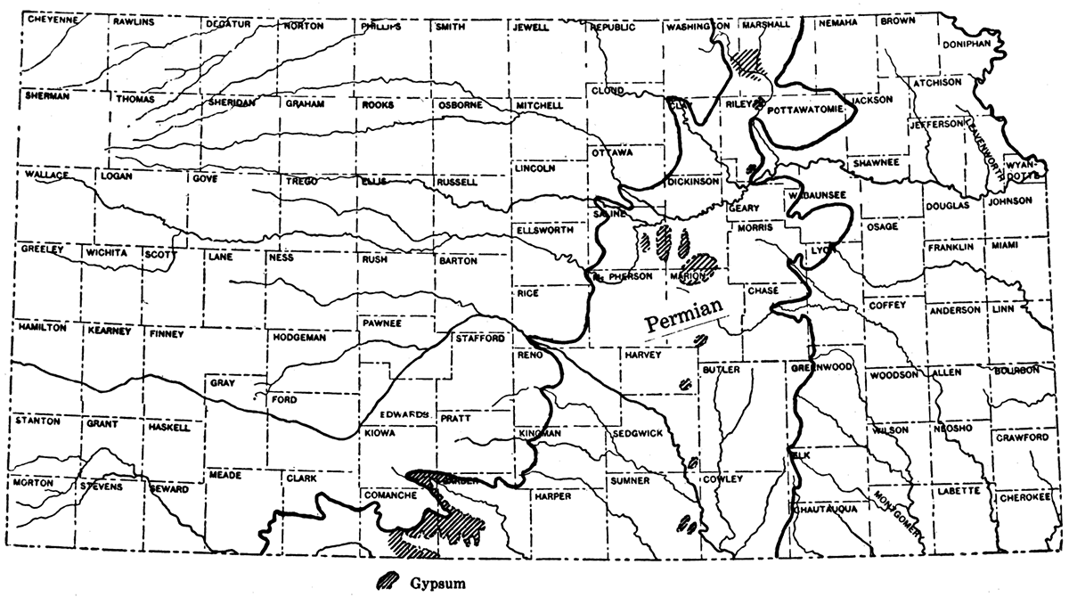
Due to their favorable location in eastern Kansas the limestones and shales belonging to the Pennsylvanian (coal measures) are most extensively used. Rocks of this age crop out in the eastern one-third of the state. Some of the Cretaceous limestones are sufficiently pure for use in cement manufacture, but to the present time but little use has been made of this series of rocks. The areal distribution of the principal limestones of Kansas is given in Figure 24. The many lines to the east represent outcrops of Pennsylvanian limestones. The heavy black bands in the west show outcrops of the Niobrara limestone belonging to the Cretaceous. Ce~ent is made by fusing mixtures of oxides of calcium, aluminum, and silicon. If the clinker is ground and water added it sets to a strong solid mass. Some impure or shaly limestones already contain the cement-making ingredients in the proper proportions. In that case the limestone is burned, and the resulting product is known as natural cement. This used to be a considerable industry in Kansas, but in 1924 only one natural cement plant was in operation in the state.
Figure 24—Map showing cement plants and the distribution of principal limestones.
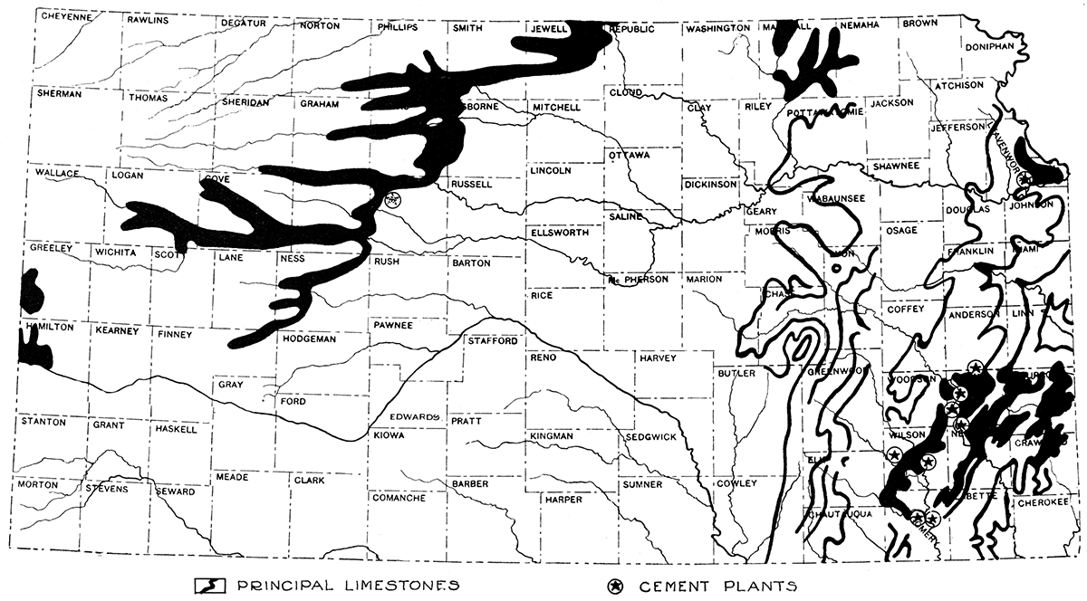
Portland, or artificial, cement is made in Kansas by mixing limestone and shale and burning the mixture. Chemical analyses of the rocks are necessary in order to determine the relative amount of each ingredient to add so that the oxides will be present in the correct proportion. About 2 per cent of gypsum is added as a retarder. This affords a considerable market for the gypsum industry of the state. In 1924 there were eight cement plants operating in Kansas. These were located at Bonner Springs, Mildred, Iola, Humboldt, Fort Scott, Chanute, Fredonia, and Independence. Most of these towns are in the southeastern part of the state. The plant at Fort Scott produced natural cement. The map, showing the outcrops of principal limestones, also gives the locations of cement plants. Some of these were not operating in 1924.
Kansas produced 5,810,000 barrels of Portland cement in 1924. It is estimated that of this amount a little over 2,000,000 barrels was consumed within the state. This leaves a surplus of 3,667,000 barrels which was sold outside the state. Only two other states produced a greater surplus of cement during that year. So cement manufacture in Kansas is by no means a local industry,
Cement has an ever increasing use as an ingredient of concrete in the paving of roads. It is also indispensable in the construction of large buildings, dams, bridges, canals, etc.
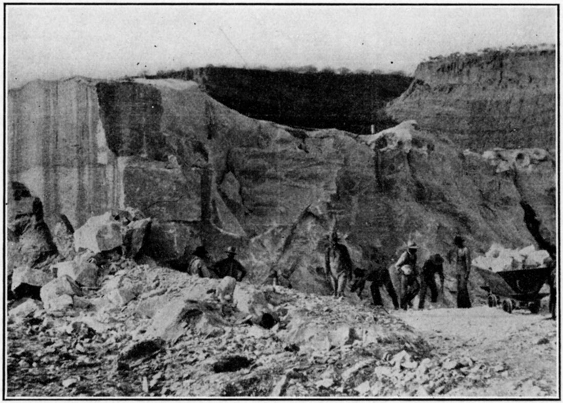
Figure 25—Quarry, Independence, Kan.
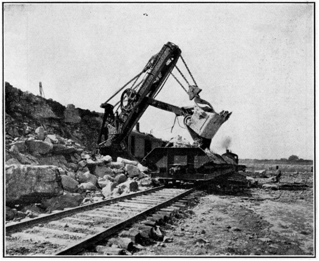
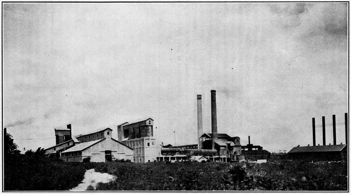
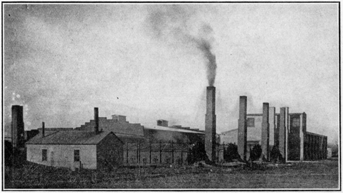
Figure 26—Cement Plant, Independence, Kan.
Clay Products
Kansas annually produces from four to five million dollars' worth of clay products. The production by years since 1916 is given in the accompanying table. The total for that period is $35,760,802.
| Annual Production Values of Clay Products in Kansas | |
|---|---|
| 1916 | $2,747,803 |
| 1917 | $2,696,722 |
| 1918 | $2,069,520 |
| 1919 | $3,426,002 |
| 1920 | $4,921,740 |
| 1921 | $3,739,594 |
| 1922 | $3,715,819 |
| 1923 | $4,425,067 |
| 1924 | $4,024,535 |
| 1925 (est.) | $4,000,000 |
| $36,760,802 | |
Pure clay is composed of the mineral kaolinite (a hydrous aluminum silicate) which is an important decomposition product of such rocks as granite. Running water may carry this material many miles from the original granite and deposit it as clay sediment on the floor of a lake or sea. Due to the weight of overlying younger material the sediment may be compacted into shale. Upon being exposed again to the atmosphere and surface waters shale has a tendency to disintegrate into a surface clay deposit. Other clays occur beneath coal beds and in glacial deposits. The latter are very rare in this state. Both clays and shales may be utilized in manufacture of the so-called clay products.
There are in Kansas large amounts of clay and shale suited for the manufacture of structural material. So far the shales have been much more extensively developed than the clays. Our knowledge in regard to the distribution and character of Kansas ceramic material is very limited. There is need for a great amount of field work and laboratory testing in order that our resources in regard to this valuable natural product may become better known. A few years ago the Kansas State Geological Survey studied the clays occurring in the Dakota formation (Cretaceous) of central Kansas. Samples were taken and tested in the well-equipped clay laboratories of the Survey. This work indicated the presence of clays suitable for the manufacture of high-grade bricks.
To date the main development of the clay resources has been in the eastern one-third of the state. This has been due largely to the presence in this portion of the state of an abundant supply of fuel for the firing of clay products. In four counties in the southeastern part of the state where natural gas and coal is abundant there are twenty-six operators manufacturing clay products. These counties are Montgomery, Crawford, Allen and Wilson. Another but lesser concentration of plants is noted in the northeast portion of the state where the proximity of the Kansas Cities stimulates productive activity. Most of the other counties in the eastern third of the state contain one or two brick and tile factories, but such plants are very rare in the western counties.
To date the Kansas ceramic industry has been largely confined to the manufacture of brick and tile. Clays of the degree of purity necessary for the manufacture of high-grade pottery are rare. The clays which underlie some of the coal beds in southeastern Kansas do not appear to be sufficiently refractory to be classed as fire clays. When properly fired they produce a product of light color and vitrify at a fairly low temperature.
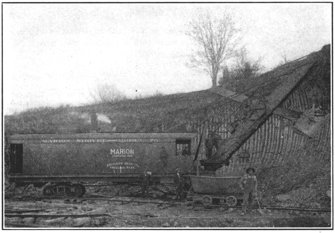
Figure 27—A clay pit near Fredonia, Kan.
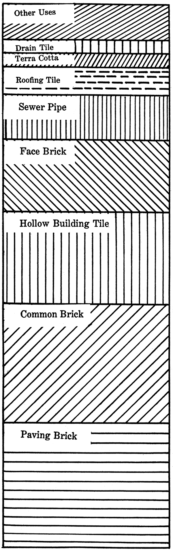
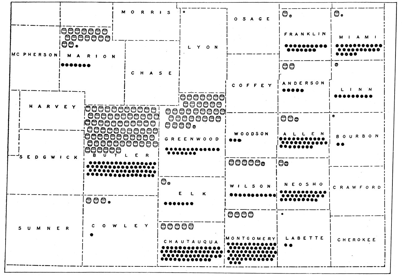
Bricks are made by molding the clay or shale into .~he desired form and then baking the material for several days in a kiln. Tile is manufactured similarly, except that a different type of kiln is used in order that the heat in burning may be more evenly distributed than is necessary in brick making. In Kansas the commonest ceramic products are paving (vitrified) brick, common brick, hollow building tile, face brick, sewer pipe, roofing tile, terra cotta, and drain tile. Products of lesser importance are furnace and flue linings, retorts, condensers, and wall coping. The more important brick and tile products of Kansas are given in a diagram in Figure 30. In this figure the size of the block represents the relative value of the product.
Figure 28—View of a Kansas brick plant, Fredonia, Kan.
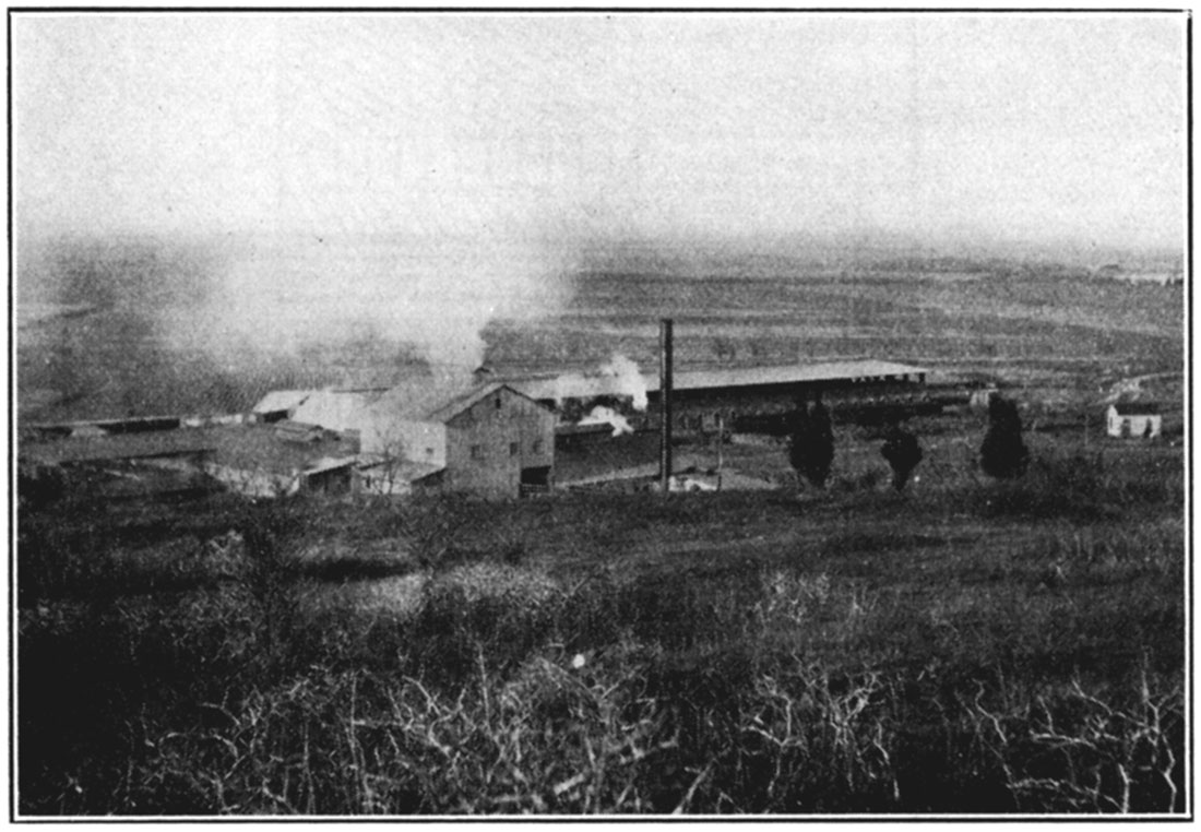
Figure 29—View in a brick kiln, Fredonia, Kan.
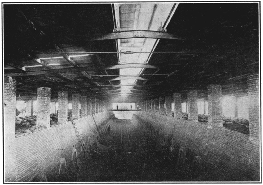
Figure 30—Diagram to show relative amounts of clay products produced in Kansas.
Coal
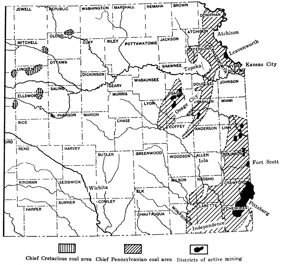
Coal is widely distributed in Kansas. It occurs at the surface or at comparatively shallow depth throughout most of the eastern one-fourth of the state, in the north-central and locally in the southwestern parts, and at considerable depth some coal is probably to be. found beneath most of Kansas. However, the commercially valuable deposits are found only in the eastern counties. Here the Pennsylvanian or as it is sometimes termed, the Coal Measures system of rocks contains many different beds of coal, some of which are traceable for many miles at their outcrop. Since in eastern Kansas the strata slope gently downward in a direction slightly north and west the lowest or oldest Pennsylvanian rocks and their included coal beds are found to the south and east and the higher or younger beds at varying distances to the northwest. The coal-bearing rocks underlie practically all of Kansas but in the central and western parts of the state they are too deeply buried to permit development of any coal which they may contain. Since also many of the coal beds which appear at the surface are too thin to be of commercial importance the actual area of minable coal comprises relatively only a small part of the outcrop of the coal-bearing strata.
Figure 31—Map of eastern Kansas, showing chief coal-producing areas and active mining districts.
The Permian system, which rests upon the Pennsylvanian rocks, and which appears at the surface in a broad band crossing the central part of Kansas, is not known to contain any coal beds. The Permian is overlain by Cretaceous rocks which in the north-central part of the state contain coal that is locally worked. Coal in these rocks extends westward under cover of younger strata, and has been encountered at places in borings but it is not very important.
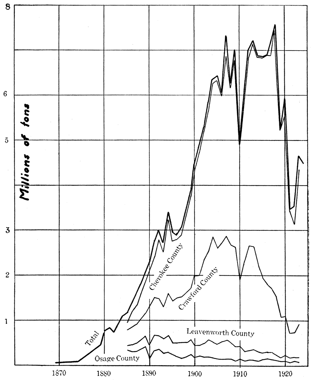
More than 90 per cent of the coal which is produced from the Kansas fields comes from the so-called Cherokee district in Cherokee and Crawford counties, in the southeastern corner of the state. The producing area, which comprises approximately 123,000 acres of workable coal, extends slightly across the line into Missouri. According to estimate there was originally something over 295,000,000 tons in this field in the coal bed which is mainly worked, but this coal is more than half worked out. There are three other commercial producing districts: (1) Linn county, in the vicinity of Pleasanton and La Cygne, (2) Osage county, near Osage City, Scranton and Carbondale, and (3) Leavenworth, in Leavenworth county. Some coal for local use is also mined in the vicinity of Fort Scott. As shown by the diagram representing total production, the amount of coal produced in these fields is relatively small.
Figure 32 is a generalized section of the Pennsylvanian rocks of Kansas showing the position of the main coal beds. The Cherokee shale is the chief coal-bearing formation, containing the thick WeirPittsburg and a number of other coal beds. The lowest coal occurs locally at the base of the Cherokee, but it has never been developed. A water well at Weir shows 2 feet of coal, 64 feet above the base of the shale, but this bed has not been mined. A coal bed 12 to 18 inches thick, occurring about 150 feet above the base of the shale, lies very near the surface near Columbus, Cherokee county, and has been mined by stripping. The Weir-Pittsburg bed, which is much the most important coal deposit in the Cherokee of southeastern Kansas, is found about 250 feet above the base of the Cherokee shale'. The coal ranges in thickness from 32 to 43 inches. This coal may be present beneath Fort Scott, as a boring here records 34 inches of coal at the approximate horizon of the Weir-Pittsburg bed. Figure 31 shows the Weir-Pittsburg coal field. In the east part of the district, where the coal lies very near the surface, the bed is mined by stripping off the soil and shale that conceal the coal. For this work large steam or electric shovels are used, some of them being able to move as much as 6 cubic yards of material in the dipper which has a 58-foot handle and an 85-foot boom. Up to 40 feet of overburden is removed in some stripping operations. Farther west, where the coal becomes gradually deeper, shafts are sunk and the coal is removed by room-and-pillar method of mining.
Figure 32—Generalized section of the Pennsylvanian rocks of Kansas showing position of main coal beds.
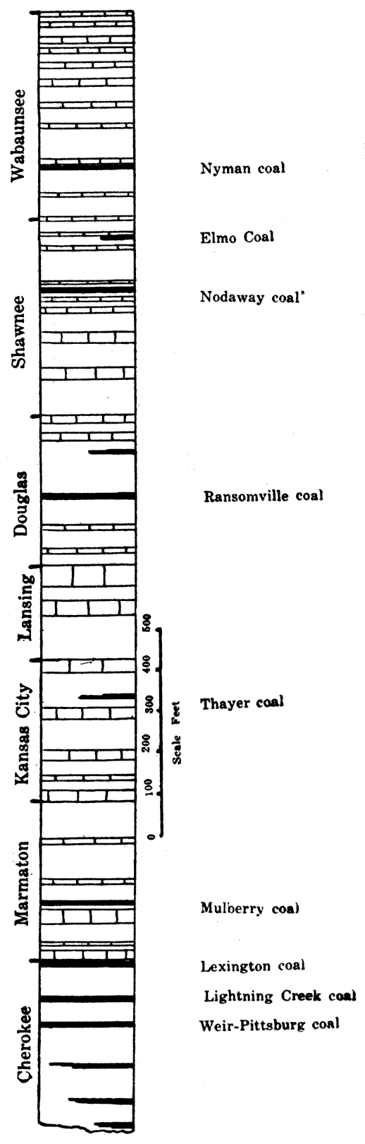
Figure 33—General view of strip pit. (Photograph by Prof. C. M. Young.)
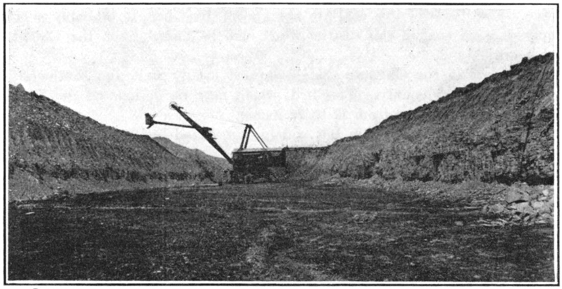
Figure 34—A scene in a Kansas coal strip pit.
At an average distance of about 60 feet above the Weir-Pittsburg coal is another bed known as the Lightning Creek coal. This bed is of about the same quality as the lower one, but is only about 2 feet thick, and at present it is not extensively mined. At the top of the Cherokee is the Lexington coal, which is mined in the vicinity of Fort Scott and in some other places. It is locally known as the Fort Scott coal. Its thickness ranges from about 15 to 20 inches. It is mined chiefly by stripping.
In the Marmaton formation there is a coal in the Bandera shale which corresponds to the Mulberry coal of Missouri. This coal ranges in thickness from 6 inches near Redfield, west of Fort Scott, to 3 feet 4 inches in the vicinity of La Cygne. It is mined by stripping near Fulton, Hammond and Prescott, and by shallow underground mining in the vicinity of Pleasanton, Boicourt and La Cygne. The limits of this coal are not known, but there is probably a large supply of good coal in this district which will be mined when the Cherokee coal is worked out.
A coal bed in the Chanute shale is mined locally west and southwest of Thayer in Neosho county. This bed, which may be designated the Thayer coal, ranges in thickness from 12 to 20 inches.
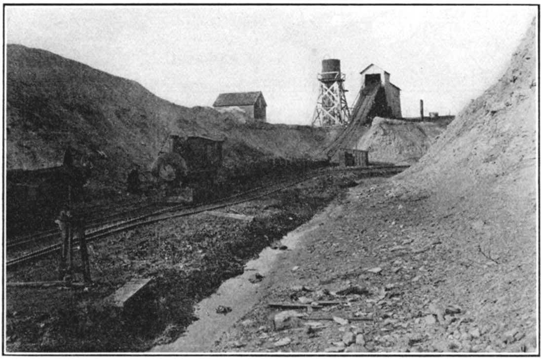
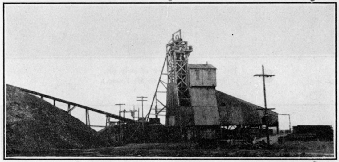
Figure 35—Tipple in Cherokee-Crawford district. (Photograph by Prof. C. M. Young.)
In the Lawrence shale thin but widely distributed beds of coal are found for many miles along the outcrop. The chief development is in the southwest part of Franklin county, in the vicinity of Homewood, Ransomville and Williamsburg, in a bed that may be called the Ransomville coal. It occurs about 150 feet below the top of the shale and ranges in thickness from 12 to 24 inches. A less important bed is recorded about 30 to 40 feet below the top of the shale. The Ransomville coal is mined by stripping and by underground mining, the long-wall method being employed.
The Osage county district exploits coal in the Severy shale. This coal, known stratigraphically as the Nodaway bed, is very widely traceable in Kansas, Nebraska, Missouri and Iowa, but in most places it is too thin for profitable mining. The coal at this horizon in Kansas is only mined actively in Osage county, and it is known commercially as the Osage coal. Its thickness where mined ranges from 11 to 30 inches, but the average is about 15 inches. It is interesting to note that this coal is approximately 2,000 feet higher in the series of rock strata than the Cherokee bed. The coal is mined by the longwall method. An estimate of the original workable coal in this field is recorded by C. M. Young as 89,000,000 tons.
Thin beds of coal are known higher in the Pennsylvanian section of Kansas. The Elmo coal, occurring a few feet below the Burlingame limestone, has been mined in the northeastern corner of Kansas and is exploited in a small way by the only coal mine in Nebraska, just north of the Kansas line, in Richardson county. It extends at least as far southwest as Greenwood county, but is not workable there. The Nyman coal, found just below the Table Creek limestone of Nebraska, that is, in the lower part of the Admire shale of present stratigraphic classification in Kansas, is mostly too thin to work, but was mined in Nemaha county, Kansas, in the early days before rail transportation made other fuel readily available.
Coal in the Cretaceous is found at various points in Cloud, Ellsworth, Lincoln, Mitchell, Republic and Russell counties, and is generally mined by stripping along the outcrop. The thickness of the coal ranges up to 22 inches. It is a fair grade of lignite. This coal has never been extensively exploited but is used chiefly for local supply.
According to the best available records Kansas produced 196,865,404 tons of. coal with a total value of $352,733,000, up to the beginning of 1926. Figure 36 shows the total production of Kansas coal for years since 1869 and the yield of the main producing counties for years since 1889. During the period up to 1908, there was a fairly steady and rapid increase in the production of coal in the state. Following years show considerable fluctuation, partly resulting from strikes and from the apparent saturation of the market. Since peak production in 1918 there has been a marked decline, ascribed to competition with oil and gas, with Illinois coal which was introduced by reason of favorable freight rates from the east and because of various labor difficulties in the mining district.
Figure 36—Curve showing the cumulative production of coal in Osage, Leavenworth, Cherokee, and Crawford counties in long tons, and the total production since 1870.
Kansas coal is a good grade bituminous coal. In heating value it compares favorably with bituminous coal from other districts in the United States, but is somewhat softer than some of the Illinois coals. If stored for too long a time it tends to slack, and its ash and relatively high volatile matter make it naturally less valuable than semibituminous or anthracite coals for many purposes. Good coke can be made from Kansas coal, but the sulphur content makes this coke unfit for some uses, especially in metallurgical work. Studies by Professor H. C. Allen, of the Kansas University Division of State Chemical Research, indicate interesting possibilities in manufacture of a semi coke from Kansas coal. The coal is heated to a lower temperature than in ordinary coking, and as by-products many valuable materials are obtained. The coke derived from this treatment, made in the form of briquettes, is an excellent domestic fuel, Analyses of average Kansas coals, as given by Allen, are recorded below. The most detailed recently published description of Kansas coal will be found in a report by Professor C. M. Young, University of Kansas, Engineering Bulletin 13, "Occurrence and Production of Kansas Coal," and H. C. Allen, Chemical Research Division, Bulletin 4, "The Chemistry of Kansas Coal."
| Average Analyses and Heating Values of Kansas Coals | |||||||
|---|---|---|---|---|---|---|---|
| No. | Form | Proximate analysis | |||||
| Moisture | Volatile | Fixed carbon |
Ash | Sulphur | British thermal units |
||
| 1 | A | 9.12 | 35.66 | 40.26 | 14.96 | 4.59 | 10,810 |
| B | 39.25 | 44.35 | 16.40 | 5.06 | 11,910 | ||
| C | 46.95 | 53.05 | 14,240 | ||||
| 2 | A | 7.29 | 36.62 | 45.78 | 10.31 | 4.42 | 10,630 |
| B | 39.48 | 49.36 | 11.16 | 4.77 | 11,470 | ||
| C | 44.46 | 55.54 | 12,900 | ||||
| 3 | A | 4.65 | 32.25 | 49.89 | 13.21 | 4.18 | 11,100 |
| B | 33.83 | 52.32 | 13.85 | 4.38 | 11,650 | ||
| C | 39.24 | 60.76 | 13,510 | ||||
| 4 | A | 3.26 | 33.55 | 54.24 | 8.95 | 4.26 | 13,402 |
| B | 34.68 | 56.06 | 9.26 | 4.40 | 13,860 | ||
| C | 38.22 | 61.78 | 15,270 | ||||
| No. | Number of analyses | Source of coal |
| 1 | 537 | Leavenworth and vicinity |
|---|---|---|
| 2 | 18 | Osage City and vicinity |
| 3 | 337 | Southeastern Kansas |
| 4 | 8 | Samples from seams in southeastern Kansas mines |
| Total Production and Value of Coal Produced in Kansas, 1869-1925, Inclusive |
|||||||
|---|---|---|---|---|---|---|---|
| Year | Tons | Value | |||||
| 1869 | 32,938 | ||||||
| 1880 | 550,000 | ||||||
| 1881 (Long tons) | 750,000 | $4,200,000* | |||||
| 1882 (Long tons) | 750,000 | ||||||
| 1883 | 900,000 | ||||||
| 1884 | 1,100,000 | ||||||
| 1886 | 1,082,230 | 1,410,000 | |||||
| 1886 | 1,000,000 | 1,680,000 | |||||
| 1887 | 1,596,879 | 2,236,000 | |||||
| 1888 | 1,850,000 | 2,775,000 | |||||
| 1889 | 2,221,043 | 3,297,000 | |||||
| 1890 | 2,269,922 | 2,948,000 | |||||
| 1891 | 2,716,705 | 3,567,000 | |||||
| 1892 | 3,007,276 | 3,956,000 | |||||
| 1893 | 2,662,546 | 3,376,000 | |||||
| 1894 | 3,388,251 | 4,179,000 | |||||
| 1896 | 2,926,870 | 3,482,000 | |||||
| 1896 | 2,886,801 | 3,295,000 | |||||
| 1897 | 3,054,012 | 3,602,000 | |||||
| 1898 | 3,406,555 | 3,703,000 | |||||
| 1899 | 3,852,267 | 4,478,000 | |||||
| 1900 | 4,467,870 | 5,466,000 | |||||
| 1901 | 5,900,528 | 5,993,000 | |||||
| 1902 | 5,266,065 | 6,868,000 | |||||
| 1903 | 5,839,976 | 8,872,000 | |||||
| 1904 | 6,333,307 | 9,641,000 | |||||
| 1906 | 6,423,979 | 9,861,000 | |||||
| 1906 | 6,024,776 | 8,980,000 | |||||
| 1907 | 7,322,449 | 11,160,000 | |||||
| 1908 | 6,245,508 | 9,292,000 | |||||
| 1909 | 6,986,478 | 10,083,000 | |||||
| 1910 | 4,921,461 | 7,916,000 | |||||
| 1911 | 6,178,728 | 9,474,000 | |||||
| 1912 | 6,986,182 | 11,824,000 | |||||
| 1913 | 7,202,210 | 12,036,000 | |||||
| 1914 | 6,860,988 | 11,288,000 | |||||
| 1915 | 6,824,474 | 11,860,000 | |||||
| 1916 | 6,881,466 | 12,253,000 | |||||
| 1917 | 7,184,975 | 16,618,000 | |||||
| 1918 | 7,661,947 | 22,028,000 | |||||
| 1919 | 5,224,724 | 15,917,000 | |||||
| 1920 | 5,926,408 | 22,928,000 | |||||
| 1921 | 3,466,641 | 18,467,000 | |||||
| 1922 | 2,955,170 | 10,816,000 | |||||
| 1923 | 4,035,404 | 12,981,000 | |||||
| 1924 | 4,150,000 | 13,000,000* | |||||
| 1925 | 4,092,000* | 11,600,000* | |||||
| *Estimated. | |||||||
Gypsum
Slightly over one million dollars worth of gypsum was mined in Kansas in 1925. This places gypsum twelfth among the mineral industries of Kansas. It likewise places Kansas ninth among the states of the union in value of gypsum production. Gypsum production by years since 1916 is given below.
| Annual Production Values of Gypsum in Kansas | |
|---|---|
| 1916 | $322,785 |
| 1917 | $424,611 |
| 1918 | $848,749 |
| 1919 | $620,673 |
| 1920 | $968,298 |
| 1921 | $655,164 |
| 1922 | $690,740 |
| 1923 | $842,740 |
| 1924 | $894,262 |
| 1925 | $1,009,510 |
| $6,672,681 | |
Chemically gypsum consists of calcium sulphate with combined water. It is formed by precipitation on the floor of the sea or of saline lakes in the same manner as salt. In fact strata of the latter substance often underlie or overlie gypsum beds. Anhydrite, which is calcium sulphate without chemically combined water, is another common associate of gypsum. In some regions gypsum beds when followed beneath the surface for some distance change into anhydrite. In this case the gypsum is secondary, having been formed through the hydration of anhydrite by near-surface waters. Anhydrite has no commercial value.
Workable deposits of gypsum are found in Kansas in rocks of Permian age. Strata of this age appear at the surface in a broad band extending from the center of the southern boundary of the state to the Nebraska line in a direction slightly east of north. The gypsum mining districts are located along this band. There are three main centers of production. The northern two contain gypsum beds interstratified with limestones and shales. In the southern part of the state thick layers of gypsum are interbedded with red shales and sandstones known as the "red beds." In this area the gypsum is higher stratigraphically and therefore younger than in the districts to the north.
Figure 37—Map of Kansas showing the distribution of gypsum deposits. (From Bull. 697, U. S. Geol. Survey.)
The Blue Rapids district is in the northern part of the state in Marshall county. Southwest of the town of Blue Rapids the United States Gypsum Company is mining by underground workings a bed of gypsum averaging 7 feet in thickness. At Blue Rapids both this company and the Beaver Products Company operate plants.
The central, or Gypsum City district, lies in Dickinson and Saline counties. There are two well marked horizons of gypsum in this area, with some indication of a third and lower horizon in the southern part. The upper or thinner of the well marked horizons has been quarried at Hope, where the gypsum bed is about 5 feet thick. The lower horizon, containing 14 feet of gypsum in places, was penetrated by an 8O-foot shaft a quarter of a mile west of the Hope quarry. This bed has also been mined near Solomon, twenty miles northwest of Hope. The central district had no regularly operated plant in 1924.
The southern, or Medicine Lodge district, is located in Barber and Comanche counties. It is the largest of the Kansas districts and, with its continuation in Oklahoma and Texas, forms the largest area of gypsum in the United States.
The principal gypsum bed of this district, known as the Medicine Lodge, is massive, with the lower portion very compact. It forms the cap rock for the gypsum hills which lie to the west of Medicine Lodge. Underlying red sandstones and shales crop out along the flanks of the hills. The gypsum layer varies in thickness from 3 to 20 feet, depending upon the amount of erosion. Elsewhere in the region a bed of gypsum 15 feet in thickness appears above a red shale of equal thickness which overlies the Medicine Lodge bed.
Figure 38—A Kansas gypsum quarry.
The Best Brothers Keene's Cement Company operates a quarry at Sun City, in northwestern Barber county. They mine a single bed of gypsum 16 feet thick which is covered by a small overburden. From Sun City the quarried material is transported by rail to Medicine Lodge, where the company has a mill.
About one-fifth of the annual production of gypsum in the United States is marketed without calcining. This "raw" gypsum is mainly used by the cement industry as a retarder. In the manufacture of Portland cement 2 per cent of gypsum must be added to prevent too quick setting. The next largest use for crude gypsum is as a land plaster, or fertilizer. It is not in itself a plant food, but it often reacts with other substances to produce plant foods.
Raw ground gypsum is used in manufacturing blackboard crayons, as a base for paints and insecticides such as Paris green, and as a filler for cotton and paper. In arid regions rock gypsum may be used as a road metal and building stone.
The remaining four-fifths of the gypsum produced in the United States is calcined. This process consists of driving off by heat about three-fourths of the chemically combined water. The resulting material, plaster of Paris, has the property of setting or hardening when mixed with water. If all of the water is driven off anhydrite will be formed, which reunites with water too slowly to be of commercial use. Gypsum plaster sets so rapidly that for most uses a retarder is employed. A common retarder is one containing hair, caustic soda, and lime.
Figure 39—A gypsum mill at Medicine Lodge, Kan.
The greatest use of calcined gypsum is as wall plaster. For this purpose other ingredients are added such as hair, wood fibre, and sand. Gypsum plaster is a very poor conductor of heat. A more recent use of gypsum is in the manufacture of plaster board, tile, and blocks. These products are of value for their fireproof character and their ability to deaden sound. Other major uses are in the manufacture of stucco and Keene's cement. The plate glass industry is a large purchaser of calcined gypsum for use in bedding plate glass for polishing.
Several score minor uses for gypsum could be mentioned. Among these are in the manufacture of statuary, relief maps, and models; as pottery, terra cotta, and foundry molds; for making artificial marble, surgical casts, and specimen mounts; and as a mild abrasive, such as tooth pastes and powders. Calcined gypsum is also used as a binder in match heads, and as a chief ingredient in pipe covering.
Lead and Zinc
Lead and zinc occur in the southeastern corner of Kansas in Cherokee county. Although the producing district is very limited in areal extent, Kansas produced in 1925, 22,775 tons of lead and 118,778 tons of zinc. The value of this production was $22,017,106, which places lead and zinc second only to petroleum in the mineral resources of the state. Considering the country as a whole Kansas is the second largest producer of metallic zinc and the seventh state in lead production. Since 1906 Cherokee county has produced one hundred and two million dollars worth of zinc and twenty-one and one-third million dollars worth of lead. A statistical table showing this production by years is given herewith.
The metalliferous deposits of southeastern Kansas are a part of a much larger lead-zinc district which extends over the state boundaries into Missouri and Oklahoma. At one time during 1917 one thousand rigs were at work in Oklahoma and Kansas searching for new ore. They were so successful in their hunt that the center of mining activity was shifted from the vicinity of Joplin, Mo., to a point near the border between Kansas and Oklahoma. Here it has remained for the ores in this area are richer than those in the neighborhood of Joplin and may be profitably worked during periods of deflation when the mines in the older district are forced to shut down.
The tri-state district produces 61 per cent of the country's zinc. At one time Missouri led the other two states, but now Oklahoma leads, and Kansas is second. The production curve for each of the three states in the district is given in Figure 40. This graph illustrates forcibly the meteoric rise of the two western states as zinc producers, coincident with Missouri's decline. It is believed by many that Oklahoma is at or near the peak of production. On the other hand, Kansas in all probability has not yet reached that point, as indicated by the trend of its production curve. This state will undoubtedly become an even greater producer of zinc than it is to-day.
Curves showing production of lead in the tri-state area are shown in Figure 41. They likewise illustrate the ascendency of Oklahoma and Kansas over Missouri in recent years. Furthermore the production of the tri-state district as a whole has grown enormously since 1915. The annual increase for the last three years exceeds the annual production for any single year before 1915. Oklahoma and Kansas consequently should have a great future in the production of lead.
The lead and zinc ores mined in.the tri-state district occur in what is known as the Boone formation of Mississippian age. This formation crops out in the southeastern corner of Cherokee county and extends across the state boundaries into Missouri and Oklahoma. It has a gentle dip of a few feet per mile to the northwest. This inclination carries the ore-bearing strata under the surface of the land in that direction. Above the Boone formation lie sandstones, shales, and coal beds of Pennsylvanian age, which crop out in successive bands to the west and northwest. The newer mines in Kansas are located on shale which must be penetrated before the ore is encountered.
The Boone formation consists largely of limestone and chert beds. The minerals containing the lead and zinc have been deposited by subsurface waters along certain horizons in the chert and in cavities existing in the limestone. Most of the mining is confined to the first three hundred feet beneath the surface, although drill records show the existence of ore to greater depths.
| Annual Production Values of Lead and Zinc in Kansas | ||
|---|---|---|
| Year | Lead | Zinc |
| 1906 | $198,170 | $1,996,615 |
| 1907 | 270,830 | $2,097,096 |
| 1908 | 211,512 | $1,327,186 |
| 1909 | 237,704 | $1,236,060 |
| 1910 | 212,256 | $1,428,732 |
| 1911 | 257,310 | $1,171,008 |
| 1912 | 213,390 | $1,467,354 |
| 1913 | 213,576 | $1,129,856 |
| 1914 | 109,902 | $1,160,968 |
| 1915 | 113,928 | $3,562,620 |
| 1916 | 227,424 | $3,336,064 |
| 1917 | 520,300 | $4,130,796 |
| 1918 | 1,029,784 | $6,495,854 |
| 1919 | 1,195,998 | $6,954,856 |
| 1920 | 2,686,080 | $9,893,826 |
| 1921 | 1,681,110 | $3,699,400 |
| 1922 | 2,559,810 | $6,409,650 |
| 1923 | 2,463,720 | $13,731,784 |
| 1924 | 2,969,600 | $13,700,960 |
| 1925 | 3,967,850 | $18,064,266 |
| $21,340,254 | $101,974,839 | |
Figure 40—Curves showing the relative values by states of zinc produced in the Tri-state district.
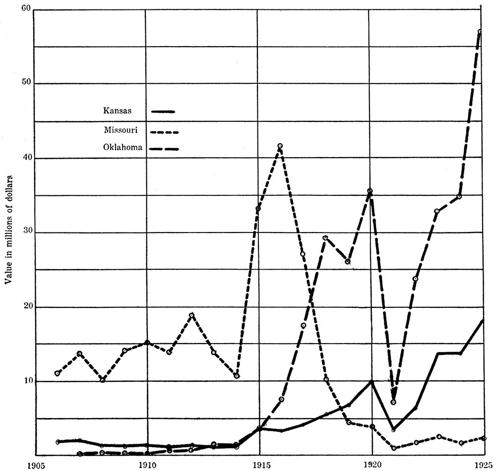
Figure 41—Curves showing the relative value by states of lead produced in the Tri-state district.
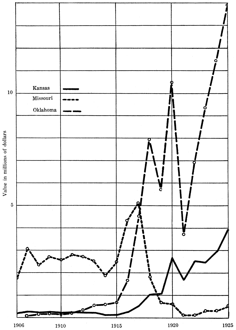
Figure 42—Underground view in Tri-state mining district.
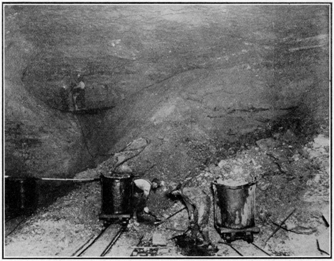
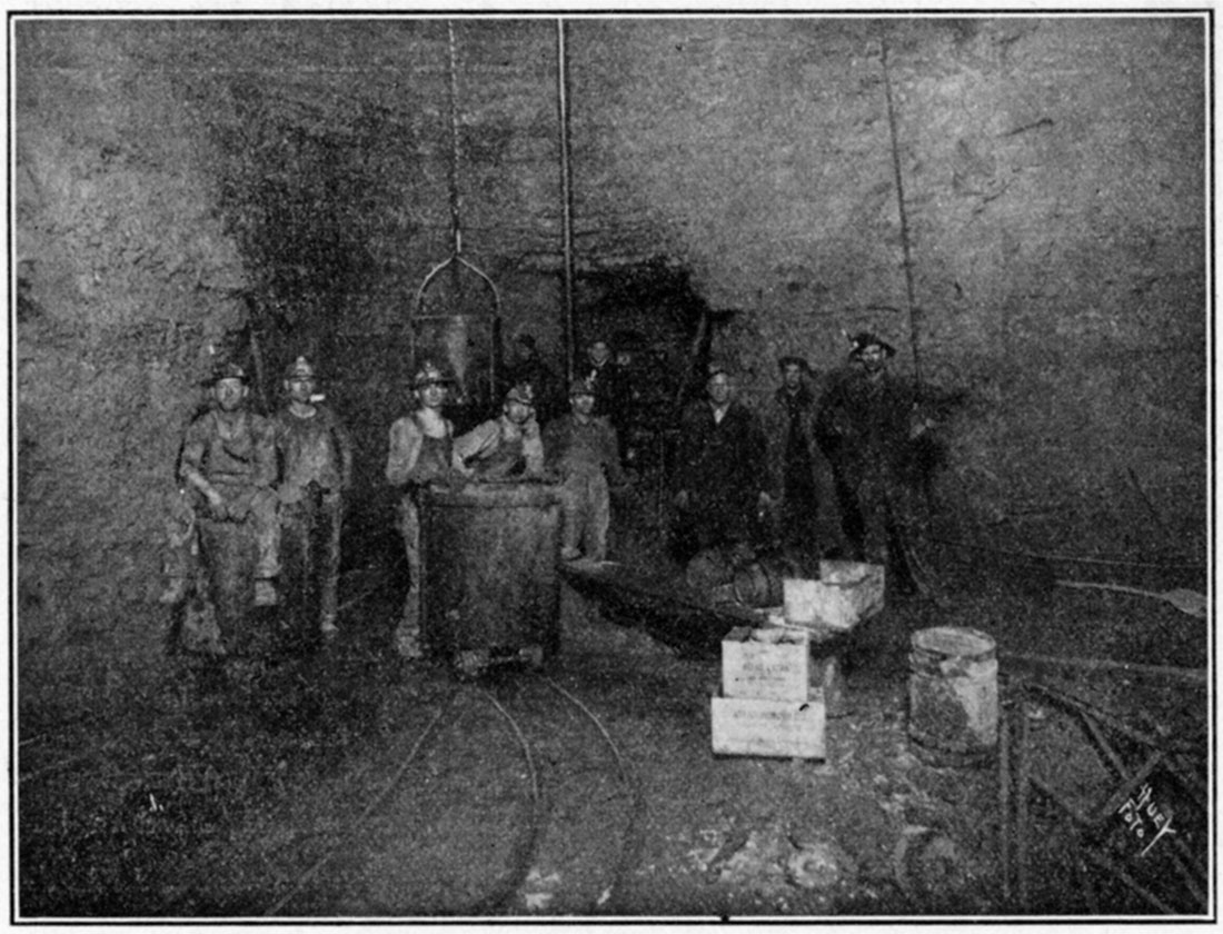
Figure 43—Underground mining scene, southeastern Kansas.
Assuming stable market conditions, there are three possible causes for the shutdown of a mine. In the first place the operators may run out of ore. Secondly, the ore may become of such poor grade as to be unprofitable. Lastly, the ore may descend to such depths that increased operating costs will exceed the receipts from the marketing of the ore. In the first instance the property will have to be abandoned. But in the second and third instances one of a. variety of causes may allow the mine to continue in operation. Slowing up of production may create a world shortage and a consequent increase in market value. Improved methods in mining and milling often allow the working of leaner or deeper ores at a profit which was not possible with older methods.
Figure 44—Lead-zinc mill at Westville, Kan.
In the Kansas portion of the tri-state district there is little possibility that the miners will soon run out of ore. But when the near-surface deposits have been worked out deeper mining win be necessary, which will, of course, involve greater hoisting and pumping expense. Kansas operators will have a choice of two courses to follow. They can go deeper in their present mines or they can follow the ore horizons in the Boone formation to the northwestward under the overlying shales, as is already being done by some operators. If they follow the latter course they may encounter areas of flatter and even reversed dips which will delay for a time the downward trend of the ore body. On the other hand the Boone formation may cease to be ore bearing at greater depth. There is need for an intensive underground study of the Kansas lead-zinc district. The question as to the distance below the surface that ore may be expected is an all-important one. Detailed research by the Kansas State Geological Survey would certainly thrown some light on this subject and thereby save the operators from useless expenditure of funds.
Southeastern Kansas may be divided into four principal mining camps. Of these the Blue Mound-Baxter Springs district just north of the Oklahoma line is by far the most important. Of the sixty mines operating in Kansas in 1924, forty-four were in this neighborhood. These mines produced almost twelve million dollars worth of zinc and over two and one-half million dollars worth of lead in that year. This is 93 per cent of the state's lead-zinc production.
The Kansas portion of the Waco district comes second with a zinc production of $1,700,000 and a lead production of $27,360. The Badger-Peacock-Crestline area is next, having produced $211,000 worth of lead and $24,000 worth of zinc in 1924. The oldest district in Kansas, Galena, is last with a lead production of $56,480 and a zinc production of $2,080. Although lower in total production the last two districts exceed Waco by a large amount in the production of lead.
Smelting of the ore is necessary to produce metallic lead and zinc. Kansas had two smelters operating in 1924, one at Cherryvale, the other at Caney. The presence in the state of smelters affords a market for our coal, clay and natural-gas industries. Unfortunately much of the locally mined ore goes outside of the state for smelting.
The chief uses of zinc are in galvanizing and brass making. A considerable quantity of the metal every year is rolled into sheet zinc. It also has a variety of other uses, such as in the manufacture of French oxide, die castings, and in the desilverization of lead. The most important uses of lead are in the manufacture of storage batteries, white lead, and in covering cables. It is also used in the manufacture of litharge, water pipe, and shot.
As in most other industries the mining and milling of lead and zinc is not without its by-products. Silver very often accompanies lead in highly profitable amounts, but that is not the case in the tri-state district. However, the sulphur separated from the metals during the process of smelting is manufactured into sulphuric acid, which is one of our most important commercial chemicals. The chert accompanying the ores is crushed during milling into a product known as chats. Twenty-nine thousand dollars worth of this material was marketing during 1924. It is used for road metal, ballast, and in concrete work.
Mineral Paints*
[*Much of the material for this chapter has been secured from an article on "The Manufacture of Zinc Oxide," by H. W. Curry, in the 1919 Chameleon, published by Sherwin-Williams Company.]
Kansas has one plant in which zinc and lead pigments are made directly from the ores. This is located at Coffeyville, in southern Montgomery county. The plant is owned by the Ozark Smelting and Mining Company, which is a subsidiary of The Sherwin-Williams Company. The value of the 1925 production of mineral paints in Kansas is included in the miscellaneous column of [Table 2].
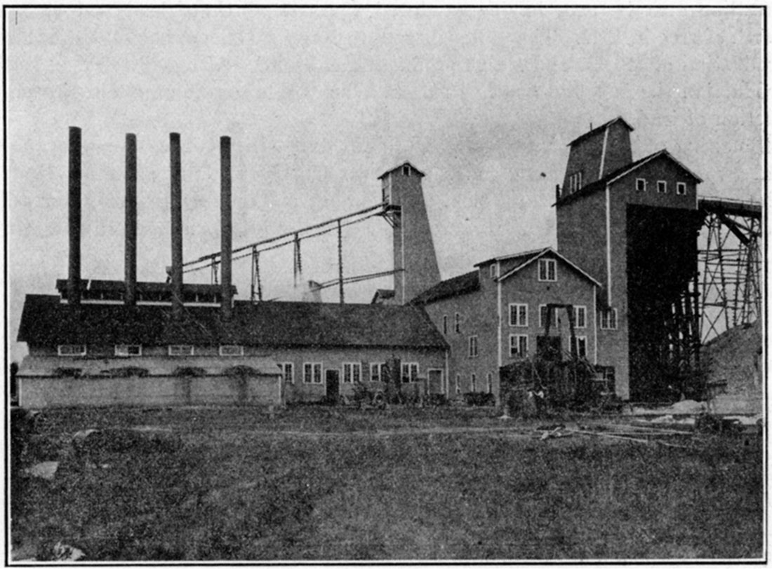
The main product of the Coffeyville plant is leaded zinc oxide. Ores containing about thirty per cent of combined lead and zinc, and free from impurities which might later discolor the pigment, are roasted to drive off the sulphur. Just enough sulphur is left behind to combine with the lead to form lead sulphate. Then the roasted product is mixed with coal and siliceous material and charged into the pigment furnaces. At Coffeyville there are three blocks of these containing sixteen furnaces each. Here the lead and zinc are reduced, separated from their impurities, and immediately reoxidized to zinc oxide and lead sulphate. The fume containing the latter compounds is led through combustion chambers and pipes where the impurities still present are either burned off or precipitated, and then into a bag house where the leaded zinc pigment is caught by the bags. It is removed at certain intervals, refined and marketed.
Figure 45—Mineral paint plant.
The usual tri-state ore is so easily concentrated that it is too valuable to be made into pigment. The mineral paint industry affords a market for ores of lesser concentration.
Zinc oxide is used in the manufacture of high grade rubber goods, as its presence increases the durability and resiliency of the material. It is also used in the manufacture of linoleum, and when mixed with zinc chloride it is used by dentists in filling teeth. As a pigment zinc oxide is inferior to white lead in covering power, but it has the advantage of being nonpoisonous and of not becoming discolored by hydrogen sulphide. A very practical pigment is one containing sixty-five per cent zinc oxide and thirty-five per cent lead sulphate. The leaded zinc oxide manufactured at Coffeyville is all ready for use, as it contains these two ingredients intimately mixed through their simultaneous deposition in the bag house. If the zinc oxide and lead sulphate are produced independently they must be mechanically mixed, involving an extra Step, before being ready for use.
Mineral Waters
Although one of the smaller industries of Kansas the value of mineral waters produced in 1923 amounted to $72,935. This does not include water that is given away, or water furnished to guests at hotels or patients of sanitariums for drinking or bathing purposes. Mineral water may be classified by uses into two groups, medicinal and table. Medicinal waters valued at $47,503 were sold in 1923. The production of table waters amounted to $30,432.
On a basis of chemical composition mineral waters may be classified into the following groups [this is the classification followed by E. H. S. Bailey, in "Special Report on Mineral Waters." (Geological Survey of Kansas, Vol. VII, 1902.)]:
- 1. Chloride group.
- 2. Sulfate group.
- 3. Chlor-sulfate group.
- 4. Carbonate group.
- 5. Chlor-sulfo-carbonate group.
- 6. Sulfide group (those waters that give off hydrogen sulfide and are commonly called sulfur waters).
- 7. Iron and manganese group.
- 8. Special group (containing some special substance such as lithium, boron, etc.).
- 9. Soft water group (containing only small quantities of mineral substances).
In the report by Bailey 108 natural mineral waters of Kansas are described; of this number 21 belong to the sulfate group, 18 to the chloride group, 16 to the iron group, 13 to the carbonate group, and the remainder scattered among the other groups. These springs are all located in the eastern two-thirds of the state where the Paleozoic and Mesozoic rocks crop out at the surface. They are more abundant in the Paleozoic rocks than in those of younger age.
Figure 46—Mineral spring fountain at Waconda.
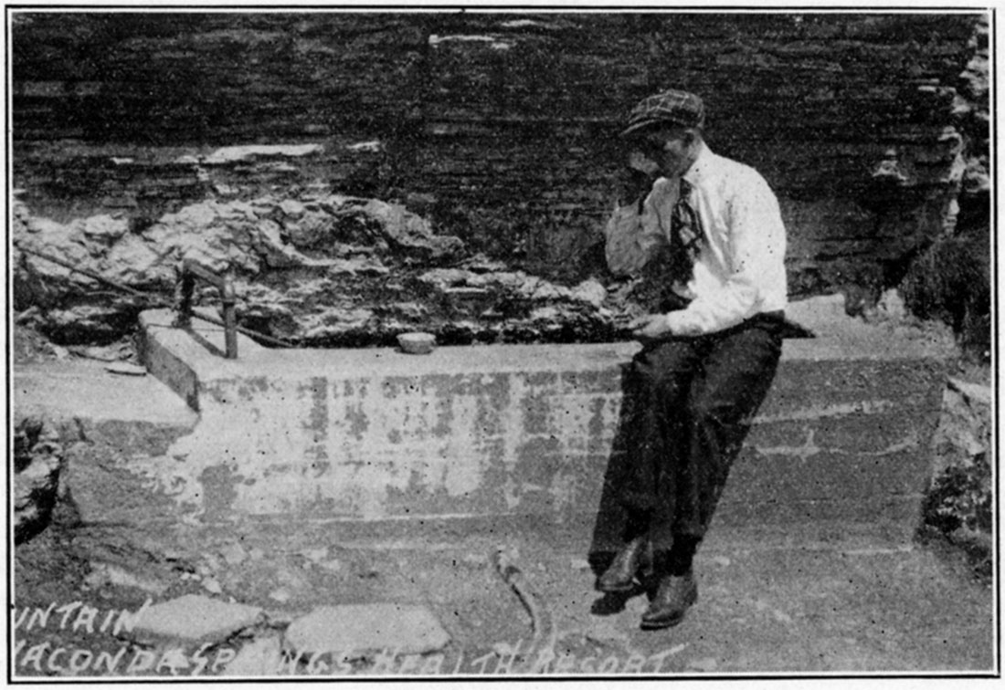
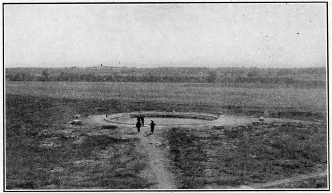
Figure 47—Mineral spring at Waconda.
There were twelve mineral springs in Kansas from which waters were sold in 1923. These are listed below:
| Spring or well | Nearest post office | County |
|---|---|---|
| Abilene wells | Abilene | Dickinson |
| Blasing's Springs | Manhattan | Riley |
| Conway Springs | Conway Springs | Butler |
| Crystal Springs | Coffeyville | Montgomery |
| Geuda Springs | Geuda Springs | Cowley |
| Mineral Rock Springs | Kansas City | Wyandotte |
| Mission Springs | Mission | Harvey |
| Rockheart Mineral Springs | Parsons | Labette |
| Sunnydale Springs | Valley Center | Sedgwick |
| Sycamore Springs | Morrill | Brown |
| Viola Springs | Viola | Sedgwick |
| Waconda Springs | Waconda Springs | Mitchell |
At Blasing's Springs and Waconda Springs there are bathing establishments and hotels in connection.
Natural Gas
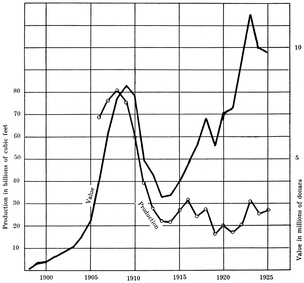
More or less gas has been found with the oil of the Kansas oil fields, but in some districts large gas production is obtained without finding oil. In the mad scramble for petroleum in past years much of the gas has been wasted. From 1908 to 1910 Kansas ranked third as a gas producing state and fourth as to the value of the gas produced. In 1911 it fell to fifth place in both regards, and since that time, while production has been large, it has not reached the peak of 80 billion cubic feet which was produced in 1908.
The number of gas wells in the state is relatively small when compared to the total number of oil wells. Many of the latter have also yielded considerable quantities of gas. Sometimes the gas has been utilized in field development. The fact that the rich Longton gas field was developed in an area that had already been tested for oil seems to indicate that future developments may still find good gas supplies in the old long prospected shallow fields of eastern Kansas. The following table shows the production of natural gas in Kansas by years and the value of the production. Brief description of some of the gas pools is given under county headings in the chapter on "Petroleum."
| Natural Gas in Kansas 1898-1925 | ||
|---|---|---|
| Year | Production in billions cu. ft. |
Value |
| 1898 | $175,000 | |
| 1899 | $888,000 | |
| 1900 | $857,000 | |
| 1901 | $659,000 | |
| 1902 | $824,000 | |
| 1908 | $1,124,000 | |
| 1904 | $1,518,000 | |
| 1905 | $2,262,000 | |
| 1906 | 69,328 | $4,011,000 |
| 1907 | 76,707 | $15,199,000 |
| 1908 | 80,740 | $7,692,000 |
| 1909 | 75,074 | $8,299,000 |
| 1910 | 59,880 | . $7,555,000 |
| 1911 | 88,799 | $4,855,000 |
| 1912 | 28,068 | $4,265,000 |
| 1913 | 22,884 | $3,288,000 |
| 1914 | 22,628 | $3,340,000 |
| 1916 | 27,046 | $4,037,046 |
| 1916 | 31,710 | $4,865,000 |
| 1917 | 24,488 | $5,701,000 |
| 1918 | 27,825 | $6,641,000 |
| 1919 | 16,150 | $5,492,000 |
| 1920 | 21,158 | $7,164,000 |
| 1921 | 15,717 | $7,382,000 |
| 1922 | 20,289 | $9,123,000 |
| 1923 | 80,918 | $11,249,000 |
| 1924 | 26,680 | $10,087,000 |
| 1926 | 26,917 | $9,991,000 |
Figure 48—Curve showing value and production of natural gas in Kansas since 1898.
Natural-gas Gasoline
The production of natural-gas gasoline by treatment of natural gas has been steadily increasing in Kansas and throughout the country during the past few years. Formerly this gasoline which is abstractable from the natural gas was run through the gas mains and used by consumers, In 1924 there were fourteen natural-gas gasoline plants in the state, five making gasoline by compression methods and nine by a combination of compression and absorption processes. A total of 19,592,000 gallons of this gasoline was produced in 1925, valued at $2,223,000. The recovery of this gasoline is obviously profitable, and it has been estimated in some fields, such as the Rainbow Bend, that the extraction of the gasoline from natural gas may yield approximately 25 per cent of the total oil recovered.
Some of the natural-gas gasoline is run into the pipe lines, but most of it is blended for use as a motor fuel with the gasoline from refineries. In 1925 approximately 25 per cent of the motor fuel produced in the United States was made by cracking processes in refineries, about 64 per cent from straight-run processes of manufacture from petroleum, and 10 per cent from raw natural-gas gasoline, and about 1 per cent from benzol derived in the coke industry. At present about 90 per cent of the natural gas produced is treated to recover gasoline, and within a very short time the amount of gasoline that is derived from this source will probably be limited by the quantity of natural gas produced. Growth of the natural-gas gasoline industry in the state of Kansas for the past years is indicated in the following table:
| Amount and Value of Natural-gas Gasoline Produced in Kansas, by Years, 1916 to 1925, Inclusive |
||
|---|---|---|
| Year | Number of Gallons | Value |
| 1916 | 215,000 | $35,030 |
| 1917 | 1,175,000 | $241,219 |
| 1918 | 2,390,000 | $593,730 |
| 1919 | 3,284,000 | $620,876 |
| 1920 | 4,331,000 | $828,887 |
| 1921 | 3,587,000 | $565,408 |
| 1922 | 2,855,573 | $435,056 |
| 1923 | 8,775,000 | $690,000 |
| 1924 | 11,658,000 | $913,000 |
| 1925 | 19,592,000 | $2,223,000 |
Figure 49—Curve showing production and value of natural-gas gasoline in Kansas since 1916.
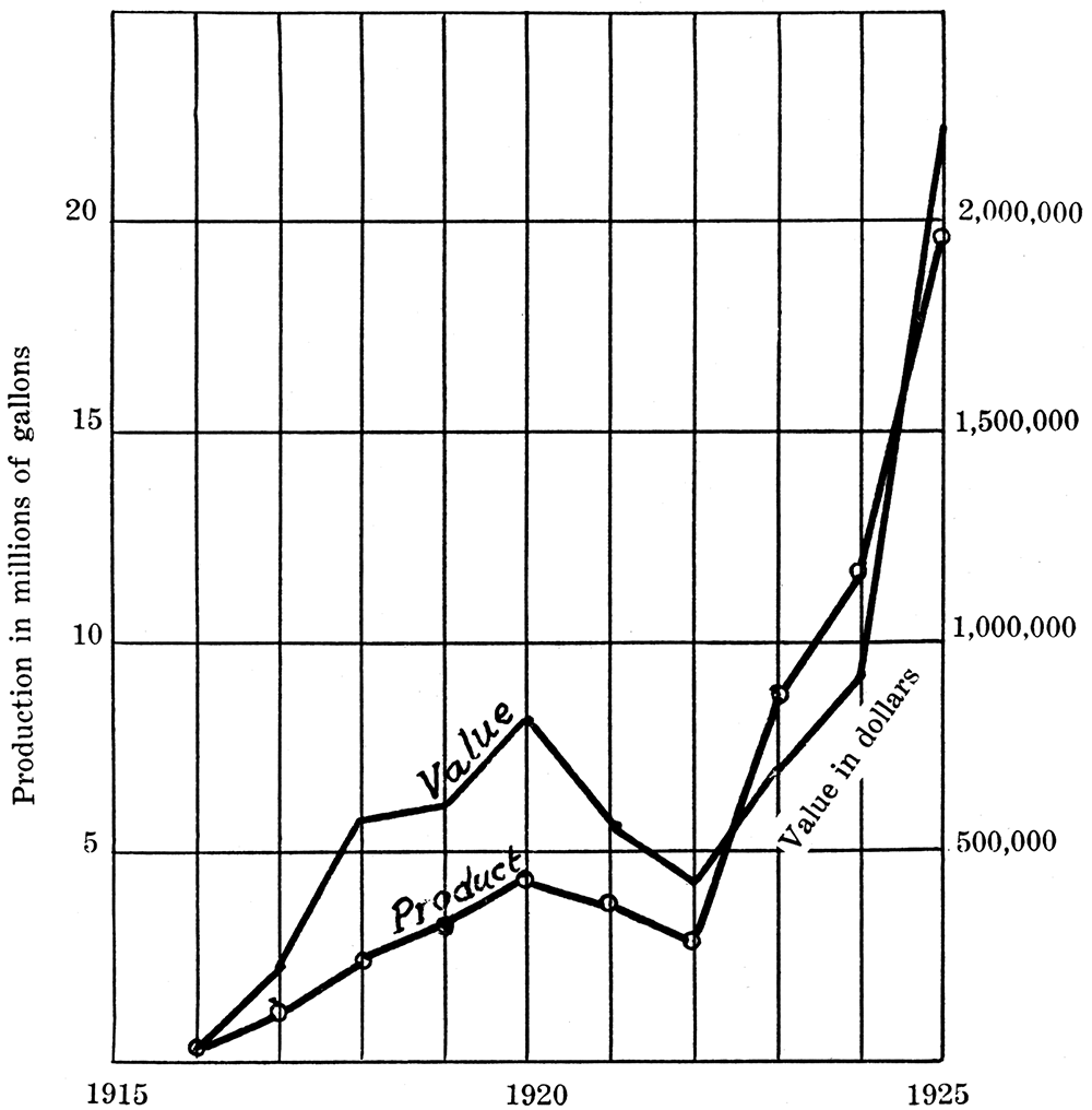
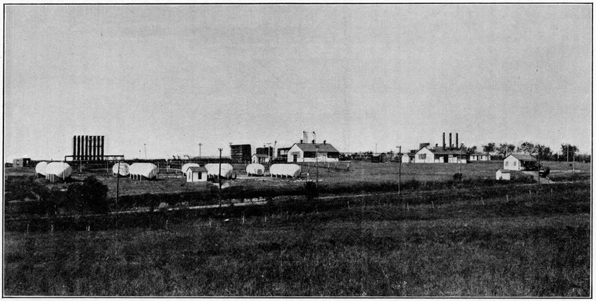
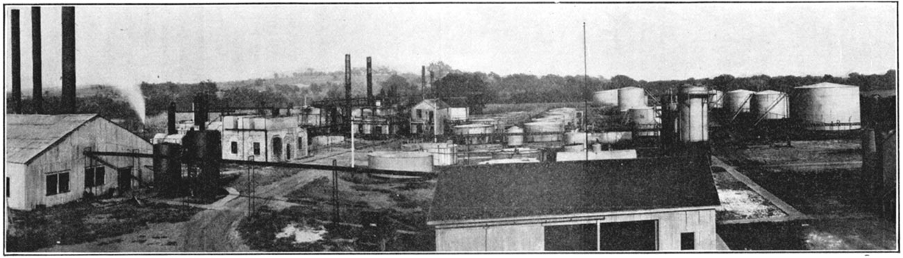
Figure 50—The Empire natural-gas gasoline refinery at Arkansas City.
Petroleum
As a producer of petroleum Kansas has held for many years a prominent place. Prospecting for this fuel, so important in modern commerce and civilization, began in Kansas almost as soon as the prairie soil had been furrowed by the plow, only shortly after the famous Colonel Drake discovery of oil in Pennsylvania in 1859. Despite this early beginning of exploration, production of commercial importance was developed very slowly, and it is only within the last ten years that Kansas has assumed a real place among the oil-producing states. At the present time (1925), though production is not so great as in the banner year, 1918, the annual oil yield of the state is about equal to the total combined Kansas oil production up to 1916. For the years since 1916 the lowest annual production of oil in Kansas was 28,836,000 barrels, in 1924. The production of 1925, 38,284,000 barrels, was surpassed only by the yield for the years 1918 and 1920. On December 31, 1925, there were 19,358 oil wells in Kansas, with a daily average production of 5.69 barrels. According to records, Kansas had produced up to the end of the first six months in 1926 the huge total of 377,873,000 barrels of oil, which exceeds the production for all time of any foreign oil field except Russia and Mexico. In the United States Kansas is surpassed as an oil producing state only by California, Oklahoma, Texas, Pennsylvania and Ohio. For the year 1925 Kansas ranked fifth among the states in quantity of oil produced, the order being: California, Oklahoma, Texas, Arkansas, Kansas.
In a report of a committee of the American Petroleum Institute, organized to make a thorough study of the oil resources of this country for report to the Oil Conservation Board appointed by President Coolidge, the entire 82,158 square miles of Kansas are classed as producing or potentially producing oil territory. All of the state is indeed, underlain by rock strata which in certain places and under certain conditions do yield oil, but from the fact that at least 40 wells have been drilled entirely through the sedimentary rocks into the underlying barren crystalline rocks, and many hundreds of wells have been drilled without success through all of the rocks likely to contain oil, the promise of commercial oil deposits in many places is not very great. In regions that have been intensively drilled, the limits of commercial production seem to be fairly well defined. Up to the end of 1924, 1,027 dry holes had been drilled in Butler and Marion counties, and 600 dry holes had been drilled in Greenwood county. On the other hand, commercial-oil fields have been found in parts of the shallow producing district in eastern Kansas after hundreds of dry holes had been drilled, and the very rich pools in Greenwood county were located after the county had been widely tested and practically condemned by oil men as prospective producing territory. The great oil pool in Russell county was located by a wildcat test more than 100 miles from a commercially productive field. It is therefore obvious that the petroleum resources of Kansas are only partly developed, and very much remains to be done in further exploration. For this exploration an authentic record of the results of past drilling, the recording and interpretation of geological information obtained and much detailed study by qualified specialists is required in order to develop the future oil supply which may be derived from this state.
Figure 51—Curve showing production, in barrels, of petroleum in Kansas since 1889.
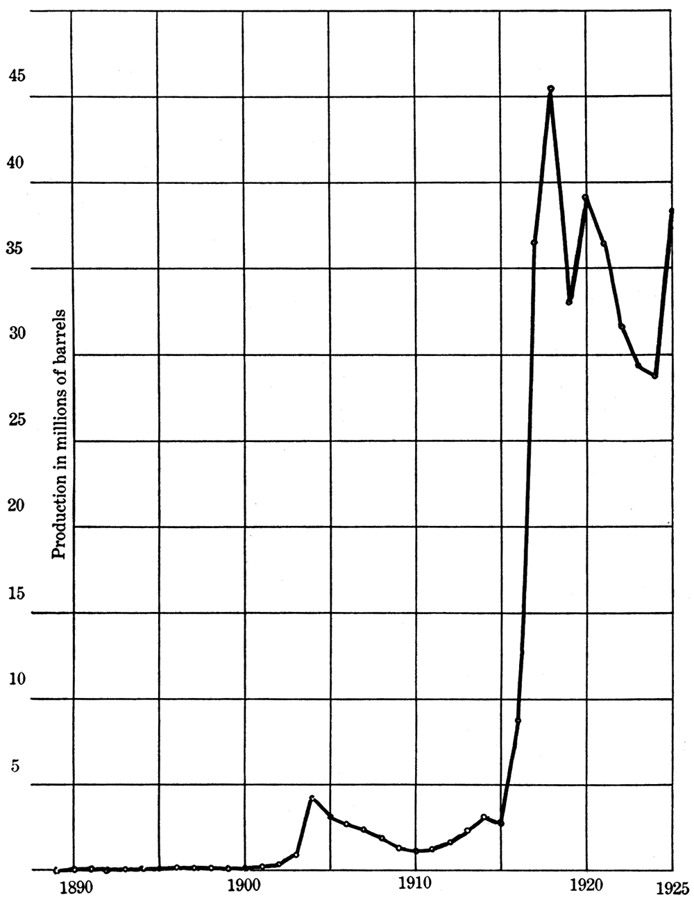
Figure 52—Showing relation of oil production to producing wells. Large barrel indicates annual production of 200,000 barrels. Heavy dot indicates 50 producing wells.
The oil fields of Kansas may be conveniently grouped from a geographic standpoint into four districts.
(1) The first, which may be termed the eastern Kansas shallow district, includes the fields southeast of a line drawn through Lawrence, Ottawa, Yates Center and Sedan. The principal oil-producing counties are Douglas, Miami, Franklin, Anderson, Allen, Linn, Bourbon, Wilson, Neosho, Chautauqua, Montgomery and Labette. In this area the lower and middle strata of the Pennsylvanian system are exposed at the surface and the oil-containing sands which are found in these rocks are reached at depths of 100 or 200 feet up to 1,500 feet. The average depth of wells in the district is 700 feet. The rocks slope gently downward in a direction slightly north and west, so that a given sand or formation is encountered at increasing depths below the surface in going from east to west. Most of the oil in the shallow district is obtained from more or less lenticular sand bodies in the lower part of the Pennsylvanian; a smaller part is obtained from the underlying Mississippian and older rocks, chiefly in Chautauqua and Montgomery counties. In general the accumulation of the oil in pools appears to depend less on structured conditions than the porosity and thickness of the sands. Some of the sands, especially in Anderson county and northern Allen county, are known to be very elongate, narrow "shoestrings," which have the form of a channel-filling in the associated shale. They represent stream valleys that were carved in the early Pennsylvanian rocks and filled with sand before the deposition of the overlying strata. In other cases there are lenticular sands that appear to be ancient sandbars which existed along the shore line of the sea which occupied eastern Kansas in early Pennsylvanian time. The rock strata are only slightly affected by minor folding, and in some places oil occurs in synclines as well as on anticlines.
Although a very large number of wells have been drilled in the eastern Kansas shallow fields the individual production is commonly small, often amounting to only one or two barrels per day. Initial production of as much as 500 barrels a day has been reported, but a 50-barrel well is ordinarily accounted a good one. On the average these wells produce for many years by pumping. The quality of the oil is in general lower than that of the deeper fields, ranging from about 19 to 37 degrees Baumé and averaging about 31 degrees. The total production of the district is small as compared with the deeper fields which lie to the west. However, the small expense of drilling a well largely offsets the hazard in exploration for new fields, and since it has been found that productive territory often lies in a region that has apparently been pretty fairly drilled there is prospect of continued activity in the shallow fields, especially under favorable market conditions.
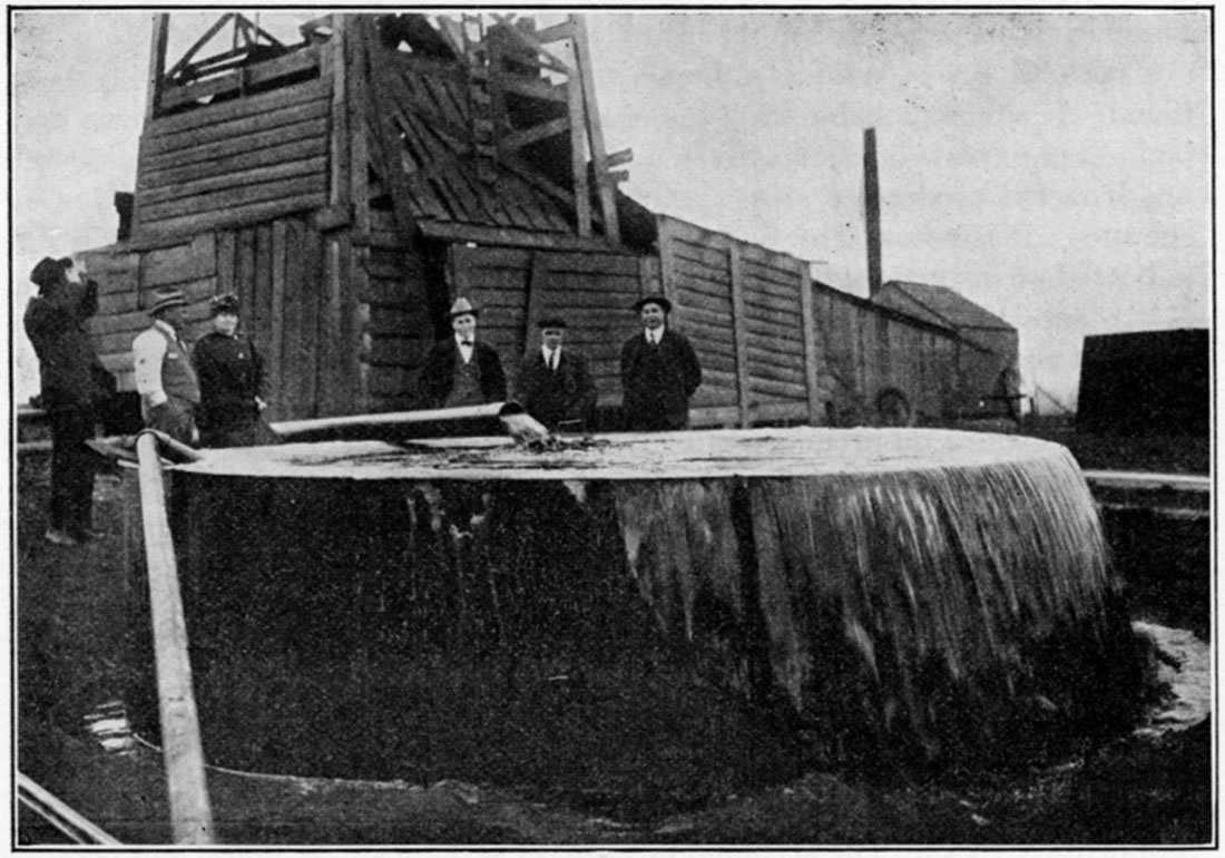
Figure 53—A Kansas gusher.
(2) The second district, which may be designated the eastern Kansas deep district, comprises a belt including western Chautauqua and Elk, eastern Cowley, Greenwood, eastern Butler, and southern Lyon counties. In this region the average depth to the producing horizon is around 2,000 to 2,500 feet. The oil comes chiefly from sands in the lower part of the Pennsylvanian, but in certain districts is obtained also from the underlying Mississippian limestone. Greenwood county is the main producer, and it is of interest that the prolific "golden lane," trending northwest across the county from Sallyards, was discovered after widespread and apparently exhaustive drilling. The sands in this area are lenticular in cross section and extend in a nearly straight line for more than 40 miles. Like some of the sands farther east these appear in part to represent bar deposits along the shore of the sea of early Pennsylvanian times. The average production of the wells is very much greater than in the shallow district and the quality of the oil is better, ranging from 36 to 41, and averaging around 39 degrees Baumé, Extensive drilling in northern Greenwood and southern Lyon counties in the effort to extend the area of production has not been wholly successful, although several outlying pools have lately been found. It seems probable from the character of the sands that extensions may be located in parts of eastern Lyon and Coffey counties, and there are probably undiscovered productive areas in Greenwood, Chase, east Butler, and Cowley counties. It is noteworthy that the location of the main producing area is not indicated at the surface by a distinct anticlinal flexure of the beds. Knowledge of the actual conditions underground obtained by careful subsurface study of the well records, cuttings from the wells and other data is very important in planning exploratory work.
(3) The third oil-producing area may be designated the Granite Ridge district. This includes the fields along the trend of the buried granite ridge which extends across Kansas in a nearly straight line from Nemaha county on the north to western Cowley county on the south. No oil has been discovered above or on the flanks of this buried ridge in the north part of the state, but on the west side in Marion county, and above the ridge in the vicinity of El Dorado and Augusta and in western Cowley county, important fields have been developed. A strongly defined anticlinal structure in the stratified rocks of Permian age which occur at the surface in this region marks the trend of the underlying granite. The oil at El Dorado is found in part of the uplifted sedimentary rocks. The accumulation covers several square miles, and because of the porous character of the sand and limestone in which the oil occurs, production has been very prolific. Some wells which flowed without pumping have yielded as much as 20,000 barrels per day. While some oil and gas are obtained in sands in the Pennsylvanian, most of the production has come from more or less weathered parts of Ordovician rocks, chiefly the "siliceous lime" and Wilcox. Farther south oil has been produced mainly from sands that lie on the flanks of the major anticline above the granite. The oil has an average gravity of 32 to 34 degrees Baumé.
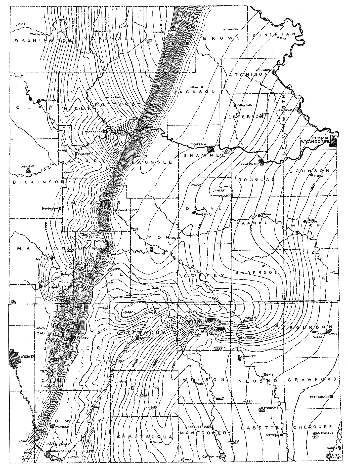
Figure 54—The "Granite Ridge" of Kansas. Drilling for oil in Kansas has afforded interesting information concerning the ancient rock floor on which the oil-bearing and other sedimentary rocks of the region were deposited. A prominently elevated portion of the floor, consisting mainly of granite, underlies the oil fields of Butler and Marion counties and extends entirely across the state. It rises to within 500 feet of the surface in the north, but is gradually depressed southward. (Contoured by Raymond C. Moore.)
Contour interval, 100 feet.
Elevation of granite, underlined figures.
Elevation of bottom of deep well, no granite, not underlined.
[Also available as an Acrobat PDF version, 3.1 MB.]
While it is possible that no new field will be discovered which will yield as much oil as El Dorado, it is known that there are important possibilities of future production in certain parts of this district. Exploration in western Cowley and eastern Sumner counties is very difficult because there are no surface hard rocks which show the detailed structure of the rock strata. This obstacle is being overcome by some of the larger companies by shallow test drilling which reveals the position of a marker bed and permits determination by the geologist of the structure of the rocks. In Marion county, and possibly farther north, bodies of sand deposited on the flanks of the uplift have been found or may be found productive of oil. In this region also there is possibility of production from porous zones in pre-Pennsylvanian rocks. Since for the most part there are no good surface evidences of oil accumulation, exploration is hazardous.
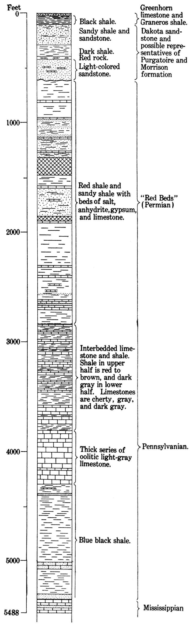
Figure 55—Generalized stratigraphic section of buried rocks of Hamilton County, Kansas, as shown in log of well drilled in sec. 5, T. 26 S., R. 41 W.
(4) In the fourth district may be included all of the western part of Kansas beyond the Granite Ridge. district. A convenient eastern boundary is the sixth prime meridian which crosses the state from north to south through Wichita. Up to the present time oil in commercial quantities has been found in only a few parts of this great territory and the ultimate importance of the region from the standpoint of oil production is very uncertain. [Note: On January 1, 1927, after this report was in the hands of the printer, Hartman & Skaer and Skelly Oil Company brought in a 150-barrel well in sec. 24, T. 24 S., R. 8 W., near the town of Abbyville, Reno county. Production was obtained from a depth of 3,545 feet.] The largest oil yield and the most interesting development in Western Kansas is in Russell county, approximately 135 miles northwest of the El Dorado field. The oil here occurs along a well-defined north-south trending anticline which was located in the course of geologic exploration and tested by a well drilled late in 1923. The discovery well produced first at the rate of about 10 barrels a day, but on drilling slightly deeper another pay zone was encountered at 2,998 feet from which 300 barrels a day was obtained by pumping. Other wells subsequently drilled showed larger production, some with a capacity reported up to 1,600 barrels per day. The main pay zone lies near the bottom of the Pennsylvanian rocks in this region, and is encountered at a depth of around 3,000 feet. Deeper pay zones have been encountered in some wells. Development in the last three years has considerably extended production. The Russell field has already (to August 1926) produced more than 2,500,000 barrels of oil, and the county ranks fourth in the state in volume of production. The oil which has a gravity of about 41 degrees Baumé is unusually light for Kansas oil and its content of gasoline, amounting to 43 per cent, is correspondingly large.
An interesting oil field has been developed about 12 miles north of Hutchinson in the southeast part of Rice county. The oil here occurs in a porous residual chert that belongs in the Cherokee shale of early Pennsylvanian age. Data are not available on the local and regional structures in this area. Most of the legion lacks traceable key beds and is in part covered by extensive deposits of dune sand, the discovery well being located without geologic guidance. In Kingman county oil has been found at a depth of around 4,000 feet in beds which may correspond to the siliceous lime. The commercial possibilities of this region are as yet undetermined, but increasing amounts of water in the one producing well and the failure of offsets and other tests are very disappointing. Reports of oil and gas in adjacent territory, especially to the south, seem to suggest that production of commercial importance may be found here.
Figure 56—Kanotex oil refinery. Arkansas City.
Several tests have been drilled in various parts of western Kansas, one in Hamilton county to a depth of 5,488 feet, and another in Clark county to 5,679 feet. With the exception of showings of oil and gas these explorations have not as yet proved successful. The deep Clark county well in sec. 20, T. 32 S., R. 21 W., reported a showing of oil at 5,318 feet and 25,000,000 cubic feet of gas at 5,304 feet. A well west of Liberal in Seward county reported 10,000,000 cubic feet of gas at a depth of about 2,700 feet. [Note: In June, 1927, a wildcat well southwest of Hugoton, Stevens county, in sec. 31, T. 33 S., R. 37 W., struck a gas flow estimated between 7 and 10 million cubic feet in a porous layer tapped at 2,660 feet. The gas caught fire and burned the rig.] The finding of oil in Russell county, the successful developments of gas at Wray, Colo., just west of the northwest corner of Kansas, the knowledge of a fairly prominent anticline trending south from the line between Decatur and Norton counties, and the scattered showings of oil and gas which have been mentioned encourage prospecting in the western part of Kansas. [Note: On July 6, 1927, the Vickers Petroleum Company brought in a 200-barrel wildcat at a depth of 3,257 feet in the southwest 1/4 of southeast 1/4 of sec. 11, T. 9 S., R. 16 W., in southeastern Rooks county. This is 22 miles northwest of the Fairport pool of Russell county.] However, the fact that through many hundreds of square miles in this section of the state there are surface deposits of sand and gravel which conceal the underlying stratified rocks and make surface observations of structure impossible, and the fact that many of the surface beds that are exposed lack good key beds for structural geologic study, make exploration for oil in this region unusually difficult. Further, the very deep borings which have been put down in Clark and Hamilton counties show that the Pennsylvanian lies at great depth, and unless oil is found in higher beds the expense of this deep drilling will be an important factor in the attempt to develop new fields.
| Kansas Petroleum Production in Barrels, by Years, 1889 to 1925, inclusive |
|
|---|---|
| 1889 | 500 |
| 1890 | 1,200 |
| 1891 | 1,400 |
| 1892 | 5,000 |
| 1893 | 18,000 |
| 1894 | 40,000 |
| 1895 | 44,000 |
| 1896 | 114,000 |
| 1897 | 81,000 |
| 1898 | 72,000 |
| 1899 | 70,000 |
| 1900 | 76,000 |
| 1901 | 179,000 |
| 1902 | 332,000 |
| 1903 | 932,000 |
| 1904 | 4,251,000 |
| 1905 | 3,100,000* |
| 1900 | 2,700,000* |
| 1907 | 2,410,000 |
| 1908 | 1,801,000 |
| 1909 | 1,264,000 |
| 1910 | 1,128,000 |
| 1911 | 1,279,000 |
| 1912 | 1,693,000 |
| 1913 | 2,375,000 |
| 1914 | 3,104,000 |
| 1915 | 2,823,000 |
| 1916 | 8,738,000 |
| 1917 | 36,636,000 |
| 1918 | 45,451,000 |
| 1919 | 33,048,000 |
| 1920 | 39,005,000 |
| 1921 | 36,456,000 |
| 1922 | 31,766,000 |
| 1923 | 29,407,000 |
| 1924 | 28,836,000 |
| 1925 | 38,357,000 |
| Total | 358,270,000 |
| *Estimated | |
| Kansas Wells Drilled in 1924 and 1925 | ||
|---|---|---|
| 1924 | 1925 | |
| Wells completed | 1,125 | 2,003 |
| Dry holes | 396 | 636 |
| Gas wells | 79 | 86 |
| Oil wells | 650 | 1,281 |
| Initial daily production, barrels | 92,268 | 207,880 |
| Average initial daily production, barrels | 141.9 | 162.3 |
Allen County
The production of oil and gas has long been a well-established industry in Allen county, the gas pool at Iola being one of the very early developments in Kansas. Some production of oil and gas has been found in almost all parts of the county, but the main producing areas may be grouped into three pools: the Iola, the Moran and the Humboldt.
The Iola pool is primarily a gas producer, but there are some oil wells, mainly in the area three or four miles west and southwest of Iola. The field extends from the south side of T. 25 S., R. 17 E., northeastward about 15 miles to the vicinity of Carlyle. The productive area has an average width of about five miles, but near Iola and La Harpe it is fully ten miles wide. Some of the wells had a reported capacity of 15,000,000 cubic feet per day, but most of the wells are smaller. Much of the gas has been put to industrial uses, and it is responsible for the location at Iola of large zinc smelters. The producing sands occur in the Cherokee formation. They are lenticular in shape, and in places grade into shale in very short distances. The average depth of wells is 600 to 850 feet.
Figure 57—Allen county.
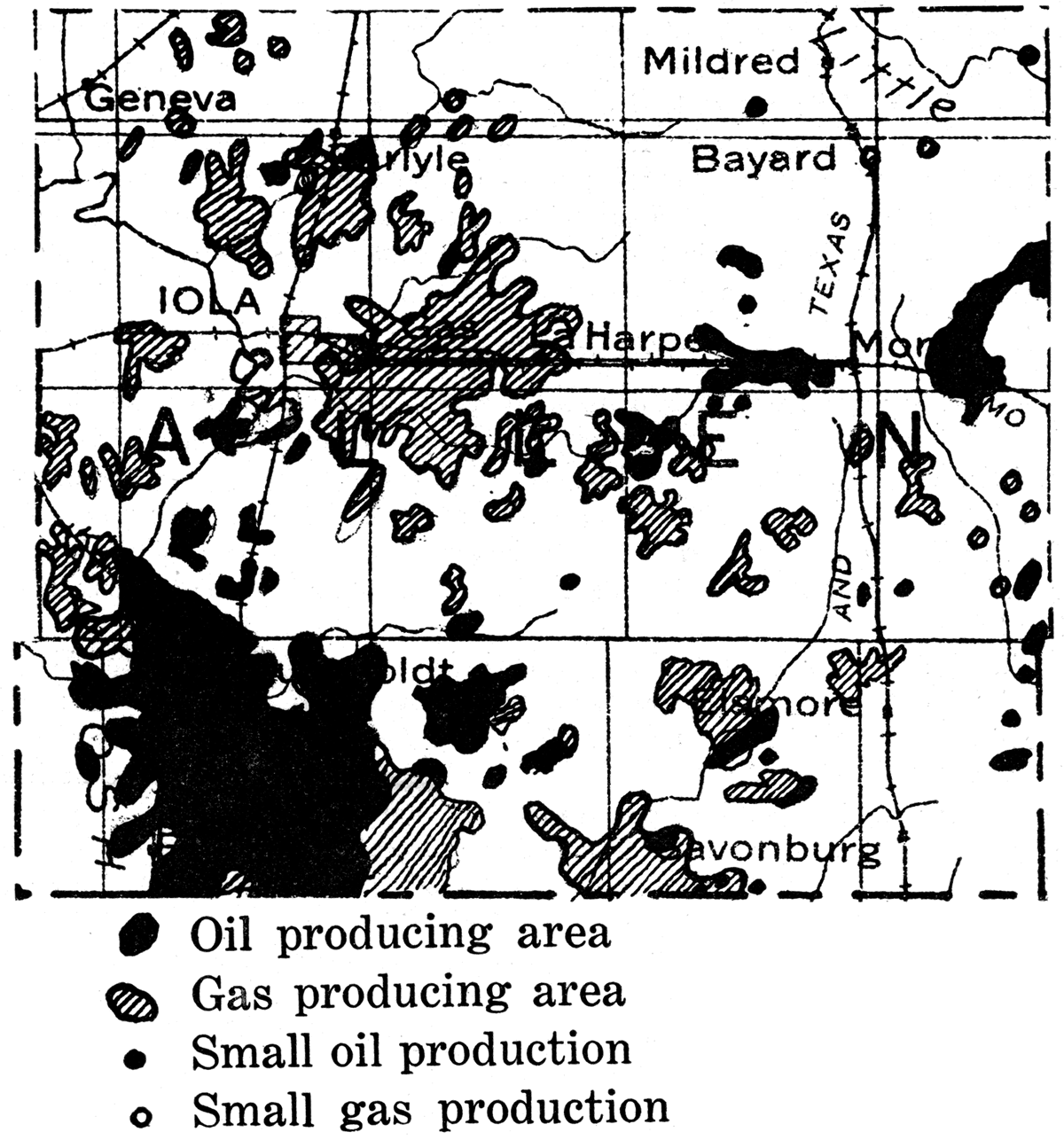
The Humboldt pool lies in the southwest part of the county, including practically all of T. 26 S., R. 18 E., and extending east and northwest into parts of adjoining townships. As a matter of fact production is almost continuous with the Iola gas pool to the north and the Chanute oil pool to the south. Most of the wells yield oil, but there are some gas wells scattered throughout the district, especially in the southwest part of the field. The oil is mostly a low grade heavy-crude, with a gravity ranging from 18 to as much as 38 degrees Baumé, The wells have a small initial production, few producing more than 100 barrels a day, and most of them being much smaller. However, production declines. very slowly and this fact, coupled with the shallow drilling, has permitted profitable development.
Near Moran there are oil fields east and west of the town and gas in a small area to the south. Conditions are essentially similar to those in the Humboldt and Iola pools, but drilling is slightly shallower. There are smaller areas of gas production east of Leana and near Elsmore, and oil wells west of Savonburg. The production of oil in Allen county in 1922 was 549,570 barrels; 1923, 506,896 barrels; 1924, 427,111 barrels; 1925, 556,342 barrels; and in the first half of 1926, 140,264 barrels—a total production for the 4%-year period of 2,180,183 barrels. Records of drilling show that approximately 85 per cent of the test wells in the county have met with success, which means that only a little over one well in ten is a failure.
Anderson County
For many years before 1921 a small production of gas and a much smaller yield of oil was obtained in Anderson county, chiefly in the vicinity of Garnett. In 1921 a very important gas field was found in the southern part of the county near Colony, and since 1923 a considerable and steadily increasing production of oil is reported. The total yield for the county in 1925 was 824,039 barrels, or an average of 2,258 barrels a day. This production has increased to more than 3,000 barrels a day.
The oil and gas are confined almost entirely to narrow elongate sand bodies called "shoestrings." These sands are found mainly at three horizons: (1) The first occurring in the Bandera shale and found at depths ranging from 475 to 675 feet below the surface. This sandstone corresponds to the horizon of the Peru sand in southeastern Kansas and northern Oklahoma. It ranges in maximum thickness up to 60 feet, and northwest of Welda, west and east of Garnett, and along Deer creek, east of Colony, it has produced gas in commercial quantities. Part of the oil production in the field east of Greeley probably comes from this sand. (2) A second productive horizon occurs near the top of the Cherokee shale, and is encountered at depths ranging from 600 feet in the east part of the county to about 825 feet in the west. There are two principal shoestring sands which are now known—the Garnett string and the Bush City string. The former is developed for about 4 1/2 miles and the latter for almost 14 miles. These sands appear to be channel-fillings marking the courses of ancient streams which deposited the sand during a time of temporary emergence in the early part of the Pennsylvanian period. (3) At the Bartlesville horizon, in the lower part of the Cherokee shale, and found at depths ranging from 825 to 1,000 feet there are several small gas pools west of Garnett, north of Bush City and south of Greeley. The most important sand at this horizon, however, is the Colony sand which extends for a number of miles north of Colony. It has a maximum thickness of about 100 feet. Wells have produced from 20,000,000 to 32,000,000 cubic feet of gas, initial open flow, and the Colony field is said to have had a total open flow of 1,350,000,000 cubic feet. Below the Bartlesville zone a small amount of oil and gas, but very little commercial production, has been obtained in a sand near the bottom of the Cherokee shale. The Mississippian limestone has not yielded any commercial . production in Anderson county, although low-gravity oil in small quantity has been found in the top of the lime south and east of Kincaid in Linn county.
Figure 58—Anderson county.
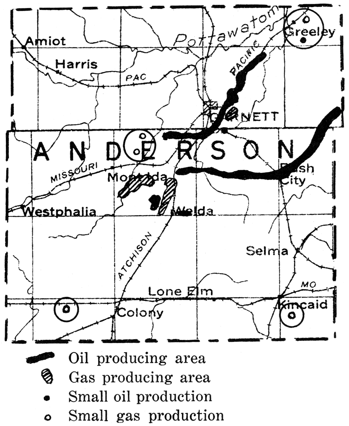
Most of the oil wells are small producers, but one well in sec. 8, T. 21 S., R. 21 E., in the Bush City shoestring is reported to have had an initial yield of 500 barrels from a sand encountered at 593 to 620 feet. The oil is 36 gravity. This section is probably the richest productive area in the county, for a number of other wells having production of 200 to 300 barrels a day were found here.
In the Garnett shoestring more than 40 wells have been reported, with an initial production of 200 barrels or more, and, the yield appears to be fairly long lived.
As is characteristic of the shoestring-sand bodies there is little or no structural indication at the surface of the position or trend of these productive areas. Very many dry holes had been drilled before the discovery of the commercially profitable producing pools. At the present there are about 800 oil wells, about 400 gas wells, and something over 600 dry holes in the county. The average cost of drilling in Anderson county is low. Dry holes in the Bush City district have been reported to have been drilled for less than $1,000. Further exploration will undoubtedly result in extending the shoestring production.
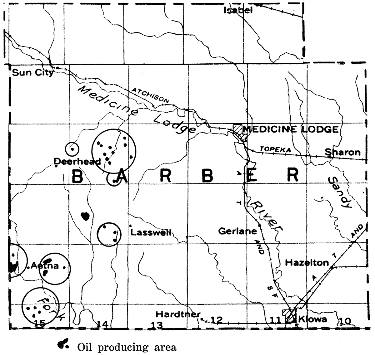
Figure 59—Barber county. Oil and gas in small quantities, but not as yet in commercial amount. have been found in parts of Barber county as here indicated.
Bourbon County
Some oil and gas have been produced for many years in Bourbon county, but this region has never had the importance of Allen county to the west or Neosho to the southwest. According to available records there were in 1906 eight oil wells and six gas wells in the county. In 1917 the Walnut-Hepler field in southwest Bourbon county was opened by a good producer in sec. 19, T. 27 S., R. 22 E., at a depth of 600 feet. This well had 28 feet of oil sand, and also flowed about a quarter of million cubic feet of gas. A number of good gas wells were drilled in 1918 south of Mapleton, in the southwest part of T. 23 S., R. 23 E., and extending a short distance southward. The following year a small oil field was opened near Bronson, about 2 miles north and a mile east, the oil occurring in a 10-foot sand encountered at 654 feet. Another pool a few miles south of Bronson in T. 25 S., R. 21 E., and extending into Allen county has been developed. The productive area is about 7 miles long by a half mile wide; the oil coming from a 50- to 60-foot sand at depths of 650 to 800 feet. An unusual shallow field has been developed between Hume, Mo., and Fort Scott, extending from south of Hume to within six miles of Fort Scott. About 80 oil wells producing from 3 to 10 barrels a day have been drilled. A well reported to make 1,500,000 cubic feet of gas was brought in a mile east of here. The wells, especially in the Bronson area, are good producers and the oil is exceptionally good for the eastern Kansas shallow fields, averaging around 32 degrees Baumé. Initial production of the wells ranges from 5 to 100 barrels, settling down to 1 to 10 barrels. One well about seven miles southwest of Bronson is reported to produce from the. upper part of the Mississippian limestone at a depth of 830 feet.
Figure 60—Bourbon county. (Modified after map by Oil and Gas Journal.)
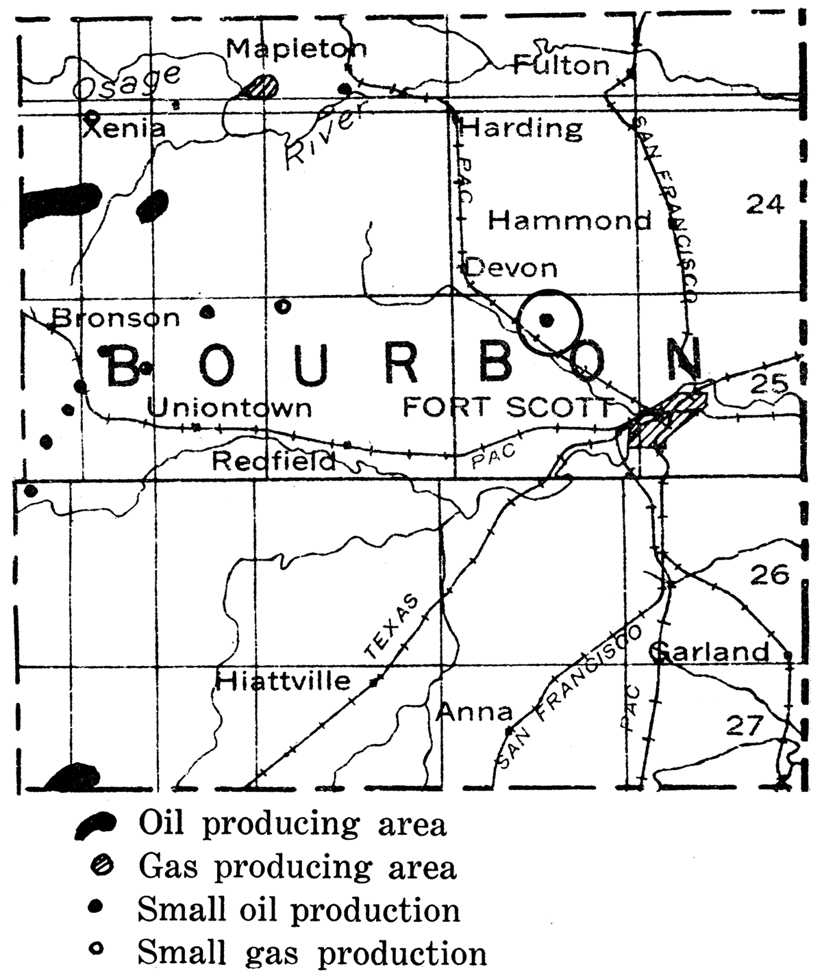
In 1924 the production of Bourbon county was 35,231 barrels; in 1925 the production dropped to 13,315 barrels; and in the first half of 1926 the yield was only 3,470 barrels.
Butler County
Butler county contains the most important oil-producing territory in Kansas. Indeed, the total production from this county surpasses that of the entire remainder of the state since the beginning of recorded production in 1889, and this notwithstanding the fact that the first important commercial production in the county was only discovered in December, 1915. More than 200,000,000 barrels of oil have been produced from Butler county fields. This huge quantity of oil exceeds the total production up to the present of any foreign field except Russia, Mexico, Dutch East Indies and Rumania.
Prior to the year 1916 the largest annual production of oil in Kansas was 4,250,708 barrels-i-in 1904. In 1912 the entire state produced only 1,128,668 barrels. In the first year following the discovery of the deep producing sand in Butler county the state's total production was 8,738,000 barrels, of which about two-thirds were produced in Butler county. In 1917 the Augusta pool produced 11,353,600 barrels and the El Dorado district 19,915,569 barrels, the total production from the state being 36,536,000 barrels. The peak of production was reached the following year, 1918, when the county produced 36,069,670 barrels, or an average of 98,821 barrels per day. Of this amount the El Dorado district produced 29,198,145 barrels. The oil from these fields is a good grade, averaging in gravity from 33 to 35 degrees Baumé,
In May, 1917, the Towanda pool, in T. 26 S., R. 4 E., in the west part of the El Dorado district was discovered. The Trapshooters Oil Company drilling on the Williams farm in the southeast of the west half of the northwest quarter of sec. 11, T. 26 S., R. 4 E., secured a flowing well estimated as high as 20,000 barrels a day. This was undoubtedly one of the largest producers of high grade oil in the world. In September, 1917, the Gypsy Oil Company's No. 5, Shumway, in the same section, started out with 20,000 barrels a day, and produced two and a quarter million barrels before it quit. Other wells in the vicinity had a production of more than 10,000 barrels a day, and one, the Shriver No. 23, started at 23,000 barrels, but stopped after one day's flow. According to records of the Empire Gas and Fuel Company the Shumway lease of the Gypsy Oil Company, 160 acres in extent, averaged over 50,000 barrels per acre. The Empire's Cardey farm, an 80-acre lease, has yielded more than 30,000 barrels to the acre.
Following the initial development of the great El Dorado and Augusta oil district, exploration has proved the existence of considerable quantities of oil in other parts of the county. The most important of these is the Elbing pool in T. 23 S., R. 4 E. Other important pools are the Potwin pool, in the southeast part of T. 24 S., R. 3 E., the Fox-Bush pool in the east part of T. 28-29 S., R. 5 E., the Sluss pool in T. 26 S., R. 5 E., the Leon pool in T. 27 8., R. 6 E., and the Blankenship pool in T. 26 S., R. 8 E.
The rocks which appear at the surface in Butler county belong in the lower part of the Permian system. They consist of more or less flinty limestone and shale formations. At the east edge of the county and extending into west Greenwood county is the prominent Flint Hills escarpment, formed by the outcrop of hard flinty limestone of Permian age. Most of the remainder of the county is gently rolling, and there are few prominent topographic features. The rock strata have a general slight inclination to the west, amounting on the average to about 30 feet per mile. In the El Dorado and Augusta districts geologic studies before the drilling of the discovery wells showed the existence of a prominent anticlinal fold, trending in a direction slightly east of north and west of south. (Figure 62.) Near El Dorado the eastward dip of the strata is prominent.
Figure 61—Butler county. (Modified after map by Oil and Gas Journal.)
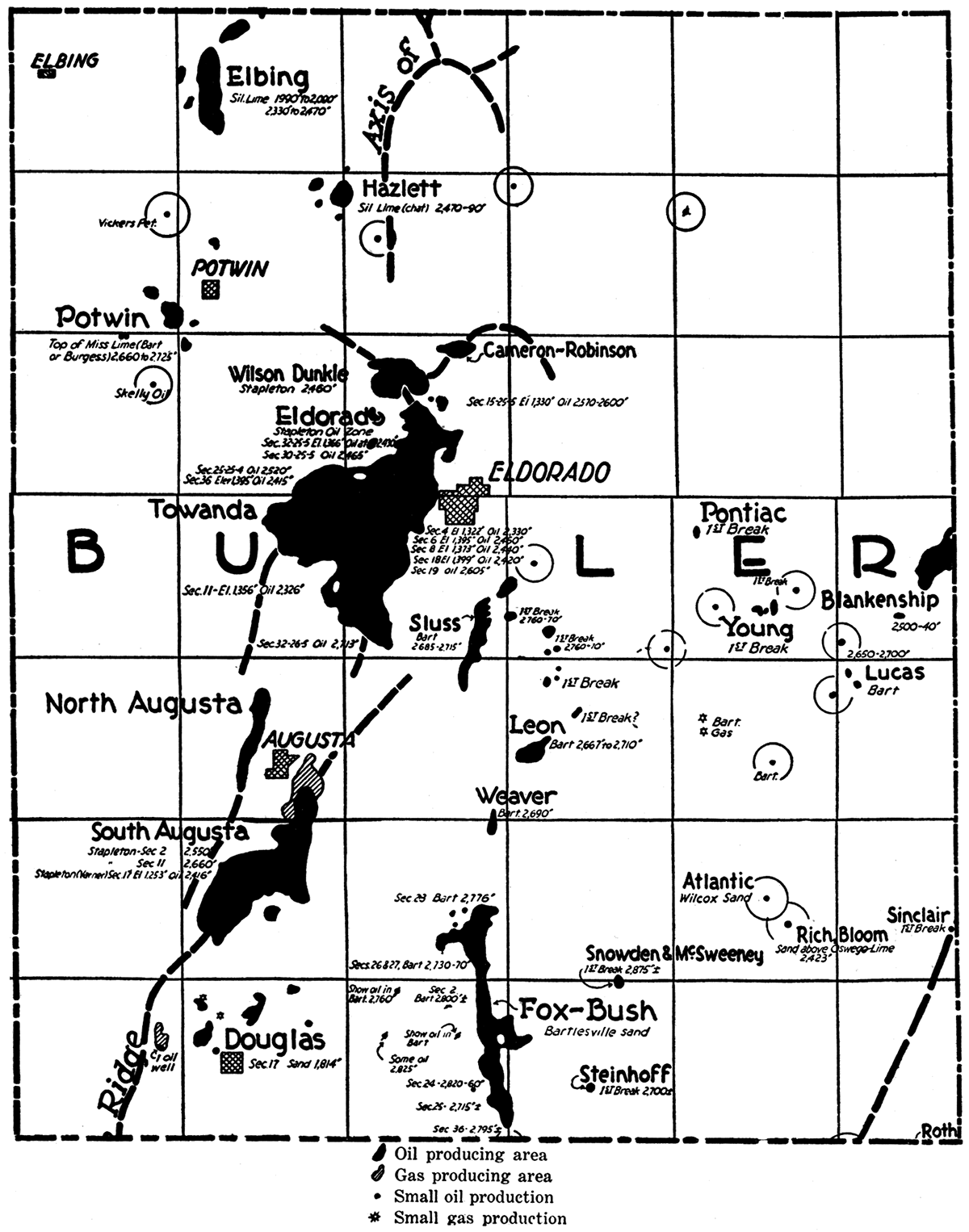
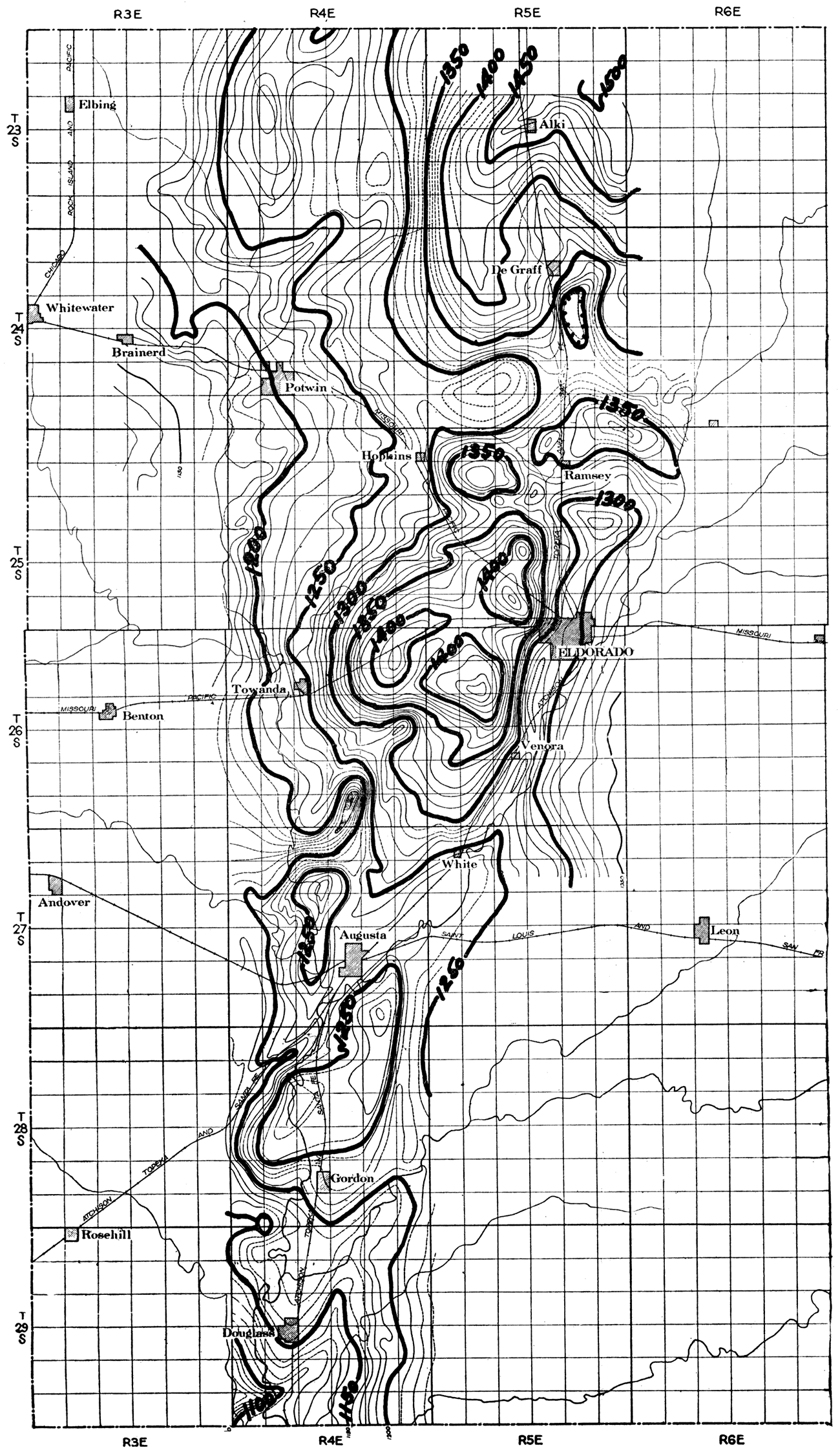
Figure 62—Structure map of El Dorado oil field. Structure contours on top Fort Riley limestone.
Beneath the Permian in the El Dorado and Augusta districts, are a little over 2,000 feet of alternating limestone, shale and sandstone beds, belonging to the Pennsylvanian system.
A shallow oil sand at an average depth of about 550 feet occurs in the Admire shale of upper Pennsylvanian age. Another oil sand at an average depth of about 660 feet appears in the north part of the El Dorado field. It is also a part of the Admire shale. A thin oil sand belonging in the lower part of the Douglas formation occurs locally. At an average depth of 1,700 feet is an oil "sand" near the top of the Lansing formation. The oil is accompanied by gas, and initial productions as high as 500 barrels have been reported from this horizon. A 2,000-foot oil "sand" occurs in the top of the Kansas City formation. The main oil-producing horizon known as the Stapleton pay is encountered at an average depth of about 2,500 feet. This zone comprises rocks which are older than Pennsylvanian. Gas sands have been found at depths of 900 feet, 1,125 feet, and 1,475 feet. Wells in these sands had initial open flows up to 9,000,000 cubic feet and a rock pressure up to 400 pounds per square inch. Many wells are at present being drilled to the 660-foot oil sand, and by pumping about 50,000 cubic feet of air per day into certain of these wells a good yield of oil averaging 37 degrees Baumé is obtained.
Beneath the Pennsylvanian in the El Dorado and Augusta district the drill passes directly into rocks of Ordovician age (Stapleton pay). The Mississippian and other geologic divisions which are present elsewhere in Kansas and Oklahoma are absent. In the central, structurally highest part of the field, siliceous limestone next underlies the Pennsylvanian, and from this formation the largest production has come. On the flanks of the fold there is found in many places fairly thick, pure quartz sandstone, commonly known as the Wilcox. This formation overlies the siliceous lime and contains large quantities of oil, but production from the formation has been less than in the case of the limestone, although production is longer lived. Still younger Ordovician rocks are found above the Wilcox sand farther out on the flanks of the fold. These relations indicate that the Ordovician rocks in which the main pay occurs were uplifted and eroded before the deposition of the Pennsylvanian rock. (Figure 63.)
Figure 63—Cross section of El Dorado and Blankenship oil pools.
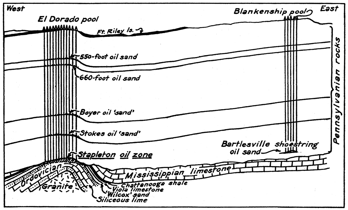
It is now known from deep borings in various parts of central Kansas that the pre-Cambrian crystalline rocks, consisting chiefly of granite, are considerably elevated along a line which passes from south to north through the Augusta and El Dorado fields and continues through the north line of the state in Nemaha county. In other words, the granite basement forms a prominent buried ridge. Wells in the El Dorado district have found the granite at a depth of about 2,750 feet. The earth movement which elevated the granite appears to have taken place in post-Mississippian and pre-Pennsylvanian time, for the upper part of the Ordovician and all of the Mississippian has been stripped away in the region of El Dorado and Augusta. North of Butler county, along the axis of uplift, all of the sedimentary rocks older than the Pennsylvanian were removed so that the Pennsylvanian sediments rest directly on the granite ridge.
Figure 64—Map of the El Dorado field, showing the extent of the gas-producing territory in comparison to that of the oil-producing territory.
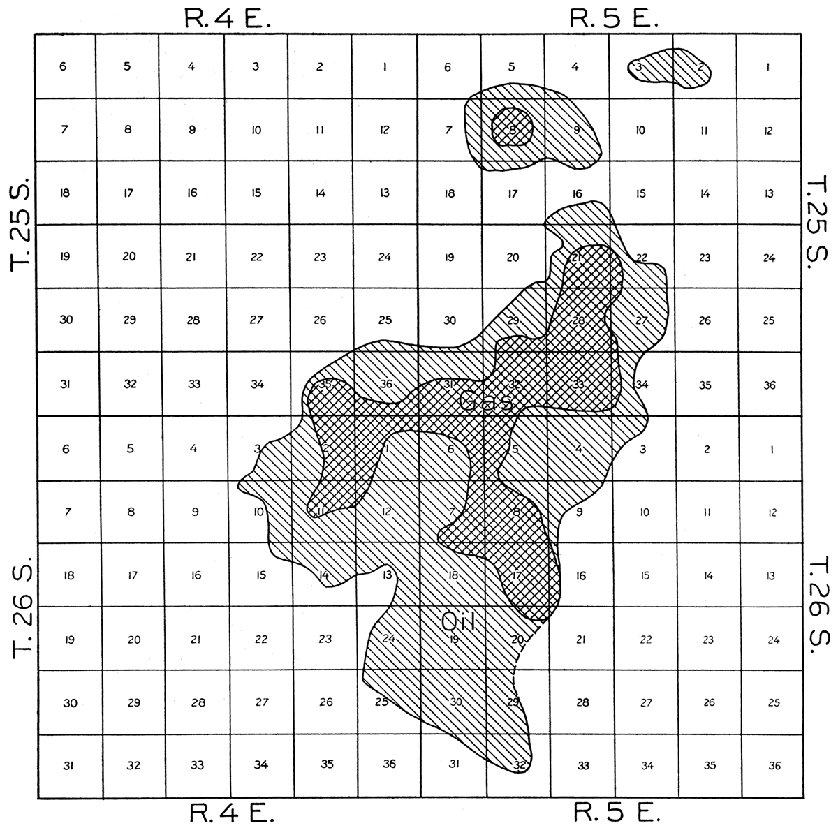
The Elbing field lies on the west flank of the granite ridge, and the production comes from siliceous limestone, conditions being essentially comparable to those in the El Dorado or Towanda districts. Production is obtained at depths ranging from 2,000 to 2,450 feet. In the Potwin pool oil is obtained from the top of the Mississippi lime or in sand and residual chert which may be correlated with the Burgess sand.
The Blankenship, Leon-Weaver, and Fox-Bush districts, in the east and southeast parts of the county obtain oil-from sand in the lower part of the Cherokee which may be correlated with the Bartlesville sand. Depths to the oil pay range from 2,650 to 2,800 feet. This sand was deposited in early Pennsylvanian time, being apparently derived from exposed hard rocks in the granite ridge area to the west. Elongate sand bodies of similar geologic age are found to the northeast in Greenwood county where large production is obtained.
Several small pools in the eastern part of Butler county have been obtained in the Mississippian limestone.
The record of oil production in Butler county by years since 1916 is as follows:
| Oil Production in Butler County, by Years, 1917-1925, in Barrels |
|
|---|---|
| 1917 | 31,269,169 |
| 1918 | 36,069,670† |
| 1919 | 24,060,408† |
| 1920 | 18,425,716 |
| 1921 | 15,015,977 |
| 1922 | 19,733,299 |
| 1923 | 14,221,115 |
| 1924 | 10,821,699 |
| 1926 | 9,659,608 |
| 1926 | 6,068,164* |
| * First six months. † Includes Marion county. |
|
Shallow gas wells were drilled in the vicinity of Augusta as early as 1906, the town being supplied with gas long before the discovery of oil in June, 1914. Of the twenty-nine wells drilled in this year only five were oil producers, the rest being listed as gas wells; in 1916 60 wells were completed, of which 38 were gas wells. Drilling operations reached their climax.in 1918 when 1,144 oil wells were obtained out of 1,440 wells drilled.
Since the development of the oil fields most of the gas produced has been used for development, and thus much of the gas production has not been metered. About three-fourths of all the gas wells, however, were owned by the Empire Gas and Fuel Company, and records which were kept for these indicate that between May, 1916, and March, 1918, the total production from 69 wells was 6,660 millions of cubic feet. Almost ten per cent of this total was produced in the month of December, 1916, from twenty-four wells. If to the total of the Empire's wells we add the probable production of other wells there is a total of about 9,000 million cubic feet of gas produced in the El Dorado field alone, before April, 1918. The gas wells vary greatly in size, the largest having a capacity of 21,000,000 cubic feet per day. Decline in production of these wells has been rapid. Some of the gas wells near Augusta, where the capacity was near 1,000,000 cubic feet produced a gas which contained as much as 87 per cent noncombustible gas, of which nearly 2 per cent was helium and other rare gases. The quality of most of the gases in this region is below average. The Butler county gas fields are of little commercial importance at present.
Figure 65—Stapleton well No. 1. The discovery well of the El Dorado field
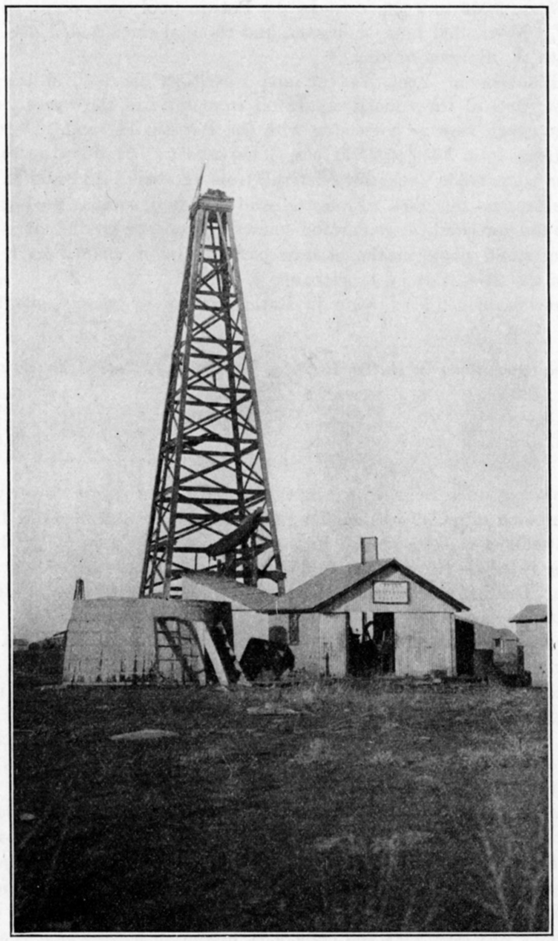
Figure 66—Chase county.
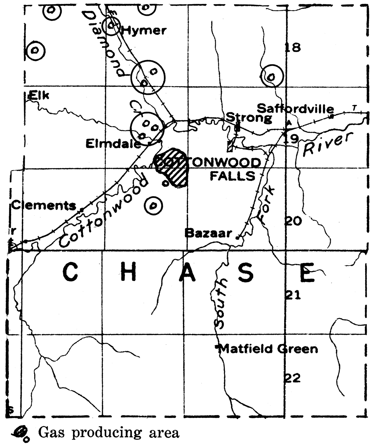
Chautauqua County
Oil and gas development began in Chautauqua county about 1900 with the opening of the Peru pool. There was very active drilling in 1904 and 1905, but relative inactivity after that until about 1912. In recent years there has been a steady production of almost a million barrels a year from the oil fields and very large quantities of gas from prolific gas pools.
Around Sedan, Peru and Chautauqua are relatively large, almost continuous areas productive in oil and gas. This is the region which was first developed, but the finding of additional oil and gas has maintained production at a good rate. Separated from this area is the Elgin district, six miles west of Chautauqua. This has been one of the active pools of the county since 1919, when a well found 53 feet of oil sand below 1,316 feet and gave an initial production of 400 barrels per day. Most of the oil wells in the county have a production of less than 10 barrels a day. However, the total production for the county in 1924 was 936,099 barrels; in 1925, 863,789 barrels; and in the first half of 1926, 443,789 barrels.
Figure 67—Chautauqua county. (Modified after map by Oil and Gas Journal.)
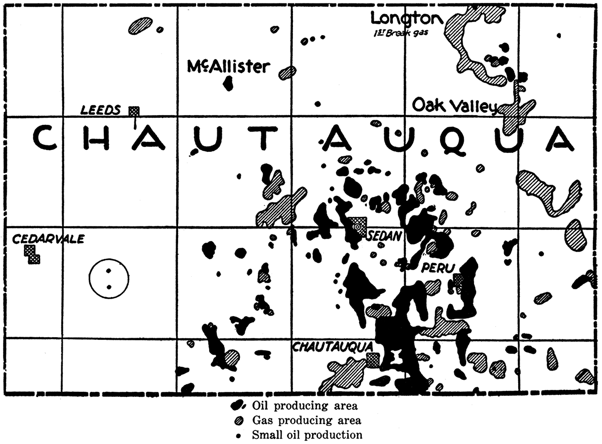
Gas is produced in several parts of the district around Chautauqua, Peru, Sedan and Elgin. Some of the most prolific gas producers have been discovered in the northeastern part of the county near Hale, and in the Longton field which extends southwestward from Elk county. The gas field near Hale was first developed in 1907. Pressure decline was relatively slow, and in December, 1921, the total open flow capacity of the wells was 97,000,000 cubic feet per day. In July, 1922, there were 177 producing wells in the field. The initial capacity of the wells in the Hale field rarely exceeded 2,000,000 cubic feet The marketed production for one month in 1922 was 351,000,000 cubic feet.
The Longton field, which produced for many years from a shallow sand yielding both oil and gas, has produced large amounts of oil and gas from the top of the Mississippi lime in T. 32 S., R. 12 E. This horizon is reached at a depth of around 1,550 to 1,650 feet.
A study of well records in Chautauqua county shows five more or less persistent sand horizons in the Pennsylvanian which produce oil and gas. In some instances the sands are reported to pinch out on anticlines and are productive in the adjacent synclines. (1) The Old Red sand, with an average thickness of 30 feet, is productive in the vicinity of Sedan, where it is found at a depth of about 950 feet. The sand is also identified in other parts of the southeast Chautauqua field. (2) The Peru sand is one of the most persistent producing horizons in the region. It varies in thickness from 20 to 55 feet and generally occurs about 125 feet below the Old Red. At Peru the sand is about 1,100 feet below the surface, the depth varying of course with topography. The Peru occurs in the Bandera shale in the lower part of the Marmaton formation. (3) About 90 feet below the Peru the porous lowest division of the Fort Scott limestone, sometimes designated the Wheeler or Hancock "sand," is found. It is unreliable as a steady producer. (4) The Bartlesville sand lies about 350 feet below the Peru and has an average thickness of about 40 feet. Because of production at shallower depths the Bartlesville has not been thoroughly tested. It is well known that sands in this zone are very lenticular, and since in various parts of the eastern Kansas fields they are very productive, it is probable that development of large production at this horizon in Chautauqua county will be found. (5) The Burgess sand lies at the base of the Pennsylvanian, filling irregularities in the surface of the Mississippian limestone. Where productive this sand is reported to contain small amounts of gas under considerable pressure.
In the McAllister district, T. 32 S., R. 10 E., the Mississippi lime yields oil at a depth of around 2,000 feet.
Figure 68—Coffey county.
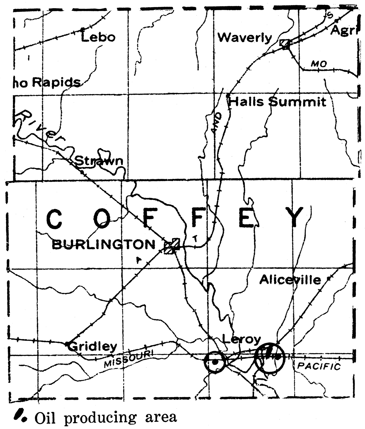
Cowley County
For many years, especially since the discovery of the very rich oil fields in Butler county, Cowley county has been the scene of active drilling exploration. To the north and northeast are the prolific oil producers in Greenwood and Butler counties, on the east are the oil and gas-producing areas of Elk and Chautauqua counties, and to the south are the very rich pools in Kay and Noble counties, Oklahoma. The axis of the buried granite ridge above which lie the El Dorado and Augusta pools doubtless extends southward through a part of western Cowley county. In the eastern part of Cowley county is the Dexter anticline, one of the best defined folds which is known in southern Kansas. It is much narrower than the broad, gentle arch above the granite ridge, but is sharply defined. Despite these favorable indications most of the test wells drilled in Cowley county have been disappointments.
The discovery of the Rainbow Bend field in the west central part of T. 33 S., R. 3 E., was the first big success in Cowley county drilling. It now seems possible that this pool and others which have lately been discovered may repay the industry for the enormous sum spent in drilling dry holes in the county. A deep producing sand in the Winfield pool just east of the town of Winfield was discovered in June, 1924. Good production has also been obtained in the Biddle field, about five miles northeast of Winfield. The Eastman field in the northwest part of T. 31 S., R. 6 E., and extending slightly into the township to the north has been a prolific gas producer and has yielded considerable oil. The Clark pool in the northwest part of T. 31 S., R. 4 E., the Slick pool in the west central part of T. 32 S., R. 3 E., the Graham pool in the north central part of T. 33 S., R. 3 E., and the State Land pool just north of Winfield are among interesting recent developments.
Figure 69—Cowley county. (Modified after map by Oil and Gas Journal.)
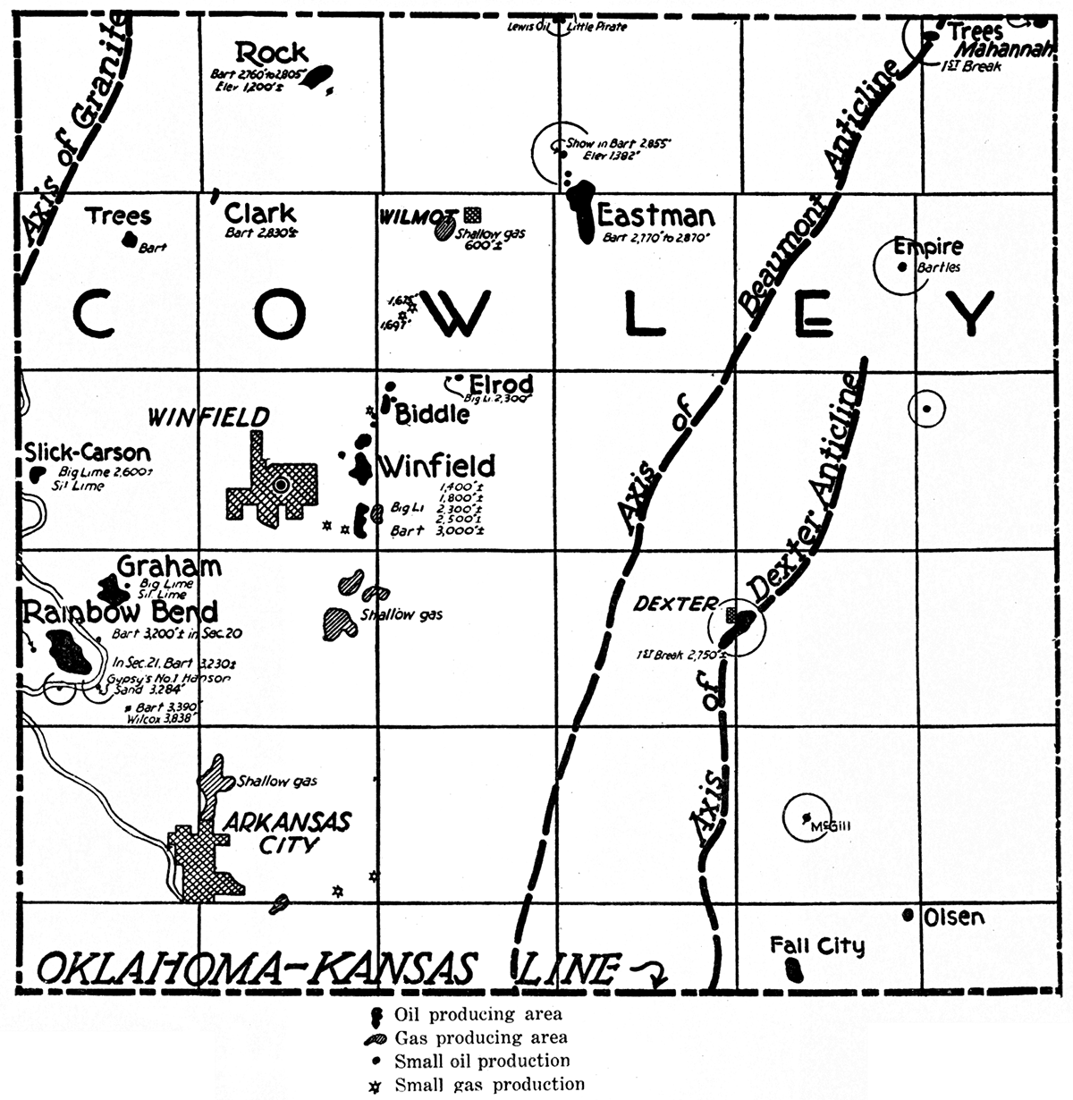
The most important producing district in Cowley county is the Rainbow Bend field, in the west central part of T. 33 S., R. 3 E., along Arkansas river. The discovery well in this field was drilled on the Johnson farm in section 20 of this township, the well being completed early in December, 1923. The pay sand, which was reached at a depth of 3,198 feet, yielded an initial production of 350 barrels. The proved productive territory is a little more than 900 acres, and as production has already exceeded 5,000,000 barrels, the per acre yield is more than 5,000 barrels. The producing sand, ranging in thickness from 5 to 35 feet, occurs at the base of the Cherokee shale. The most productive portions of the field are found where the sand is thickest and most porous. The Mississippian limestone which immediately underlies the producing sand is about 100 feet thinner on the crust of the fold than on the flanks. The field has yielded substantial profits from the manufacture of casing-head gas. There are two plants with a combined capacity of 40,000 gallons daily, about 3 gallons of gasoline being extracted from each 1,000 cubic feet of gas treated. It is estimated that the ultimate value of casing-head gas in the field is equal to about 25 per cent of the value of the recoverable oil.
The Winfield pool lies chiefly in sec. 24, T. 32 S., R. 4 E., about two miles east of Winfield. The discovery well was Wallace No.7 on the center of the west line of the northeast quarter of the southeast quarter of section 24. This well reached the pay zone at a depth of 3,003 feet. A well a few hundred feet to the north made 1,200 barrels initially. The producing sand belongs at the horizon of the Bartlesville.
Figure 70—Milliken oil refinery, Arkansas City, Kan.
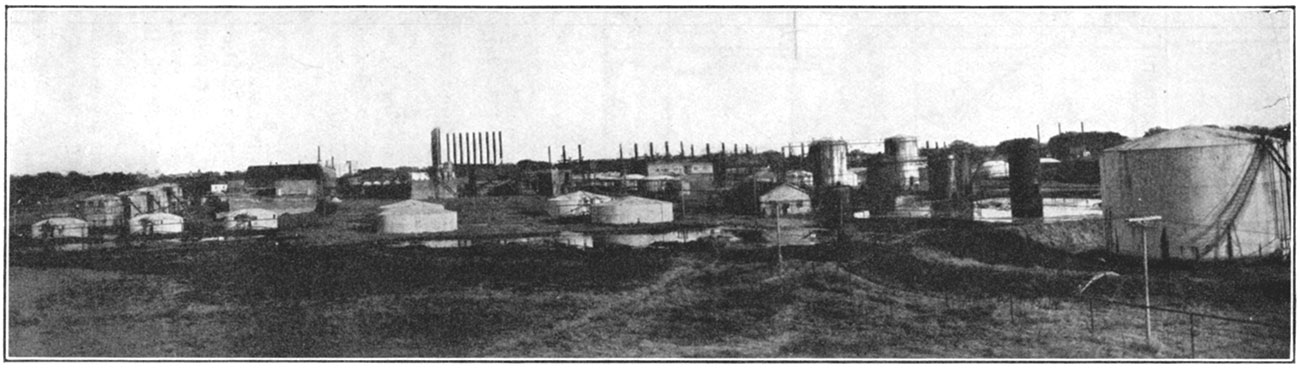
An important oil pool was opened in 1926 just north of the town of Winfield. The discovery well was drilled by the J. A. Hull Company and the Shaffer Oil and Refining Company on land owned by the state of Kansas in the northwest comer of the southeast quarter of sec. 15, T. 32 S., R. 4 E. It encountered the Ordovician siliceous lime at 3,363 feet, and was drilled 46 feet in this formation. An initial production of 800 barrels of 40-degree gravity oil was reported, but on drilling slightly deeper the yield was increased to 1,000 barrels. This area was investigated by the State Geological Survey on request of the Board of Administration, recommendation being subsequently made that the state land be drilled. The 1925 legislature authorized this drilling on a location designed by the state geologist.
The Eastman pool in the north central part of the county has a north-south trend in line with the Fox-Bush field in Butler county. The sand occurs at the same horizon, the Bartlesville, in the lower part of the Cherokee shale. In the south part of the field are large gassers which gauged from 30,000,000 to 40,000,000 cubic feet.
The discovery well in the Graham pool was the Gypsy Oil Company's pool No. 1 well in the northwest of the northeast quarter of sec. 9, T. 32 S., R. 3 E., drilled in June, 1924, to a depth of 3,510 "feet. This well was good for 300 barrels, but when deepened 3 feet the production increased to 960 barrels. An off-set well made initially 850 barrels. The producing sand is correlated as Wilcox.
The Slick well, in sec. 19, T. 32 S., R. 3 E., obtained oil from the Wilcox horizon at a depth of 3,427 feet. The initial production of the discovery well was reported at the rate of about 925 barrels a day.
Along the Dexter anticline in the east part of the county there has been very little successful drilling. A number of years ago gas was discovered just east of the town of Dexter, but the gas contains a large proportion of noncombustible gas. It has been found to be fairly high in percentage of helium.
In 1924 the production of Cowley county was 2,266,341 barrels; in 1925, 7,038,874 barrels; and in the first six months of 1926, 2,105,122 barrels.
Crawford County
Some oil and gas have been developed in the northwest part of Crawford county, chiefly in the vicinity of Walnut and Hepler. The producing sand in this field is encountered at around 600 feet and it ranges in thickness from about 25 to 30 feet. In a southeastward extension towards Girard oil has been found at depths of 400 to 500 feet. A number of wells have been drilled in this region, and a pipe line has been completed from the fields to the railroad loading station.
Figure 71—Crawford county.
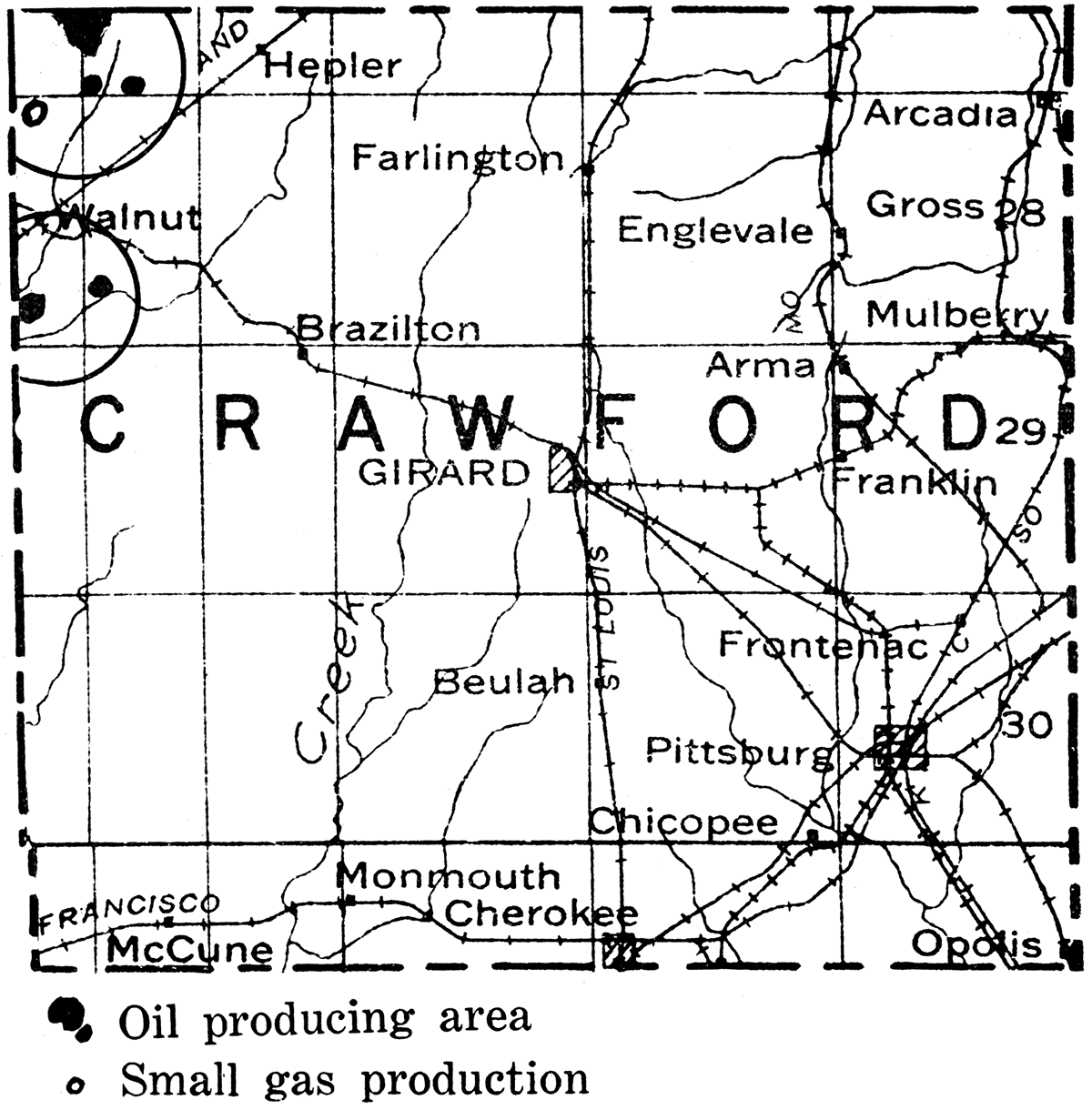
Douglas County
For a number of years Douglas county has witnessed sporadic drilling operations, but with the exception of a small area in the southeastern corner of the county no commercial production occurs. The first well in this area, which may be designated the Baldwin shallow field, was completed in 1919, in sec. 12, T. 15 S., R. 20 E. Oil was obtained in sand at a depth of 800 feet, the wells having an average initial production of about 20 barrels. In some wells an initial production up to 220 barrels was obtained, but the decline was rapid, and the relatively heavy grade of the oil has not encouraged building a pipe line. A number of gas wells have been obtained in sec. 14, T. 14 S., R. 21 E., the average flow being about 1,000,000 cubic feet from a sand found at 820 feet. A small amount of gas has been obtained at Eudora in the northeast part of the county, and showings. of gas at 747 and 1,300 feet in a well drilled at Lawrence. In 1925 Douglas county was credited with 15,999 barrels, and in the first half of 1926, 7,934 barrels.
Figure 72—Douglas county.
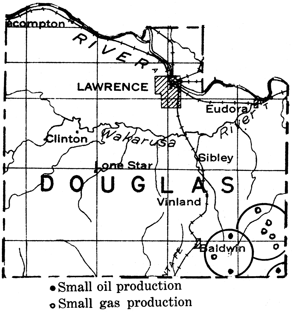
Elk County
Oil was discovered in a shallow sand near Longton in the southeastern part of Elk county in 1902, and this has been a center of profitable production since that time. Until 1916, however, there was little active development in this region. At the present time oil is produced mainly in the Longton field, in the Arbuckle field in T. 31 S., R. 9 E., the Bush-Denton field in T. 30 S., R. 9 E., and in small fields in the northwest and northeast parts of the county. As shown on the accompanying map there are several gas pools, the most important of which are in the southwest, south and southeast parts of the county. Important recent developments are in the Moline district in T. 31 S., R. 10 E., and in the Bush-Denton area. A small part of the Elk City field on the ElkMontgomery line has been extraordinarily prolific in natural gas.
Figure 73—Elk county. (Modified after map by Oil and Gas Journal.)
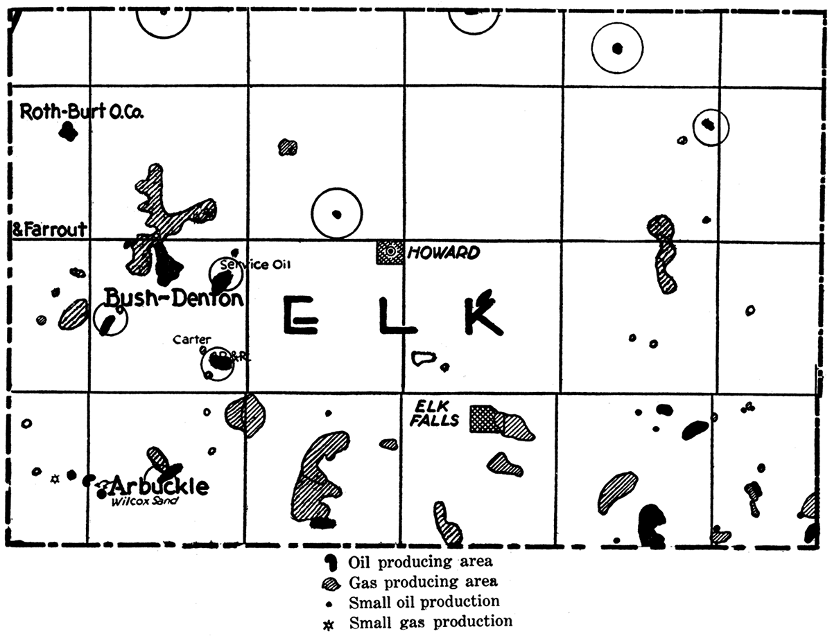
The Longton field, which extends south into Chautauqua county, is one of the important gas fields of the state. The gas was discovered in this region at the top of the Mississippi lime as early as 1915. There was little activity, however, until a well drilled in sec. 28, T. 31 S., R. 12 E., came in with an initial capacity of 10,000,000 cubic feet. In August, 1922, there were 45 producing wells in the field, and by the first of the following year the number had increased to 69. The initial rock-pressure averages 550 pounds, and on some wells as much as 7,000,000 cubic feet are produced per pound decline of pressure. Production in the Longton field comes from a porous broken part of the Mississippian lime which is reached at depths ranging from 1,540 to 1,690 feet. It has been the custom to drill 50 to 90 feet into the lime, the surface of which has been so eroded that it is quite possible that the lime may be altogether missing in places. If this is the case, some of the production comes from underlying rock of Ordovician age. The anticlinal fold which has been defined in this region is a rather prominent one, trending north and south, and it was so well determined by subsurface geologic work that one company was able to secure most of the leases before drilling had outlined the field. It is interesting to note that of the first 52 wells drilled by this company in the Longton field only one was a failure. An estimate of the total gas production in this field has been put at 50,000,000,000 cubic feet.
The west part of the Elk City gas field lies in Elk county; that is, sec. 22 and 27, T. 31 S., R. 13 E. The discovery well in the northeast quarter of section 27 had an initial open flow capacity of 10,000,000 cubic feet, but the second well, 800 feet farther west had an original volume of 32,000,000 cubic feet. The gas comes from a sand in the lower part of the Cherokee shale which may be correlated with the Bartlesville sand. It is found at an average depth of about 1,350 feet. The original rock pressure in all of the first wells was 520 pounds, but with rapid production of gas the pressure fell rather rapidly, the decline in a year being more than 150 pounds.
Oil has been developed in Elk county chiefly within the past few years, the main production being found in the west part of the county. However, in northeastern Elk county, in T.29 S., R. 12 E., wells with an initial capacity of 500 barrels have been reported, producing from a sand at a depth of about 1,600 feet. The oil production of Elk county in 1924 was 267,585 barrels; in 1925, 513,145 barrels; and in the first six months of 1926,294,378 barrels.
In different parts of this region there are at least six producing horizons for oil or gas: (1) Sand in the upper part of the Marmaton formation corresponding to the Old Red in Chautauqua county; (2) the Peru sand, occurring in the Bandera shale in the lower part of the Marmaton; (3) the Fort Scott or "Oswego" limestone; (4) the Bartlesville sand, in the lower part of the Cherokee; (5) the Burgess, at the base of the Cherokee or top of the Mississippian lime; and (6) production within the Mississippian limestone, or at the so-called Wilcox horizon. The shallow oil and gas comes chiefly from the upper sand, the prolific Elk City gas from the Bartlesville horizon, the Longton production from the Burgess, or weathered upper part of the. Mississippian, and wells in the Arbuckle pool, in the southwest part of the county, from the Mississippian or Wilcox. Developments in Elk county have been rather slow, but the discoveries of recent years and the successful development of very rich fields in Greenwood county to the north after drilling appeared to indicate lack of commercial oil, has encouraged the hope that new fields may be found in Elk county.
Franklin County
Oil and gas have been developed for many years in the eastern part of Franklin county. The most important production is obtained in the vicinity of Rantoul, but oil wells and some gas wells are found several miles to the north and south of this place and in the vicinity of Peoria. In the Rantoul pool the main sand is found at depths of 500 to 600 feet, the pay zone belonging in the upper part of the Cherokee shale. A shallow sand encountered at 300 to 400 feet also produces both oil and gas. The north part of the district, chiefly in T. 16 S., R. 21 E., sometimes known as the Wellsville pool, is essentially a continuation of the producing area farther south. The main sand body, encountered at depths of 600 to 750 feet, has a northwest-southeast trend. The thickness of this sand ranges up to 50 feet. The wells have an average initial production of 20 barrels, although some have been reported with an initial production as high as 200 barrels. Including a small amount of oil from Douglas county in 1924, when the counties were not separately recorded, production from Franklin county in the last two and a half years has been, in 1924, 237,119 barrels; 1925, 208,111 barrels; 1926, first six months, 85,838 barrels.
Figure 74—Franklin county.
Greenwood County
Greenwood county at present (1926) leads all other Kansas counties in total oil production, the monthly yield being more than 1,000,000 barrels. In the last four and one-half years (ending June 30, 1926) Greenwood county has produced the huge amount of 41,549,072 barrels. The production of the county for 1925 was 13,464,805 barrels. The finding of important oil fields in this county dates from the year 1921, before which time, although there had been very much drilling, practically no production of any importance had been found, and the region was largely condemned by many oil companies. The Sallyards pool, located in T. 25 S., R. 8 E., was discovered first, good production being found in a sand not far above the Mississippian limestone. The producing area in this field was gradually extended so as to show a marked trend in a northeast-southwest direction. The sand body, which belongs at the Bartlesville horizon, is distinctly lenticular in cross section.
Figure 75—Greenwood county. (Modified after map by Oil and Gas Journal.)
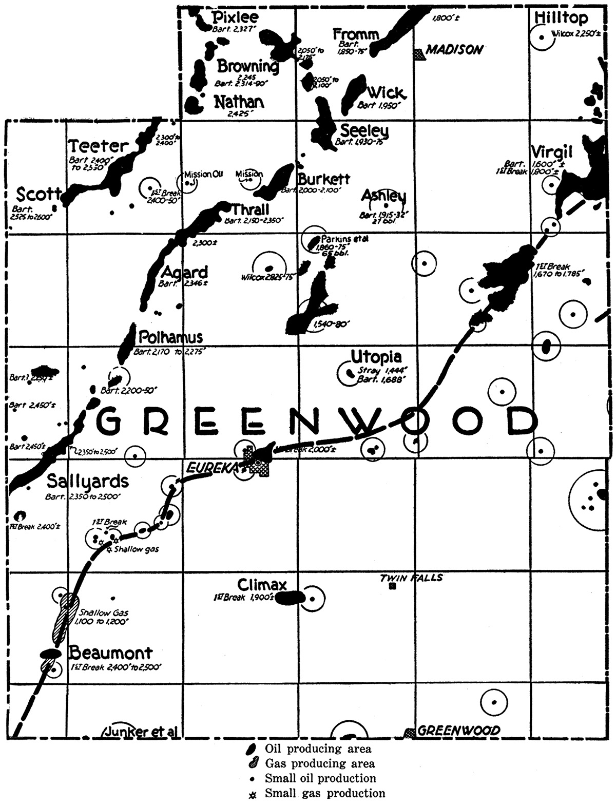
In 1921 the Madison pool, about 35 miles northeast of Sallyards, was located. The wells in this pool were not large, ranging mostly from about 20 to 75 barrels. There was no suggestion at this time of the much more productive areas between Sallyards and Madison.
The next oil field discovered was the Seeley pool, 6 or 7 miles southwest of Madison. Some of the wells here had a flush production of as much as 1,200 barrels, and a number of wells made from 300 to 500 barrels a day. Subsequently the discovery of the Polhamus, Burkett, Fromm and other pools has outlined a rather narrow but nearly continuous zone of prolific oil production crossing Greenwood county from Sallyards to Madison. As in the case of Sallyards the producing sand occurs at the Bartlesville horizon, and because of its very elongate narrow form is typical of the so-called "shoestring sands." There is little or no observable relation between the distribution of this sand body and the structure of the surface beds. In places the sand lies on normal, gentle westward dips, or across slight terraces and production in it occurs in synclinal depressions as well as on anticlinal uplifts. Naturally very many dry holes have been drilled in the exploration to locate the productive areas of this "Golden Lane." But the large production of the sand and the high gravity of the oil, about 41 degrees Baumé, has amply repaid this exploratory expense.
Northwest of the Golden Lane is a parallel but somewhat shorter shoestring crossing the northwestern part of Greenwood county and reaching into Chase and Butler counties. This trend was first developed in the Teeter pool, which was discovered during the time of large production in the El Dorado district. No serious efforts to extend the field were made for three or four years. Eventually the Pixlee discovery well was drilled by the Empire Gas and Fuel Company in T. 22 S., R. 10 E. This pool lies 8 or 9 miles northeast of Teeter, and the subsequent development of the intervening Browning and Nathan pools has served practically to connect these districts and to form another important shoestring body. A southwestward extension to the Scott. pool, in T. 23 S., R. 8 E., has added much to the production of this district, and there is a prospect of outlining a much longer sand body extending into Butler county and possibly connecting with the Fox-Bush field.
Within the last few months productive sands have been found northwest of the Seeley pool, indicating a more or less well defined trend running northwest-southeast. This sand appears to be stream channel deposit, while the southwest-trending shoestrings probably represent bars along the shore of the early Pennsylvanian seas. However, there are some indications that the latter sand bodies may also be channel deposits. The discoveries which have been made and present knowledge as to the probable character of these richly productive sands indicate the possibility of other pools in this region. Efforts will undoubtedly be made not only to extend the shoestrings already outlined but to locate new sand bodies.
The oil of the Bartlesville sand trends in Greenwood county is very high grade, ranging from 38 to 43 degrees Baumé.
In the vicinity of Virgil and Gridley in the east part of Greenwood county, oil production has been obtained in the "first break" in the Mississippian limestone. Production at this horizon is generally somewhat uncertain and the wells are shorter lived than in the Bartlesville sand area farther west. The producing district lies in T. 22 S., R. 12 E.; T. 23 S., R. 13 E.; and T. 24 S., R. 14 E. The field came into prominence in 1921 when a yield of about 800 barrels a day was obtained from 50 wells. In May, 1923, production was 8,000 barrels a day from 535 wells. The daily average for the first six months of 1926 was over 4,500. The oil has a specific gravity of 38 to 40 degrees Baumé.
Figure 76—Harvey county.
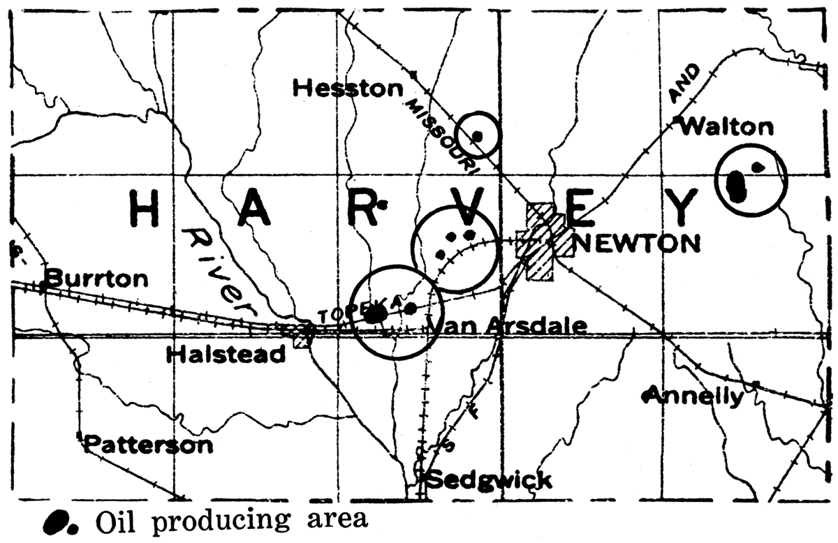
Figure 77—Johnson county.
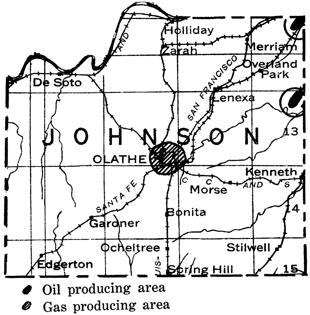
Figure 78—Kingman county.
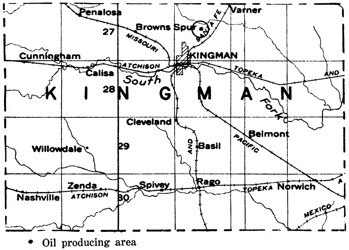
Labette County
Gas and some oil have been produced in Labette county for many years. The main area of production is in the western portion of the county in Ts. 32 and 33 S., Rs. 17 and 18 E. There are gas-producing areas in the vicinity of Dennis and south of Parsons; northwest of Valeda, T. 34 S., R. 18 E., two miles south of Kingston, T. 35 S., R. 18 E., and south of Altamont in T. 33 S., R. 19 E. Oil wells, yielding in most cases less than 10 barrels per day but with initial production up to 50 barrels, have been found in various parts of this district. In 1924 the county produced a total of 23,246 barrels; in 1925, 14,767 barrels; and in the first half of 1926, 5,134 barrels. The oil and gas occur at shallow depths and are found almost entirely in the Cherokee shale.
Figure 79—Labette county.
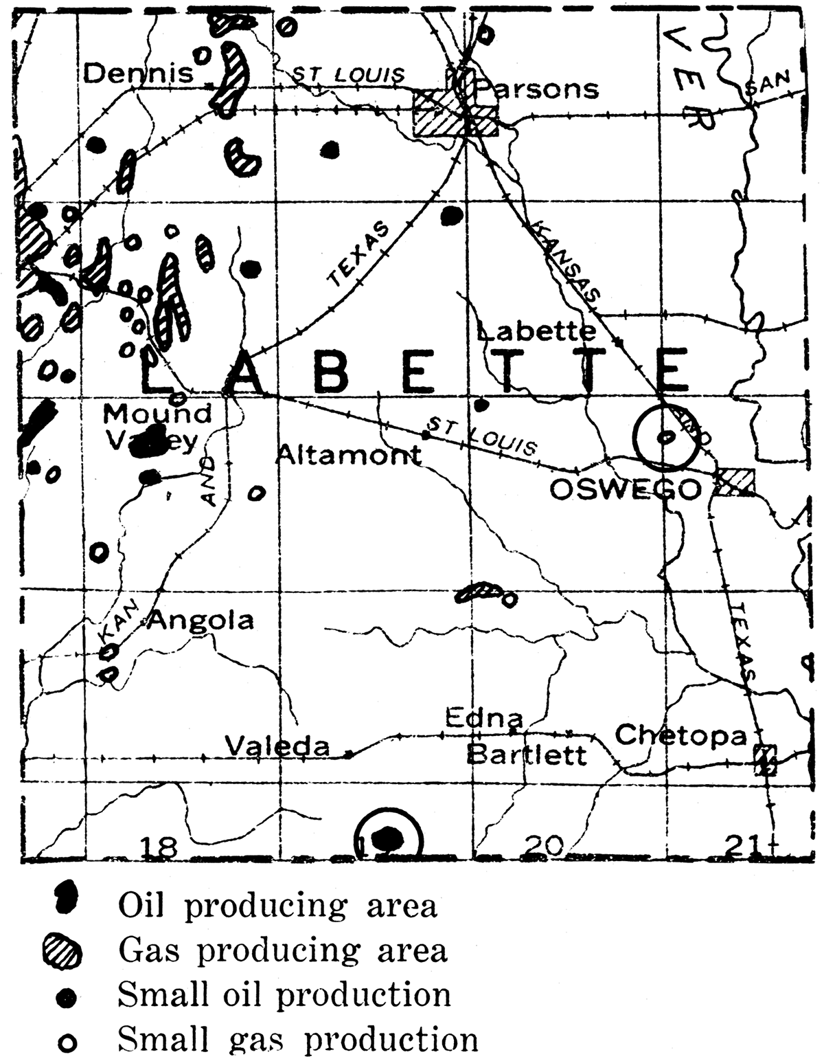
Linn County
For many years Linn county has produced gas and oil from scattered wells with a small yield. Within the last few years, however, systematic exploration which has mainly resulted in extending eastward the moderately prolific shoestring sands in Anderson County has considerably increased oil production. At present two well-defined shoestring sands are known in the northwest part of the county, the Parker-Goodrich string, in T. 20 S., R. 22 E., trending in a direction from northeast to southwest, and the Centerville string, in T. 21 S., R. 22 E., trending across the county in a direction slightly west of a direction northwest to southeast. These producing sand bodies are very narrow and in some cases the productive belt is not more than a location wide. Where the sand is low in porosity production has been small, but some wells up to 200 barrels initial production have been reported. The oil sands occur near the top of the Cherokee shale and are encountered at depths of around 600 feet.
A small field is known in the vicinity of Mound City in T. 22 S., Rs. 23-24 E. Oil is obtained from a Ill-foot sand at a depth of 320 feet and a 20-foot sand at 290 feet. Flush production of about 25 barrels is reported, but this soon declines to about a barrel or slightly less when put on the pump. An area of gas production is found about two miles north of Mound City. Production from the Linn county fields is not large, but because of the shallow drilling it has been profitable. Records for the last two and a half years show in 1924, 152,637 barrels; 1925, 130,401 barrels; 1926, first six months, 43,500 barrels—a total of 326,538 barrels.
Figure 80—Linn county.
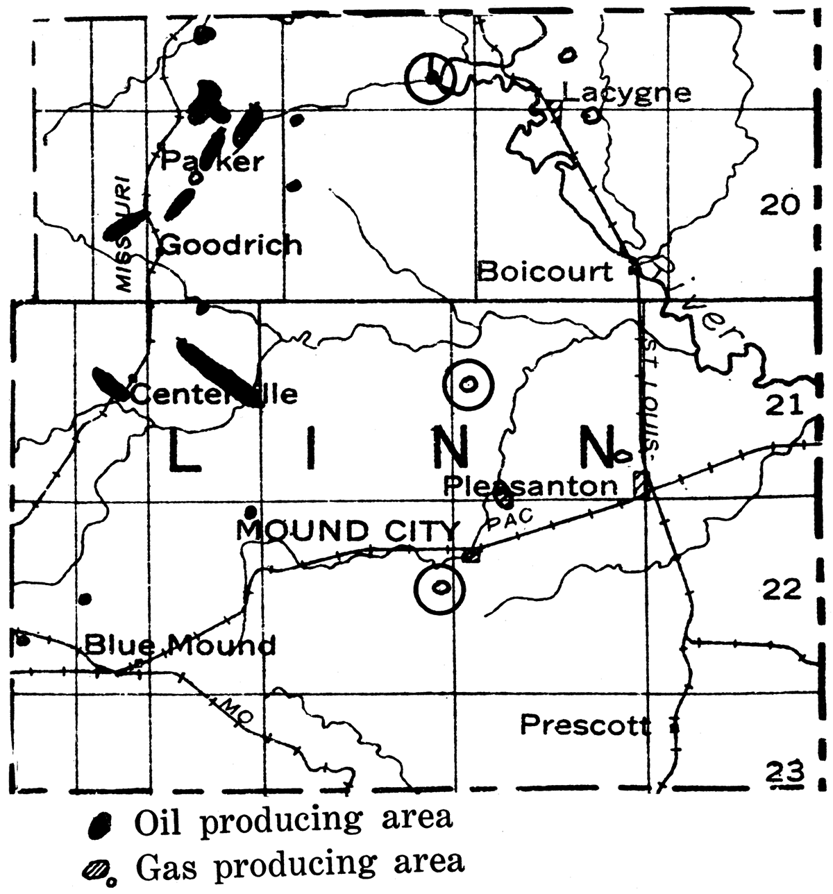
Lyon County
A northward extension of the richly productive shoestring sands in northwestern Greenwood county into southern Lyon county has brought the latter into the list of Kansas producers. In the first half of 1926 Lyon county produced 215,175 barrels.
A new pool has recently been opened by the J. W. McCulloch Oil Company in sec. 16, T. 21 S., R. 10 E. Wells with an average initial production of 190 barrels are obtained from the sand at a depth of 2,700 feet. The oil is of somewhat low gravity, 29 degrees Baumé, and has been chiefly utilized as fuel.
Figure 81—Lyon county.
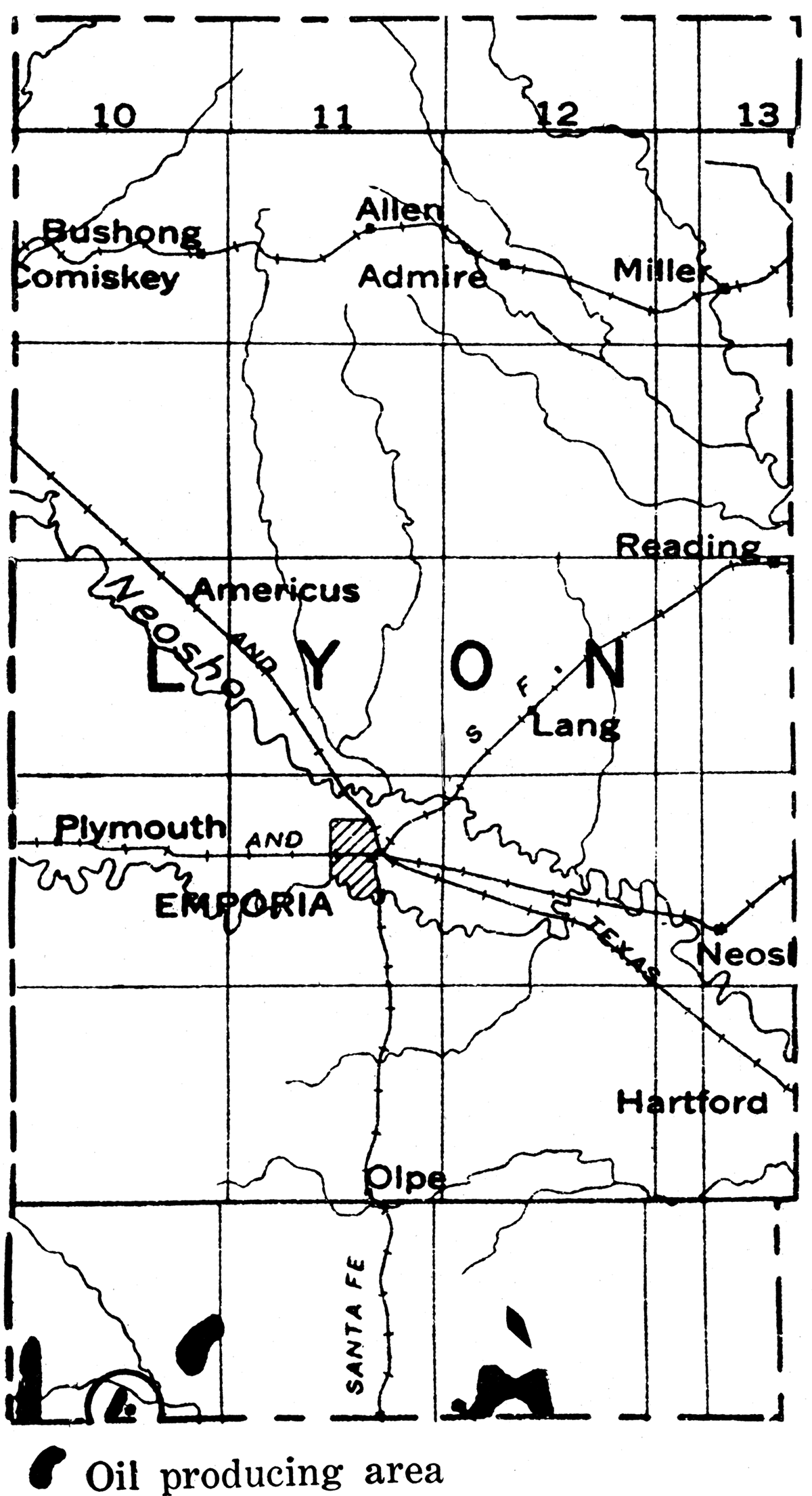
Marion County
Following the discovery of the rich Elbing pool in northwest Butler county in 1919, exploration was extended northward into Marion county. The Peabody pool was shortly found north of Elbing and later the Florence pool. In 1920, the Peabody-Elbing and Florence fields produced 8,932,929 barrels. In the following year, 1921, production in these districts reached a total of 12,751,797 barrels. In adjacent parts of southern Marion county, the Covert, Sellers and Urschel pools were discovered. While these were rather small in area they were rich in oil. Including the production of Elbing in 1920 and 1921, when records for this field were not kept separately, Marion county produced a total of 30,510,689 barrels in the period from January 1, 1920 to June 30, 1926, or an average daily production through the entire time of 12,873 barrels. Extensive exploration in central and northern Marion county was mostly unsuccessful, more than 40 costly dry holes being drilled in about a year's time. Like the El Dorado oil, that from Marion county is a good grade light oil, with a gravity of 32 to 34 degrees Baumé,
The oil in Marion county is mostly found in the top of the siliceous lime of Ordovician age. In places there are accumulations of gravel and of residual chert on the top of this limestone, such porous deposits forming an excellent reservoir for the oil. These fields lie on the west slope of the buried granite ridge which extends northward from Butler county, and the regional dip of the rock strata is westward at a rate of about 30 feet per mile.
The Peabody pool, in T. 22 S., R. 4 E., was developed in 1919. Production is obtained from the Ordovician at a depth of about 2,500 feet. Some of the wells had initial capacities of more than 1,000 barrels a day. The Peabody pool yielded 1,231,259 barrels in 1924; 893,434 barrels in 1925; and 347,432 barrels in the first half of 1926. The oil is 32 gravity degrees Baumé,
The Florence-Urschel pool, located in T. 21 S., R. 5 E., is the northernmost of the group of oil fields lying immediately west of the buried granite ridge in central Kansas. The discovery well was the J. T. Greeley No. 1, drilled by the Robinson Petroleum Company in section 18. The sand was encountered at 2,396 feet, the well having an initial production of 150 barrels. It was later discovered that the major structure was in section 16 and 21. A well drilled by Merriam & Findeiss and the National Refining Company on the D. F. Urschel lease in section 16 was completed in July, 1920, at a depth of 2,30ti feet and was good for 3,000 barrels a day. Development was rapid, and by the end of 1921 the field was defined by dry holes. Very few wells in the field flowed naturally, as no gas was encountered, the pressure being due to water. The oil is 34 degrees Baumé, but because of water and bottom sediment it is necessary to treat the oil before it is run into the pipe lines. The peak of production was reached in March, 1921, when the daily average yield was 30,000 barrels from 85 wells. By the time the pool was two years old over 10,000,000 barrels of oil had been produced.
Figure 82—Marion county.
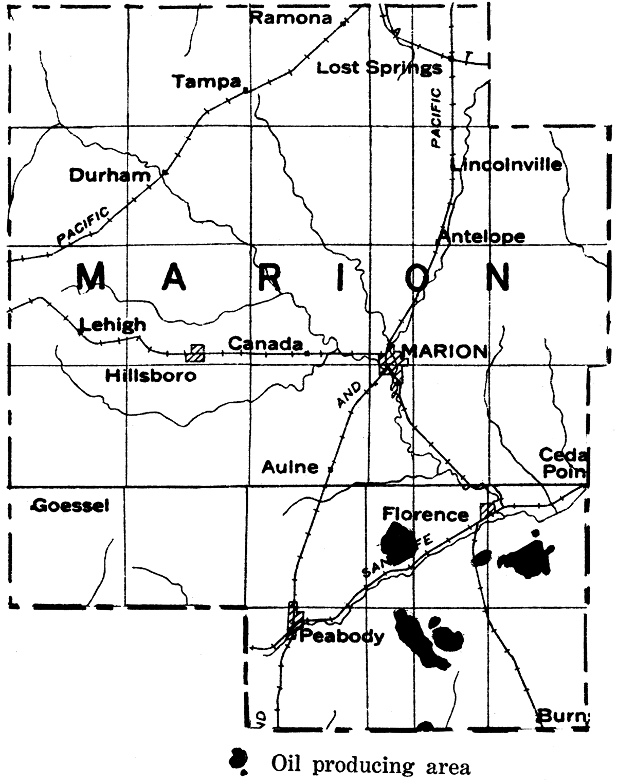
The Covert-Sellers pool, in T. 21 S., R. 4 E., was discovered shortly after the Peabody field was located. Production comes from the same Ordovician rocks as in that field, but the pay is reached at slightly shallower depth-about 2,350 feet. After 7 years' production the field had an average daily production of 832 barrels for the first six months of 1926.
Drilling up to the present time has by no means exhausted the possibilities of the Marion county district, for it is very possible that in areas between existing dry holes there may be porous reservoir rock at the producing horizon which may yield large quantities of oil. Some of the richly productive territory already developed covers a small area. Unfortunately, however, there is little surface geologic evidence to guide location of the favorable territory.
[Note: Subsequent to the writing of this report a new pool has been opened up near the town of Lost Springs, in northeastern Marion county. The discovery well was in the southwest 1/4 of the northwest 1/4 of sec. 22, T. 17 S., R. 4 E., and was rated at 30 barrels at a depth of 2,373-2,396 feet. Since then a number of successful wells have been drilled in the near Vicinity with initial production as high as 1,000 barrels. In addition a well two miles north, in the southeast 1/4 of the southwest 1/4 of sec. 2, T. 17 S., R. 4 E., is reported to have made 100 barrels when it was brought in in September, 1927.]
Miami County
Not only has Miami county long been known as an oil and gas producer, but it has the distinction of being the first place west of the Mississippi tested for oil by drilling. As early as 1860, an oil spring just east of Paola attracted attention, and a company was organized which drilled three wells, the deepest reaching a depth of about 100 feet. The Civil War put an end to these operations, but between 1870 and 1890 other wells were drilled in the county, which found considerable gas and a little oil. Since 1890 activity has greatly increased, and beginning about 1912 the fields have had their greatest development.
There are two main productive areas in the county, one, known as the Paola pool, extending westward from Paola, and the other, a part of the Rantoul pool, in the extreme western part of the county. Most of the productive wells in the vicinity of Paola are in sees, 16, 17, 18 and 19, T. 17 S., R. 23 E. A narrow extension passes to near Whittaker. Smaller areas of production lie northwest of Paola. Gas is obtained in the Paola district about 3 miles west of the city.
[Note: During the winter of 1926-'27 a new pool was discovered northeast of Paola, in sec. 20, T. 16 S., R. 24 E. Production has been secured at depth. between 350 and 450 feet, and initial productions as high as 400 barrels have been reported. The sand is of the' shoestring type with a northeast-southwest trend. A large number of wells are now operating along this trend in both directions from section 20.]
The Rantoul field extends from the northeastern part of Franklin county to the south part of T. 17 S., R. 22 E., in Miami county. Most of this district is oil-producing, but gas wells are found near the county line just southeast of Rantoul.
The oil wells in Miami county are not phenomenal producers. Initial production as high as 250 barrels per day has been reported, but most of them are much smaller, and shortly decline to a settled production of 4 or 5 barrels. The gas wells are rather small, most of them showing all initial capacity of less than 1,000,000 cubic feet per day. Producing sands are recorded at depths ranging from less than 300 feet to more than 900 feet. Most of the production comes from sand between 400 and 600 feet. Shallow sands occur in the Marmaton formation, but the chief production is found in the Cherokee shale. Deep wells which recently have been drilled through the Mississippi lime and the older formations near Paola have failed to find commercial production, The specific gravity of the oil varies from 26 to 38 degrees Baumé, The production of the county for 1924 was 225,421 barrels; for 1925, 186,244 barrels; and in the first half of 1926, 82,868 barrels.
Figure 83—Miami county
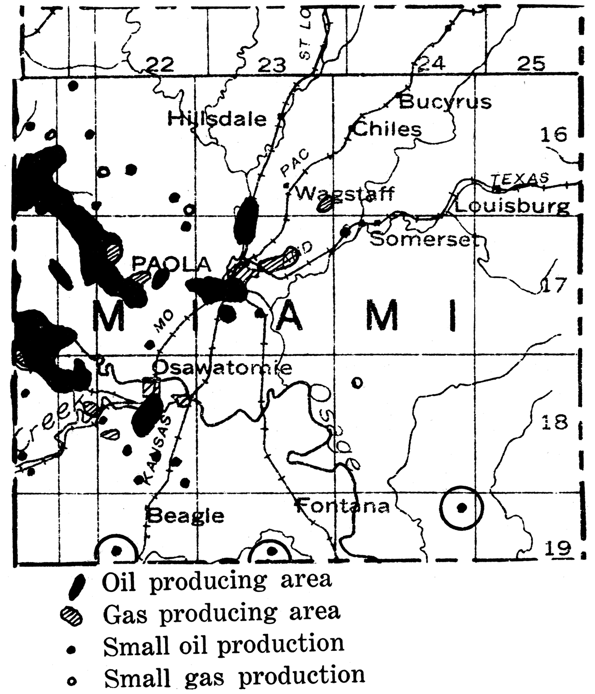
Montgomery County
Gas has been produced from the area near Independence since 1881, and near Cherryvale and Coffeyville since 1889, the gas being piped to Cherryvale and Independence in 1893. At first the supply was small, but from 1902 to 1904 a number of wells were drilled which had initial open flow capacities ranging from 12,000,000 to 35,000,000 cubic feet of gas daily. Montgomery county became an oil-producing district in 1903 with the opening of the Bolton pool, which in 1904 had over 200 producing oil wells. A few of these wells had an initial production of 1,000 barrels a day, and 150- to 200-barrel wells were common. Originally centering about a few discovery districts, the county has now been so widely developed that wells in one region are almost continuous with those in another. Oil production is obtained mainly from the fields in the southwestern part of the county, Bolton, Wayside-Havana, Caney and Tyro, and in part from the Coffeyville, Cherryvale and Larimer-Sycamore fields. The average initial daily production for the county has been 10 to 20 barrels, but some wells in the southwest field have yielded 100 to 200 barrels in settled production. The oil ranges in quality from a heavy crude with a gravity of 22 degrees Baumé to a good paraffin base oil of 38 or 39 Baumé, The poorer grades have been reported from south of Independence in the east part of the county, while the better ones are found in the central, west and southwest parts of the county.
Figure 84—Montgomery county.
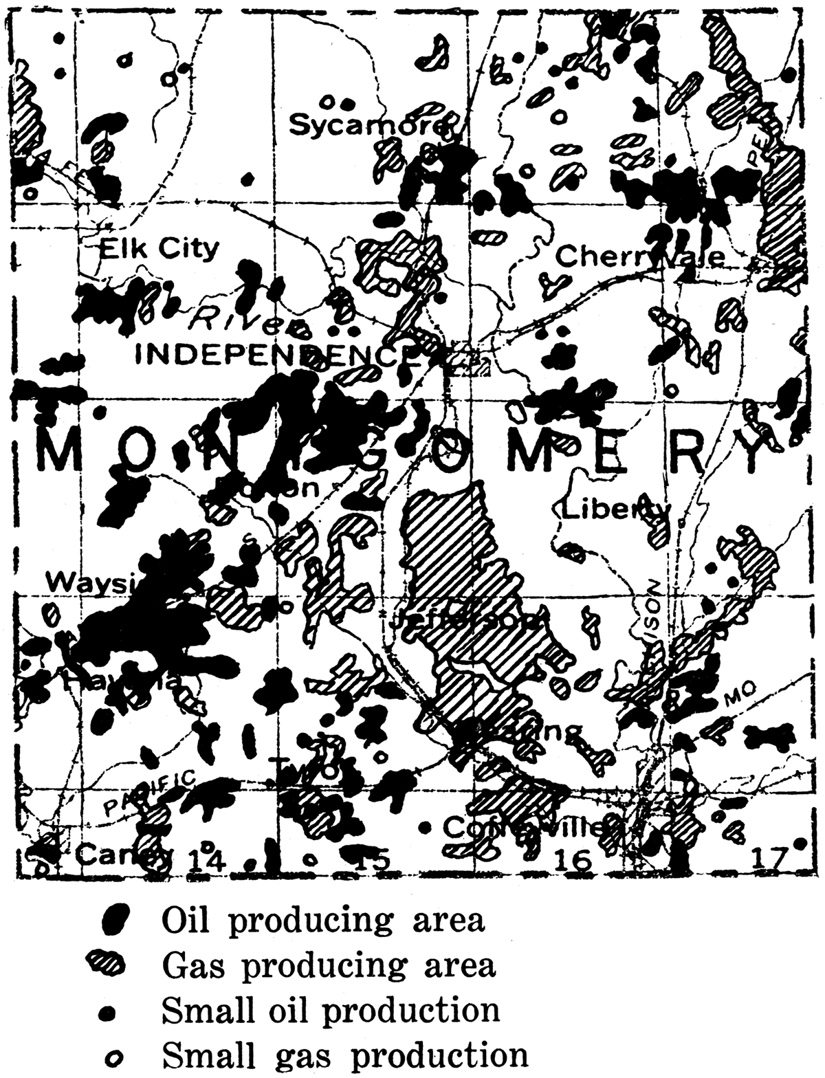
In parts of the county production is obtained from several different pay horizons. The uppermost sand is the Wayside, which is found in the WaysideHavana pool at about 600 feet below the surface. It is characterized by the long life of the wells producing from it. About 125 feet below the Wayside is the Weiser sand, which yields a heavier oil than that in the upper sand. The Bartlesville sand in the lower part of the Cherokee is encountered at a depth of around 1,100 feet in the western part of the county. This sand contains oil chiefly. At the bottom of the Pennsylvanian is the Burgess sand. This sand yields much gas.
Production of oil and gas has declined greatly from the maximum yield of former years. The Independence gas field had a total open flow capacity of about 700,000,000 feet in 1904, but at present this gas area is almost exhausted. The Elk City gas field in the northwest part. of the county has been a very prolific gas producer, containing some wells with a capacity of as much as 37,000,000 cubic feet daily.
In the last few years deep wells, which were drilled on small but' fairly wen defined anticlinal folds near Liberty, Cherryvale, and west of Independence on the Coleman farm, obtained production from the "Wilcox" horizon, below the main body of the Mississippi limestone. This pay is not actually equivalent to the Wilcox of the El Dorado producing region or the north-central Oklahoma fields. Though this development caused considerable excitement for a short time, the presence of water and a relatively low gravity for the oil made extensive development unprofitable. The oil production of the county in 1924 was 1,117,114 barrels; in 1925, 1,136,654 barrels; and in the first half of 1926, 378,238 barrels.
Neosho County
There are many square miles of productive oil and gas territory in Neosho county, chiefly distributed in the northwest and west parts. The main producing area, known as the Chanute field, is essentially a continuation of the Humboldt field in Allen county. The principal oil production extends in a belt from the northwest part of the county to the vicinity of Erie. Gas wells are distributed irregularly through the oil-producing district, and gas-producing areas with scattered oil wells lie northeast and southwest of the main oil trend. Oil fields also occur a short distance west and east of Thayer in the southwestern part of the county.
Most of the oil wells in Neosho county are small, few reporting an initial production of as much as 250 barrels. The yield commonly settles to 5 or 10 barrels per day, and continues at this rate for several years before the wells are exhausted. The gravity of the oil ranges from 18 to 30 degrees Baumé. The oil and gas occur in more or less lenticular sand bodies in the Cherokee shale at depths ranging from about 550 to 1,100 feet. Production in Neosho county for the past four and a half years totals 1,456,007 barrels, distributed as follows: 1922, 393,901 barrels; 1923, 362,161 barrels; 1924, 300,273 barrels; 1925, 276,945 barrels; 1926, first half year, 122,727 barrels.Figure 85—Neosho county.
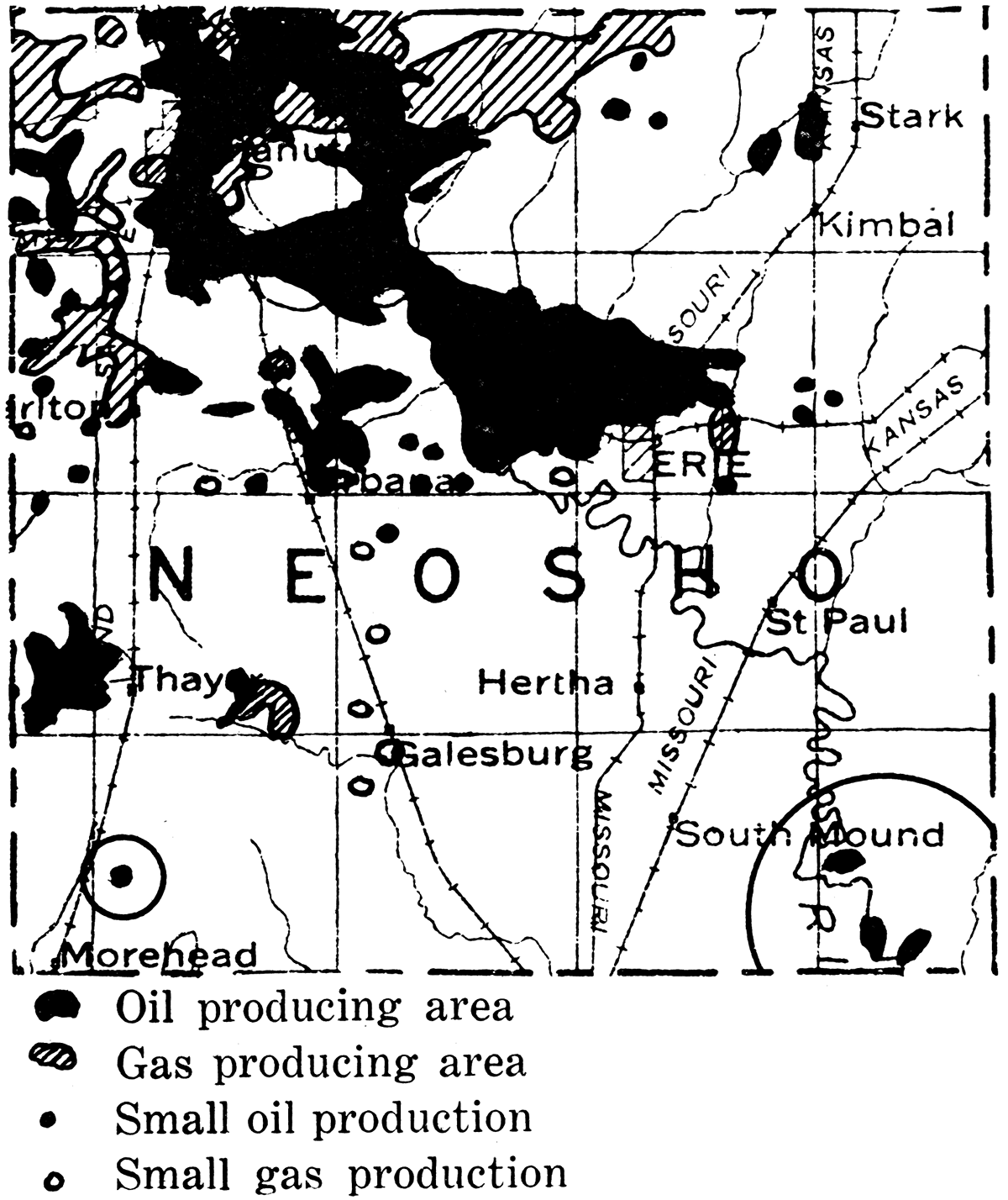
Rice County
Rice county joined the list of oil-producing counties in Kansas in 1924, when Hipple and Childs of Hutchinson brought in a wildcat test on the Welch farm in the southeast part of the county. The production to date is confined to sec. 2, T. 21 S., R. 6 W. [Note: Since this report was written production has been extended westward into sec. 3 and northward into secs. 26, 34, and 85, T. 20 S., R. 6 W.] The oil comes from a porous chert formation which apparently is a residual or a transported deposit derived from adjacent older rocks. This "sand" has an average thickness of 28 feet and belongs in the lower part of the Cherokee shale of Pennsylvanian age. It is encountered at a depth of about 3,350 feet. One well, the R. E. Youkers No. 2 Walstein, in the southwest corner of the northeast of the northwest quarter of sec. 2, T. 21 S., R. 6 W., is reported to have made initially 900 barrels daily. There is very little surface geologic evidence in Rice county to aid in location of test wells. In the southeast part of the county are soft shales belonging to the upper part of the Wellington formation of Permian age, and throughout the remainder of the county the Dakota sandstone of Cretaceous age covers the surface. Reliable key beds for structural mapping are absent. Widespread deposits of dune sand are found in parts of the region. In 1924 the oil production of the county was 25,690 barrels; in 1925, 35,255 barrels; and in the first half of 1926,48,207 barrels.
Figure 86—Rice county.
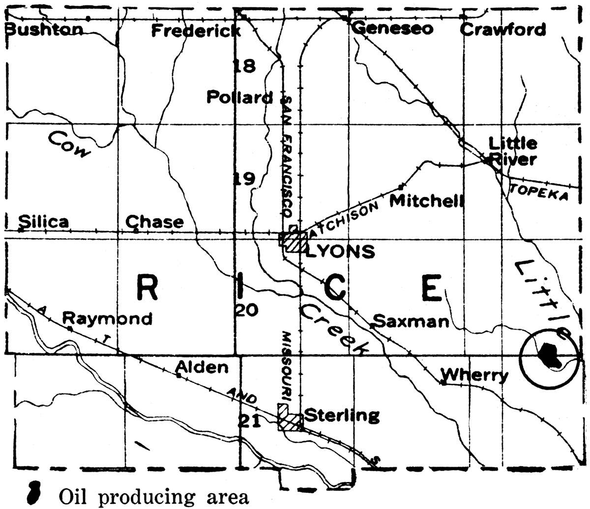
Russell County
One of the most interesting developments in the past few years of oil and gas exploration in Kansas is the discovery of commercial oil in northwestern Russell county, 135 miles northwest of the productive territory in Butler county and separated throughout this distance by territory lacking production. The discovery well was brought in during the latter part of 1923 on a north-south trending anticline first mapped by V. H. McNutt, geologist, of Tulsa, Okla. The first well showed some oil in porous streaks in Pennsylvanian limestone at about 2,700 feet. The well was completed at a total depth of 3,001 feet with a production of 300 barrels. Subsequently when production declined the well was deepened to 3,035 feet, when it encountered another pay streak from which it is making 100 barrels per day. The second well, an offset to the west, made about 1,000 barrels originally at a total depth of 3,027 feet. In the period, nearly three years, since the finding of this oil, more than 50 producing oil wells have been drilled, and for part of the time a daily production of more than 5,000 barrels has been reported. Several pay zones have been found beneath the first producing horizon, which indicate important possibilities of increased yield after the present producing zones have been exhausted. The continued large production of the wells shows a slow rate of decline in the field. The present proved area is in places nearly a mile wide from east to west and extends fully four miles from north to south. The completion of an oil well in sec. 30, T. 12 S., R. 15 W., indicates a probable further southward extension of 1 1/2 to 2 miles. The discovery of commercial oil by the Midwest Oil Company in sec. 5, T. 14 S., R. 15 W., near Gorham, 7 miles south of the nearest producing well to the north, is a most interesting and significant new development. [Note: Since this report was written a number of wells in the vicinity of Gorham and across the line in Ellis county have been successfully completed.]
Figure 87—Russell county.
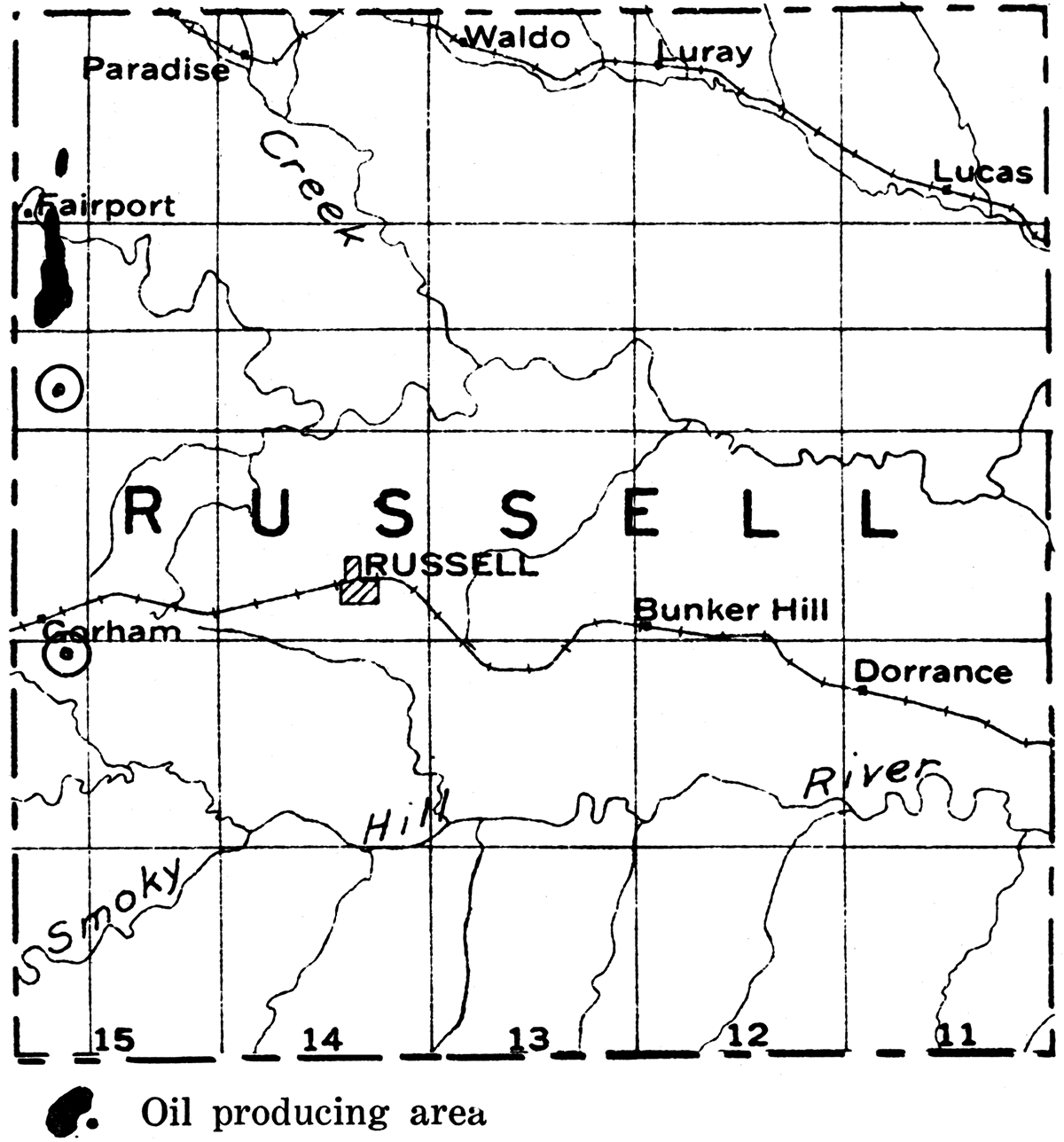
The oil produced in the Russell field is black, but the gravity ranges from 41.5 to 42.6 degrees Baumé, and it has a gasoline content of 43 per cent. The Sinclair Crude Oil Purchasing Company takes the oil through a 3-inch and a 4-inch pipe line to Paradise, Kan., at which point it is shipped out in tank cars. A 2,500-barrel refinery has been built recently at Russell.
At present (1926) Russell county is one of the best oil pools in the state, both in. quantity of oil produced and in the very high gravity of the oil. The county ranks fourth among counties of the state in quantity of oil produced both in 1925 and 1926. Its annual yield exceeds the. combined production of Bourbon, Linn, Labette, Miami, Franklin, Douglas, Neosho, Allen, Wilson, Elk, Harvey, Rice and Sumner counties, and it is surpassed only by Greenwood, Butler and Cowley. Indications point to the considerable extension in the area of production in Russell county and strongly encourages prospecting in other parts of western Kansas. In many parts of this region the lack of reliable horizons for use in structural mapping and the widespread deposits of sand and gravel which conceal the underlying rocks make exploration difficult, and there are likely to be many disappointments. However, it is certain that there will be extensive search for oil in areas that appear at all promising.
Russell county production in 1924 was 232,266 barrels; in 1925, 1,336,148 barrels; and in the first six months of 1926, 1,005,413 barrels—a total of 2,573,827 barrels. The Russell county field is described in a report issued by the State Geological Survey in 1925. This is Bulletin 10, by W. W. Rubey and N. W. Bass.
Sumner County
The development of the very rich Rainbow Bend field, just east of the Sumner-Cowley line, has stimulated active exploration for oil in Sumner county. That some commercial production has been found is indicated by the record of 34,338 barrels produced in the county during the first six months of 1926. Favorable indications for important pools, especially in the eastern part of the county, are suggested by the probable southward extension of the buried granite ridge which underlies the Augusta and El Dorado pools in Butler county. The absence of reliable key beds for surface structural mapping makes the geologic study of oil possibilities in the county very difficult. Some of the oil companies have done extensive core drilling in order to locate favorable areas, and there are prospects of increased production in the future. A well drilled by the Roxana Petroleum Corporation on the Miller farm in the northeast corner of the southwest quarter of sec. 17, T. 32 S., R. 2 W., is reported to have encountered the Wilcox sand on the west flank of the buried granite ridge at a depth of 3,637 feet, and at a depth of 5 feet in the sand swabbed 650 barrels a day. A number of deep tests have been drilled in the county, some of which show that the Mississippian limestone is present in typical development underlaid by Chattanooga shale and sand.
Figure 88—Sumner county.
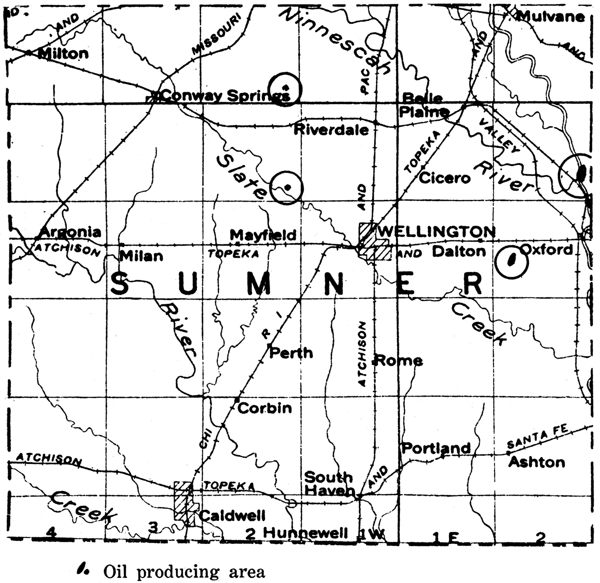
Wilson County
Oil and gas have been produced in the vicinity of Neodesha since 1890. The towns of Fredonia, Benedict and Buffalo became oil and gas centers in about 1900. The chief producing districts in the county are: (1) In the vicinity of Neodesha; (2) Altoona and the area northeast near Neosho county; (3) the area surrounding Fredonia; (4) the northern part of the county, including territory about Roper, Benedict and Buffalo.
Figure 89—Wilson county.
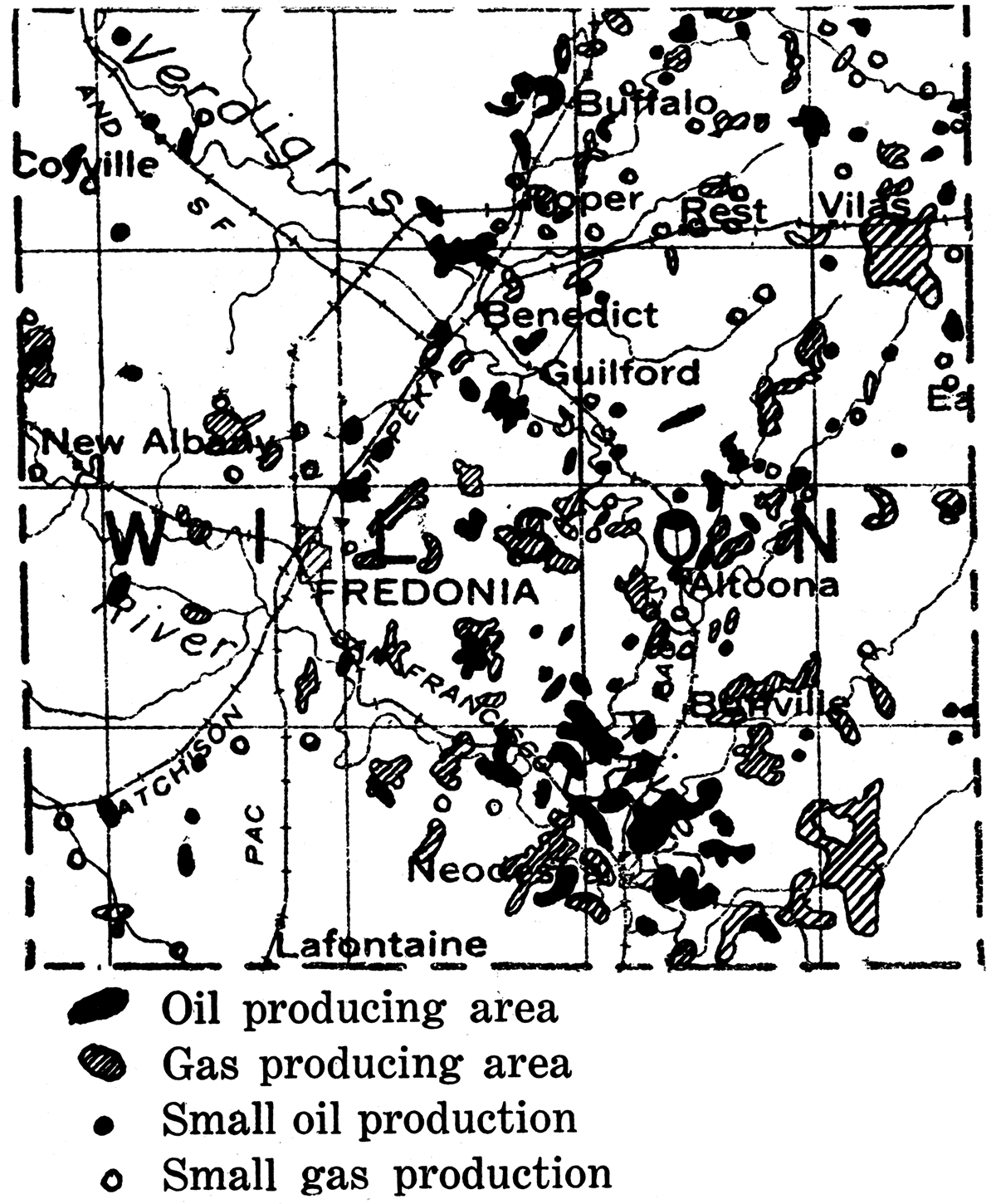
The oil- and gas-producing districts are not sharply differentiated, but on the contrary oil wells and gas wells are rather closely associated in most of the fields in the county, and in many cases both oil and gas have been obtained from the same well. The areas of most important gas production have been in the vicinity of Fredonia, about Neodesha, and between Altoona and Vilas. The oil comes chiefly from near Neodesha, between Benedict and Fredonia, and in the Benedict-Buffalo district. The wells are relatively small producers on the average, but yield a relatively good grade of paraffin base oil with a specific gravity of 33 to 38 degrees Baumé. The wells have a long period of production, and in spite of small yields are profitable. The producing sands are found at depths ranging from 350 to about 1,000 feet.
An interesting development of the past few years in this region has been the rather extensive production of the so-called shale gas, coming from a black, fissile shale at the Fort Scott limestone horizon. Gas had long been known to occur here, but as production is generally less than half a million cubic feet, little attention had been paid to it in the quest for larger-producing gas and oil wells obtained in the sand horizon. It has been discovered that the production of gas from the shale is maintained to a remarkable degree and the wells are exceedingly long lived. This is probably due to the very fine texture of the rocks from which the gas is derived.
The oil production of Wilson county was 99,464 barrels in 1924; 126,270 barrels in 1925; and 35,857 barrels in the first half of 1926.
Figure 90—Woodson county.
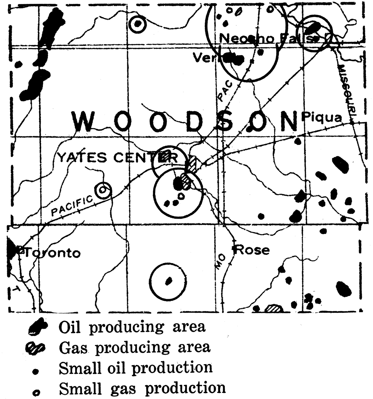
Figure 91—Wyandotte county.
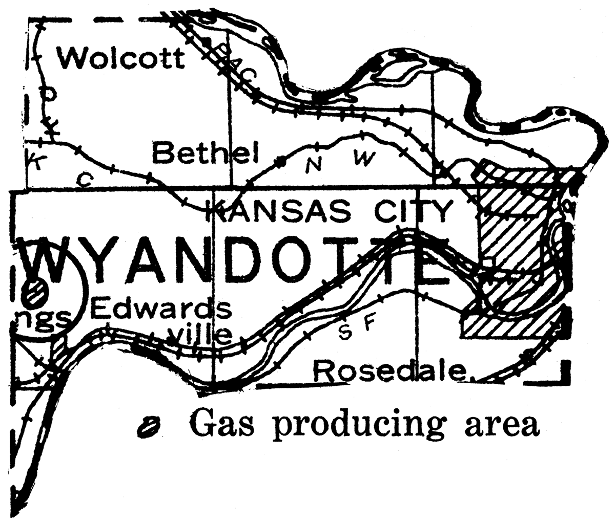
Salt
Kansas first entered the salt market as a producer in 1892, with an initial annual production of $189,000. This figure increased until 1922, when it reached $3,850,000. Then a decline set in, and by 1925 the production had fallen to slightly under two and one half million dollars. This decline was not caused by a lessened tonnage but by a decrease in price per ton, which caused the total value of production for the United States to likewise decline. For some years Kansas has ranked fourth among the states of the Union in the annual value of its salt production, and that industry is tenth among the mineral industries within the state. The value of salt production in Kansas between 1888 and 1925 reaches the enormous total of $39,480,755.
The Kansas salt deposits are almost inexhaustible. They underlie several thousand square miles in the central and western portions of the state, and reach thicknesses exceeding 300 feet. A map prepared by N. W. Bass, is given in figure 92. (Structure and Limit of Kansas Salt Beds: Part 4, Bulletin 11, State Geological Survey of Kansas, 1926 [available online].) It shows the distribution and thickness of salt as determined by drilling.
This salt was precipitated on to the floor of seas and saline lakes which existed in the region in Permian time. Strata of the age crop out at the surface in a broad band which extends from near the center of the KansasOklahoma boundary a little east of north to the Nebraska boundary. The Permian rocks are dipping at a small angle to the west. This carries the salt-containing strata westward under formations of younger age.
At the present commercial production is secured from the Wellington formation in the middle Permian. Wells in Clark county have encountered a 200-foot bed of salt lying about 1,000 feet above the Wellington salt. The salt penetrated by the deep well in Hamilton county was also at or near this upper horizon. According to Bass' map the salt thins out in going east or west toward Seward county and disappears completely in and to the north of that county. The logs of the Seward county wells show no salt. This indicates that either this area was elevated and the salt eroded subsequent to its deposition or that it was a land barrier separating two seas in the period of salt precipitation.
| Annual Production Values of Salt in Kansas | |
|---|---|
| 1916 | $1,302,359 |
| 1917 | $2,027,466 |
| 1918 | $3,598,289 |
| 1919 | $4,497,247 |
| 1920 | $3,839,409 |
| 1921 | $3,268,661 |
| 1922 | $3,849,427 |
| 1923 | $3,570,135 |
| 1924 | $2,781,217 |
| 1925 | $2,494,423 |
| $31,228,633 | |
Figure 92—Isopachus map showing thickness of salt in western Kansas. (Map by N. W. Bass.)
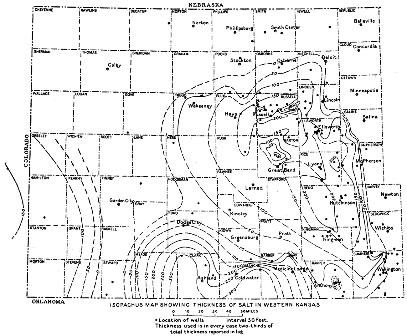
Salt is mined in two ways—by brine wells and by ordinary room-and-pillar mining underground. In the first case water is pumped into a well which penetrates the salt deposit. The salt is allowed to dissolve and the saturated brine comes to the surface. The salt is obtained by evaporation of the brine. This may be by artificial drying, which secures a better grade, or by solar evaporation. Brine wells have an advantage over underground mining in that only the soluble material is removed, while the shale partings and other insoluble materials are left behind. This proves to be a disadvantage, however, if there are beds of gypsum associated with the salt, for this substance is likewise soluble. Evaporating plants are located at Hutchinson, Sterling, Anthony, Ellsworth, and Lyons. The Anthony Salt Company, at Anthony, Kan., has two wells which penetrate two distinct beds of salt. The top of the first, a 30-foot bed, is reached at a depth of 830 feet, while the top of the lower bed, which is 40 feet thick, lies 920 feet below the surface. Water is forced down an inner pipe and brine pumped out between the inner pipe and the outer casing.
Figure 93—Salt mining underground.
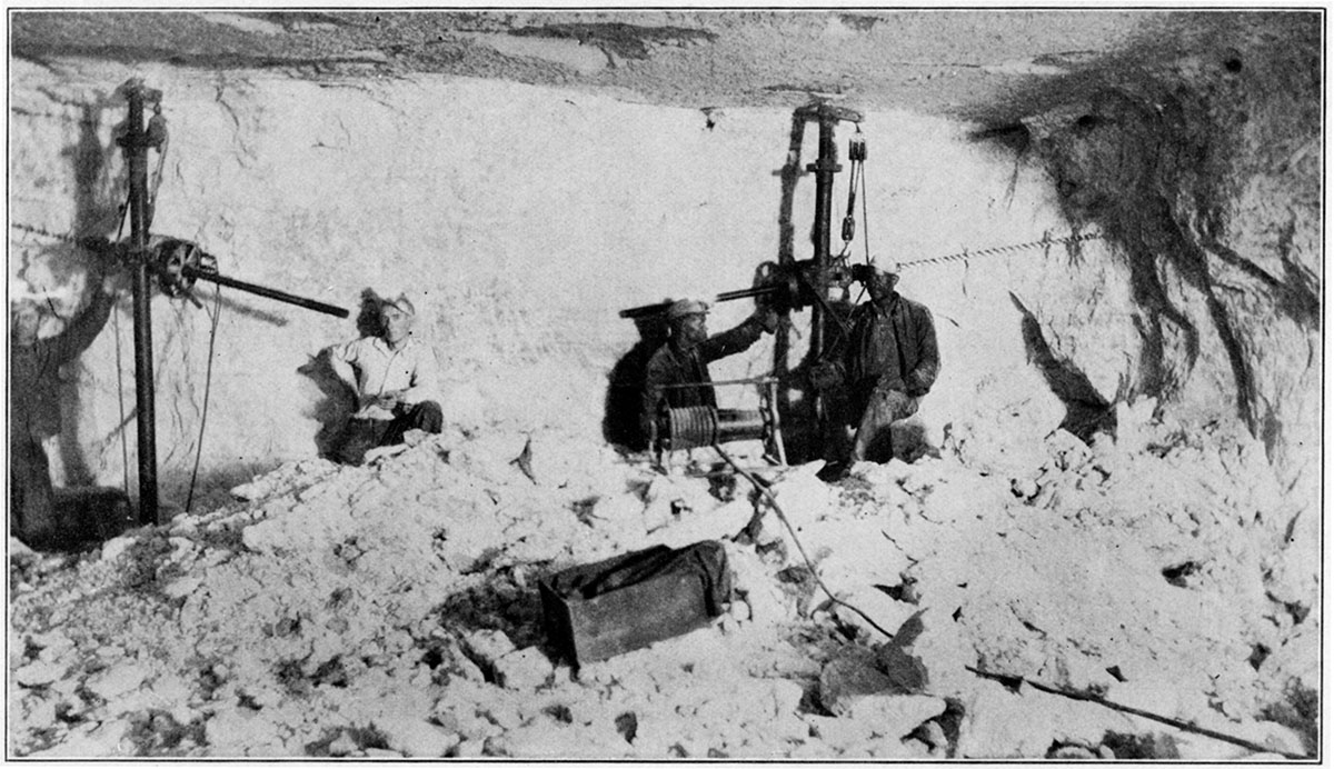
Figure 94—Loading salt in Kansas salt mine.
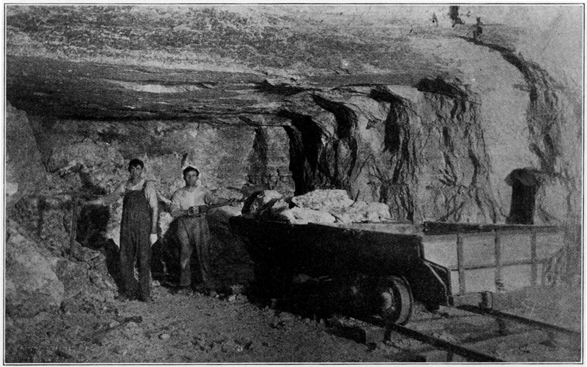
Figure 95—Loading salt onto hoist.
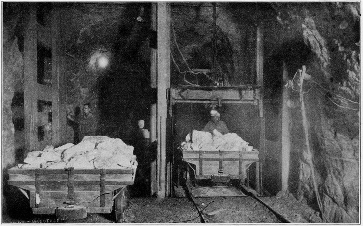
Figure 96—Surface view at salt mine.
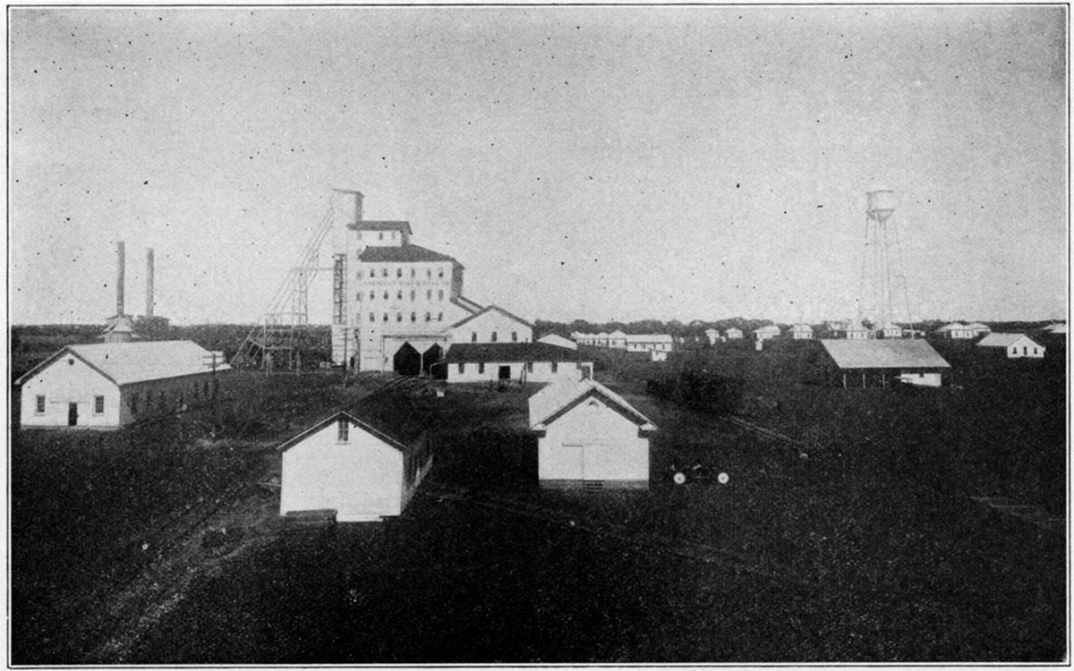
Where underground mining is employed the salt is removed in much the same manner as coal. At the Royal Salt Company's mine at Kanopolis, in Ellsworth county, the salt is reached by shaft at a depth of 860 feet. The salt bed is 10 feet thick and very regular and pure, though there are a few thin shale partings. Electricity is used for drilling, hauling and' hoisting. The Crystal Salt Company and the Independent Salt Company also have mines at Kanopolis, exploiting the same bed as the Royal Company. Upon reaching the surface the salt is crushed to different sizes. The coarser is sold crude and the finer material is converted into blocks. No salt is refined at Kanopolis. Salt is also mined at Lyons.
The commoner uses of salt are well known. The best grades are consigned for table and dairy use. Poorer grades are used in the meat-packing and fish-curing industries, and in preparing pickles and curing hides. Salt is also used in refrigeration, in the chlorination of gold, and to form a glaze on pottery. Crude salt is fed to live stock. Brine is used by the chemical industry in the manufacture of soda ash and caustic soda.
Figure 97—Brine method of salt mining, Lyons, Kan. (Courtesy American Salt and Coal Company.)
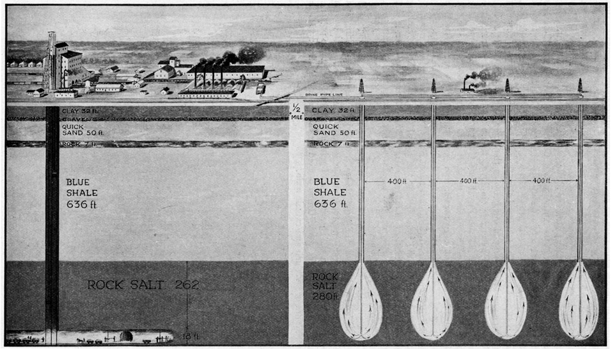
Figure 98—Interior of salt plant.
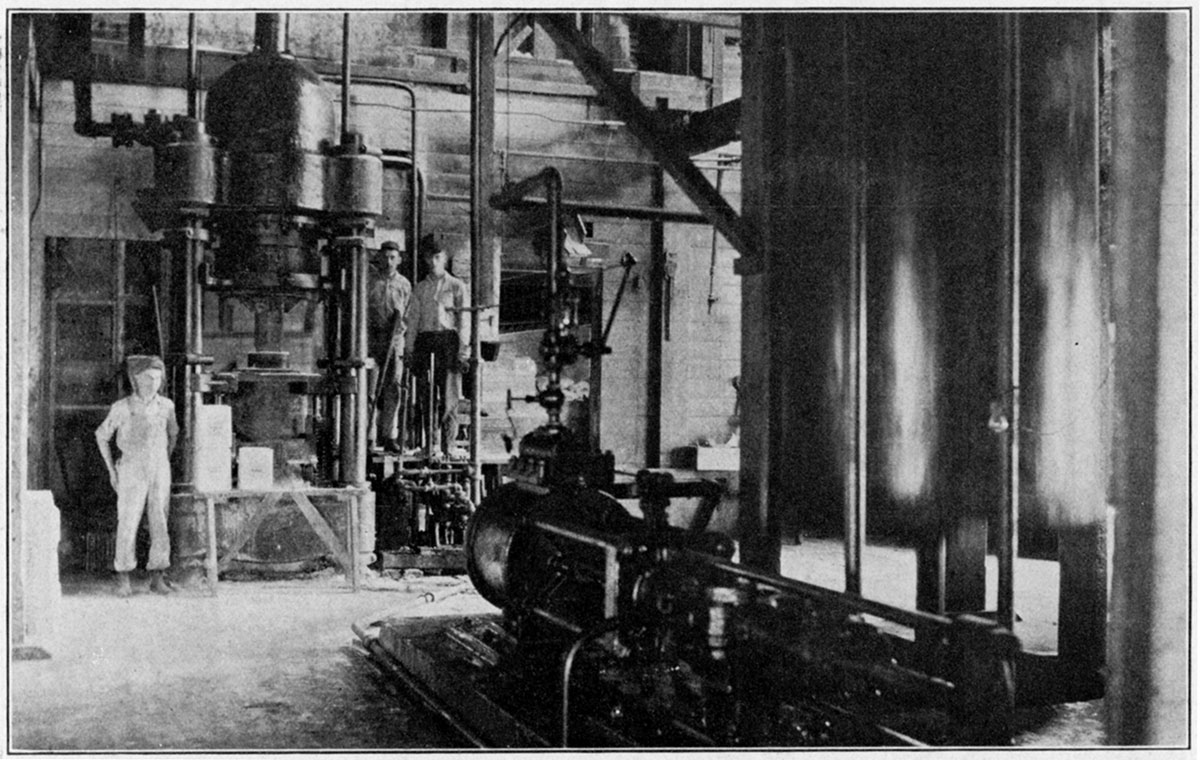
Figure 99—Compressed salt blocks on floor at Kansas salt plant.
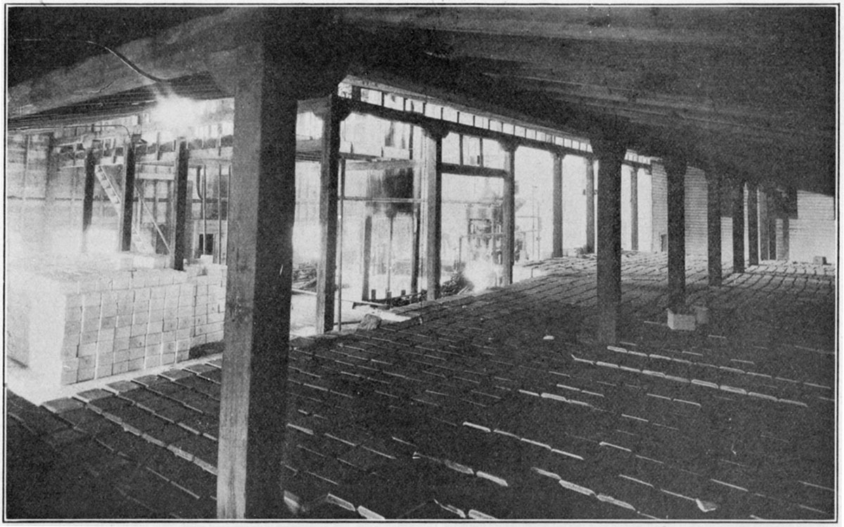
Sand and Gravel
During each of the last three years Kansas has produced over $1,000,000 worth of sand and gravel. Since 1916 this industry has totaled $7,180,488. This figure is small in comparison with the recent annual production due to the very limited activity of the industry in the war years. The detailed production for the past ten years is shown in the following table:
| Annual Production Values of Sand and Gravel in Kansas |
|
|---|---|
| 1910 | $303,633 |
| 1917 | $195,578 |
| 1918 | $364,073 |
| 1919 | $507,642 |
| 1920 | $905,936 |
| 1921 | $647,723 |
| 1922 | $790,763 |
| 1923 | $1,039,064 |
| 1924 | $1,223,016 |
| 1925 | $1,303,060 |
| Total | $7,180,488 |
Deposits of sand and gravel are widely distributed over Kansas. They fall into three main groups: Tertiary, glacial, and stream. Dune, or wind-blown sand may be of local importance. The Tertiary sands and gravels were deposited by streams which flowed eastward over the Great Plains region in preglacial time. They consist of fragments derived from the older sedimentary rocks and granites of the Rocky Mountain region. Subsequent erosion by recent streams has in part removed the Tertiary sediment. Sand and gravel of this age compose what is known as the Ogalalla formation. They" cover the surface in most of the counties in the western third of the state, as may be seen on the accompanying map.
Glacial gravel was deposited by the immense glaciers which pushed down over the northern part of the continent a few thousand years ago. They did not advance into the state beyond the northeast corner. Consequently sands and gravels of this type are confined to an area north of the Kansas river and east of one of its tributaries, the Big Blue river.
Figure 100—Map of Kansas, showing the distribution of sand and gravel.
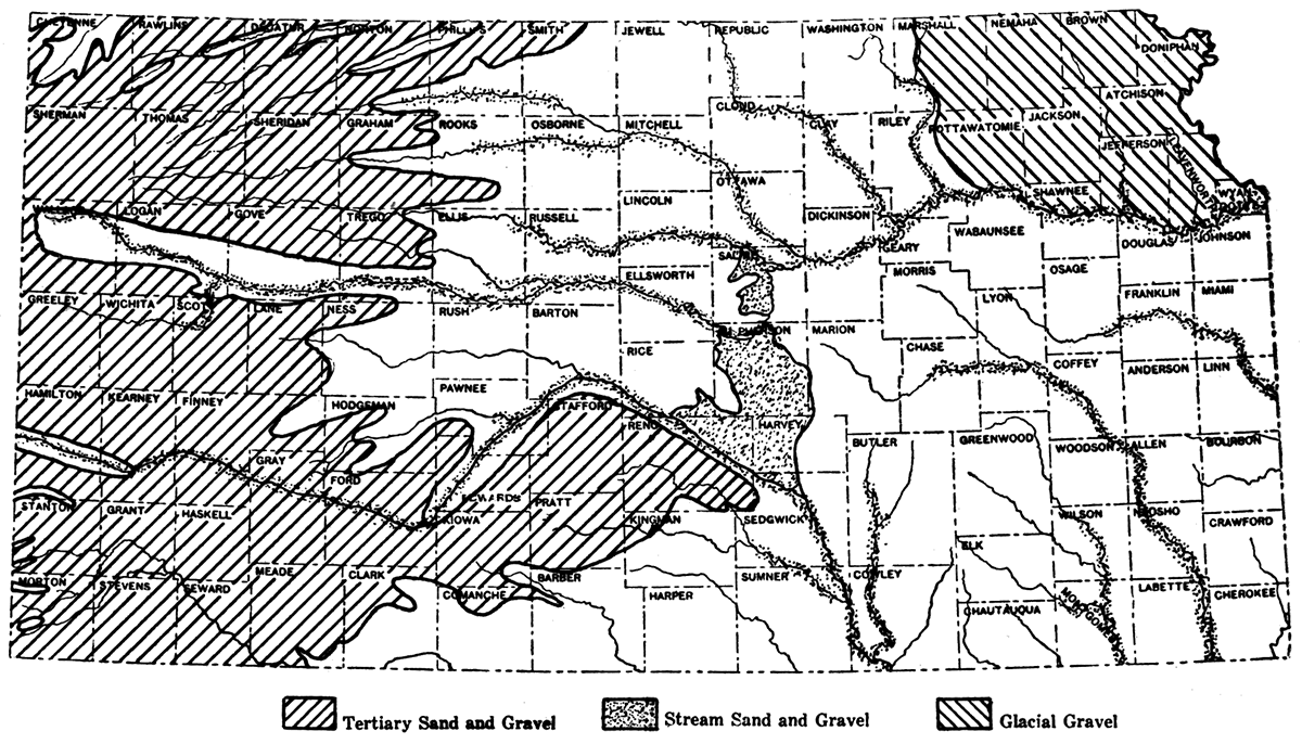
Stream gravels and sands occur along all the main rivers and their major tributaries. Such rivers as the Kansas and the Arkansas have abundant deposits along their courses. The Smoky Hill, Saline, Solomon, Republican and Big Blue rivers, all important tributaries of the Kansas, contain sand and gravel deposits for some distance upstream from their mouths. In southeastern Kansas the Verdigris and Neosho rivers likewise contain sand and gravel deposits.
The major uses of sand and gravel are in the building and paving industries. Other uses for sand are for filtering, grinding and polishing, and in glass manufacture. Gravel is also used for ballast. The table given below shows the uses to which sand and gravel were put in Kansas in 1924 in the order of value.
| Building sand | $709,829 |
| Paving sand | $190,633 |
| Paving gravel | $159,508 |
| Building gravel | $150,755 |
| Engine sand | $8,776 |
| Filter sand | $2,260 |
| Railroad ballast | $202 |
| Other sands | $1,064 |
In Bulletin 3 of the Engineering Experiment Station at Manhattan, Kan., R. A. Seaton and I. I. Taylor publish the results of tests conducted by them on Kansas sands. A tabular review of their results is given in the accompanying table. The rating given any sand is based on a comparison of its strength with the strength of the standard sand from Ottawa, Ill.
| Tests on Kansas Sands Conducted by Engineering Experiment Station, Manhattan, Kan. |
|||
|---|---|---|---|
| Rank | Description | Location | Grade per cent |
| 1 | Blue river sand | Manhattan, Kan. | 126 |
| 2 | Pit sand | Kinsley, Kan. | 120 |
| 3 | Missouri river sand | Atchison, Kan. | 120 |
| 3 | Arkansas river sand | Osage, Okla. | 120 |
| 5 | Beebe sand bar (Arkansas river) | Hutchinson, Kan. | 112 |
| 6 | Reformatory pit (Cow creek) | Hutchinson, Kan. | 112 |
| 7 | Colby, Kan. | 111 | |
| 8 | Rhoades pit | Norton, Kan. | 108 |
| 9 | Missouri river sand | Leavenworth, Kan. | 106 |
| 10 | Missouri river sand | Leavenworth, Kan. | 106 |
| 11 | Barger pit (bend in the Solomon river) | Beloit, Kan. | 105 |
| 12 | Arkansas river sand | Larned, Kan. | 105 |
| 13 | Kaw river sand | Manhattan, Kan. | 103 |
| 14 | Missouri river sand | Atchison, Kan. | 103 |
| 15 | Concrete sand (Terry's bar, Smoky Hill river) | Ellsworth, Kan. | 103 |
| 16 | Arkansas river sand | Great Bend, Kan. | 102 |
| 17 | Aitken pit | Cimarron, Kan. | 102 |
| 18 | Republican river sand | Clay Center, Kan. | 101 |
| 19 | Kaw river sand | Topeka, Kan. | 101 |
| 20 | Kaw river sand | Kansas City, Kan. | 100 |
| 21 | Standard Sand | Ottawa, Ill. | 100 |
| 22 | Arkansas river sand | Hutchinson, Kan. | 98 |
| 23 | Little Arkansas river sand | Wichita, Kan. | 98 |
| 24 | Garden City, Kan. | 97 | |
| 24 | McCall pit | Norton, Kan. | 97 |
| 26 | Lamberson's pit (Cow creek) | Lyons, Kan. | 95 |
| 27 | Colby, Kan. | 95 | |
| 28 | Unwashed Kaw river sand | Kansas City, Kan. | 94 |
| 29 | Sand creek | Sharon Springs, Kan. | 94 |
| 30 | Arkansas river sand | Wichita, Kan. | 93 |
| 31 | Arkansas river sand (near Indianapolis street) | Wichita, Kan. | 93 |
| 32 | Sand Springs sand (Smoky Hill river) | Abilene, Kan. | 92 |
| 33 | Arkansas river sand | Arkansas City, Kan. | 92 |
| 34 | A pit sand | Pratt, Kan. | 91 |
| 35 | Kingman, Kan. | 91 | |
| 36 | Arkansas river sand | Arkansas City, Kan. | 91 |
| 37 | Anthony, Kan. | 90 | |
| 37 | Arkansas river sand | Oxford, Kan. | 90 |
| 39 | Ebel sand bank | Russell, Kan. | 86 |
| 40 | Arkansas river sand | Cimarron, Kan. | 86 |
| 41 | Missouri river sand | Kansas City, Kan. | 83 |
| 42 | Mortar sand (Terry's bar, Smoky Hill river) | Ellsworth, Kan. | 83 |
| 43 | Smoky Hill river sand | Junction City, Kan. | 83 |
| 44 | Fordice pit | Norton, Kan. | 82 |
| 45 | Pratt, Kan. | 81 | |
| 46 | Bar of the Solomon river | Beloit, Kan. | 80 |
| 46 | Kingman, Kan. | 80 | |
| 48 | Republican river sand | Junction City, Kan. | 78 |
| 49 | Pit sand | Pratt, Kan. | 76 |
| 50 | Arkansas river sand | Oxford, Kan. | 74 |
| 50 | Bates pit | Salina, Kan. | 74 |
| 52 | Banker pit | Salina, Kan. | 73 |
| 53 | Bank sand | Garden City, Kan. | 72 |
Figure 101—Pumping sand on the Kansas river.
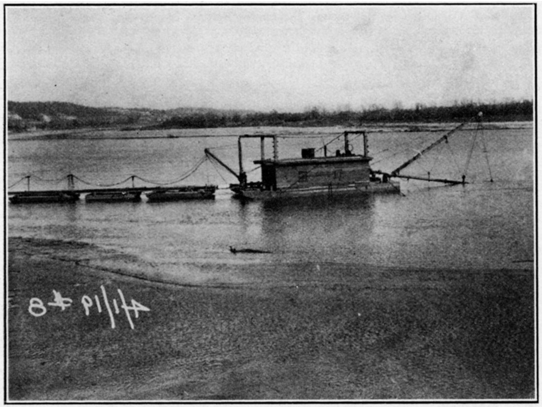
Figure 102—Sand loading bins on the Kansas river.
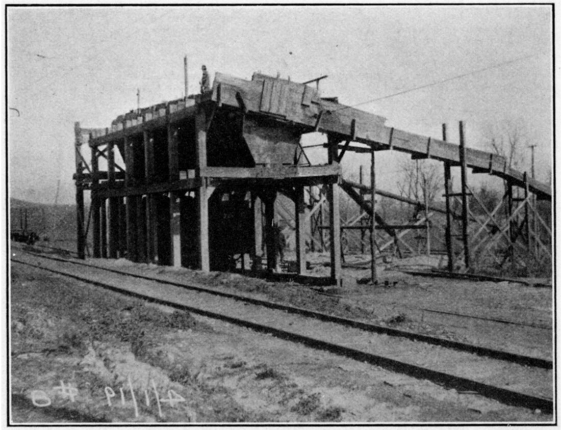
Stone
Limestone to the value of 1958,779 was quarried in Kansas in 1925. A small amount of sandstone was also produced in this state during that year, but the figures are not available for publication. Production values since 1915 are given in the table below:
| 1916 | $608,490 |
| 1917 | 678,881 |
| 1918 | 561,882 |
| 1919 | 860,851 |
| 1920 | 1,013,891 |
| 1921 | 675,145 |
| 1922 | $895,476 |
| 1923 | 1,180,397 |
| 1924 | 964,626 |
| 1925 | 958,779 |
| $8,388,868 |
Limestone ranks next to shale in abundance among the Mississippian, Pennsylvanian and Permian rocks of Kansas. It is also present among the Cretaceous rocks of central and western Kansas. In fact, the only area of any size in which limestone could not be found would be in western Kansas, where the sands and gravels of Tertiary age obscure the older formations which lie beneath. Reference to the geologic map on page 11 will show in what regions limestone could and could not be expected to occur. The outcrops of the more important limestones are shown in a map printed in connection with cement on page 38.
Figure 103—Exposure of limestone in railroad cut.
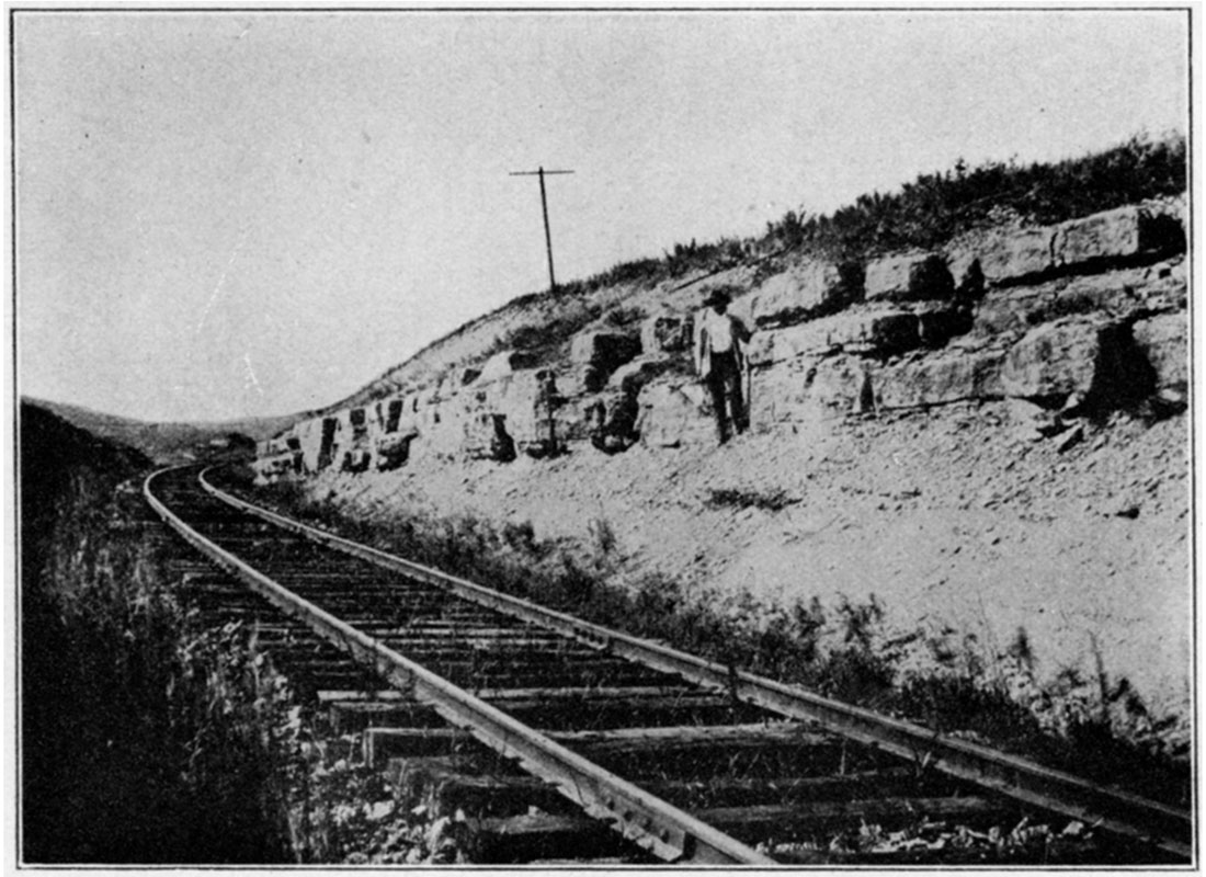
Figure 104—Left: Quarry in Fort Riley limestone north of Silverdale, Cowley county. Right: Exposure of Winfield limestone at Horseshoe Hill, Cowley county.
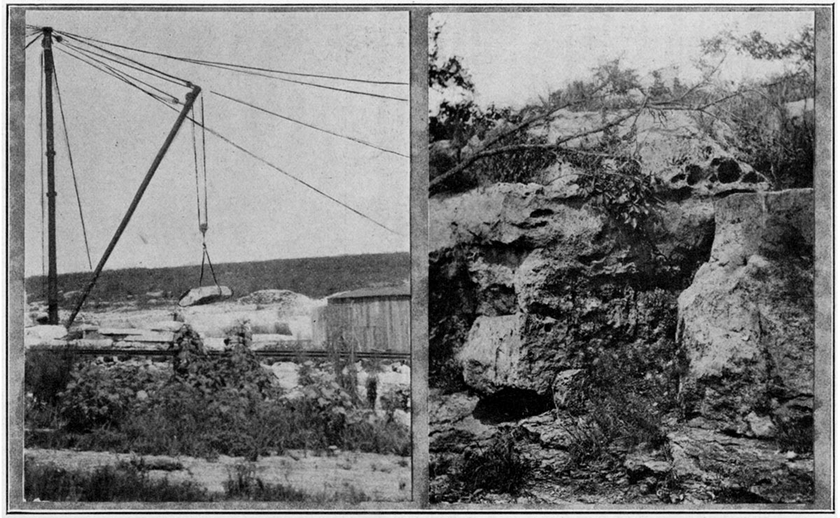
Figure 105—Bluff of Fort Hays limestone member of Niobrara formation at old Quarry at Yocemento, Ellis county.
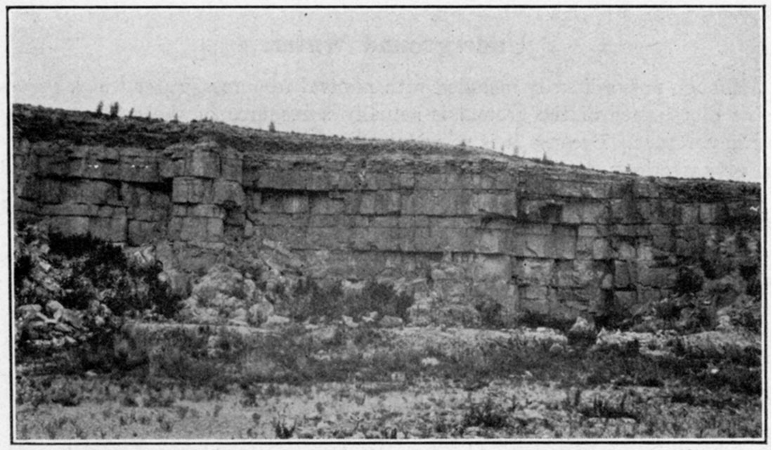
Figure 106—Quarry in the "fence-post" limestone bed of the Pfeifer shale member of the Greenhorn limestone—Barton county.
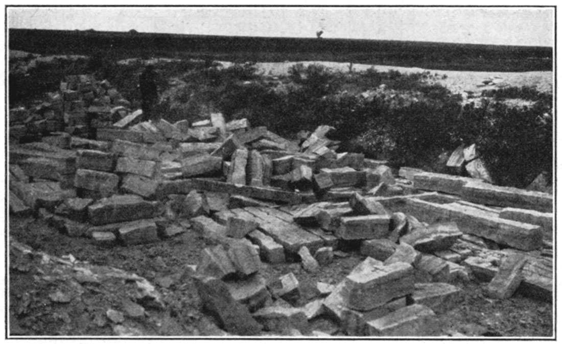
Sandstones are relatively rare in the Paleozoic rocks of Kansas, but some of the Cretaceous formations are sandy in part. The lowermost formation of the Cretaceous, known as the Dakota, is largely sandstone.
No recent data are at hand giving the location of stone quarries in Kansas. Almost every municipality of any size in central and eastern Kansas has a limestone quarry near by. Below is given a table showing more important uses to which limestone was put in 1924. The table is arranged in order of value.
| Concrete and road material | $672,512 |
| Railroad ballast | $188,103 |
| Riprap | $39,610 |
| Building construction | $12,885 |
| Rubble | $5,796 |
Minor uses of limestone are in rough architectural work, agriculture, and as a flux in metallurgical processes. The limestone which is used by the cement industry or in the manufacture of lime is not included in this chapter.
The relatively small amount of sandstone which was quarried in Kansas in 1924 was used as flagging and road metal.
Underground Water
Although not ordinarily included with mineral resources, water which occurs below the surface of the ground is actually a resource of the greatest value and importance. Because it is so widely distributed and occurs so commonly one may overlook the fact that water is a naturally occurring substance found in the surface and in the rocks of the earth's crust under conditions controlled by various factors in the climate, topography and geology of a region. Particularly as regards underground water, utilization is affected by geological considerations which bear both on the quantity and quality of the water. An ample supply of water of desired quality is not by any means always easy to obtain, and water has a money value which is greatly enhanced wherever scarcity of rainfall, unfavorable geological conditions, dense population, or unrestrained pollution makes competition for water keen.
Figure 107—Curve drawn from analyses of underground waters.
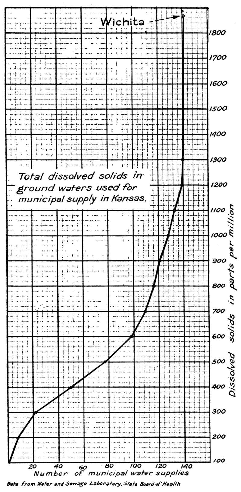
Figure 108—Curve drawn from analyses of underground waters.
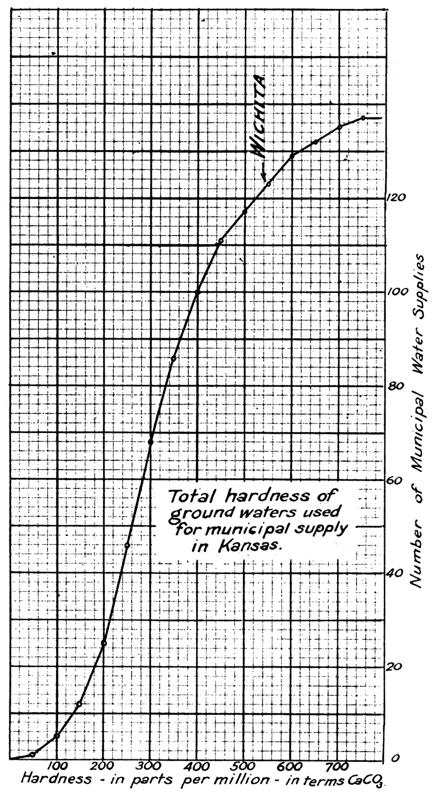
The underground waters in Kansas which have commercial value are derived from surface waters, either the water of rainfall which sinks into the ground and moves downward until the porous spaces in the rocks are saturated, or surface streams which in crossing certain porous rocks lose part of their water to the ground. Some of this water moves only a short distance laterally until it emerges in springs or is drawn into wells for the use of man. Other parts of this water migrate many scores of miles in the porous rock formations underground. For example, water which enters the porous Dakota sandstone in Colorado along the Front Range of the Rockies moves eastward through this formation until it emerges in the plains region of central Kansas and at other places. Much of the water which falls in the Ozark region seeps slowly through the limestones extending downward beneath eastern Kansas, and water is obtained from these rocks in various deep wells.
Figure 109—Block diagram of a part of central Kansas.
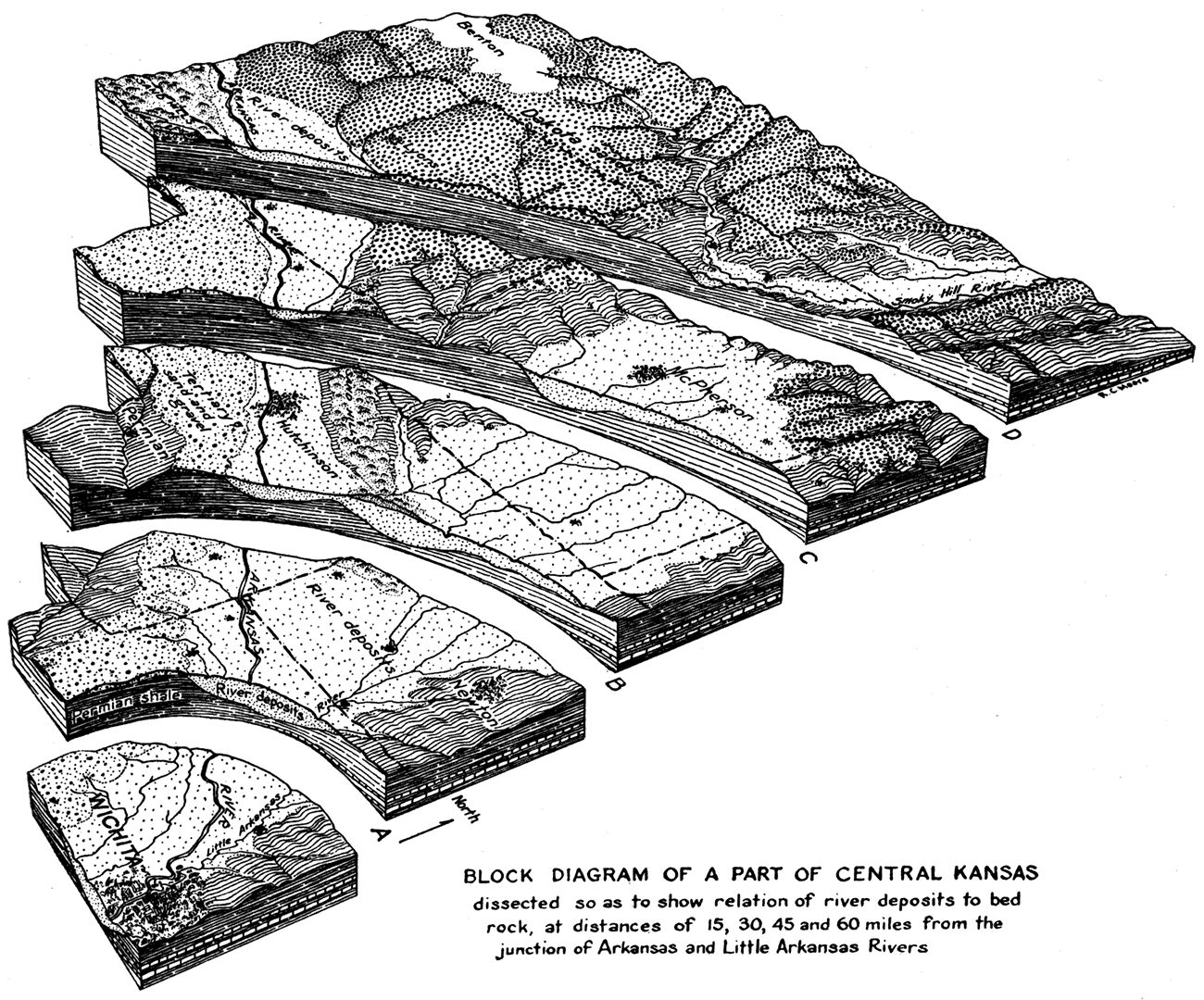
There is some water in the deeply buried rock formations of the state that was doubtless left in the porous spaces of the rock when the formations were first deposited. This consists essentially of ancient sea water which, as it contains not only the salt which was originally dissolved but in most cases additional mineral matter derived from the surrounding sediment, is characterized by its salty nature and the large amount of dissolved mineral matter. Such waters are commonly designated connate water.
Underground waters may be classified conveniently according to the nature and amount of the dissolved mineral matter which they contain, Silica, iron, calcium, magnesium, sodium, potassium, carbonate, bicarbonate, sulphate, nitrate, and chloride are very commonly found in underground waters and occasionally there are measurable quantities of aluminum, arsenic, lithium, manganese and even the rare metals. Carbonates and sulphates and calcium, magnesium and sodium chlorides, are the most common and important dissolved mineral constituents. Some of these waters are very undesirable on account of hardness, deposition of scale in boilers, plates and other containers and because of the large amount of soap which is required in household and laundry use. A considerable amount of dissolved sodium chloride or common salt makes water distinctly unpalatable, and waters high in sulphate such as calcium sulphate and sodium sulphate are not only objectionable to the taste but offer other difficulties in domestic and industrial use.
The quantity and quality of underground water and its depth below the surface are largely controlled by geologic considerations. From a structural standpoint the rocks of the state may be considered as making a very broad, shallow trough or basin whose major axis strikes roughly north and south through the central portion of the state. In the east the rocks dip very gently westward, and in the west they are slightly inclined to the east. The oldest rock formation exposed anywhere in Kansas is the Mississippian limestone. It appears in the extreme southeast corner of the state. In Missouri this formation has a large outcrop, and water which enters the limestone in this region moves slowly down the dip beneath the overlying rocks in Kansas. Good supplies of water are obtained from the Mississippian limestone in various parts of southeastern Kansas. Beneath the Mississippian is a thickness of about 1,000 or more feet of interbedded limestone, dolomite and sandy strata. These strata crop out in the central part of the Ozarks but, like the Mississippian, carry water from that region westward beneath the Kansas shale. In western Missouri and in certain parts of eastern Kansas good water in large quantity is obtained from these rocks, but farther west the quantity of dissolved mineral matter becomes so large that the waters are mostly unfit for use.
The Pennsylvanian rock, consisting of alternating shale, limestone, sandstone and in places coal beds, is exposed throughout the eastern one-fourth of the state. The beds have a total thickness of about 2,500 to 3,000 feet and, like the older rocks, are gently inclined westward in the region of their outcrop. The more porous formations, chiefly the sandstone but also including some of the limestone, carry fresh water for a distance of some miles from the outcrop. Where they are too deeply buried it is common to find the waters in these beds rather highly mineralized. Salt brines occur in sands where the Pennsylvanian is deeply buried.
The next overlying division of rocks, the Permian, crops out in a band wide at the south and narrow toward the north, reaching across the central part of the state. The lower part of the Permian consists of alternating shales and limestone rather similar to the Pennsylvanian, but the upper part which appears mainly in the southern part of the state, consists mainly of red shale and sandstone containing in places gypsum beds. Gypsum also crops out in northern and central Kansas in the Permian area. In the Wellington formation are thick salt beds that are mined at various places in central and southern Kansas. The comparatively large quantity of readily soluble materials, chiefly salt and gypsum in the Permian, makes the underground waters of this belt generally of very poor quality. In one part of the Permian outcrop there is a belt which may be very readily recognized by the chemical analysis of the water showing extreme hardness and a large amount of calcium sulphate.
The Cretaceous rocks occur at or beneath the surface throughout most of western Kansas. The basal division, the Dakota sandstone, is a rather porous formation which permits the ready passage of water. In parts of southwestern Kansas and in eastern Colorado the Dakota yields not only a large amount of water of very good quality but this water reaches the surface under artesian head and it is not necessary to pump the well. Unfortunately in the Dakota of north-central Kansas contained salty beds give to the waters of the Dakota a salt content so high that in most places the water is not suitable for domestic use.
Figure 110—Reconnaissance map of western Kansas showing structure of Dakota sandstone. (By N. W. Bass.)
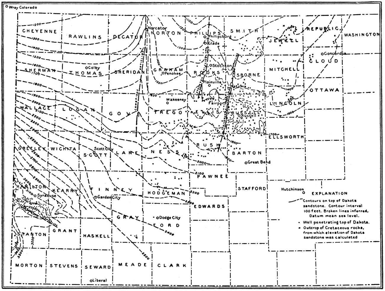
As has been noted the water in the Dakota is chiefly derived from distant outcrops in the high plains region of Colorado bordering the Rocky Mountains. The overlying portions of the Cretaceous consist of rather impervious clay shale containing scattered gypsum and other mineral matter, and of more or less chalky limestone. Very little water is obtained in the shale areas, and that which is found is in most cases highly mineralized. In the chalk area there are in some places good springs, and water which is obtained is of good quality. Like the Dakota, probably most of the water in the chalky limestone is derived from the plains region west of Kansas. The large sink in the bed of Smoky Hill river just east of the town of Sharon Springs in Wallace county, which recently attracted nation-wide attention, was caused by the solution and removal of part of the chalk which there underlies the surface by eastward moving underground water. In eastern Colorado where water enters the chalk the elevations at the surface are more than 4,000 feet, but where the water emerges in western Kansas it is in places less than 3,000 feet.
Widely scattered over the western Kansas plains are deposits of sand and gravel more or less cemented together by lime carbonate. These deposits of Tertiary and Pleistocene age carry large quantities of water that is only very slightly mineralized. This formation is the main source of water supply for most of the towns and farms in this region. In many places there are excellent springs, and luckily, as in Meade county, there are artesian wells which obtain their water from the Tertiary sand.
Figure 111—Map of western Kansas, showing areas covered by Tertiary rocks.
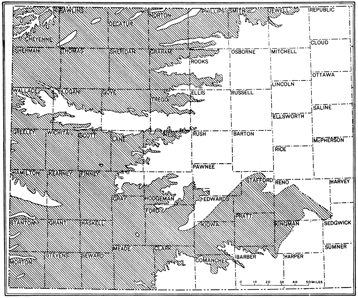
One very interesting sand and gravel deposit, altogether of Pleistocene age, occurs in central Kansas, covering most of McPherson and western Harvey county. The deposit is known as the McPherson formation. From a geologic standpoint the deposit offers a number of interesting problems as to origin. Consideration of these is inappropriate here, but it may be noted that the surface of the deposit slopes very gently southward, and that the bottom of the excavation in bed rock reaches a materially lower level than the Arkansas river only a short distance to the southwest and south. The evidence suggests a south-flowing stream of relatively large size, and it is possible that the deposit marks the position of the outlet of drainage from the entire northwestern part of the United States, when ice of the continental glaciers blocked eastward passage along what is now the valley of the Missouri and Kansas. From a standpoint of water supply this sand and gravel area is of very great interest because of the large quantity and fairly pure quality of the water which is found. The city water supply of Newton, McPherson and smaller towns, and of many farms, is obtained from the McPherson formation. In contrast with this water is that of the sand fill along the Arkansas, which is highly mineralized and contains so much salt that the water is almost unfit for drinking. The underground geologic relations and surface distribution of these rocks is represented in Figure 109, showing a portion of central Kansas northwest of Wichita cut into a number of blocks.
Figure 108 shows in graphic form the total hardness of ground waters used for municipal supply in Kansas. Figure 107 shows the total dissolved solids in the underground water used in municipal supply in Kansas. For comparison with other towns the rather highly mineralized water which is used in the city of Wichita is shown in these diagrams.
Figure 112—Limestone sink, Hamilton county.
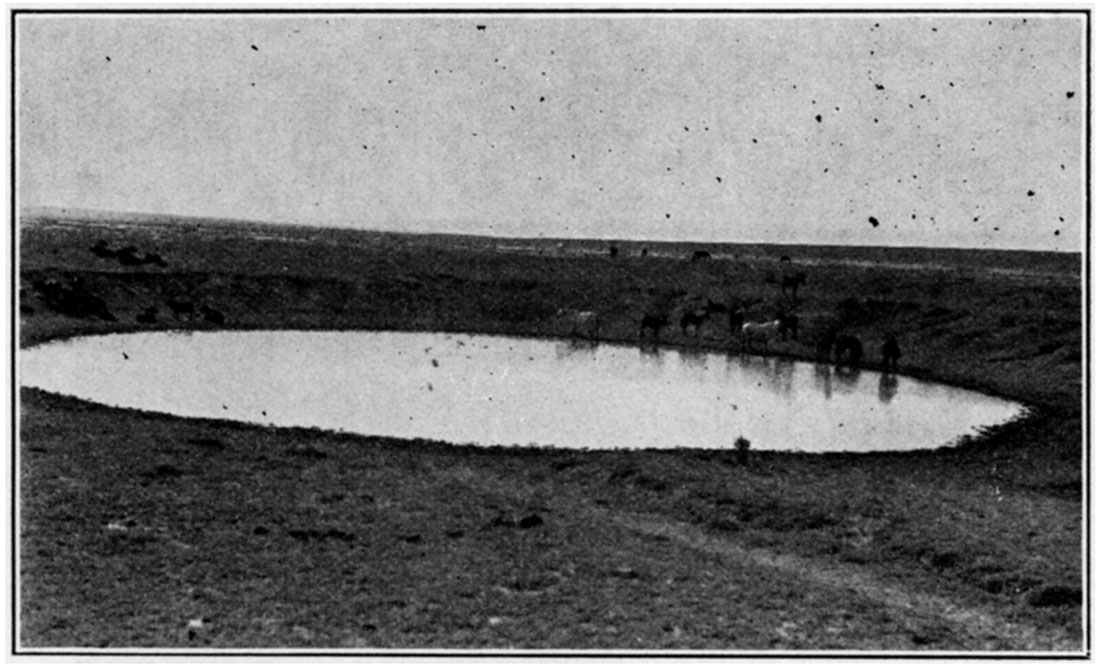
Figure 113—Irrigation in Kansas.
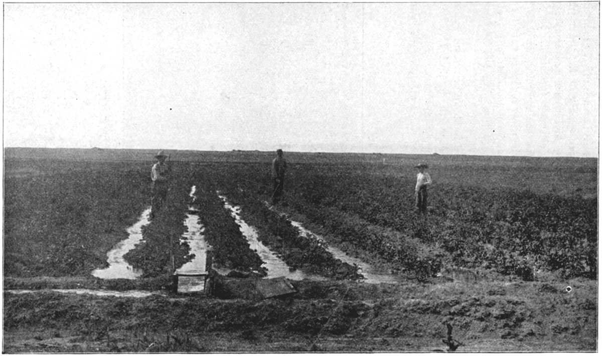
Volcanic Ash
Kansas is the leading state in the United States from the standpoint of production of volcanic ash, or, as it is sometimes designated, pumicite. This no doubt seems rather strange since there are no volcanoes in the Kansas plains. Nevertheless deposits of volcanic ash are widely distributed over the western part of the state. They occur in beds up to 15 feet thick, and they lie at or very near the surface of the ground. Their widespread distribution and position above Tertiary or even Pleistocene deposits indicates that they were formed in comparatively recent geologic time, probably by settling of the ash out of the air. Explosive volcanic eruptions, somewhere in the West, must have supplied to the prevailing westerly winds enormous quantities of this finely divided material which finally came to rest in various parts of the plains country.
Figure 114—Map of Kansas showing the distribution of volcanic ash deposits.
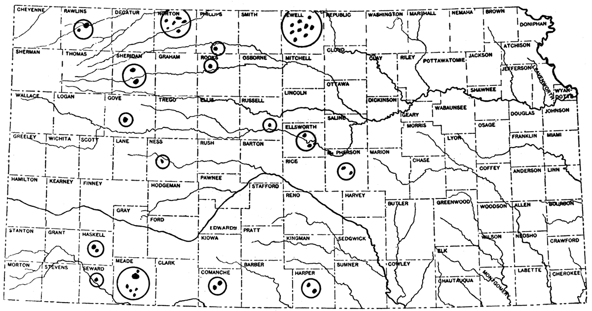
The principal deposits of volcanic ash in Kansas are found in Jewell, Meade and Norton counties, but there are scattered deposits of this material in very many other central and western Kansas counties. Two of the largest deposits of ash are reported in Jewell county about four miles north of Burr Oak. These contain approximately 1,000,000 tons each. One of the deposits is controlled by the Cudahy Packing Company and the other by the Volcanic Ash Company of America. A number of smaller deposits, ranging from 25,000 to 100,000 tons, also occur in this county.
There is record of some twelve deposits of volcanic ash in Meade county, the principal one being about 8 miles due north of the town of Meade. This deposit contains more than 1,000,000 tons and is owned by the Cudahy Packing Company, who have built a railroad ten miles from Fowler in order to work their property. One mile south of this large deposit is another with an estimated tonnage of about 100,000 tons. A quarter mile north of the Cudahy main deposit is another fair-sized bed of ash. Two areas about one mile out of the town of Meade contain around 100,000 tons each.
There are some twenty deposits of volcanic ash in Norton county, the principal one being at Calvin, a quarter mile south of the town. This is owned by the J. B. Ford Company, of Wyandotte, Mich. Adjoining it is a deposit worked by the Miller Pumice Company, which has been operated for a good many years. The Davidson Pumice Company of Norton, Kan., operates from this same deposit, which has an estimated tonnage of about 1,009,000 tons. A fair-sized deposit of volcanic ash is located one-half mile south of the Rock Island Pacific railroad at Dellvale, and two miles south of Dellvale is a small area with a tonnage of about 60,000 tons. Unlike the deposits in Jewell, Meade and other areas where the volcanic ash is white in color, that in Norton county is bluish gray.
Figure 115—Outcrop of volcanic ash in sec. 18, T. 26 S., R. 41 W., Hamilton county.
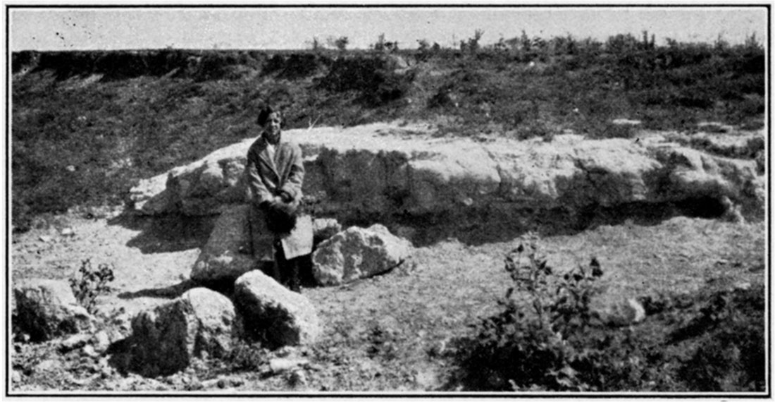
In McPherson county there are volcanic ash beds about six miles north of the town of McPherson. There are at least two of these deposits, both of which, however, are small.
In Seward county a small deposit of ash is located near the town of Kismet, the tonnage of which is perhaps 2,000 or 3,000.
In Haskell and Grant counties, near the town of Satanta, are two deposits, one containing about 15,000 tons owned by the Western Spar Products Company, of Dodge City, and the other amounting to about 60,000 tons owned by the Volcanic Ash Company of America.
In Sheridan county there are two known deposits located near the town of Hoxie, one about a mile north and the other one and seven-tenths miles south. These beds are both fair-sized deposits.
In Rawlins county, about two miles south of the town of Beardsley, there are several volcanic ash deposits, the tonnage of which is unknown, as they have not been prospected. However, they appear to be fairly large.
Four miles south of the town of Beardsley is a small deposit, with an estimated quantity of 2,000 or 3,000 tons.
In Comanche county there are two deposits about one-half mile north of the town of Wilmore.
In Ellsworth county is a deposit located at Kanopolis, adjoining the Union Pacific right of way.
In Phillips county about seven miles south of Speed, is a deposit with an estimated quantity of 500,000 tons.
There are two known deposits of volcanic ash in Harper county, the principal one being located about two miles east of Anthony. Here the Volcanic Ash Company of America has recently completed a plant which is now in operation, refining the various grades of material, as well as drying it for the market.
Very much of the volcanic ash which is obtained in Kansas is used in the manufacture of cleaning compounds such as "Old Dutch Cleanser." Many other uses have been, devised, such as employment in making concrete where it reduces the quantity of cement which otherwise is required, as insulation, etc.
Kansas Geological Survey, Geology
Placed on web March 23, 2018; originally published November 1, 1927.
Comments to webadmin@kgs.ku.edu
The URL for this page is http://www.kgs.ku.edu/Publications/Bulletins/13/04_resources.html