
|
Depositional Model and Exploration Potential in the
St. Louis Carbonates Beneath the Hugoton Field of Kansas
|

Kansas Geological Survey
Open-file Report 2002-8 |
Pleasant Prairie Pool Study Model and Analagous Pool
Studies
Pleasant Prairie Field
Description
T26S-34W Sections 7, 17-20, 28-33
T27S-34W Sections 3-6, 8-10, 14-16, 21,22
Method of Exploration
The discovery well was the Helmerich & Payne #0-16 Jones,
located in the C W/2 Section 4-27S-34W. Initial potential was
167 barrels of oil per day with reservoir pressure of 1045 psi
on drillstem test. Development of the field as based on drilling
Winfield structural highs.
Nature of Trap
Production occurs in multiple shoaling events within the St. Louis
formation in association with a south to southeast plunging structural
anticline. This anticline is reflected at the top of the St.
Louis and continues up through the Chase Group. The field is
bounded on the south and west sides by a deep-seated fault, expressed
as very strong folding on the Chase Group, and on the east side
by an incised valley that is filled with Chesterian age clastics.
Loss of shoaling bounds the northeast side of the field.
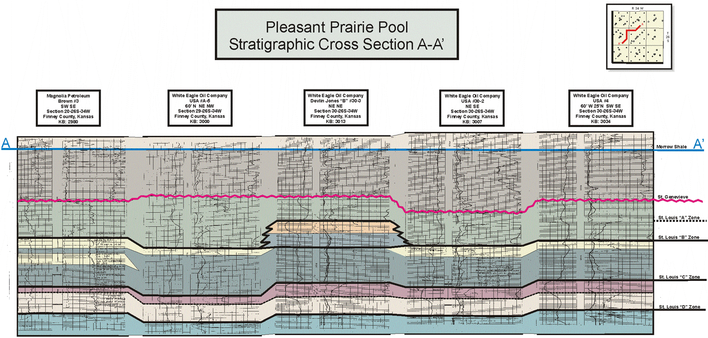
Lithology of the Pay Zone
The St. Louis formation consists of multiple shoals that are highly
oolitic bounded both vertically and laterally by limestone that
is dense, fine crystalline and slightly chalky. Cores indicate
that fracturing, particularly in the top 50 feet of the formation,
is prevalent throughout the pool. This fracturing is believed
to enhance the reservoir capacity and interconnects the various
shoaling events.
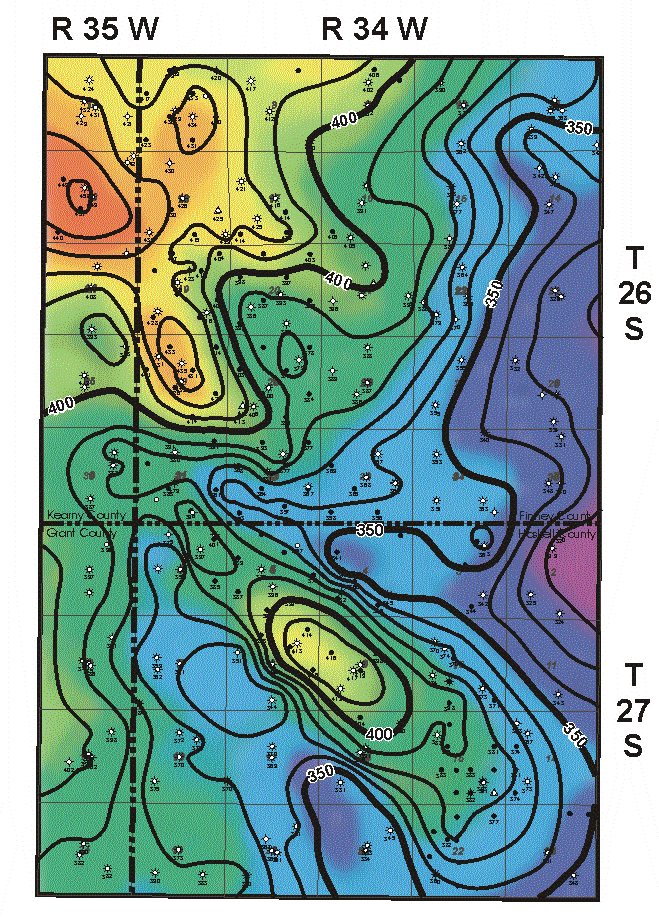 |
Winfield Structure
Contour Interval = 10 feet |
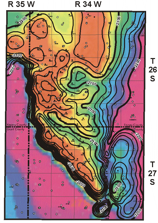 |
St. Louis Structure
Contour Interval = 10 feet |
e-mail : webadmin@kgs.ku.edu
Last updated March 2002
http://www.kgs.ku.edu/PRS/Poster/2002/2002-10/P2-01.html