
|
Depositional Model and Exploration Potential in the
St. Louis Carbonates Beneath the Hugoton Field of Kansas
|

Kansas Geological Survey
Open-file Report 2002-8 |
Regional Structural Features of the Hugoton Study
Area
Isopach of the Winfield to Meramec reflects the structure of
the Mississippian Meramec at the time of the Lower Permian Winfield
deposition. Irregularities of the Mississippian erosional surface
can create interpretation problems in small areas. However, the
erosional surface irregularities are quite small compared to regional
deformation. The isopach can be used to interpret hydrocarbon
migration pathways at Lower Permian time. The structural anomalies
have charged reservoirs in the Meramec. An integrated detailed
analysis utilizing structure, isopach intervals, dip slope trends,
geophysics and residual maps with subsurface reservoirs studies
can enable you to interpret trends that have potential for Meramec
production.
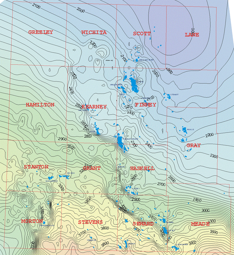 |
Winfield to Meramec Isopach Map
Contour Interval = 50 feet |
e-mail : webadmin@kgs.ku.edu
Last updated March 2002
http://www.kgs.ku.edu/PRS/Poster/2002/2002-10/P3-07.html