
Midcontinent Interactive Digital Carbon Atlas and
Relational Database (MIDCARB)
Kansas Geological Survey
Open-file Report 2002-7
|
|
|
Kansas Geological Survey Open-file Report 2002-7 |
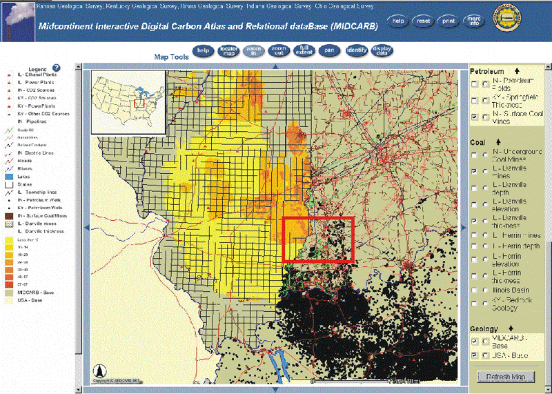
Zoomed map from initial MIDCARB display showing area of southern Illinois, southern Indiana and western Kentucky highlighted with red polygon. Map layers includes CO2 sources in the three states, an isopach map of the Danville coal, Danville coal mines, oil wells in Indiana and Kentucky, pipelines and electric lines in Indiana, and additional cultural data. Map can be further zoomed to area of red polygon to show additional detail and data.
|
|
|
e-mail : webadmin@kgs.ku.edu
Last updated March 2002
http://www.kgs.ku.edu/PRS/Poster/2002/2002-7/P2-04.html