
Midcontinent Interactive Digital Carbon Atlas and
Relational Database (MIDCARB)
Kansas Geological Survey
Open-file Report 2002-7
|
|
|
Kansas Geological Survey Open-file Report 2002-7 |
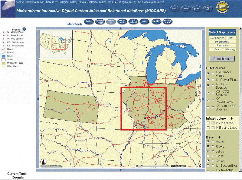
The MIDCARB Internet map browser provides a set of pre-selected map themes and highlights the states in the consortium. The themes are shown in the legend. One can use the tools at the top of the browser to zoom, pan, obtain help, identify objects and display data. Additional map layers are listed to the right and can be turned on or off with the check boxes. Data can be displayed or objects identified using the radial buttons. Data is being assembled in the browser from up to five different servers in five different organizations.
|
|
|
e-mail : webadmin@kgs.ku.edu
Last updated March 2002
http://www.kgs.ku.edu/PRS/Poster/2002/2002-7/P2-03.html