Gravity Data
Wellington Gravity Survey Part I: Gravity Data Description by Allen H. Cogbill (Acrobat file, 7.3 MB)
ReducedGravityData-TCs.xls--an Excel spreadsheet containing the gravity measurements.
ReducedGravityData.kml--a Google Earth file that shows the locations of the gravity stations, along with pertinent information about each measurement. The latter information is accessed by clicking on the station icon displayed in Google Earth.
GravityStationLocations.pdf--a file showing the locations of the gravity measurements on a topographic base (Acrobat, 1.7 MB).
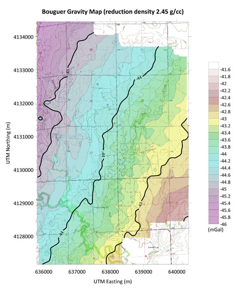
BouguerGravity-245_s.pdf--a file showing the contours of the Bouguer gravity anomaly, plotted on top of a topographic base. Calculated using a reduction density of 2.45 g/cc (Acrobat, 5.2 MB).
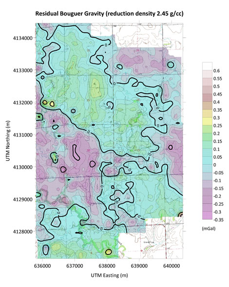
ResidualBouguerGravity-245_s.pdf--a file showing the contours of the residual Bouguer gravity anomaly, plotted on top of a topographic base. The residual anomaly is calculated by subtractig from the Bouguer anomay a least-squares plane (Acrobat, 5.3 MB).
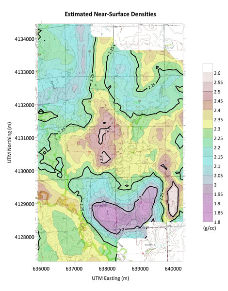
NearSurfaceDensities_s.pdf--a file showing the contours of the estimated near-surface densities, plotted on top of a topographic base (Acrobat, 5.4 MB).
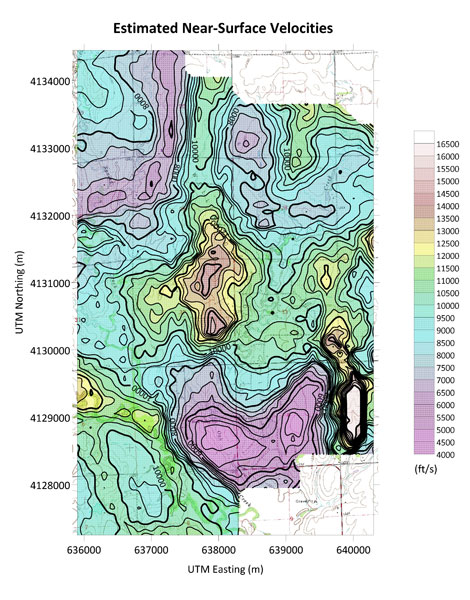
NearSurfaceVelocities_s.pdf--a file showing the contours of the estimated near-surface velocities, plotted on top of a topographic base. The estimated velocities are calculated from the estimated densities using Gardner's relation (Acrobat, 5.5 MB).