Kansas Geological Survey, Open-file Report 2004-62
Back to report...
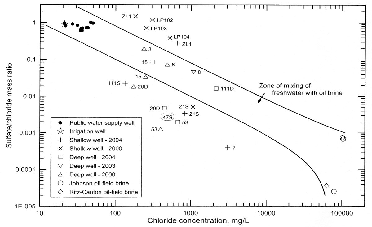
Figure 6. Sulfate/chloride versus chloride concentration for ground waters in the study area, freshwater supply wells just to the west of the study area, and oil brines east of the study area. The solid curves represent the mixing of fresh ground water in the Equus Beds part of the High Plains aquifer with oil brine. The oval around the label "47S" represents the approximate location of the point for this monitoring well if the sulfate concentration is assumed to be about that of the detection limit for the water sample (Table 3).
Kansas Geological Survey, Geohydrology
Placed online June 1, 2005
Comments to webadmin@kgs.ku.edu
The URL for this page is HTTP://www.kgs.ku.edu/Hydro/Publications/2004/OFR04_62/fig6.html