Russell County
|
|
Russell County |
|
Help us direct future mapping activities by leaving your voluntary comments here.
Comments about how you are using these maps are especially appreciated. Thank you!
Download the map from these links:
|
|
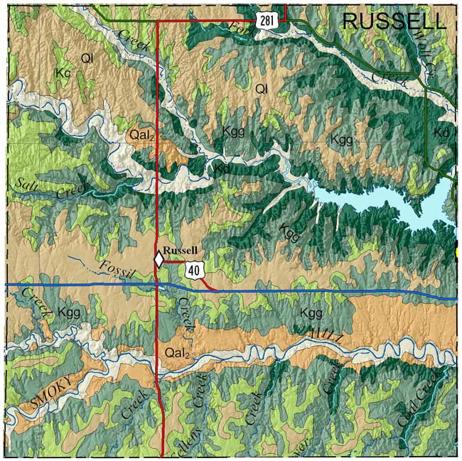
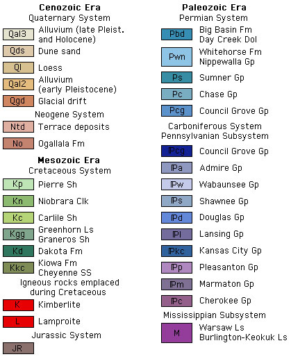
Johnson, W.C., and Arbogast, A.F., 1996, Geologic Map of Russell County, Kansas: Kansas Geological Survey, Map M-37, scale 1:50,000, 42 1/2 x 45 inches
Paper copies of the complete map (with stratigraphic column and legend info) can be purchased from the Kansas Geological Survey, 1930 Constant Ave., Lawrence, KS 66047-3724 (or phone 785-864-3965) and at 4150 W. Monroe St., Wichita, KS 67209-2640 (phone 316-943-2343).
Arbogast, A.F., and Johnson, W.C., 1996, Surficial geology and stratigraphy of Russell County, Kansas: Kansas Geological Survey, Technical Series 7, 45 p. [available online]
Rubey, W. W., and Bass, N. W., 1925, The geology of Russell County, Kansas, with special reference to oil and gas resources: Kansas Geological Survey, Bulletin 10, pt. 1, p. 1-86 [available online]
Cartographic Services, Kansas Geological Survey
Updated December 9, 2020
Comments to webadmin@kgs.ku.edu
URL=http://www.kgs.ku.edu/General/Geology/County/rs/russell.html