Maps
Location Map
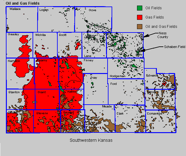
Southwestern Kansas
Ness County
Oil & Gas Fields
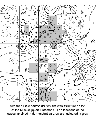
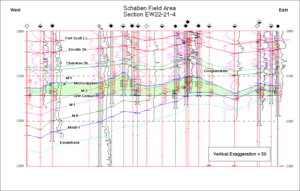
Schaben Field
Demonstration Field
Structural Maps
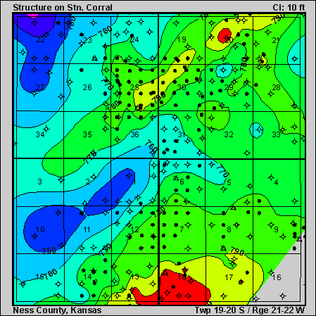
Stone Corral Formation
Sumner Group, Lower Permian
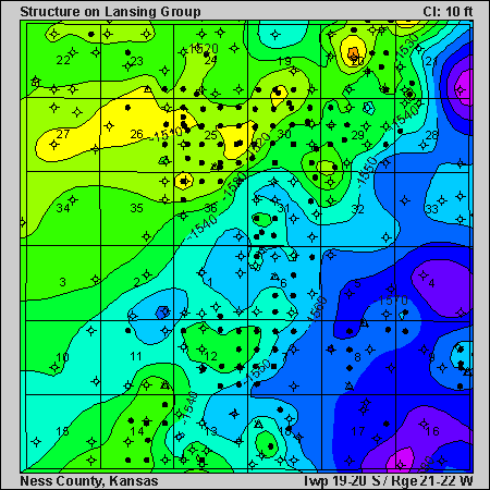
Lansing Group
Missourian Series, Upper Pennsylvanian
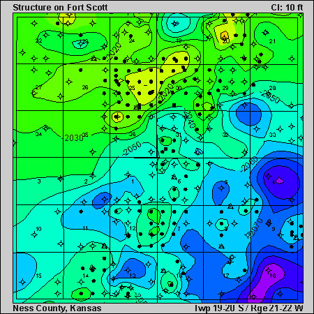
Fort Scott Limestone
Marmaton Group, Desmoinesian Stage, Middle Pennsylvanian
Mississippian
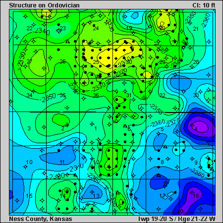
Ordovician
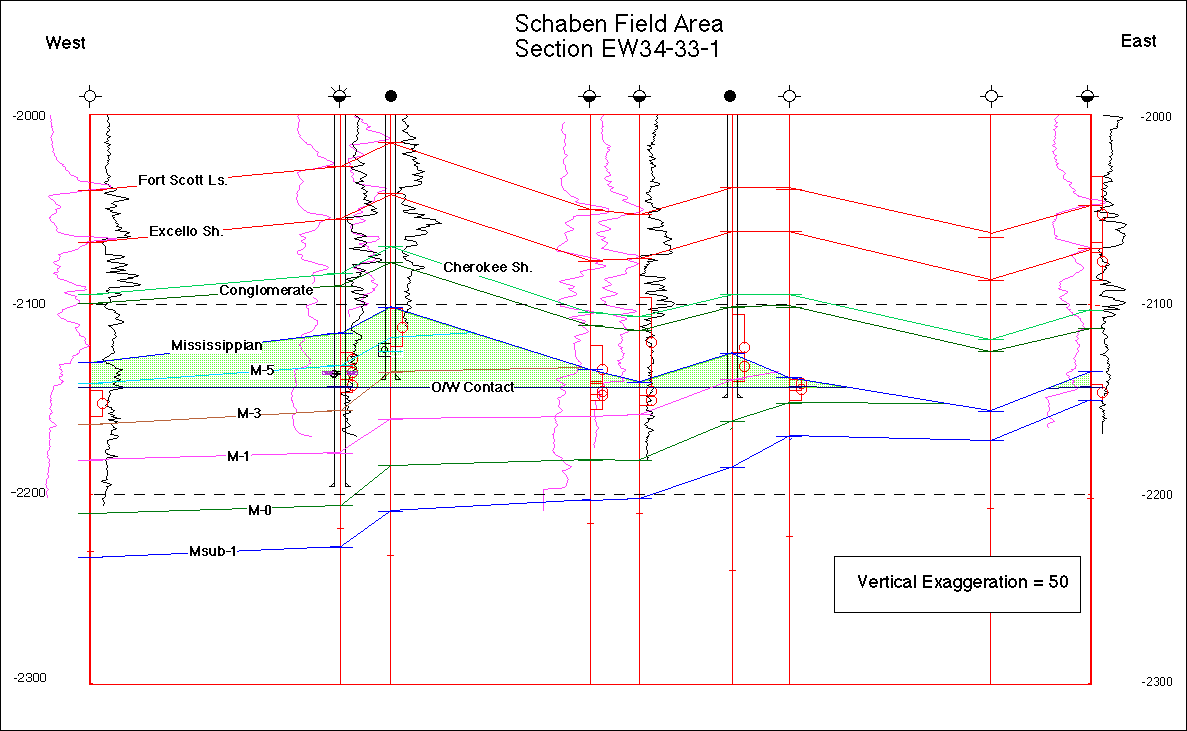
Cross Sections
North
Middle
South
Updated June 2000
Send comments and/or suggestions concerning content to:
webadmin@kgs.ku.edu
The URL for this page is http://www.kgs.ku.edu/Class2/c2_maps.html