![]()
![]()
![]()
![]()
Kansas Geological Survey, PIC 11--Kansas Springs, Part 2 of 5
Previous Page ||
Next Page
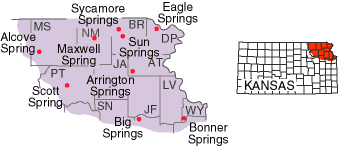
The northeastern tip of Kansas was covered by glacial ice roughly 600,000 years ago. That ice sheet covered an area from about the Kansas River on the south to the Big Blue River on the west. Mineral water springs, developed as resorts and spas, were common in this area in the late 1800's (Bailey, 1902), in locations such as Eagle Springs (Doniphan County), Bonner Springs (Wyandotte County), or Arrington Springs (Atchison County). Prolific springs continue to flow at Sycamore Springs and Sun Springs (Brown County); both areas are used today as resorts. Alcove Spring (Marshall County) and Scott Spring (Pottawatomie County) were well-known stops along the Oregon Trail. Both continue to flow, and both are either in or near public parks. Maxwell Spring (Nemaha County) still provides water for the town of Seneca.
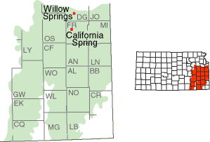
This is an area of interbedded limestones and shales, mostly Pennsylvanian in age, that create slightly rolling hills in the eastern third of the state. Large springs are relatively uncommon here. Several historic springs, such as California Spring (Franklin County), were found along trails that cut across this area. Willow Springs, a stop along the Santa Fe Trail, continues to flow (Domer, 1996), as do springs in the vicinity of the town of Big Springs (Douglas County), though the latter have been altered by the construction of Interstate 70.
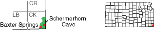
The very southeasternmost corner of Kansas is part of the Ozark Plateau, a region that is generally associated with Missouri and Arkansas. The bedrock here is Mississippian in age, deposited about 330 million years ago, making it the oldest rock exposed at the surface in Kansas. The high levels of precipitation here, averaging as much as 40 to 45 inches per year (Goodin et al., 1995), along with the cavernous nature of the limestone, are conducive to the formation of springs. A spring issues from Schermerhorn Cave in the city park south of the town of Galena, creating an environment for rare animals, such as orange cave salamanders (Gress and Potts, 1993). At Baxter Springs, on the edge of the Ozark Plateau, mining has altered the subsurface rocks, changing the nature and flow rates of springs in the town.
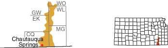
A thick layer of sandstone creates the distinctive geology and vegetation of this area, which extends north through Chautauqua and Elk counties, and beyond. A mineral-water spa was constructed in the late 1800's at Chautauqua Springs in the town of Chautauqua. This spring, on the east edge of town, continues to flow, as do others in the area.
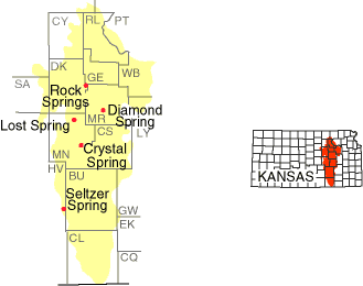
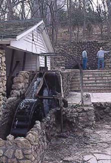
This strip of hills, extending north to south across east-central Kansas, consists primarily of interbedded limestones and shales of Permian age. Many of the limestones contain chert, commonly known as flint. Chert resists erosion, so the soils here are relatively thin and much of the area remains in native prairie grasses, used primarily to pasture cattle. Because much of the area is relatively undisturbed, a number of the well-known springs in the Flint Hills continue to produce large amounts of water. One of the largest springs in the state, Rock Springs (Dickinson County) at Rock Springs 4-H camp (fig. 4), flows at around 1,000 gallons a minute, continuing to provide water for the camp.
Diamond Spring (Morris County) and Lost Spring (Marion County) were famous Santa Fe stops that continue to flow. Crystal Spring (Marion County) provides the town of Florence with its water supply, which the local water-tower advertises as 99.96% pure (an analysis that is fairly accurate). Springs in Flint Hills pastures in Chase County, and farther to the south in Cowley County, continue to flow at rates of several hundred gallons per minute.
Figure 4--Rock Springs in Dickinson County.
Kansas Geological Survey, Public Outreach
Comments to webadmin@kgs.ku.edu
Web version October 1998
http://www.kgs.ku.edu/Publications/pic11/pic11_2.htm