![]()
Prev Page--Stratigraphy || Next Page--Coal Measures 2
II—The Coal Measures
The Coal Measures proper of Kansas constitute a heavy mass of rocks aggregating almost 3,000 feet in thickness, composed of alternating beds of limestones, sandstones, and shales. In general character the limestones have a strong resemblance from the lowest to the highest, with sufficient differences in detail to make a discrimination between them possible by a minute examination. The lower and older limestones are a little more dense in appearance, finer in texture, and are more highly crystalline than those higher up in the geologic scale. Their color is a stronger, richer, bluish brown and buff, and in general appearance they are more substantial, and apparently will resist decay more strongly. The higher and younger ones are lighter in color, approaching a delicate light buff; sometimes even an almost pure white, and have an inferior, younger, and more delicate and friable appearance.
The shales likewise are similar in general character from top to bottom of the Coal Measures. In detail there are certain differences, which may be noticed by the experienced eye, sufficiently marked to enable one to discriminate in a general way between the older and the younger, yet these differences are such that they can hardly be described. We find black shales at the base of the Coal Measures and near the top; we find light colored shales at the base of the Coal Measures and near the top; we find greenish colored shales at the base of the Coal Measures and near the top, with all other varieties recurring irregularly at intermediate positions. Apparently it is impossible to decide that this shale is an old shale because it is black or any other color, or that the other shale is a young shale for similar reasons. The Cherokee shales lying at the base of the Coal Measures have beds jet black in color, but likewise shales equally black may be found here and there in the Upper Coal Measures. They have beds a pale ashen gray in color which are duplicated in almost every detail in the Upper Coal Measures. In general the younger shales, particularly near the top of the Coal Measures, are a little more inclined to a reddish hue, with streaks of clay shale here and there decidedly red in color. Greenish tinges are also more common in the younger shales than in the older. The names of the colors found at one place may be practically the same as those at the other, the principal differences being in the particular run of degrees of greens or browns or grays, with different degrees of intensity of these same runs of color.
In texture the same conditions prevail. The older shales contain clay shales free from sand, and also argillaceous shales which gradually grade over into sandstone. Likewise the shales of middle age and of younger ages have beds of clay shales within them, and of arenaceous shales which grade into sandstones, in every respect similar to those of greater age. It is only by regarding a few details, therefore, that one may he able to recognize the differences between various shale beds as regards age.
With the sandstones there is perhaps a greater difference than with either the limestones or shales. The Lower Coal Measure sandstones are more firmly cemented and produce much more valuable building stone than any sandstones yet discovered in the Upper Coal Measures. Aside from this fact but little difference can be noted regarding the geologic age of the sandstone in question.
Cherokee Shales (Haworth and Kirk, 1894, p. 105)
At the base of the Coal Measures lies a heavy bed of shale, averaging from 400 to 500 feet in thickness, which here and there carries a considerable amount of sandstone. This shale bed is the heaviest and the most extensive of anyone constituting a part of the Kansas Coal Measures.
Areal Extent of the Cherokee Shales
The Cherokee shales cover the surface of the greater part of Cherokee county, and the southeastern corners of both Crawford and Labette counties, representing an area approximately 540 square miles in Cherokee county, 200 square miles in Crawford county, and 100 square miles in Labette county. In addition, at different places in southeastern Bourbon county streams have cut through the overlying formations and exposed narrow strips of Cherokee shales aggregating at least twenty-five square miles.
Beyond the limits of the state on the south the Cherokee shales are known to cover a wide area in the Indian Territory and quite probably bear eastward and across into Arkansas, south of the Boston mountains, forming the principal coal fields of that state. This, however, has not been fully demonstrated. To the northeast of Kansas they pass into Missouri. The writer has traced them across the northeastern part of Jasper county and into Barton county. There are many reasons for believing the same general shale beds, with probably slight variations in character, extend far into Missouri and possibly even across into Iowa, constituting a part of the Lower Coal Measures of the Des Moines formation of that state. While this has never been established by complete mapping in the field, yet the heavy shale beds at the bottom of the Coal Measures of Missouri and Iowa seem to be continuous with the Lower Coal Measure shales of Vernon and Barton counties, Missouri, and if so then they are continuous with the Cherokee shales of Kansas.
The westward extension of the Cherokee shales is great. This is conclusively shown from the records of the various oil and gas wells drilled in the southeastern part of the state. Everyone of them, if carried deep enough, strikes the Cherokee shales and shows something of their thickness. The Toronto well is about seventy-five miles west of the eastern side of Kansas, or a hundred miles west from the easternmost extension of the Cherokee shales. This well penetrated the shales about 372 feet, showing that their thickness is maintained westward to a remarkable degree. Likewise wells at Fall River, Howard, and other western points reveal the same general conditions. With this positive evidence before us it may well be assumed that the Cherokee shales extend westward at least a hundred miles further before they are very seriously altered in general character. Deep wells now in operation beyond the Flint Hills, in the vicinity of Wichita, Hutchinson, etc., if carried to a sufficient depth, doubtless would find the same bed of shales.
Thickness of the Cherokee Shales
In thickness the Cherokee shales have the following measurements: At Oswego, 500 feet; at Cherryvale, 425 feet; at Neodesha, 425 feet; at Saint Paul, 416 feet, with an undetermined remainder at the bottom of the well; at Chanute, 410 feet; at Girard, 446 feet; at Fort Scott, 410 feet; at Pleasanton, 440 feet; at Kansas City, 420 feet; at Leavenworth, 540 feet. Further west few wells have passed through them. The Topeka well implies that the Cherokee shales have a much greater thickness at that place, apparently being 700 feet with an undetermined amount below the bottom of the welL At McFarland the well seems to have struck the Cherokee shales at a depth of 1,832 feet and continued in them to 2,006 feet, at which point drilling was discontinued. At Toronto the well seems to have reached the Cherokee shales at a depth of about 1,000 feet and passed into them 350 feet to the bottom of the well, leaving an undetermined remainder below. What their thickness is further west is wholly conjectural as no well has thus far been drilled into them of which a record has been kept.
Various wells have been drilled to the northeast of Leavenworth at different points in Missouri, the records of some of which are on file in the office of this Survey. Such wells show conclusively that the general thickness of the Cherokee shales is maintained to the northeast for a considerable distance beyond the limits of Kansas.
General Characteristics of Cherokee Shales
The character of the Cherokee shales varies materially both vertically and longitudinally. Shale of almost all descriptions may be found. With reference to color, portions of them are as black as coal and at a short distance cannot be distinguished from coal. These carbonaceous shales are abundant in various places. At the immediate summit of the shales, just underlying the Oswego limestone, such a bed is found from ten to twenty feet in thickness; It is in this black carbonaceous shale that the Fort Scott coal occurs. Likewise at other points lower down prominent beds of jet black carbonaceous shale are found which so strongly resemble coal in color that numerous instances are known of people who were badly disappointed in not being able to use such masses for fuel.
From this extreme many variations may be noted through different degrees of black and gray and greenish gray into a very light colored ashen gray shale. Sometimes, too, such a light colored shale is close to the heaviest coal beds. An instance of this is at the Nesch brick factory at Pittsburg. Here the shale which overlies the coal is used for brick making. In color it is a light leaden gray, although taken from but a few feet above the heaviest bed of the Pittsburg coal. As far as observed the Cherokee shales furnish no example of a red color, and therefore do not thus imply a concentrated ocean water.
Sandstone in the Cherokee Shales
A careful study of the Cherokee shales with reference to their composition likewise shows a great variation, ranging from a fairly good clay shale, composed almost entirely of clay, into a perfect sandstone, with all intervening grades. The records of every well studied show that a relatively large proportion of arenaceous shale and sandstone is found. Where they come to the surface the sandstone is irregular in position. At the base of the shales a mass of sandstone is found along the west bank of Spring river which in places is from 20 to 30 feet thick. This is noticeable from south of Baxter Springs far into Missouri on the northeast. Frequently the sandstones are highly indurated, producing a firm and solid rock, the boulders from which are prominent. A few hundred yards northwest from the border, sandstone may or may not be found. In the vicinity of Lowell station, on the Kansas City, Fort Scott and Memphis railway, and northeast, just outside the timber line along Spring river, many wells were examined which showed a great variation in the character of the material they passed through. Some of them found sandstone extending down to the surface of the Mississippian limestone, while others found shale resting directly on the Mississippian. The deep wells show a similar variation; some of them find sandstone lying immediately at the base of the shales, and others do not.
The amount and position of the sandstone beds throughout, the Cherokee shales justify the conclusion that at no time were the conditions favorable for the production of a large and continuous sandstone area. In Cherokee county the most noted sand rocks are those capping the hills in the vicinity of Tehama postoffice, the Columbus sandstone (Haworth and Kirk, 1894, p. 106), a mass of rock which lies about 150 feet above the base of the shales, and which are exposed for miles to the northeast and southwest, passing near Crestline, Tehama, Neutral, and Baxter Springs. Wherever the cementing material has been extraordinarily abundant, producing an unusually firm rock, hills and escarpments result from the protection afforded by such sandstone. Generally but a short distance on either side the absence of escarpments shows plainly that the sandstone was less durable and therefore more easily eroded. Likewise observations made in the coal mining districts from near Columbus northeast to Arcadia reveal the same general variations. Here the coal is covered by a firm arenaceous shale which might almost be called a sand rock, producing a firm and durable roof so desirable in coal mining; there, possibly less than a mile away, the arenaceous character of the shale has disappeared and the roof is "rotten," and the mine dangerous from caving; while beyond, the same conditions recur in stencil-like repetitions.
Coal in the Cherokee Shales
The Cherokee shales carry the largest beds of coal known in Kansas, the Weir-Pittsburg coal. A coal of but little importance lies immediately at the base of the shales which is found here and there in the southeastern part of Cherokee county. It has never been mined to any extent, except locally in a few instances more than twenty years ago.
Above this and immediately under the Columbus sandstone a bed of coal occurs with a thickness varying from twelve to eighteen inches. This coal has been mined by the strip pit process at scores of places to the northeast, east, and southeast of Columbus. It is fair in quality and is easily mined. It outcrops along the sinuous line of the Columbus sandstone escarpment. During recent years, since the price of coal has become so low, it has not been found profitable in that part of the state to operate so thin a bed of coal, but during the coal miners' strike in 1893 many little mines sprang into existence along the outcropping of this bed which furnished a good supply of coal for neighboring towns and rural districts, thereby preventing any serious lack of fuel throughout the strike period. This Columbus coal lies at about 150 feet above the base of the Cherokee shales, but westward and northwestward it either disappears or occupies a lower position. The record of the Weir City water well shows that at 64 feet above the base of the shales a 2-foot bed of coal appears, with another 14-inch bed 168 feet above the base. It is impossible to say which one of these two coals corresponds to the Columbus coal, if either.
Above the Columbus coal the next coal of importance found at the surface is the Weir-Pittsburg heavy bed, that averages nearly 40 inches in thickness, and which lies about 250 feet above the base of the shales. Still above the Weir-Pittsburg lower bed is the so-called "upper" bed that will average about 27 to 30 inches in thickness. Westward from the outcropping of these two still other small beds of coal are found and are mined at various places.
At the very summit of the Cherokee shales we find the Fort Scott coal lying but a few feet beneath the Oswego limestone. It averages from 15 to 20 inches in thickness, and has been mined extensively by stripping at many places in the vicinity of Fort Scott. The Oswego limestones have produced greater or lesser escarpments with numerous indentations made by drainage channels, producing an exceedingly sinuous outline. The coal mining has been confined to a strip of from 10 to 50 feet in width, following these outlines.
The northwestern extension of these various coal beds is a matter of great economic and scientific interest. How wide was the coal forming zone? And how much of that zone yet remains intact from erosion? Those interested in the question financially have devoted considerable time and money to prospecting to the west and northwest from Weir City and Pittsburg. It seems that the northwestern limit of the heavy Pittsburg coal is only a few miles away, and that the workable coal forms an irregular, elliptical area trending northeast and southwest, and is a little less than ten miles in width. The other coal beds likewise have a limited westward extension. It is probable that they formerly reached farther to the southeast and have been destroyed by erosion.
But the Cherokee shales as a whole contain large quantities of coal. Almost every deep well throughout the southeast part of the state shows a considerable quantity of coal, which, if combined in one horizon, would be exceedingly rich. The furthest western workable deposit thus far known is at Leavenworth, seventy-five miles to the northwest from the Mississippian exposures, Here at a depth of 720 feet a 2-foot bed of coal is found which is about 100 feet below the top of the Cherokee shales; Above it, 28 and 42 feet respectively, are two other beds of coal, 6 inches and 12 inches each, while below, at a depth of 747 feet and at 988 feet, are two beds of coal each of which is 2 feet in thickness, aggregating 7 feet 6 inches of coal in the Cherokee shales at Leavenworth.
Whether the same amount of coal could be found at other points equally distant from the eastern limits is riot known, but there are no geologic reasons for doubting it. Such a line would pass from Leavenworth through Lawrence, Ottawa, Burlington, Yates Center, Fredonia, and Sedan, forming an area aggregating over 12,000 square miles, under any portion of which coal is liable to be found in as great abundance as at Leavenworth. The drill records, however, show that in many places it does not occur in such great abundance. The wells at Girard and Fort Scott and other places near by the heavy coal beds show that these particular coal beds do not extend very far to the northwest. But all of them show that coal forming conditions obtained to a great extent throughout the whole period of formation of the Cherokee shales. The well at Oswego, for example, passed through eleven distinct beds of coal, and the one at Cherryvale passed through nearly as many, with a 27-inch bed within ten feet of the bottom of the shales. Whether future prospecting will develop other deeply buried coal beds as valuable as the Leavenworth ones are no one can tell in advance, but from every consideration of the geologic conditions there is no reason to doubt the occurrence of similar and equally valuable deposits. It is tolerably well established that the Cherokee shales, over the above-mentioned area of 12,000 square miles, will average nearly one percent of its aggregate thickness in coal.
Limestone in the Cherokee Shales
Here and there throughout the extent of the Cherokee shales varying amounts of calcareous matter appear. In some places a limestone of considerable importance is found, such as the one just west of Cherokee, a limestone reaching 4 or 5 feet in thickness and covering many square miles in area. Elsewhere a finer and more impure bed of calcareous matter may be found from 6 inches to 24 inches in thickness. Sometimes concretionary masses, largely calcareous in character, are abundant, producing odd shaped forms round or irregular and varied as concretionary masses usually are. They are occasionally found at many places within the Cherokee shales but most abundantly at the upper part, immediately over and under the Fort Scott coal.
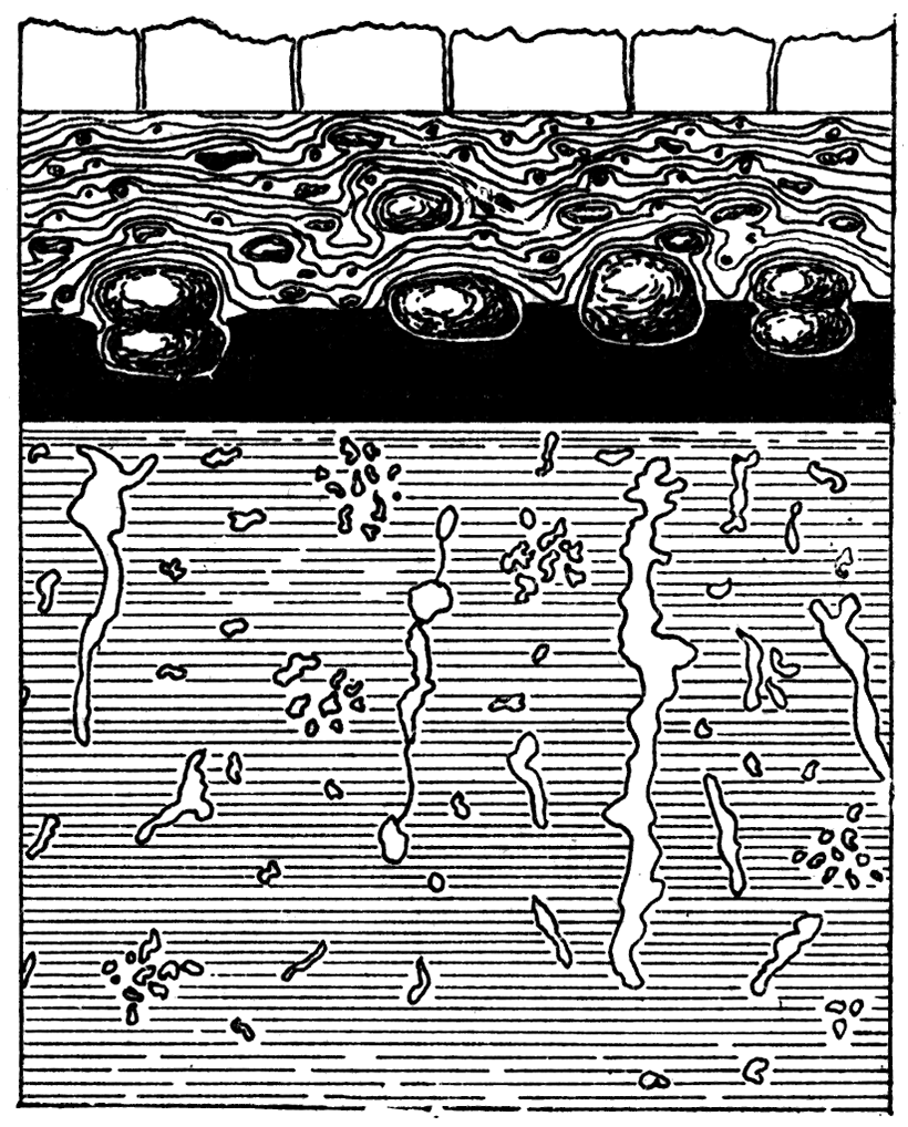
Some of them are semi-spherical in shape, reaching diameters of 15 or 20 inches; others are exceedingly irregular, elongated vertically, and producing most peculiar forms. Figure 1 is a diagrammatic illustration of them. Frequently these lesser bodies are so intermingled with shale material that they are dark in color, and would yield upon analysis perhaps not more than 50 percent of calcium carbonate. The heavier beds of limestone, as the one near Cherokee already referred to, are good grades of limestone and frequently are well filled with remains of marine invertebrates. It is difficult to estimate the total amount of such calcareous material in the Cherokee shales, but it might not be far amiss to put the aggregate at from 5 to 10 feet in thickness.
Figure 1—Section at Fort Scott showing Calcareous Concretions in the Shale Adjacent to the Fort Scott Coal. (After Bennett's Fig. 4, Vol. I.)
Origin of the Cherokee Shales
From the descriptions already given it is evident to the geologist that the Cherokee shales were, in the main, coastal deposits. The various sandstone horizons and the arenaceous shales with wave marks and ripple marks so abundant within them admit of no other explanation. The extensive accumulations of carbonaceous material in the greater and lesser coal beds likewise show that the shales were formed near shore and probably in shallow water. The thin beds of limestone and other calcareous material which are so frequently found imply that the water under which the shales accumulated was ocean water. Another evidence of the latter is the frequent occurrence of salt water obtained from the Cherokee shales in many drilled wells. Some of the drillers even report finding beds of rock salt. Whether the latter is true or not it is abundantly demonstrated that the Cherokee shales produce vast quantities of salt water, the salt from which came originally from ocean water.
Attempts were made to locate the heaviest and most extensive sandstone beds to throw light upon the question of coastal boundaries during the period of the deposition of the Cherokee shales. The irregular occurrences of the sandstone made such a task difficult. In general there are indications that the coastal lines extended far to the southwest, and that the conditions favorable for sandstone production were more prominent than farther north. Yet it must be confessed that the heavy gas-bearing sandstones in the vicinity of La Harpe and Iola militate against these views. The great variation of materials and lack of continuity in the sandstone beds imply a large number of small streams carrying sand from the dry land areas into the western ocean and the rapid deposition of the Cherokee shales, rather than a smaller number of streams and a slow deposition thereby permitting the ocean waves more nearly to equalize the strata by long continued wave movements. The sandstones and coal at the very base of the Cherokee shales at Cherryvale imply as strongly a coastal origin as do the sandstones and coals at the base of the shales fifty miles further east. Could we reproduce the scenes of those carboniferous times they would represent low coastal plains over which the tidal waves were carried and to which the land drainage was continually adding sediment, while the luxuriant growth of coal-forming plants was producing material for coal.
Oswego Limestones (Haworth and Kirk, 1894, p. 105)
Immediately above the Cherokee shales lie two distinct beds of limestone separated from each other by an unusually black shale varying from 4 to 12 feet in thickness, being in most places about 7 or 8 feet. This places the two limestone beds so close together that they practically have the same southeastern extension and may be considered as one limestone system. In his report on Kansas Geology of 1866 Professor Swallow named the lower one Fort Scott Cement Rock, and the upper one Fort Scott Limestone. In 1894, on account of the intimate association of the two limestone horizons Haworth and Kirk suggested that they might be grouped into one system and offered the name Oswego limestones for the group.
Areal Extent of the Oswego Limestones
The Oswego limestones outcrop to the southeast along an exceedingly irregular line crossing the south side of the state about five miles west of the southeast corner of Labette county. From here the line of outcropping passes to the north always following up stream along each drainage line, no matter how small, and is found in the Neosho river bluffs at Oswego. They occupy the high bluffs on the west bank of the river almost as far north as Laneville, from which place they cross over to the south, forming a line of bluffs on the west side of Lightning creek to beyond the north line of Cherokee county. At a few places northeast of Sherman the limestones are still left on outlying mounds and high bluffs on the east side of Lightning creek. They finally cross to the east side of Lightning creek in the southern part of Crawford county, reach southward at a point or two into Cherokee county; then veer again to the northeast passing about three miles east of Girard and finally almost reach the state line at Mulberry, from which point they again veer to the northwest on the western side of Drywood, and thence north to about three miles of Fort Scott, from which place they extend eastward into Missouri.
The Oswego limestones do not cover the surface of a very wide area of territory, but soon pass beneath the overlying strata to the west. The deep well records at various places in the state show that they are continuous westward and northwestward for many miles. The wells at Mound Valley, Cherryvale, Independence, La Harpe, Iola, Toronto, and many others all give the same evidence. An inspection of the geologic sections, Plates I and II, illustrates this better than can be told by words. Their thickness gradully increases westward. At Cherryvale they probably represent 130 or 40 feet of limestone, but are everywhere separated by a thin bed of shale corresponding to the one observable along their outcroppings.
Fort Scott Cement Rock
The lower member of the Oswego system is the limestone from which the Fort Scott hydraulic cement is manufactured. It consists in most places of but one layer, being in appearance of a light lead-gray color, forming a compact and fine grained texture, with a conchoidal fracture. Whether it retains these qualities far to the west cannot now be determined, as the cuttings from the drill do not show its characters in detail.
The chemical composition of the cement rock is interesting. A few published analyses may be found here and there, made years ago, with. the authority for the analyses rarely given. Recently this Survey has had a number of analyses made from specimens very carefully chosen and located by Mr. Bennett, with the results as given in [Table 1].
Table I—Analyses of Fort Scott Cement Rocks.
| Cement Rock from | Calcium Carbonate CaCO3 |
Magnesium Carbonate MgCO3 |
Silica SiO2 |
Silica and insoluble |
Ferric Oxide Fe2O3 |
Alumina Al2O3 |
Ferric Oxide and Alumina |
Potash and Soda K2O3 and Na2O |
Water H2O |
Undetermined | Water and Undetermined |
Totals | |
|---|---|---|---|---|---|---|---|---|---|---|---|---|---|
| Analyst or Authority: Dr. Edward Bartow | |||||||||||||
| Fort Scott, Kan. | No. 1a | 73.95 | 2.26 | 18.75 | 2.32 | 2.15 | 0.37 | 0.20 | 100.00 | ||||
| No. 1b | 63.05 | 12.21 | 16.64 | 4.43 | 3.09 | 0.26 | 0.32 | 100.00 | |||||
| No. 1c | 55.40 | 20.92 | 13.34 | .57 | 1.51 | 0.29 | 1.97 | 100.00 | |||||
| No. 2a | 60.21 | 17.30 | 15.48 | 2.98 | 2.71 | 0.31 | 1.01 | 100.00 | |||||
| No. 2b | 53.16 | 26.62 | 11.75 | 4.59 | 2.06 | 0.33 | 1.49 | 100.00 | |||||
| No. 2c | 51.12 | 15.88 | 24.25 | 5.04 | 2.28 | 0.63 | 0.80 | 100.00 | |||||
| No. 3a | 65.62 | 4.43 | 18.45 | 2.17 | 8.47 | 0.44 | 0.42 | 100.00 | |||||
| No. 3b | 64.93 | 11.01 | 16.27 | 3.87 | 2.91 | 1.01 | 100.00 | ||||||
| No. 3c | 54.80 | 4.77 | 32.07 | 3.40 | 3.99 | 0.97 | 100.00 | ||||||
| No. 4 | 77.90 | 3.27 | 13.84 | 1.68 | 2.47 | 0.84 | 100.00 | ||||||
| No. 5 | 81.31 | 3.32 | 11.08 | 1.69 | 1.77 | 0.80 | 100.00 | ||||||
| 65.21 | 10.65 | 15.21 | 4.56 | 4.37 | 100.00 | ||||||||
| Analyst or Authority: Mineral Industry, Vol. 1 | |||||||||||||
| Rosendale, Ulster Co., N. Y. | 45.91 | 26.14 | 15.37 | 11.38 | 1.20 | 100.00 | |||||||
| Utica, Ill. | 42.25 | 3l.98 | 21.12 | 1.12 | 1.07 | 2.46 | 100.00 | ||||||
| Milwaukee, Wis. | 45.54 | 32.46 | 17.56 | 3.03 | 1.41 | 100.00 | |||||||
| Cement, Georgia | 43.50 | 22.00 | 22.10 | 1.80 | 5.45 | 0.22 | 4.95 | 100.02 | |||||
| Siegfried, Pa. | 78.92 | 2.66 | 11.62 | 6.25 | 0.55 | 100.00 | |||||||
| a. Samples taken from top of layer. b. Samples from middle of layer. c. Samples from bottom of layer. Rock No. 1 is from the southeastern part of the city. No. 2 is from northeast part of city. No. 3 is from the cement factory north of the city. No. 4 is rock considered the best. No. 5 is rock said to contain too much lime. | |||||||||||||
No. 4 is a sample which Mr. Thomas, superintendent of one of the cement works, calls the best cement rock in the district. The other samples are all taken from the quarries furnishing material for the cement factories.
A few points of special interest in the composition of the rock as above given may be mentioned. First, the comparatively low percent of magnesium carbonate in the rocks at the factory north of the city as compared with: those taken from the city limits. The average of the five analyses made, from the northern rock is but 5.36, while the average of the six analyses made from rocks gathered within the city limits is 15.86. This difference in the amount of magnesium carbonate the limestone contains with the specimens gathered less than three miles apart is quite unusual. But the most surprising feature of the whole composition is the variation of the amount of magnesia in the vertical range. For example, sample "1a" from the top of the layer has but 2.26 magnesium carbonate while "1b" from the middle of the layer has 12.21, and "1c" from the bottom has 20.92, although the rock here is not over 5 feet in thickness. Samples "2a," "2b" and "2c" show a similar condition. Sample "2a" is taken from the top of the layer, "2b" from the middle, and "2c" from the bottom, with amounts respectively, 17.33, 26.62, and 15.88. Why we should find this great difference in the amount of magnesium carbonate is difficult to explain, and particularly so as the largest amount in "2" and" 3" is in the middle of the layer where the weathering agents and the metamorphic agents of any description have had no influence whatever as far as can be judged from the appearance of the rock. Usually it is considered that the high percent of magnesium carbonate in limestones is at least partially due to a process of dolomization. But here we have the middle part of the limestone carrying by far the largest amount of magnesia and at the same time showing no indication whatever of having been dolomized to any appreciable extent. It would seem that the magnesium carbonate is an original constituent of the rock mass, yet one cannot well make such a statement unconditionally.
Beyond the Fort Scott district no hydraulic cement has been made from this rock, excepting, perhaps, a few trial quantities at Oswego and elsewhere. Neither have analyses of the rock been made. From general appearances, however, one might think that the properties of the limestone were equally favorable for cement either north or south of Fort Scott.
Fort Scott, or Upper Oswego Limestone
The Upper Oswego or Fort Scott limestone differs in many particulars from the lower one. It is co-extensive with it wherever observed, and, being above, is more frequently exposed to the surface than the Lower or Cement rock. The occurrence of the two in the vicinity of Fort Scott has been sketched by Bennett, and the following quotation is from his description (Bennett, 1896, p. 83-90):
"Immediately above this interesting shale bed [Cherokee shales] lies the first important limestone of our section. It consists of a single stratum which is 4 1/2 feet thick, the vertical seams in which cut it into large blocks. These blocks are flat at their base, although they do not lie directly on the shales, for a few inches of argillaceous limestone comes between. This little seam grades from a pure buff clay to a firm rock structure, the firmer portions on some little exposure being easily split into very thin horizontal sections. The upper portions of the rocks are rounded, giving the surface, where some time exposed, a rough appearance. Where recently exposed this rough surface is leveled up by hard calciferous clays, the effect of which is to take away the rough appearance of the upper surface. The local name given to the limestone is the cement rock, from the fact that the Fort Scott hydraulic cement is made from it. At the cement mill, north of the Marmaton, on the Kansas City, Springfield & Memphis railway, it is quarried extensively and burned by the underlying coal. On long exposure the limestone breaks into angular fragments of all dimensions, and it weathers buff, although originally of a light gray color. It is noted for its large crinoid remains—the calcareous columns of these plant-like animals reaching a diameter of 1 1/4 inches. They occur all the way through it, but more frequently in the clays immediately below. Exceedingly large varieties of Meekella striatocostata, Productus punctatus, Athyris subtilita, and other organic remains are to be found in it. A coral mentioned in the system of limestones above this has an existence here, (Chaetetes milliporaceous), also another coral, Syringopora.
"Between the 'cement' limestone and the system immediately associated with it above, is a stratum of clay and bituminous shales. The latter form the greater part, and at their middle lies a thin coal vein, nowhere over an inch thick along the Marmaton where seen, and frequently in the same region altogether wanting. At the summit of this shale is a yellow clay streak varying from 4 inches to a foot which yields a minute form of the characteristic coal fossil Chonetes mesoloba, also many of the dorsal valves of Spirifer plano-convexus. The concretions found so abundant, in the bituminous shales below, are found in like quantities and peculiar forms, in these shales above.
"In our upward course we have now reached one of the most remarkable limestones in our whole series. It runs from 10 to 14 feet in thickness. The lower layers are somewhat evenly bedded, with frequent vertical seams, making it easily quarried. This part of it is fairly good building stone, as can be seen in many houses made of it in Fort Scott and the neighboring country. The upper section of it, however, is unevenly bedded, and tells the story of its origin, so full of interest to the paleontologist. It takes him far back into the dim and misty past, when innumerable polyp life built up their stony abodes, and left a coral reef for the citizens of Fort Scott to erect their homes upon. Vast quantities of this coral has been crystallized until scarcely a trace has been left of its original condition, but much of it is yet found with its cells as plainly visible as on the day the coral builder put his filmy parting in the honeycombed apartments which he builded so well. In geology his house is known by the name of Chaetetes milliporaceous. [According to Zittel, this is not a coral, but a mollusk of the order Bryozoa.] Everywhere skirting the hills of eastern Bourbon county this rock is to be found, and in Crawford county to the south are numerous and interesting exposures of it with its abundance of Chaetetes milliporaceous. This limestone extends east of Fort Scott into Missouri, and to the west is seen for the last time near the bed of the Marmaton three miles west and two miles south of the city. The Fort Scott, Springfield & Memphis railway rests upon it from Fort Scott to Fulton, a distance of 13 miles. . . . Its general dip, like all the rocks of the country, is to the northwest, but locally its position is quite horizontal. Sometimes it even rises towards the west and again dips very rapidly, forming anticlinals and corresponding synclinals.
"There are good exposures of this interesting rock at the military bridge, one mile east and one mite north of Fort Scott, and at the Missouri Pacific cut near the plaza in Fort Scott, where the whole series from 15 feet below the 'rusty coal' up to this rock is exposed, as partly shown in Figure 1; again on the west side of the city by the cutting for the Minden branch of the Missouri Pacific railway, and again on the Missouri, Kansas & Texas railway to the southwest of the city three miles.
"In the lower section of this limestone the abounding and characteristic fossil is the Spirifer martinia, specimens of which can scarcely ever be taken out of their firm matrix in good condition. The coral so abundant in this system is nevertheless found in great quantities in the next limestone above, at its very summit, but it has not the lateral extent, as far as observed, which it has in this one."
Labette Shales [Suggested by Dr. George I. Adams[
First above the Oswego limestones is a bed of shale varying from 30 to 60 feet in thickness for which the name Labette shales is adopted. They are exposed along an irregular line from the south side of the state to the east side north of Fort Scott and constitute the whole of an escarpment here and there visible throughout the whole distance, the upper limits being the succeeding limestone which helps to produce the escarpment.
At Fort Scott they are 35 feet thick; at Labette City they are fully 60 feet. Southward they decrease in thickness until at the state line one can hardly notice them. Westward the deep wells show that they likewise decrease in thickness. The section at Fort Scott gives them less than 30 feet thick; the one at Cherryvale about 30 feet, where they carry a thin seam of coal; at La Harpe, Iola, and Toronto they are hardly visible, the overlying limestone going down and almost coalescing with the Oswego limestone below.
They have been so well described in the vicinity of Fort Scott by Bennett that we will again copy from his publication (Bennett, 1896, p. 91):
"Over this limestone is a heavy bed of arenaceous and somewhat micaceous shales, varying from 35 to 60 feet in thickness. At the state line it is 60 1/2 feet thick, at Fort Scott. but 39, and at Rock school house, four miles southwest of Fort Scott, it is 80 feet thick, made so probably by the rapid dip of the limestone immediately below. The dip to the west here is 25 feet in 1,500 feet.
"Near the base of this shale bed and at its summit are everywhere to be seen two bituminous layers, the lower one yielding some coal in one place southwest of Fort Scott, where it is mined by stripping. Here it is an intensely black coal and lies in a bed of blue clay shale, not a particle of bituminous shale being in connection with it. This was a feature nowhere else seen in the coal deposits of Bourbon county.
"Dividing this whole area of shale into nearly three equal parts there are again two other streaks of bituminous deposits, which, in a few places, yield small quantities of coal. One of these coals, the upper, is capped by a calciferous clay quite cemented in places, and largely made up of broken shells and crinoids. There are many fossils in it unbroken, but so covered and cemented in the clays that clean specimens cannot well be secured from it. The prevailing types are Derbyi (hemipronites) crassus; Chonetes mesoloba; (in abundance) Athyris subtilita; Lophophyllum proliferum; Campophyllum torquium; Zeacrinus, and a small gasteropod.
"Near the top of this shale at the Missouri state line, but 16 feet. from the limestone above, is found 2 or 3 feet of gray limestone in thin layers from half an inch to 3 inches in thickness, which may be called, for want of a better term, shelly lime rock, on account of its laminated condition. This rock is not seen as far west as Fort Scott, but has an equivalent in a calcareous clay of a few inches, and containing fossils such in all respects as I have just described. These shales carry sandstone in certain localities which are quite firm, but possibly not firm enough for building purposes. Such a condition is found a couple of miles west of the state line, in the road, directly east of Fort Scott."
Pawnee Limestone (Swallow, 1866, p. 24)
First above the Labette shales lies a bed of limestone known as the Pawnee limestone, which is of sufficient extent and continuity to make it an important stratigraphic feature and therefore suitable for a distinct name.
Areal Extent of Pawnee Limestone
The Pawnee limestone is most prominent in the vicinity of Fort Scott. Here it covers the surface on all of the hills in every direction from the city and extends southward at or near the surface to Farlington along the Kansas City, Fort Scott & Memphis railway line. Eastward it outcrops on the hills east of the city, and northward reaches to beyond Hammond.
Its line of outcropping may be described tolerably well by saying that it occupies an escarpment prominent in some places and elsewhere almost indistinct, which passes from two to five miles to the west of the outcropping of the Oswego limestone already described. Beginning on the north it may be located as follows: It crosses the state line into Missouri at the extreme northeastern corner of Bourbon county; it passes upwards along a small tributary of the Little Osage for a distance of four or five miles into Linn county, thence veering to the west it disappears under the water of the Little Osage between nine and ten miles west from the state line. It follows the bluffs on the south side of the Little Osage eastward, again crossing into Missouri, but reappears in Kansas along the bluffs north of the Marmaton, up which stream its outcropping bears westward for a distance of seventeen miles. It again bears back east on the south side of the Marmaton to the state line and finally veers westward again in an exceedingly irregular line passing just west of Girard, thence by McCune, Laneville, Parsons, and Stover into the Indian Territory, along the median line of Labette county. Its outcropping is well represented on the map, Plate VII.
To the west and northwest the Pawnee extends under the surface for a distance as far as any of our drills have given us data. At Stover, Mound Valley, and Cherryvale it is easily recognized, gradually increasing in thickness to the west. At La Harpe and Iola it is also easily recognized, although the shales between it and the Oswego limestones have become quite thin. At Toronto it has almost coalesced with the Oswego limestone, the two together forming a mass of limestone, with but little interbedded shale, aggregating 75 feet in thickness. To the north it is continuous as far as Doniphan, as is plainly shown by the wells at Paola, Iola, Olathe, Kansas City, Leavenworth; and Doniphan.
Characteristics and Thickness of Pawnee Limestone
The thickness of the Pawnee limestone varies greatly in places where it is exposed to the surface. At Fort Scott it is about thirty feet thick. Both to the north and to the south, as exposed to the surface, it perceptibly decreases in thickness. Whether this is due entirely to surface-erosion or partially to the normal condition of the rock is difficult to say, but probably to the latter. The thickness which it possesses underground, further to the north, likewise varies, but in general increases to the westward until, as shown above at Toronto, it has a thickness of 40 or 50 feet.
The general characteristics of the Pawnee limestone are quite distinct from those of the Oswego limestone below it or from the Altamont limestone above it. These characteristics are best represented in the vicinity of Fort Scott where it forms great boulders, covering the country, many of them being from 5 to 15 feet across and from 2 to 4 feet in thickness. Here the individual beds are unusually thick and heavy, making such large boulders possible. It is unusually white in color so that the boulders produced from it, when seen at a distance, present a beautiful appearance in the landscape. It more closely resembles the massive and crystalline appearance of the Iola limestone than does any other limestone in the Coal Measures of Kansas.
The following fossils have been found in the Pawnee limestone: Cyanthaxonia distorta; Lophophyllum proliferum, Chaetetes milleporaceus, Fistulipora nodulifera, Athyris subtilita, Productus longispinus, Spirifera lineata, Spiriferina kentuckiensis, Pleurotomaria sphaerulata.
Pleasanton Shales (Haworth, 1895, p. 274)
Immediately above the Pawnee limestone lies a heavy bed of shales, important in many particulars. It has already been described (Haworth, Erasmus, and others, 1896, p. 22, 44, 74, 93, and 153) as occupying a position between the Pawnee limestone below and the Erie limestone above. Bennett (1896, p. 94) however, noted that midway between the two limestone boundaries was another limestone which in his section from Fort Scott to Yates Center he found to be 8 feet thick, but, as it was supposed that it did not extend very far laterally, it was not named. During the summer of 1897 Doctor Adams discovered that this 8-foot limestone of Bennett's is continuous with the Altamont limestone already described, and occupying a well known horizon to the south. It therefore becomes advisable to give a distinct name to the shale between the Pawnee and the Altamont limestones. Adams traced the Altamont limestone from the south side of the state northward to the section already run by Bennett from Fort Scott to Yates Center. Here, the same season, Mr. Bennett took it up and carried it beyond the divide north of the Osage river, but it gradually grew thinner and entirely disappeared before the high bluffs in the vicinity of Boicourt and La Cygne were reached.
The following is his note book description of its northern extension:
"It is easily traced north as far as the divide north of the Osage river in Linn county, but beyond that it is uncertain. Its northeast trend into Missouri could not be found, but it probably passes as far northeast as Prescott. It dips under the Little Osage near the Missouri Pacific railroad bridge a little below Mapleton. It is the same everywhere in lithologic characteristics. Its equivalent is perhaps the thin limestone found in the hills near Fort Scott, although I am inclined to think the latter to be one of the thin limestones in the Upper Pleasanton shales. There are patches of rock southeast of Pleasanton that might with safety be placed as its equivalent. No limestone was found in any of the mounds, of which there are so many in the neighborhood of the Marais des Cygnes, that would take its place. Its stratigraphic position would be near the base of these mounds, but it was nowhere seen."
It would appear, therefore, that should we give a distinct designation to the lower shales in the south, differing from that given to the upper, it would be difficult to decide which name should apply to the shales lying north of the northern extension of the Altamont limestone. Yet the shales lying between the Pawnee and the Altamont are so important in many ways that they deserve a distinct characterization. We will, therefore, speak of them as the Lower Pleasanton shales, and the shale bed lying between the Altamont and the Erie limestones as the Upper, leaving the original and unqualified name, Pleasanton shales, applicable to the whole bed north of the northern extension of the Altamont limestone.
Lower Pleasanton Shales
This division of the Pleasanton shales is important from both the theoretic and the economic standpoints. It carries a large amount of coal and also flagging stone of great commercial importance. Along the section west from Fort Scott—Plate II—in the bluffs of the Marmaton near Redfield they are about a hundred feet thick; at La Harpe they have dropped to but 75 feet; at Iola 50; and at Toronto they have increased to 72 feet. Along this section and to the north they are not more than half as thick as the Upper Pleasanton shales, and will average perhaps not more than one-third. Southward from this section they increase in thickness. At Altamont they are fully a hundred feet thick; at Mound Valley 111 feet; at Cherryvale 124 feet; while judging from the prominence of the divide, south from Altamont their thickness appears to increase.
Coal in the Lower Pleasanton Shales
The Lower Pleasanton shales carry a large amount of coal. This is noted in many places. At Redfield the coal lies but a short distance above the Pawnee limestone and is from 6 to 10 inches in thickness. Northward it increases in thickness and in areal extent. North of Fort Scott and in the vicinity of Hammond, Fulton, and Prescott coal has been mined in scores of places by the strip pit process, all of which coal comes from the Lower Pleasanton shales. At Pleasanton, Boicourt, Mound City, La Cygne, and adjacent territory coal is likewise mined to a great extent from the same shale beds, or from the lower part of the Pleasanton shales north of the limits of the Altamont limestone. In some localities this coal reaches a thickness of 3 feet, making it perhaps the most important coal bearing shale bed above the Cherokee shales.
Flagging Stones in the Lower Pleasanton Shales
The Lower Pleasanton shales also carry large quantities of excellent flagging stone which is extensively quarried at many places to the west of Fort Scott in the vicinity of Redfield, Bandera, and Gilfillan, and farther south near Farlington. The quality of these flags is unsurpassed, in many places great quantities of them being available, of smooth surface and uniform thickness, of any dimension desired. Their surfaces are covered with wave marks and ripple marks, showing that they were formed in shallow water where the tidal waves were spreading the sands on the bottom of the ocean near the shores.
Upper Pleasanton Shales
The shales lying above the Altamont limestone possess neither coal nor flag stone of economic importance and but little of special scientific interest. Northward they are heavier than the Pleasanton shales and southward lighter. Just west of Uniontown, in the escarpment covered by the Erie limestone, they are at least 130 feet thick; at La Harpe 150 feet; at Iola 160; and at Toronto 160 feet thick. Southward in the vicinity of Mound Valley, Cherryvale, and Coffeyville they are again divided into not less than four distinct shale beds separated by individual limestone horizons which converge northward and constitute the Erie limestone. At Cherryvale the uppermost member of the Erie limestone, which in reality limits the upper part of the Pleasanton shales, has been called the Independence limestone and will be described later in this report. Immediately below it there is a bed of shale at least a hundred feet thick which forms the body of the mounds and escarpments in the vicinity of Cherryvale, as well as the Bender mounds to the northeast.
Pleasanton Shales North of the Altamont Limestone
Northward beyond the limits of the Altamont limestone the Lower and Upper Pleasanton shales coalesce, forming a heavy shale bed which was first described (Haworth, 1895, p. 274) as the Pleasanton shales. At Boicourt they are fully 200 feet thick. Northward they decrease in thickness to the vicinity of Paola, beyond which they again increase to about 200 feet at Kansas City. They constitute the main shale bed which assists in producing the heavy escarpment so prominent in the vicinity of Mound City, Pleasanton, Boicourt, La Cygne, and other places to the east in Missouri. To the west and southwest of Mound City they likewise are prominent along the bluffs of Sugar creek and its tributaries in the western part of Linn county, as well as the bluffs along the Osage river and its tributaries below Paola. The extraordinary amount of sandstone contained in the Lower Pleasanton shales in the vicinity of Redfield, Gilfillan, etc., has already been described. The uppermost part of the shales in many places carries heavy beds of sandstone. At Boicourt a bed of sandstone 10 feet in thickness occupies a position almost at the very summit of the shales. The lateral extent of this sandstone is comparatively great as it can be found everywhere throughout the entire extent of the heavy escarpment already mentioned. The well records at La Harpe show 20 feet of sandstone near the top of the shales. The well at Iola shows 60 feet of sandstone and sandy shales; the one at Toronto, about 35 feet of sandstone and sandy shales, all of which is located at the summit of the Pleasanton shales and therefore corresponds to the sandstone exposed along the bluffs of Sugar creek and the Osage river. In many places wave marks and riffle marks abound in the sandstone, showing the coastal character of the deposit.
Stratigraphically the Pleasanton shales are of great importance as they constitute an unusually heavy bed of shales throughout the whole of southeastern Kansas and therefore can usually be recognized when reached with the drill or when observed at the surface. In general character they are similar to the Cherokee shales and stratigraphically .are very important. They are the third heaviest shale beds in the whole Coal Measures of Kansas. They show a repetition of the general physical conditions which obtained throughout the period during which the Cherokee shales were deposited, both as to the extraordinary growth of vegetable matter and the production of heavy beds of coal therefrom as well as the extensive accumulation of coastal arenaceous deposits, implying shallow water conditions. Their great lateral extent from north to south and from east to west, as shown by their surface exposures and by the records of the scores of deep wells in the state, likewise make them important stratigraphic landmarks.
As already explained at considerable length (Haworth, 1896a, p. 179) the upper limit of the Pleasanton shales has been made the division line between the Lower and Upper Coal Measures of Kansas. Recent investigations in the stratigraphy confirm the desirability of this location. From the stratigraphic and lithologic properties of the different terranes no more favorable point could be found for making a great division. This line of separation, therefore, will be retained.
Erie Limestones (Haworth and Kirk, 1894, p. 188)
At the close of the Pleasanton shales period a great limestone forming period was ushered in. Conditions were favorable for limestone production throughout a wide area reaching from the southern part of Kansas northeastward to Kansas City, as shown from investigations in this state, and probably continuing northward and northeastward through Missouri and Iowa. These limestones, following the heavy Pleasanton shale beds, are all the more prominent in their surface exposures. Producing a protecting cap to the shale, they have assisted in forming prominent escarpments which are noticeable entirely across the state and which are particularly prominent throughout the greater part of this distance. The limestone formed is not one continuous layer a hundred or more feet in thickness, but a number of layers separated from each other by shale beds and shale partings varying in thickness from each other and each individual parting varying in thickness in different places throughout this extent. Yet the limestones, as a whole, are closely related and may, therefore, be referred to as one limestone system which is everywhere in strong contrast with the heavy shale beds underneath.
The Erie limestones are well represented west of Fort Scott, producing the heavy escarpments just west of Uniontown. Here, as described by Bennett (Bennett, 1896, p. 95), there are three distinct limestones, which caused him to speak of the system as the "triple limestone system" when making his preliminary report, a term which has crept into print, but which was used merely as a local designation. His description of the detailed section west of Marmaton may be inserted.
"In detail these limestones are as follows: Beginning at the bottom of the series there is first a dark limestone 16 inches thick in two layers, and above it 3 feet of drab clay shale. Upon this lies 22 feet of unevenly and very heavily bedded limestone, projecting from the sides of the ravines like unto turreted walls. Immediately above this is 7 feet of clay shale, then again 3 feet of evenly bedded limestone in two layers, above which lies 4 feet of clay and bituminous shales. Again we come to 16 feet of limestone-the lower portion somewhat evenly bedded, the middle heavily bedded and near to the top brecciated, with few vertical seams-then the top section a somewhat silicious limestone, diagonally laminated in places, like unto some of our sandstones, all standing out in many localities in bold relief along the ravines. Above this is 9 feet of somewhat argillaceous shale, and on these shale we again find a limestone 172 feet thick, in two layers also evenly bedded. Above this again there is 3 feet of bituminous shale, and superincumbent on this is our third limestone 25 feet in thickness. The lower 20 feet of this last is evenly bedded white limestone with an occasional chert concretion buried in it, but the upper 5 feet is a very cherty-rock, around the cherts of which there is much chalky matter. This chert forms a coarse gravel overlying the hills in the vicinity of its immediate outcrop."
Southward from this section the shale partings increase in thickness and the limestones decrease correspondingly until in the vicinity of Cherryvale the limestones are separated by a hundred or more feet of shale, and some of them have become so thin that they have lost much of their stratigraphic importance. Still further southward the decrease of the limestones continues so that along the state line the uppermost one, the Independence limestone, is the only one of much importance. Northeastward from Uniontown, on the other hand, their thickness is maintained and their importance as well. They are prominent in the vicinity of Pleasanton, Boicourt and La Cygne, Osawatomie and Paola, and further northeast into Missouri and are occasionally visible from Osawatomie to Kansas City along the deep valleys of streams which have cut their channels through them. At Kansas City the lowermost member of the system is the Bethany Falls limestone of Broadhead (Missouri Geol. Surv. Rep., 1872, part 2, p. 97), No. 78 of his section. Opposite Uniontown the whole system is nearly 125 feet in thickness; at La Harpe they have increased to about 175 feet; at Iola to 200 feet; and at Toronto to 225 feet in thickness. Like the limestones below they increase in thickness and massiveness of character to the west, as is shown by all the wells drilled through them.
The general physical characters of the Erie limestones are not particularly different from those of other Coal Measure limestones, except the upper bed which, as Bennett has shown, is remarkable for the large amount of chert or flint rock it carries. As the limestone wears away this chert is left behind, forming great gravel beds which are abundant over the entire surface of the country. Many pieces of the chert are from two to four feet long, weighing hundreds of pounds, while other masses are small and so full of fracture seams that when liberated by the weathering of the limestones they form pebbles of varying sizes even to small gravel. No other limestone in the whole Kansas Coal Measures produces as much flint as this one which, in this respect, resembles the Permian limestones of the Flint Hills.
The Erie limestones abound in fossils from the list of which the following may be selected as representatives: Fusulina cylindrica, Axophyllum rudis, Campophyllum torquium, Archiocidaris mucronatus, Archiocidaris triserrata, Erisocrinus typus, Eupachycrinus tuberculatus, Scaphocrinus hemisphericus, Zeacrinus acanthophorus, Serpula incita, Spirorbis carbonaria, Fenestella ——, Polypora submarginata, Synocladia biserialis, Chonetes granulifera, Chonetes smithi, Chonetes millipunctatus, Orthis precosi, Orthis robusta, Orbiculoida ——, Productus americana, Productus pertenuis, Productus symmetricus, Syntrialasma hemiplicata, Terebratula bovidens, Allorisma granosa, Allorisma reflexa, Allorisma subcuneata, Aviculopecten carboniferus, Aviculopecten interlineatus, Aviculopecten providencensis, Aviculopecten americana, Chaenomya leavenworthensis, Conocardium obliquan (very rare) , Edmondia aspinwallensis, Edmondia ovata, Edmondia reflexa, Macrodon carbonarius, Monopteria gibbosa, Myalina subquadrata, Myalina swallowi, Nucula parva, Pinna paracuta, Pleurophorus oblongus, Scizodus wheeleri, Solenopsis solenoides, Bellerophon crassus, Loxonema rugosa, Naticopsis gigantia, Platyceras nebrascense, Pleurotomaria turbiniformia, Pupa vitusta, Conularia cristula, Goneatites lyoni, Nautilus occidentalis, Nautilus ponderosus, etc.
The southern extension of the Erie limestones, where the individual members are separated by heavy shale beds, deserves special attention. The lowermost member, which probably is a continuation of the Bethany Falls limestone, outcrops along an intermediate escarpment noticeable between Altamont and Mound City. The limestone as such has little significance. Above this lies the heavy bed of shales which constitutes the escarpment to the northwest of Mound Valley. These shales may be called the Mound Valley shales.
Mound Valley Shales
They are prominent throughout a distance of twenty to thirty miles and form the mounds giving the name to Mound Valley. In general character they are similar to the other shales of the Upper Coal Measures, varying from a light ashy color to a jet black. Along the bluffs of Hill creek, west of Mound Valley, where a good section of the shales may be seen for miles in extent, it is noticed that some of them are light in color while others are black. They also carry sandstone here and there very like the Lower Coal Measure shales.
Mound Valley Limestone (Adams, 1896, p. 23)
Overlying the Mound Valley shales is a limestone varying in thickness from 5 to 10 feet, which corresponds to the middle one of the Erie limestones. On account of its being so far separated vertically, and therefore horizontally, from the other members of the Erie limestones in this vicinity it would not be amiss to designate it by the term Mound Valley limestone, as Adams has done, as it constitutes the covering upon the hills near Mound Valley. This limestone is particularly fossiliferous, many brachiopods and lamellibranchs occurring in it, excellent specimens of which may be obtained along the bluffs of Hill creek. To the northwest well records show that this limestone gradually thickens and approaches in vertical distance the other members of the Erie system.
Cherryvale Shales
Above the Mound Valley limestone lies a bed of shales 120 feet in thickness which is prominent from Coffeyville north almost to the Neosho river. These are the shale beds separating the middle and upper members of the Erie limestone. From the Verdigris river northward by the way of Cherryvale and Mortimer they produce an escarpment and a series of isolated bluffs which are as prominent as any escarpments and bluffs in the state. This is particularly true in the vicinity of Cherryvale where the valley of Drum creek cuts off a row of mounds on the east from the prominent escarpment along its western bluffs. Northeast of Cherryvale the mounds are locally designated as the Bender mounds, an allusion to an important historical event which occurred in their midst. These Cherryvale shales have no special properties different from the Mound Valley shales and could scarcely be distinguished from them by physical or paleontological properties.
Independence Limestone (Adams, 1896, p. 23)
The upper member of the Erie limestone system, on account of its prominence in the vicinity of Independence, has been named Independence limestone. Along the southern part of the state this limestone occupies the summit of the hills and mounds and caps the escarpments already described as being largely due to the existence of the thick bed of Cherryvale shales. It has lost the flint which the same horizon carries, in the vicinity of Uuiontown. Here its most characteristic properties are the large number of invertebrate fossils it carries an unusually large proportion of which belong to lamellibranchiata and gasteropoda, the more important specimens of which have already been given in the fossils common to the Erie limestone. In many places the fossils are so abundant that the limestone when dressed presents a beautiful variegated appearance and probably could be successfully worked into ornamental table tops and other similar uses.
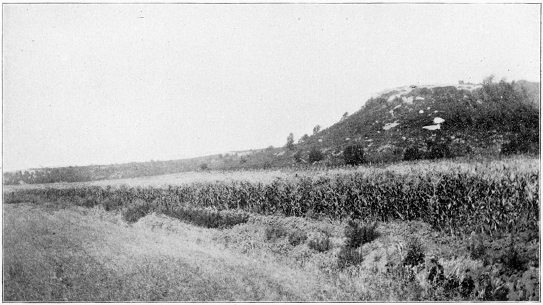
The Independence limestone dips rapidly to the west from Cherryvale to beyond Independence. making one of the steepest inclinations known in the state. At Cherryvale it is about 935 feet above sea level. From Cherryvale to Independence it dips to about 800 feet, or 15 feet to the mile, while at Howard it was, reached in a well at a depth of 75 feet below sea level. Howard is 40 miles on an air line to the northwest of Cherryvale, which would make the Independence limestone dip from the hill tops around Cherryvale at an avearge of 25 feet to the mile. It likewise thickens rapidly to the northwest, the increase of the Erie limestone, already described, being largely due to the thickness of the Independence limestone. To the south and southwest it gradually decreases in thickness, while the shale beds, both above and below it, correspondingly increase.
Plate X—Mound Valley Limestone. Hill northwest of Mound Valley. (Photographed by Adams, 1894.)
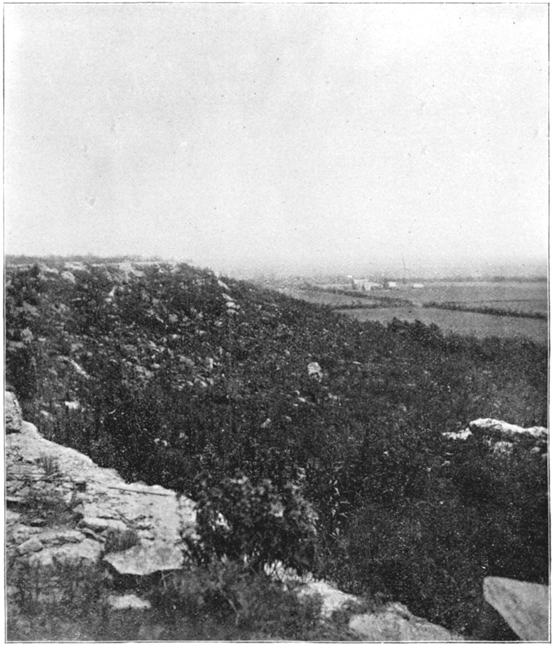
Plate XI—Verdigris River and Independence Limestone. Independence. (Photographed by Adams, 1894,)
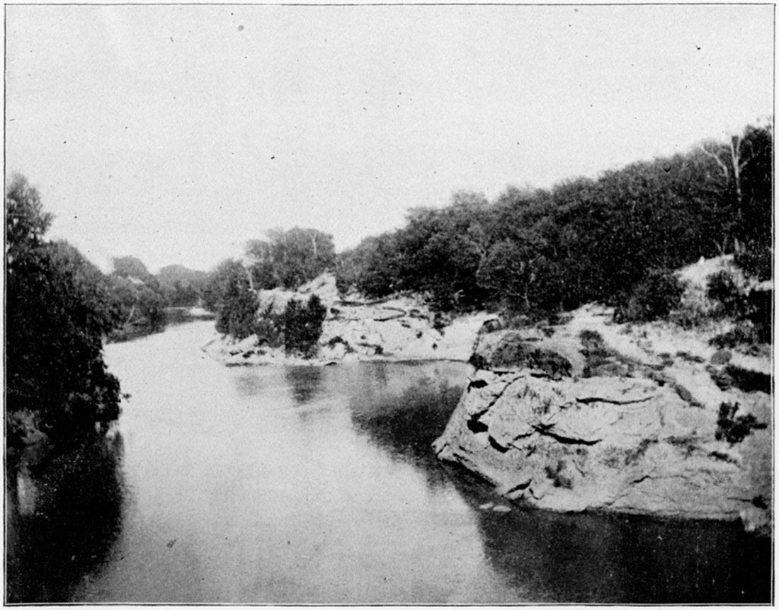
Plate XII—Mound south of Cherryvale capped with Independence Limestone. (Photographed by Haworth, 1894.)
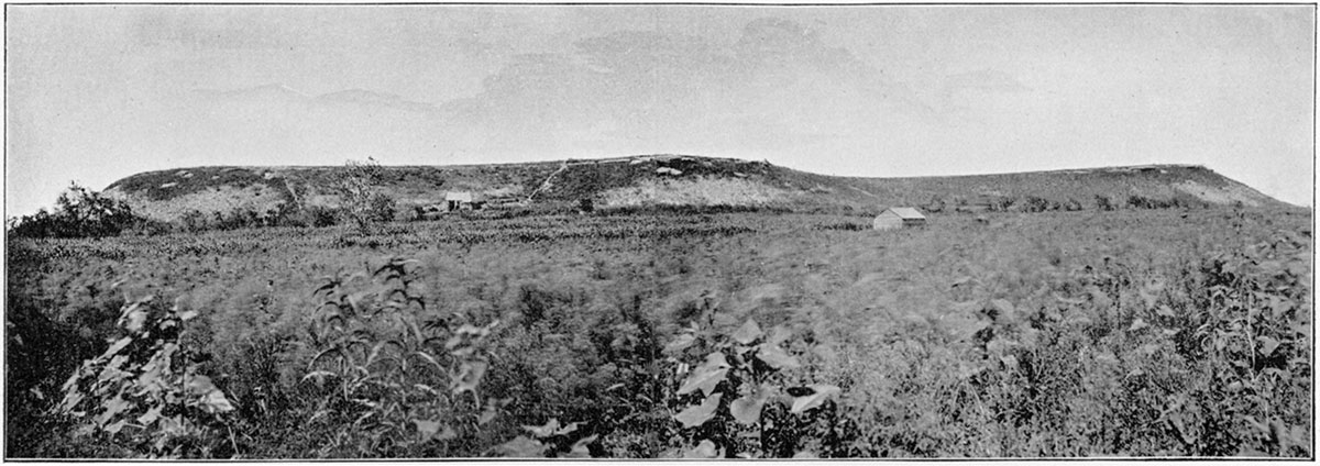
Plate XIII—Surface exposure of Independence Limestone. Southwest of Cherryvale. (Photographed by Adams, 1891,)
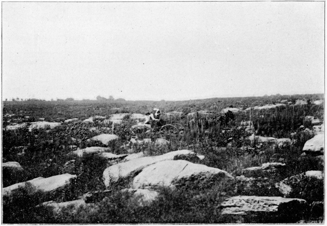
Plate XIV—Hill north of Cherryvale capped with Independence Limestone. (Photographed by Haworth, 1894,)
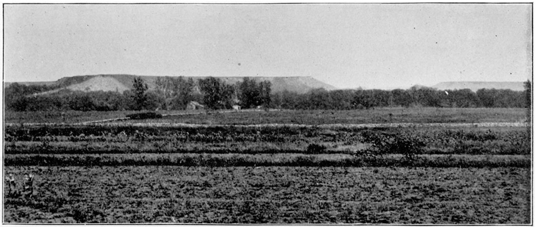
Plate XV—Hill capped with Independence Limestone. North of Cherryvale. (Photographed by Adams, 1894.)
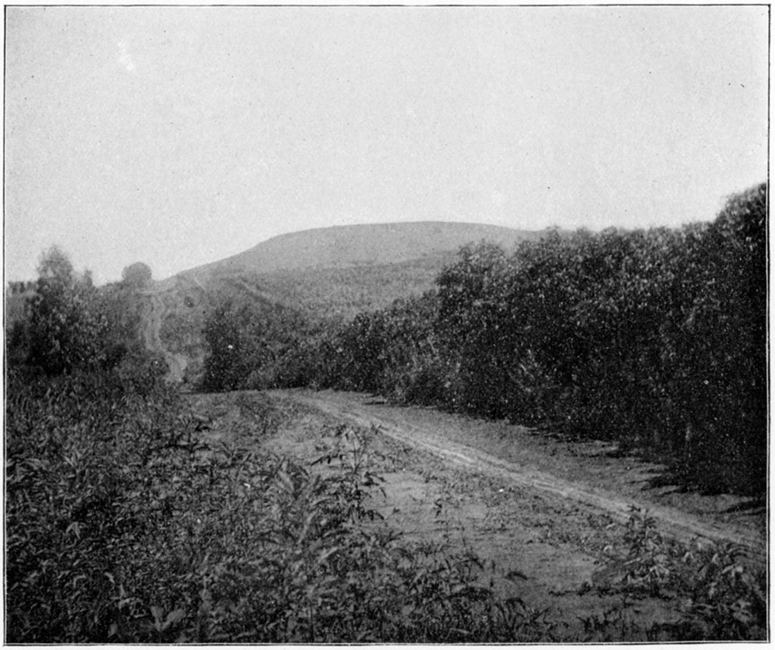
Plate XVI—Table Mound, near Independence, capped with Iola Limestone. (Photographed by Adams, 1894.)
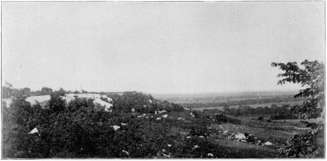
Plate XVII—Table Mound, near Independence, capped with Iola Limestone. (Photographed by Adams, 1894.)
Thayer Shales (Haworth, 1895, p. 274)
At the close of the long period during which the Erie limestone system was formed a heavy bed of shales was produced which constitutes an important terrane in the Upper Coal Measures of Kansas. Immediately above the Independence limestone these shales are found which have been studied in detail over a considerable portion of Neosho, Wilson, and Montgomery counties and further to the northeast. Also they are recognizable further to the west and northwest in the records of every oil and gas well carried to a sufficient depth to reach them. They are prominent in the vicinity of Chanute, Thayer, Neodesha, Fredonia, and other points in that vicinity, where they reach a thickness of fully 200 feet and constitute the great body of the hills and outlying isolated mounds and prominent escarpments to the west and northwest of Independence and Neodesha. The Verdigris river and its various tributaries have cut wide and deep channels through the overlying limestone and into the shales, forming high bluffs along their courses. This escarpment, traced to the northeast, is prominent as far as Moran, beyond which its importance gradually diminishes on account of the thinning of the shale beds until, from Mound Valley north, the shales become so thin that the escarpment produced by them practically coalesces with that produced by the Erie limestone underlying the Pleasanton shales. Their southeastern outcropping crosses from Kansas into Missouri as has already been explained for the Pleasanton shales. Westward and northwestward well records show that their thickness gradually decreases. At La Harpe they are but 100 feet thick, and at Toronto they are 90 feet thick, showing a constant decrease in thickness in a westerly direction.
In general character the Thayer shales are similar to the Pleasanton shales and the Cherokee shales. They carry a large quantity of coal and sandstone. The coal is most abundant near the surface to the, west and southwest of Thayer where it is mined by stripping and by tunneling, and it supplies a large local demand. The coal reaches a thickness of from 12 to 20 inches and is fair in quality.
The sandstone of the Thayer shales is variable, sometimes forming broad thin layers and elsewhere constituting heavy beds with thick layers which would supply large blocks of dimension stone. It is not, however, of much value as a building material. It is poorly cemented and in places is irregularly marked with iron oxide forming an uneven color.
The sandstone and the sandy shales almost everywhere carry ripple marks and other indications of being shallow water deposits. In fact they have as strong internal evidence that they are marginal deposits be can be found anywhere in the Cherokee or Pleasanton shales.
A few thin limestone beds likewise occasionally are found in the Thayer shales, none of which have sufficient thickness or lateral extent to be of much importance stratigraphically. Two or more of these may be seen along the Verdigris valley between Independence and Altoona; one of them, quite oolitic in character, may be seen on the bluff west of the bridge over the Verdigris north of Independence; the second is exposed principally between the bridge and Neodesha on the east side of the river; a third is found northeast of Neodesha along Chetopa creek; and one of these is readily recognized in the bluffs west of Neodesha, although it cannot be definitely correlated. In the vicinity of Kansas City where the Thayer shales are comparatively thin several of the lesser limestone series are noted between the Erie and the Iola limestones, which occupy a position corresponding to those just mentioned. It is evident, however, that they are not continuous from Kansas City to the southwest as many well records show their absence.
Earlton Limestone
But heavier still and more persistent than any of the lesser limestones just mentioned is one occupying a position near the summit of the Thayer shales which develops into a prominent ledge that has exercised a strong and marked influence on the topography of the country to the west and northwest of Earlton, for which Doctor Adams has suggested the name Earlton limestone. West of Sycamore the Earlton limestone is separated from the Iola limestone by a comparatively thin bed of shales which thickens further north towards Guilford and Chanute so that the, limestone is further removed from the overlying Iola limestone. This permits the production of a prominent escarpment by the Earlton limestone which is a prominent feature of of the landscape to the west of Earlton and Chanute.
The Earlton limestone has been traced in detail no further north than the Neoshoriver. What its northern limit is cannot be stated definitely, but it is known that it cannot be traced much beyond the Neosho river. We therefore have a lenticular mass appearing prominently at certain places and gradually growing thinner both to the north and to the south until it entirely disappears.
Vilas Shales
The shale bed occupying the position between the Earlton limestone and the overlying Iola reaches a thickness of 75 feet or more immediately west, of Chanute and Earlton. For convenience in local description it may be recognized as a distinct shale bed, although when traced to the north or to the south it coalesces with the Thayer shales upon the disappearance of the Earlton limestone. Doctor Adams has suggested that this shale bed might be designated the Vilas shales, as it is well represented around the little town of Vilas on the Santa Fe railway between Chanute and Benedict.
Iola Limestone (Haworth and Kirk, 1894, p. 109)
Above the Thayer shales an unusually prominent limestone horizon exists which has been named the Iola limestone. No limestone in the state is more important stratigraphically than this and no one reaches a greater thickness or has a greater lateral extent, Its southeastern outcropping marks a prominent terrace from the south line of the state, a few miles west of Independence, to the Missouri state line in the northeastern part of Miami county. The escarpment here passes into Missouri but soon veers westward again, crossing back into Kansas in the southeastern part of Johnson county, from which place it follows an irregular course to the northeast to a few miles east of Kansas City.
The Missouri river and all of its tributaries near Kansas City have cut through the Iola limestone and the underlying Erie limestone forming high bluffs on either side of their valleys. At Kansas City the Iola limestone is the most prominent of the rocks in the bluffs and measures about 30 feet in thickness. The thickness of the rock along its line of outcropping is variable, dependent partially upon its original form and partially upon the extent to which erosion has reduced it. Likewise the escarpment which it covers varies in thickness and in prominence, dependent principally upon the thickness of the underlying Thayer shales. As before explained the Thayer shales are heaviest to the southwest. Northward, as they gradually become thinner, the Iola escarpment approaches the escarpment produced by the Erie limestone. In the southern part of the state these two heavy escarpments are from ten to twenty miles apart, but to the northeast their lines converge until in Linn county they almost coalesce. From here northward they practically become the same, constituting the Bethany escarpment of the Missouri geologists.
The westward extension of the Iola limestone is known to be great, reaching probably far beyond the limits of our knowledge, which does not extend beyond the deep wells of Howard, Toronto and other points. In the bluffs at Kansas City the limestone is 30 feet thick. At Iola, a few miles to the west of its outcropping, it is 40 feet thick. The Fall River well found it to be 100 feet thick. The Howard well revealed a thickness of over 200 feet for the Iola limestone, assisted probably by a few lesser ones which do not teach the surface. The Toronto well likewise, shows that the Iola limestone has a thickness of about 200 feet at that place. To the far north, beyond Kansas City, the Thayer shales seem almost to disappear, at least to lose their identity as far as can be judged from the well records. The Iola limestone, therefore, practically coalesces with the underlying Erie limestone, making it difficult to distinguish between the two. The Leavenworth well, the Atchison well, the Doniphan well, and other deep wells in that part of the state show a large amount of limestone corresponding to the Iola and to the Erie, implying at least that limestone forming conditions existed for a long period almost to the exclusion of the formation of important shale beds.
The Iola limestone is important regarding some of its physical conditions. Its most noted characteristic is the absence of vertical fissures within it, thus permitting the existence of large blocks of the limestone on the hillsides where they have fallen by the undermining processes of decay. It also renders it most valuable as a quarry stone, making it possible to obtain dimension blocks of any desirable proportion. The quarries at Iola have produced as large blocks as was desired and doubtless much greater ones could be obtained were mechanical devices at hand to lift them.
The Iola limestone also is remarkable an account of its highly crystalline character. No limestone in the whole Coal Measures of the state is crystallized to a greater extent than this. In many places parts of it, in fact, are almost a perfect marble, the crystallization is carried to so high a degree of perfection. This crystalline character is not, however, everywhere noticeable to the same extent. In the bluffs of Kansas City it is not prominent, nor is this property particularly noticeable along the south line of the state.
The Iola limestone carries a great many fossils, although in general appearance it does not seem to have as many as some of the other limestones. Apparently the greater part of the formation was deposited in deep ocean water where the conditions were not the most favorable for the accumulation of fossils. Elsewhere north or south from such a location a larger number of fossils may appear. Of these the following species of invertebrates may betaken as types of those the most abundant: Michelinia eugenex, Athyris subtilita, Lingula scotica, Productus longispinus, Productus pertenuis, Spirifera camerata, Spirifera lineatus, Aviculopecten carboniferus, Pinna subspatulata, Nautilus occidentalis, Nautilus missouriensis.
Lane Shales (Haworth and others, 1896, p. 49)
Above the Iola limestone lies a heavy bed of shales which, contrary, to the conditions of the shale beds occupying a lower horizon, thickens to the north. The upper limit of the shales is determined by the Garnett limestone, a prominent limestone horizon from Garnett northward to beyond the limits of the state at Leavenworth, which, however, across the Neosho river to the southward gradually decreases in thickness and at the same time approaches the Iola limestone. The Lane shales therefore cannot be traced with certainty to the south line of the state. Probably they are represented by the thin bed of shales immediately above the Iola limestone shown in Plate 1. At Garnett and in the Howard well opposite Moline and to the northeast they are very prominent, and with the overlying Garnett limestone form a heavy and prominent escarpment line from near Carlyle to the Kansas river bluffs near Argentine by the way of Kincaid, Garnett, Greeley, Lane, and Paola.
At Lane and other points along the Pottawatomie river they vary from 75 to 100 feet in thickness. Frequent outlying mounds are noticeable here and there from Lane to Osawatomie and their physiographic features are well marked, which could not occur without the existence of a comparatively heavy bed of shale. Northward from Paola the shales gradually decrease in thickness. Along the Kansas river bluffs from Argentine to Eudora, throughout the whole of which distance they are exposed, the average thickness which they maintain does not exceed 40 feet, and in many places they are not 10 feet thick. A drilled deep well at Lawrence likewise shows that here their thickness is not greater than along the river bluffs. The Topeka well, on the other hand, shows that the limestones at that place are not as heavy as one might reasonably expect from the conditions elsewhere, and that the shale beds in general, including the Lane shales, have greatly thickened.
The general character of the Lane shales has but little special interest. They carry a smaller amount of sandstone than do the heavy shale beds already described, and practically no coal. They have more indications of being deep water deposits than any shale beds thus far described. On account of their great irregularity in thickness, they almost entirely disappear both to the south and to the north. They are therefore less important stratigraphically than some of the other shale beds of the Kansas Coal Measures.
Garnett Limestones (Haworth and Kirk, 1894, p. 110)
Above the Lane shales the Garnett limestones are found. The name is applied to two different limestone horizons separated from each other by a thin and relatively unimportant bed of shale. They are prominent at Carlyle, Garnett, Ottawa, Lane, Paola, Olathe, and Argentine, and are exposed over an unusually wide zone, trending in a northeast and southwest direction. This is due to the heavy Lawrence shales overlying them having been eroded away much further to the west than the other shale beds usually are, leaving the Garnett limestones as a floor covering a wide area of country. The shale bed between the two limestones is so thin that the eastern outcroppings of the two usually are the same.
In previous descriptions it has been thought that the limestone exposed at Carlyle was distinct from the Garnett limestones and therefore the term Carlyle limestone was introduced. But during the summer of 1897 Bennett discovered that the so-called Carlyle limestone was the same as the Garnett. As the latter name had been used much more extensively than the former, and the two first used at the same time by the writer, it is preferable to retain the name Garnett and to entirely do away with the name Carlyle.
The thickness of the Garnett limestones along their line of outcropping varies more, perhaps, than that of any other system of limestone known in the Coal Measures. On the south side of the Neosho river they are relatively unimportant, the Lane shales being so thin the Garnett limestones almost coalesce with the Iola. Northward they gradually increase in thickness, being perhaps 25 feet thick at Carlyle. In the vicinity of Lane their thickness is more than double this, while opposite Olathe the lower one of the two has a thickness of more than 50 feet and the upper one nearly as great. At Argentine and other points westward along the Kansas river bluffs to Eudora their thickness is not so great, varying from 10 to 20 feet, as is also found to be the case at Ottawa, Princeton, and other points in that vicinity. Westward they gradually increase in thickness. again, reaching about 65 feet at Toronto, where the shale parting between the two seems to have entirely disappeared and they are separated from the Iola limestone by about 16 feet of Lane shales.
The Garnett limestones are particularly rich in invertebrate fossils, of which the following may be taken as representatives: Campophyllum (?), Fenestella (?), Synocladia biserialis (?), Derbya (?), Productus americanus, Productus semireticulatus, Syntrialasma hemiplicata (very abundant in places), Myalina kansasensis, Myalina recurvirostris, Euomphalus subrugosus, Naticopsis altonensis, Pleurotomoria tabulata, Nautilus occidentalis, and about forty other species.
Prev Page--Stratigraphy || Next Page--Coal Measures 2
Kansas Geological Survey, Geology
Placed on web Sept. 12, 2018; originally published 1898.
Comments to webadmin@kgs.ku.edu
The URL for this page is http://www.kgs.ku.edu/Publications/Bulletins/Vol3/03_meas.html