![]()
Prev Page--Introduction || Next Page--Stratigraphy, Silurian to Mississippian
Stratigraphy
The exposed rocks in the Salina basin and those that have been penetrated in wells range in age from Pre-Cambrian to Quaternary. The sequence of the pre-Pennsylvanian rocks in the Salina basin is shown in Table 1. This table also shows the range of thickness of the pre-Pennsylvanian rocks, and the characteristics by which the several formations are recognized in the cuttings of wells. Every one of the pre-Pennsylvanian formations is absent in some part of the area. Most of the formations were deposited originally throughout the area, but many of them were later removed in whole or in part from certain areas during recurrent periods of emergence and erosion. Some of the formations, however, were deposited only locally and never extended across the area. In consequence, no columnar section showing the sequence of formations is representative of the basin as a whole.
Table 1--Sequence of pre-Pennsylvanian formations encountered in the Salina basin, their range of thickness, and the distinctive physical characteristics of the well cuttings under the microscope.
| System | Series | Correlatives | Formations and members | Approximate thickness in feet |
Distinctive physical characteristics (Detailed descriptions will be found in the text) |
|---|---|---|---|---|---|
| Mississippian | Meramecian | Spergen limestone | 0-99 | Noncherty or sparsely cherty granular limestone at top and silty dolomite at base. The small insoluble residues, rarely more than 5 percent, are characterized by salmon-colored chalcedonic chert include races of microfossiliferous chert. Granular limestones may contain sparsely distributed Endothyra. | |
| "Warsaw" limestone | 0-80 | Chert, opaque, partly gray and partly dark, characteristically packed with silicified broken microorganisms, Chert constitutes 10 to 50 percent of samples. | |||
| Osagian | Undivided Keokuk and Burlington limestones |
0-110 | Upper zone. Chert, white, rough, pitted, and porous Cotton rock in some samples. Residues include soft spongy particles resembling tripoli. Includes, also, in some zones microfossiliferous organisms similar to those in chert of the "Warsaw' limestone but replaced by chalcedony or quartz. |
||
| 0-155 | Lower zone. Chert abundant, mainly white, opaque, microscopically massive breaking in smoothish blocky crumbs. Hackly quartz present in samples and drusy quartz common in insoluble residues. |
||||
| Rocks of Fern Glen age | Reeds Spring limestone | 0-120 | Chert, bluish to bluish gray or gray, translucent to semi-translucent, breaking in sharp-edged crumbs and splintery fragments. | ||
| St. Joe limestone | 0-40 | Noncherty or sparsely cherty, dark gray to gray, argillaceous limestone of earthy or finely crystalline texture | |||
| Kinderhookian | Gilmore City limestone | 0-62 | Oolitic limestone in part, with soft chalky matrix; not oolitic throughout. Nonoolitic limestone is granular. Residues negligible. | ||
| Upper member of Sedalia dolomite | 0-20 | Buff to brown, locally gray, noncherty or sparsely cherty sucrose dolomite. | |||
| Mississippian or Devonian |
Kinderhookian or late Devonian |
Boice shale | 0-110 | Red and brown ironstone oolite, and red shale at base. | |
| Chattanooga shale | 0-255 | Gray to black generally silty, finely micaceous shale. Pyrite common. Spores disseminated throughout but abundant near base. Includes some argillaceous sucrose dolomite and locally toward the west a zone of argillaceous limestone. | |||
| Devonian | Late | Undifferentiated dolomite of Devonian age; includes Cooper dolomite | 0-200 | Contains, in lower zone, imbedded coarse rounded sand grains thinly disseminated in dolomite or limestone but generally abundant at base. Upper zone includes chert at base Not sandy. | |
| Silurian | Niagaran and Alexandrian |
Undifferentiated rocks of Silurian age; includes Chimneyhill dolomite | 0-315 | In ascending order: First zone, characterized by oolitic dolomite; Second zone, characterized by white chert; Third zone, characterized by small silty insoluble residues containing rare specimens of Ammodiscus and other foraminifera and glauconite, locally, streaked with red or pink dolomite or limestone; Fourth zone, characterized in the upper part by insoluble residues of drusy and hackly quartz and fine quartz crystals in the northeastern part of the area and by doloclastic and spongy chert in the southern and western parts of the area. | |
| Ordovician | Late | Sylvan shale of Oklahoma | Maquoketa shale | 0-155 | Gray and greenish-gray silty and nonsilty dolomitic shale. Locally, includes cherty dolomite yielding large insoluble residue of very dolocastic semi-translucent chert. Insoluble residues of shale are, generally, dolocastic in contrast to Chattanooga shale. |
| Middle | Part of Viola limestone of Oklahoma | Kimmswick limestone | 0-310 | Chert with imbedded black or dark tubular microorganisms; buff chert enclosing densely matted silicified microorganisms. Alternate zones sparsely cherty. | |
| Rocks of Simpson age in Oklahoma | Platteville formation | 0-95 | Limestone, dolomite, and sandstone interbedded with green shale; a persistent bed of sucrose dolomite at the base, little or no chert. | ||
| Early | St. Peter sandstone | 0-90 | Coarse rounded to subangular sand interbedded with green shale. | ||
| Rocks of Arbuckle age in Oklahoma | Undivided Cotter dolomite and Jefferson City dolomite | 0-400* | Upper part, abundant chert of variable character, much oolitic chert, oolites, commonly, brown or translucent in light colored matrix; lower part, less cherty, predominantly white and in lesser volume. Tripoli-like chert increasingly common in insoluble residues toward the base. | ||
| Roubidoux dolomite | 0-247 | Sand less abundant than in Missouri. Generally, sandy dolomite in Kansas. Sand in most Kansas areas fine-grained, commonly, with secondary enlargement. | |||
| Undivided Gasconade dolomite and Van Buren formation | 0-50* | Chert abundant in upper part, chert is dense, gray to dark to dark bluish. In lower part, chert is dense white to quartzose, grading downward to white doloclastic chert. Gunter sandstone or sandy dolomite member at base. | |||
| Cambrian | Late | Eminence dolomite | 0-35* | Chert, vitreous to quartzose, light bluish gray, characterized in insoluble residues by lace-like structure due to the abundance of fine dolocasts. | |
| Bonneterre dolomite | 0-183* | Noncherty dolomite with abundant glauconite. | |||
| Lamotte sandstone | 0-80 | Coarse angular to rounded poorly sorted sand. | |||
| Pre-Cambrian | Pre-Cambrian rocks | Arkose; granite. | |||
| The nomenclature and classification follow the usage of the State Geological Survey of Kansas. *(Keroher and Kirby, 1948) |
|||||
The sequence of formations of Pennsylvanian, Permian, and Cretaceous age is given in the chapters dealing with the stratigraphy of these systems. The age classification and nomenclature used in the report accord with the usage of the Kansas Geological Survey.
The accompanying thickness maps show the approximate present distribution and thickness of formations and groups of formations that were affected by similar structural development. The maps show, also, the areas from which various formations that were once present have been eroded. The cross section accompanying each map is designed to show the relation of each formation or sequence to the overlying and underlying rocks.
Pre-Cambrian Rocks
The oldest rocks known in the Middle West consist of various types of igneous and volcanic rocks and altered sedimentary rocks which are generally classified collectively as Pre-Cambrian. They are nearly everywhere covered by younger deposits but come to the surface in the Arbuckle and Wichita Mountains of Oklahoma, in the St. Francois Mountains of southeastern Missouri, in southeastern South Dakota and adjoining parts of Iowa and Minnesota, in the Black Hills of South Dakota and Wyoming, and in Colorado. In the Salina basin, which is roughly central to these outcrops, the Pre-Cambrian rocks lie deep beneath a variable thickness of sedimentary rocks that include representatives of nearly all ages from Cambrian to Recent.
The Pre-Cambrian rocks of the subsurface in Kansas resemble more closely those exposed in Oklahoma and Missouri than in the other areas mentioned. Landes (1927), who studied the samples of Pre-Cambrian rocks from deep wells in Kansas and adjoining states, found that these rocks consist mainly of granite or granite gneiss and schist, although intrusive igneous rocks and other metamorphic sediments have been penetrated in some wells.
The surface of the Pre-Cambrian rocks dips away from the granitic cores of the mountain areas, and reaches depths of several thousand feet below the surface in the adjoining structural basins. In some areas, the sedimentary rocks deposited on the Pre-Cambrian surface were elevated above sea level and their removal by erosion laid bare areas of ancient crystalline rocks. Such a series of events occurred in Kansas at the end of Mississippian time on parts of the Nemaha anticline and in places on the Central Kansas uplift. These areas, however, later sank below sea level and were buried by Pennsylvanian sediments. Although the Kansas region has since been re-elevated, the Pre-Cambrian rocks of that State have not been raised high enough nor has erosion cut deep enough to bring them to the surface.
Rocks of Late Cambrian and Early Ordovician Age
The entire sequence of dolomites of Late Cambrian and Early Ordovician age in Kansas was formerly called the Arbuckle limestone, a name derived from exposures of these rocks in the Arbuckle Mountains of Oklahoma. In Missouri, they were known as the Cambro-Ordovician. These rocks are also known to some oil men as the "siliceous lime." The Arbuckle limestone of Oklahoma and the corresponding Cambrian and Ordovician rocks of Missouri have now been subdivided into many formations. The formational units in Missouri were first differentiated by the Missouri Geological Survey and identified in the subsurface by McQueen (1931) in his pioneer work on insoluble residues. Keroher and Kirby (1948) and others, using the Missouri terms, have extended the identification of these formations into and throughout Kansas.
Rocks of Late Cambrian Age
The Cambrian System is represented in Missouri and Kansas only by rocks of Late Cambrian age. Table 2 shows, in descending order, the sequence of these rocks. Several of the formations present in Missouri wedge out and do not extend into Kansas.
Table 2--Late Cambrian formations in Kansas and Missouri.
| Missouri | Eastern Kansas |
|---|---|
| Proctor dolomite | Absent |
| Eminence dolomite | Eminence dolomite |
| Potosi dolomite | Absent |
| Derby and Doe Run dolomites | Absent |
| Davis formation | Absent |
| Bonneterre dolomite | Bonneterre dolomite |
| Lamotte sandstone | Lamotte sandstone |
Inasmuch as the oldest Cambrian rocks in Missouri and Kansas belong to the upper part of the system, long exposure and erosion of the land surface must have preceded deposition of the first Cambrian sediments. The Pre-Cambrian surface was reduced to a relatively level plain and the Lamotte sandstone and the overlying Bonneterre dolomite were widely deposited on it. Broad regional topographic relief on the Pre-Cambrian surface, however, is suggested by excessive thickening of the Lamotte sandstone in some areas in Missouri and its absence beneath the Bonneterre dolomite in parts of Kansas.
Lamotte Sandstone
McQueen (1931) described the Lamotte sandstone as yellow to white sandstone having fine to coarse subangular and rounded grains. It is generally arkosic at the base and in consequence the exact contact between arkosic sand and weathered granite is difficult to determine from cuttings of some wells. The Lamotte sandstone is transitional upward into sandy dolomite at the base of the Bonneterre dolomite.
The Lamotte sandstone has a maximum thickness of 350 feet in southeastern Missouri but thins westward to the Kansas-Missouri line where it has an average thickness of about 100 feet. According to Keroher and Kirby (1948) it continues to thin westward and wedges out east of the Salina basin. They report a thickness of only 6 feet in a well in Wabaunsee County, and report the absence of the Lamotte in a well in Greenwood County where the Bonneterre dolomite rests on granite. The Lamotte is present, however, beneath the Bonneterre in two wells in a synclinal area in McPherson County; in one of these wells (sec. 4, T. 21 S., R. 3 W.) Keroher and Kirby (1948) report 80 feet of Lamotte sandstone, and in the other (sec. 9, T. 17 S., R. 3 W.) Leatherock found approximately 70 feet of this sandstone. Farther west it is absent in an anticlinal area in which the Roubidoux dolomite overlies granite. Northward, the Lamotte is locally absent beneath the Bonneterre but in sec. 22, T. 5 N., R. 1 W. in Nebraska, the Lamotte, overlain by the Bonneterre, is more than 65 feet thick.
Where the Lamotte is absent in broad areas in central Kansas, including part of the area of the Salina basin, the Pre-Cambrian rocks are overlain by the Roubidoux dolomite of Early Ordovician age (cross sections A-A', Pl. 1; B-B', Fig. 8 (as PDF)). The stratigraphic relations of these rocks suggest that the Lamotte sandstone had originally a broader distribution but was eroded from these areas in pre-Roubidoux time.
Bonneterre Dolomite
The Bonneterre dolomite, which crops out in southeastern Missouri, is present in the subsurface throughout Missouri and most of Kansas but is absent in a considerable area in central Kansas, including part of the Salina basin.
McQueen (1931) describes the Bonneterre as consisting of finely to coarsely crystalline dolomite and magnesian limestone with almost no chert. The dolomite is light colored to brown; it contains disseminated sand and interbedded green and brown shales. Characteristic features are abundant glauconite and the dolomoldic pitting of the shale in the insoluble residues. The Bonneterre in Kansas is similar to the Bonneterre in Missouri, but shale is a less common constituent in the Salina basin than in many localities.
The maximum reported thickness of the Bonneterre in Missouri is 440 feet. Keroher and Kirby (1948) report a thickness of 112 feet in Wilson County in southeastern Kansas and 90 feet in Shawnee County in northeastern Kansas. The Bonneterre is absent on the crest of the Southeast Nebraska arch where, together with younger formations, it was eroded preceding the deposition of the St. Peter sandstone (Lee, 1943, p. 102). It is thin or absent on the southern extension of this arch (Fig. 2A) but thickens again westward where, in sec. 4, T. 21 S., R. 3 W., McPherson County, Keroher and Kirby (1948) found 183 feet of Bonneterre. Leatherock found 170 feet of Bonneterre in a well in northern McPherson County in sec. 9, T. 17 S., R. 3 W. In the Kansas area directly north of McPherson County, no wells have reached the Bonneterre but it is present in southern Nebraska where E. C. Reed (personal communication) of the Nebraska Geological Survey reports Bonneterre dolomite, from 17 to 70 feet thick, in wells within 30 miles of the Kansas-Nebraska line as far west as R. 13 W. Leatherock determined a thickness of 44 feet in a well in sec. 1, T. 1 S., R. 2 E., Washington County, Kansas. The Bonneterre is absent on the arch west of McPherson County where the Roubidoux dolomite overlies granite, but Keroher and Kirby (1948) found the Bonneterre to be present farther west in Kansas.
As shown in cross section B-B' (well 8, Fig. 8 (as PDF)) the Eminence dolomite in western Missouri overlaps unconformably upon the Bonneterre. Farther west in Wilson County, Kansas (well 6, Fig. 8 (as PDF)), the Bonneterre is unconformably overlain by undivided Van Buren and Gasconade dolomites. In well 5B, Greenwood County, and at other points, it is overlain unconformably by the Roubidoux dolomite. The significance of these unconformities is discussed later in the chapters dealing with structure. It seems probable that the Bonneterre was originally deposited across central Kansas but, like the Lamotte, was eroded from parts of the area as a result of later emergence and exposure.
Eminence Dolomite
The Eminence dolomite is present throughout most of Missouri but Keroher and Kirby (1948) found it in only limited areas in eastern and western Kansas. It is absent so far as known in the Salina basin except in the deep well in sec. 4, T. 21 S., R. 3 W., McPherson County.
As described by McQueen (1931), the Eminence is a cherty dolomite recognized by large percentages of insoluble residues which consist, in large part, of chert that is so pitted with dolomoldic cavities that it is almost lacelike. The chert, mainly of vitreous luster, is bluish to white. Many fragments are coated with crystalline quartz.
The Eminence has a known thickness of 320 feet in southeastern Missouri but, like other Cambrian formations, it thins westward into Kansas. It is reported by Keroher and Kirby (1948) to have a thickness of 175 feet in Douglas County and 172 feet in Crawford County, but to the west and south it wedges out or is beveled by the Van Buren formation. It has not been recognized in deep wells in Wilson, Greenwood, or Pottawatomie Counties. It is present in limited areas in western Kansas, but the only well on the map of the Salina basin (Pl. 1) in which the Eminence was recognized by Keroher and Kirby (1948) is in sec. 4, T. 21 S., R. 3 W. (well 4B, Fig. 8 (as PDF)) in the pre-Roubidoux synclinal basin in McPherson County where it has a thickness of 35 feet.
The Eminence dolomite rests unconformably on the Bonneterre dolomite in Kansas. The magnitude of this stratigraphic break is measured by the absence in Kansas of the Davis formation, the Derby and Doe Run dolomites, and the Potosi dolomite, all of which occur in ascending sequence above the Bonneterre in southeastern Missouri (cross section B-B', Fig. 8 (as PDF), McQueen, 1931). The Eminence lies unconformably below the undifferentiated Van Buren-Gasconade sequence. The noncherty Proctor dolomite, 225 feet thick, which intervenes between the Eminence and Van Buren in southeastern Missouri, is not recognized in Kansas. The Eminence is overlain in Kansas by the Gunter sandstone member of the Van Buren formation.
Rocks of Early Ordovician Age
The Lower Ordovician formations in Missouri and in Kansas are shown in descending order in Table 3.
Table 3--Formations of Early Ordovician age in Kansas and Missouri.
| Missouri | Kansas |
|---|---|
| St. Peter sandstone | St. Peter sandstone (equivalent to part of Simpson group of Oklahoma) |
| Smithville formation (McQueen, 1931, Pl. 12) | Absent |
| Powell dolomite | Absent |
| Cotter dolomite | Undifferentiated Cotter and Jefferson City dolomites |
| Jefferson City dolomite | |
| Roubidoux formation | Roubidoux dolomite |
| Gasconade dolomite | Undifferentiated Gasconade dolomite and Van Buren formation |
| Van Buren formation |
Van Buren-Gasconade Sequence
The dolomites lying between the top of the Gunter sandstone member of the Van Buren formation and the Roubidoux sandstone were originally known as Gasconade dolomite. Ulrich (McQueen, 1931, p. 18), on the basis of paleontology, later restricted the term Gasconade to the upper part and named the lower part, including the Gunter sandstone, the Van Buren formation. McQueen (1931, p. 18) has differentiated the formations lithologically by insoluble residues. They crop out widely on the valley slopes of streams traversing the northern flanks of the Ozark uplift. The formations are difficult to separate, however, in the subsurface in areas far removed from the outcrop, and in Kansas were designated by Keroher and Kirby (1948) as the Van Buren-Gasconade sequence. This sequence was recognized in the subsurface by Keroher and Kirby only in eastern and southeastern Kansas. It is not known to occur north of McPherson County nor west of Wabaunsee County. It is absent in northern Greenwood County (well 5B, cross section B-B, Fig. 8 (as PDF)) where it seems to have been beveled by pre-Roubidoux erosion.
Except for the Gunter sandstone member, the Gasconade and the Van Buren formations consist of cherty dolomite. The cherts of the Van Buren dolomite in the central Ozarks, as described by McQueen (1931), are white, drusy, porcelainlike, and in part oolitic. The chert of the Gasconade dolomite is reported to be bluish gray, blue, or even bluish black and predominantly vitreous and quartzose. The Gunter sandstone at the base of the Van Buren is composed of fine- to medium-grained subangular to rounded, and frosted sand grains. In some wells in Kansas it is a sandy dolomite.
The Van Buren and Gasconade in the Ozark region of Missouri have a combined thickness of about 400 feet. They are much thinner in eastern and southeastern Kansas. According to Keroher and Kirby (1948), they are 100 feet thick in Osage County, 14 feet thick in Wabaunsee County, 228 feet thick in Wilson County, 115 feet thick in Sedgwick County, and 50 feet thick in southern McPherson County.
The unconformity at the base of the Van Buren in Kansas is substantiated by the westward thinning of the underlying Eminence dolomite and by the absence of the Proctor dolomite which in southeastern Missouri directly underlies the Van Buren. Keroher and Kirby (1948) show that the Gunter sandstone in southeastern Kansas overlaps westward beyond the edge of the Eminence dolomite and rests progressively in this direction on the Bonneterre dolomite and the Pre-Cambrian rocks. The contact of the Gasconade dolomite with the overlying Roubidoux dolomite is probably unconformable, although the relations shown in cross section B-B' (Fig. 8 (as PDF)) might be interpreted as an overlap of the Roubidoux onto a pre-Van Buren topographic high.
Roubidoux Dolomite
The Roubidoux formation underlies the surface of much of the upland areas of the central part of the Ozark Plateau of Missouri where it is composed of thick beds of sandstone alternating with cherty dolomite. Keroher and Kirby (1948) found the Roubidoux represented in most places in Kansas by sandy dolomite without interbedded sandstone. It is therefore referred to as Roubidoux dolomite in Kansas. The Roubidoux is generally present throughout Kansas but on the crest of the Southeast Nebraska arch it was eroded prior to the deposition of the St. Peter sandstone (cross section A-A', Pl. 1) and on the Central Kansas uplift it was removed by erosion preceding the deposition of Pennsylvanian rocks.
Sand constitutes from 5 to 80 percent of the insoluble residues of well cuttings but in many samples the sand is so disseminated in the dolomite that the sandy character of the dolomite is not determined without recourse to insoluble residues. The dolomites are cherty. Keroher and Kirby (1948) report that the residues include quartzose and cherty oolites. Traces of bright-green shale are reported in the well cuttings.
The Roubidoux is relatively regular in thickness. Keroher and Kirby (1948) report thicknesses of 175 to 200 feet in southeastern Kansas and 350 feet in some places in western Kansas. In the Salina basin its thickness ranges from 154 to 247 feet.
In Missouri the Roubidoux rests unconformably on the Gasconade (Lee, 1913, p. 33, figs. 3, 4), although the unconformity is obscure. In Kansas, Keroher and Kirby (1948) found that the Roubidoux overlies the Van Buren-Gasconade sequence in eastern and southeastern Kansas; that toward the west it overlaps from these rocks upon Bonneterre dolomite; and that still farther west in parts of the Salina basin it rests on Pre-Cambrian rocks. West of the Salina basin (Pl. 1) Keroher and Kirby (1948) show the Roubidoux overlying the Bonneterre dolomite.
The relation of the Roubidoux to the overlying Jefferson City is uncertain. It is regarded as unconformable in Missouri by McQueen (1931) but Cullison (1944, p. 23) is uncertain. Inasmuch as no consistent boundary has been drawn between these formations in the multitudinous outcrops in Missouri it seems probable that the unconformity separating them is no greater than the many sedimentary interruptions within both formations and that the two formations are in effect conformable.
Jefferson City and Cotter Dolomites
All the rocks in Missouri between the St. Peter sandstone and the Roubidoux formation were originally called Jefferson City dolomite. Through the paleontological work of Ulrich and others, parts of the original formation were cut off to form the Cotter and younger formations. The Cotter and the restricted Jefferson City were differentiated in the subsurface in Missouri by McQueen (1931) on the basis of insoluble residues. The difficulty of separating these formations by this means in wells in areas distant from the outcrops has resulted in the practice of referring to these rocks as undifferentiated Cotter and Jefferson City dolomites. Cullison (1944), whose approach to the problem was based on both lithologic and paleontologic studies, redefined the Jefferson City of McQueen and raised it to the rank of a group, consisting of two formations, the Rich Fountain formation below and the Theodosia formation above. The Theodosia includes a part of the rocks previously included in the Cotter dolomite.
In Kansas, the undivided Jefferson City and Cotter dolomites were everywhere truncated by erosion so that the original thickness has been materially reduced. According to Keroher and Kirby (1948), this sequence wedges out toward the north in Rooks, Osborne, Mitchell, Cloud, and Clay counties. It thickens with some regularity toward the south to more than 600 feet near the Kansas-Oklahoma line in Cowley County. A thickness of 360 feet is reported in the well in sec. 4, T. 21 S., R. 3 W. in southern McPherson County. This well was drilled near the pre-Pennsylvanian trace of a thrust fault developed after Mississippian time on the west flank of the Voshell anticline (Bunte and Fortier, 1941, fig. 5). The thickness of the sequence is exceptional for the locality and the well was thus probably drilled through the fault.
In sample logs, the contact of the Jefferson City dolomite with the Roubidoux dolomite is placed by Keroher and Kirby (1948) at the first appearance of sand in the cuttings and residues. Probably no important unconformity occurs at this contact. Throughout most of the Salina basin, the St. Peter sandstone overlies unconformably the Jefferson City-Cotter sequence. The magnitude of this unconformity in Kansas is attested by the absence of the Powell, Smithville, Black Rock, and Everton formations of Arkansas. The Jefferson City-Cotter rocks were raised and thinned by erosion on the Chautauqua arch in pre-Devonian time and again prior to Chattanooga time. They were eroded from parts of the Nemaha anticline and from much of the Central Kansas uplift preceding Pennsylvanian deposition. In consequence the Jefferson City-Cotter sequence in different areas lies unconformably below rocks of many different ages ranging from the St. Peter sandstone of Ordovician age to beds of Pennsylvanian age.
St. Peter Sandstone
The St. Peter sandstone of Early Ordovician age, which crops out in northern Missouri, and the Platteville formation of Middle Ordovician age, as restricted by Kay (1935, p. 288) in outcrops in Iowa, occupy the stratigraphic position of the Simpson group of Oklahoma, but they represent only a part of the Simpson group, which in some places is more than 1,500 feet thick.
In the Salina basin, the St. Peter sandstone consists of three zones (Leatherock, 1945, p. 10). The upper and lower zones consist of sandstone characterized by rounded and frosted sand grains. The middle zone which is of variable lithology consists of (a) green clay shale containing sand grains, (b) interbedded sandstone and shale, or (c) sandstone consisting of finer and less rounded sand grains than those in the upper and lower zones. The middle zone is also characterized locally by disseminated grains of glauconite. Red and brown shale and red and brown ironstone oolites are also found in the middle zone where it overlaps upon rocks older than the St. Peter. This seems to be the red zone described by Dake (1921, pp, 68, 85, 128) at the base of the St. Peter sandstone in certain wells in Minnesota and Illinois and in some exposures in Missouri, and is the middle zone in other areas of these states (Dake, 1921, pp. 24, 86, 99).
The thickness of the upper zone ranges from 15 to 45 feet, the middle zone from 10 to 30 feet, and the lower zone from 15 to 50 feet. Where only one sand zone composed of rounded grains is present, it is impossible to determine from the cuttings whether this sandstone represents the upper or lower zone.
The St. Peter sandstone has an irregular thickness, ranging from 10 to 90 feet; however, greater thicknesses are known in some places. The sandstone is notably thin in wells in Smith and Jewell counties where it is 10 to 13 feet thick and in Riley and Pottawatomie counties where it is 10 to 15 feet thick. Both these areas lie on the margin of the North Kansas basin where more or less continuous upward movements may have taken place during St. Peter time. The variations in the thickness of the St. Peter, however, are probably due mainly to erosional irregularities of the beveled surface upon which the St. Peter was deposited or to deposition in sink holes as in the Kasper No. 1 James well in sec. 8, T. 13 S., R. 25 E. in Johnson County where it is 403 feet thick. There were also slight local structural movements at the end of St. Peter deposition and an erosional unconformity preceded the deposition of the overlying Platteville rocks (Leatherock, 1945, pp. 11-12). Regional unconformity between the Platteville and the St. Peter is revealed by the presence in southeastern Missouri and southern Illinois of a thick sequence of formations which are not present in Kansas (Lee, 1943, p. 32).
Rocks of Middle and Late Ordovician Age
The following Ordovician formations above the St. Peter sandstone, listed in descending order, are recognized in the Salina basin.
- Late Ordovician
- Maquoketa shale (equivalent to Sylvan shale of Oklahoma)
- Middle Ordovician
- Kimmswick limestone (equivalent to part of the Viola limestone of Oklahoma)
- Platteville formation (equivalent to part of the Simpson group of Oklahoma)
The North Kansas basin was the dominant structural feature under development between the deposition of the St. Peter sandstone and the Mississippian limestones. The variations in thickness and lithology of the rocks deposited during this time interval were closely related to the subsidence of this basin. Frequent references are made, therefore, to the central and marginal areas of the North Kansas basin in discussing the lithology of this sequence of rocks. The Salina basin, which did not come into existence until after Mississippian time, was formed on the southwestern flank of the North Kansas basin. All references to the Salina basin prior to the end of Mississippian time are therefore geographical and refer to the area in which the Salina basin was later developed and not to the Salina basin as a structural feature.
Platteville Formation
The upper part of the sequence of Simpson age in the Salina basin has been correlated by Leatherock (1945, pp. 12-14) with the Platteville formation of Iowa. In northeastern Kansas, the Platteville consists of a variable sequence of green clay shale and minor amounts of interbedded limestone, dolomite, and sandstone, but the basal member is a persistent bed of dolomite. This dolomite is composed mainly of sucrose or granular dolomite but some wells reveal local variations of interbedded earthy limestone of lithographic texture. In some wells disseminated rounded grains of sand occur in parts of the dolomite, and interbedded green clay shale has also been noted. The thickness of the basal dolomite in the area of the Salina basin ranges from 5 to 35 feet.
The variable lithology of the upper beds of the Platteville is illustrated by the following observations. In the Coronado Oil Company No. 1 Parks well in sec. 16, T. 10 S., R. 8 E., Pottawatomie County, and in the Turner et al. No. 1 Umscheid well in sec. 32, T. 8 S., R. 9 E., Riley County, the basal dolomite bed is overlain directly by a bed of sandstone 15 to 20 feet thick. South and west of these wells the sandstone changes laterally to sandy shale with about 5 feet of sandstone at the base. Toward the northwest the sandstone grades into green shale.
The Platteville thickens toward the northeast into the deeper part of the North Kansas basin in southeastern Nebraska where the upper part of the Platteville is composed mainly of coarsely granular and earthy limestone and sucrose dolomite interbedded with minor amounts of green clay shale, thin sandstone, and rarely some red shale. The upper part of these limestones and dolomites is probably younger than any part of the Platteville in the Salina basin. In the deeper part of the North Kansas basin the predominant dolomite and limestone of the lower part of the Platteville seem to interfinger with the shales, sandy shales, and sand on the margin of the basin.
The subdivision of the Platteville limestone in the outcrops in Iowa and Illinois is dependent largely on paleontologic criteria which are not available in samples from the subsurface. The lithologic variations observed in the Salina basin are the expression of advance and retreat of the shoreline of the North Kansas basin which caused intraformational disconformities at least on the margin of the basin.
The Platteville is 104 feet thick in Richardson County, Nebraska, 85 feet thick in T. 5 N., R. 1 W. in Nebraska, and 100 feet thick in northern Brown County, Kansas. All these areas are in the deeper part of the North Kansas basin. On the southwestern flank of this basin, the Platteville thins somewhat irregularly toward the margin. It is 60 feet thick in Pottawatomie County, 20 to 30 feet thick in Dickinson and Saline counties, and wedges out on the margin of the basin in parts of Marion and McPherson counties on the southwest and in Douglas County on the south.
The Platteville rests unconformably on the St. Peter sandstone. This unconformity is recognized in the subsurface of Kansas by the fact that the persistent dolomite at the base of the Platteville overlies different zones of the St. Peter in different areas. The unconformity is expressed regionally by the absence in Kansas of the Stones River limestone, the Joachim dolomite, and the Dutchtown formation of the Missouri section which have an aggregate thickness in southeastern Missouri of about 900 feet (Weller and McQueen, 1939). These formations are separated from one another by unconformities and were deposited in a subsiding basin while eastern Kansas and northwestern Missouri remained at or about sea level.
The Platteville is unconformably overlain by the Kimmswick limestone of Missouri. This unconformity is expressed in the North Kansas basin by the irregular thickness of the Platteville and by the fact that in the deeper part of the basin, the Kimmswick overlies younger deposits of Platteville age, and toward the southwestern margin of the basin in Kansas progressively overlaps the basal dolomite member and the St. Peter sandstone (cross sections A-A', Pls. 2 and 4; Leatherock, 1945, pl. 1).
Kimmswick Limestone
The Kimmswick limestone, which is named for outcrops in southeastern Missouri, is widely distributed in the surface and subsurface in the Mississippi Valley. It is equivalent to at least part of the Viola limestone of Oklahoma and is equivalent also to part of the Galena limestone, which extends northward to Minnesota. In northern Illinois and Iowa, the Galena is treated as a group and is subdivided, in ascending order, into the Prosser limestone, Stewartville dolomite, and Dubuque formation, mainly by fossils. Inasmuch as stratigraphic units can be recognized in the subsurface only by their lithological characteristics as revealed in the cuttings from wells, these lithologically similar formations cannot be differentiated with confidence in places far removed from outcrops. In parts of Nebraska where rocks of Galena age are thicker than in Kansas, the Nebraska geologists have tentatively identified the formations recognized in Iowa. It seems probable that in northeastern Kansas only the Prosser limestone is represented. The Missouri name for these rocks is used in this report because the Kimmswick limestone of that state has been traced in the subsurface across northern Missouri to the border of northeastern Kansas by McQueen and Greene (1938) and because this unit in Kansas more closely resembles the Kimmswick of Missouri than the Viola of Oklahoma.
The Decorah shale of Iowa, which comprises the Ion and Guttenburg members, lies between the Platteville formation and the Galena limestone. These members have not been identified in Kansas. If they are present as shaly or sandy beds, they are included in the Platteville in the thickness maps, and if represented by a calcareous phase, they are included in the basal Kimmswick. Their combined thickness in outcrops is reported at only about 30 feet (Kay, 1928, p. 16), but in view of the overlap and unconformity at the base of the Kimmswick, the Decorah may not be represented in Kansas. In southeastern Nebraska and northeastern Kansas, the Kimmswick is conveniently divided into four zones of alternating cherty and noncherty or sparsely cherty dolomite. Some limestone is interstratified with the dolomite in central Kansas toward the southwestern margin of the North Kansas basin.
The Kimmswick limestone, as a whole, reaches a maximum known thickness of 310 feet in sec. 1, T. 1 S., R. 2 E., Washington County, Kansas. It is 272 feet thick on the Kansas-Nebraska line in sec. 31, T. 1 N., R. 1 E., Jefferson County, Nebraska (well 10, Pl. 2). It thins as a whole with considerable regularity toward the southwestern margin of the North Kansas basin. In T. 24 S., R. 2 W., Harvey County (well 1, Pl. 2), where only the second of the four zones of the Kimmswick has survived, its total thickness is only 20 feet.
Porosity in the Kimmswick, as indicated by microscopic cavities and loosely interlocked grains of granular and sucrose dolomite, is confined to the upper 5 to 50 feet of the third zone. Where the upper beds are especially cherty, the porosity occurs mainly in the dolomite or cherty dolomite beneath the zone of maximum chert concentration.
The unconformity between the Platteville and the Kimmswick is revealed mainly by the variable thickness of the underlying Platteville (Leatherock, 1945, Pl. 1). This unconformity seems to be of minor importance in Kansas but the regular beveling of the Platteville indicates an exceptionally well-developed flat surface. The upper surface of the Kimmswick is separated from the overlying Maquoketa by a marked unconformity indicated by the progressive overlap of the Maquoketa from the fourth zone of the Kimmswick in southeastern Nebraska upon the third and second zones on the southwestern flank of the North Kansas basin. It is probable that the younger formations of Trenton age, the Dubuque and Stewartville, which have been tentatively recognized in the deeper part of the North Kansas basin in Nebraska (Condra and Reed, 1943, pp. 68-69) were laid down throughout the northern midcontinent region but that almost the whole of this sequence was eroded from the southwestern flank of the basin before the deposition of the Maquoketa shale.
The four zones of the Kimmswick limestone are described below in ascending order of age.
First zone--The first zone extends from the top of the Platteville to the top of a thin cherty bed that separates it from the second zone. In the deeper part of the North Kansas basin, where the deposits are thickest, the first zone consists almost entirely of dolomite, but toward the southwestern margin of the basin this zone is composed of interbedded granular dolomite and earthy limestone. The upper 10 to 20 feet contains sparsely disseminated coarse rounded grains of sand.
The cherty bed at the top of the first zone is 10 to 15 feet thick and includes 2 to 10 percent chert. The chert is buff to brownish buff and is characterized by matted texture owing to the silicification of vast numbers of broken micro-organisms and spicules that accumulated in the original sediments. The first zone is 45 feet thick in the Ebke No. 1 Mathies well in sec. 22, T. 5 N., R. 1 W., Nebraska, near the center of the North Kansas basin, but becomes thinner toward the south and southwest and wedges out in Harvey County as shown in well 1 of cross section A-A', Plate 2. On the southwestern margin of the North Kansas basin, it is overlapped by the second zone.
Second zone--Toward the north, the second zone consists of sucrose and granular dolomite and chert but, toward the south and west, the dolomite is interbedded with earthy and granular limestone. On the southwestern margin of the North Kansas basin (cross section A-A', Pl. 2) where the second zone overlaps the first and rests on either the Platteville or the St. Peter, coarse rounded grains of sand are sparsely disseminated in the basal 10 to 15 feet. The disseminated sand in the lower part of this zone continues basinward above the first zone but does not reach so far northward into the basin as the sand in the first zone.
The upper and middle parts of the second zone are very cherty. The chert is in part gray or buff and microscopically massive. Much of the chert, however, is characterized by traces of imbedded fragments of spicular and tubelike micro-organisms either black or of dark shades which are in contrast with the lighter-colored matrix. Part of the filling of the black tubular fragments is pyrite but part is siliceous. This type of chert with its black and dark flecks is characteristic of the second and third zones of the Kimmswick in the Salina basin.
In the northeastern part of the area shown on Plate 2, the cherts of the second zone occur in two well-defined beds which are separated by a noncherty bed as shown in well 11 of the cross section. This sequence was described by Lee (1943, pp. 38-39) in northeastern Kansas and by McQueen and Greene (1938, pp. 40-42) in northwestern Missouri as the middle zone of the Kimmswick. Toward the west, in the area of the Salina basin, however, the lower chert bed of this middle zone fades out and cannot be used to mark the base of the middle zone. The second zone of this report, in consequence, is extended down to the top of the matted chert bed of the first zone and thus includes noncherty beds that were considered to be below the middle zone of previous reports. The chert in the cherty beds of the second zone amounts to 20 to 80 percent of the samples. Where both chert beds are present the upper one is 10 to 35 feet thick and the lower 5 to 35 feet thick. They are separated by 45 to 65 feet of noncherty dolomite. The noncherty bed at the base of the second zone is 25 to 60 feet thick.
The second zone reaches a maximum known thickness of 153 feet in the Mathies well in T. 5 N., R. 1 W., Nebraska (well 11, Pl. 2). It thins somewhat irregularly toward the southwestern margin of the North Kansas basin and, as shown in cross section A-A' (Pl. 2), is 55 feet thick in T. 18 S., R. 1 W. (well 26) in the area in which it is overlain by the third zone.
Third zone--The carbonate rocks of the third zone, as in the other zones, consist of granular dolomite to the north. South of T. 4 S., R. 2 E. (well 8, Pl. 2) earthy and granular limestone is interstratified with granular and sucrose dolomite. The chert, which is present in its upper part, is more variable in lithologic character than the chert in the first and second zones and comprises 20 to 100 percent of the samples. The chert in the third zone, like that in the second, is characterized by dark and black flecks but it includes also much opaque and grainy chert, for the most part white and gray. Toward the deeper part of the North Kansas basin, other types of chert occur in this zone, such as curdled chert, chert with matted texture, similar to but less distinctive than that in the first zone, and in some wells soft white chert resembling tripoli. The cherty phase at the top of the third zone occurs only where the zone is relatively thick. The cherty beds are from 10 to 35 feet thick and increase irregularly in thickness toward the center of the North Kansas basin. Toward the margin of the basin, the cherty beds were removed by beveling, and in this direction the lower noncherty beds are capped by the Maquoketa shale as shown in Plate 2.
The maximum known thickness of the third zone is 101 feet in T. 1 N., R. 1 E., Jefferson County, Nebraska (well 10, Pl. 2). Toward the south, as shown in the cross section, the third zone thins irregularly to thicknesses ranging from 45 to 15 feet. In T. 21 S., R. 1 W. (well 24) it is overlapped by the Maquoketa shale which is there in contact with the second zone. The third zone, which was probably originally deposited throughout a broader area, is in consequence now absent on the margin of the North Kansas basin.
Fourth zone--A fourth and higher zone--consisting mainly of dolomite and minor amounts of chert--is recognized above the third zone in the central area of the North Kansas basin in Nebraska, but this zone is not present in the Salina basin.
Maquoketa Shale
The Maquoketa shale, the youngest of the Ordovician formations in northeastern Kansas, is named for outcrops on Maquoketa River in northeastern Iowa and is exposed in adjoining areas of Illinois, Wisconsin, and Minnesota, and also in southeastern Missouri and southern Illinois. The Maquoketa is widespread in the subsurface and extends westward in Kansas at least to the Central Kansas uplift, and southward its equivalent, the Sylvan shale, occurs throughout most of eastern Oklahoma. In Iowa, the Maquoketa was subdivided by Calvin (1906) into the following formations listed in ascending order: Elgin limestone, Clermont shale, Fort Atkinson limestone, and Brainerd shale, but these subdivisions have not been identified in north-central Kansas.
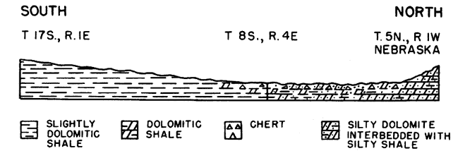
The Maquoketa shale in north-central Kansas is composed of very silty dolomite or dolomitic silt and silty dolomitic shale. In some areas beds of very cherty dolomite occur near the top of the formation and in others the shale is argillaceous and only slightly dolomitic. Silty dolomite predominates in the northern part of the Salina basin and toward the center of the North Kansas basin. In the southern part of the Salina basin, the dolomite facies grades laterally through dolomitic silty shale to nonsilty only slightly dolomitic shale.
In T. 5 N., R. 1 W., Nebraska (well 11, Pl. 2) the Maquoketa is 105 feet thick and consists of silty dolomite with minor amounts of interbedded silty shale. Farther south in the Wolf Creek Oil Company No. 1 Brenizer well, sec. 35, T. 12 S., R. 2 E., the Maquoketa is 95 feet thick but, except for the upper 10 feet of silty dolomite, it consists of dolomitic shale. In the Auto-Ordnance Corporation No. 1 Ruch well in sec. 25, T. 13 S., R. 2 W., however, the Maquoketa, 100 feet thick, is composed entirely of shale. In the northern and northeastern parts of the area shown in Plate 2, the rocks of the upper 10 to 20 feet of the dolomite facies are interbedded with gray chalcedonic chert and silty shale. The chalcedonic chert is found only in areas where the Maquoketa is of less than the average thickness and has not been observed where the dolomitic phase of the Maquoketa is thick or where the Maquoketa consists mainly of shale. These facts suggest that the cherty beds are the result of cementation of especially silty dolomite under conditions of erosion and weathering (Fig. 3A). The upper 28 feet of the Maquoketa (total thickness 78 feet) in the Transcontinental No. 1 Acker well in sec. 1, T. 12 S., R. 4 E. consists of indurated highly silty shale resembling gray opaque chert, which is interbedded with gray chalcedonic chert. This indurated shale may be the result of weathering of very silty dolomite and silty shale.
Fig. 3A--Diagrammatic cross section showing the distribution of chert in Maquoketa shale in areas once subjected to weathering and erosion.
The shale varies considerably in color. It is generally green and light gray in the upper part and medium to dark gray in the lower part. In some wells, however, the shale is greenish gray throughout. Glauconite is uncommon but occurs sparingly in wells in the northern part of the area. It was noted throughout the upper 49 feet of shale in the Boyle Grossman Drilling Company No. 1 Bonham well in sec. 31, T. 1. N., R. 1 E., Nebraska.
The insoluble residues of the dolomitic facies of the Maquoketa consist of 5 to 15 percent of silt and silty sponge. Probably considerable silt was lost in the washing of the residues. The insoluble residues of the shales approach 100 percent and generally include one-half to 2 percent silt. The insoluble residues of the shale from all parts of the formation are nearly everywhere dolomoldic. The cherty zones yield large residues of dolomoldic chert. Some geologists have referred dolomitic rocks at the top of the Maquoketa to the overlying Silurian but the dolomite in this position is distinguished from the Silurian by the silt or by the dolomoldic chert of the insoluble residues.
The Maquoketa shale does not thicken toward the central part of the North Kansas basin, like the Platteville and Kimmswick below and the Silurian and Devonian rocks above, although it may once have done so. The thickness of the Maquoketa, where it is overlain by Silurian rocks, ranges irregularly from 155 feet in the Appleman Oil. Company No. 1 McManus well in sec. 29, T. 15 S., R. 6 W., Ellsworth County, to 40 feet in the Gulf Oil Corporation No. 1 Baker well in sec. 1, T. 1 S., R. 2 E., Washington County.
The Maquoketa is thin in a belt extending northward from Marion County where it is 80 feet thick in the White Eagle Oil and Refining Company No. 1 Ucker well in sec. 24, T. 17 S., R. 2 E., and 40 feet thick in the well in Washington County mentioned above. East of this belt its thickness increases to 110 feet in sec. 6, T. 15 S., R. 7 E. and toward the west to 155 in Ellsworth County in the Appleman Oil Company No. 1 McManus well. In the McManus well, part of the increase seems to be at the expense of the underlying Kimmswick. The trend of the belt of thinning corresponds roughly to the trend of a belt of thick Silurian rocks above and thus suggests a pre-Silurian erosional. basin.
Although it is probable that there was some topographic relief on the pre-Maquoketa surface of the Kimmswick, the relations of the thickness of the Maquoketa and the Silurian strongly suggest that most of the variations in thickness of the Maquoketa are due to topographic relief on its upper surface. The Maquoketa is absent in wells in southwestern Smith County and northwestern Osborne County (Pl. 4), where the Silurian rocks overlapped the eroded surface of the Maquoketa onto the Kimmswick. The unconformity between the Maquoketa and the overlying Silurian rocks is revealed also in the Arab Petroleum Company No. 1 Ogle well in sec. 9, T. 1 N., R. 14 E in Nebraska. In this well, the Maquoketa is thinner than is common for this locality and is separated from the Silurian dolomites by a 12-foot zone of red shale in which ferruginous oolites are imbedded. Du Bois (1945, p. 13), who noted topographic relief at the top of the Maquoketa in Illinois, reports similar ferruginous oolites between the Maquoketa and the Silurian limestones of Illinois, Iowa, and Wisconsin, but they are uncommon in areas adjacent to Kansas.
In north-central Kansas, the topographic relief on the pre-Silurian surface over a broad area may have reached 100 feet, but within the area of one or two townships, the relief in few places exceeded 25 feet.
The area in which the Maquoketa was deposited was originally more extensive than the area now underlain by it in northeastern and central Kansas. Pre-Silurian erosion removed the Maquoketa from parts of Osborne and Mitchell counties; pre-Devonian erosion beveled the Silurian, Maquoketa, and older rocks on the southwestern and southeastern borders of the North Kansas basin (Pl. 4; Lee, Grohskopf, Reed, and Hershey, 1946, sheet 2); pre-Chattanooga erosion cut a valley in McPherson and adjoining counties and removed the Maquoketa from part of the area (Pl. 5); and pre-Pennsylvanian erosion removed it from the crest of the northern end of the Nemaha anticline (Pl. 8).
Prev Page--Introduction || Next Page--Stratigraphy, Silurian to Mississippian
Kansas Geological Survey, Geology
Placed on web Dec. 28, 2007; originally published Nov. 1948.
Comments to webadmin@kgs.ku.edu
The URL for this page is http://www.kgs.ku.edu/Publications/Bulletins/74/03_strat.html