Kansas Geological Survey, Bulletin 52, Part 3, originally published in 1944
Back to Neosho and Wilson counties...
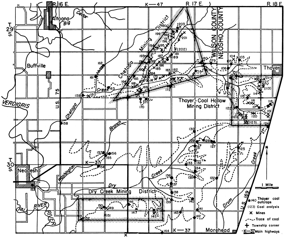
Figure 6--Map of Neosho and Wilson counties, Kansas, showing coal-mining districts and location of mines and outcrops. A larger version of this figure is available.
Back to Neosho and Wilson counties...
Kansas Geological Survey, Geology
Placed on web April 23, 2009; originally published in July 1944.
Comments to webadmin@kgs.ku.edu
The URL for this page is http://www.kgs.ku.edu/Publications/Bulletins/52_3/fig6.html