KGS Home PagePRS Home PageOnline Pubs Page

Kansas Geological Survey, Open File Report 96-50

Seismic Modeling in the Minneola Complex, part 7 of 10


Multi-Well Model Interpretation

The multi-well model uses the Cannon, Statton, Rooney, and Shumate wells (Fig. 3) to build a pseudo-cross section which should show the change in seismic signature as a sandstone thickens in a relatively thin channel interval, as a channel interval thickens while keeping the same sandstone thickness, and as a moderately thick sandstone changes laterally into a shale in a relatively thick channel interval (Fig. 7a). Unlike the single well model, all of the wells are different and none of them are modified. Correlated tops are the same as the single well model, but include a base of Morrow sand horizon (BMSD) which extends to the Shumate well for correlation consistency even though the well contains no upper Morrow sandstone (the phantom correlation does not affect the log values at the well). The model extends above the Marmaton but is not shown to focus on the area of interest.

Figure 7a--Multi-well model cross section. Sonic curves are red and bulk density curves are blue. Vertical scale in feet below sea level. Horizon (tops) abbreviations are Marmaton (MRMT), Cherokee (CHRK), Atoka (ATOK), Morrow (MRRW), base of upper Morrow sandstone (BMSD), and Mississippian (MISS).

cross section showing log curves

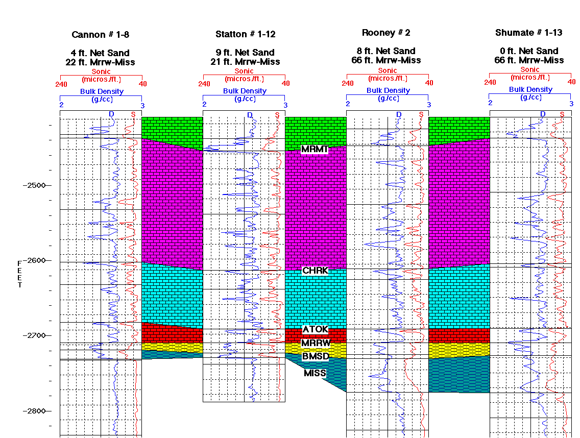
Figure 7b--Interpolated single well acoustic impedance model. Reds represent limestones, sandstones, and higher velocity shales. Yellows and oranges represent lower velocity shales. Vertical scale in seconds of two-way travel time from the top of the model and is approximately twice that of the seismic models. A black and white verion of this plot is available.

colored seismic plot

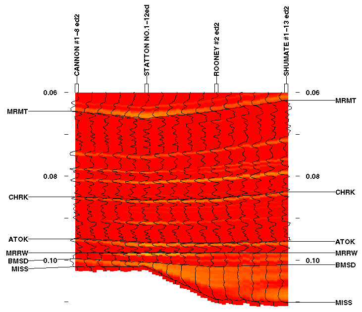
Figure 7c--Same as Figure 7b but with a vertical scale approximately the same as the seismic models. A black and white verion of this plot is available.

colored seismic plot, different scale

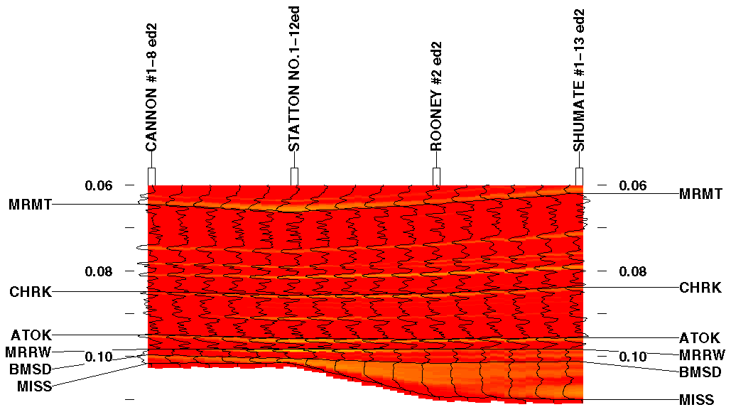
The log interpolation model of this cross section is shown as a vertically expanded version in Figure 7b and at the same scale as the synthetic seismic section in Figure 7c. The log interpolation model is generated and displayed in the same way as the interpolation model for the single well case. The color representation is also the same. One difference, however, is that this log interpolation model is flattened along the top of the Morrow to simplify seismic interpretation of the Morrow-Mississippian interval.


Report Contents || Previous Page--Higher Resolution Single-Well Model || Next Page--Lower Resolution Multi-Well Model
Kansas Geological Survey, Open-File Report 96-50
Placed online Feb. 1997
Comments to webadmin@kgs.ku.edu
URL=http://www.kgs.ku.edu/PRS/publication/OFR96_50/rep7.html