


Kansas Geological Survey, Open File Report 96-50
Seismic Modeling in the Minneola Complex, Figure 3
Please use the "Back" command of your browser to return to the page
you were viewing.
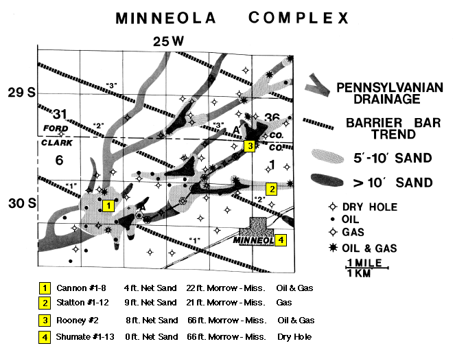
Figure 3--Wells used in seismic modeling (yellow
squares). Base map of the Minneola complex indicates well
locations, major lower Pennsylvanian drainages as interpreted
from previously acquired seismic data, and barrier bar sandstone
accumulations and trends mapped from well control (modified from
Clark, 1987).
Please use the "Back" command of your browser to return to the page
you were viewing.
Report Contents
Kansas Geological Survey, Open-File Report 96-50
Placed online Feb. 1997
Comments to webadmin@kgs.ku.edu
URL=http://www.kgs.ku.edu/PRS/publication/OFR96_50/fig3.html