
Southeast Kansas Coal Geology Field Trips
Open-file Report 2002-27
|
|
|
Kansas Geological Survey Open-file Report 2002-27 |
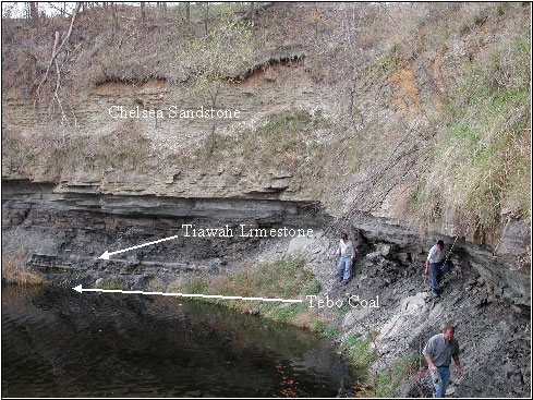
Abandoned and flooded coal pit where the Weir-Pittsburg was mined.
Pit is located in the NWNWNW Sec. 2, T28S, R25E, Crawford County,
KS (Cato Quad). Exposure is from shales above the Chelsea Sandstone
down to the Tebo Coal at the waterline. Exposed in ascending order
are the Tebo Coal, black Shale marker bed, Tiawah limestone bed
and the Chelsea Sandstone.
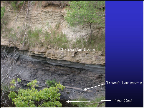
Abandoned and flooded coal pit where the Weir-Pittsburg was
mined. Pit is located in the NWNWNW Sec. 2, T28S, R25E, Crawford
County, KS (Cato Quad). Exposure is from shales above the Chelsea
Sandstone down to the Tebo Coal at the waterline. Exposed in ascending
order are the Tebo Coal, black Shale marker bed, Tiawah limestone
bed and the Chelsea Sandstone.
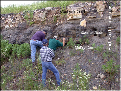
Roadcut showing Ft. Scott Limestone units. The Blackjack Creek Member overlies the Excello Shale and Mulky Coal. Located on west side of 69 Highway about 0.2 mile from section corner (SESESE Sec. 7, T28S, R25E, Crawford County.
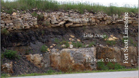
Roadcut showing Ft. Scott Limestone units. From top to bottom
are the Blackjack Creek, Little Osage and Higginsville members.
Located on west side of 69 Highway about 1.2 mile from section
corner (SESESE Sec. 7, T28S, R25E, Crawford County (about 1 mile
south of previous image).
|
|
e-mail
: webadmin@kgs.ku.edu
Last updated June 2002
http://www.kgs.ku.edu/PRS/publication/2002/ofr27/P1-07.html