
Southeast Kansas Coal Geology Field Trips
Open-file Report 2002-27
|
|
|
Kansas Geological Survey Open-file Report 2002-27 |
Openfile report contains notes and images associated with investigations on coalbed methane in southeast Kansas. Images cover three field trips in 2001 and 2002.
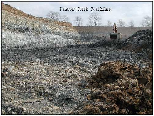
Panther Creek Coal Mine run by Continental Coal Inc.. Located in Sec9, T39N, R29w, Bates Co., MO (Butler 1:100,000 quad). Coals mined at Panther Creek are the Mineral Coal (24-50” thick) and the Tebo Coal (12-18” thick). The Tebo is located approximately 15-18” below the Mineral Coal. Production in 2000 was about 157,000 tons.
View is looking to the east in the coal pit as the overburden above the Mineral Coal is removed. The top of the Mineral coal is being exposed. Note the sand ridges overlying the Mineral Coal. A scattered coal is located in the lows of the ridges above the Mineral and is approximately 12” thick in the western edge of the pit. This coal will be seen in later pictures.
Small pit in the left foreground was dug into the Mineral coal and is seen in the next image.
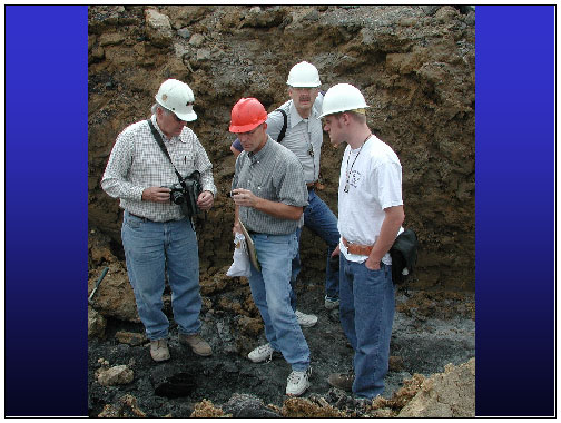
Larry Brady, Jim Stegeman, Dave Newell and Jonathan Lange examining
the Mineral Coal in a small pit.
|
|
e-mail
: webadmin@kgs.ku.edu
Last updated June 2002
http://www.kgs.ku.edu/PRS/publication/2002/ofr27/index.html