
Southeast Kansas Coal Geology Field Trips
Open-file Report 2002-27
|
|
|
Kansas Geological Survey Open-file Report 2002-27 |
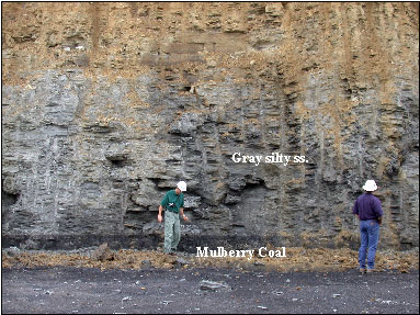
June Trip with Devon. View looking west in coal pit at Lost
Creek Mine operated by Continental Coal Inc. Mine is located in
Sec. 18, T23S, R24E, Linn Co., KS. Coal mined is the Mulberry
Coal of the Bandera Formation (Marmaton Group). The Mulberry Coal
is approximately 20-26” thick. Production in 2000 was about
50,000 tons due start-up late in the year. Production in 2001
was 176,000 tons.
June Trip with Devon. View looking west in coal pit at Lost Creek Mine operated by Continental Coal Inc. Mine is located in Sec. 18, T23S, R24E, Linn Co., KS. Coal mined is the Mulberry Coal of the Bandera Formation (Marmaton Group). The Mulberry Coal is approximately 20-26” thick. Production in 2000 was about 50,000 tons due start-up late in the year. Production in 2001 was 176,000 tons.
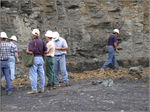
June Trip with Devon. View looking southeast at the Mulberry
Coal of the Bandera Formation (Marmaton Group). The Mulberry Coal
is approximately 20-26” thick.
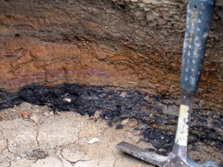
Close-up of Croweburg Coal at the Clemens Mine #22 located
in Sec. 34, T27S, R25E, Crawford County, KS (Cato Quad). Exposure
shows the sharp lower contact with claystone (seatrock) and gradational
contact with overlying claystone with abundant brachiopods (monospecefic
assemblage).
|
|
e-mail
: webadmin@kgs.ku.edu
Last updated June 2002
http://www.kgs.ku.edu/PRS/publication/2002/ofr27/P1-06.html