| Year | Oil | Gas | ||||
|---|---|---|---|---|---|---|
| Production (bbls) |
Wells | Cumulative (bbls) |
Production (mcf) |
Wells | Cumulative (mcf) |
|
| 1995 | 328,712 | 207 | 28,678,605 | 637,272 | 70 | 56,560,056 |
| 1996 | 328,958 | 191 | 29,007,563 | 971,944 | 67 | 57,532,000 |
| 1997 | 299,778 | 189 | 29,307,341 | 374,482 | 57 | 57,906,482 |
| 1998 | 250,258 | 176 | 29,557,599 | 876,908 | 56 | 58,783,390 |
| 1999 | 230,066 | 171 | 29,787,665 | 685,125 | 56 | 59,468,515 |
| 2000 | 221,014 | 170 | 30,008,679 | 300,572 | 54 | 59,769,087 |
| 2001 | 221,651 | 167 | 30,230,330 | 322,331 | 56 | 60,091,418 |
| 2002 | 243,635 | 166 | 30,473,965 | 316,075 | 57 | 60,407,493 |
| 2003 | 240,498 | 168 | 30,714,463 | 254,830 | 60 | 60,662,323 |
| 2004 | 229,000 | 169 | 30,943,463 | 299,328 | 55 | 60,961,651 |
| 2005 | 203,322 | 165 | 31,146,785 | 264,798 | 60 | 61,226,449 |
| 2006 | 197,753 | 169 | 31,344,538 | 264,618 | 66 | 61,491,067 |
| 2007 | 183,423 | 173 | 31,527,961 | - | - | 61,491,067 |
| 2008 | 180,798 | 180 | 31,708,759 | 65,362 | 64 | 61,556,429 |
| 2009 | 216,359 | 182 | 31,925,118 | 247,788 | 68 | 61,804,217 |
| 2010 | 395,734 | 195 | 32,320,852 | 271,613 | 67 | 62,075,830 |
| 2011 | 615,138 | 210 | 32,935,990 | 213,339 | 67 | 62,289,169 |
| 2012 | 592,020 | 225 | 33,528,010 | 269,595 | 67 | 62,558,764 |
| 2013 | 470,332 | 241 | 33,998,342 | 403,955 | 66 | 62,962,719 |
| 2014 | 414,927 | 246 | 34,413,269 | 390,412 | 70 | 63,353,131 |
| 2015 | 305,069 | 238 | 34,718,338 | 388,440 | 71 | 63,741,571 |
| 2016 | 244,608 | 225 | 34,962,946 | 349,388 | 69 | 64,090,959 |
| 2017 | 237,906 | 223 | 35,200,852 | 340,423 | 66 | 64,431,382 |
| 2018 | 214,718 | 222 | 35,415,570 | 310,483 | 64 | 64,741,865 |
| 2019 | 178,647 | 217 | 35,594,217 | 315,230 | 66 | 65,057,095 |
| 2020 | 155,530 | 208 | 35,749,747 | 320,636 | 68 | 65,377,731 |
| 2021 | 143,539 | 197 | 35,893,286 | 317,281 | 65 | 65,695,012 |
| 2022 | 138,993 | 184 | 36,032,279 | 287,561 | 64 | 65,982,573 |
| 2023 | 120,551 | 172 | 36,152,830 | 255,180 | 58 | 66,237,753 |
| 2024 | 132,559 | 175 | 36,285,389 | 134,695 | 61 | 66,372,448 |
| 2025 | 127,219 | 154 | 36,412,608 | 204,547 | 60 | 66,576,995 |
| 2026 | 34,242 | 133 | 36,446,850 | 59,760 | 46 | 66,636,755 |
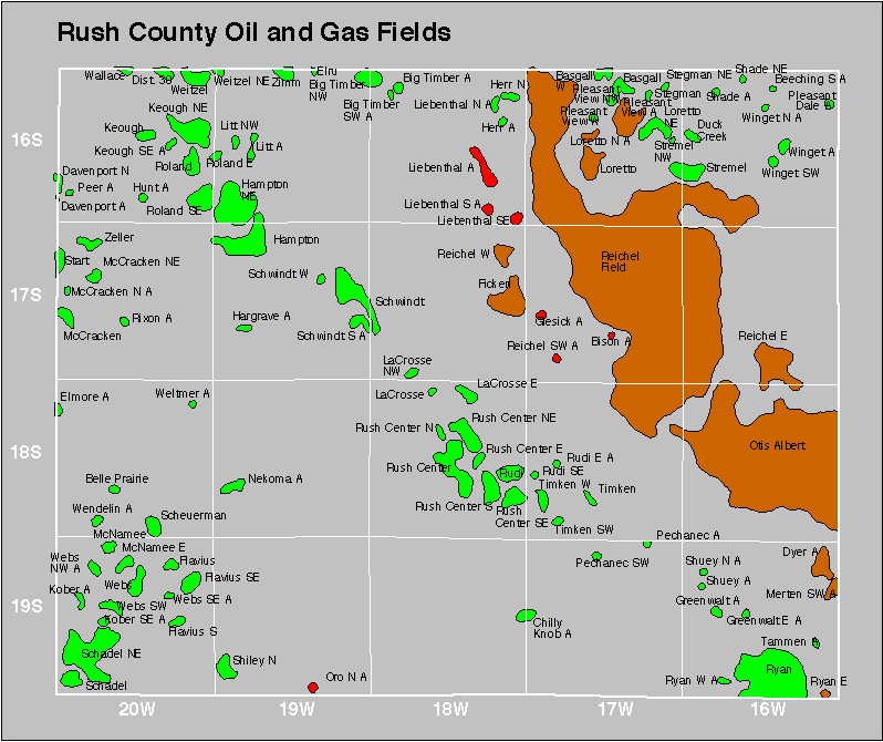

| Abandoned | ||
|---|---|---|
| Big Timber Bison Chilly Knob Greenwalt Herr Hunt |
Kober Loretto Northeast Mccracken North Pechanec Ryan East Ryan West |
Shuey Webs Northwest Wendelin |