| Year | Oil | Gas | ||||
|---|---|---|---|---|---|---|
| Production (bbls) |
Wells | Cumulative (bbls) |
Production (mcf) |
Wells | Cumulative (mcf) |
|
| 1995 | 589,044 | 861 | 202,554,338 | 341,065 | 74 | 22,852,745 |
| 1996 | 562,386 | 695 | 203,116,724 | 293,913 | 75 | 23,146,658 |
| 1997 | 529,529 | 680 | 203,646,253 | 237,385 | 71 | 23,384,043 |
| 1998 | 464,771 | 647 | 204,111,024 | 234,678 | 70 | 23,618,721 |
| 1999 | 474,852 | 603 | 204,585,876 | 220,131 | 67 | 23,838,852 |
| 2000 | 455,965 | 601 | 205,041,841 | 186,484 | 58 | 24,025,336 |
| 2001 | 440,813 | 595 | 205,482,654 | 180,448 | 56 | 24,205,784 |
| 2002 | 435,709 | 579 | 205,918,363 | 167,764 | 52 | 24,373,548 |
| 2003 | 434,791 | 603 | 206,353,154 | 166,147 | 50 | 24,539,695 |
| 2004 | 432,048 | 596 | 206,785,202 | 165,124 | 49 | 24,704,819 |
| 2005 | 426,862 | 598 | 207,212,064 | 168,449 | 52 | 24,873,268 |
| 2006 | 420,324 | 596 | 207,632,388 | 170,726 | 53 | 25,043,994 |
| 2007 | 419,432 | 605 | 208,051,820 | 165,443 | 49 | 25,209,437 |
| 2008 | 429,757 | 615 | 208,481,577 | 169,237 | 44 | 25,378,674 |
| 2009 | 435,848 | 617 | 208,917,425 | 143,063 | 39 | 25,521,737 |
| 2010 | 418,590 | 617 | 209,336,015 | 120,981 | 40 | 25,642,718 |
| 2011 | 415,895 | 605 | 209,751,910 | 143,849 | 39 | 25,786,567 |
| 2012 | 415,235 | 608 | 210,167,145 | 144,205 | 36 | 25,930,772 |
| 2013 | 410,163 | 604 | 210,577,308 | 134,655 | 35 | 26,065,427 |
| 2014 | 407,968 | 615 | 210,985,276 | 110,047 | 34 | 26,175,474 |
| 2015 | 376,177 | 602 | 211,361,453 | 63,805 | 25 | 26,239,279 |
| 2016 | 357,050 | 585 | 211,718,503 | 31,442 | 11 | 26,270,721 |
| 2017 | 342,284 | 577 | 212,060,787 | 26,157 | 11 | 26,296,878 |
| 2018 | 329,545 | 573 | 212,390,332 | 24,490 | 7 | 26,321,368 |
| 2019 | 315,974 | 557 | 212,706,306 | 26,864 | 6 | 26,348,232 |
| 2020 | 275,804 | 538 | 212,982,110 | 22,585 | 6 | 26,370,817 |
| 2021 | 285,039 | 525 | 213,267,149 | 21,615 | 6 | 26,392,432 |
| 2022 | 291,233 | 528 | 213,558,382 | 13,795 | 5 | 26,406,227 |
| 2023 | 285,614 | 524 | 213,843,996 | 16,312 | 5 | 26,422,539 |
| 2024 | 270,775 | 503 | 214,114,771 | 10,017 | 4 | 26,432,556 |
| 2025 | 270,073 | 495 | 214,384,844 | 2,197 | 3 | 26,434,753 |
| 2026 | 21,429 | 265 | 214,406,273 | - | - | 26,434,753 |
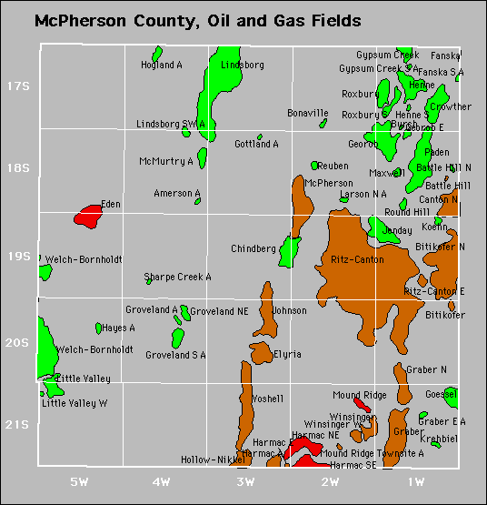

Abandoned
Gottland
Groveland
Hayes
Larson North
Lindsborg Southwest
Mound Ridge Townsite
Sharpe Creek