| Year | Oil | Gas | ||||
|---|---|---|---|---|---|---|
| Production (bbls) |
Wells | Cumulative (bbls) |
Production (mcf) |
Wells | Cumulative (mcf) |
|
| 1995 | 73,221 | 114 | 2,018,022 | 163,630 | 30 | 17,411,624 |
| 1996 | 84,554 | 149 | 2,102,576 | 118,196 | 46 | 17,529,820 |
| 1997 | 85,894 | 157 | 2,188,470 | 148,216 | 50 | 17,678,036 |
| 1998 | 92,615 | 164 | 2,281,085 | 130,526 | 52 | 17,808,562 |
| 1999 | 78,638 | 161 | 2,359,723 | 131,605 | 66 | 17,940,167 |
| 2000 | 81,564 | 162 | 2,441,287 | 124,877 | 82 | 18,065,044 |
| 2001 | 73,523 | 162 | 2,514,810 | 113,391 | 75 | 18,178,435 |
| 2002 | 76,354 | 167 | 2,591,164 | 112,313 | 73 | 18,290,748 |
| 2003 | 68,935 | 162 | 2,660,099 | 97,588 | 90 | 18,388,336 |
| 2004 | 74,627 | 168 | 2,734,726 | 106,979 | 89 | 18,495,315 |
| 2005 | 74,537 | 171 | 2,809,263 | 106,921 | 78 | 18,602,236 |
| 2006 | 78,215 | 175 | 2,887,478 | 92,859 | 89 | 18,695,095 |
| 2007 | 77,922 | 191 | 2,965,400 | 42,640 | 84 | 18,737,735 |
| 2008 | 74,605 | 199 | 3,040,005 | 74,833 | 82 | 18,812,568 |
| 2009 | 75,231 | 197 | 3,115,236 | 79,102 | 82 | 18,891,670 |
| 2010 | 62,793 | 203 | 3,178,029 | 85,619 | 86 | 18,977,289 |
| 2011 | 60,254 | 202 | 3,238,283 | 68,781 | 67 | 19,046,070 |
| 2012 | 64,912 | 210 | 3,303,195 | 56,932 | 51 | 19,103,002 |
| 2013 | 66,099 | 211 | 3,369,294 | 58,957 | 49 | 19,161,959 |
| 2014 | 58,115 | 197 | 3,427,409 | 28,197 | 41 | 19,190,156 |
| 2015 | 54,109 | 203 | 3,481,518 | 19,484 | 20 | 19,209,640 |
| 2016 | 52,304 | 197 | 3,533,822 | 1,060 | 12 | 19,210,700 |
| 2017 | 49,048 | 204 | 3,582,870 | - | - | 19,210,700 |
| 2018 | 41,287 | 202 | 3,624,157 | - | - | 19,210,700 |
| 2019 | 43,742 | 198 | 3,667,899 | - | - | 19,210,700 |
| 2020 | 37,729 | 184 | 3,705,628 | - | - | 19,210,700 |
| 2021 | 35,224 | 165 | 3,740,852 | - | - | 19,210,700 |
| 2022 | 31,130 | 125 | 3,771,982 | - | - | 19,210,700 |
| 2023 | 31,359 | 119 | 3,803,341 | - | - | 19,210,700 |
| 2024 | 32,462 | 124 | 3,835,803 | - | - | 19,210,700 |
| 2025 | 30,605 | 121 | 3,866,408 | - | - | 19,210,700 |
| 2026 | 7,628 | 96 | 3,874,036 | - | - | 19,210,700 |
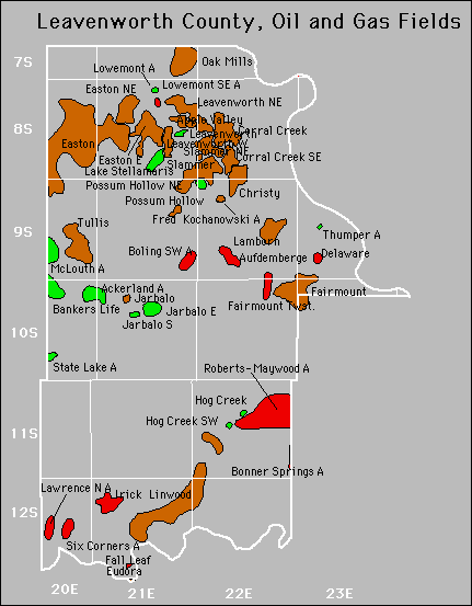

Abandoned
Ackerland
Fairmount
Jarbalo
Six Corners
Gas Storage Fields