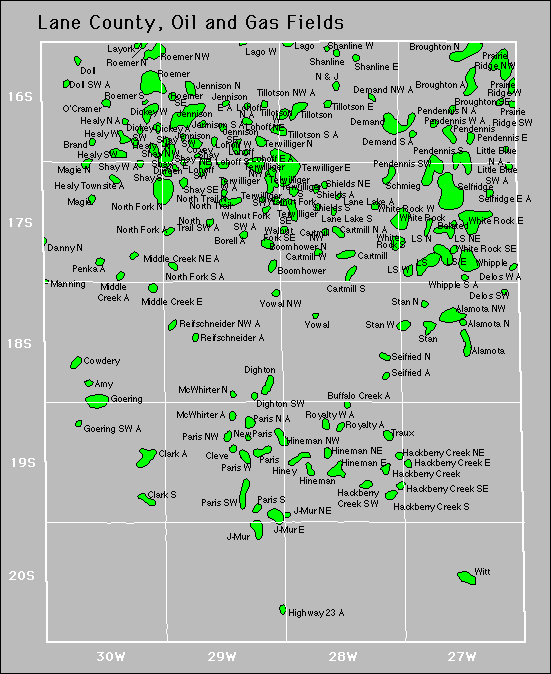
Alamota
Alamota North
Alamota Northeast
Alamota Northwest
Alamota South
Alamota Township
Alamota Township Northwest
Alamota Townsite
Alamota West
America
America Northwest
Amy
Amy East
Amy Townsite
Amy Townsite Northeast
Amy West
Belated
Bison Bluffs
Bison Bluffs Southwest
Bison Cliff
Blaine
Boomhower
Boomhower North
Borell
Brand
Brand Southwest
Brand West
Broughton
Broughton North
Broughton Northeast
Broughton Northwest
Broughton Southeast
Buffalo Creek
Buffalo Creek East
Caliche Pit
Cartmill
Cartmill North
Cartmill Northwest
Cartmill South
Cartmill Southwest
Cartmill West
Clark
Clark South
Clark Southeast
Cleve
Covey
Cowdery
Cowdery East
Cowdery Northeast
Cramer
Creeks Edge
Danny Northeast
Darr Creek
Darr Creek East
Darr Creek North
|
Darr Creek Northwest
Delos Southwest
Delos West
Demand
Demand Northwest
Demand South
Dickey
Dickey Southwest
Dickey West
Dighton
Dighton Southwest
Dighton Townsite
Dighton West
Dirreen
Doll
Doll East
Doll Southwest
Doll West
Dowd
Drift Fence
Dull Knife
Frontier
Frontier East
Goering
Goering Southeast
Goering Southwest
Gola
Hackberry Bend
Hackberry Creek
Hackberry Creek East
Hackberry Creek Northeast
Hackberry Creek South
Hackberry Creek Southeast
Hackberry Creek Southwest
Healy
Healy North
Healy Southwest
Healy Townsite
Healy West
Hickok Road
Highway 23
Hineman
Hineman East
Hineman Northeast
Hineman Northwest
Hiney
Horse Tank
J-Mur
J-Mur East
J-Mur Northeast
J-Mur Southeast
Jennison
Jennison East
Jennison North
Jennison South
|
Jennison Southeast
Jennison Southwest
Kingpin
Lago
Lago West
Lamoree North
Lane Lake
Lane Lake North
Lane Lake South
Layork
Little Blue Southwest
Little Wolf
Lohoff
Lohoff East
Lohoff North
Lohoff Northeast
Lohoff South
Lohoff Southwest
Lohoff West
Ls
Ls East
Ls North
Ls Northeast
Ls Northwest
Ls Southwest
Ls West
Lucy
M & A
Magie
Magie North
Magie Northwest
Magie Southeast
Magie Southwest
Mammoth Kill
Manning
Mauch
Mcwhirter
Mcwhirter North
Mcwhirter Northeast
Mcwhirter Northwest
Mcwhirter Southwest
Mcwhirter West
Melissa
Middle Creek
Middle Creek East
Middle Creek Northeast
Middle Stan
Middle Walnut
Newparis
Nimocks & Johnson (N & J)
Nimocks & Johnson (N & J) East
North Fork North
North Fork South
North Trail
North Trail North
|
North Trail Southwest
O'Cramer
Paris
Paris North
Paris Northwest
Paris South
Paris Southwest
Paris West
Pendennis
Pendennis East
Pendennis North
Pendennis Northwest
Pendennis South
Pendennis Southwest
Pendennis West
Penka
Prairie Ridge Northwest
Prairie Ridge Southwest
Prairie Ridge West
Reifschneider
Reifschneider North
Reifschneider Northeast
Reifschneider Northwest
Reifschneider Southeast
Reifschneider Southwest
Repshire
Repshire East
Repshire Southeast
Rivendell
Rivendell Northwest
Roemer
Roemer North
Roemer Northeast
Roemer Northwest
Roemer South
Roemer Southeast
Royalty
Royalty East
Royalty West
Scane
Schmieg
Scola
Seifried
Seifried North
Seifried Southeast
Selfridge
Selfridge East
Selfridge Northeast
Shanline
Shanline East
Shanline Southwest
Shanline West
Sharp Seed
Sharp Seed South
Sharp Seed Southwest
|
Shay
Shay East
Shay North
Shay Northeast
Shay Northwest
Shay South
Shay Southeast
Shay West
Shields
Shields Northeast
Shields South
Shields Townsite
Stan
Stan North
Stan Northwest
Stan West
Stone Knife
Stone Knife Southeast
Stormont
Sutton Cemetery
Sutton Cemetery North
Sutton Township
Sutton Township East
Sutton Township North
Terwilliger
Terwilliger East
Terwilliger North
Terwilliger Northwest
Terwilliger South
Terwilliger Southeast
Terwilliger Southwest
Terwilliger West
Tillotson
Tillotson East
Tillotson North
Tillotson Northwest
Tillotson South
Tillotson West
Truax
Walnut Fork
Walnut Fork Southeast
Walnut Fork Southwest
Whipple
Whipple South
White Rock
White Rock East
White Rock South
White Rock Southeast
White Rock West
Whiting
Witt
Witt South
Yowal
Yowal Northwest
|