| Year | Oil | Gas | ||||
|---|---|---|---|---|---|---|
| Production (bbls) |
Wells | Cumulative (bbls) |
Production (mcf) |
Wells | Cumulative (mcf) |
|
| 1995 | - | - | 520,207 | - | - | 0 |
| 1996 | 3,556 | 12 | 523,763 | - | - | 0 |
| 1997 | 2,078 | 8 | 525,841 | - | - | 0 |
| 1998 | 585 | 8 | 526,426 | - | - | 0 |
| 1999 | 4 | 7 | 526,430 | - | - | 0 |
| 2000 | - | - | 526,430 | - | - | 0 |
| 2001 | - | - | 526,430 | - | - | 0 |
| 2002 | - | - | 526,430 | - | - | 0 |
| 2003 | 2,861 | 1 | 529,291 | - | - | 0 |
| 2004 | 2,500 | 3 | 531,791 | - | - | 0 |
| 2005 | 1,776 | 3 | 533,567 | - | - | 0 |
| 2006 | 1,700 | 3 | 535,267 | - | - | 0 |
| 2007 | 1,392 | 3 | 536,659 | - | - | 0 |
| 2008 | 457 | 3 | 537,116 | - | - | 0 |
| 2009 | 645 | 3 | 537,761 | - | - | 0 |
| 2010 | 1,438 | 3 | 539,199 | - | - | 0 |
| 2011 | 618 | 3 | 539,817 | - | - | 0 |
| 2012 | 3,329 | 4 | 543,146 | - | - | 0 |
| 2013 | 6,143 | 5 | 549,289 | - | - | 0 |
| 2014 | 8,908 | 6 | 558,197 | - | - | 0 |
| 2015 | 6,109 | 10 | 564,306 | - | - | 0 |
| 2016 | 5,590 | 8 | 569,896 | - | - | 0 |
| 2017 | 3,504 | 7 | 573,400 | - | - | 0 |
| 2018 | 3,945 | 10 | 577,345 | - | - | 0 |
| 2019 | 4,080 | 11 | 581,425 | - | - | 0 |
| 2020 | 1,130 | 7 | 582,555 | - | - | 0 |
| 2021 | 1,335 | 7 | 583,890 | - | - | 0 |
| 2022 | 1,131 | 5 | 585,021 | - | - | 0 |
| 2023 | 1,144 | 3 | 586,165 | - | - | 0 |
| 2024 | 958 | 3 | 587,123 | - | - | 0 |
| 2025 | 961 | 3 | 588,084 | - | - | 0 |

| Active | |||
|---|---|---|---|
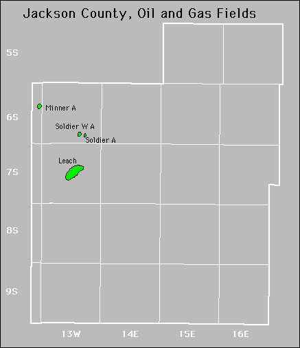
| Forest City Coal Gas Area Leach |
Minner Soldier West |
||
Abandoned