| Year | Oil | Gas | ||||
|---|---|---|---|---|---|---|
| Production (bbls) |
Wells | Cumulative (bbls) |
Production (mcf) |
Wells | Cumulative (mcf) |
|
| 1995 | 1,594 | 1 | 62,658 | - | - | 0 |
| 1996 | 2,063 | 4 | 64,721 | - | - | 0 |
| 1997 | 2,034 | 4 | 66,755 | - | - | 0 |
| 1998 | 1,265 | 1 | 68,020 | - | - | 0 |
| 1999 | 1,423 | 1 | 69,443 | - | - | 0 |
| 2000 | 1,376 | 2 | 70,819 | - | - | 0 |
| 2001 | 664 | 1 | 71,483 | - | - | 0 |
| 2002 | 1,550 | 1 | 73,033 | - | - | 0 |
| 2003 | 1,322 | 1 | 74,355 | - | - | 0 |
| 2004 | 1,322 | 1 | 75,677 | - | - | 0 |
| 2005 | 3,795 | 1 | 79,472 | - | - | 0 |
| 2006 | 13,141 | 1 | 92,613 | - | - | 0 |
| 2007 | 10,633 | 1 | 103,246 | - | - | 0 |
| 2008 | 7,408 | 2 | 110,654 | - | - | 0 |
| 2009 | 5,082 | 10 | 115,736 | - | - | 0 |
| 2010 | 4,033 | 10 | 119,769 | - | - | 0 |
| 2011 | 3,638 | 10 | 123,407 | - | - | 0 |
| 2012 | 3,050 | 9 | 126,457 | - | - | 0 |
| 2013 | 2,737 | 8 | 129,194 | - | - | 0 |
| 2014 | 2,066 | 8 | 131,260 | - | - | 0 |
| 2015 | 13,380 | 9 | 144,640 | - | - | 0 |
| 2016 | 11,060 | 9 | 155,700 | - | - | 0 |
| 2017 | 9,405 | 9 | 165,105 | - | - | 0 |
| 2018 | 8,255 | 9 | 173,360 | - | - | 0 |
| 2019 | 7,548 | 9 | 180,908 | - | - | 0 |
| 2020 | 6,415 | 9 | 187,323 | - | - | 0 |
| 2021 | 5,302 | 1 | 192,625 | - | - | 0 |
| 2022 | 5,080 | 9 | 197,705 | - | - | 0 |
| 2023 | 4,629 | 7 | 202,334 | - | - | 0 |
| 2024 | 3,837 | 3 | 206,171 | - | - | 0 |
| 2025 | 3,362 | 1 | 209,533 | - | - | 0 |
| 2026 | 809 | 1 | 210,342 | - | - | 0 |
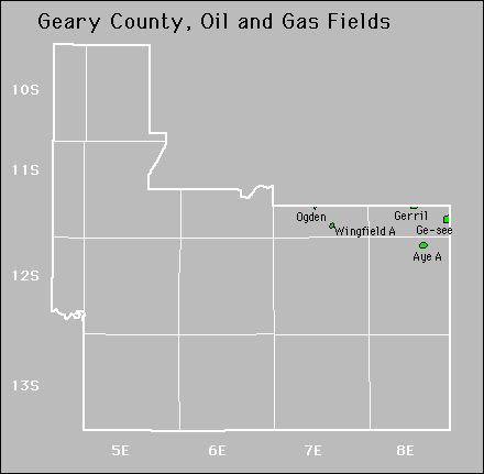

| Active | |||
|---|---|---|---|
| Aye Ge-See |
Gerril Mcdowell |
||
Abandoned