News Release, Kansas Geological Survey, November 1, 2022
LAWRENCE—A new geologic map of Miami County published by the Kansas Geological Survey received an Excellence in Cartography award at the world's largest conference dedicated to geographic information system (GIS) technology.
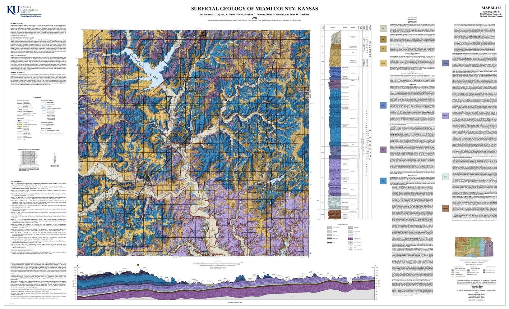
A panel of judges from two mapping organizations - the International Cartographic Association (ICA) and the International Map Industry Association (IMIA) - selected "Surficial Geology of Miami County, Kansas" as one of two recipient of the Excellence in Cartography award at the 2022 Esri International User Conference. The winners were chosen from more than 600 maps displayed in the conference's map gallery.
In addition, the map has been selected to appear in Esri Map Book, Volume 38, to be released in July at the 2023 Esri International User Conference.
KGS Cartographic Services Manager John Dunham performed the computer compilation, editing, and cartographic work on the Miami County map. Former KGS student employees Emily Bunse, Sarah F. Child, Hillary C. Crabb, Dustin A. Fross, Atefeh Hosseini, Richard B. Jarvis, and Charity M. Phillips-Lander assisted in digital data compilation and map layout. KGS geologists Anthony L. Layzell, K. David Newell, Stephan C. Oborny, and Rolfe D. Mandel mapped the geology.
GIS is a system in which all types of geographic information is collected, interpreted, managed and displayed using specialized computer software. GIS data is used regularly in cartography, or map making. For example, the Miami County map displays newly acquired geologic data as well as data from several other sources, including surface elevations, contour lines, and the location and dimension of creeks, lakes, towns, roads, airports, and quarries. It represents the first detailed geologic mapping of the area since 1966.
About 15,000 professionals from various industries attended the Esri International User Conference in July in San Diego sponsored by Esri (Environmental Systems Research Institute), a private company that produces GIS software and GIS-related web applications and data.
The Kansas Geological Survey is a non-regulatory research and service division of the University of Kansas. KGS researchers study and provide information about the state's geologic resources and hazards, including groundwater, oil and natural gas, rocks and minerals, and earthquakes
"Surficial Geology of Miami County, Kansas" is available online.
For more information, contact John Dunham, jdunham@ku.edu, (785) 864-2148.
Story by Julie Tollefson.
Kansas Geological Survey, Public Outreach
URL: