News Release, Kansas Geological Survey, April 8, 2020
LAWRENCE —As part of a national effort to reduce the release of carbon dioxide into the air, the Kansas Geological Survey has joined forces with private and public partners to help determine whether carbon dioxide (CO2) from industrial sources can be safely and economically injected underground for long-term storage and to produce hard-to-reach oil.
Pore space in subsurface rock units has been used for more than a century to dispose of waste fluids produced through industrial processes, petroleum production, municipal water treatment, and other operations. Now CO2 disposal is being considered as a commercially viable way to combat climate change.
The joint-effort, known as the Integrated Midcontinent Stacked Carbon Storage Hub (IMSCS-HUB), is the second phase in the U.S. Department of Energy's multi-phase CarbonSAFE program. Its objective is to investigate the subsurface geology at sites in southwest Kansas and southwest Nebraska to verify the viability of injecting CO2 into underground rock layers.
"Our main goals during this phase are to provide all necessary background work such as geological and engineering characterization of the storage site, capture-facility design, infrastructure design, and injection permitting," said Eugene Holubnyak, petroleum engineer and the project's lead investigator at the Kansas Geological Survey (KGS).
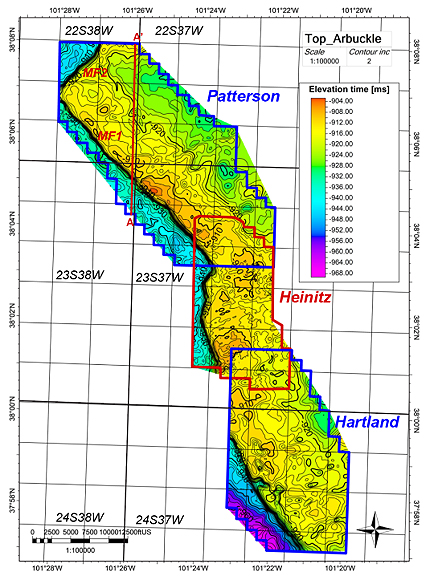
The IMSCS-HUB project tasks include drilling two wells in Kearny County, Kansas, and one in Red Willow County, Nebraska, conducting a seismic survey, and analyzing acquired data. Among its contributions, the KGS will provide geologic modeling and characterization, petroleum engineering, 3D seismic interpretation, and outreach.
Battelle, the scientific research and technology company leading the IMSCS-HUB project, has already completed seismic work at the Kearny County site. A non-invasive seismic reflection survey is carried out by creating a vibration with explosives or specially equipped vehicles. The resulting seismic (sound) waves, which rebound off different subsurface rocks and structures in unique ways, are recorded at the surface and used to produce images of rock layers, voids, faults, and other geologic structures.
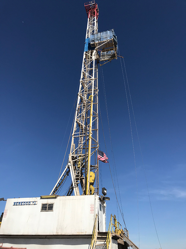
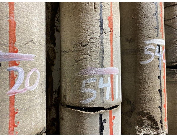
An affiliate of Berexco, a Wichita-based exploration and production company, is currently drilling the first Kearny County well to approximately 6,600 feet in depth. About 800 feet of that will be cored at key geologic intervals, including the oil-bearing rock layers. Cores are cylindrical segments, about two to four inches in diameter, that are brought up intact. Although coring is more expensive than rotary drilling, which chops the rock into small pieces, cores provide a more complete picture of the subsurface environment than chopped rock.
The cores, drilling records, and 3D seismic data will be made available to the public once the project is complete. Besides being essential for Carbon Capture, Utilization and Storage (CCUS) projects, the results will be a valuable resource for conventional oil and gas exploration, geologic research, and other activities.
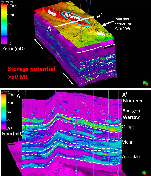
"Extensive 3D seismic datasets, such as the one acquired at the Kearny County site, are expensive and not often available to the public," Holubnyak said. "This dataset will provide insight on the architecture of structures in the subsurface throughout the region, where there are many similar structures. We hope that by analyzing this data we will better understand the Ordovician-age Arbuckle and Precambrian basement interface and other geologic formations in Kansas."
The Arbuckle Group is a porous rock formation that contains extremely saline water in western Kansas, where it is separated from shallower, freshwater aquifers by thousands of feet of impermeable rock. The formation is the key target for CO2 storage, and data gathered during the IMSCS-HUB investigation will help determine whether it can safely contain CO2 for the long term. The Precambrian basement, composed of igneous and metamorphic rock, directly underlies the Arbuckle in Kansas.
"Data on the Precambrian/Arbuckle interface is sparse, but it is essential for both fundamental science and applications such as CCUS," Holubnyak said.
In the past 10 years, the KGS's Energy Research Section has led or played a key role in five large-scale CCUS projects funded by the U.S. Department of Energy. KGS-led ICKan (Integrated Carbon Capture and Storage for Kansas) was one of three Phase I projects in DOE's CarbonSAFE program. In that phase, KGS was tasked with developing a plan to address the challenges and opportunities for commercial-scale CCUS in Kansas.
Interest in capturing and storing carbon emissions was regenerated in 2018 when the Internal Revenue Service updated a tax incentive, known as 45Q, for companies willing to capture and store CO2. Oil and gas production, ethanol, electrical-power generation, pipeline, agriculture, and other industries are eligible.
Besides the KGS, Battelle, and Berexco, other partners in the IMSCS-HUB project include the University of Kansas Department of Geology; the Conservation and Survey Division, School of Natural Resources at the University of Nebraska, Lincoln; the University of Missouri Department of Geology, the Energy and Environmental Research Center at the University of North Dakota; Great Plains Energy, LLC; and the Nebraska Public Power District.
More information can be found about the project on the KGS's IMSCS-HUB page.
The Kansas Geological Survey is a non-regulatory research and service division of the University of Kansas. KGS researchers study and provide information on the state's geologic resources and hazards, including groundwater, oil and natural gas, rocks and minerals, and earthquakes.
Contact: Cathy Evans, (785) 864-2195.