![]()
Prev Page--Stratigraphy--Pennsylvanian || Next Page--Mineral Resources--Subsurface
Part 2--Mineral Resources of Lyon County
By Howard G. O'Connor, Edwin D. Goebel, and Norman Plummer
Introduction
The known mineral resources of Lyon County comprise oil, coal, limestone, shale, gravel, sand, silt and clay, and volcanic ash. Ground water, also an important mineral resource, is discussed separately in Part 3 of this report. Limestone, gravel, sand, and coal have been exploited for local use for many years, but extensive reserves remain. Oil has been produced since 1922 but much of the county remains inadequately explored for petroleum. Volcanic ash was mined in what is now the City of Emponia for several years beginning about 1910. Clay resources have been utilized to a very small extent or not at all.
Plate 2 is an economic geologic map of Lyon County. Locations of active and inactive pits, quarries, and mines, names of exploited stratigraphic units, and test data on several of the limestones, shales, and clays are shown on the map. Locations of all wells that have been drilled for oil or gas for which any information is available also are indicated. The map shows the lowest stratigraphic depth reached and present status of all wells. Areas of oil fields, location of roads, railroads, streams, oil and gas pipe lines, pumping stations, and benchmarks are indicated.
Economic Geology of Outcrops
Properties and the sequence of outcrops are discussed in Part 1 of this report. Their distribution is shown on Plate 1.
Limestone
Many of the limestones occurring in the exposed portion of the geologic column are of economic importance because of their physical or chemical properties. Included as the more common uses for which these rocks are suitable are concrete and other aggregate, crushed rock for road metal and other uses, agricultural limestone, riprap, subgrade and embankment material, and building stone. Some of the limestones, because of chemical composition, may be suited to more specialized uses. Chemical analyses of rock samples from the more important ledges are listed in Table 1. Location of all active and inactive limestone quarries together with the stratigraphic unit represented is shown on Plate 2.
Agricultural Limestone
Limestone having a calcium carbonate equivalent of 80 percent or more occurring in ledges sufficiently thick to allow economical quarrying is regarded as potential material for agricultural limestone. Physical requirements for agricultural limestone largely are dependent on processing and are not considered here.
Of 22 samples of limestone collected for chemical analysis, 20 met minimum requirements for calcium carbonate equivalent (Table 1). Limestones which are of proved or potential value as material for agricultural limestone include the Funston, Crouse, Morrill, Cottonwood, Neva, Howe, limestone parts of the Bennett shale, Long Creek, Five Point, Aspinwall, Grandhaven, Reading, Wakarusa, Burlingame, limestone conglomerate phases of the Silver Lake shale, Curzon, Hartford, and possibly others.
Table 1--Chemical analyses of selected outcropping limestones from Lyon County.
| Stratigraphic unit, thickness, and type of sample | Location | SiO2 | Al2O3* | Fe2O3 | CaO | MgO | P2O5 | SO3 | Ignition loss | Calculated CaCO3** | Calculated MgCO3 |
|---|---|---|---|---|---|---|---|---|---|---|---|
| Howe ls., composite of lower 4.0 ft of 4.4-ft bed | SE NE 34-15-11E | 5.4 | 0.74 | 0.27 | 51.97 | 0.73 | 0.01 | 0.07 | 41.33 | 92.55 | 1.53 |
| Upper Crouse ls., composite of upper 5.6 ft | NE NW 15-16-10E | 14.09 | 2.76 | 1.03 | 43.71 | 1.01 | 0.05 | 0.06 | 36.47 | 77.76 | 2.11 |
| Upper Crouse ls., composite of lower 2.9 ft of bed | NE NW 15-16-10E | 3.61 | 0.98 | 1.12 | 51.78 | 0.74 | 0.03 | 0.09 | 41.25 | 92.83 | 1.55 |
| Funston ls., composite of lower 5.6 ft of upper bed | NW NE 18-16-10E | 7.9 | 1.49 | 0.7 | 49.11 | -- | 0.04 | 0.15 | 39.24 | 87.3 | 1.72 |
| Funston ls., composite of 2.0 ft, entire middle detrital bed | NW NE 18-16-10E | 4.99 | 1.25 | 1.01 | 50.72 | 0.79 | 0.06 | 0.02 | 40.46 | 90.26 | 1.65 |
| Morrill ls., composite of entire bed, 2.4 ft | SW NE 17-16-11E | 5.65 | 0.37 | 0.42 | 51.93 | 0.82 | 0.05 | 0.08 | 41.14 | 92.37 | 1.72 |
| Cottonwood ls., composite of upper 5.3 ft of member | SE NW 17-16-11E | 9.7 | 0.97 | 0.51 | 48.3 | 0.73 | 0.12 | 0.39 | 38.7 | 85.34 | 1.53 |
| Upper Neva ls., composite of entire 1.7 ft bed | NW SW 20-16-11E | 4.18 | 0.62 | 0.46 | 52.25 | 0.64 | 0.03 | 0.03 | 41.42 | 93.06 | 1.34 |
| Middle Neva ls., composite of entire 5.7 ft middle bed | NW SW 20-16-11E | 3.92 | 0.93 | 0.53 | 52.07 | 0.77 | 0.05 | 0.02 | 41.53 | 92.76 | 1.61 |
| Brownville ls., composite of entire 3.0 ft bed | NW NW 21-16-12E | 6.19 | 1.38 | 1.83 | 47.65 | 2.09 | 0.29 | 0.69 | 39.19 | 83.52 | 4.37 |
| Dover ls., composite of entire bed, 1.5 ft | NW SW 25-16-12E | 36.62 | 5.67 | 1.86 | 29.39 | 0.92 | 0.13 | nil | 23.84 | 52.41 | 1.92 |
| Reading ls., entire bed, 2.8 ft | SE SE 12-17-12E | 6.53 | 1.43 | 1.38 | 49.45 | 0.93 | 0.09 | 0.47 | 39.48 | 87.39 | 1.95 |
| Grandhaven ls., composite of entire lower bed, 2.6 ft | SW SW 15-17-12E | 9.56 | 2.93 | 3.08 | 44.36 | 2.04 | 0.15 | 0.01 | 37.41 | 78.82 | 4.27 |
| Upper Grandhaven ls., composite entire bed, 2.6 ft | NE NE 21-17-12E | 3.55 | 0.98 | 1.23 | 52.19 | 0.81 | 0.04 | 0.19 | 41.63 | 92.74 | 1.69 |
| Cottonwood ls., composite of upper 4.7 ft of member | SW NW 7-18-10E | 5.97 | 1.09 | 0.37 | 51.22 | 0.65 | 0.08 | 0.12 | 40.65 | 91.16 | 1.36 |
| Aspinwall ls., composite of upper 4.6 ft of bed | NE SW 16-18-11E | 1.99 | 0.61 | 1.24 | 53.12 | 0.62 | 0.06 | 0.04 | 42.17 | 94.58 | 1.3 |
| Upper Grandhaven ls., composite of upper 7.5 ft of bed | SE SW 29-19-11E | 4.22 | 1.49 | 2.12 | 51.6 | 0.79 | 0.07 | nil | 40.54 | 92.01 | 1.65 |
| Wakarusa ls., composite of 3 ledges, 4.3 ft | SW SE 9-19-12E | 5.32 | 1.6 | 3.24 | 45.26 | 3.94 | 0.08 | 0.16 | 40.22 | 80.33 | 8.24 |
| Silver Lake sh.? (ls. conglomerate filling channel cut down into White Cloud sh., composite ±20 ft | NE NE 30-19-13E | 6.06 | 1.54 | 2.79 | 47.76 | 2.02 | 0.19 | 0.2 | 39.56 | 84.52 | 4.23 |
| Americus ls., composite of entire lower bed, 1.8 ft. | SW SE 4-20-10E | 4.25 | 0.75 | 0.72 | 51.63 | 0.73 | 0.39 | 0.14 | 40.68 | 91.08 | 1.52 |
| Reading ls., composite of entire bed, 2.75 ft. | SW SE 33-21-11E | 4.44 | 1.56 | 3.44 | 47.55 | 2.74 | 0.1 | 0.13 | 40.53 | 84.79 | 5.73 |
| Reading ls., composite of upper "super" ls., entire bed, 5.0 ft | SW SE 33-21-11E | 4.75 | 0.73 | 0.99 | 51.75 | 0.7 | 0.11 | 0.08 | 40.67 | 91.94 | 1.46 |
| *Includes MnO and TiO2 **Not corrected for small percentages of calcium in phosphates and sulfates |
|||||||||||
Building Stone
Many of the limestone ledges in Lyon County have been used as sources of building stone but greatest use has been made of the Funston, Crouse, Cottonwood, Neva, Americus, Brownville, and Reading limestones. Other limestones have been used locally for farm buildings and small engineering works such as small bridge foundations and abutments. Factors considered for suitability as building stone include durability, color on weathering, thickness of ledges and individual beds, and spacing of joints. Not considered are such factors as markets and other economic considerations.
Crouse limestone--Parts of the Crouse limestone have been quarried and used for trimmed structural stone for some of the older school houses, farm buildings, and bridge foundations in Lyon and adjacent counties. Although it is durable and easy to cut and handle, its weathered color is not as pleasing as Cottonwood or Fort Riley limestone and it has never attained much popularity.
Cottonwood limestone--The Cottonwood limestone has bong been regarded as an important building stone in Kansas. It is massive, durable, even textured, light gray to nearly white in color, and can be quarried in large blocks. It has been quarried for building stone at three localities in Lyon County and several large commercial quarries were formerly active in adjacent Chase County.
Howe limestone--The Howe limestone, although used to little or no extent in the past, seems to have physical properties that would make it a very desirable building stone. It is a spergenite similar in color, texture, and appearance to the Salem ("Bedford") limestone of Indiana, one of the most widely used building stones in the United States. It is finer textured than the Cottonwood limestone but not as fine as the "Bedford" limestone. Its light gray-white color, durability on the outcrop, and occurrence in usable beds 4 feet or more in thickness, locally, without shale partings or chert nodules, suggest that it would make a durable and attractive building stone.
Americus limestone--Both the lower and upper ledges of the Americus limestone have been quarried and used extensively in eastern Kansas, chiefly for farm buildings, bridge foundations and abutments and for sidewalk construction. The rock is durable and has no tendency to become slabby after long exposure. It can be quarried in large blocks 1 to 2 feet thick. Its gray color is too dark to make it appealing as a building stone for residential or business building uses.
Crushed Rock and Riprap
Nearly all the thicker limestone ledges in Lyon County are potential sources of rock for crushing and riprap material. No recommendations of individual ledges for aggregate or riprap material are made because of the many current sets of specifications for aggregate for specialized uses and because no physical tests on any of the limestones were made.
Limestones known to have been used as sources of crushed rock for concrete aggregate include Cottonwood, Grandhaven, Wakarusa, and Burlingame limestones and possibly others. Those used as sources of crushed rock for road metal and other purposes include Funston, Crouse, Cottonwood, Neva, Aspinwall, Brownville, Grandhaven, Reading, Wakarusa, Burlingame, and Utopia limestones.
Not utilized as yet but believed suitable for crushing include the thick biohermal limestone in the Bennett shale which is more than 20 feet thick locally, and the limestone conglomerate which occurs in the basal deposits of Silver Lake shale in the Neosho Rapids area, also more than 20 feet thick locally.
Limestones used for riprap include nearly half the named limestones cropping out in the county. Most projects requiring riprap for road, bridge, or railroad fill and embankment protection have utilized the nearest local limestone that occurred in suitable quantities and had the necessary physical requirements. An example is the use of Maple Hill limestone as riprap for the dam impounding Lake Wilhite in Lyon County State Park.
Ceramic Materials
Clay for Structural Products
Several samples of clay and shale obtained in Lyon County were tested in the ceramics laboratory of the State Geological Survey (P1. 2, Table 2). These samples included shales of Pennsylvanian and Permian age and alluvial materials of Pleistocene age. Since these materials are mostly red-firing, their range of usefulness is confined largely to structural products such as brick and tile and to lightweight aggregate.
Table 2--Ceramic data on clay and shale samples from Lyon County.
| Plastic and Dry Properties | |||||||||
|---|---|---|---|---|---|---|---|---|---|
| Sample No. |
Location | Stratigraphic Position |
Thickness Sampled, feet |
Water of Plasticity, percent |
Shrinkage water, percent |
Pore Water, percent |
Volume Shrinkage, percent |
Measured Linear Shrinkage, percent |
Calculated Linear Shrinkage, percent |
| Pennsylvanian | |||||||||
| LY-9 | NW 18-19-13E | Silver Lake shale | 18 | 20.62 | 4.33 | 16.29 | 8.03 | 3.41 | 2.6 |
| LY-1 | SW 2-20-11E | Willard-Langdon shale | 30 | 27.38 | 12.77 | 14.61 | 23.94 | 5.53 | 7.4 |
| LY-2 | NW 19-16-13E | Langdon shale | 11 | 23.57 | 6.02 | 17.55 | 10.6 | 2.83 | 3.42 |
| LY-3 | SE 32-19-11E | Langdon shale | 12.5 | 24.88 | 9.56 | 15.32 | 17.56 | 4.87 | 5.55 |
| LY-4 | SW 35-17-12E | Langdon shale | 11 | 26.02 | 8.23 | 17.79 | 14.64 | 4.13 | 4.65 |
| LY-5 | NW 22-18-12E | Pierson Point shale | 20 | 27.06 | 13.05 | 14.01 | 24.88 | 6.16 | 7.69 |
| LY-6 | SE 34-21-10E | French Creek shale | 14.5 | 28.26 | 10.93 | 17.33 | 19.68 | 4.75 | 6.18 |
| Permian | |||||||||
| LY-8 | SE 13-16-10E | Speiser shale | 8.4 | 24.15 | 11.36 | 12.79 | 22.4 | 6.44 | 6.97 |
| LY-7 | SW 26-15-11E | Roca shale | 6.8 | 21.63 | 9.78 | 11.85 | 18.59 | 5.37 | 5.94 |
| Pleistocene | |||||||||
| LY-11 | SW 16-19-11E | Emporia terrace | 7 | 29.94 | 18.56 | 10.38 | 36.31 | 11.94 | 10.87 |
| Pleistocene--Recent and Wisconsianan | |||||||||
| LY-10 | SE 14-19-12E | Neosho River alluvium | 11.8 | 28.86 | 19.09 | 9.77 | 38.29 | 11.16 | 11.41 |
| LY-12 | NW 22-19-10E | Cottonwood River alluvium | 9.8 | 25.47 | 14.85 | 10.62 | 29.33 | 8.48 | 8.94 |
| Fired Properties | ||||||||||
|---|---|---|---|---|---|---|---|---|---|---|
| Sample> No. |
Ignition loss, percent |
Firing Range, cones |
Fired to Cone |
Color | Measured Linear Shrinkage, percent |
Total Linear Shrinkage, percent |
Percent Absorption | Saturation Coefficient |
Hardness, as to Steel |
|
| 24 hrs. Cold Water |
3 hrs. Boiling Water |
|||||||||
| LY-9 | 6.37 | 03-2 | 5 | red | 2.66 | 6.07 | 11.18 | 13.8 | 0.81 | harder |
| 2 | red | 3.84 | 7.25 | 8.06 | 11.19 | 0.72 | harder | |||
| 2 | red | 7.41 | 10.82 | 0.91 | 1.62 | 0.56 | harder | |||
| LY-1 | 5.63 | 07-01 | 6 | red | 5.06 | 10.59 | 6.39 | 6.94 | 0.93 | harder |
| 4 | red | 6.03 | 11.56 | 4.86 | 5.46 | 0.89 | harder | |||
| 1 | red | 7.68 | 13.21 | 1.02 | 1.91 | 0.53 | harder | |||
| LY-2 | 4.78 | 03-1 | 6 | light red | 0.96 | 3.79 | 17.37 | 19.61 | 0.89 | softer |
| 4 | red | 3.4 | 6.23 | 12.42 | 15.31 | 0.81 | softer | |||
| 1 | red | 7.49 | 10.32 | 3.54 | 5.41 | 0.65 | harder | |||
| LY-3 | 5.82 | 05-01 | 6 | orange red | 3.05 | 7.92 | 11.18 | 12.89 | 0.87 | harder |
| 4 | bright red | 5.16 | 10.03 | 6.58 | 8.88 | 0.74 | harder | |||
| 1 | red | 6.8 | 11.67 | 2.86 | 4.85 | 0.59 | harder | |||
| LY-4 | 5.32 | 05-02 | 6 | light red | 2.72 | 6.85 | 13.63 | 14.78 | 0.92 | softer |
| 4 | red | 7.2 | 11.33 | 5.06 | 5.7 | 0.88 | harder | |||
| LY-5 | 7.22 | 06-04 | 6 | red | 4.04 | 10.2 | 8.17 | 9.04 | 0.9 | harder |
| 4 | red | 6.38 | 12.54 | 2 | 4.15 | 0.48 | harder | |||
| LY-6 | 6.65 | 06-04 | 6 | orange | 4.96 | 9.71 | 9.47 | 9.87 | 0.96 | harder |
| 4 | bright red | 8.67 | 13.42 | 1.5 | 2.45 | 0.61 | harder | |||
| LY-8 | 16.04 | 2 plus | 5 | buff | 2.98 | 9.42 | 15.32 | 17.76 | 0.86 | softer |
| 2 | yellow | 2.85 | 9.29 | 15.65 | 18.42 | 0.85 | as hard | |||
| 2 | green-buff | 3.37 | 9.49 | 12.35 | 15.72 | 0.79 | harder | |||
| LY-7 | 13.96 | 2 plus | 5 | buff | 1.23 | 6.6 | 17.56 | 20.54 | 0.85 | softer |
| 2 | gray-buff | 1.37 | 6.77 | 16.91 | 20.22 | 0.84 | as hard | |||
| 2 | green-buff | 2.61 | 7.93 | 13.04 | 16.64 | 0.78 | harder | |||
| LY-11 | 8.78 | 04-2 | 5 | orange red | 1.41 | 13.35 | 9.38 | 12.66 | 0.74 | harder |
| 2 | red | 2.36 | 14.3 | 8.02 | 11.09 | 0.72 | harder | |||
| 2 | red | 6.29 | 18.75 | 2.3 | 5.65 | 0.41 | harder | |||
| LY-10 | 6.09 | 07-02 | 5 | orange red | 4.23 | 15.39 | 4.14 | 4.67 | 0.89 | harder |
| 2 | red | 5.63 | 16.79 | 1.57 | 2.33 | 0.67 | harder | |||
| LY-12 | 4.37 | 05-2 | 5 | orange red | 1.97 | 10.45 | 8.59 | 11.26 | 0.76 | harder |
| 2 | red | 3.13 | 11.65 | 6.58 | 8.97 | 0.73 | harder | |||
| 2 | red | 5.99 | 14.41 | 1.34 | 2.13 | 0.63 | harder | |||
Shales of Pennsylvanian age are exposed at the surface over a proportionately large area in Lyon County. The shales occur in thick beds that could be mined economically by surface methods, and compare favorably with the lower Pennsylvanian shales that are used extensively for the manufacture of brick, building tile, roofing tile, sewer pipe, and lightweight aggregate in southeastern Kansas.
The Pennsylvanian shales are easily formed into the desired shapes by the almost universally employed extrusion method. Usually the more clayey shales have to be extruded with care in the choice of die shapes in order to avoid a laminated product. Drying shrinkages are low to moderate, and warpage is usually not a problem in drying. These shales fire to shades of red varying with both the formation and the temperature of firing. Light or orange reds are obtained at low temperatures and dark reds are obtained at higher temperatures, close to vitrification. Most of the shales can be fired to vitrification, that is, they can be fired to a temperature high enough to reduce the absorption to less than 3 percent. Such shales and clays are suitable for use in the manufacture of sewer pipe and vitrified bricks.
Despite the similarity of the Pennsylvanian shales tested, significant differences in ceramic data can be noted in Table 2. In general, those showing the least change in absorption and shrinkage over a given temperature range are the most suitable for use. The saturation coefficient, also shown in Table 2, is the ratio of cold water absorption to the absorption obtained by immersion in boiling water. Fired clay products having a saturation coefficient below 0.80 are generally resistant to severe weathering conditions such as freezing and thawing.
The two Permian shales for which ceramic data are given in Table 2 fire to buff or greenish-buff colors. This fired color is due primarily to the influence of calcium carbonate which is present in amounts sufficient to mask, or neutralize, the red color normally caused by iron oxide. Although the buff color is desirable, the calcium carbonate produces a ceramic material with a short firing range. Furthermore, a product made from such shales must be fired to a temperature high enough to take the calcium into permanent combination with other ingredients. If fired below this temperature, the fired product will disintegrate due to the hydration of quick lime produced during the firing process. The Speiser and Roca shales for which data are given, are steel hard at cone 2 (about 2100° F.) and seemingly are sound at this temperature. Absorptions are rather high, however, and the materials would probably be improved by firing to a slightly higher temperature.
The alluvial clays, or clayey silts, produce a finished ceramic product very similar to those made from Pennsylvanian shales. The raw material differs markedly in appearance, however, and the forming, drying, and firing behavior differ more than the data in Table 2 indicate. These materials contain a relatively large proportion of nonplastic materials and are therefore somewhat harsh in contrast to the outstanding smoothness of the Pennsylvanian shales. Ordinarily clayey materials containing a large proportion of nonplastic silt have a low drying shrinkage, and show no tendency to warp. The materials tested, however, warped slightly, and had a rather high drying shrinkage. If used for structural clay products, these materials should be altered slightly either by the addition of sand, or by low-temperature roasting of the raw material.
The fired colors of the alluvial materials are good clear reds. The fired products should have an unusually good resistance to freezing and thawing, and other agencies of weathering.
Lightweight Aggregates
Six samples of Pennsylvanian shale were tested in the State Geological Survey ceramics laboratory for their bloating characteristics by the rotary kiln method. The results of these tests were reported in a previous publication (Plummer and Hladik, 1951), and data on the six samples are reported in Table 3.
Table 3--Results of experimental production of lightweight aggregate from Lyon County Pennsylvanian shales.
| Sample No. |
Thickness Sampled, feet |
Thickness Available, feet |
Firing Temperatures, degrees F | Unit Weight, lbs per cu ft | Color of Crushed Aggregate |
|||
|---|---|---|---|---|---|---|---|---|
| Initial Softening |
Optimum for Bloating |
Maximum Attained |
Crushed, unsized |
Crushed, sized |
||||
| LY-1 | 15 | 30 | 2190 | 2220 | 2280 | 46.1 | 52.2 | gray |
| LY-2 | 11 | 18 | 2140 | 2170 | 2240 | 48.7 | 55.1 | gray |
| LY-3 | 12.5 | 25 | 2130 | 2140 | 2170 | 62 | 71.9 | pink and gray |
| LY-4 | 11 | 11 | 2080 | 2120 | 2180 | 38.8 | 40.4 | red and gray |
| LY-5 | 20 | 20 | 2200 | 2230 | 2250 | 61.5 | 76.6 | dark gray |
| LY-6 | 14.5 | 22 | 2160 | 2175 | 2200 | 64.7 | 72.3 | dark gray |
The unit weight of bloated shale lightweight aggregate should range from 40 to 55 pounds per cubic foot. Unit weights on crushed but unsized aggregate from three Lyon County localities, LY-1, LY-2, and LY-4, were less than 51 pounds per cubic foot. Unit weights on the other three were less than 65 pounds per cubic foot. These three, LY-3, LY-5, and LY-6. were sampled from oxidized exposures of the shale. Under commercial production conditions, such shales usually bloat satisfactorily, even when oxidized, but there is little doubt that unoxidized samples of the same shale would bloat sufficiently even under laboratory conditions of testing.
The quality of lightweight aggregate produced from Pennsylvanian shales is high. In general, they combine light weight with high strength.
Although data on the bloating characteristics of the Lyon County alluvial clays or clayey silts were not obtained in the laboratory, similar materials were tested (Plummer and Hladik, 1951). Since these materials are friable, it is necessary to form them into pellets before firing in a rotary kiln. In most cases a rather dense aggregate is formed at temperatures ranging from 2250 to 2400° F. The addition of 2 percent powdered coal or a mixture of powdered gypsum and powdered coal during the pelletizing process usually results in the production of a high-grade lightweight aggregate. A sample from the Emporia terrace, taken in the SW sec. 11, T. 19 S., R. 11 E., was fired in a rotary kiln at 2470° F. in the experimental production of a material suitable for heavy aggregate or railroad ballast (Plummer and Hladik, 1948). An excellent high density aggregate was produced. The addition of a small percentage of powdered coal or other combustible material would make possible the production of a lightweight aggregate at about 2300° F.
These alluvial clays and clayey silts are well adapted to production of lightweight aggregate by the sintering process. In this process the raw material is mixed with 5 to 15 percent powdered coal or coke, pelletized, and sintered on a moving grate-type machine. Pennsylvanian shales can also be made into lightweight aggregate by the sintering method.
Gravel and Sand
Large deposits of gravel and sand composed chiefly of chert occur in the terraces (Pl. 4G) along Cottonwood, Neosho, Marais des Cygnes, and Verdigris rivers and some of their tributary streams (P1. 2). These gravel deposits have been used as a source of road metal for county and township roads for many years but extensive reserves remain. To some extent washed gravel from these deposits has also been used as an aggregate for concrete. The Bechtold pits (Pl. 4D) in sec. 9, T. 19 S., R. 10 E., are the only presently active pits having washing and screening equipment mining terrace sand and gravel.
Plate 4D--Small gravel pit in Emporia terrace on Bechtold farm, NW NW sec. 9, T. 19 S., R. 10 E., from which vertebrate remains have been recovered.
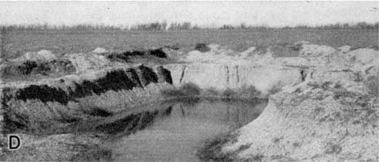
Plate 4G--Soil development on high terrace chert gravel, SW sec. 1, T. 19 S., R. 10 E.

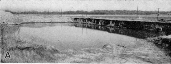
Accumulations of sand and gravel, chiefly chert and quartz but including limestone also, in the alluvium of Cottonwood River and of Neosho River below its junction with Cottonwood River, are extensive and barge. Wesley Parks operates a barge pit (Pl. 4A) in sec. 6, T. 20 S., R. 13 E. with hydraulic mining equipment. The washed and sized sand and gravel are used chiefly as road metal for county, township, and bituminous mat roads. One other pit using alluvium of Cottonwood River is operated in sec. 20, T. 19 S., R. 11 E.
Plate 4A--Gravel pit in Neosho River alluvium, NE SE sec. 6, T. 20 S., R. 13 E. Pond surface is water table.
Alluvial deposits of sand and gravel in Marais des Cygnes and Verdigris River valleys are similar to those of Cottonwood River valley except for a smaller percentage of quartz grains.
Large deposits of very fine to medium quartz sand and friable sandstone occur in several of the shale formations that crop out. Mica, together with varying amounts of clay minerals, generally is present in the Pennsylvanian and Permian sands and sandstones. In a pit (Pl. 4C) in sec. 5, T. 19 S., R. 12 E., the Pierson Point-Willard shale (sandstone) has been exploited for use as subgrade and embankment material on highway projects in the county.
Volcanic Ash
Volcanic ash (Pearlette) has been mined commercially for use as an abrasive from one pit in Lyon County. Mining operations were carried on for several years commencing about 1910 in the area between Sixth and Seventh Streets just east of Garfield Street (SE SE SW sec. 9, T. 19 S., R. 11 E.) in the City of Emporia. Thickness of the bed at the mine is reported to have been 3 to 4 feet. A thickness of 5 inches of ash was penetrated in a well about one-half mile east of the mine (Carey and others, 1952, p. 51). The ash occurs in the Emporia terrace.
Inasmuch as this area is now a residential section of Emporia the deposit is not accessible for mining. Other deposits may be present in the county; however, no outcrops of volcanic ash were observed nor were any deposits penetrated in the test drilling program of the Geological Survey during the ground-water investigations.
Coal
At least four coals have been mined in Lyon County since Swallow (1866) first recorded the occurrence of coal in the area. Coals mined include the Lorton and Nodaway coals and coals in the Langdon-Pierson Point shale and Auburn shale. At least 18 shaft, drift, and strip mines have been operated which together have produced approximately 18,000 tons of coal. Schoewe (1946) presents detailed data on the history, location of mines, production, and reserves of coal in the Wabaunsee group in Lyon County.
At least 15 separate coal beds have been identified in outcrops (stratigraphic column, Pl. 2). According to Schoewe (1946), there are approximately 5,520,000 tons of proved coal reserves and 303,180,000 tons of potential coal reserves in the Wabaunsee group in Lyon County. Permian coals and some of the Wabaunsee coals were not considered in these estimates.
Prev Page--Stratigraphy--Pennsylvanian || Next Page--Mineral Resources--Subsurface
Kansas Geological Survey, Lyon County Geohydrology
Web version Sept. 2001. Original publication date March 1953.
Comments to webadmin@kgs.ku.edu
The URL for this page is http://www.kgs.ku.edu/General/Geology/Lyon/pt2_mine.html