Kansas Geological Survey, Open-file Report 2008-8
by
Ronald R. West and Robert S. Sawin
KGS Open File Report 2008-8
PR = Photorevised
Copies of the field maps are open-filed at the Kansas Geological Survey, Lawrence, Kansas.
These maps indicate lithostratigraphic units only. No temporal, genetic, or related depositional aspects are meant or implied.
Stratigraphic nomenclature follows:
Zeller, D. E., ed., [1968] 2008, Classification of rocks in Kansas, revised by Kansas Geological Survey Stratigraphic Nomenclature Committee; in, The Stratigraphic Succession in Kansas: Kansas Geological Survey, Bulletin 189, 81 p., chart.
The stratigraphic sequence in this report is restricted to the interval from the Speiser Shale at the base to the Nolans Limestone at the top. Overlying these Permian rocks are Quaternary alluvium and terrace deposits.
Terminology of the left side of the Composite (Generalized) Lithologic Sequence is that of Zeller (1968).
The following lithostratigraphic contacts were mapped in the Morris County quadrangles of this report:
Solid Line = Observed Contact
Dashed Line = Concealed Contact
Explanation--data control points for the Morris County map are identified by the following letter prefixes:
MMW-16 = Matfield (Blue Springs shale, Kinney limestone and Wymore shale) Shale exposed in a road cut and streambank in SE, SE, Sec. 31, T. 14 S., R. 9 E., Morris Co., Kansas. Same as MR-6.
MTB-98 = Barneston (Florence) Limestone and Matfield (Blue Springs shale, Kinney limestone, and Wymore shale) Shale in road cut and along Middle Branch of Munkers Creek in SE, Sec. 31 and SW, Sec. 32, T. 14 S., R. 9 E., Morris Co., Kansas. Same as MR-6.
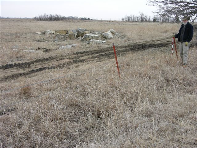
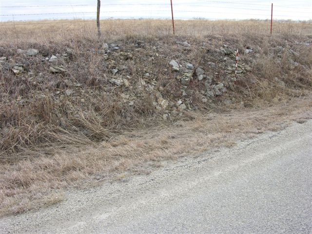
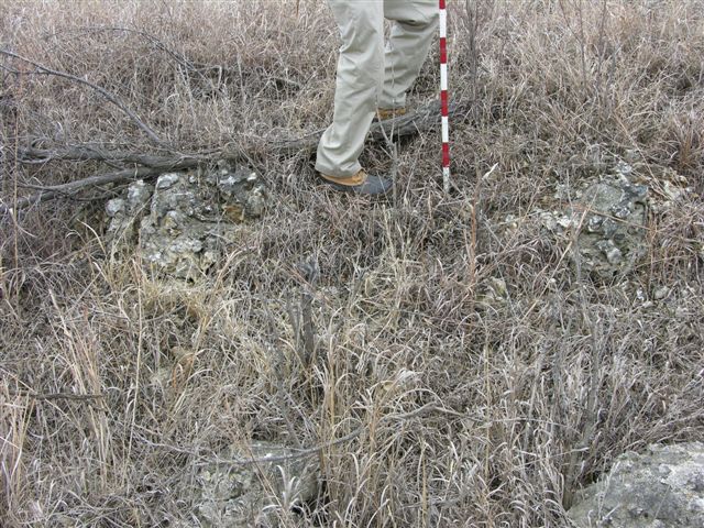
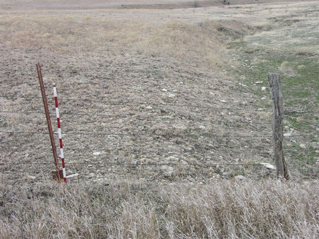
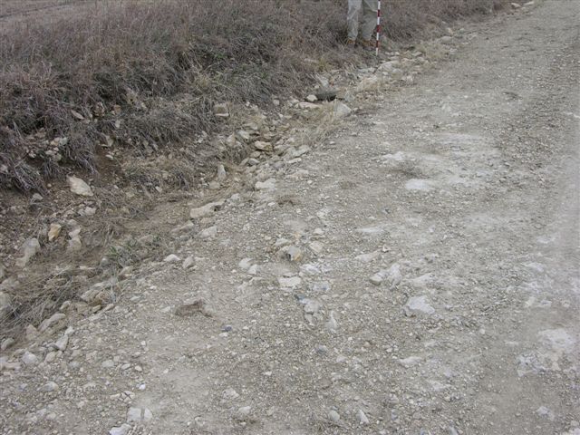
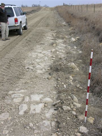
MR-1 = Exposure of Fort Riley "rim rock"? at 1412' in road and on South side of road; 1 digital photo; approx. 100' West of Center North line NE, NW, Sec. 19, T. 14 S., R. 9 E., Morris Co., Kansas.
MR-2 = Base of Barneston (Florence) Limestone at 1365' in South bank of stream on West side of road; 1 digital photo; near Center of East line NE, SE, Sec. 26,T. 14 S., R. 8 E., Morris Co., Kansas.
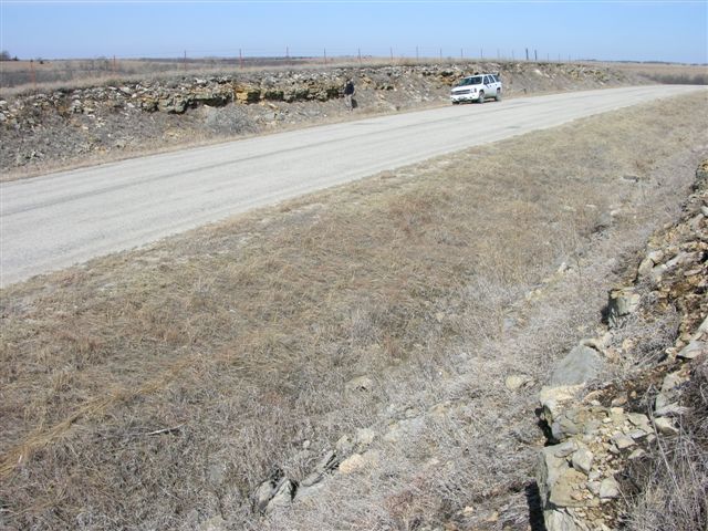
MR-3 = Fort Riley "rim rock" at 1409' in old quarry on East side of road and in the road; 1 digital photo; SW cor. Sec. 25, T. 14 S., R. 8 E., Morris Co., Kansas.
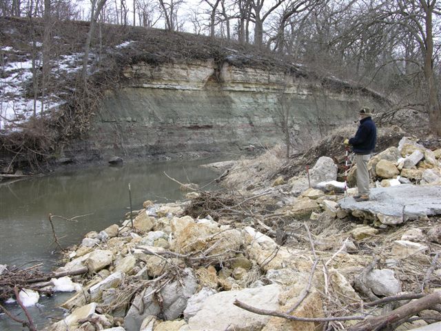
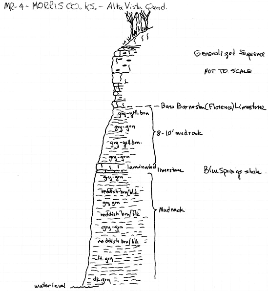
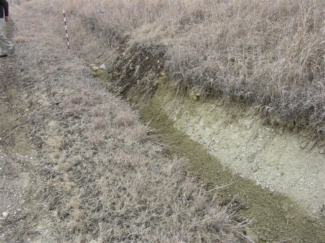
MR-4 = Base of Barneston (Florence) Limestone at 1388' with Blue Springs Shale below in South bank of Middle Branch Creek on the South side of road; 1 digital photo and generalized sketch of exposed sequence; just West of NE cor. Sec. 29, T. 14 S., R. 9 E., Morris Co., Kansas.
MR-5 = Base of Barneston (Florence) Limestone at 1435' in road cut exposures on east side of road with reddish and greenish gray mudrocks in road below Florence; 1 digital photo; Center of East line SE, NE, Sec. 34, T. 14 S., R. 9 E., Morris Co., Kansas.
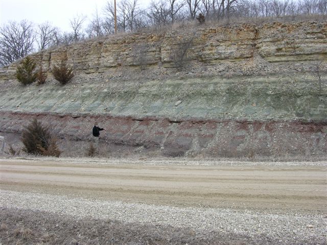
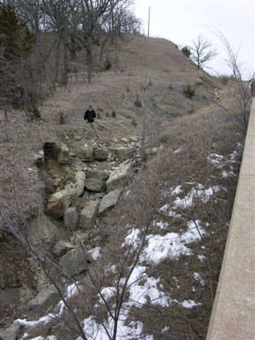
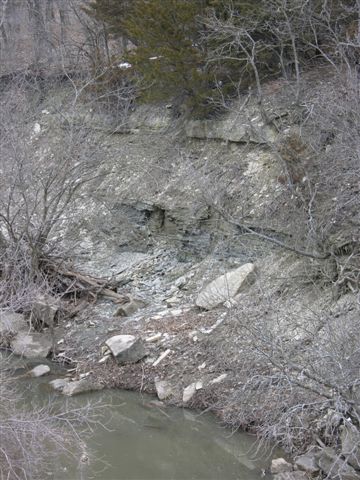
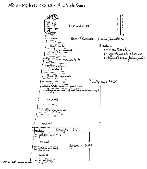
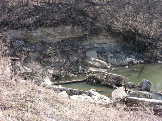
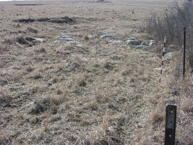
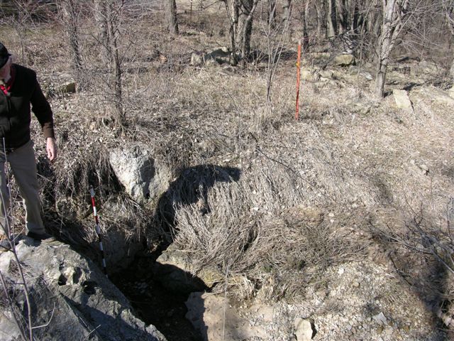
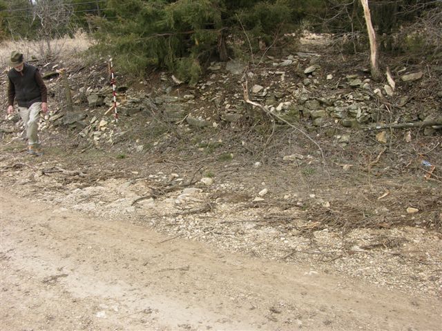
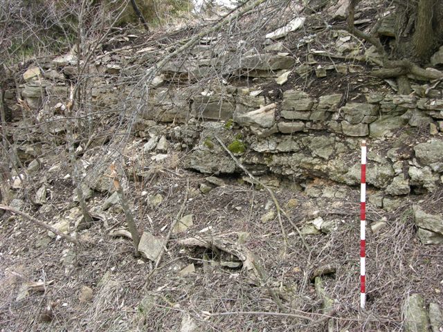
MR-6 = Base of Barneston (Florence) Limestone at 1390' in road cut exposure n North side of road with the Blue Springs Shale, Kinney Limestone at 1345' and Wymore Shale exposed below in ditch draining in the Middle Branch of Munkers Creek; 3 digital photos and generalized sketch of exposed sequence; NE cor. Sec. 6, T. 15 S., R. 9 E., Morris Co., Kansas. NOTE--Same as Same as Mudge, et al., 1958 Sec. 16 and Mazzullo, et al., 1997, Sec. 98.
MR-7 = Exposure of Fort Riley "rim rock" at 1440' on North side of road; 1 digital photo; Center of South line SE, SW, Sec. 35, T. 14 S., R. 8 E., Morris Co., Kansas.
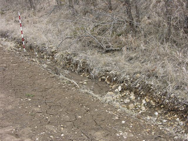
MR-8 = Covered base of Barneston (Florence) Limestone estimated at 1410' in road ditch on West side of road; 1 digital photo; approx. 250' North of Center of East line NE, Sec. 8, T. 15 S., R. 9 E., Morris Co., Kansas.
Explanation--Control points for the Morris County map are identified as follows:
MR-9 = Fort Riley "rim rock" at 1414' in road and fields and road ditches on both sides of road, check for the base of the Barneston (Florence) Limestone in drainage West of road and North of the "rim rock" exposure; 1 digital photo; near Center SW, Sec. 32, T. 14 S., R. 8 E., Morris Co., Kansas.
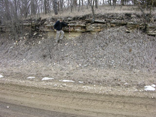
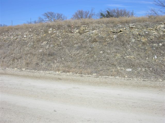
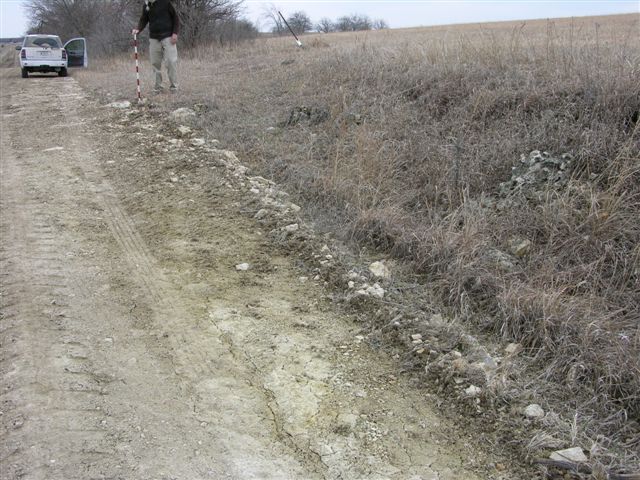
MR-10 = Base of approximately 10 feet of Barneston (Florence) Limestone at 1421' on both sides of road with greenish gray mudrock (Blue Springs) below; 1 digital photo; approx. 1000' West of SE cor. Sec. 30, T. 14 S., R. 8 E., Morris Co., Kansas.
MR-11 = Fort Riley "rim rock" at 1430' on both sides of road; 1 digital photo; approx. 500' South of Center of East line Sec. 26, T. 14 S., R. 7 E., Morris Co., Kansas.
MR-12 = Fort Riley "rim rock" at 1449' on both sides of road; 1 digital photo; near Center of East line NE, Sec. 23,T. 14 S., R. 7 E., Morris Co., Kansas.

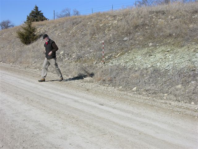
MR-13 = Covered base of Barneston (Florence) Limestone estimated at 1457' in hillside on South side of road with greenish gray mudrock in creek bed on North side of road; 1 digital photo; near Center of North line NW, NE, SW, Sec. 3, T. 14 S., R. 8 E., Morris Co., Kansas.
MR-14 = Base of Barneston (Florence) Limestone at 1439' with Blue Springs Shale in road and creek bed on South side of road; 1 digital photo; approx. 2500' West of NE cor. Sec. 19, T. 14 S., R. 8 E., Morris Co., Kansas.
MR-15 = Base of Barneston (Florence) Limestone at 1470' and Blue Springs Shale exposed in road and in creek bank on South side of road; 1 digital photo; approx. 700' West of SE cor. Sec. 18, T. 14 S., R. 8 E., Morris Co., Kansas.
MR-16 = Probably top of Wreford (Schroyer) limestone at 1364' in road ditch at Northwest corner on road intersection; 1 digital photo; SE cor. Sec. 2, T. 15 S., R. 7 E., Morris Co., Kansas.
MR-17 = Base of Barneston (Florence) Limestone at 1439' with greenish gray mudrock below in road ditch on west side of road; 1 digital photo; near Center of East line SE, NE, NE, sec. 1, T. 15 S., R. 7 E., Morris Co., Kansas.
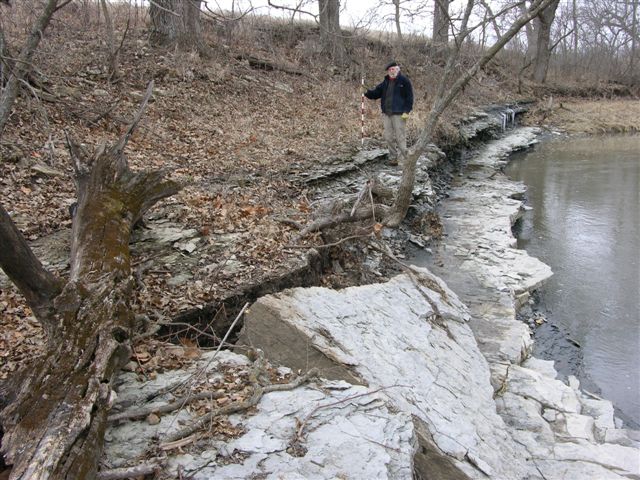
MR-18 = Base of Wreford (Threemile) Limestone at 1315' with upper beds of the Speciser Shale in stream bank and bed on the East side of the stream bridge; 1 digital photo; approx. 200' east of NW cor. Sec. 18, T. 15 S., R. 8 E., Morris Co., Kansas.Morris Co., Kansas.
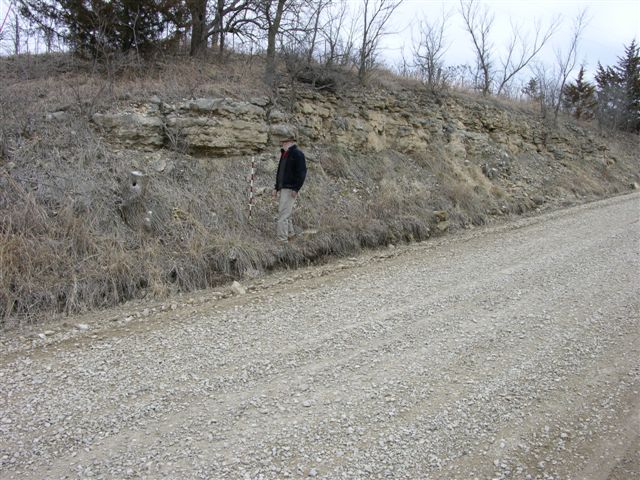
MR-19 = Top of Wreford (Schroyer, a good grainstone) Limestone at 1362' in road ditches on both sides of road; 19.5' of Wreford exposed (hand leveled, 13.5+ = Shroyer, 4.0' = Havensvlle, 2.0+' = Threemile); 2 digital photo (second photo looking NE across field); near Center of East line SE, NE, SE, Sec. 12, T. 15S., R. 7 E., Morris Co., Kansas.
MR-20 = Fort Riley "rim rock" at 1370' in road ditches on both sides of road an around pond in a field North of road; 1 digital photo; approx. 200' West of Center South line SW, SW, Sec. 5, T. 15 S., R. 8 E., Morris Co., Kansas.
MR-21 = Fort Riley "rim rock" at 1377' in road ditches on both sides of road and in a field South of road; 1 digital photo; near Center of North line NW, Sec. 9, T. 15 S., R. 8 E., Morris Co., Kansas.
MR-22 = Base of Barneston (Florence) Limestone at 1338' in East stream bank South of road; 2 digital photos; NE cor. Sec. 9, T. 15 S. R. 8 E., Morris Co., Kansas.
MR-23 = Base of Barneston (Florence) Limestone at 1350' in road on North side; 1 digital photo; near Center of South line SE, SE, SW, Sec. 10, T. 15 S., R. 8 E., Morris Co., Kansas.
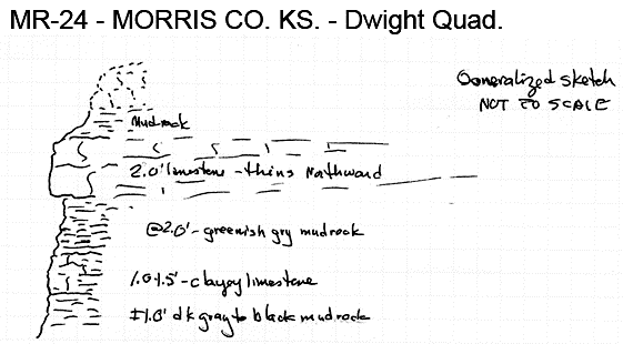
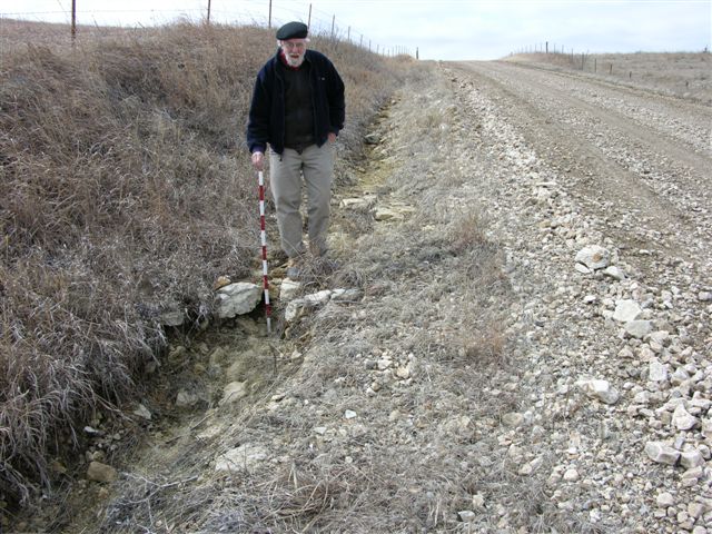
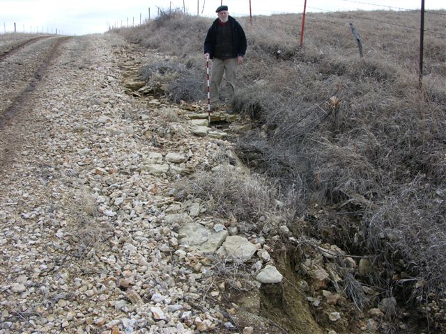
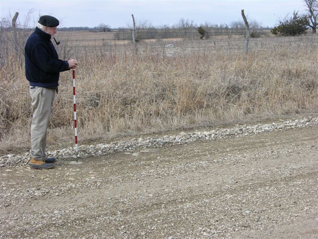
MR-24 = Probable top of the Wreford (Schroyer) Limestone at 1335' in drainage on West side of road; 1 digital photo, with sequence below in West creek bank on East side of road, creek bank sequence sketched and 2 digital photo; near Center of South line NE, NE, NE, Sec. 18,T. 15 S., R. 8 E., Morris Co., Kansas.
MR-25 = Base of Barneston (Florence) Limestone at 1405' in road ditch on South side of road; 1 digital photo; approx. 1900' West of SE cor. Sec. 7, T. 15 S., R. 8 E., Morris Co., Kansas.
MR-26 = Base of Barneston (Florence) Limestone at 1445' in road ditch on West side of road; 1 digital photo; near center Sec. 31, T. 14 S., R. 8 E., Morris Co., Kansas.
Explanation--data control points for the Morris County map are identified by the following letter prefixes:
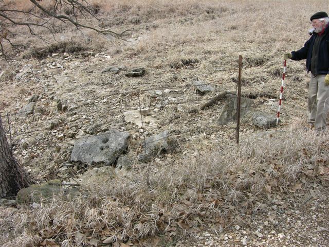
M-3 = Quarry in Barneston (Fort Riley) Limestone, 17.5 feet of limestone measured and described by W. Ives, 12 August 1953 in NW cor. Sec. 32, T. 14 S., R. 7 E., Morris Co., Kansas; now overgrown. Same as MR-35.
MR-27 = Fort Riley "rim rock" at 1431' in road and field on West side of road; 1 digital photo; Center North line NE, Sec. 9, T. 15 S., R7E., Morris Co., Kansas.
MR-28 = Base of the Barneston (Florence) Limestone at 1440' in road ditches; 1 digital photo of South side of road; near Center of South line SW, SE, SE, Sec. 34, T. 14 S., R. 7 E., Morris Co., Kansas.
MR-29 = Fort Riley "rim rock" at 1419' in road and field on East side of road; 1 digital photo; approx. Center of West line NW, NE, Sec. 17, T. 15 S., R. 7 E., Morris Co., Kansas.
MR-30 = Fort Riley "rim rock" at 1395' in road and field on West side of road; 1 digital photo; approx. 200' West SE cor. Sec. 12, T. 15 S., R. 6 E., Morris Co., Kansas.
MR-31 = Upper Fort Riley in road cut on East side of road; thin-bedded, platy upper Fort Riley in road ditch on West side of road; 2 digital photos. Fort Riley in South bank of Neosho River; return to measure, described, and photograph; approx 150' North of Center of West line Sec. 12, T. 15 S., R. 6 E., Morris Co., Kansas.
MR-32 = Fort Riley "rim rock" at 1390' in road ditches on both sides of highway; 1 digital photo of North side of road; Center of North line NW, NW, Sec. 7, T. 15 S., R. 7 E., Morris Co., Kansas.
MR-33 = Fort Riley "rim rock"? at 1390' in road ditches on both sides of highway; 1 digital photo; approx. 400' North of SW cor. Sec. 5, T. 15 S., R. 7 E., Morris Co., Kansas.
MR-34 = Fort Riley "rim rock" at 1410' in road ditches on South side of road; 1 digital photo; approx. 150' West of NE cor. Sec. 5, T. 15 S., R. 7 E., Morris Co., Kansas.
MR-35 = Upper, or "second rimrock" in Fort Riley at 1430' in road ditches and fields on both sides of Kansas Highway 4. Ft Riley "rimrock" in quarry south of highway at 1410'; 1 digital photo of exposure on North side of highway; approx. 400' East of SW cor., Sec. 29, T. 14 S., R. 7 E., Morris Co., Kansas. Same as M-3.
MR-36 = Fort Riley "rim rock" at 1435' in road ditches and fields on both sides of Kansas Highway 4; 1 digital photo of exposure on East side of highway; approx. 250' South of Center of East line Sec. 27, T. 14 S., R. 7 E., Morris Co., Kansas.
MR-37 = Base of Barneston (Florence) Limestone at 1390' in West bank of Lairds Creek on South side of road; 2 digital photos; Center of North line Sec. 27, T. 14 S., R. 7 E., Morris Co., Kansas.
MR-38 = Fort Riley "rim rock" at 1440' in field on East side of road; 1 digital photo; approx. 1000' South of Center of West line Sec. 23, T. 14 S., R. 7 E., Morris Co., Kansas.
MR-39 = Doyle (Towanda limestone) Shale at 1435' on both sides of road; 2 digital photos; approx. 800' South of NE cor. Sec. 5, T. 14 S., R. 7 E., Morris Co., Kansas.
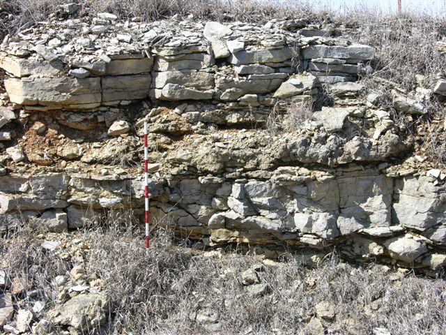
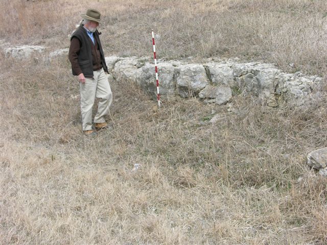
MR-40 = Very good exposure of the Fort Riley "rim rock" at 1382' in South bank of Davis Creek on West side of road, 27. 5 feet of Fort Riley limestone based on hand leveling from the base of the "lower rim rock" to the top of the exposure approx. 1/8 mile South along West side of road, "upper rim rock" 10 to 12 feet above "lower rim rock; 3 digital photos (first two are of lower "rim rock" and third one is of upper" rim rock"); near Center of East line, SE, SE, Sec. 5, T. 14 S., R. 7 E., Morris Co., Kansas.
MR-41 = Fort Riley "rim rock" at 1379' on South side of road in drainage and North flowing stream; 1 digital photo; Center of North line of NE, NW, Sec. 8,T. 14 S., R. 7 E., Morris Co., Kansas.
MR-42 = Winfield (Stovall) Limestone at 1483' in road ditch on East side of road; 2 digital photos; approx. 200' South of Center of West line Sec. 17, T. 14 S., R. 7 E., Morris Co., Kansas.
MR-42A = Excellent exposure of Fort Riley "rim rock" at 1430' in what appears to be an old quarry on the West side of road; 1 digital photo; approx. 200' West of Center of East line NE, SE, Sec. 21, T. 14 S., R. 7 E., Morris Co., Kansas.
MR-43 = Road ditch exposure of Doyle (Towanda limestone) Shale with base of Towanda limestone at 1401'; 1 digital photo; near Center of West line NW, Sec. 6, T. 14 S., R. 7 E., Morris Co., Kansas.
MR-44 = Near base of Towanda Limestone Member (Doyle Shale) at 1368' in road; 1 digital photo; approx. 400' West of Center of North line NE, Sec. 3, T. 14 S., R. 6 E., Morris Co., Kansas.
MR-45 = Fort Riley "rim rock" at 1323' in West bank of Thomas Creek on North side of road; 1 digital photo; near Center of South line SE, SE, Sec. 34, T.13S., R. 6 E., Geary Co., Kansas.
MR-46 = Doyle Shale with upper beds of Holmesville shale and base of Towanda limestone at 1365' on East side of road; 2 digital photos; near Center of West line SW, NW, NW, Sec. 2, T. 14 S., R. 6 E., Morris Co., Kansas.
MR-46A = Doyle Shale with base of Towanda Limestone Member at 1386' and Holmesville Shale Member exposed below in road ditch on North side of road, 9.6' of Towanda exposed (hand leveled); I digital photo; near Center of South line SW, Sec. 11, T. 14 S., R. 6 E., Morris Co., Kansas.
Explanation--data control points for the Morris County map are identified by the following letter prefixes:
M-1 = Sequence from Doyle Shale, Towanda Limestone Member, to Winfield Limestone, Cresswell Limestone Member, near Center of West line, NW, SW, Sec. 25, T. 14 S., R. 5 E., Morris Co., Kansas; measured and described by M. K. Elias in 1935.
M-2 = Sequence from Doyle Shale, Towanda Limestone Member, to Winfield Limestone, Cresswell Limestone Member, near Center of South line, SE, SW, Sec. 25, T. 14 S., R. 5 E., Morris Co., Kansas; measured and described by M. K. Elias in 1935.
MMW-10 = Road cut exposure of Doyle Shale, Gage Shale Member, in SW, SW, Sec. 25, T. 14 S., R. 5 E., Morris Co., Kansas.
MMW-11 = Road cut exposure of Doyle Shale, Holmesville Shale Member and Towanda Limestone Member, in SW, NW, Sec. 6, T. 14 S., R. 6 E., Morris Co., Kansas. Same as MTB-101.
MMW-12 = Road cut exposure of Barneston Limestone, Oketo Shale Member and Fort Riley Limestone Member in NE, NE, Sec. 5, T. 14 S., R. 6 E., Morris Co., Kansas.
MMW-13 = Road cut exposure of Barneston Limestone, Oketo Shale Member and Fort Riley Limestone Member in NE, NE, Sec. 8, T. 14 S., R. 6 E., Morris Co., Kansas.
MTB-101 = Doyle Shale, lower part of Towanda limestone and upper part of Holmesville shale just SW of Skiddy, Kansas; road cut in SW, NW, Sec. 6, T. 14 S., R. 6 E., Morris Co., Kansas. Same as MMW-11.
MR-47 = Conglomeratic limestone, probable Winfield (Cresswell) Limestone at 1412' in road ditch and field West of road; 2 digital photos, one of vertical surface and one of horizontal surface; approx. 200' North of Center of East line Sec. 21, T. 14 S., R. 6 E., Morris Co., Kansas..
MR-48 = Possible base of Towanda Limestone Member (Doyle Shale) at 1371' in road ad road ditch on West side of road; 1 digital photo.1 digital photo; just North of Center of East line, SE, SE, Sec. 16, T. 14 S., R. 6 E., Morris Co., Kansas.
MR-49 = Possible base of Towanda Limestone Member (Doyle Shale) at 1360' in road and road ditch on West side of road, good exposure of upper Holmesville shale and lower Towanda limestone; 1 digital photo; approx. 100' North of Center of East line, SE, NE, Sec. 16, T. 14 S. R. 6 E., Morris Co., Kansas.
MR-50 = Possible base of Towanda Limestone Member (Doyle Shale) at 1360' in road and road ditch on West side of road; 1 digital photo; approx. 100' South of NE cor. Sec. 9, T. 14 S. R. 6 E., Morris Co., Kansas.
MR-51 = "Rim Rock" (lower) of Fort Riley Limestone Member at 1310' on South side of road; 1 digital photo; Center of North line NE, NW, Sec. 9, T. 14 S., R. 6 E., Morris Co., Kansas.
MR-52 = Base of Barneston (Florence) Limestone at 1260' in South bank of Ralls Creek on South side of road with Blue Springs shale below and Oketo shale and Fort Riley "Rim Rock" (lower) above; 2 digital photos, one with scale at base and one of "Rim Rock" without scale; approx. 200' East of SW cor. Sec. 4, T. 14 S., R. 6 E., Morris Co., Kansas. Compare with MTB-99B.
MR-53 = Near base of Towanda Limestone Member of Doyle Shale at 1349' in road ditch on both sides of paved road with best exposure on East side; 1 digital photo near base on East side of road; near Center of West line SW, SW, NW, Sec. 9, T. 14 S., R. 6 E., Morris Co., Kansas.
MR-54 = Winfield (Stovall) Limestone at 1424' in road ditch on North side of paved road; 1 digital photo; SE cor. Sec. 28, T. 14 S., R. 6 E., Morris Co., Kansas.
MR-55 = Base of Towanda Limestone Member at 1347' with upper beds of Holmesville Shale Member (Doyle Shale) below in road and road ditch, thin bedded, platy limestone in the greenish gray and reddish mudrocks of the upper Holmesville; 1 digital photo; near Center of South line SW, SW, Sec. 20, T. 14 S., R. 6 E., Morris Co., Kansas.
MR-56 = Base of Towanda Limestone Member of Doyle Shale at 1350' in road North of an active quarry; 1 digital photo of exposure and two of the quarry pit being backfilled taken from the road; approx. 100' West of Center of South line Sec. 20, T. 14 S. R. 6 E., Morris Co., Kansas.
MR-57 = Winfield (Stovall) Limestone at 1388' in road ditch on North side of road, document for publication; 2 digital photos; near Center of South line SE, SE, SW, Sec. 30, T. 14 S., R. 6 E., Morris Co., Kansas.
MR-58 = Winfield (Stovall) Limestone at 1385' in road ditch on West side of road, poor exposure; 1 digital photo; near Center of East line NE, Sec. 25, T. 14 S., R. 5 E., Morris Co., Kansas.
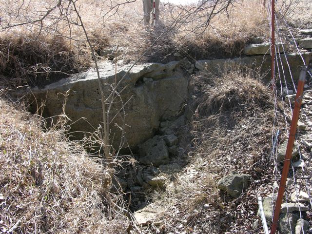
MR-59 = Base of Towanda Limestone Member of Doyle Shale at 1350' on both sides of road, good exposure of limestone in road just West of stream, document for publication; 5 digital photos of road cut exposure, 1 of the stream bed (dark gray to black mudrocks in upper Fort Riley limestone) on North side of road; and 2 of the spring in the upper Fort Riley limestone on South side of road; near Center of East 1/2, NE, Sec. 30, T. 14 S., R. 6 E., Morris Co., Kansas.
MR-60 = Base of Towanda Limestone Member of Doyle Shale at 1327' on East side of road; 1 digital photo; near Center of West line SW, NW, SW, Sec. 18, T. 14 S., R6E., Morris Co., Kansas.
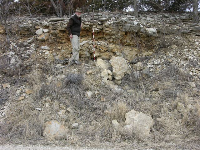
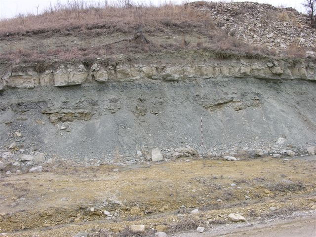
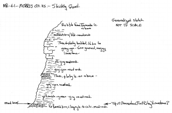
MR-61 = Top of Barneston (Fort Riley) Limestone at 1310' with Doyle Shale (Holmesville shale into the Towanda limestone) above, thickness from top of "rim rock" to top of Fort Riley is 25.5' (hand leveled); document for publication; 1 digital photo of exposure on East side of road; see graphic sketch; near Center of West line NW, SW, SW, Sec. 7, T. 14 S., R. 6 E., Morris Co., Kansas.
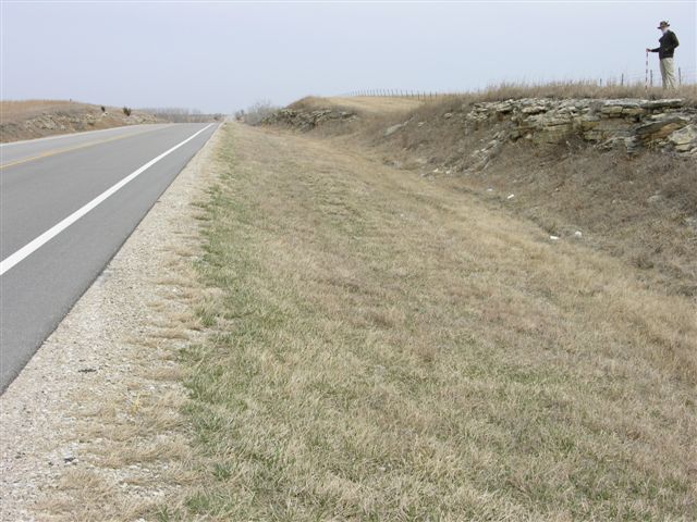
MR-62 = Fort Riley "Rim Rock" (lower) at 1290' in road cut exposures on both sides of Skiddy Road; 1 digital photo; near Center of West line NW, NW, Sec. 5, T. 14 S., R. 6 E., Morris Co.,Kansas.
MR-63 = Base of Towanda Limestone Member of Doyle Shale at 1321' in road; 1 digital photo; near Center of West line NW, Sec. 13, T. 14 S., R. 5 E., Morris Co., Kansas.
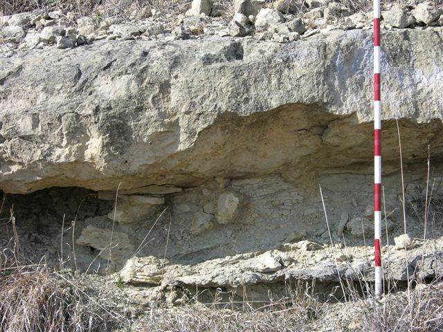
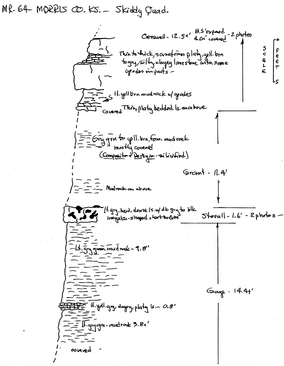
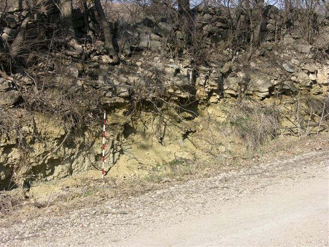
MR-64 = Exposure of sequence from Gage Shale Member (Doyle Shale) into the Winfield (Cresswell) Limestone in road cut on North side of road with Stovall at 1380', document for publication; 4 digital photos (2 of Stovall and 2 of Cresswell); section measured (hand level) and briefly described; see graphic sketch; from near Center of South line SW, SE, SW to Center of South line SW, SE, Sec. 25, T. 14 S., R. 5 E., Morris Co., Kansas.
MR-65 = Base of Towanda Limestone Member (Doyle Shale) at 1315' in road on North side of road; 1 digital photo; approx. 100' West of Center of South line, SW, Sec. 24, T. 14 S., R. 5 E., Morris Co., Kansas.
MR-66 = Winfield (Stovall) Limestone at 1345' in road ditch on East side of road; 1 digital photo; Center of West line, NW, SW, NW, Sec. 23, T. 14 S., R. 5 E., Morris Co., Kansas.
MR-67 = Winfield (Stovall) Limestone at 1355' in road; 1 digital photo; approx. 250' South of Center of West line Sec. 26, T. 14 S., R. 5 E., Morris Co., Kansas.
MR-68 = Winfield (Stovall) Limestone at 1350' in road and cut bank at road intersection; 2 digital photos; Center of West line, SW, SW, Sec. 26, T. 14 S., R. 5 E., Morris Co., Kansas.
MR-69 = Winfield (Cresswell) Limestone, chert nodules and geodes (chert nodules originally? were geodes and geodes were originally? anhydrite/gypsum nodules) at 1390' in road cut exposure on West side of road, document for publication; 2 digital photos; near Center of East line, NE, SE, Sec. 35, T. 14 S., R. 5 E., Morris Co., Kansas.
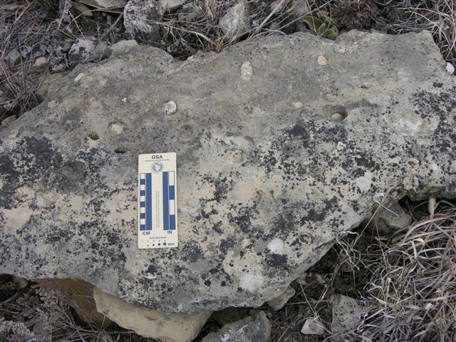
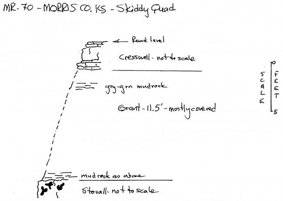
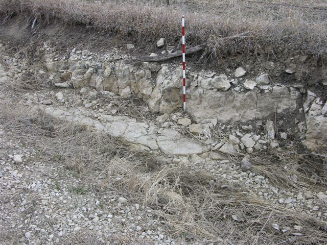
MR-70 = Winfield (Stovall) Limestone at 1379' in road ditch on North side of road with partially covered Grant shale (1.5 feet) and lower beds of Cresswell limestone above; 4 digital photos, 1 of Stovall, 1 of complete sequence, and 2 of probable Aviculopinna bivalves/burrows in lower Cresswell; see graphic sketch; approx. 100' East of Center of South line SE, SE, Sec. 35, T. 14 S., R. 5 E., Morris Co., Kansas.
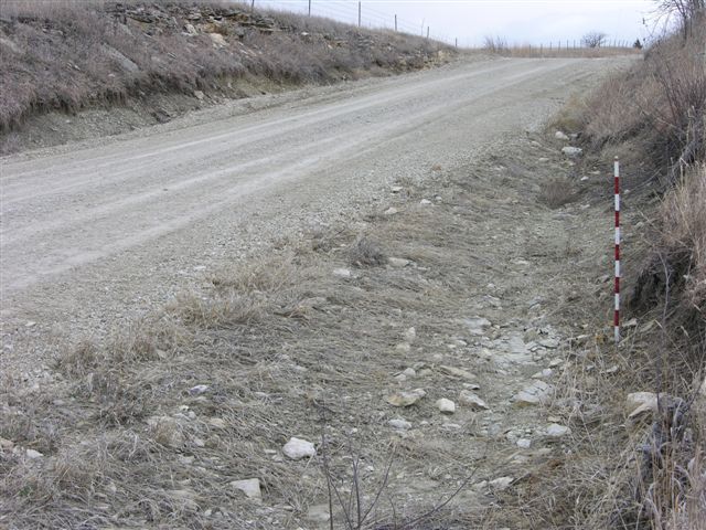
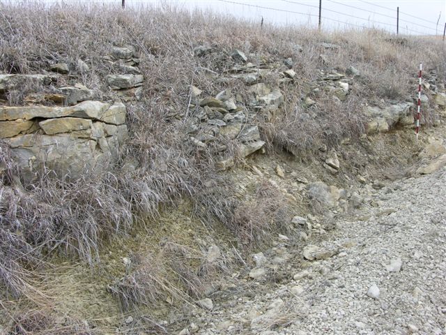
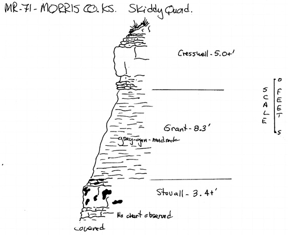
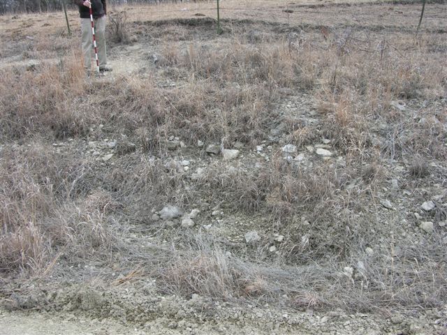
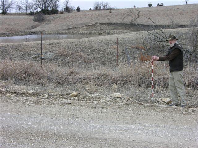
MR-71 = Exposure of Winfield Limestone (Stovall limestone at 1345', Grant shale, and lower beds of Cresswell limestone) on both sides of road and also on the East side of the road intersection, much better exposure than MR-70, document for publication; 3 digital photos, sequence measured (hand level) and briefly described; see graphic sketch; at road intersection in SE cor. Sec. 33 and SW cor. Sec. 34, T. 14 S., R. 5 E., and NE cor. Sec. 4, and NW cor. Sec.3, T. 15 S.,R. 5 E., Morris Co., Kansas.
MR-72 = Top of Stovall Limestone Member of Winfield Limestone at 1360' on East side of road with Doyle (Gage) Shale below and Grant shale and Cresswell limestone (Winfield Limestone) above; 1 digital photo; near Center of NW, NE1.4, NE, Sec. 3, T. 15 S., R. 5 E., Morris Co., Kansas.
MR-73 = Winfield (Stovall) Limestone at 1370' in road, in fields on both sides of road and in a pond bank West of road; 2 digital photos; near Center of East line, SE, SE, NE, Sec. 2,T. 15 S., R. 5 E., Morris Co., Kansas.
MR-74 = Winfield Limestone (Stovall limestone at 1375', Grant shale, and Cresswell limestone) on both sides of road; 1 digital photo; near Center of East line, NE, SE, NE, Sec. 11, T. 15 S., R. 5 E., Morris Co., Kansas.
MR-75 = Winfield Limestone (Stovall limestone at 1388' and Grant shale) in road and road ditches on both sides of road; 1 digital photo; approx. 100' East of Center of North line,Sec. 1, T. 15 S., R. 5 E., Morris Co., Kansas.
MR-76 = Winfield (Stovall) Limestone at 1398' in road ditches on both sides of paved road; 1 digital photo of exposure on South side; just West of Center of North line, NW, NE, NW, Sec. 32, T. 14 S., R. 6 E., Morris Co., Kansas.
MR-77 = Winfield (Stovall) Limestone exposed at 1402' in road ditch on South side of road, lower beds with in situ Aviculopinna but without chert and lacking chert are very similar to the limestone beds the lower Cresswell limestone; 1 digital photo; approx 400' East of NW cor. Sec. 5, T. 15 S., R. 6 E., Morris Co., Kansas.
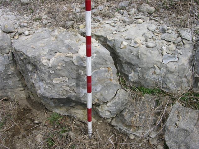
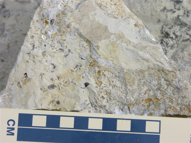
NOTE: When well exposed three distinct lithologies constitute the Stovall limestone and these are, in ascending order: (1) thin beds of light brown to brownish orange clayey limestone with bivalve burrows and sometimes in situ Aviculopinna, (2) a medium bed of hard, dense, light to medium gray limestone with dark gray to black, highly irregularly shaped chert bodies suggestive of burrow fillings, and (3) thin to platy bedded light brown to brownish orange clayey limestone often with chert nodules (3 to 5 cm in size). The commonly seen and readily identified unit is the hard, dense, medium limestone with irregularly shaped chert bodies. If this characteristic chert bed of the Stovall limestone is absent, these lower beds of the Stovall could easily be mistaken forlimestone beds in the lower Cresswell limestone.
MR-78 = Same as MR-77 with Stovall limestone at 1412', but on the North side of road; 1 digital photo; near Center of South line, SE, SW, Sec. 32, T. 14 S., R. 6 E., Morris Co., Kansas.
MR-79 = Chert from Stovall limestone in road ditch at 1412' on South side of road suggestive of in place Stovall; 1 digital photo; approx. 100' West of Center of North line,NE, NE, Sec. 5, T. 15 S., R. 6 E., Morris Co., Kansas.
MR-80 = Winfield (Stovall) Limestone at 1420' in road and road bank on South side of road; 2 digital photos; near Center of North line, NW, NW, NE, Sec.4, T. 15 S., R. 6 E., Morris Co., Kansas.
MR-81 = Winfield (Stovall) Limestone at 1418' in ditch on East side of road,; 1 digital photo; Center of West line NW, SW, Sec. 4, T. 15 S., R. 6 E., Morris Co., Kansas.
MR-82 = Base of Cresswell limestone at 1390' with Grant shale below in road ditch on North side of road, thin bed of chert above lower medium bed of limestone in Cresswell with geodes in lower Cresswell and upper Grant; 1 digital photo; approz. 200' East of NE cor. Sec. 7, T. 15 S., R. 6 E., Morris Co., Kansas.
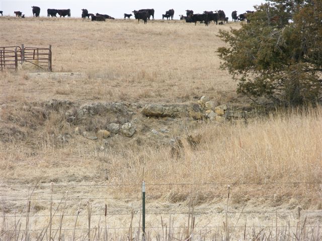
MR-83 = Stovall limestone with Grant shale above in field and drainage West of road, Stovall limestone is at an elevation of about 1380'; 1 digital photo; near Center of NE, SE, SE, Sec. 1, T. 15 S., R. 6 E., Morris Co., Kansas.
Explanation--data control points for the Morris County map are identified by the following letter prefixes:
MMW-8 = Exposure of Winfield Limestone (Grant shale and Cresswell limestone) in road cut exposure in SE, SE, Sec. 31, T. 14 S., R. 5 E., Morris Co., Kansas
MR-84 = Near top of Winfield Limestone at 1340' in field East of section line road and in stream bank just North of this site; 1 digital photo; near Center of West line, SW, Sec. 28, T. 14 S., R. 5 E., Morris Co., Kansas.
MR-85 = Probable Nolans (Krider) Limestone at 1395' in field just North of paved road; 1 digital photo; near Center of South line SW, SE, Sec. 28, T. 14 S., R. 5 E., Morris Co., Kansas.
MR-86 = Base of Winfield (Stovall) Limestone at 1315' and overlying members of Winfield Limestone in road ditches on both sides of Kansas Hwy. 209; 2 digital photos of exposure on South side of hwy; approx. 200' West of Center of North line NE, NW, Sec. 31, T. 14 S., R. 5 E., Morris Co., Kansas.
NOTE: Digital photo of Stovall limestone just North of MR-86 along Northwest side of U. S. Highway 77.
MR-87 = Winfield (Stovall) Limestone at 1295' in road and road ditches, poorly exposed; 1 digital photo; approx. 100' West of Center of North line, Sec. 30, T. 14 S., R. 5 E., Morris Co., Kansas.
MR-88 = Winfield (Stovall) Limestone at 1315' in road cut at road intersection; 2 digital photos, one of Stovall and a longer view looking Northeast; just West of Center of East line Sec. 30, T. 14 S., R. 5 E., Morris Co., Kansas.
MR-89 = Near top of Winfield Limestone at 1335' in road; 1 digital photo of exposure on North side of road; near Center of North line NE, NW, NW, Sec. 21, T. 14 S., R. 5 E., Morris Co., Kansas..
MR-90 = Winfield (Stovall) Limestone at 1310' in road and on West side of road; 1 digital photo; Center of West line SW, Sec. 16, T. 14 S., R. 5E., Morris Co., Kansas.
MR-91 = Winfield (Stovall) Limestone at 1309' in road cuts on Northwest side on U. S. Highway 77; 2 digital photos; just South of Center of North line SE, NE, NW, Sec. 29, T. 14 S., R. 5 E., Morris Co., Kansas.
MR-92 = Top of Winfield Limestone at 1331' in road cut on Southeast side of U. S. Highway 77; 2 digital photos; document sequence from MR-91 through MR-92 for publication; near Center of North line SE, SW, NW, Sec. 29, T. 14 S., R. 5 E., Morris Co., Kansas.
MR-93 = Winfield (Stovall) Limestone at 1315' in road cut on East side of U. S. Highway 77; 2 digital photos (one close-up of chert in Stovall); near SW cor. Sec. 7, T. 15 S., R. 5 E., Morris Co., Kansas.
MR-94 = Winfield (Stovall) Limestone at 1319' in drainage on West side of road; 1 digital photo; near Center of NE, NE, NE, Sec. 18, T. 15 S., R. 5 E., Morris Co., Kansas.
MR-95 = Winfield (Stovall) Limestone at 1320' in drainage on West side of road; 1 digital photo; approx. 150' South of Center of East line NE, Sec. 6, T. 15 S., R. 5 E., Morris Co., Kansas.
MR-96 = Winfield (Stovall) Limestone at 1318' in drainage on East side of road; 1 digital photo; near Center of West line NW, SW, Sec. 32, T. 14 S., R. 5 E., Morris Co., Kansas.
MR-97 = Nolans Limestone, base of Krider limestone at 1390', Paddock shale, and lower beds of Herington limestone exposed in road and road ditch on South side of road, small bivalves in Krider and small, calcite lined geodes in Herington; 2 digital photos; near Center of North line NE, NE, NE, Sec. 5, T. 15 S., R.5E, Morris Co., Kansas.
Kansas Geological Survey, Geology
Updated July 28, 2009
Comments to webadmin@kgs.ku.edu
The URL for this page is http://www.kgs.ku.edu/Publications/OFR/2009/OFR09_14/index.html