Atchison County Landslide Map
A new map showing the location of landslides in Atchison County is now
available from the Kansas Geological Survey. Compiled by Survey geologist
Gregory C. Ohlmacher, the map is part of a larger project to inventory
and describe geologic hazards in northeastern Kansas.
The map shows the location of recent landslides, older landslides, and
rock-fall hazards in Atchison County. This information can be used by
city planners and engineers, public works officials, and anyone interested
in building on a particular piece of property.
Landslide Inventory Map of the Atchison West and East 7.5-minute
Quadrangles, Atchison County, Kansas, is drawn at a scale
of 1:36,000 (one inch on the map equals just over one-half mile). Copies
of the new map, produced in full-color, are available from the KGS for
$15.00, plus tax, shipping, and handling.
Wilson County Geologic Map
A new geologic map of Wilson County, showing the age and type
of rocks at the earth’s surface, was recently released by the KGS.
Because geologic maps show the rock formations likely to be encountered
at a particular location, they are useful in construction, in understanding
soils and agriculture, in searching for water and mineral deposits, and
in a variety of engineering and environmental uses.
The Wilson County geologic map, compiled by retired U.S. Geological Survey
geologist Holly C. Wagner, is part of a Survey program to produce new
geologic maps of counties in the state.
The map, produced in full color, is drawn at a scale of 1:50,000 (one inch on the map equals about 3/4 mile). Copies of the new map are available from the KGS. The cost is $15.00, plus tax, shipping, and handling.
New
Maps
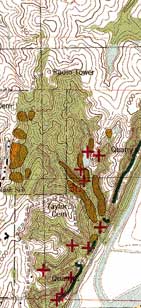
Segment of Landslide Inventory Map.
The
Survey’s home page (http://www.kgs.ku.edu/)
was redesigned early in the year 2000. Over the past few months, a number
of the Survey’s water and petroleum online data bases were enhanced.
The most popular data base on the Survey’s
web site displays oil and gas production data. This site includes a map
showing the fields in each county. For each field, information available
includes a list of leases, production (both annual and cumulative), number
of wells, depth, producing horizon, and other data. Work is underway to
make monthly production data available by field or by lease. The address
is http://www.kgs.ku.edu/PRS/petro/interactive.html.
The Survey’s master list of oil and gas wells
includes information on 431,000 wells in the state. For each well, the
data base shows location, operator, completion information, total depth,
and other data. If core or cuttings for a well are available from the
Survey, that information is displayed. For some wells, header data from
wireline logs or digital versions of the logs themselves are also available.
The data base can currently be searched by legal description or county,
but work is underway to make the data base searchable by lease, operator,
or API number. The address is http://magellan.kgs.ku.edu/Qualified/index.html.
The Survey’s water-well data base includes
information for nearly 130,000 wells in the state. For each well, the
data base shows location, owner, well use, completion data, well depth,
water depth, and other information. This data base can be searched by
legal description or county at http://magellan.kgs.ku.edu/WaterWell/index.html.
Each year the Survey and the Division of Water
Resources of the Kansas Department of Agriculture measure water levels
in about 1,500 wells in central and western Kansas. For each well, current
water levels along with historic measurements are available. The data
base also includes information on a number of other wells that are not
part of the measurement program. The data base can be searched by legal
description, county, or groundwater management district at http://magellan.kgs.ku.edu/WaterLevels/index.html.
KGS Web Site Continues to Expand
URL:http://www.kgs.ku.edu/Publications/GeoRecord/2000/vol6.2/Page3.html