![]()
Prev Page--Geography || Next Page--Mining Systems
Detailed Stratigraphy of Kansas Coals
General Outline of the Stratigraphy
The Coal Measures
The Kansas coals occur in various shale beds, occupying all positions from the Cherokee shales at the base to the Osage shales more than 2000 feet above. In connection with the following descriptions the reader is referred to the generalized geologic section, Plate VI, and to the two maps, Plates VII and VIII.
The Cherokee shales produce vastly larger quantities of coal than any other shale beds in the whole Coal Measures. It is from this horizon that is obtained the coal of Cherokee and Crawford counties, the Fort Scott coal of Bourbon county, nearly all the coal of Labette county, and the coal of Leavenworth county. In addition to these localities it is known that coal could be obtained in other places. The deep borings at Cherryvale, in Montgomery county, show that a bed of coal from 26 to 28 inches in thickness lies near the base of the Cherokee shales at that place. Wells in the vicinity of Pleasanton likewise show that beneath the coal now operated and within the Cherokee shales other coal is found which sometimes may be operated to advantage. Other wells which have penetrated the Cherokee shales at various places within the state likewise show the same conditions, namely, that coal may be found in the Cherokee shales under a large part of southeastern and eastern Kansas. The abundance of coal within these shales seem,s to be so great that it need not be a surprise if heavy beds be found under any part of the eastern fifty or seventy-five miles of the state.
The Labette shales, first in order above the Cherokee shales, have considerable bituminous matter within them, but nowhere does it amount to a good bed of coal. In a few places to the southwest of Fort Scott the coal is heavy enough so that it was formerly mined to a limited extent, but nowhere so far as is known have they produced any considerable amount.
The next shale bed above this, the Pleasanton shales, carries large quantities of coal; particularly in the Lower Pleasanton shales. This is true to so great an extent that a detailed description of the Pleasanton shales is given. in the proper place. Suffice it here to say that next to the Cherokee shales the Pleasanton shales probably carry the largest amount of coal known in the state.
Above the Pleasanton shales the next important shale bed is that of the Thayer shales, a shale bed that likewise carries a considerable amount of coal. This is particularly true in the vicinity of Thayer and to the southwest between Thayer and Neodesha and Independence.
From the Thayer shales upwards the next important shale bed is the Lane shales which as far as is known, is void of coal.
Above this is found the Lawrence shales, a heavy bed carrying a sufficient amount of coal to be of great commercial importance. Coal is mined or has been in these shales in Atchison county at Atchison, in different places in Jefferson county, in scores of places in Douglas county, but most of all in Franklin county, to the west and southwest of Ottawa. Farther south they have produced coal in limited amounts throughout almost the whole area over which the Lawrence shales are exposed, to the southwest entirely to the south part of the state.
The various shale beds above the Lawrence shales seem to be barren of coal, or almost so, until the Osage shales are reached. Here is a formation averaging about 200 feet thick, extending entirely across the state from north to south and which carries a large amount of coal that has been mined in nearly a hundred places. In the northeastern part of the state to the northwest of Atchison a half dozen or more localities have furnished coal from these shales. Southward in the vicinity of Topeka coal has been mined for years near the city and also further west near Sugar Works. And again southward, in the vicinity of Burlingame, Osage City, Carbondale, Scranton, etc., it has been mined to a great extent for more than twenty years. South from the Osage region, the same bed of shales has produced coal in the vicinity of Lebo, in Coffey county; Hilltop, and Virgil and other points in Greenwood county; at different places in Elk county; and at Leeds, in Chautauqua county. The coal of the Osage shales is not uniform in quantity or quality throughout this whole distance, but, it must be confessed, there is a strong similarity between the different samples found at the different places.
Above the Osage shales no coal has been found in the Carboniferous of Kansas of sufficient importance to justify mining, even for local consumption. At different places in the upper parts of the Coal Measures and also in a few places in the Permian rich carboniferous shales exist which somewhat resemble coal and which occasionally are locally called coal.
The only remaining coal in the state that need be noticed is the Cretaceous coal, found in the Dakota area of north central Kansas. The Dakota of Kansas has been divided by Logan (Logan, 1897, p. 206) into two divisions, the "lower" and "upper," the division between the two being provisionally made the sandstone layer which immediately underlies the heavy bed of shale that is the coal producer. Logan's description of the stratigraphy of these western coals may be here included (Logan, 1897, p. 208).
The Upper Group
"Lignite Horizon.-Resting upon the gray or white sandstone, in the last upper layer of the sandstone group, is a thin bed of lignite which is entirely wanting in certain localities. The lignite varies in thickness from 6 to 26 inches. In Republic county it occurs from 80 to 100 feet below the Benton limestone. In Lincoln county it is only 60 feet below that horizon, and in Russell county it is 90 feet. The thickest vein occurs in the mines on Little Timber creek in Lincoln county where the lignite rests between the beds of shale and gray sandstone, the shale adjacent the coal being extremely bituminous in character. In Republic county, near Minersville, two 9-inch veins are intercalated with shales which are argillaceous, and not bituminous in character. Above the lignite bed in Mitchell county rests a thick bed of bituminous shales which seem to pass conformably into lignite. In Coal cañon thin layers of lignite are intercalated with sandstone and shale. The lignite is mined in this locality by tunneling into the drift of the creek bed. Shafts have been sunk to a depth of 80 feet in Republic county and 50 feet in Lincoln county. Lignite is mined and used for fuel in Republic, Mitchell, Lincoln, Russell, and Ellsworth counties. The lignite contains much ash in the form of pyrite, shale, etc. The principal mines are located on Wolf creek and Coal cañon in Russell county; on Coal creek and Elkhorn in Ellsworth county; on Spillman creek, Little Timber creek, Bacon creek, Rattlesnake creek, and Elkhorn creek in Lincoln county; on Rock creek and Solomon river in Mitchell county; on West creek in Republic and Cloud counties.
"The strata adjacent the lignite vary with the locality. In some localities the lignite rests between beds of shale, in others between layers of sandstone, and still in other localities it is found resting upon sandstone and covered with shale. In many places it is entirely wanting. Its place, however, may be occupied by a thin bed of bituminous shale."
The different coal-bearing horizons will now be considered more in detail, beginning at the base of the Coal Measures and progressing upwards.
Cherokee Shales
The position, areal extent, and general characteristics of the Cherokee shales have been given in considerable detail in the first part of this volume, to which the reader is referred in this connection.
Of all coal-bearing horizons in the state the Cherokee shales are by far the most important, as they have produced more than three-fourths of all the coal that has thus far been mined in Kansas. They occupy large surface areas in both Cherokee and Crawford counties and lesser areas in Labette and Bourbon counties. In addition to this they pass westward and northward under the overlying strata to unknown distances, and throughout a considerable part of this. westward extension they are known to carry coal. It is impossible to make any definite statement regarding the amount and position of this deeply buried coal. It is mined extensively at Leavenworth, and has been reached by scores of walls drilled in prospecting for oil and gas. The coal map, Plate VIII, shows in detail the surface area covered by the Cherokee shales and how they pass westward under the overlying formations. Also the gradual decrease westward of the shading illustrates the decreasing probability of finding coal in the Cherokee shales which are there covered by succeeding strata.
It is no vain statement that from every standpoint of geology there is a possibility of finding coal in this covered area. Had not enterprising prospectors sunk the deep wells at Leavenworth we would be in ignorance. of the coal at that place. There is just as much reason a priori for looking for coal in the Cherokee shales anywhere to the east of the outcropping of the Oread limestone as there was at Leavenworth, and no one need be surprised at any time should prospecting develop such coal:
Already the well record at Cherryvale shows that the coal exists there in as great quantity as it does at Leavenworth and it need be no surprise if dozens of other localities are found where similar quantities, may be had.
With the known amount of coal in the Cherokee shales and with the probability of finding other amounts likewise, as jus.t stated, we must look upon them as being one of the greatest coal producing horizons in the Mississippi valley.
For a more detailed account of the Cherokee shales the following extracts are taken from the records of the various deep wells that have gone into or through them:
Weir City Water Well
| Reported by A. B. Cockerill, Manager Cherokee-Lanyon Spelter Company | |||
|---|---|---|---|
| Material | Thickness of Coal |
Thickness of Strata |
Depth to Bottom of Strata |
| Soil and Clay | 15 feet | 15 feet | |
| Sandstone | 5 feet | 20 feet | |
| Shale | 10 feet | 30 feet | |
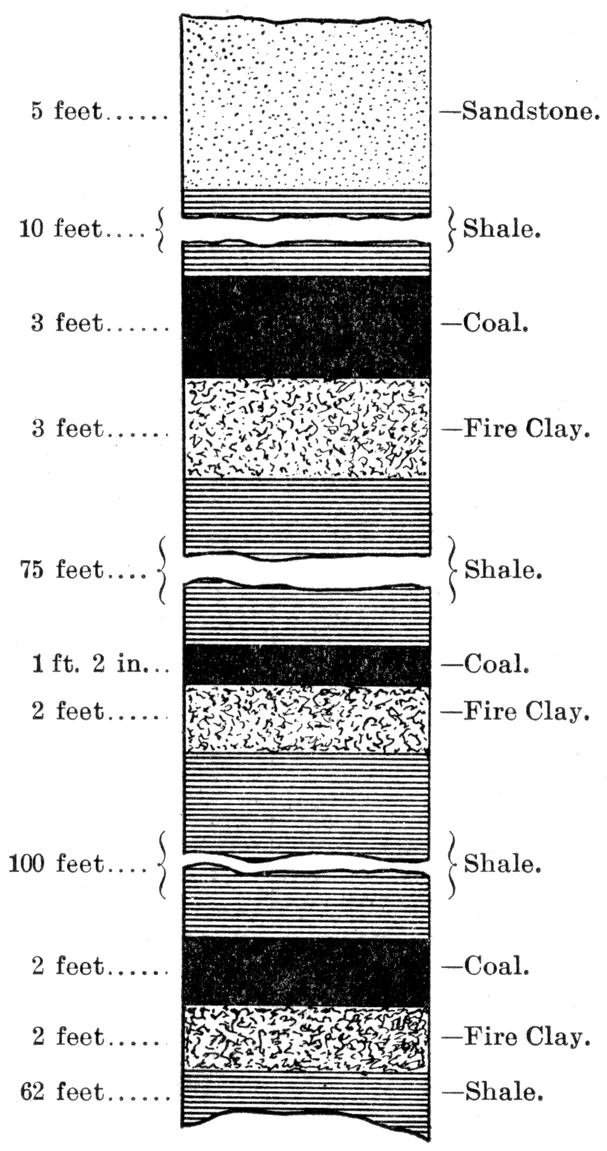
| Coal | 36 inches | 3 feet | 33 feet |
| Fire clay | 3 feet | 36 feet | |
| Shale | 75 feet | 111 feet | |
| Coal | 14 inches | 1 foot, 2 inches | 112 feet, 2 inches |
| Fire clay | 2 feet | 114 feet, 2 inches | |
| Shale | 100 feet | 214 feet, 2 inches | |
| Coal | 24 inches | 2 feet | 216 feet, 2 inches |
| Fire Clay | 2 feet | 218 feet, 2 inches | |
| Shale | 62 feet | 280 feet, 2 inches | |
Figure 4—Section of Weir City Well.
Well near Pittsburg
| Reported by Prof. O. St. John. | |||
|---|---|---|---|
| Material | Thickness of Coal |
Thickness of Strata |
Depth to Bottom of Strata |
| Soil and Yellow Clay | 5 feet | 5 feet | |
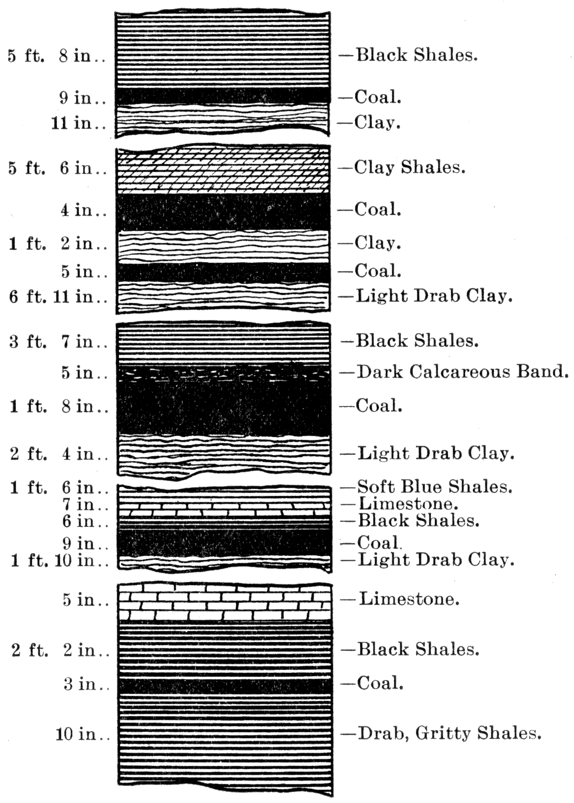
| Soft Drab Shales | 10 feet, 5 inches | 15 feet, 5 inches | |
| Dark Drab Shales | 3 feet, 7 inch | 19 feet | |
| Black Shales | 5 feet, 8 inches | 24 feet, 8 inches | |
| Coal | 9 inches | 9 inches | 25 feet, 5 inches |
| Soft, Light, Drab Clay | 11 inches | 26 feet, 4 inches | |
| Limestone | 2 feet, 4 inches | 28 feet, 8 inches | |
| Black Shales | 2 feet, 9 inches | 31 feet, 5 inches | |
| Limestone | 8 inches | 32 feet, 1 inch | |
| Black Shales | 2 feet, 8 inches | 34 feet, 9 inches | |
| Limestone | 11 inches | 35 feet, 8 inches | |
| Black Shales | 1 foot, 6 inches | 37 feet, 2 inches | |
| Drab Clay Shales | 5 feet, 6 | 42 feet, 8 inches | |
| Coal | 4 inches | 4 inches | 43 feet |
| Drab Clay | 1 foot, 2 inches | 44 feet, 2 inches | |
| Coal | 5 inches | 5 inches | 44 feet, 7 inches |
| Light Drab Clay | 6 feet, 11 inches | 51 feet, 6 inches | |
| Light Drab Gritty Shales | 9 feet, 8 inches | 61 feet, 2 inches | |
| Soft Blue Shales | 4 feet | 65 feet, 2 inches | |
| Black Shales | 3 feet, 7 inches | 68 feet, 9 inches | |
| Dark Calcareous Band | 5 inches | 69 feet, 2 inches | |
| Coal | 20 inches | 1 feet, 8 inches | 70 feet, 10 inches |
| Light Drab Clay | 2 feet, 4 inches | 73 feet, 2 inches | |
| Hard Gray Sandstone | 1 foot, 2 inches | 74 feet, 4 inches | |
| Drab, Slightly Gritty, Shales | 7 feet, 8 inches | 82 feet | |
| Drab Clay Shales | 4 feet | 86 inches | |
| Soft Blue Shales | 1 foot, 6 inches | 87 feet, 6 inches | |
| Limestone | 7 inches | 88 feet, 1 inches | |
| Black Shales | 6 inches | 88 feet, 7 inches | |
| Coal | 9 inches | 9 inches | 89 feet, 4 inches |
| Light Drab Clay | 1 foot, 10 inches | 91 feet, 2 inches | |
| Drab, Gritty Shales | 10 inches | 92 feet | |
| Compact, Gray, Sandy Shales | 7 feet, 10 inches | 99 feet, 10 inches | |
| Dark Clay Shales | 2 feet, 6 inches | 102 feet, 4 inches | |
| Gray, Coarse, Gritty Shales | 6 feet, 6 inches | 108 feet, 10 inches | |
| Dark, Drab, Slightly Gritty Shales | 2 feet, 6 inches | 111 feet, 4 inches | |
| Compact, Drab, Gritty Shales | 1 foot, 6 inches | 112 feet, 10 inches | |
| Soft, Dark, Drab, Shales | 1 foot, 3 inches | 114 feet, 1 inches | |
| Dark Blue Shales | 2 feet, 4 inches | 116 feet, 5 inches | |
| Limestone | 5 inches | 116 feet, 10 inches | |
| Black Shales | 2 feet, 2 inches | 119 feet | |
| Coal | 3 inches | 3 inches | 119 feet, 3 inches |
| Drab, Gritty Shales | 10 inches | 120 feet, 1 inches | |
| Drab, Fine Gritty Shales | 6 feet | 126 feet, 1 inches | |
| Hard Gray Sandstone | 1 foot, 4 inches | 127 feet, 5 inches | |
| Gray, Sandy Shales | 9 feet | 136 feet, 5 inches | |
| Drab, Coarse, Gritty Shales | 2 feet, 10 inches | 139 feet, 3 inches | |
| Gray, Sandy Shales, Coal Streaks | 5 feet, 10 inches | 145 feet, 1 inches | |
| Gray, Coarse Gritty Shales | 1 foot, 1 inch | 146 feet, 2 inches | |
| Soft Drab Shales | 3 inches | 146 feet, 5 inches | |
| Coal | 39 inches | 3 feet, 3 inches | 149 feet, 8 inches |
| Gray, Gritty Clay | 3 inches | 149 feet, 11 inches | |
| Soft, Dark Drab, Clay | 1 foot, 1 inches, 151 feet | ||
| Dark Blue Clay with Coal Streaks | 8 inches | 151 feet, 8 inches | |
| Light Drab Clay | 4 inches | 152 feet | |
Figure 5—Section of Well near Pittsburg.
McKee's Gas Well. North of Girard.
| Material Beginning 148 feet |
Thickness of Coal |
Thickness of Strata |
Depth to Bottom of Strata |
|---|---|---|---|
| Black Shale | 5 feet | 153 feet | |
| Brown Limestone | 2 feet | 155 feet | |
| Oil Sand | 5 feet | 160 feet | |
| Sand shale | 55 feet | 215 feet | |
| White Shale | 33 feet | 248 feet | |
| Brown Shale | 10 feet | 258 feet | |
| Brown Limestone | 4 feet | 262 feet | |
| Shale | 2 feet | 264 feet | |
| Limestone | 3 feet | 267 feet | |
| Shale | 2 feet | 269 feet | |
| Limestone | 3 feet | 272 feet | |
| Shale | 52 feet | 325 feet | |
| Sandstone | 7 feet | 332 feet | |
| Shale | 26 feet | 358 feet | |
| Black Shale | 2 feet | 360 feet | |
| Lime Shale | 3 feet | 363 feet | |
| White Shale | 17 feet | 380 feet | |
| Brown Shale | 30 feet | 410 feet | |
| Alternate Light and Dark Shale | 79 feet | 489 feet | |
| Sand and Little Gas | 3 feet | 492 feet | |
| Shale | 4 feet | 496 feet | |
| Alternate Sandstone and Shale | 13 feet | 509 feet | |
| Sandstone | 6 feet | 515 feet | |
| Black Shale, Little Coal | 3 feet | 518 feet | |
| Dark Shale | 32 feet | 550 feet | |
| Total | 402 feet |
La Harpe Well.
| Reported by L. C. Beattie, Manager Palmer Oil Company | |||
|---|---|---|---|
| Material Beginning at 637 feet |
Thickness of Coal |
Thickness of Strata |
Depth to Bottom of Strata |
| Gray Shale | 5 feet | 642 feet | |
| Gray Sandstone | 8 feet | 650 feet | |
| Gray Shale | 8 feet | 658 feet | |
| Dark Shale | 6 feet | 664 feet | |
| Red Flint and Limestone | 3 feet | 667 feet | |
| Black Shelly Sandstone | 10 feet | 677 feet | |
| Dark Shale | 26 feet | 703 feet | |
| Changeable Shale; Light, Dark, Green, Black | 192 feet | 895 feet | |
| Sand Shale, with some Clear Sand | 12 feet | 907 feet | |
| Black Shale | 6 feet | 913 feet | |
| Dark Sand Shale | 8 feet | 921 feet | |
| Black Shale | 61 feet | 982 feet | |
| Total | 345 feet | ||
Girard Well. No. 1.
| Material Beginning at 54 feet |
Thickness of Coal |
Thickness of Strata |
Depth to Bottom of Strata |
|---|---|---|---|
| Soapstone Shale | 104 feet | 158 feet | |
| Limestone | 11 feet | 169 feet | |
| Black Slate Shale | 4 feet | 173 feet | |
| Soapstone Shale | 130 feet | 303 feet | |
| Sand Shale | 97 feet | 400 feet | |
| Soapstone Shale | 75 feet | 475 feet | |
| Coarse Sandstone | 25 feet | 500 feet | |
| Total | 446 feet |
Humboldt Well. No. 1.
| Reported by Guffey & Galey. Location: Section 8, township 26 south, range 18 east. | |||
|---|---|---|---|
| Material Beginning at 635 feet |
Thickness of Coal |
Thickness of Strata |
Depth to Bottom of Strata |
| Shale—Water bearing | 10 feet | 645 feet | |
| White Shale | 30 feet | 675 feet | |
| Black Shale | 70 feet | 745 feet | |
| White Shale | 15 feet | 760 feet | |
| Black Shale | 36 feet | 796 feet | |
| Sandstone | 2 feet | 798 feet | |
| Black Shale | 96 feet | 894 feet | |
| Sandstone | 5 feet | 899 feet | |
| Shale | 46 feet | 945 feet | |
| Sandstone—Salt Water bearing | 25 feet | 970 feet | |
| Total | 335 feet | ||
Humboldt Well. No. 5.
| Location: Northeast quarter of northwest quarter, section 29, township 25 south, range 18 east. | |||
|---|---|---|---|
| Material Beginning at 650 feet |
Thickness of Coal |
Thickness of Strata |
Depth to Bottom of Strata |
| Shale | 15 feet | 665 feet | |
| Shale | 147 feet | 812 feet | |
| Sandstone | 4 feet | 816 feet | |
| Shale | 62 feet | 878 feet | |
| Sandstone | 47 feet | 925 feet | |
| Break, White Sandstone and Shale | 17 feet | 937 feet | |
| Total | 287 feet | ||
Toronto Well.
| Reported by Mr. Troxel | |||
|---|---|---|---|
| Material Beginning at 1,080 feet |
Thickness of Coal |
Thickness of Strata |
Depth to Bottom of Strata |
| Dark Shale | 24 feet | 1,104 feet | |
| Oil Sand | 25 feet | 1,129 feet | |
| Shale | 11 feet | 1,140 feet | |
| Shale | 110 feet | 1,250 feet | |
| Soft Sandstone | 4 feet | 1,254 feet | |
| Shale | 86 feet | 1,340 feet | |
| Soft Sandstone | 7 feet | 1,347 feet | |
| Shale | 83 feet | 1,430 feet | |
| Soft Sandstone | 8 feet | 1,438 feet | |
| Shale | 14 feet | 1,452 feet | |
| Total | 372 feet | ||
Pleasanton Well.
| Location: Section 25, township 21 south, range 24 east | ||||
|---|---|---|---|---|
| Material Beginning at 214 feet |
Thickness of Coal |
Thickness of Strata |
Depth to Bottom of Strata |
|
| Shale | 74 feet | 288 feet | ||
| Shale and Sandstone | 20 feet | 302 feet | ||
| Sandstone | 8 | 316 feet | ||
| Black Shale | 22 feet | 338 feet | ||
| Shale-Water Bearing | 10 feet | 348 feet | ||
| Brown Sandstone | 5 feet | 353 feet | ||
| White Shale | 5 feet | 358 feet | ||
| Black Shale | 40 feet | 398 feet | ||
| Black Sandstone | 26 feet | 424 feet | ||
| White Sandstone | 20 feet | 444 feet | ||
| White Shale | 95 feet | 539 feet | ||
| Black Shale | 117 feet | 656 feet | ||
| Sandstone and Limestone (?) | 30 feet | 686 feet | ||
| Sandstone | 6 feet | 692 feet | ||
| Shale and Sandstone | 65 feet | 757 feet | ||
| Total | 543 feet | |||
Coal Beds in the Cherokee Shales
The Cherokee shales have coal at different positions within them. These positions vary both vertically and horizontally. In some localities coal exists near the base. In the southeastern part of Cherokee county coal has been found only a few feet. above the base of the shales. This coal, however, is thin and of little commercial importance. A few farmers mined it years ago to supply their own fires, but beyond this it has never been developed. In the latter sixties coal was mined by stripping in different places on the west side of Brush creek in Cherokee county. Here the coal was heavier than that just mentioned, but was still too light to support mines for commercial purposes. In the early days of the settlement of the country coal was teamed from these mines to the neighboring villages and to a limited extent into Missouri. But of recent years the mines have been entirely abandoned.
Next above this coal is a horizon which still furnishes a considerable quantity of coal for the general markets, particularly when a combination of events favors a slight advance in prices. It lies about 150 feet above the base of the shales. It is capped by a thin layer of shale which in turn rests immediately under a heavy sandstone—the Columbus sandstone—which covers so large an area to the east and southeast of Columbus. Here over an area of many square miles the coal is found outcropping along the bluffs of Brush creek and Shawnee creek and other lesser tributaries, reaching all the way from within a mile of Columbus eastward to the escarpments facing Crestline and the valley to the south. This coal horizon seems not to extend very far west of Columbus, at least its absence is known in many places where wells have penetrated the shales It sufficient depth to have reached it.
The Weir-Pittsburg Beds
Above the Columbus coal lie the Weir-Pittsburg Lower and Upper coals which are the heaviest known in the state, the Lower averaging about 40 inches and the Upper about 30 inches in thickness. The outcroppings of these coal beds form an irregular line extending northeast and southwest by way of Stippville, Scammon, Weir City, Pittsburg, and other points to the northeast.
Development of the Weir-Pittsburg Coals—In 1868, after the sale to the James F. Joy Company of the "Cherokee neutral lands," as they were then called—an area twenty-five by fifty miles in the southeastern part of the state including all of Cherokee and Crawford counties and the south part of Bourbon county—Professor Wilbur of Chicago was sent out by a Chicago company to examine the lands for coal. He reported that coal existed in large quantities along a narrow strip of country from Pittsburg to Weir and farther to the southwest. In some places he found the coal to be about four feet thick, but elsewhere much thinner.
Previous to this time the early settlers had mined coal from the Weir-Pittsburg Lower and Upper beds at a half dozen or more localities. It seems that before the civil war, back in the 'fifties, coal was mined to a limited extent from the Weir-Pittsburg Lower bed by citizens of Missouri who teamed it to Granby and other places where it was used for blacksmithing. During the autumn of 1866 a blacksmith from Granby came over and obtained the assistance of Mr. W. H. Peters, a citizen of the southeast part of Cherokee county and at present a member of the board of county commissioners. The blacksmith led the way to an outcropping of the Weir-Pittsburg Lower at a point near the present eastern suburbs of Weir City. Here with almost no labor at all they stripped a little soil from the upper surface of the coal and loaded their wagons rapidly by the use of pick and shovel. Later in the same autumn Mr. Peters with other neighbors revisited the locality and obtained coal in a similar manner. At that date the wide prairie land between Spring river and Neosho river was not occupied by settlers, so that coal was obtained nearly ten miles from the nearest residence. As the settlements pushed farther west during the summer of 1867 and '68 the coal mining likewise was increased, so that by the time Professor Wilbur visited the area he had the assistance of the partially developed mines to direct his investigations.
Shortly after the Missouri River, Fort Scott & Gulf railroad, now the Kansas City, Fort Scott & Memphis, completed its line to Baxter Springs in 1870, a coal company was formed in Fort Scott for the purpose of mining coal which was sold principally to the railroad company. Mining operations were conducted in the vicinity of Fort Scott and on the Drywood to the south, as elsewhere explained, and also by the same company along the outcroppings of the Weir-Pittsburg Lower in the vicinity of Stilson, now Scammon, from which point coal was teamed to the different railroad stations to supply the demands of the road and for shipment into the general market. The Fort Scott company operated for about two years when it quit the business. During this time a large number of individuals began mining operations at various places by the strip pit process so that in the aggregate a considerable quantity of coal was shipped into the market.
In 1874 Scammon Brothers sank a shaft just north of the old town of Stilson, now Scammon, from which shaft large quantities of coal were obtained. There was considerable opposition to this enterprise by their friends who doubted the expediency of such a method of mining, fearing that the nearness to the surface would cause the roof to break and crumble to such an extent that mining by the room and pillar system could not be employed. But the firm of Scammon Brothers persevered and from the start succeeded admirably, both mechanically arid financially. From a shaft which began with two or three car loads a day they soon had it developed to a capacity of forty cars a day. Upon the success of this new method of mining others imitated them and shafts were sunk in many localities until the development of today was reached.
In 1871 the firm of Keith & Rawlings, of Kansas City, began dealing in coal and conducted- their operations so that they were of great assistance in the development of mining property. After the death of Mr. Rawlings Mr. Keith was associated with a second partner by the name of Borard. In 1872 they began mining by the strip pit process and shipping coal to Kansas City and other markets, as well as supplying the railroad with large quantities of it. Later Mr. Keith was associated with a Mr. Henry, and in 1880 the firm of Keith & Perry was formed, a company which perhaps has exerted as wide an influence on coal mining in Kansas as any other company, largely because they were pioneers in the business.
In 1878 and 1879 Moffet and Sargent, of Joplin, Missouri, built the Joplin & Girard railroad from Joplin to Pittsburg, primarily for the purpose of obtaining coal from the Kansas fields. The city of Pittsburg originated with the road and was purely a coal mining town until the zinc smelters were established there later. It was in 1878 also that the Kansas and Texas Coal Company began their operations in a small way at Weir. Here from a beginning of operating coal mines by the strip pit method on a small scale this company has grown into one of the strongest in the territory. The Santa Fe Company, now changed to the Mount Carmel Coal Mining Company, did not obtain a foothold in these coal fields until March, 1886, and the Missouri, Kansas & Texas Railway Company did not get its mines started at Mineral City until 1895.
In 1897 Cherokee and Crawford counties produced 2,652,029 tons of coal, giving employment to 5540 men part of the year. These figures include the production from the Arcadia area as well as that from the Weir-Pittsburg beds.
The first mining that was done on this Weir-Pittsburg horizon in the early 'seventies was confined to the strip pit processes and therefore the principal mining towns were located along the irregular line of outcropping previously mentioned. As the coal dips to the northwest at a low angle it may be reached by shafting to various depths, dependent upon the distance back from the line of outcropping, and upon the general contour of the surface.
Mining developments have now been carried hr enough to determine the extent of this heavy coal with a tolerable degree of accuracy. It is found that it is limited in extent to the southwest so that it reaches a point opposite Columbus, while to the northwest in transverse direction it does not reach as far as Girard. It therefore is a long elliptical area with the major axis trending northeast and southwest. From the central area the coals gradually grow thinner in every direction.
The extreme southwestern limit, however, is not yet known. Only a few years ago it was thought that the ridge along the line of the Missouri Pacific railroad between Cherokee and Sherwin Junction limited the western extent of these coals. At present, however, it is known that there is a large quantity of coal in the vicinity of Mineral where the M. K. & T. Railroad Company has its mines. Beyond Mineral to the west, northwest, and southwest the limitations are not yet fully determined.
Further to the southwest in the vicinity of Oswego there is a varying amount of coal at about the same horizon as the Weir-Pittsburg coal, although a definite connection between the two areas has not been made. The Oswego coal is by no means so heavy, the thickest bed being from 18 to 24 inches.
Coal above the Weir-Pittsburg
Above the two Weir-Pittsburg horizons are other lesser beds of coal, the outcropping lines of which are farther to the northwest. At some places it would seem there is but one of these, while in others there appear to be two. They are found in northwestern Cherokee county on the east side of Lightning creek, and to a less extent in southwestern Crawford county, and also farther to the northeast towards the state line.
Still higher, at the very summit of the Cherokee shales, is another coal bed which has produced large quantities of coal for the market and has therefore performed all important part in the history of coal mining in the state. This is generally known as the Fort Scott coal. It lies from 6 to 10 feet below the lower member of the Oswego limestone system. In the vicinity of Fort Scott these limestones are cut through by the Marmaton river and by all of its many tributaries. South from Fort Scott the upper tributaries of the Drywood likewise cut through the Oswego limestones in many places. Throughout all of this area, making many miles In linear extent, the Fort Scott coal outcrops along the banks and, bluffs of these various streams and drainage channels. It has been extensively mined, but always by the strip pit process. As the overlying limestone is heavy and difficult to remove the stripping never has been carried back very far from the front surface—the coal thus obtained therefore always has been exposed to the weathering agents and the pyrite it contains has been oxidized into iron rust, giving a reddish color to the coal. In this way the coal from this whole area has been known in the markets as the Fort Scott "red" coal.
The Leavenworth coal is found in the Cherokee shales. It seems that here three horizons exist, the lower one at a depth of 988 feet below the surface, the middle one at 748 feet, and the upper one 720 feet. Each of these three is reported to be a 24 inch bed of coal. It is the upper one that is mined at the present time. If the published drill records can be relied upon either of the other beds would be almost as profitable as the one now mined. Any attempt at correlations between the Leavenworth coals and the coals of Cherokee and Crawford counties would be largely conjectural further than to show that they all belong to the Cherokee shales. The lowermost coal, the one at 88 feet below the surface, is 157 feet above the base of the Cherokee shales, which would place it at about the same position as the Columbus coals already described. The middle horizon is 398 feet above the base of the shales, and the upper one, the one now mined, 425 feet above the base of the shales. It manifestly would be improper to look upon these as an extension of the southern coal beds, but rather it should be considered that during the formation of the Cherokee shales physical conditions were favorable for the production of coal here and there at irregular intervals throughout a wide area and that the southern coals were formed in one basin and the Leavenworth coals in another, with an indefinite number of intermediate areas probably existing.
Weir-Pittsburg Area
Returning now to Cherokee and Crawford counties it may be well to examine the mining territory in more detail.
The two strata of coal known as the Weir-Pittsburg Upper and Lower furnish the greater part of the workable coal of the state. A third stratum makes its appearance between the Upper and Lower and will be called the Intermediate.
The Lower stratum is the thickest and is the one most worked. It is worked at a depth of about 90 feet in the northern part of the county. In the western part the same stratum is worked at a depth of 230 feet, in the central portion it is reached at a depth of 70 to 80 feet, while in the south-central part the same coal is met with at 25 feet from the surface.
The Upper stratum of the Weir-Pittsburg coal is reached at a depth of 96 feet in the western part of the county; in the northern part it is worked at about 50 or 60 feet on the average; in the west-central part it is passed through at a depth of 15 or 20 feet; and in the southern part no trace of the stratum is to be found. The line of outcropping of this stratum lies west of Weir City, passing to the south and west, while on the north it follows quite closely a line parallel to the outcropping of the Lower, maintaining an average vertical distance of 30. feet above it. The line of outcropping of these two strata of coal cannot be traced continuously throughout the county, due to the fact that the covering is shale, which weathers into soil so readily that the coal strata in most cases are covered up. To reach the Weir-Pittsburg coal in the northern part of the county a vertical distance of at least 270 feet would have to be passed through.
Mineral City and Vicinity
The lowest coal stratum is reached at a depth of 229t feet at the southeast corner of the northwest quarter of the south. west quarter of section 9, township 31, range 23, about five miles north of Mineral City. It is 32 inches in thickness, good coal, roofed by 19 1/2 feet of black, bituminous shale, and underlaid by 14 inches of fire clay. A drill hole here shows the following association of strata:
| A—Record of Drill Hole Five Miles North of Mineral City. | ||||
|---|---|---|---|---|
| Material | Thickness of Coal |
Thickness of Strata |
Depth to Bottom of Strata |
|
| Soil and Clay | 12 feet | 12 feet | ||
| Clay and Gravel | 27 feet, 4 inches | 39 feet, 4 inches | ||
| Gray Shale | 5 feet, 4 inches | 44 feet, 8 inches | ||
| Coal | 16 inches | 1 foot, 4 inches | 46 feet | |
| Fire Clay | 2 feet | 48 feet | ||
| Gray Shale | 5 feet | 53 feet | ||
| Black Shale | 14 feet, 6 inches | 67 feet, 6 inches | ||
| Coal | 34 inches | 2 feet, 10 inches | 70 feet, 4 inches | |
| Fire Clay | 2 feet, 2 inches | 72 feet, 6 inches | ||
| Drab Shale | 9 feet, 1 inch | 81 feet, 7 inches | ||
| Coal | 15 inches | 1 foot, 3 inches | 82 feet, 10 inches | |
| Fire Clay | 4 feet, 2 inches | 87 feet | ||
| Sandstone | 4 feet | 91 feet | ||
| Gray Shale | 5 feet, 7 inches | 96 feet, 7 inches | ||
| Coal | 25 inches | 2 feet, 1, inch | 98 feet, 8 inches | |
| Fire Clay, soft | 2 feet, 8 inches | 101 feet, 4 inches | ||
| Drab Shale | 16 feet, 8 inches | 118 feet | ||
| Coal | 9 inches | 9 inches | 118 feet, 9 inches | |
| (?) | 2 feet, 9 inches | 121 feet, 6 inches | ||
| Gray Shale | 33 feet, 6 inches | 155 feet | ||
| Black Jack | 4 feet, 6 inches | 159 feet, 6 inches | ||
| Coal | 11 inches | 11 inches | 160 feet, 5 inches | |
| Gray Shale | 17 feet, 7 inches | 178 feet | ||
| Coal | 41 inches | 3 feet, 5 inches | 181 feet, 5 inches | |
| Black Shale | 1 foot, 5 inches | 182 feet, 10 inches | ||
| Coal | 4 inches | 4 inches | 183 feet, 2 inches | |
| Fire Clay | 1 foot, 7 inches | 184 feet, 9 inches | ||
| Gray Shale | 8 feet, 3 inches | 193 feet | ||
| Black Shale | 8 feet, 2 inches | 201 | feet, 2 inches | |
| Coal | 12 inches | 1 foot | 202 feet, 2 inches | |
| Gray Shale | 7 feet, 10 inches | 210 feet | ||
| Black Shale | 19 feet, 6 inches | 229 feet, 6 inches | ||
| Coal | 32 inches | 2 feet, 8 inches | 232 feet, 2 inches | |
| Fire Clay | ||||
The same stratum was passed through by a drill 400 feet south and 528 feet west Of the northeast corner of the northwest quarter of the northeast quarter of section 24, township 31, range 23. The following is a record of the prospect hole:
| B—Record of a Prospect Hole near Mineral City. | |||
|---|---|---|---|
| Material | Thickness of Coal |
Thickness of Strata |
Depth to Bottom of Strata |
| Clay and Shale | 7 feet, 7 inches | 7 feet, 7 inches | |
| Coal | 11 inches | 11 inches | 8 feet, 6 inches |
| Gray Shale | 10 inches | 9 feet, 4 inches | |
| Sandstone | 6 feet, 3, inches | 15 feet, 7 inches | |
| Black Shale | 14 feet, 7 inches | 30 feet, 2 inches | |
| Coal | 24 inches | 2 feet | 32 feet, 2 inches |
| Fire Clay, soft | 5 feet, 5 inches | 37 feet, 7 inches | |
| Drab Shale | 6 feet, 5 inches | 44 feet | |
| Gray Shale | 6 feet, 10 inches | 50 feet, 10 inches | |
| Drab Shale | 10 feet | 60 feet, 10 inches | |
| Coal | 8 inches | 8 inches | 61 feet, 6 inches |
| Fire Clay | 2 feet, 6 inches | 64 feet | |
| Gray Shale | 4 feet, 10 inches | 68 feet, 10 inches | |
| Sandstone | 4 feet, 6 inches | 73 feet, 4 inches | |
| Gray Shale | 5 feet, 2 inches | 78 feet, 6 inches | |
| Drab Shale | 21 feet, 4 inches | 99 feet, 10 inches | |
| Gray Shale, hard | 22 feet, 4 inches | 122 feet, 2 inches | |
| Coal | 47 inches | 3 feet, 11 inches | 126 feet, 1 inch |
| Black Bituminous Clay | 2 inches | 126 feet, 3 inch | |
By comparing these records we see that the black shale roof of the first has changed to a gray shale in the second, which makes a somewhat better roof than the bituminous shale; the fire clay floor of the former has also been replaced by bituminous clay. The coal found in these borings is of fairly good quality and of uniform thickness, but has considerable "black jack" (bituminous shale) and sulphur in the form of pyrite. "Horsebacks" are quite numerous here, but are found most abundant at Mineral City, at which place much of the coal is rendered worthless by the frequent crossing and recrossing of "horsebacks" and, in many instances, the complete cutting out of the coal by them. Ten strata of coal were passed through in the 232 feet drilled, as seen in the record. These vary in thickness from 4 to 41 inches. In the thinner strata the coal merges into bituminous shale. The exceedingly large number of coal strata with accompanying shale shows how very carbonaceous the shales are in this locality. The sandstone and arenaceous shales met with are very characteristic of the Cherokee shales as found further east.
The Upper and Lower strata are represented in A at 96 feet 7 inches and 229 feet 6 inches, respectively, and in B only the Upper was reached, which was found at 122 feet 2 inches. In consequence of the westward dip the Lower stratum lies much deeper at this point. Deeper drilling here—regarding the dip of the strata as uniform—would result in finding the Lower at a depth of 250 odd feet. From both A and B we see a third coal stratum making its appearance at 67 feet 6 inches and 30 feet 2 inches, respectively, from the surface, or at an average of 60 feet above the Upper. One 40-inch stratum appears between the Upper and Lower.
Vicinity of McCune
Passing a short distance northwest to McCune, we find a shaft which was sunk here ten or twelve years ago, but which has not been in operation for several years. No detailed record of the shaft is obtainable, but the following general record shows the position of the coal passed through:
| C—Record of Coal Strata in a Shaft at McCune. | |||
|---|---|---|---|
| Material | Thickness of Coal |
Thickness of Strata |
Depth to Bottom of Strata |
| Coal | 18 inches | 85 feet | |
| Coal | 24 inches | 125 feet | |
| Coal | 12 inches | 155 feet | |
| Coal | 12 inches | 185 feet | |
| Coal | 12 inches | 215 feet | |
| Coal | 6 inches | 333 feet | |
| Coal | 14 inches | 400 feet | |
| Coal | 10 inches | ||
According to this record we find eight distinct coal strata in the 400 feet passed through, only one of which strata is of sufficient thickness to warrant mining.
The Upper stratum, as it dips 12 feet to the mile, would be in the neighborhood of 200 feet from the surface at this point. The 24 inch stratum of this record, placed at 125 feet, might possibly be the Upper. The Lower, dipping westward 20 feet to the mile, ought to be found at this point about 350 to 400 feet below the surface. The 14 inch stratum of the above record, at 400 feet, comes the nearest to correlating with the Lower. The extreme thinness might be accounted for by local alteration in the stratum.
Passing east to Cherokee we find a shaft 150 feet deep. The Upper and Lower are quite prominent here. The Upper is reached at 40 feet, showing a 20 to 24 inch stratum; at 150 feet the Lower stratum was reached. The Lower stratum is said to be 36 inches in thickness, but varies from 30 to 48 inches. The coal is of excellent quality with very little or no bituminous shale ("black jack") either above or below. "Horsebacks" are present but not rrumerous. The amount of "sulphur" found in the coal is probably considerably below the average of the coal of the Cherokee shales. A few fossil invertebrates and plants are found. The dip is to the northwest.
Stippville
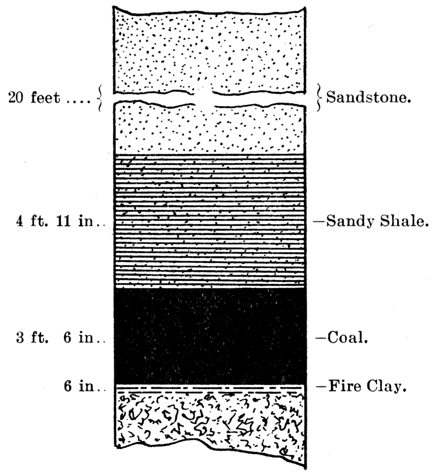
About five miles north of Columbus, at Stippville, the first shaft is met with in passing northward into the coal mining regions. Here the coal is 4 feet thick and lies 20 feet below the surface. It is the Weir-Pittsburg Lower and is of extra good quality. The mine was closed when last visited during the summer of 1897. Two or three miles north of Stippville, on the Perry farm, which is two and one-half miles south of Scammon, on the northwest forty of the quarter section, a pros. pect drill hole has been sunk, the record of which is as follows:
| D—Record of a Drill Hole near Stippville. | |||
|---|---|---|---|
| Material | Thickness of Coal |
Thickness of Strata |
Depth to Bottom of Strata |
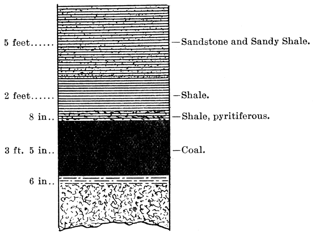
| Soil and Clay | 8 feet | 8 feet | |
| Shale | 1 foot, 6 inches | 9 feet, 6 inches | |
| Coal Blossom | 6 inches | 6 inches | 10 feet |
| Fire Clay | 2 feet | 12 feet | |
| Sandy Fire Clay | 6 feet | 18 feet | |
| Shale | 2 feet, 6 inches | 20 feet, 6 inches | |
| Sandstone | 5 feet, 3 inches | 25 feet, 9 inches | |
| Ironstone | 2 inches | 25 feet, 11 inches | |
| Sandstone | 1 feet, 1 inches | 27 feet | |
| Sandy Shale | 4 feet | 32 feet | |
| Blue Shale, soft | 1 foot | 33 feet | |
| Shale, pyritiferous | 8 inches | 34 feet, 8 inches | |
| Coal | 41 inches | 3 feet, 5 inches | 38 feet, 1 inch |
Figure 6—Section of Well South of Scammon, on Perry Farm.
On the same farm, in the center of the south half, is another prospecting drill hole, which gives the following section:
| E—Record of a Drill Hole near Stippville. | |||
|---|---|---|---|
| Material | Thickness of Coal |
Thickness of Strata |
Depth to Bottom of Strata |
| Soil and Clay | 9 feet | 9 feet | |
| Sandstone | 6 feet | 15 feet | |
| Streaks of Sand and Shale | 7 feet, 6 inches | 22 feet, 6 inches | |
| Soft Blue Shale | 1 foot, 7 inches | 24 feet, 1 inch | |
| Hard Blue Shale | 1 foot, 1 inch | 25 feet, 2 inches | |
| Coal | 45 inches | 3 feet, 9 inches | 28 feet, 11 inches |
The coal reached here at 34 feet 8 inches and at 25 feet 2 inches in D and E respectively is of the same quality as that found at Stippville. The roofing of the former is pyritiferous shale, which makes a fairly good roof, in the latter a good working roof of hard blue shale is found. The floor is a good quality of fire clay. "Horsebacks" occur occasionally. Sulphur in the form of balls and thin laminae of pyrite in the coal is often met with. The workable stratum found here is the Lower.
A stratum intermediate between the Upper and the Lower averaging 6 inches in thickness is passed through here in D, just on the southeast limit, the "blossom" being reached at a depth of 9 feet 6 inches: In E it short distance to the south of D no trace of this "blossom" is found.
Scammon and Vicinity
Two prospecting drill holes on the Scammon farm, designated here as F and G respectively, give the depth of coals with accompanying strata, as passed through in shaft No. 7, northeast quarter of section 4; township 32, range 24.
| F—Record of a Drill Hole at Scammon. | |||
|---|---|---|---|
| Material | Thickness of Coal |
Thickness of Strata |
Depth to Bottom of Strata |
| Clay and Soil | 12 feet | 12 feet | |
| Shale | 4 feet | 16 feet | |
| Coal | 12 inches | 1 foot | 17 feet |
| Fire Clay and Shale | 13 feet | 30 feet | |
| Gray Shale | 13 feet | 43 feet | |
| Sandstone | 3 inches | 43 feet, 3 inches | |
| Blue Shale | 5 feet, 6 inches | 48 feet, 9 inches | |
| Sandstone and Ironstone | 1 feet, 3 inches | 50 feet | |
| Blue Shale | 1 feet, 6 inches | 51 feet, 6 inches | |
| Coal | 6 inches | 6 inches | 52 feet |
| Fire Clay | 8 feet | 60 feet | |
| Sandy Shale, gray | 15 feet | 75 feet | |
| Sandy Shale | 5 feet, 6 inches | 80 feet, 6 inches | |
| Coal | 6 inches | 6 inches | 81 feet, 6 inches |
| Sandstone, gray | 1 feet, 9 1/2 inches | 82 feet, 9 1/2 inches | |
| Coal | 13 1/2 inches | 1 foot, 1 1/2 inches | 83 feet, 1 1/2 inches |
The second well, G, located about 300 feet southwest of the shaft, shows the following sequence of strata:
| G—Record of Drill Hole at Scammon. | |||
|---|---|---|---|
| Material | Thickness of Coal |
Thickness of Strata |
Depth to Bottom of Strata |
| Soil and Clay | 11 feet | 11 feet | |
| Shale | 2 feet | 13 feet | |
| Coal | 6 inches | 6 Inches | 13 feet, 6 inches |
| Fire Clay | 3 feet | 16 feet, 6 inches | |
| Sandstone | 2 feet, 6 inches | 19 feet | |
| Shale | 6 feet | 25 feet | |
| Shale, gray | 15 feet, 11 inches | 40 feet, 11 inches | |
| Sandstone | 1 inch | 41 feet | |
| Blue Shale | 6 inches | 41 feet, 6 inches | |
| Ironstone | 2 inches | 41 feet, 8 inches | |
| Blue Shale | 3 feet, 10 inches | 45 feet, 6 inches | |
| Ironstone | 5 inches | 45 feet, 11 inches | |
| Blue Shale, | 6 inches | 46 feet, 5 inches | |
| Ironstone | 5 inches | 46 feet, 10 inches | |
| Blue Shale | 1 foot, 6 inches | 48 feet, 4 inches | |
| Coal | 4 inches | 4 inches | 48 feet, 8 inches |
| Fire Clay, sandy | 6 feet, 4 inches | 55 feet | |
| Sandstone, gray | 20 feet | 75 feet | |
| Sandy Shale | 4 feet, 11 inches | 79 feet, 11 inches | |
| Coal | 42 inches | 3 feet, 6 inches | 85 feet, 5 inches |
Figure 7—Section of Well at Scammon.
In F and G the Upper is reached at 16 feet and 13 feet respectively from the surface. The coal in this stratum averages 9 inches, and is poor in quality, carrying much pyrite or "sulphur" and "black jack." The floor and roof are good. The Lower stratum, reached at a depth of 82 feet 10 inches and 79 feet 11 inches, respectively, is found to vary considerably in thickness, in G maintaining its usual thickness of 42 inches, while in F it has shrunk to 13 inches. This is simply a local thinning out, a phenomenon which is not of infrequent occurrence. The roof in the above mentioned mine is composed principally of sandstone and arenaceous shales, forming a brittle, unreliable covering to the coal. Fire clay and occasionally a little "black jack" comprise the floor of the mine. The coal is a very good quality, but is somewhat pyritiferous.
As will be seen in examining F a new coal stratum makes its appearance still lower than the one mentioned in D. It is not found in G.
Weir City and Vicinity
A section on the Lewis farm about 300 yards northwest of No. 8 shaft gives a fair record.
| H—Record of a Well near Weir City. | |||
|---|---|---|---|
| Material | Thickness of Coal |
Thickness of Strata |
Depth to Bottom of Strata |
| Soil and Clay | 10 feet | 10 feet | |
| Shale | 6 feet | 16 feet | |
| Sandstone | 1 foot | 17 feet | |
| Blue Shale | 3 feet, 6 inches | 20 feet, 6 inches | |
| Coal | 5 inches | 5 inches | 20 feet, 11 inches |
| Fire Clay | 9 feet, 1 inch | 30 feet | |
| Shale, gray | 6 feet | 36 feet | |
| Sandstone, gray | 11 feet | 47 feet | |
| Sandy Shale | 10 feet, 1 inch | 57 feet, 1 inch | |
| Coal | 39 inches | 3 feet, 3 inches | 60 feet, 4 inch |
The Weir-Pittsburg has dropped out at this place. The Intermediate coal stratum, mentioned in connection with the record D, still occurs at approximately the same hight above the Lower, having a thickness of 5 inches. At 57 feet 1 inch the Lower stratum is mined. The coal is of a good quality, although considerable "sulphur" and "black jack" are found in spots. The roof is made up of arenaceous shale, the same as that noted in G, with a floor made up of fire clay. "Horsebacks" are quite numerous.
On the Kepple farm; near shaft No. 5, a drill hole record shows the strata assuming the following order:
| I—Record of a Drill Hole near Weir City. | |||
|---|---|---|---|
| Material | Thickness of Coal |
Thickness of Strata |
Depth to Bottom of Strata |
| Clay and Sandstone | 13 feet | 13 feet | |
| Shale, hard and soft | 3 feet, 6 inches | 16 feet, 6 inches | |
| Blue Sandy Shale, hard | 7 feet, 6 inches | 24 feet | |
| Blue Shale | 3 feet | 27 feet | |
| Blue Black Shale, soft | 3 feet | 30 feet | |
| Coal | 6 inches | 6 inches | 30 feet, 6 inches |
| Fire Clay | 3 feet | 33 feet, 6 inches | |
| Fire Clay, sandy | 4 feet | 37 feet, 6 inches | |
| Sand and Shale | 10 feet | 47 feet, 6 inches | |
| Fire Clay | 2 feet | 49 feet, 6 inches | |
| Sandy Shale | 6 feet | 55 feet, 6 inches | |
| Coal | 48 inches | 4 feet | 59 feet, 6 inches |
Figure 8—Section of Drill Hole on the Kepple Farm near Weir City.
The Intermediate 6 inch stratum is still persistent. The Lower is found here at a depth of 59 feet 6 inches, with a thickness of 4 feet. The coal is good, although containing some "sulphur" and "black jack." The roof is breaking down into a soft bituminous shale. The floor is of fire clay and "black jack" and is fairly good. "Horsebacks" are numerous.
One and a half miles north of Weir City on the Daisy farm, a prospect hole was sunk within about 250 yards of the Daisy shaft. From the record of this hole the following sequence of strata was noted:
| J—Record of Prospect Hole on the Daisy Farm. | |||
|---|---|---|---|
| Material | Thickness of Coal |
Thickness of Strata |
Depth to Bottom of Strata |
| Soil and Clay | 8 feet, 6 inches | 8 feet, 6 inches | |
| Sandstone | 10 feet | 18 feet, 6 inches | |
| Shale, gray and soft | 6 feet, 6 inches | 25 feet | |
| Coal | 2 inches. 2 inches | 25 feet, 2 inches | |
| Clay, black | 2 feet, 2 inches | 27 feet, 4 inches | |
| Shale, bluish gray | 6 feet, 6 inches | 33 feet, 10 inches | |
| Ironstone | 4 inches | 34 feet, 2 inches | |
| Blue Black Shale | 3 feet | 37 feet, 2 inches | |
| Coal | 4 inches | 4 inches | 37 feet, 6 inches |
| Fire Clay | 1 foot, 8 inches | 39 feet, 2 inches | |
| Gray Sand | 1 foot, 10 inches | 41 feet | |
| Fire Clay | 10 feet | 51 feet | |
| Dark Sand | 10 feet, 6 inches | 61 feet, 6 inches | |
| Shale, soft | 3 feet | 64 feet, 6 inches | |
| Gray Sandy Shale | 5 feet, 10 inches | 70 feet, 4 inches | |
| Sandstone, blue | 3 feet, 8 inches | 74 feet | |
| Coal | 4.2 inches | 3 feet, 6 inches | 77 feet, 6 inches |
Figure 9—Section of Drill Hole on Daisy Farm near Weir City.
The Weir-Pittsburg Upper is here represented by a 2-inch stratum of coal and "black jack" or bituminous shale. The roof is soft shale and is weak. The floor is bituminous clay. The Intermediate stratum occurs 36 feet above the Lower and has a thickness of only a few inches at this point. The roof is bituminous and blue shale; the floor is fire clay. The Lower stratum, reached at a depth of 74 feet has a blue sandstone roof which is bituminous. The coal if of good quality and of average thickness, 3 feet 6 inches. The floor is fire clay; "horsebacks" are quite numerous; "sulphur" and "black jack" are quite abundant, with the "sulphur" occurring in balls or in rounded masses in the seams of the coal. A 4-inch stratum of ironstone, or "bastard rock," as called by the miners, is found 32 feet from the surface. This form of rock occurs quite frequently throughout the Cherokee shales, especially to the north. The bituminous, carbonaceous, and arenaceous shales are still found to merge back and fourth in rapid succession.
On Mr. Scranton's estate, in the southern part of Weir City, about a half mile from the main street, a shaft has been in operation for several years. The lower stratum of coal is worked here at a depth of 30 odd feet. The Upper stratum was passed through not as coal but bearing close resemblance to soft charcoal, a soft, black, bituminous, and carbonaceous earth. The 6 inch stratum before mentioned as lying between the Upper and the Lower is found at this point. To the east of this shaft about a half mile the Lower stratum comes to the surface in a ravine.
Starting from a point a few rods south of this shaft and passing around to the east and north of Weir from one-half mile to a mile and a half of the city strip pits are numerous. These strippings are located on or near the outcropping of the Lower stratum, the Upper cropping out further to the west. The average thickness of material removed in these strippings is 10 feet, although varying from 6 to 16 feet. The coal thus obtained is of a fairly good quality but, on account of its nearness to the surface, has been so thoroughly saturated by surface waters that it is badly slacked and therefore rendered soft and difficult to handle. For several years it has been mined quite extensively by stripping in the northern part of the city to supply the smelters located near by, but recently less has been stripped than formerly. The covering of the coal is, as a rule, light blue shale, often merging into arenaceous shales and sandstone. The floor is fire clay; "horsebacks" are quite numerous and troublesome.
About a mile and a half northeast of Scammon considerable mining by stripping has been done in times past. Coal is still removed at this point by Mr. Clemens, and there is demand for it. The coal in this neighborhood is in better condition than that stripped further east. The reason for this is that it is farther from the outcroppings and is generally at a greater depth and is therefore less affected by weathering, but it is also more expensive to work. "Horsebacks" occur quite frequently in these strippings.
Chicopee
Three prospect drill holes in the vicinity of Chicopee will serve to show the association of strata at this point. The reoord of hole No. 1, located on section 27, township 30, range 24, reads as follows:
| K—Record of a Prospect Well near Chicopee | ||||||||||
|---|---|---|---|---|---|---|---|---|---|---|
| Material | Thickness of Coal |
Thickness of Strata |
Depth to Bottom of Strata |
|||||||
| Soil | 13 feet | 13 feet | ||||||||
| Gray Shale | 4 feet, 6 inches | 17 feet, 6 inches | ||||||||
| Dark Shale | 4 feet, 6 inches | 22 feet | ||||||||
| Gray Shale | 10 inches | 22 feet, 10 inches | ||||||||
| Coal | 10 1/2 inches | 10 1/2 inches | 23 feet, 8 1/2 inches | |||||||
| Gray Shale | 7 feet | 30 feet, 8 1/2 inches | ||||||||
| Black Shale, hard | 5 feet, 1 inch | 35 feet, 9 1/2 inches | ||||||||
| Coal | 7 inches | 7 inches | 36 feet, 4 1/2 inches | |||||||
| Gray Shale | 10 inches | 37 feet, 2 1/2 inches | ||||||||
| Black Shale | 5 feet, 1 inch | 42 feet, 3 1/2 inches | ||||||||
| Coal | 6 1/2 inches | 6 1/2 inches | 42 feet, 10 inches | |||||||
| Gray Shale, hard | 22 feet | 64 feet, 10 inches | ||||||||
| Gray Sandstone, hard | 9 feet, 7 inches | 74 feet, 5 inches | ||||||||
| Coal | 32 inches | 2 feet, 8 inches | 77 feet, 1 inch | |||||||
| Black Shale | 1 foot | 78 feet, 1 inch | ||||||||
| Gray Shale, soft | 6 feet, 4 inches | 84 feet, 5 inches | ||||||||
| Total depth of well, 95 feet 7 inches. | ||||||||||
Hole No. 2, on section 27, township 30, range 24, gives the following sequence of strata:
| L—Record of a Prospect Well near Chicopee. | |||
|---|---|---|---|
| Material | Thickness of Coal |
Thickness of Strata |
Depth to Bottom of Strata |
| Clay and Gumbo | 17 feet, 3 inches | 17 feet, 3 inches | |
| Black Shale, hard | 5 feet, 5 inches | 22 feet, 8 inches | |
| Coal | 32 inches | 2 feet, 8 inches | 25 feet, 4 inches |
| Gray argillaceous Shale | 6 feet | 31 feet, 4inches | |
| Limestone, blue, fossiliferous | 8 inches | 32 feet | |
| Gray argillaceous Shale | 8 feet, 6 inches | 40 feet, 6 inches | |
| Black Shale | 3 feet, 8 inches | 44 feet, 2 inches | |
| Coal | 14 inches | 1 foot, 2 inches | 45 feet, 4 inches |
| Gray argillaceous Shale | 4 feet | 49 feet, 4 inches | |
| Gray Shale | 22 feet, 2 inches | 71 feet, 6 inches | |
| Black Shale | 6 feet | 77 feet, 6 inches | |
| Coal | 6 inches | 6 inches | 78 feet |
| Gray arenaceous Shale | 12 feet, 6 inches | 90 feet, 6 inches | |
| Gray arenaceous Shale | 2 feet | 92 feet, 6 inches | |
| Gray arenaceous Shale | 6 feet | 98 feet, 6 inches | |
| Coal | 39 inches | 3 feet, 3 inches | 101 feet, 9 inches |
| Black Shale | 1 foot, 1 inch | 102 feet, 10 inches | |
Figure 10—Section of Drill Hole near Chicopee.
Hole No. 3, located on section 27, township 30, range 24, although a trifle deeper than either 1 or 2—K or L—shows the same association of strata at this locality. The record is as follows:
| M—Record of a Prospect Well near Chicopee. | |||
|---|---|---|---|
| Material | Thickness of Coal |
Thickness of Strata |
Depth to Bottom of Strata |
| Clay and Gumbo | 12 feet, 8 inches | 12 feet, 8 inches | |
| Black Clay | 2 feet | 14 feet, 8 inches | |
| Coal | 28 inches | 2 feet, 4 inches | 17 feet |
| Argillaceous Shale, gray | 11 feet | 28 feet | |
| Blue Limestone | 6 inches | 28 feet, 6 inches | |
| Argillaceous Shale, gray | 4 feet, 6 inches | 33 feet | |
| Dark Shale | 10 inches | 33 feet, 10 inches | |
| Gray Limestone | 1 foot, 2 inches | 35 feet | |
| Dark Shale | 4 inches | 35 feet, 4 inches | |
| Coal | 9 inches | 9 inches | 36 feet, 1 inch |
| Argillaceous Shale, gray | 5 feet, 7 inches | 41 feet, 8 inches | |
| Gray Shale | 19 feet, 9 inches | 61 feet, 5 inches | |
| Black Shale | 2 feet | 63 feet, 5 inches | |
| Blue Limestone | 4 inches | 63 feet, 9 inches | |
| Black Shale | 4 feet, 4 inches | 68 feet, 1 inches | |
| Coal | 5 inches | 5 inches | 68 feet, 6 inches |
| Gray Shale | 9 feet | 77 feet, 6 inches | |
| Gray Sandstone | 1 foot, 6 inches | 79 feet | |
| Shale, hard | 1 foot, 6 inches | 80 feet, 6 inches | |
| Blue Limestone | 7 inches | 81 feet, 1 inch | |
| Gray Shale, hard | 10 feet | 91 feet, 1 inch | |
| Gray Sandstone | 3 feet, 4 inches | 94 feet, 5 inches | |
| Gray Shale, hard | 1 foot, 8 inches | 96 feet, 1 inches | |
| Coal | 25 1/2 inches | 2 feet, 1 1/2 inch | 98 feet, 2 1/2 inches |
| Dark argillaceous Shale | 1 foot | 99 feet, 2 1/2 inches | |
The Upper stratum is reached in K, L, and M at 21, 22, and 14 feet, respectively. The roof of this coal is argillaceous and bituminous shale, in some places weak, but as a general rule making a fairly good supporting roof. The floor material is similar to that of the roof, being argillaceous shale.
The Intermediate stratum increases a trifle in thickness as it passes to the north, having here an average thickness of 7 inches. The bituminous shale here makes a very good covering and is quite persistent. The floor is a good quality of hard, gray shale and is tolerably level, making a good working floor.
The Lower stratum is reached at a depth of 83 feet 7 inches, 93 feet 6 inches, and 96 feet 1 inch, in K, L, and M, respectively. The roof merges from hard blue shale in M to arenaceous shale in L, then to hard sandstone in K. The floor consists of a very bituminous hard shale, yet in M an argillaceous shale is met with, making a poor working floor.
The large amount of bituminous (black) shales and clays found in these drill hole records, as well as the arenaceous shales and sandstone, are very characteristic of these shale beds as noted farther south.
The Area North of Pittsburg and Chicopee
A smaller number of records of wells and shafts have been obtained from the area lying north of Chicopee and Pittsburg than have already been given for the southern portion of the country, but from observations taken covering the greater part of the above mentioned district it is found that the coal strata continue to dip gradually deeper beneath the surface to the north and west at an angle which does not differ materially from that already observed farther south. The Weir-Pittsburg Lower outcrops in the vicinity of Pittsburg and has been stripped quite extensively on the south, west, and north of the city. At present it is taken from the clay pits at the clay factory at which place it is found at a depth of from 16 to 20 feet below the surface, being overlaid with arenaceous and argillaceous shales. The line of outcrop passes northeastward from Pittsburg to the state line -eight to ten miles from Pittsburg. The outcropping is seen only in the ravines, consequently on the higher ground to the north and west the coal is mined by shafting.
Details of Stratigraphy in the Mines
To give a more definite idea of the depth of the workable strata of coal, their thickness, and the character of the associated strata, the exact data will be given as obtained directly from the operators of the various mines. The mines from which the following data were obtained are located principally in Cherokee county.
- 1. The Western Coal Mining Company, Mine No. 3. Fleming. The mine is 100 feet deep. Thickness of coal is 3 feet 3 inches. The roof is blue shale, merging into sandy shale. Considerable gas is found here. The floor is generally fire clay, but quite frequently pyritiferous "black jack." The Lower coal stratum is mined.
- 2. The Western Coal Mining Company, Mine No. 2. Fleming. The mine is 100 feet deep. Coal is 3 feet 2 to 4 inches in thickness. The floor is level and composed of fire clay and pyritiferous "black jack," which makes mining difficult as the force of the charge in blasting is lost in the elastic "black jack." The roof is shale, sometimes sandy. The Lower coal stratum is mined here.
- 3. The Schaub Coal Company. The J. H. Durkee Coal Company, lessee, Mine No. 3. The mine is located on the southwest quarter of section 6, township 32, range 24. The mine is 50 .feet deep and the coal is 3 feet 6 inches in thickness. Very little "black jack" is found associated with roof or floor. Little or no iron pyrite or "sulphur" occurs. The floor is level and smooth and composed of fire clay. The roof is blue shale and a trifle arenaceous in places. The Lower coal stratum is mined.
- 4. Hamilton and Grant Coal Company, Mine No. 3. Weir City. The mine is 30 feet deep. Coal is 3 feet 6 inches thick. "Horsebacks" are numerous and "black jack" is troublesome. The roof is composed of shale and sandy shale. The floor is "black jack" and fire clay. The Lower coal stratum is the one mined.
- 5. Kansas and Texas Coal Company, Mine No. 47. North of Weir three miles. The mine is 30 feet deep and the coal 3 feet 4 to 6 inches in thickness. The floor dips to the northwest, is quite smooth, and is composed principally of fire clay with a little "black jack" intermixed. Roof is shale—fairly good. Lower coal stratum is mined.
- 6. Kansas and Texas Coal Company, Mine No. 23. North of Weir three miles. The mine is 42 feet deep. Coal is 3 feet 6 to 8 inches in thickness. The floor is rather uneven and is composed of fire clay and "black jack." The roof is shale and sandy shale. The Lower stratum is mined.
- 7. Kansas and Texas Coal Company, Mine No. 18. North of Weir nearly three miles. The mine is 76 feet deep and the coal is 3 feet 6 inches in thickness. The roof is arenaceous shale and sandstone—poor. The floor is composed of shale and "black jack," 3 to 4 inches in thickness, then fire clay—poor. "Horsebacks" are numerous. The Lower stratum is mined.
- 8. Hamilton and Braidwood, Mine No. 2, In the vicinity of Weir. The mine is 73 feet deep. Coal is 3 feet 3 to 6 inches thick. The roof is arenaceous shale and sandstone-poor. There are 6 inches of "black jack" under the coal, then fire clay. At this point the drill hole, 110 feet deep, shows two other coal strata -10 and 8 inches in thickness, respectively. The depths at which these two strata were reached were not known to the operator. The roof is arenaceous shale. "Horse. backs" are of frequent occurrence. The Lower stratum is worked.
- 9. The Central Coal and Coke Company, Mine No. 5. In the vicinity of Weir. Mine is 60 feet deep. Coal is 3 feet 6 inches thick. A strip of faulty coal, several rods wide, passes through this neighborhood trending northeast and southwest. "Horsebacks" are very numerous. The roof is arenaceous shale and shale. The floor is fire clay and "black jack." "Black jack" is not very troublesome. Lower stratum is worked.
- 10. Durkee Coal Company, Mine No. 1. Location: East half of the northeast quarter of section 33, township 31, range 24. The mine is 50 feet deep, and coal is 3 feet 8 inches in thickness, and dips very perceptibly to the northwest. The roof is shale and sandy shale. The floor is fire clay and "black jack," but there is very little of the latter. Lower stratum is mined.
- 11. John Bennett Coal Company, Mine No. 5. In the vicinity of Weir. Mine is 55 feet deep. Coal is 3 feet 6 inches in thickness. The roof is shale: The floor, composed of "black jack" and fire clay, dips to the northwest. "Horsebacks" are numerous. The stratum mined is the Lower.
- 12. Central Coal and Coke Company, Mine No. 8. West of Weir. The mine is 75 feet deep. The coal is 3 feet 4 to 6 inches thick. The floor is almost level, dipping to the west slightly, and is composed of fire clay and "black jack," with very little of the latter. The roof is shale, fairly good. "Horsebacks" are of frequent occurrence. The stratum mined is the Lower.
- 13. Weir Brothers Coal Company, Mine No. 2. Weir City. Mine is 96 feet deep. The coal is 3 feet 4 to 8 inches thick. The floor is fire clay and "black jack." The roof is shale and sandy shale. Some gas is found here. "Horsebacks" are met occasionally. The stratum worked is the Lower.
- 14. Central Coal and Coke Company, Mine No. 6. West of Weir. Mine is 72 feet deep. Coal is 3 feet 8 inches thick. Floor is fire clay and "black jack." Roof is blue shale. n Horsebacks" are numerous. Lower stratum is worked.
- 15. Davis Coal Company, Mine No. 3. The mine is, located on the northeast quarter of section 19, township 31, range 24. Cherokee. Depth of mine is 150 feet. Two strata are found here. The first is reached at a depth of 40 feet where the coal is 2 feet thick; the second at a depth of 150 feet where the coal is 3 feet 3 to 6 inches thick. The floor is fire clay with a thin stratum of "black jack" next to. the coal. "Horsebacks" are not numerous. The Lower stratum is mined.
- 16. Norton's Works, Mine No. 2. Durkee Coal Company, lessee, Mine No. 3. Scammon. The mine is 67 feet deep, and the coal is 4 feet in thickness. .Floor strata as shown in "sump" are as follows: "black jack" 2 to 3 inches in thickness; blue shale 18 to 20 inches; coal 2 to 3 inches; and fire clay 2 to 3 feet in thickness. The roof is arenaceous shale and sandstone, fossiliferous. The floor is rough and wavy and dips to the northwest. "Horsebacks" are numerous. The stratum mined is the Lower.
- 17. The Durkee Coal Company, Mine No. 4. Location is on the northeast half of section 16, township 31, range 24. The mine is 60 feet deep. Coal is 3 feet 6 inches to 4 feet thick. The roof is blue shale. The floor is "black jack," shale, and fire clay, similar to that found in No. 16. "Horsebacks" are quite numerous. The Lower stratum is worked.
- 18. Southwestern Coal and Improvement Company, Mine No. 6. Mineral City. The mine is 125 feet deep. The coal is 3 feet 8 to 10 inches in thickness. "Horsebacks" are very troublesome. The roof is blue shale and is fairly good. The floor is "black jack" and pyritiferous fire clay. The coal carries considerable pyrite in the nature of fine seams and bands. The floor is wavy and dips to the northwest. Gas is found here. The Mineral City Lower is mined here,
- 19. The McCune Coal Company. McCune. This company's mine is 400 feet deep. There are six strata of coal. One is 6 inches in thickness; three are 1 foot each in thickness; one is 2 feet; and one is 18 inches. Both the 18 inch and the 2 foot strata have been worked. The 24 inch strata is probably the Weir-Pittsburg Upper. The roof is shale and sandstone. The floor is fire clay and "black jack."
- 20. Columbus Coal Company, Mine No. 4. This mine is located at the southeast corner of the northwest quarter of section —, township 32, range 24, and is 25 feet deep. The coal is 4 feet thick. The roof is blue shale and sandy shale. The floor is fire clay and "black jack." "Horsebacks" occur here. The stratum worked is the Lower.
Inclination of Coal Beds
It is desirable to determine the inclination of the coal beds. The practical question for the miner being the distance below the surface at which the coal is found the inclination of the coal beds with reference to the surface rather than with reference to a level will be sought after. But as the whole of the coal mining area in Cherokee and Crawford counties is almost level the figures obtained will not differ materially from figures obtained showing the dip referred to the horizontal.
The Weir-Pittsburg Lower may be traced from its outcrop. ping three-fourths of a mile east of Weir westward to the limit of mining operations at Mineral City, by noticing its position in the records of the strip-pits, shafts, and drill holes located between these two points. The Lower occurs here as follows:
- 1. In the strip-pits east of Weir at a depth of from 10 to 16 feet.
- 2. At Mr. Scranton's mine in the southeastern part of Weir at a depth of 30 odd feet.
- 3. In the Daisy shaft at a depth of 75 feet.
- 4. In prospect hole No. 2 as seen in record G at a depth of 79 feet.
- 5. At Cherokee at a depth of 150 feet.
- 6. In prospect hole, record A, five miles north of Mineral City, at 229 feet 6 inches.
This makes an average westward dip below the surface of 20 feet to the mile.
The Weir-Pittsburg Lower may be traced to the north from its outcropping near Columbus, but as the exact location of the outcrop is uncertain, due to the covering of soil, it would probably be best to use the locality where the exact depth of the stratum is known as the initial point in the correlation on the south.
- 1. A shaft at Stippville, a few miles north of Columbus, reached the Lower stratum at a depth of 25 feet.
- 2. On the Perry farm two and a half miles south of Scammon, in prospect hole No. 2, record D, it was found at a depth of 24 feet 8 inches.
- 3. On the Scammon farm, near Scammon, in hole No. 2, record G, the Weir-Pittsburg Lower was reached at a depth of 79 feet 11 inches.
- 4. Still farther north at the Daisy shaft, on the Daisy farm, it was met with at a depth of 75 feet.
- 5. At the M. K. & T. mine No. 18, a few miles north of Weir, it is reached at a depth of 75 feet.
- 6. At Fleming the same stratum is worked at a depth of 100 feet.
From the above it will be seen that the dip to the north is on the average 4 feet to the mile below the surface.
The Weir-Pittsburg Upper stratum may be traced as follows:
- 1. It is first noted in records F and G at 16 and 13 feet, respectively.
- 2. In the Daisy shaft the Upper occurs at a depth of 20 odd feet.
- 3. At Fleming this stratum is reached at 18 or 20 feet.
We thus see that this coal stratum is dipping below the surface on an average of 3 feet to the mile, in passing northward.
Passing westward from Weir to Mineral City and vicinity the following points may be noted at which the Upper stratum can be found:
- 1. The "blossom" of the Upper appears on the Scranton farm one-half mile south of Weir at a few feet from the surface.
- 2. On the Daisy farm, one and one-half miles north of Weir (see record J) , the Upper is reached at a depth of 24 feet from the surface.
- 3. Near Scammon, in hole No. 2, record F, it is reached at a depth of 16 feet.
- 4. At Cherokee it was reached at a depth of 40 feet.
- 5. North of Mineral City, see records A and B, it was reached at 96 feet 7 inches and 122 feet 2 inches, respectively.
This gives for the Upper an average westward dip beneath the surface of 12 feet to the mile.
This difference in westward inclination of the two main coal beds is somewhat surprising and at the same time interesting. It implies that throughout this area there was a more rapid accumulation of shale forming material to the west during the interval between the production of the two coal beds. This excessive westward thickening averages 8 feet to the mile, the difference between the dip of the two coal beds. The general westward inclination of the Cherokee shales as a whole along the south line of the state, as shown in Plates I and II, is about 20 feet to the mile. The westward inclination of the Lower or principal coal bed is therefore about the same as that of the Cherokee shales, while the position of the Upper coal bed is such that it is inclined to the general bedding planes of the Cherokee shales.
The dip of the Cherokee shales to the north and west, in Cherokee county, is therefore quite marked, which dip soon carries them below the higher geological formations to the north and west, and to such a depth that in a comparatively short distance beyond the upper line of outcrop the accompanying coal strata become, for the present, unworkable.
The Intermediate coal stratum is as persistent in the constancy of its thickness and extent of occurrence as well as in its dip as are the Upper and Lower.
Arcadia Area
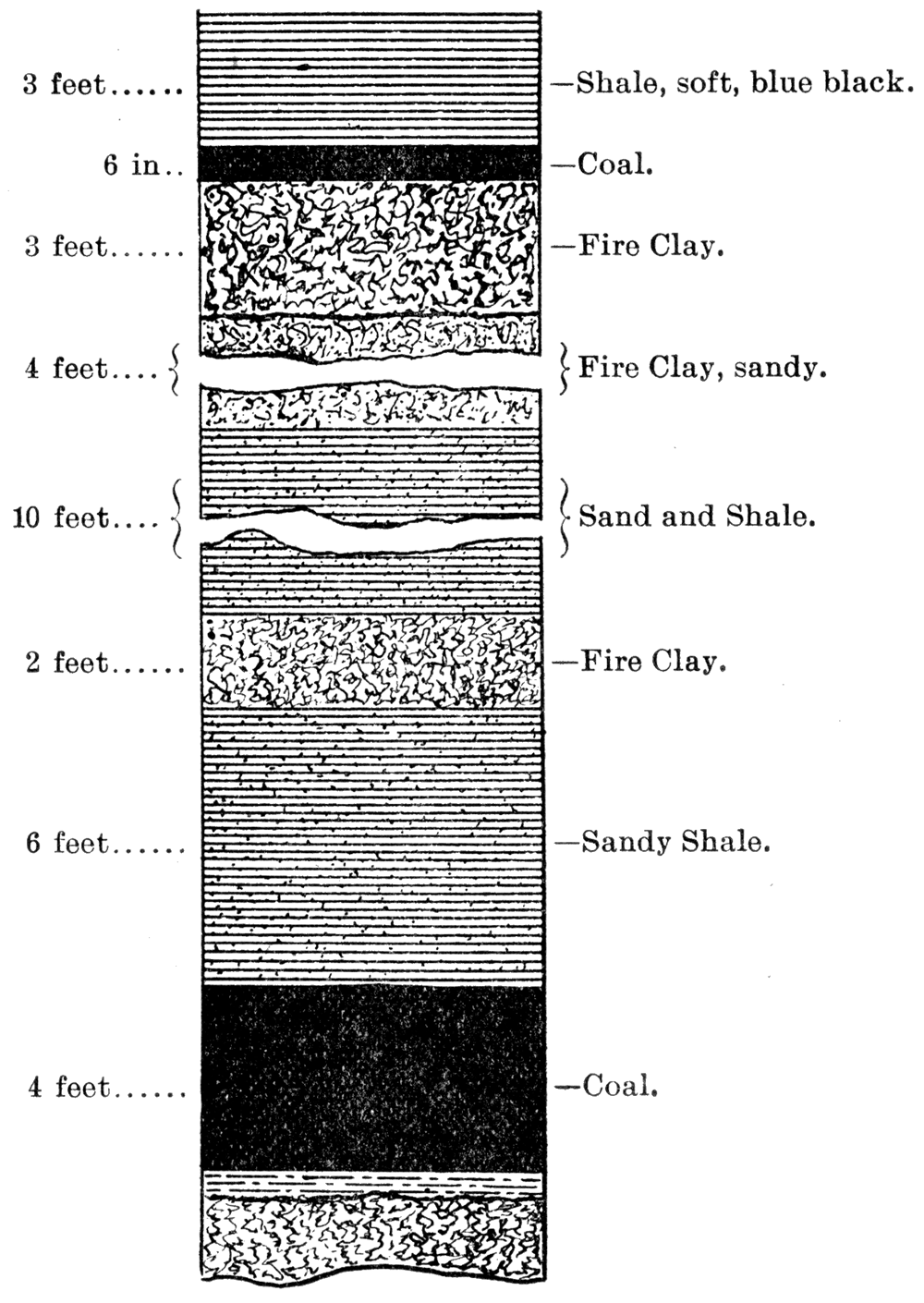
At Arcadia three strata are found from which considerable coal is removed. The upper stratum comes within a few feet of the summits of Bunker Hill and Coal Mound, at which places it is mined. It resembles the Fort Scott "red" and is much used as a domestic fuel. The second stratum is stripped just east of town, and is also drifted for on the creek bank south of Arcadia. At Coalvale, about four miles south of Arcadia, a third stratum is shafted for in the creek valley. These coal strata average probably 20 inches in thickness and produce large quantities of good coal which is put on the market in competition with Weir-Pittsburg coals to the south. These strata belong to the Cherokee Shales, but are higher than those to the south. Plate XXXI shows the association of strata found here.
Fort Scott Area
Near the top of the Cherokee shales in the vicinity of Fort Scott coal has been mined for over thirty years. Here there are two beds of coal, one from 6 to 10 feet below the lower Oswego limestone, and the other 60 feet or more still further below. The former is mined in many places around Fort Scott, while the latter is mined to a lesser extent near the state line along the Drywood and along the Marmaton.
Coal mining was first begun in the Fort Scott vicinity about the close of the war, in 1865. The upper bed of coal outcropped in a thousand places along the banks of the ravines, and larger tributaries of the Marmaton. Here exposed to the weathering agents the iron sulphide within it became oxidized, producing iron rust which gave the coal a rusty appearance from which the name "red coal" was derived. Being so close to the overlying Oswego limestone the escarpments and steep bluffs produced on account of the protective action of the limestone made it possible for the coal to be oxidized completely along the surface and to be practically unaffected only a few feet back in the bank. The contrast between this condition and the conditions in the vicinity of Weir City and Pittsburg, where there is no protective limestone overlying, is very great. In the latter place such a weathering and such a production of "red" coal extends many times as far back from the line of outcropping while this outcropping line is concealed almost entirely by the overlying soil so plentifully produced by the decomposition of the shales.
When the Kansas City, Fort Scott & Gulf railroad, now the .Kansas City, Fort Scott & Memphis railroad, entered Fort Scott in 1869 a strong demand was created for coal which was principally supplied by mining the Fort Scott "red." The road soon ran a switch into the mining territory five or six miles southeast of Fort Scott so that the coal could be loaded directly on the cars. Previous to this improvement it had been teamed. to the stations of Fort Scott and Godfrey and loaded onto the cars from wagons. Later, after the road had reached the southern state line, and after the coal mines in Cherokee and Crawford counties were opened, the railroad found it to their advantage to obtain their supply of coal from the southern mines where the coal is thicker and consequently cheaper.
Since that date the principal mining of the Fort Scott coals has been confined to supplying the local demand. Occurring in so many places immediately at the surface where stripping can be done at so Iowan expense and where drifts can be carried back into the bank a short distance without the use of machinery it offers an excellent opportunity for the small miner to work at odd times and during the winter and to devote the remainder of his time to other employment. Many thousands of bushels are mined annually in this way and carted into Fort Scott for the retail market. The "rusty" coal is particularly desirable for use in the forges of blacksmiths and also for other fires where the presence of a small amount of sulphur is especially objectionable. The output of Bourbon county is confined principally to these two beds from the Cherokee shales, the upper one of which furnishes the "rusty" coal. Still, a small amount of coal is mined in the northern part of Bourbon county from beds which occupy a higher position, as will be explained under the Pleasanton shales.
In 1897 Bourbon county produced 28,483 tons of coal, which equals .86 percent of the total state production.
Leavenworth Area (E. Jameson, 1890, Coal Resources of Leavenworth, Kansas, Leavenworth)
North from Fort Scott no coal has been mined from the Cherokee shales until the vicinity of Leavenworth is reached. Here the Leavenworth coal is obtained from the upper part of the Cherokee shales. The coal at this place is about 2 feet thick, averaging for the whole mine run possibly a little less. Twenty-five feet below the coal which is being worked lies another bed of about the same thickness and quality although it has not yet been mined, while still further below is a third coal bed also about 2 feet in thickness. The Leavenworth mining area lies just to the southeast of the Oread escarpment, so that in order to reach the coal the shaft must pass through the lower part of the Lawrence shales and all intervening formations, which here are not as thick as they are in the southern part of the state by some 200 or 300 feet.
This same coal horizon outcrops further east, in Missouri, from which coal has been mined for more than forty years. It was the knowledge of this outcropping that led that veteran geologist, Maj. F. Hawn, to predict so emphatically the existence of coal under Leavenworth and to estimate its depth so accurately. Fortunately for him and all concerned his prediction came true, although dozens of oil and gas wells in southern Kansas, starting from about the same geologic horizon, just east of the Oread escarpment, have passed entirely through the Cherokee shales without finding nearly so much coal as exists at Leavenworth. Had Major Hawn been familiar with many of the facts recently brought to light in drilling for oil and gas in southern Kansas probably his faith in the existence of the Leavenworth coal would have been less strong and most likely the Leavenworth mines never would have been developed.
History of Development of the Leavenworth Area
In 1859, after much persistent effort, Major Hawn organized the Leavenworth Coal Mining Company. The next year twenty acres of land on the government reservation were leased and a prospect hole was commenced with a rude drill operated by a spring pole. The civil war, lack of money, and want of confidence in Major Hawn's convictions led the company to abandon the enterprise and to transfer all their rights to Major Hawn who continued the prospecting intermittently as he could secure means to push it.
A 2 foot bed of coal was reached in 1865. The city now granted to Major Hawn the right to mine under the streets and alleys of Leavenworth. A new company was then organized and the right to mine under the military reservation was granted by the Post Commander and confirmed by the Secretary of War. On July 20, 1868, Congress confirmed this grant and sold the company a tract of twenty acres from the reservation. In January 1869, Major Hawn transferred back to the Leavenworth Coal Mining Company all his rights in the mines and lands.
Figure 11—Section of the Lansing Coal Shaft.
The shaft reached the bed of coal at 713 feet in 1870. For two years the mine was operated at a loss. It had cost $200,000, the stock represented $300,000 face value, but was worth only fifteen cents on the dollar in the market. Through the influence of Doctor Sinks, a gentleman much interested in the mining operations, Hon. Lucien Scott, of the First National Bank, in 1872 purchased a large interest in the mine and in the same year the company employed as mine superintendent a practical mining engineer, Mr. John E. Carr, a man of wide experience in managing mines in England and in different parts of America. Under his supervision the mine was re-timbered, the ventilation improved, and the capacity greatly enlarged. In 1880 a new shaft was sunk, and in 1882 the size of the old shaft was increased, and the most improved machinery introduced in the mine and buildings, A system of cable roads was introduced in 1885, supplanting the mule cars commonly employed in coal mines. A hole has since been drilled below the shaft to a total depth of 1130 feet and shows four workable beds of coal, aggregating 8 feet.
In 1879 the Legislature authorized the officers of the State Penitentiary to sink a shaft at Lansing and appropriated $25,000 for that purpose. On November 20, 1879, under the direction of Mr. Oscar F. Lamm, the shaft was begun, and on January 15, 1881, coal was reached at 713 feet.
In 1885, Mr. John Braidwood, State Inspector of Coal Mines, resigned his position and assisted in organizing the Riverside Coal Company. That fall. the city voted $10,000 in bonds in aid of the enterprise, as authorized by the Legislature at its previous session. The shaft was begun on January 17, 1886, and coal reached on September 17, of the same year. The shaft was sunk and coal hoisting begun at a cost of less than $50,000. In 1888 this company began freighting coal down the Missouri river to Kansas. City in barges, but the difficulties of river navigation were so great that this was soon abandoned.
In March, 1889, the shaft of the Home Coal Mining Company reached coal at a depth of 710 feet and mining was actively begun. The shaft was carried 30 feet below the first bed and at 25 feet a second bed of 22 inch coal was found, the same as has since been shown by the drill at other places.
Several other attempts at coal mining were made about 1888 and 1889. The Brighton Coal Company's shaft was the next one completed and reached coal at a depth of 850 feet about the close of 1889. This shaft was operated for one season, after which work was suspended and has not been resumed. A prospect hole was drilled in 1889 at Tonganoxie and coal found at a depth of 850 feet, but no development has yet been made.
The Home Coal Mining Company and the Riverside Coal Company were consolidated on August 1, 1894, under the name of the Home-Riverside Mining Company. The two shafts, about a mile apart, were connected by a tunnel, making them virtually one large mine.
The production and number of men employed by the Leavenworth mines during 1897 is as follows:
| Leavenworth Company | 112,261 tons | 301 men |
| Home-Riverside Company | 190,000 tons | 435 men |
| Penitentiary mine | 64,880 tons | 336 men |
| Total of Leavenworth county | 367,141 tons tons | 1,072 men |
Coal Production from the Cherokee Shales
From the foregoing discussion it will be seen that the Cherokee shales are a great coal producing formation and that at present they produce nearly all the coal mined in the state. By reference to Table III, [following], it will be seen that for 1897 they produced 93.32 percent of the total state output, and that for preceding years they produced a proportion which gradually decreases backwards. With the current low price of coal and the consequent necessity of operating mines which can produce coal at the least possible cost the tendency will be for the percent of output from the Cherokee shales to increase. Should the time come when the price of coal will permit the operation of the many lesser mines in the upper horizons then we shall have a relative decrease in the production from the Cherokee shales.
Table III—Showing amount and value of coal produced in Kansas by counties, arranged according to geologic formations, and percent of state output by counties and geologic formations.
| Geologic Formation | County | Number of Tons Produced | Estimated Value | Percent of State Output by Counties | Percent of State Output by Geologic Formations | ||||||||||||||||||||||||||||
|---|---|---|---|---|---|---|---|---|---|---|---|---|---|---|---|---|---|---|---|---|---|---|---|---|---|---|---|---|---|---|---|---|---|
| 18901 | 18911 | 18921 | 1893 | 1894 | 1895 | 18961 | 1897 | 18901 | 18911 | 18921 | 1893 | 1894 | 1895 | 18961 | 1897 | 18901 | 18911 | 18921 | 1893 | 1894 | 1895 | 18961 | 1897 | 18901 | 18911 | 18921 | 1893 | 1894 | 1895 | 18961 | 1897 | ||
| Cherokee Shales | Bourbon | 19,000 | 19,200 | 50,000 | 28,483 | $33,250 | $33,600 | $75,000 | $56,966 | .659 | .531 | 1.56 | .86 | 77.09 | 81.53 | 81.97 | 85.653 | 88.796 | 85.99 | 74.40 | 93.32 | ||||||||||||
| Cherokee | 724,861 | 832,289 | 825,531 | 807,796 | 1,036,614 | 1,013,612 | 918,944 | 1,061,409 | $882,186 | $989,785 | $1,009,524 | $1,009,704 | $1,295,768 | $1,013,612 | $1,206,022 | $1,010,343 | 28.89 | 30.02 | 27.45 | 28.030 | 28.705 | 28.77 | 25.65 | 32.24 | |||||||||
| Crawford | 900,464 | 997,759 | 1,309,246 | 1,377,265 | 1,809,836 | 1,517,936 | 1,271,434 | 1,590,620 | $1,114,701 | $1,090,540 | $1,413,423 | $1,721,581 | $2,262,295 | $1,517,936 | $1,229,691 | $1,566,761 | 35.78 | 36.23 | 43.53 | 47.790 | 50.117 | 47.57 | 39.83 | 48.32 | |||||||||
| Labette | 4,000 | 800 | 800 | 4,000 | 3,400 | 2,500 | 600 | 2,000 | $9,000 | $2,000 | $2,000 | $9,000 | $7,650 | $5,000 | $1,200 | $4,000 | .15 | .03 | .02 | .139 | .094 | .07 | .01 | .06 | |||||||||
| Leavenworth | 319,866 | 380,142 | 330,166 | 260,378 | 337,644 | 258,060 | 284,700 | 367,141 | $490,224 | $530,681 | $528,307 | $423,115 | $548,672 | $364,900 | $368,825 | $458,926 | 12.27 | 13.84 | 10.97 | 9.035 | 9.349 | 8.02 | 8.91 | 11.84 | |||||||||
| Pleasanton Shales | Linn | 10,474 | 38,934 | 43,913 | 74,085 | 58,476 | 32,000 | $14,534 | $26,775 | $14,078 | $47,901 | $55,645 | $92,606 | $73,095 | $40,750 | $14,176 | $29,452 | .41 | 1.41 | 1.46 | 2.571 | 1.619 | 1.02 | .45 | .81 | .41 | 1.41 | 1.46 | 2.571 | 1.619 | 1.02 | .45 | .81 |
| Thayer Shales | Montgomery3 | ||||||||||||||||||||||||||||||||
| Neosho3 | |||||||||||||||||||||||||||||||||
| Wilson3 | |||||||||||||||||||||||||||||||||
| Lawrence Shales | Franklin | 9,045 | 10,277 | 11,150 | 22,051 | 16,021 | 18,000 | 12,861 | 6,452 | $18,130 | $19,528 | $20,671 | $44,103 | $32,042 | $34,200 | $23,506 | $12,097 | .35 | .37 | .37 | .765 | .443 | .56 | .40 | .11 | .35 | .37 | .37 | .768 | .512 | .77 | .54 | .26 |
| Douglas3 | |||||||||||||||||||||||||||||||||
| Atchison | 115 | 2,500 | 7,000 | 4,592 | 5,152 | $214 | $5,625 | $10,050 | $9,184 | $12,880 | .003 | .069 | .21 | .14 | .15 | ||||||||||||||||||
| Osage Shales | Brown | 2,000 | 3,400 | 2,300 | $4,500 | $5,850 | .055 | .11 | .07 | 7.59 | 12.93 | 12.55 | 10.589 | 8.587 | 8.70 | 5.97 | 5.96 | ||||||||||||||||
| Chautauqua | 1,760 | 1,520 | 3,000 | 1,200 | $4,400 | $3,800 | $6,000 | .062 | .042 | .10 | .03 | ||||||||||||||||||||||
| Coffey | 12,200 | 1,218 | 3,664 | 15,000 | 3,500 | 3,600 | 10,000 | $6,800 | $32,813 | $7,815 | $8,100 | $22,500 | .48 | .04 | .12 | .520 | .096 | .11 | .30 | ||||||||||||||
| Elk | 800 | 1,500 | 320 | $2,000 | $3,900 | $800 | .022 | .04 | + | ||||||||||||||||||||||||
| Lyon | 360 | 775 | 835 | $900 | $1,850 | $1,878 | .009 | .02 | .02 | ||||||||||||||||||||||||
| Osage | 179,012 | 355,286 | 372,806 | 280,758 | 296,011 | 263,036 | 190,948 | 181,857 | $242,198 | $724,232 | $759,225 | $529,900 | $555,021 | $462,313 | $324,250 | $300,974 | 7.11 | 12.89 | 12.43 | 9.742 | 8.197 | 8.18 | 5.97 | 5.52 | |||||||||
| Shawnee | 7,633 | 6,000 | 4,500 | 804 | $22,900 | $17,500 | $11,250 | $2,146 | .265 | .166 | .14 | .02 | |||||||||||||||||||||
| Cretaceous | Cloud | 3,588 | 3,700 | 5,000 | 2,800 | $9,866 | $9,250 | $11,250 | $6,300 | .124 | .102 | .15 | .08 | .419 | .487 | .34 | .18 | ||||||||||||||||
| Ellsworth | 2,400 | 2,010 | 2,000 | 1,427 | $7,800 | $6,533 | $6,000 | $4,281 | .083 | .055 | .06 | .04 | |||||||||||||||||||||
| Lincoln | 2,400 | 2,480 | 2,000 | 750 | $7,800 | $8,060 | $6,500 | $2,250 | .083 | .869 | .06 | .02 | |||||||||||||||||||||
| Mitchell3 | |||||||||||||||||||||||||||||||||
| Republic | 1,605 | 8,242 | 1,724 | 1,300 | $4,414 | $22,666 | $3,880 | .056 | .228 | .05 | .04 | ||||||||||||||||||||||
| Russell | 2,100 | 900 | 600 | 181 | $6,825 | $2,925 | $1,800 | $543 | .073 | .025 | .02 | + | |||||||||||||||||||||
| Totals2 | 2,516,054 | 2,753,722 | 3,007,276 | 2,881,931 | 3,611,214 | 3,190,843 | 3,191,748 | 3,291,806 | $3,170,870 | $3,607,375 | $3,954,568 | $3,960,331 | $4,899,774 | $3,590,141 | $3,227,357 | $3,488,381 | |||||||||||||||||
1 Output and value for 1890, 1891. 1892 and 1896 obtained from United States Geological Survey Reports
2 Totals from Reports of State Inspector of Coal Mines.
3 No statistics.
Totals and items do not agree exactly as detailed statistics for some counties were not obtainable.
Future of Coal Production from the Cherokee Shales
No question in connection with the coal fields of Kansas is of more vital importance than that of the future production from the Cherokee shales. At the rate at which coal is mined in Cherokee and Crawford counties it can be readily seen that within a few generations the coal now known to be available near the surface in those two counties will have been removed. Nothing but the most careful and detailed prospecting with the drill will determine in advance the extent of these heavy coal beds in Cherokee and Crawford counties. It is well known, as has already been pointed out, that there are many other lesser beds covering wide areas, the extent of which cannot be given at present, even approximately, on account of the little development that has been made.
The great question for the future is with reference to the existence of coal beds farther to the west, coal overlaid by the Oswego limestone and succeeding formations. There is no reason known to the geologist why one may not confidently expect large quantities of coal in such positions. The mere fact that the overlying strata have not been worn away by erosion has no bearing whatever on the subject. The whole question depends entirely upon the physical conditions which existed during the formation of the Cherokee shale beds. If these conditions were favorable for the extensive growth of the coal plants and their preservation then large accumulations of coal must exist farther to the west. If, on the other hand, the conditions were not favorable for such growth and preservation then such coal need not be expected. The hundreds of deep wells in different parts of the state show conclusively that the Cherokee shales wherever penetrated contain large quantities of organic matter. Yet it must be confessed that the failure. to discover heavy beds of coal throughout the oil and gas area is somewhat discouraging for one who hopes for the existence of such coal beds. The coal at Leavenworth and at Cherryvale and at a few other points where wells have shown its existence proves that there is a greater amount of coal existing at greater depths.
These various well records, as shown in detail in Part I of this volume, show that the Cherokee shales do extend away to the westward for an indefinite distance. If there are three distinct coal beds at Leavenworth each of which is two feet in thickness, and if there is one at Cherryvale 27 inches in thickness, no one can say why we should not expect similar or possibly even greater deposits to be found elsewhere in the deeply buried Cherokee shales.
But from the well known conditions under which coal is formed and from our knowledge of the position and trend of the coastal borders during early Coal Measure times in general it must be true that the farther west one goes the less prospect one has of finding workable coal deposits. This fact is illustrated on the last sheet of the coal map, Plate VIII, where the intensity of shading represents in a measure the degree of probability of finding workable coal beds in the Cherokee shales throughout their westward extension.
Labette Shales
The Labette shales, occupying the position between the Oswego limestones below and the Pawnee limestone above, as far as is now known carry but little coal. At a few points to the southwest of Prescott a thin bed of coal from 6 to 8 inches in thickness has been known and years ago was worked a little by the strip pit method. Aside from this no coal, more than the merest streak, is thus far known within the Labette shales.
Pleasanton Shales
The Pleasanton shales, occupying the position between the Pawnee limestone and the Erie limestones, carry a large amount of coal, particularly in the lower parts., In northern Bourbon county and in many places in Linn county coal has been mined extensively both by the strip pit method and by shafting. In southeastern Linn county and northeastern Bourbon county the strip pit method is the most common. Here in the vicinity of Hammond and Fulton and Prescott and Miami, along the Memphis railroad, and at other points farther west are scores of strip pits which are worked during the winter season and abandoned during the summer.
The coal varies from 16 to 30 inches and in some places is reported to be as much as 3 feet thick. It is of good quality, is easily obtained, and is used very extensively for local consumption throughout the whole area.
In the vicinity of Pleasanton, Boicourt, and La Cygne, coal mining by shafting has been prosecuted to.a great extent. Here the coal is found lying close above the Pawnee limestone at a depth from the surface of from 60 to 100 feet, dependent upon the location. The coal in the shafts varies from 30 to 36 inches and is very nearly as good in quality as the coal from Cherokee and Crawford counties (see table of chemical analyses and of physical properties). The mines in the vicinity of La Cygne likewise obtain coal from the lower part of the Pleasanton shales which in quality is about the same as the coal found at Pleasanton and Boicourt.
West from Pleasanton, near Mound City, coal is mined at different places by stripping or by drifting, the coal here being a layer about a hundred feet vertically above the heavy coal obtained from the shafts farther east.
Coal mining was begun in the Pleasanton shales early in Kansas history. The coal was found near the surface and was easily mined by stripping, and therefore was obtained in sufficient quantities to supply the limited trade of those early days. The more extensive mining by shafting was begun later.
Lawrence Shales
As the Lane shales, first above the Iola limestone, do not produce coal the Lawrence shales form the first coal bearing horizon above the Pleasanton shales. This great shale bed, extending entirely across the state from north to south with a maximum thickness of 600 feet or more along the southern line of the state, produces coal in many localities.
Coal has been found in at least two distinct horizons within the Lawrence shales, the lower one in the vicinity of Lawrence being about 150 feet below the Oread limestones, and the upper one at Atchison and also in the southwest corner of Franklin county around Pomona and Ransomville being from 30 to 50 feet below the Oread limestones. The coal of the upper horizon is not continuous from Atchison to Ransomville but is situated at about the same place relatively in the two localities.
The lower coal bed was formerly mined in many places in Douglas county. South of the Wakarusa over a territory from five to eight miles southeast and south of Lawrence many farmers from ten to twenty years ago opened mines and supplied themselves with fuel from the 16 inch bed of coal found almost everywhere in that part of the county. Generally the coal was mined by stripping where it came near the surface on the borders of the hills. Not infrequently however was shafting resorted to, the primitive appliances of the horse hoister being employed rather than the modern improved machinery. For the past decade these mines have been almost entirely abandoned on account of the low price of coal shipped in by rail from the larger mines. Mr. Bowman, of Sibley, continued mining until about 1893 when he in common with the others abandoned the enterprise.
In Franklin county coal from the Lawrence shales is still mined to a considerable extent throughout the whole year. A mine at Ransomville with a horse holster is conducted continuously and partially supplies fuel for the Santa Fe trains running between Ottawa and Burlington. Other mines in this vicinity have been operated more extensively than they are at present. Along the Missouri Pacific line near Pomona and at a few other points in the same locality coal is yet mined. Likewise in many places through the western half of Franklin county the same coal bed is mined by the strip pit process. This coal lies from 30 to 40 feet below the Oread limestones and therefore outcrops on the face of the prominent escarpment produced by the Oread limestones and the Lawrence shales. As this escarpment is greatly corrugated by the upper ramifications of the numberless tributaries of the Osage river, many miles of outcropping of the coal are produced in the township. In driving over the country one is greatly impressed by the large amount of debris left by the miner on the hillsides, in places being the product of the strip pits and elsewhere that produced by drifting into the hillsides. The coal here approaches about 16 inches but varies considerable, so that in places it is from 6 to 10 inches thicker and elsewhere a like amount thinner.
The Atchison mines were opened in the summer of 1893, the first discovery being along the walls of a narrow ravine leading to the Missouri river about two miles south of the city of Atchison. It seems that a colored man by the name of O'Connell was the first to engage in mining here. He began drifting on the coal bed and continued until he had obtained a few wagon loads which he hauled to Atchison. A few months later Donald Brothers, of Atchison, began operating a drift mine at the point of discovery and have continued the same until the present time. In 1897 two mines were operated, one by Donald Brothers and the other by Mr. Challis, and produced about 5000 tons of coal. The coal here is heavier, perhaps, than anywhere else thus far known in the Lawrence shales. It was 16 inches thick where first discovered and has a greater thickness in parts of the mine. The quality of the Atchison coal also is superior to that found elsewhere in the Lawrence shales.
In 1854, or thereabouts, coal was mined from the Lawrence shales in the vicinity of Leavenworth along Salt creek, and later, about 1861, along Little Stranger creek. This mining was continued for a few years only when it was entirely abandoned and has not been renewed since.
Southwest from Franklin county coal has been found in the Lawrence shales in many places separated from each other by irregular distances, a line of strip pits extending almost entirely to the south part of the state in Chautauqua county. This southern coal, however, is not of much value at present and as far as developed is inferior to the Franklin county coal and the Atchison county coal. What may be discovered in the future is wholly conjectural.
It is impossible to get any accurate statistics for the total production of coal from the Lawrence shales. The coal beds being thin and the mining being conducted by individual enterprise at irregular times our reports of the State Inspector of Coal Mines in most cases have neglected them entirely. It is within reason to say, however, that the various mines within these shales have produced at least a hundred thousand tons to the present date. Their future capacity is principally dependent upon the current price of coal. So long as the heavier beds of coal in the state and adjoining territory supply coal for the large companies, that long the price will remain so low that the individual land owners throughout Douglas and Franklin and other counties cannot profitably mine the thin beds of coal on their land.
The amount of coal removed probably is but a small fraction of the total amount now lying buried within easy reach of the operator should the markets justify his seeking for it.
Osage Shales
Of all the shale beds contained within the Shawnee formation, the upper one, the Osage shales, is the only one that has produced coal. This shale bed is by far the most important coal producer known of any above the Cherokee shales. Here is one of the strange features of our Kansas coal. Situated more than 2000 feet vertically above the heavy coal beds of Cherokee and Crawford counties they have been their strongest rivals. Lying well within what previously has been called the Upper Coal Measures, corresponding to terranes generally considered barren in other parts of America, the Osage shales have large deposits of coal of a fairly good quality.
History of the Development of the Osage Coal
Coal was first discovered in the Osage shales in the spring of 1869 by Mr. John F. Dodds, who began mining at the old point known as Carbon Hill, about two miles east of Carbondale, a station on the main line of the Santa Fe railway between Topeka and Emporia, in the northern part of Osage county. Here the coal was found on top of a prominent hill a short distance back from one of the upper tributaries of the Wakarusa. The discovery was made while digging a well. The coal outcrops along the crests of the hills forming a long line from Carbon Hill southwest to beyond Osage City. In the autumn of 1869 mines were opened at Osage City by Godfrey and Price, of Hannibal, Missouri, who named their company the Carbon Coal and Mining Company of Missouri. A year or two later Mr. T. J. Peter bought their interests and continued operations under the same name excepting that the term Kansas was substituted instead of Missouri. It was as late as 1874 that the mines were first opened at Scranton, at which time Mr. O. H. Sheldon began operating strip pits and later began shafting. The same year a shaft was put down at the little town of Peterton, three or four miles north of Osage.
Mining did not begin at Burlingame until 1878 or 1879. The coal here is deeper and many thought that it did not exist. Finally it was discovered at from 90 to 100 feet below the surface, and mines were opened accordingly.
In 1880 the Santa Fe bought a half interest in the T. J. Peter Company which up to this time had been the principal company doing business in the whole vicinity. A year or two later it bought the remaining interest of the Peter Company and soon increased its purchases to about 30,000 acres of land in the Osage coal mining district. From that time to the present this company has been the principal coal mining company of the whole region, although many other companies have been in operation. The Santa Fe mines in Osage county practically supplied the whole Santa Fe system with coal for all points east of Colorado from the date of their purchase in 1880 until its mines were opened in Crawford county. In addition to this, as these mines were located on a great railway system, and as coal commanded a much higher price than at present, vast quantities of it were shipped into the general market. These were the most prosperous days for coal mining in Osage county. Recently the Santa Fe company has been disposing of its real estate in the county and now owns less than half the amount of land it at one time possessed.
When the Santa Fe Railway company leased its coal mining property of the state to the newly organized Mount Carmel Company their Osage mining properties were included in the leases. At the present time no less than thirty-one companies are operating in this territory, but the Mount Carmel Company, as shown by the reports of the State Mine Inspector, does about 45.557 percent of the whole business.
Geologic Position of the Osage Coal
The coal in the Osage shales lies about midway of the 200 feet of shales. In most localities it is capped by a thin limestone which seems to increase in thickness to the northward and which has recently been traced to the north line of the state. In Osage county the coal averages from 20 to 22 inches. The general inclination of the strata is to the west and northwest and therefore at anyone place where coal can be mined by stripping shafting will discover the same coal a little ways to the west.
Burlingame lies in a synclinal trough of mild inclination, which has carried the coal much lower than it is elsewhere. The elevation of the coal at Carbon Hill is a little over 1100 feet above sea level, while at Scranton five miles to the southwest it is nearly a hundred feet lower, and at Burlingame ten or eleven miles to the southwest of Carbon Hill it occupies a position little if any over 950 feet above sea level. From here to the south it rises, being about 1025 feet at Osage eight miles to the south, and 1125 at Lebo twenty miles further. From here to the southern part of the state the coal at its various points of outcropping gradually declines, being 1050 feet above sea level at Eureka. North from Carbon Hill it also declines towards Topeka, but from there to the northeast it rises gradually to the northern part of the state. This Burlingame synclinal trough is local in character and only adds a little variety to the monotonously uniform character of the Kansas strata.
Both north and south from Osage county coal has been mined for twenty years or more but nowhere in sufficient quantity to enter the general market. There is a line of mines, irregularly connected, reaching from Carbon Hill northeast by way of Topeka across the Kansas river into northwestern Jefferson, western Atchison, and eastern Brown counties, throughout the whole of which distance every occasionally some one has opened a strip-pit or a drift or a shaft. In most places the coal has been found to be from 14 to 18 inches in thickness, rarely or perhaps never equaling the thickness it obtains in Osage county.
The conditions to the southwest of Osage county are about the same as to the northeast. Across the line in Coffey county in the vicinity of Lebo comparatively large amounts of coal are still being mined, the product for 1897 reaching about 10,000 tons. Here the mines are principally strip pits or drifts. The coal largely supplies the local trade and is used also by the Santa Fe Railway Company to a limited extent along its Emporia branch. Southwest of Lebo one can almost trace the Osage shales by the piles of debris where mining has been prosecuted all the way from Lebo to the south line of the state by way of Madison, Eureka, Howard, and Leeds.
The total amount of coal taken from the Osage shales cannot be determined definitely, but doubtless reaches into the hundreds of thousands of tons. From 1880 to 1890 the production compared with the whole state production was much larger than it has been since and the actual production likewise was larger. The whole distance from Carbon Hill to Osage City seems to be one continuous mining area. In driving across the country or in riding on the train one is scarcely ever out of sight of the piles of debris produced by the mining operations. Recently there has been a decline in the output on account of the excessive production in Cherokee and Crawford counties. With the current prices in the southeast coal can be shipped into Osage county at such low figures that mining here scarcely is profitable, particularly in view of the fact that the southeastern coal is quite superior in quality.
What the future will reveal from the Osage shales can only be surmised. The amount of coal now in sight in this region is many times as great as that which has already been removed. Should the price increase only a few cents a bushel the Osage shales could supply the whole state for centuries even though the demand should be much greater than it now is.
Horsebacks of the Kansas Coal Measures
"Horsebacks" as certain peculiar formations occurring in Kansas coal measures are called, are not only interesting when considered geologically, but also playa most important part in the economy of coal mining. The name "horseback" or "hogback" was probably applied to these formations on account of their peculiar rounded upper extremities, yet it might have been taken from the term "horse" as applied to an enclosed mass of "country" rock; in a metalliferous vein ["Ore Deposits," J. A. Phillips, p. 35]. At various times and in various places the following terms have been applied to these formations, "horse," "want," "trouble," "nip," etc., and. most applicable of all "clay veins" [Pa. Second Geol. Sur. Rep., H., p. 27].Localities
"Horsebacks" are by no means confined to the Kansas coal fields, but are found in great abundance in the Coal Measures of Pennsylvania, in particular, and in several adjoining states. In fact there are few, if any, coal mining localities known in America where they do not occur. In our own state they have been studied by the writer in Cherokee, Crawford, Bourbon, Linn, and Osage counties. They diminish in size and frequency of occurrence in passing to the north and west and occur most abundantly in the Cherokee shales of the southeastern part of the state. The same horizon reached by the coal mining operations at Leavenworth shows no trace of these peculiar formations, but furnishes another phase of the same difficulty which the "horseback" presents to the mining operations, namely, the "pots" "kettles" or "bells " met with in the mines at the extreme northern limit of the workable coals of the Cherokee shales. These formations will be considered further on. "Horsebacks" are found in the Osage shales, but are not numerous. They seem to be merging into another form, called "rolls and slips," but which are also called "horsebacks" throughout the mining localities of the state.
Nomenclature
There seems to be a slight lack of harmony in the usage of the above mentioned term, especially in the different states ["Clay Veins Vertically intersecting Coal Measures," W. S. Gresley, p. 36]." For instance, in Kansas the term "horseback" is applied strictly to clay filled, almost vertical fissures which pass through the coal. In Pennsylvania such clay filled fissures are called "clay veins." Again in the coal fields of this state a dipping down or a bulging up of the strata from above or below the coal, especially the former, is called a "roll in the slate" of the roof. This phenomenon is given the name "horseback," "nip," "want," etc., in the Pennsylvania collieries. The nomenclature adopted by the Pennsylvania miners and geologists seems most applicable and will therefore be used in this report.
Characteristics of Horsebacks
Forms of the Fissures
The "horsebacks" or "clay veins" of Kansas seem to be clay filled fissures formed after the coal was consolidated. They trend in many directions with apparently no regularity. So far as has yet been observed the direction of individual fissures is wholly irregular, but a line trending northeast and southwest seems to strike a larger proportion of them than would a line in any other direction. The fissures usually are narrow, averaging perhaps less than five feet as they are found in the coal. Plate XXXII. They generally pass through the coal and into the shale above, often reaching almost to the surface, but sometimes thinning to a mere fissure with no apparent thickness only a few feet above the coal. Figures 12 and 13. At other times they do not pass entirely through the coal from below, while still again in much rarer cases they seem to be passing downward from above. Figure 14. The downward extent of the fissures in most cases is entirely unknown, as coal mining operations do not follow them much below the coal itself.
The fissures often bifurcate, or in some cases split into three or more branches, in both horizontal and vertical directions. The hade is generally but a few degrees from the vertical, and perhaps a large majority of them hade less than thirty degrees from the vertical, but occasionally one is found making an angle as high as eighty or eighty-five degrees.
Plate XXXII—Intersection of Horsebacks 1 and 2, as seen in Nesch Brick Yards, Pittsburg. (Photographed by Crane, 1897.)
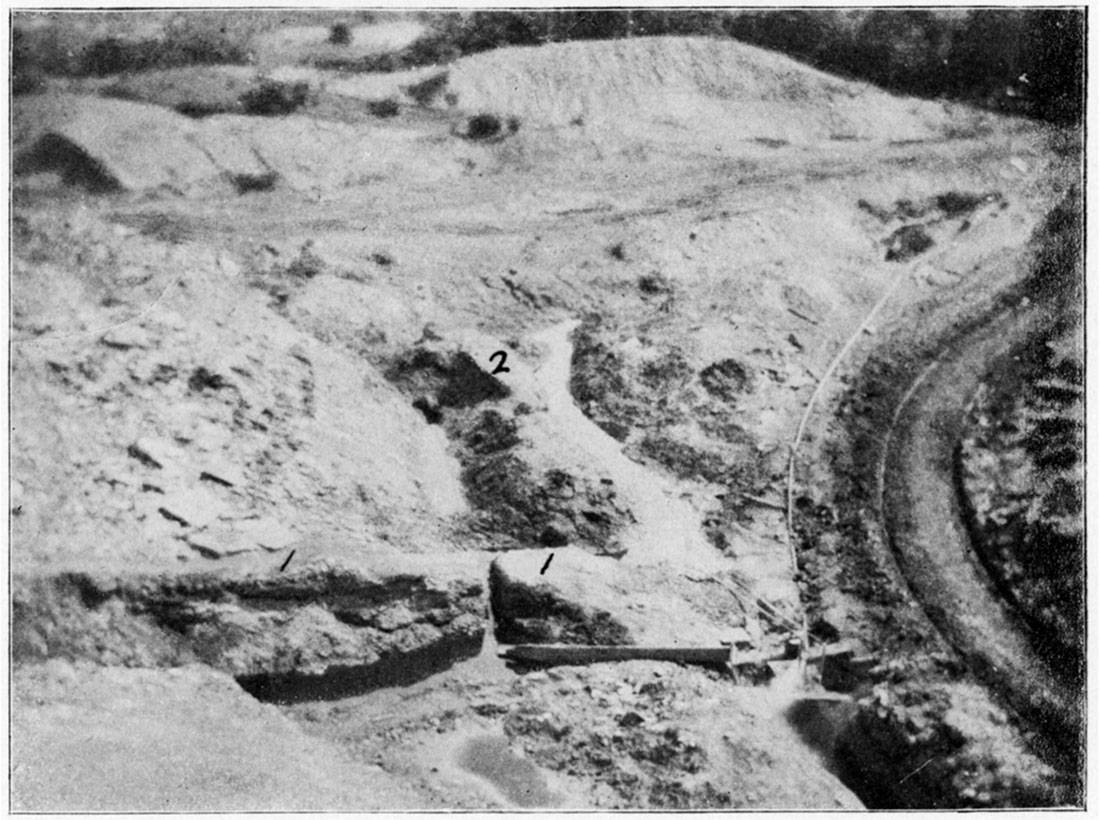
Figure 12—Typical Horseback or Clay Vein, as seen in Mine near Pittsburg.
Figure 13—Horseback, showing the Upward Bulging of the Coal and Shale. (Reproduced from the Kans. Univ. Quar., vol. iv, p. 146, Lawrence, Jan. 1896.)
Figure 14—Horseback, showing Bulging of Strata due to Lateral Compression. (Reproduced from the Kans. Univ. Quar., vol, iv, p. 147, Lawrence, Jan. 1896.)
Nature of the Walls
The walls of fissures are usually rough and ragged, but sometimes are smooth and polished, presenting well formed slickensides. Figures 15 and 16. This property is even present in the walls of the coal itself in some instances, although not so strongly marked as the fissure walls in the shales and clays. Usually the coal walls are rough and jagged with the irregularities of one side corresponding closely to those on the other, implying that the coal had been broken asunder and separated horizontally, while in rare cases a vertical displacement of a few inches or a foot has taken place. Frequently angular fragments of coal have lodged in the clay filling, as though it had dropped from the roof wall during the process of filling. Figures 17, 18, 19, 20, 21, and 22.
Figure 15—Irregular contact line between horseback and coal, as seen in a strip pit near Pittsburg.
Figure 16—Regular contact line between horseback and coal, as seen in strip pit near Pittsburg.
Figure 17—Horseback showing fragments of coal scattered through the fire clay, as seen in mines near Pittsburg.
Figure 18—Horseback intersecting Coal Stratum, showing fragment of coal in matrix, Pittsburg.
Figure 19—Horseback, showing fragments of coal in fire clay, as seen in mines near Weir City.
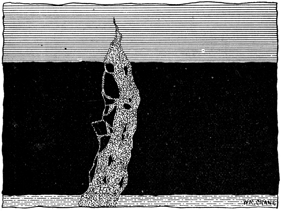
Figure 20—Horseback protruding into coal stratum from above, as seen in mines north of Pittsburg.
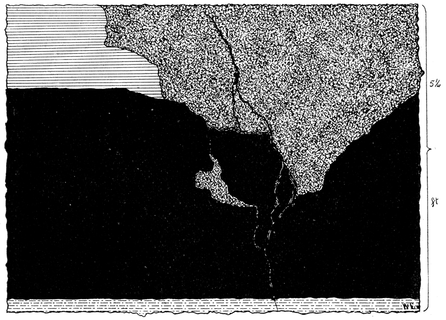
Figure 21—Horseback, showing fragments of coal scattered through fire clay, as seen in mine north of Pittsburg.
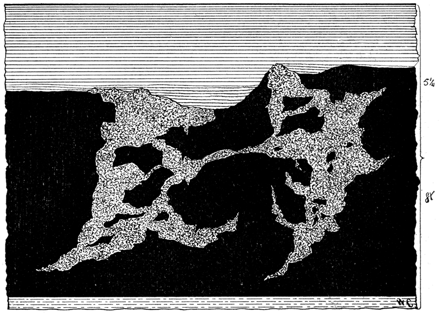
Figure 22—Horseback, showing fragments of coal scattered through the fire clay, as seen in mines near Weir.
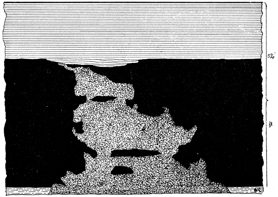
The horizontal position of the coal or shale strata usually has not been disturbed, but in some cases the strata adjacent to the fissure have been lifted up as though after the fissure was formed and filled with the clay a lateral compression occurred with a slight bulging upward of the ends of the strata in contact, as represented in Figure 23. In several instances quite noticeable folding of the strata of both coal and shale have been noticed, "horsebacks" are almost always associated with such folding.
Figure 23—Horseback protruding into the coal from above. (Reproduced from the Kans. Univ. Quar., vol. iv, p. 145, Lawrence, Jan. 1896.)
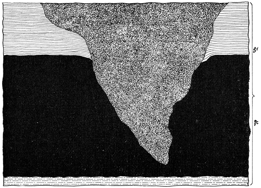
There is still another peculiar feature of the arrangement of the walls, namely, when the upper surface of a coal stratum is bent upward on one side of a clay vein, it is almost always bent downward on the other side of the vein, although the bottom of the coal on either side may not be altered in position. The coal stratum is therefore pressed into a very small space nearly pinched out, on one side, while on the other side of the clay vein it is very much expanded and broomed out.
Extent of the Fissures
The extent of the fissures, both vertically and laterally, can hardly be determined. The processes of mining operations are confined to so small a distance vertically that the fissures cannot be studied below the coal to any considerable extent, and the tunnels and driveways are made in such a way and the mines located in such position that it is also very difficult, or in fact impossible, to find the lateral extent of many of the fissures. It is known that some of them extend continuously for half a mile or more, but beyond this it is largely conjecture, although it is probable that many of them extend much farther.
Contents of the Fissures
The contents of the fissures in most cases is a low grade of fire clay produced from adjacent shales by the ground waters leaching out the iron compounds. In a few instances the clay fining contains fragments of coal, or of sandstone similar to that which may be seen in the shales above, implying that the coal and sandstone fragments have fallen into the fissure while the Clay was accumulating.
The fire clay is very finely divided, and as a general rule has no regular structure; yet in some cases a lenticular structure is noticed, the convex surfaces of the lens-shaped masses being nearly horizontal. Figure 24. The color of the fire clay is generally light, varying from a light yellow to a pale blue. The general appearance of the fire clay matrix indicates that at one time it was a plastic, semi-liquid, homogeneous mass from which the excess of water has gradually drained away. Before exposure to the air this clay is usually quite hard and tenacious, presenting a formidable obstacle to the miner. But on being exposed to the air it disintegrates and assumes more of the common properties of clay. Where the "clay veins" or "horsebacks" are abundant the" room and pillar" system of mining is usually employed and the masses of clay are used to as great a degree as possible to support the roof.
Figure 24—Lenticular structure of matrix of horseback, also showing an intersecting Seam of Sandstone, as seen in Strip Pits near Pittsburg.
Crossing of Veins
Individual clay veins or "horsebacks" are rarely found alone, few veins. having been found that are not crossed every few rods and often every few feet by other veins, one vein frequently crossing and recrossing another several times in a relatively short distance. Coal lying between horsebacks close together, usually is of little value, as it is generally badly broken and mixed with the shale or clay above and below, the lesser seams often carrying gypsum and pyrite. Occasionally the clay veins form such a network that the coal is practically non-workable, being so thoroughly broken up and mixed with clay and shale as to render it worthless.
Frequently two or more veins intersect each other. Figure 25, and Plate XXXII. Sometimes one cuts the other same as it cuts the coal and shale, showing a difference in age of the two. In other instances the matrix at the junction of the two veins is broken and mixed into a heterogeneous mass with the surrounding country-rock. In still other cases the matrix at the intersection of the veins does not differ essentially from that found in other portions of the vein. In the former cases the veins are not of the same age - the difference being shown by the structure, color, etc.; in the latter case the veins are of the same age as shown by the homogeneity of the matrix.
Figure 25—Crossing of Horsebacks, as seen in Strip Pits near Weir City.
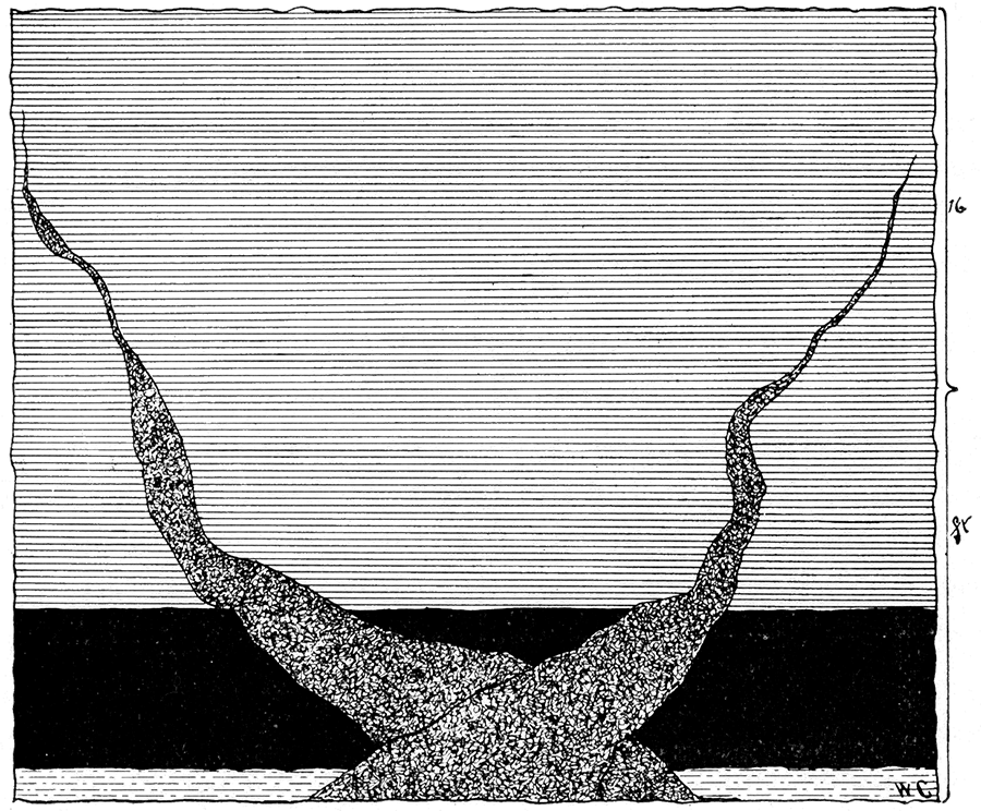
Origin of Horsebacks
Theories of Formation
Many different theories have been advanced by coal miners and others to account for the origin of horsebacks, clay veins, etc. One theory is that the fissures represent former underground water ways, and that the clay represents silt or sediment of various kinds which the stream deposited in its course, such deposition having been continued until the whole space of the fissure was filled. But how the fissure was produced in the first place the theory does not say. Another theory expressed by different miners is that the clay seams were formed contemporaneously with the coal. Neither of these views seem to correspond with all of the observed facts, consequently it cannot be concluded that either of them is correct. Before giving the view of the writer let us glance hurriedly once more at the conditions actually observed.
Observed Phenomena
After examining a large number of mines and strip pit workings in the southeastern part of the state where the clay veins are quite numerous, the following facts there observed may be summarized:
Figure 26—Horseback in Coal and Shale, showing Stretching Effect of Earth Movements, as seen in Strip Pits near Pittsburg.
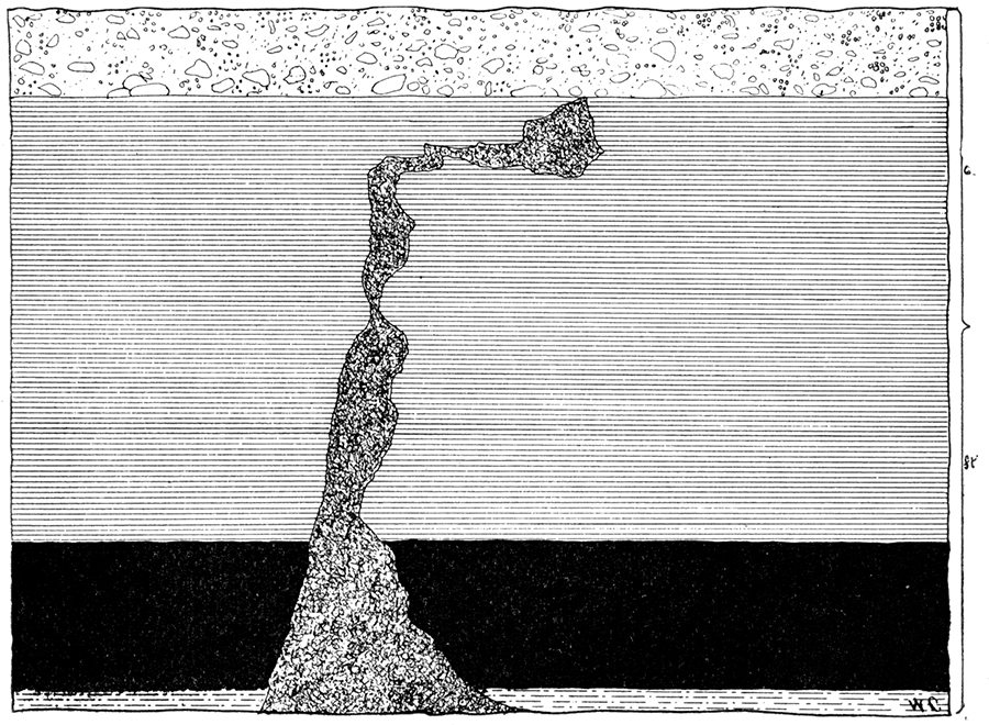
Figure 27—Horseback intersecting Coal and Shale Strata, showing Stretching Effects of Earth Movements, as seen in Mines near Pittsburg.
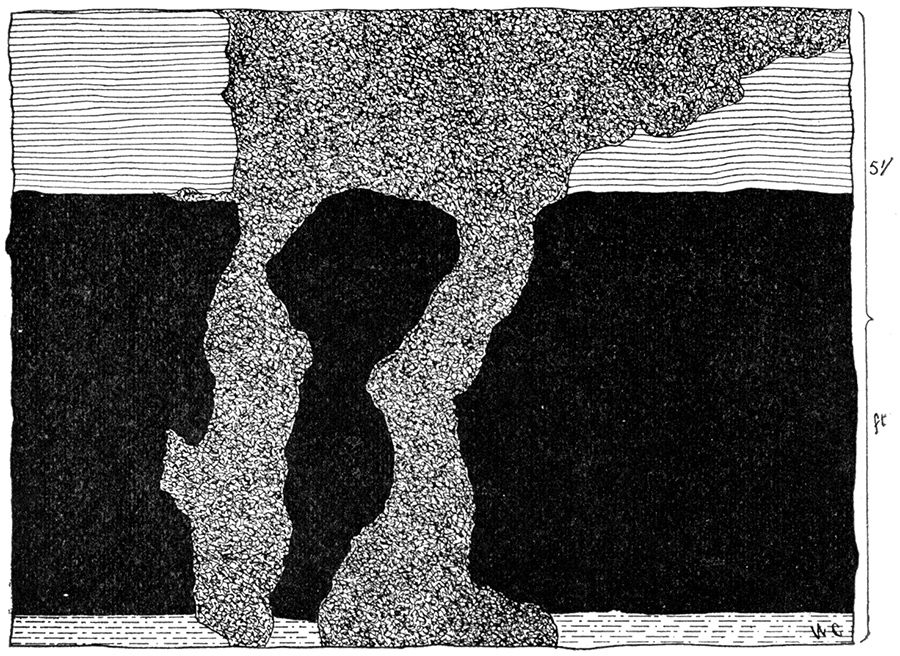
- 1. The walls of the clay filled fissures present a rough fractured surface as if they had been broken and torn apart by a horizontal stretching process which was greater than the coal beds could endure. Figures 26, 27, and 28, and Plate XXXIII. In some cases the layers of coal are pressed upwards near the upper surface and downwards near the lower. Figure 29.
- 2. There is always an upward displacement of the shale at the upper extremities of the clay veins. Figures 23 and 30. Displacement, especially in the coal, is attended by fracturing. Figures 17, 30, and 31.
- 3. The fire clay in the fissure is usually homogeneous and structureless, but sometimes has an approach towards a lenticular structure. In all cases the clay in the clay veins is similar to that underlying the coal, and when the latter is composed of two or more varieties, as a dark and a light one, the same relation exists between them in the clay vein, as shown in Figure 32.
- 4. Angular pieces of coal are often found mixed through the clay in the fissure. Figures 17, 18, and 19. These are evidently fragments of the original coal bed, for in many places their exact former position can readily be determined by their shape and the appearance of the wall of the coal. Figures 17, 27, and 21. There is very little broken or finely powdered coal to be found in any of the clay seams.
Plate XXXIII—Intersection of Coal and Horseback, as seen in Mine in Weir City. (Photographed by flash light by Crane, 1897.)
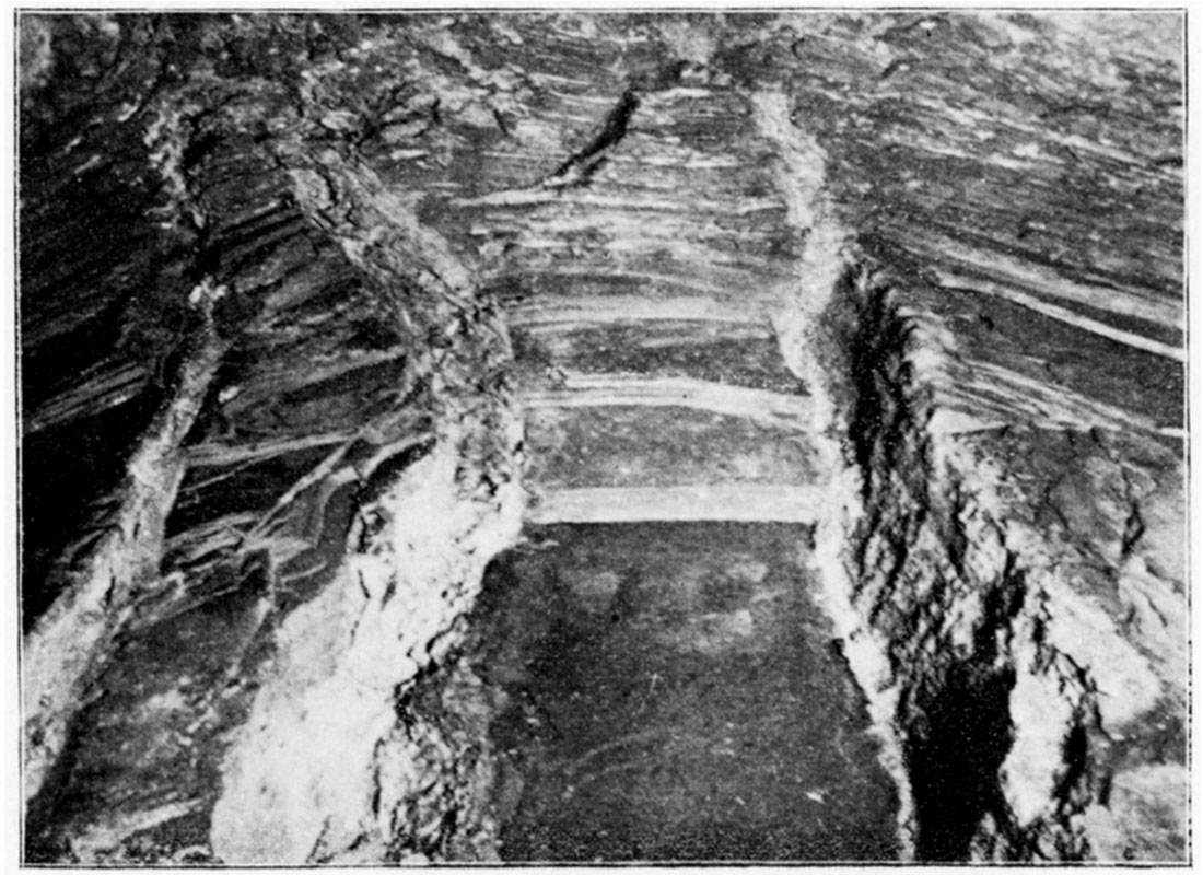
Figure 28—Horsebacks in Walls of Entry as seen in Mine at Weir City.
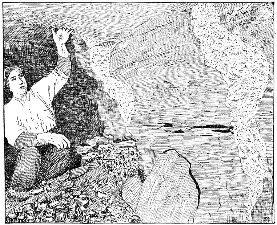
Figure 29—Horseback, showing upward and downward Displacement of Coal and accompanying Strata.
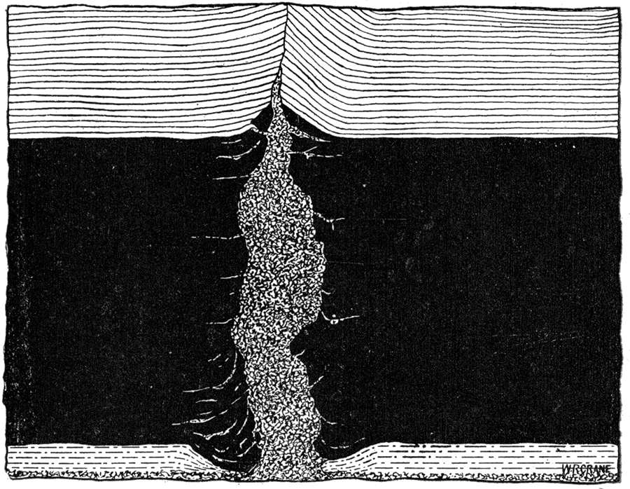
Figure 30—Horseback, showing Displacement of Coal and Shale, and Fracture of Coal. (Reproduced from Kans. Univ. Qnar., vol. iv, p, 148, Lawrence, Jan. 1896.)
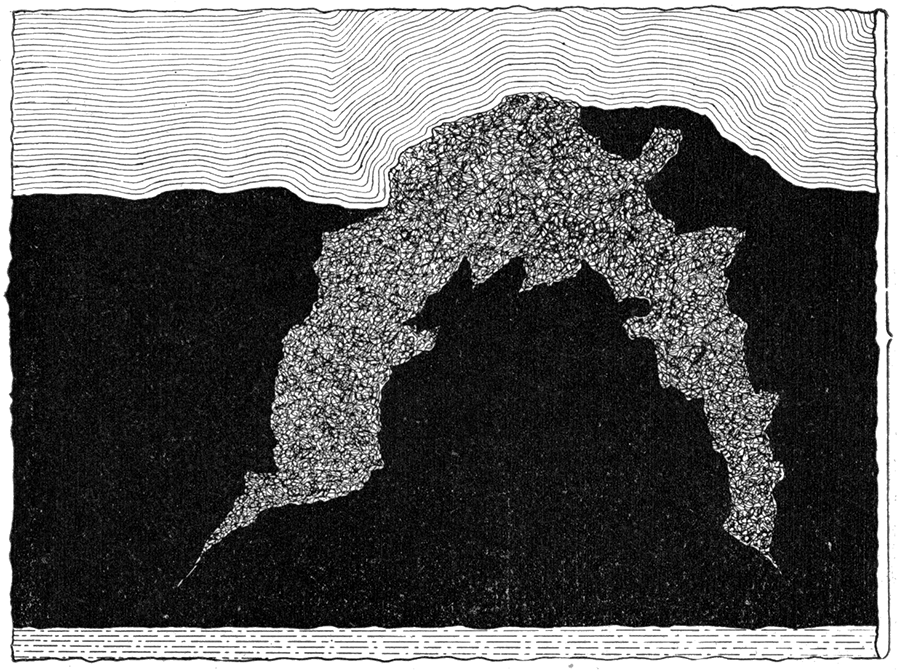
Figure 31—Horseback, showing Faulting of Coal and accompanying Lower Strata of Shale, as seen in Mines near Fleming.
Figure 32—Horseback made up of Two Varieties of Fire Clay. (Reproduced from Kans. Univ, Quar., vol, iv, p. 149, Lawrence, Jan. 1896.)
Probable Origin
From the observed conditions the writer is led to the following conclusions regarding the origin of these interesting structures. Long after the coal was formed and consolidated almost to its present state, vibratory movements of one kind or another fissured the strata including the coal beds. Figure 33. The great variety of fissures as above described corresponds well with different forms of fissures observed in many parts of the world in connection with the mining of metalliferous deposits. Upon the production of such a fissure the great pressure under which the fire clay at the bottom of the coal had been existing would now be relieved on one or more sides. If the fissure passed entirely through the fire clay the surface of each wall would be relieved of pressure; if it only reached downward to the fire clay the upper surface would likewise be relieved of pressure. Considering the exceedingly unctuous property of clay and the softening to which it would be subjected from time to time by the underground water, it is very easily understood how it would soon move upward sufficiently more or less completely to .fill the fissure produced by the earth's tremor. This process would simply be an exaggerated case of ordinary "creeping" so commonly known in the underground workings. The upturning of the shale laminae near the upper part of the fissure would very readily be produced by the upward movement of the clay acting under the great power which was forcing it along, while the occasional fragments of coal and sandy shale found within the clay veins can readily be accounted for by the occasional dropping of a block which was almost broken under the first earth movements which produced the fissures.
The vibratory movements producing so many fissures must have been comparatively gentle in character as few vertical displacements of any consequence have been recorded. Also the general results were of a nature to elongate and stretch the strata horizontally rather than to compress them. The aggregate increase in horizontal dimensions has not been determined, as the mining operations have covered but a few miles in an east and west direction. But from the large number of clay veins with an average width of from three to five feet it can be seen that the actual increase in horizontal dimensions has been very considerable. These fissures are best recorded in the coal beds because of the brittle nature of the coal. The clay veins well illustrate nature's method of filling up and obliterating fissures. of this general character when produced in ordinary shales, although the latter may be interbedded with limestones.
Figure 33—Horseback, showing well defined Fissure, which the Fire Clay has filled, as seen in Mines near Pittsburg.
The age of the clay veins cannot be determined by internal evidences. It is possible that they were produced at various periods separated by considerable time epochs. But it is probable that the greater number of them and the more important of them were produced at the time of the Ozark uplift to the southeast. The general character of this uplift seems to have produced a dome shaped elevation which would require an elongation of horizontal dimensions. The stretching of strata so marked is therefore accounted for. A careful study of the horsebacks shows that their prevalent direction is northeast and southwest, approximately tangental to the Ozark dome, with the next most common direction nearly at right angles to this. The greatest fault observed is a vertical displacement of about 8 feet exposed in a mine of the Mount Carmel Coal Company. Great as this displacement is it is surprising that so few other displacements have been found. It may incidentally be remarked that the general direction of these fissures is nearly parallel to the most prominent fissures in the lead and zinc mining district to the southeast, which adds to the probability of all of them having been made at the time of the Ozark uplift.
"Bells" in the Kansas Coal Measures
Certain structures disadvantageous to mining operations occur in the shale or roof over the coal and are known as "pots," "kettles," "bells," etc. As the names imply, the structure is circular in form, horizontally, and pot shaped, bell shaped or kettle shaped vertically.
Localities
Bells are not found very abundantly in the coal fields of the state, and are not scattered over a very wide area. They are found principally in the Cherokee shales at the coal mines of Leavenworth and vicinity. They are rarely found in the same horizon to the south. In passing. westward through the coals of the different horizons, formations bearing such a close resemblance to the bells that they are often so called increase in number, yet the number found is so small and the inconvenience caused by them so slight that they are seldom mentioned by miners and mine operators.
Nomenclature
The names "pot hole" and "kettle hole" are commonly applied to circular holes eroded by currents in flowing water. These holes filled in turn by sediment produce forms called "pots," "kettles" and" bells." The formation found in the coal measures bearing a close resemblance to the true "pot" and" kettle" holes found in various parts of the world probably received its name on account of the similarity existing. If this formation received its name through an imagined resemblance to a "pot," "kettle," or "bell" then it should receive the name of the article which it most closely resembles. As most of the formations examined by the writer more closely resemble a bell than either a pot or kettle, we will employ the term" bell" when speaking of the same hereafter.
Characteristics of Bells
Form of Bells
The forms of the bells are not much varied. The essential features of the variation are a horizontal and vertical shortening and lengthening, thus producing narrow, deeply projecting, and broad, widely extending, but relatively thin bells. The two forms above mentioned are the ones usually met with, although there are a large number of intermediate forms. The bells are usually rather small, averaging probably four feet in diameter. They extend in a vertical direction generally, but a few cases have been noted where they extend downward obliquely, seldom making an angle with the vertical exceeding 45 degrees. Figure 34. They pass downward from above, protruding into the coal several inches—seldom less than six or eight, and more often a foot or two; and it is not an infrequent occurrence for them to pass entirely through the coal. In much rarer cases the bell is reversed—Figure 35—the base protruding into the coal while the apex extends upward into the superincumbent shale. In such cases they produce what is more often called a "roll." Figures 36 and 37. This is rather a dangerous form as the roof is liable to cave in, but due to the scarcity of this form of bells few or no accidents occur on account of them.
Figure 34—Typical Bell, as seen in the State Mine at Lansing.
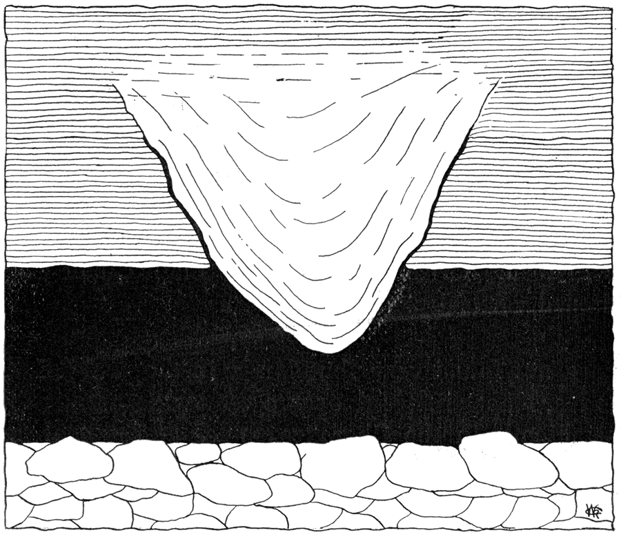
Figure 35—Inverted Type of Bell, as seen in Mine West of Prescott.
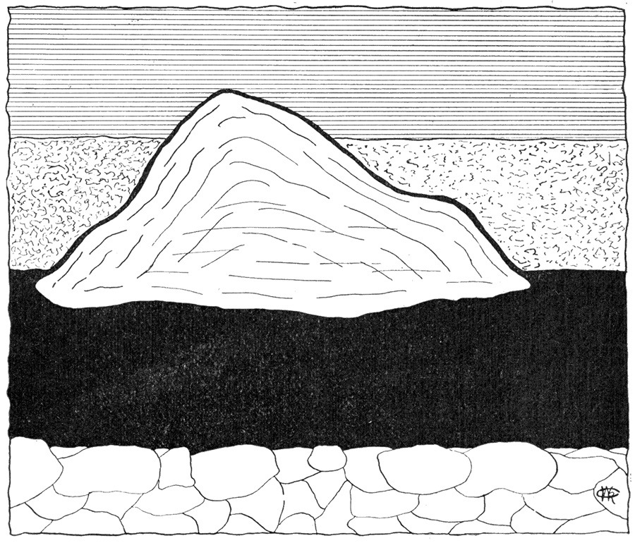
Figure 36—A "Roll" in the Roof, as seen in Mine at Weir City.
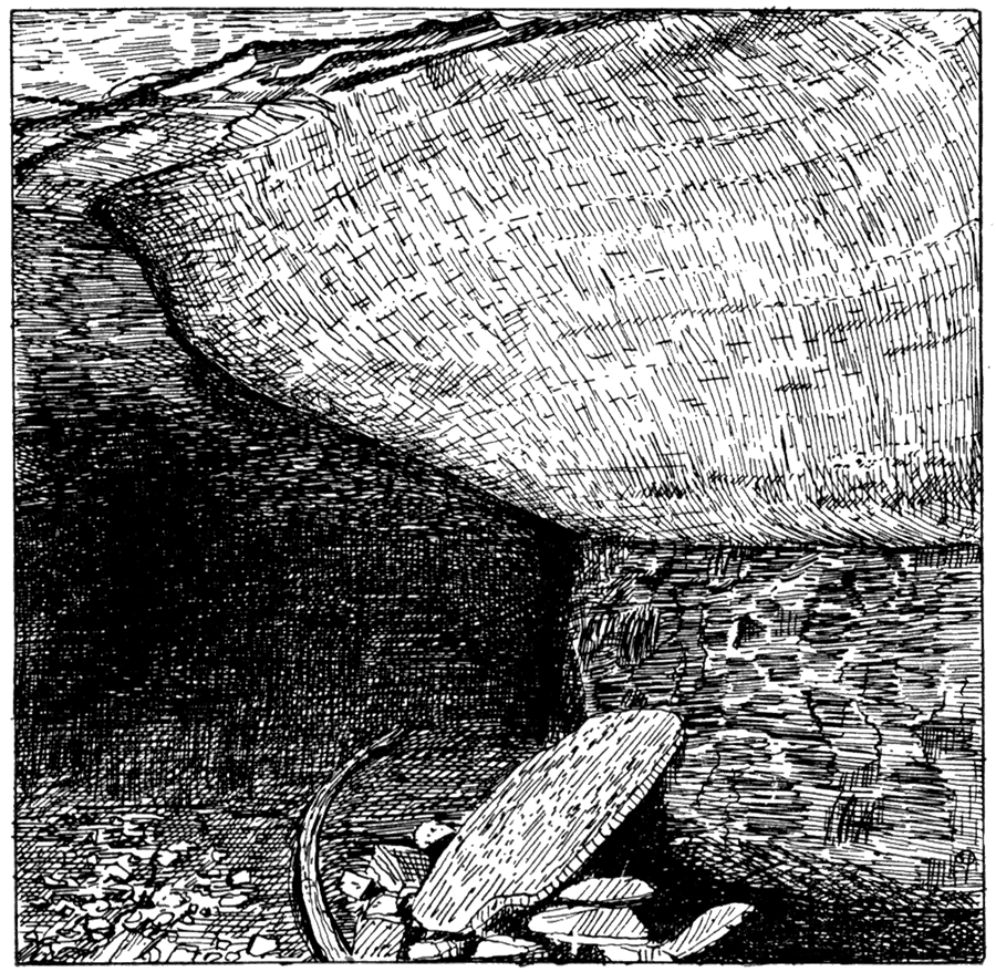
Figure 37—A "Roll," as seen at Fort Scott.
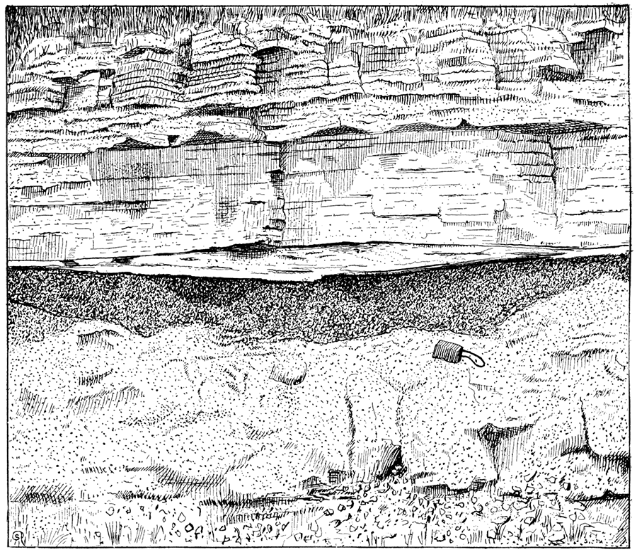
Nature of Lateral Portions
The sides of the bells are as a rule very smooth and polished. The coal adjacent to the bell is also very smooth. There is nothing in connection with the bell or adjacent coal to indicate that there has been any displacement. The laminas of the coal show no signs of having been displaced by lateral or vertical pressure, but extend up to the bell where they stop abruptly, but continue again on the opposite side without any apparent break in their order.
No fragments of coal as yet, to the knowledge of the writer, have been found in the matrix of the bell.
A very peculiar feature which should be mentioned here is that the seam produced by the junction of the coal and bell often extends upward into the roof at approximately the same angle that it makes with the vertical in the coal. This seam becomes more narrow as it passes above the stratum of coal, producing a well defined fissure—Figures 34 and 35—which is always filled with coal that has attained a remarkable degree of hardness and luster, and is an excellent quality of anthracite coal. (See Table IV, post.) In several cases noted this thin layer of coal passed entirely over the bell—this was in the case of an inverted type. Figure 35. The coal filling these fissures does not constitute a sheet or layer of uniform thickness. On the contrary it is very uneven, varying from a film to three-quarters of an inch in thickness, with a very smooth surface.
Extent of Bells
The extent vertically and horizontally can quite readily be ascertained as the bells seldom reach further than through the coal, and often in dressing down the shale of the roof all traces of the bell are removed. The horizontal extent is seldom more than eight or ten feet.
Contents of Bells
The matrix of the bell is shale—the same as that composing the roof, differing not in the least in structure or color from the adjacent shale, except that the matrix is not laminated in the same plane as the shale above and on the adjoining sides. No lines of lamination are visible until acted upon by the weather or struck by hammer, whereupon shell-like portions generally about three-fourths of an inch to two inches in thickness will fall off, disclosing concentric planes of lamination. There seems to be a larger number of fossil invertebrates in the matrix of the bell than in the surrounding shales.
If the bells occurred as frequently as the horsebacks of the southern coal fields they would necessitate the employment of the "room and pillar" system of mining, but fortunately they are not very numerous.
Origin of Bells
Theories of Formation
Several theories have been advanced to account for the formation of these bells. One is that they are holes washed in the coal by rotary currents formed in the water during the formation of the coal, and afterwards filled with the same material which now constitutes the roof of the coal. Another is that they are due to the giving way of weakened portions of the roof strata, thus producing a settling into the coal. It might be well to summarize the facts observed.
Observed Phenomena
- 1. The lateral parts of the projecting body are smooth and even, often being marked with creases, which always extend in a vertical direction. These creases are similar to those observed when two pieces of wood or rock masses are caused to slip one upon the other when under high pressure.
- 2. The laminae of the coal have not been disturbed.
- 3. The character of the contents does not differ from the adjacent shales of the roof.
- 4. The laminae of the contents of bells are in the form of concentric circles or ellipses—that is, always parallel to the outside of the bell.
- 5. There is a larger number of invertebrate fossils in the matrix of a bell than in a corresponding portion of the adjacent shales.
- 6. The seam produced by the junction of the coal with the bell often extends upward into the overlying shale strata. When this occurs the fissure is always filled with coal, which has been changed to anthracite.
- 7. No coal or rock has as yet been found in the matrix of the bell.
After carefully studying a large number of different forms, the writer has arrived at the following conclusions regarding the probable origin of the bells.
During the accumulation of the coal forming material many conditions may have caused slight irregularities in the amount of accumulated material. A local variation in the growth of the coal plants, a difference in the local water currents of the marsh or swamp, slight eddy currents here and there, the burrowing of water animals if such were possible at that time, or any other sufficient cause whatever may have obtained.
When the sediments constituting the overlying strata were deposited they would cover all such irregularities and the pressure from above throughout subsequent time would tend to depress the roof strata into the openings of the coal. Such a depression would be carried to whatever extent the amount of coal would permit, or until the coal material immediately beneath was compressed to about the same degree of density the coal had elsewhere. In this way portions of the roof for several feet above the coal would be involved.
The concentric lamination of the material within the bell probably is due to two causes: first, to a partial lamination around the walls of the cavity as the sediments were accumulated; and second, partially to a pseudo-lamination set up by the downward movements of the strata as the coal was being compressed.
The larger number of fossils within the bells likewise indicates that there was a depression or pot-hole structure in the upper surface of the coal material during the period of coal formation, in which the shells accumulated by the movements of the invertebrates while alive and by the subsequent drifting in of their shells by waves and water currents.
The fissures in the overlying shales forming continuations of the outer walls of the bell would naturally result from the shearing of the roof strata as the downward settling occurred. The creases and corrugations on the outer walls of the bell likewise were produced at that time by the downward movement.
The presence of thin laminae of coal within these fissures can be accounted for by presuming a slight upward movement of some of the coal which, under the high pressure that prevailed and the large amount of water which was present, was forced upward into the fissures. The difference in the quality of the coal in these fissures and that of the coal beds below is a most interesting condition. In some way it would seem this extraordinary squeezing in connection with a slight movement rendered the decomposition of the coal forming material more effective than that which occurred in the coal below. Or possibly the kind of material forced upwards into the fissures was slightly different from the average of the coal and therefore may have been more readily decomposed. Whatever the origin of the bell and the source of the coal material it is a most interesting observation. The presence of genuine anthracite in small quantities in immediate proximity to large beds of ordinary bituminous coal seems to be unknown elsewhere.
Prev Page--Geography || Next Page--Mining Systems
Kansas Geological Survey, Geology
Placed on web Sept. 12, 2018; originally published 1898.
Comments to webadmin@kgs.ku.edu
The URL for this page is http://www.kgs.ku.edu/Publications/Bulletins/Vol3/51_strat.html