Kansas Geological Survey, Mineral Resources Circular 9, originally published in 1933
Originally published in 1938 as Kansas Geological Survey Mineral Resources Circular 9. This is, in general, the original text as published. The information has not been updated. An Acrobat PDF version (2 MB) is also available.
The occurrence of water underground is essentially a geological problem. The State Geological Survey of Kansas has commenced an extended program of ground water investigations which will eventually cover the entire state. Reports have already been issued on the ground water resources of the Shallow Water Basin of Scott and Finney counties, and on the geology and water resources of Rawlins and Decatur counties. During the field season of 1937 one party studied the ground water resources of southwestern Kansas, and another party, working on a cooperative project between the State Geological Survey of Kansas, the Kansas Board of Health, and the U. S. Geological Survey, investigated the "Equus bed" area in central Kansas. This latter party spent five days in Ford County making a preliminary examination of the ground water resources, and the following report is the result of that examination. It is hoped that funds will be made available so that similar, but more extensive, investigations can be made of the entire western Kansas area where irrigation by ground water is a possibility.
Kenneth K. Landes
State Geologist and Assistant Director
State Geological Survey of Kansas
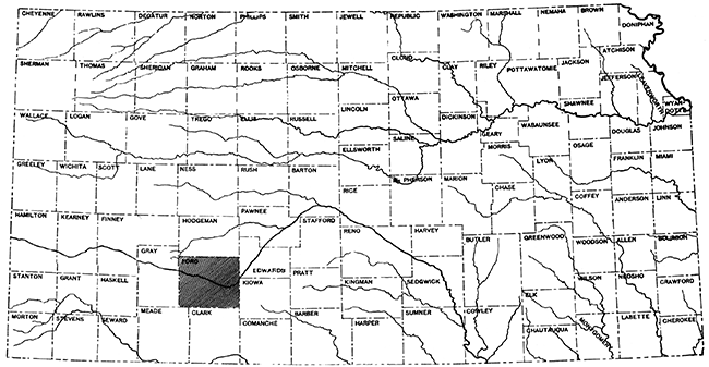
Index map of Kansas, showing the location of Ford County.
In response to a request from Dr. R. C. Moore, State Geologist of Kansas, a brief investigation was made from November 15 to November 20 in Ford County, Kansas, in order to determine the nature and extent of recent developments of water supplies from wells on the uplands of that county. This work was done in connection with ground-water investigations in other parts of Kansas by the U. S. Geological Survey in cooperation with the Kansas Geological Survey, and the Kansas Board of Health.
The writer was accompanied in the field by W. N. White and S. L. Schoff, both of the U. S. Geological Survey. The experience of Mr. white gained in a study of geologic and hydrologic problems in the High Plains in several states, and of Mr. Schoff, who has recently made a detailed investigation of ground water supplies in the adjoining High Plains area of Oklahoma, were very helpful.
O. E. Meinzer, geologist in charge, Division of Ground Water, and D. G. Thompson offered many helpful suggestions. H. P. Burleigh, Associate Geologist, Farm Security Administration, Amarillo, Texas, kindly made available for consultation several manuscript reports on adjacent areas of southwest Kansas. Acknowledgment for helpful information is also due especially to the following persons: State Senator J. C. Denious and Mr. Jay Baugh, Dodge City Daily Globe; Mr. Fred Moon, Irrigation Specialist, Kansas Power Company, Dodge ,City; Thomas Stauth, driller, Dodge City; W. A. Long and M. L. Ming, Fowler Kansas; Mr. Jack Doty, Well Work Manufacturing Company, Garden City, Kansas; and Mr. Gillespie, Garden City Company, Garden City.
Ford County lies in the southwestern part of Kansas. The main line of the Santa Fe parallels the Arkansas River across the center of the county from east to west, through Dodge City, the county seat and largest town in the county.
Ford County lies in the High Plains province, and is characterized by wide areas of nearly level or gently sloping surfaces. Arkansas River, Sawlog Creek, and several smaller streams have cut below the general level of the plains, leaving in certain areas buttes, escarpments, and badlands, notably along the valley of Sawlog Creek.
The county "is characterized by a rather dry climate, abundant sunshine, warm summer days that are alleviated by a good wind movement and low relative humidity… Hot winds occasionally blow during a dry, heated period and are the cause of great .~rop damage and much discomfort while they are occurring." [Climatic Summary of the U. S., sec. 40, p. 1]
The average annual precipitation at Dodge City for the 56- year period of record from 1874 to 1930 was 20.51 inches. The annual precipitation at this place, and the departures from this average for the last 10 years is given in the following table.
| Annual precipitation at Dodge City, Kansas 1928-1937 (From U. S. Weather Bureau) |
||
|---|---|---|
| Year | Precipitation (inches) |
Departure from average precipitation (inches) |
| 1928 | 27.77 | +7.26 |
| 1929 | 21.90 | +1.39 |
| 1930 | 19.14 | -1.37 |
| 1931 | 15.75 | -4.76 |
| 1932 | 17.71 | -2.80 |
| 1933 | 18.66 | -1.85 |
| 1934 | 11.50 | -9.51 |
| 1935 | 15.09 | -5.42 |
| 1936 | 14.17 | -6.34 |
| 1937 | 12.63 | -7.88 |
As shown in the above table the precipitation has averaged 5 inches below normal for the last 8 years, 1930-1937 inclusive. This is by far the longest consecutive period of subnormal precipitation in the 63-year record of the station. The longest periods of subnormal precipitation previously recorded were only 4 years in duration. These were periods beginning with 1901 and 1916. The deficiency in annual precipitation of 9.51 inches which occurred in 1934 was previously exceeded three times. In 1875 the deficiency was 9.83 inches and in 1893 and 1910 it was 10.39 inches.
The geology of Ford County is relatively simple. Nearly the entire county, including all that stands at the level of the High Plains, is underlain to depths of 100 to 200 feet or more by the Ogallala formation, of Tertiary age. The Ogallala, which is the principal water-bearing formation with which this report is concerned, was deposited by streams and consists of beds of gravel, sand, silt, and clay, with some beds of boulders and small amounts of caliche--which is more or less consolidated material cemented with lime. Cretaceous sediments crop out at several places north of the Arkansas River and in Clark County, south of Ford County. They probably underlie the Ogallala throughout most of Ford County. Those exposed along Sawlog Creek comprise the Greenhorn limestone, Graneros shale, and the Dakota group. Certain of the Cretaceous formations, notably the Dakota sandstone, yield water to wells in parts of southwest Kansas, and may be water-bearing beneath Ford County, but such water as is present is probably highly mineralized. The Cretaceous formations are underlain by red beds of Permian age. In areas where the Cretaceous formations were entirely removed by erosion prior to the deposition of the Ogallala formation, the Ogallala rests directly on the Permian red beds. Any water encountered in the Permian is likely to be too highly mineralized for most purposes. Recent alluvium occupies the valleys of the Arkansas River, Sawlog Creek, and a few other streams, and is a valuable source of water along the Arkansas Valley, where it is utilized for irrigation. Dune sand has accumulated along a belt of variable width just south of the Arkansas River. Terrace gravels mantle older deposits in a small area at the northeast corner of the county.
Pumping from wells for irrigation has been practiced for many years along the Arkansas Valley in and west of Ford County. However, very little attempt has been made heretofore to develop water from wells for irrigation on the uplands of the High Plains in Kansas, except in an area in Scott County and to a minor degree in an area in Meade County. In the so-called Scott County "shallow water" area, about 5,000 acres of land are irrigated with water pumped from wells. The pumping lifts in the Scott County area range from about 20 to 70 feet and are less than in most parts of the High Plains. In Meade County several hundred artesian wells have been put down, in which the water either stands only a few feet below the surface or flows naturally at the surface. Most of the artesian wells are of small diameter, and in most of them the flows are less than 10 gallons a minute, but one was observed to flow about 75 gallons a minute. A small amount of land has been irrigated in the Meade basin by flowing wells, but there are at present only five pumped irrigation wells capable of delivering large quantities of water.
Beneath most of the High Plains the water table lies rather deep, and it has been generally considered that even if there were a sufficient quantity available, the cost of lifting the water would be prohibitive for large-scale irrigation. The prolonged droughts in recent years destroyed many crops and inflicted much hardship on the farmers who had no source of water other than from rainfall. Some farmers have constructed dams across small streams or dry runs, and with the water thus impounded have been able to raise sufficient feed to maintain their cattle and sheep during the winter. Gradually there has emerged the idea that even though the cost of pumping water from wells from considerable depths may be prohibitive for large-scale irrigation, it might nevertheless be feasible to utilize wells as a source of water supply to raise reed for livestock which otherwise would have to be sold at a loss, or to save a wheat crop which otherwise would be totally destroyed by drought.
This report considers only the wells that have been drilled on the uplands, and does not take into account the irrigation wells in the Arkansas Valley. At the time the field inspection was made, about 12 irrigation wells had been completed and 5 or 6 were being drilled, or were expected to be drilled in the near future. It was rumored, however, that many additional wells were being planned, and that within a year or two the total number of wells might reach several times the present number.
Of considerable interest are three gravel-walled wells put down in the southwest corner of Ford County. This area is adjacent to the Meade County artesian basin, and the depth to water is much leas than in most other parts of the county which lie at higher elevations.
The three wells are of similar construction. First, one or more 7-inch test holes were put down by the hydraulic rotary method. Then the most successful test hole if more than one had been put down was reamed out to a diameter of 30 inches by the hydraulic rotary method, a 16-inch inner casing was set, which was perforated opposite the water-bearing strata, and gravel was packed into the annular space between the 16-inch casing and the mudded walls of the 30-inch hole. All three wells are equipped with turbine pumps and are pumped with tractors. The logs of these wells are given at the end of this report.
The well of George Lutze in the NW sec. 24, T. 29 S., R. 26 W., is 211 1/2 feet deep. It penetrated 53 feet of saturated coarse gravel from 173 to 210 feet, and on November 16, 1937, the water level in the well was 33.78 below the top of the casing, which is at the level of the land surface. When first tested, the well yielded 740 gallons a minute with a draw down of 44 feet after pumping continuously for a week. At the time of the writer's visit a pump with a capacity of 1,200 gallons a minute was being installed. (See log No. 1.)
The well of Joseph Lutz, in the NW sec. 15, T. 29 S., R. 26 W., is 149 feet deep. It penetrated an aggregate of 124 feet of saturated sand, gravel, and sandstone, but most of the water comes from 29 feet of gravel between the depths of 120 and 149 feet. On November 16, 1937, the water level was 45.07 feet below the edge of the casing, which is 1.3 feet above the land surface. This well yielded 850 gallons a minute, with a drawdown of 20 feet after pumping half an hour. (See log No. 2.)
The well of W. A. Long, on the C. I. Long estate, in the NE sec. 35, T. 29 s., R. 26 W., is 182 feet deep. It penetrated an aggregate of 102 feet of water-bearing sand and gravel. This well was being completed when visited, and the depth to water could not be measured. It was later learned that the water stood 22 feet below the land surface, and that a preliminary test developed 600 gallons a minute. (See log No. 3.)
The well of Arthur Slocum at Ensign, in Gray County, in the NW sec. 25, T. 27 S., R. 27 W., is 200 feet deep. It consists of a 16-inch inner slotted casing, packed with gravel to a diameter of 24 inches. It penetrated 35 feet of fine to coarse water-bearing gravel between 165 and 200 feet. On November 16, 1937, the water level was 166.93 feet below a projection on the pump 1.4 feet above the land surface. It is equipped with a 5-stage turbine pump, driven by a 100 horsepower, natural gas engine, and yields 800 gallons a minute with a drawdown of 20, feet after 11 hours of pumping. Farm wells in the vicinity of Ensign encounter water at a comparable depth but do not penetrate far into the gravel. It was reported that another irrigation well has recently been completed northeast of Ensign, and that it is planned to drill a third irrigation well in this vicinity.
Preliminary test holes have been completed and in late November, 1937, plans bad been made to drill a well on the Arthur Adams farm in the SW SW sec. 2, T. 26 S., R. 27 W. One test hole, 286 feet deep (See log No. 4), revealed an aggregate of 92 feet of water-bearing sand and gravel. The water level was reported to stand 112 feet below the surface in May, 1937.
Several irrigation wells nave been put down recently in the vicinity of Ford, but detailed data are lacking. One well is reported to yield 1,200 to 1,500 gallons a minute with a 50-foot lift. It is reported that in a well that was being dug by hand no water had been reached at a depth of 97 feet.
In many parts of the county, including some of the areas described above, the depth to water is more than 150 feet beneath the surface. Such areas are much less favorable for irrigation development than areas such as the southwestern part of Ford County, described above, in which the water level stands only 22 to 45 feet beneath the land surface.
The records presented above show that water in sufficient quantity for irrigation has been obtained in several parts of the uplands in Ford County or just beyond its boundaries. To judge from such meager information in regard to geologic conditions as is available, it seems likely that wells that will yield water in quantity sufficient for irrigation can be drilled at many other places in the county.
In determining whether irrigation will be practicable two important factors must be considered. First is the question as to whether the quantity of water available is sufficient, so that it can be used whenever needed either for regular irrigation or for supplemental irrigation in dry years, without danger of exhausting the supply. Second is the question as to whether the water can be developed and pumped at a cost low enough to make the practice of irrigation worth while. The present brief investigation has not been adequate to permit any definite answers to these questions, but certain problems may be considered briefly.
Logs of numerous wells in the Ogallala formation of western Kansas reveal the fact that individual beds of sand or gravel are not continuous over wide areas but generally are discontinuous lenses that may grade laterally into finer materials such as silt or clay, in many places within relatively short distances. This results from the conditions under which the Ogallala was deposited. In the main channels of the depositional streams, Where the water ran swiftly coarse gravels were deposited, but where the water ran more slowly, finer, less permeable materials such as fine sand or silt were deposited. Thus a well at one locality at a given depth may encounter thick beds of permeable gravel and yield an adequate supply of water for irrigation, whereas a well a short distance away at the same depth may encounter very little or no gravel and yield but little water. It has been considered desirable, therefore, before a large investment is made for a well, to put down one or more test holes of small diameter, in order to determine in any locality whether the Ogallala contains a sufficient thickness of permeable materials to warrant further expenditure. If a considerable thickness of permeable water-bearing material is penetrated in any hole it may be reamed out and completed as a supply well. Information of this type, as well as information as to the total thickness of the Ogallala derived from numerous well-distributed test holes, would be needed in a thorough study of the ground-water resources of Ford County. It is accordingly desirable that adequate records of all test holes be preserved, whether or not they show favorable conditions.
Most of the irrigation wells put down recently have been of the gravel wall construction. This type of construction was designed primarily for formations composed of rather fine materials. The logs of some of the wells drilled recently reveal water-bearing materials sufficiently coarse to warrant consideration of less expensive wells employing well-screens or slotted casings but without artificial gravel packing. In some wells a natural gravel wall can be developed by pumping the well at a rate greater than that at which it is to be regularly operated so that much of the fine sand immediately surrounding the screen will be pumped out. In this way wells in some localities could be constructed to deliver large quantities of water at a smaller initial investment. Preliminary test holes should provide the necessary information to determine which type of well should be constructed.
Other things being equal, it follows that the cost of lifting water to the surface increases in proportion to the total pumping lift. For example, it costs much less to pump water in the southwest corner of Ford County where the water level is 20 to 45 feet below the surface than it does from wells in the vicinity of Ensign where it is about 165 feet. In the future development of irrigation from wells in Ford County the depth to water level at any given locality will undoubtedly be of great importance in determining whether irrigation can be economically successful. A thorough study of the ground-water resources of Ford County should include water-level measurements in many wells as a basis for constructing a map showing depths to the water table.
The safe yield of a water-bearing formation, that is the quantity that may be pumped perennially without overdraft, depends among other things upon the amount and source of the water that is available for artificial withdrawal. If the water moves to the point of withdrawal from some distant area the safe yield in addition depends upon the permeability of the formation, that is, upon its ability to transmit water freely.
As stated by Theis and others, "the ground water in the southern High Plains originates in rain or snow on the plains. Some of this water penetrates to the body of ground water and then percolates slowly toward the east or southeast, until it is discharged by evaporation from water-table lakes … or in seeps and springs along the eastern escarpment." … "Before any water was pumped from wells the yearly discharge of ground water by natural processes was doubtless about equal to the average amount added yearly from the rain and snow falling upon the region. Artificial discharge by pumping represents an additional amount of water taken from the underground reservoir without any increase in the amount of replenishment. Hence the development of the ground-water resources of the region will necessarily cause lowering of the water level until the natural discharge is decreased by an amount equal to the withdrawal by pumping. As the amount of water stored in the sediments is very great, such adjustments will proceed slowly through many years, with only very gradual lowering of the general level of the water table. In the localities of heavy pumping for irrigation or municipal and industrial supplies the lowering of the water table will, however, proceed at a greater rate." [Theis, C. V., Burleigh, H. P., and Waite, H. A., Ground water in the southern High Plains: U. S. Dept. of Interior, Memo. for the Press No. 108270, pp. 2, 3, mimeographed, October 30, 1935.]
Several lines of evidence indicate that only a very small amount of the water (precipitation) that fallS on the High Plains escapes evaporation and absorption by the vegetation and percolates through the soil to the ground-water body. This small amount would be insufficient for irrigation if divided evenly over the whole area of the plains. However, water in quantity sufficient for irrigation may be obtained if conditions are favorable for the concentration in or transportation underground in large quantity to some areas from other areas where conditions are less favorable for the use of the water, for example, because of poor soil, too great surface relief, or too great a depth to water. An important problem, therefore, is to determine to what extent favorable conditions exist. The available information is not sufficient to indicate the rate of recharge for the Ford County area, and this problem deserves detailed study. The problem of determining the safe yield of the water-bearing formations of Ford County cannot be restricted to that county alone, but involves a study of the geologic and hydrologic conditions in the adjoining counties and perhaps in an even greater area of the High Plains.
Whenever wells are pumped in any area there is some lowering of the water table or artesian head. This is necessarily true as a result of the fundamental laws that govern the flow of water to pumping wells, regardless of whether the safe yield is greater or lass' than the quantity that is being pumped. Although in some areas the lowering may not be very much, in other areas it may ultimately amount to many feet. Due consideration must be given to this possibility. Observations in some areas show that even where large ultimate drop in level may occur it may be so gradual that it will not be noticeable for some years unless a systematic program of accurate water-level measurements is followed. Such measurements together with records of monthly or annual pumpage will afford data by which the safe yield of the water-bearing formations can be determined. Their value will increase with the length of the record. It is accordingly urgent that such a program of well measurements and pumpage records should be undertaken in Ford County as soon as possible.
At the present stage of development sufficient data are not available to determine the cost of developing and pumping water for irrigation. In determining the cost of water a number of factors must be considered. These include the cost of drilling and casing the well. including the cost of preliminary test holes; the cost of the pump and the power unit, and the cost of operating. Three of the gravel-walled wells drilled recently for irrigation in Ford County were put down at the rather low cost of about $750 each through an arrangement whereby one man rented his homemade drill rig to others practically at the cost of upkeep. Prices quoted by drillers equipped to put down gravel-walled wells of similar construction range from $8 to $12 a foot, including casing but not including pump or power. The cost of screened wells without artificial gravel packing would be proportionately less.
One of the most significant factors in the cost of operation is the depth from which the water must be pumped. In general, other things being equal, the cost of pumping increases in proportion to the total pumping lift. In several wells described above it has been planned to install pumping plants to increase the yield considerably above that at which the wells were tested. By so doing the drawdown will be increased, within certain limits, in proportion to the increased yield, and the cost of pumping will also be increased. For example, if a well, in which the static or non-pumping level is 50 feet, yields 600 gallons a minute with a drawdown of 60 feet, the total lift will be 110 feet. If the yield is increased to 1,200 gallons a minute, with proportionate increase in drawdown, the total lift will be 170 feet. Although a larger quantity of water will be obtained the additional lift may be so great as to make pumping unprofitable. It should also be noted that if the yield is increased too much, and so great a drawdown is created that part of the water-bearing formation is uncovered, as apparently would be true of one of the contemplated installations reported on a previous page, the yield will not maintain the proportionate relation and the increase in cost of pumping will be even greater. Furthermore, as pointed out above, some allowance should be made for a lowering of the water table or artesian head as pumping in the region increases. It is essential, therefore, that well owners give carefUl attention to all factors that enter into the cost of pumping, but particularly to the depth of the well and the pumping lift that may be required, when considering whether it will be economically feasible to irrigate.
Several wells have been drilled in Ford County and nearby territory which yield water in sufficient quantities for irrigation; and it is reasonable to believe that wells of approximately similar capacity can be obtained at many other places in the county. However, the water-bearing beds are irregularly distributed, and it may be necessary, in any given locality, to drill one or more test wells to determine the best site for an irrigation well. A question that should be determined by each landowner is as to whether the cost of obtaining water, including all first cost and operating cost, will be low enough to permit profitable operation. Two important factors in this cost are the depth to which it is necessary to drill and the pumping lift. There is further the question as to whether the safe yield of the water-bearing formations will be adequate to supply, any demand that may be imposed upon them. The data obtained in the brief investigation that forms the basis of this memorandum is not sufficient to answer these questions. It is therefore recommended that:
| 1. George Lutze well, NW, sec. 24, T. 29 S., R. 26 W. (Authority--Lee and McColley, drillers) | |
|---|---|
| Clay | 0-108 |
| Fine Gravel, water bearing | 108-123 |
| Clay | 123-173 |
| Coarse gravel, some pebble, water_bearing | 173-210 |
| Hard layer | 210- |
| 2. Joseph Lutze well, NW, sec. 15, T. 29 S., R. 26 W. (Authority--Lee and McColley. drillers) | |
|---|---|
| Soil 0-3 | |
| Clay | 3-28 |
| Medium to coarse sand, dry | 28-43 |
| Hard sandstone | 43-50 |
| Coarse sand, water-bearing | 50-120 |
| Fine gravel and coarse sand, becoming coarser with depth to coarse gravel containing pebbles | 120-149 |
| Sandstone | 149-174 |
| 3. W. A. Long well, NE, sec. 35, T. 29 S., R. 26 W. (Authority--owner, and Lee and McColley, drillers) | |
|---|---|
| Soil | 0-3 |
| Clay | 3-45 |
| Medium to coarse sand, clean | 45-55 |
| Medium to coarse sand, with some clay and caliche | 55-65 |
| Medium to coarse sand, clean | 65-75 |
| Clay, chiefly blue, some red, some sandy | 75-116 |
| Fine gravel, coarse sand | 116-125 |
| Medium and coarse sand, reddish, becoming coarser with depth | 125-168 |
| Bluish sand becoming coarser with depth to fine and medium gravel | 168-175 |
| Fine to coarse gravel, few large pebbles and boulders | 175-188 |
| Shale or clay, red and blue (may be Permian) | 188-260 |
| 4. Arthur Adams test hole (near final well Site), SW SW, sec. 2, T. 26 S., R. 27 W. (Authority--owner) | |
|---|---|
| Soil, etc. | 0-85 |
| Rock | 85-91 |
| Dry sand | 91-97 |
| "Gyp" and sand | 97-112 |
| Fine sand, some gravel | 112-165 |
| "Gyp" | 165-170 |
| Sand and Gyp | 170-200 |
| Sand, with water | 200-205 |
| "Gyp" and sand | 205-230 |
| Sand, medium to coarse | 230-249 |
| Rock | 249-250 |
| Sand, medium to coarse | 250-265 |
| "Gyp" | 265-270 |
| Clay | 270-275 |
| Rock | 275-286 |
The "Gyp" shown in the above log probably refers to beds containing caliche (lime), and not true gypsum.
Kansas Geological Survey, Irrigation in the Uplands of Ford County, Kansas
Placed on web July 8, 2015; originally published in March 15, 1938.
Comments to webadmin@kgs.ku.edu
The URL for this page is http://www.kgs.ku.edu/Publications/Bulletins/MRC9/index.html