![]()
Return to Structure of the Marine Portions
Plate 5
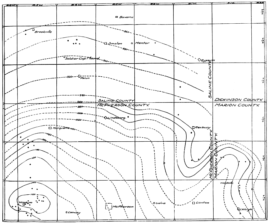
Plate V--Map showing structure of the marine strata in the central Kansas sequence. Solid lines show known structure; dashed lines hypothetical structure. The round spots denote places where either the Mentor or the Windom member is exposed. An Acrobat PDF (756 kB) of this figure is available.
Return to Structure of the Marine Portions
Kansas Geological Survey, Geology
Placed on web February 2006; originally published 1924.
Comments to webadmin@kgs.ku.edu
The URL for this page is http://www.kgs.ku.edu/Publications/Bulletins/9/plate5.html