![]()
Prev Page--Stratigraphy || Next Page--Petrology
Physiographic Expression
The lenticular masses of silicified rock in the Ogallala formation of north-central Kansas are more resistant to erosion than any other type of rock occurring in that area. Some of the most striking topographic features of the region have been produced by differential weathering and erosion which have left quartzite beds as the cap rock of buttes and rock benches along the valley sides. Sugar Loaf Mound and Twin Mounds in Rooks County, the series of high buttes south of Glade in Phillips County, and McAllister Buttes in Logan County are capped by Ogallala quartzite or chert. The easternmost outcrop of this rock known in Kansas is the cap rock of Stony Mound, an isolated low mound standing above the adjacent topography 1 mile south of Bellaire in Smith County. At many places where this rock was examined, it forms a cap rock on hills or ridges and makes a pronounced rock bench on slopes (Pls. 1, 2, and 3). This typical physiographic expression was found to be of considerable aid in locating and mapping outcrops of quartzite and chert. Along the eastern fringe of Ogallala outcrops, where the present streams have cut their valleys deep into the Cretaceous bedrock, the silicified deposits occur on the crests of major divides and thus have maximum topographic expression. Farther west, a thick section of Ogallala and Pleistocene deposits overlies the bedrock and the silicified zones generally occur low along the valley sides where they produce only minor interruptions in the slopes.
Plate 1--Ogallala quartzite in Phillips and Norton counties, Kansas. A, Hill capped by quartzite in NE sec. 28, T. 5 S., R. 19 W., Phillips County; B, quartzite outcrops in the NE sec. 15, T. 5 S., R. 21 W., Norton County; C, surface of exposure shown in B.
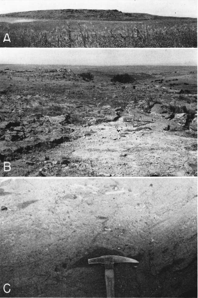
Plate 2A--Quartzite in quarry face, on top of Sugar Loaf Mound, sec. 10, T. 6 S., R. 19 W., Rooks County.
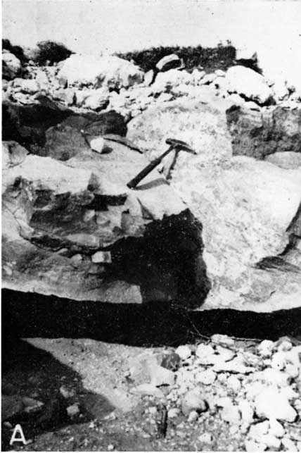
Plate 2--B, Sugar Loaf Mound, looking north; C, school building constructed of Ogallala quartzite, Luddell, Rawlins County, Kansas.
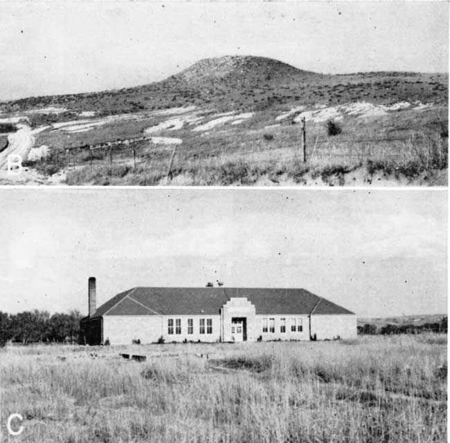
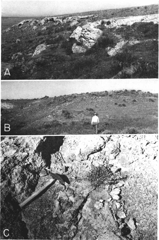
Plate 3--Ogallala chert and quartzite in Rawlins and Graham counties, Kansas. A, Chert outcrops in the NE sec. 16, T. 4 S., R. 36 W., Rawlins County; B, hill of Niobrara chalky shale capped by quartzite, NW sec. 13, T. 8 S., R. 24 W., Graham County; C, weathered surface of outcrop shown in B.
In several areas, the geographic position of the quartzite deposits has probably at least partly controlled the shape and location of present valleys. This is illustrated by the constriction of South Solomon Valley at Penokee,, where quartzite caps the bluffs both north and south of the river, and particularly by the anomalous bend in Prairie Dog Creek west of Woodruff in Phillips County. Two to 3 miles west of Woodruff and just south of the Nebraska state line, an elongate hill is capped by lentils of quartzite in loose sand, gravel, and silt. Southwest from this hill Prairie Dog Creek flows in a relatively straight valley but immediately south of the quartzite locality it turns abruptly to the west for 1.5 miles, then sharply north for about 1 mile and back toward the east, rejoining its former trend just north of the state line. Prairie Dog Creek flows on three sides of this low quartzite hill and seemingly during the period of downcutting was forced westward into its present position by the greater resistance of the quartzite lentils.
Bow Creek flows eastward from northern Graham County along the Phillips-Rooks County line, joining North Solomon River in southeastern Phillips County. The elevation of its channel bottom is distinctly higher than those of the major valleys both north and south to which it is roughly parallel. Quartzite crops out along both sides of the valley in western Rooks and Phillips Counties and forms a rock bench in some places. Even though the channel is now cut into Cretaceous bedrock, a distinct steepening occurs in the stream gradient in the vicinity of Sugar Loaf Mound a short distance west of the eastern margin of the quartzite outcrops. These data seem to indicate that the position of the stream across an extensive area of quartzite has retarded its downcutting with a resultant loss of tributaries.
Prev Page--Stratigraphy || Next Page--Petrology
Kansas Geological Survey, Geology
Placed on web Aug. 20, 2007; originally published July 1946.
Comments to webadmin@kgs.ku.edu
The URL for this page is http://www.kgs.ku.edu/Publications/Bulletins/64_2/04_phys.html