![]()
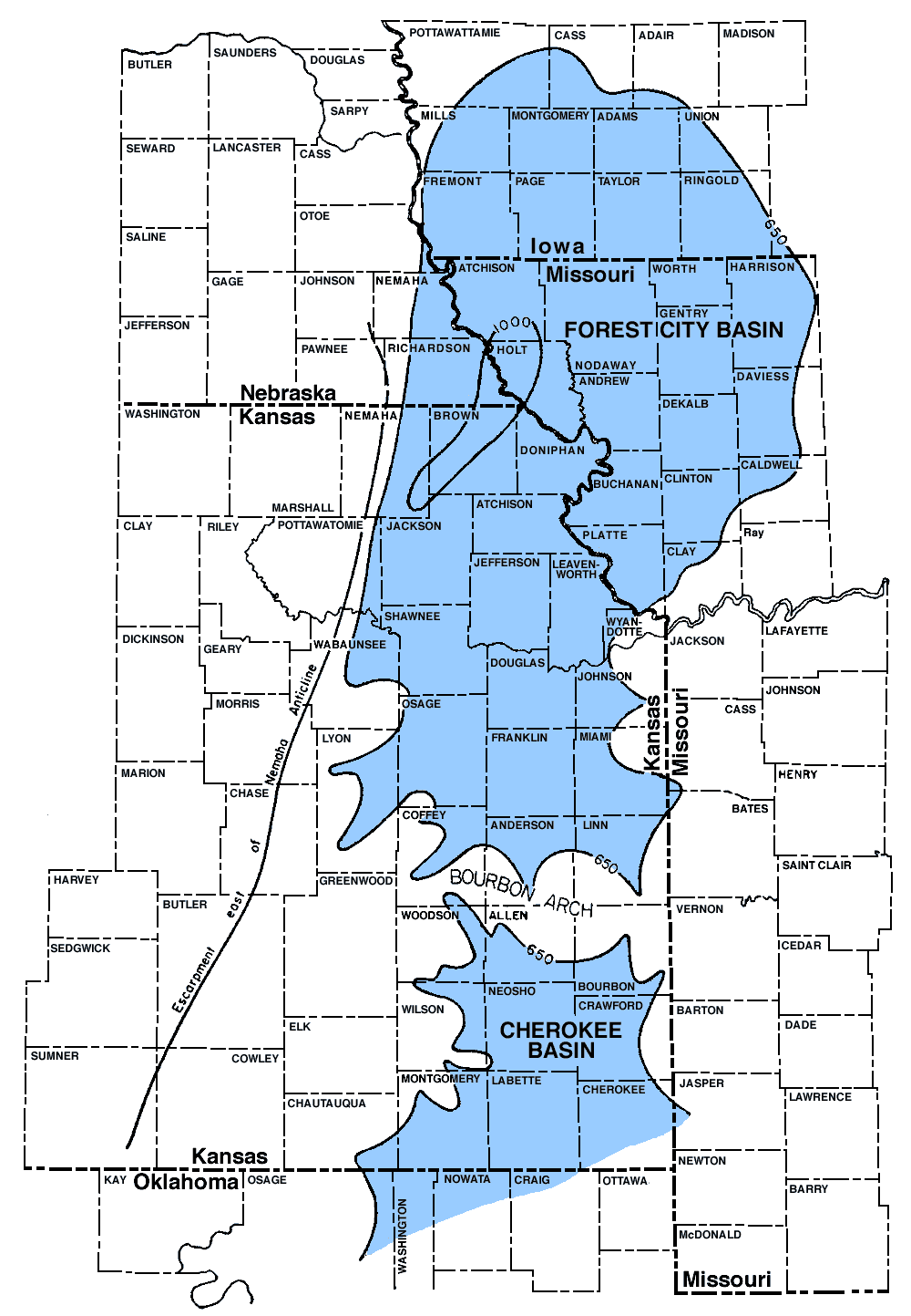
Figure 1--Map showing outline of the Forest City basin and its relation to the northern end of the Cherokee basin and to the escarpment on the east side of the Nemaha anticline. The basins are outlines by a contour indicating a thickness of 650 feet between the base of the Hertha limestone and the top of the the Mississippian limestone. The deepest part of the basin is outlined by the 1000-foot thickness contour. Data for northeastern Kansas are adapted from figures 17 and 18 of this report; for Missouri in part after McQueen and Greene (1938, pl. 4); for southeastern Kansas after Bass (1936, pl. 1); and for Iowa and Nebraska after Holl (1932).
Kansas Geological Survey, Forest City Basin
Comments to webadmin@kgs.ku.edu
Web version July 2005. Original publication date Dec. 1943.
URL=http://www.kgs.ku.edu/Publications/Bulletins/51/fig1.html