Kansas Geological Survey, Bulletin 222, originally published in 1981
Originally published in 1981 as Kansas Geological Survey Bulletin 222. This is, in general, the original text as published. The information has not been updated.
This Bulletin reports on basic research in the field of micropaleontology, the study of the microscopic fossils found in rocks. By studying these tiny fossils, much information can be obtained about the present characteristics of their host rocks and about the conditions under which those rocks were formed. Various fossils were studied to determine the age and to interpret the succession of events in the formation of host rocks. These events can be compared with those that took place in Texas, Oklahoma, Missouri, Kansas, Colorado, Wyoming, Montana, and the southwestern United States during about the same time and involving the same rock units. For this report, the rocks in a continuous core from the Mid-Continent No. 1 J. G. Collins borehole, Ness County, Kansas, were studied to determine their age and other characteristics. It is important to study this rock horizon as it may contain lead, zinc, and silver ores or be a stratigraphic trap for petroleum and natural gas.
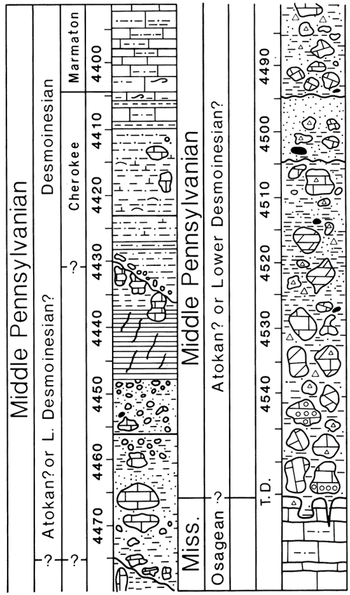
Beds encountered in a continuous core from the Mid-Continent No. 1 J. G. Collins borehole, Ness County, Kansas, include a Pennsylvanian breccia-conglomerate of Atokan or lowermost Desmoinesian age, with reworked upper Morrowan or Atokan limestone in a conglomerate or possibly a deeply weathered subsoil zone; a paleosol; a pebble conglomerate of Cherokee age; Cherokee shale beds representing transgressive-regressive marine episodes; and a normal marine limestone (Fort Scott) of early Marmaton age. Beds at the bottom of the core rest upon the upper, weathered surface of the Mississippian limestone (Osagean). The breccia-conglomerate contains a mixture of weathered-in-place cobbles and boulders and riverine pebbles and cobbles of Osagean, Meramecian, and Chesteran ages derived in part from an extensive, deeply weathered karst terrain. The chaotic nature of the matrix beds (composed mainly of fresh and white chalky chert; spicular chert; drusy and doubly terminated quartz crystals; white beekite rings; rounded, frosted and clear, angular sand and silt grains; gray and green clay residuum, and minor amounts of sphalerite and chalcopyrite) represents the mixed weathering products derived from reworking of Mississippian beds in the matrix of the breccia-conglomerate. Also in the enclosing matrix are beds at several levels with carbonized plant remains and coaly fragments of Morrowan or Atokan age and a distinctive white sandstone conglomerate below the weathered soil zone. A cross section, with base of the Fort Scott Limestone as datum, shows correlation of three of the overlying units above in the vicinity of the No. 1 Collins borehole. Variation in thickness of the "basal Pennsylvanian conglomerate" leads to difficulty in picking the top of the "Mississippi solid."
Fusulinids, endothyrids, archaediscids, conodonts, and algae were used for age determination and to interpret succession of stratigraphic, geomorphic, and structural events. These karst-related events can be compared with those that took place in Texas, Oklahoma, Missouri, Kansas, Colorado, Wyoming, Montana, and the southwestern United States during about the same time and that involved the same stratigraphic units. This Mississippian karst horizon is important as a host rock for the emplacement of lead, zinc, and silver ores and as a stratigraphic trap in the accumulation of petroleum and natural gas.
The Mid-Continent No. 1 J. G. Collins, C NW NW Sec. 24, T. 20 S., R. 26 W., Ness County, Kansas (Fig. 1), was recorded as a dry hole in 1938. This report is based upon beds encountered in a continuous core taken from this borehole from 4297 feet (1310 m) (drillers' Fort Scott Limestone, Marmaton Group, Desmoinesian Stage, Middle Pennsylvanian Series) to 4555 feet (1388 m), reported simply as "Mississippi lime."
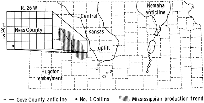
Figure 1--Location of Mid-Continent No. 1 Collins borehole, C NW NW Sec. 24, T. 20 S., R. 26 W., Ness County, Kansas, in relation to Central Kansas uplift. (After fig. 6, Zeller, 1968.)
This study is part of a larger on-going project to investigate the Mississippian-Pennsylvanian boundary in southwestern Kansas and to delineate the ages and nature of Mississippian and Pennsylvanian beds encountered in well cores in this area. Specifically, the present study was done to compare age determinations derived by using endothyrid and fusulinid foraminifers with those using conodonts in an earlier study undertaken by Thompson and Goebel (1963; 1968 [1969]) on the No. 1 Collins well core.
No electric or lithology logs were made for this borehole; however, electric and lithology logs from other boreholes in the vicinity of the No. 1 Collins have been studied and correlated with the No. 1 Collins. Approximately half of the core and core pieces had been digested in acetic acid for Thompson and Goebel's studies, and the insoluble residues were described by Welch (1963). The remaining half of breccia-conglomerate pieces and matrix was examined individually for macro- and microfossils. The only fossils visible in the matrix sandstone, clay, and shale of the core were coalified leaves and finely comminuted carbonaceous coaly debris at several intervals between 4496 and 4527 feet (1370 and 1380 m). Thin sections were made of individual pieces of limestone and chert included in the breccia-conglomerate that seemed productive of foraminifers, and the microfossils were identified in the hope that these might at least define the age of the included pebbles, cobbles, and boulders. The "Mississippian" clasts in the core yielded diagnostic endothyrid foraminifera ranging in age from Meramecian to Chesteran; and a diverse microfauna, including fusulinids and algae, was found in Pennsylvanian (Cherokee and Marmaton) rocks at 4430 feet (1350 m) and upwards.
The No. 1 Collins borehole is situated 48 miles (77 km) west-southwest of the western paleoerosional margin of the Central Kansas uplift (Fig. 1). Schierling (1968) showed a northwest-southeast-trending anticline in Gove County, indicating a positive structure that in all probability extends into the Ness County area to the south. A contour map on top of the Mississippian (Merriam, 1960) indicated regional structural trends in this same direction parallel to, but separated from, the Central Kansas uplift. In addition, plotting of the oil fields in Gove, Lane, Ness, and Hodgeman counties reveals the outline of this trend (Kansas Geological Survey, 1975). This same structural grain seems to have been present from Precambrian through Mississippian and even into earliest Pennsylvanian time.
Subsurface Paleozoic rocks previously reported as present in this area include those of Ordovician age (Arbuckle, Viola), unconformably overlain by the "Kinderhook shale" (Chattanooga, Devonian), and the Gilmore City Limestone (Kinderhookian), unnamed Osagean beds, and the "Warsaw Limestone" (Meramecian) of Mississippian age. Rocks of Pennsylvanian age (Desmoinesian, Missourian, and Virgilian stages) unconformably overlie truncated Mississippian strata. Permian beds rest disconformably upon those of the Pennsylvanian Wabaunsee Group. To the east, toward the Central Kansas uplift, younger Pennsylvanian strata successively onlap the older, deeply eroded Paleozoic beds, until, at the crest of the structure, late Pennsylvanian rocks rest directly on Precambrian granites and quartz monzonites. Of the Pennsylvanian beds, only rocks of possible Morrowan or Atokan stages, undifferentiated Cherokee Group, and basal portion of the Marmaton Group (Fort Scott Limestone) have been included in this report.
Thompson and Goebel (1963) included a study of the No. 1 Collins core in their investigation of conodonts in subsurface rocks of Meramecian age in Kansas. In regard to the age of the Mississippian portion of the core, they stated (p. 14):
Correlation using conodonts places the top of the Warsaw at a depth of 4,468 feet. From sample logs the top of the Warsaw is picked on a lithologic basis at 4,527 feet. The depth of 4,527 feet is a level in the core where fenestrate bryozoans are the dominant constituent of the core. The lack of agreement between the lithologic pick and the conodont specimens collected from the No. 1 Collins well led to the several reexaminations of the core and careful redescription. It was observed that no conodonts were recovered from the shaly, clayey, sandy sections of this well. Conodont specimens recovered were apparently from the carbonate chunks of rock. In the section from 4,480 to 4,495 feet, the most significant guide fossil to the Warsaw Limestone, Gnathodus texanus, was found in abundance.
Thompson and Goebel (1968 [1969]) pointed out that the subsurface character of the Warsaw Limestone had been described as semi-granular to coarsely crystalline limestone interbedded with saccharoidal dolomite, containing varying amounts of gray, mottled, opaque, microfossiliferous chert, locally occurring geodic and drusy quartz, and disseminated pyrite and glauconite. Molds of fossils are common. Residues from the dolomite beds sometimes contain spongy masses of spicules. They further stated (p. 9):
In cores from Kiowa and Hodgeman counties . . . the Warsaw Limestone lies directly below Pennsylvanian rocks and is made up of conglomeratic, sandy, dolomitic shale, containing chert. Post-depositional and post-chert fracturing and faulting is exhibited in the Warsaw Limestone in Hodgeman County. In Ness County, in addition to "mixed-fossil" fragmental limestone . . . the Warsaw Limestone is breccia with large fragments of finely crystalline limestone interspersed with green, silty, clayey shale. Fowler and Robbie . . . defined this lithology [in Ireland] as "quasi-breccia. " Thompson and Goebel . . . applied the term to the Warsaw Limestone in Core F [No. 1 Collins].
Thompson and Goebel (1968 [1969]) concluded, on the basis of conodont evidence, that the interval in the core that I have defined as Atokan or lower Desmoinesian breccia-conglomerate was totally Warsaw in age. However, all of the conodonts listed by them as present in the core (appendix, core F, p. 49) in the "Warsaw" of the No. 1 Collins (4450-4555 ft.) either range from Warsaw through St. Louis (or Ste. Genevieve) or are confined solely to the Warsaw (table 2, 18). Thus the conodonts in the repeated, random cobbles and boulders of "Warsaw" age would not necessarily have indicated the true age or the stratigraphic position of this portion of the core.
A detailed description of the No. 1 Collins core (Table 1) includes types of fossils found in the rocks, with generic and specific names, where ascertainable. In analyzing the core, both the drillers' log and the core record were utilized in order to augment the visual, microscopic, and thin-section examination of the rocks remaining in the core boxes. Much unconsolidated shale, mudstone, and sandstone was lost in the core recovery operation. Core record descriptions such as "4427 Green shale with chunks of dense Pennsyl. Ls. imbedded," "4493.5 Limestone broken by diagonal green clay seams," "4527 Hard gray siltstone, very sandy, it contains small pieces and larger chunks of limestone, green clay, white chert and miscellaneous materials such as black plant fragments," and at 4505, 4548, and 4555 (TD) "Soft gray clay" verified the interpretation that the bulk of the core was a breccia-conglomerate with a variable matrix of detrital materials. When examined microscopically, all the limestone core pieces were found to contain green clay and/or silt or sand in tiny crevices and irregularities on the outside, top, or bottom of the piece. In addition, thin-section examination of a "Warsaw" cobble at 4475 feet (1364 m) (Table 1) revealed much interstitial glauconite that, when completely weathered, would have contributed to the volume of green clay shale encountered in the core interval. These observations led to the belief that no solidly bedded Mississippian limestone was encountered by the coring, even to the total depth at 4555 feet (1388 m). In the lithologic documentation of the core (Table 1) some of the footage described by the geologists and driller when the samples came up, and which is no longer intact or was lost in coring, is inserted where it added important information on the nature of the beds.
Beds from the base of the core to 4475 feet (1364 m) (Fig. 2) comprise the distinctive main unit of the breccia-conglomerate, with pebbles, cobbles, and boulders of Mississippian limestones of mixed ages in varying states of weathering from fresh, with well-preserved fossils, to slightly weathered and oxidized, to completely leached, decalcified, and "rotten." Large amounts of chert, occurring as pebbles and cobbles and smaller pieces grading down to millimeter-sized fragments, are found throughout this interval. Some chert fragments are fresh and contain well-preserved endothyrid foraminifers (see Fig. 16, A), sponge spicules, or other fossils. Most pieces are moderately or severely weathered and devitrified to a chalky white composition. The matrix beds enclosing the limestone and chert pieces are predominantly light and dark gray, gray-green and green glauconitic shale, clay, or mudstone; gray, gray-green, and green (glauconitic) siltstone; and greenish-buff, gray, and gray-green (glauconitic) sandstone. The matrix beds are mostly friable, noncemented, nonindurated, and noncalcareous. They contain scattered pyrite; sphalerite; chalcopyrite; geodes; mammillary quartz; doubly terminated quartz crystals; beekite rings; drusy quartz; glauconite grains; coarse, rounded quartz grains; aggregates of pyritized spicules; plant and coaly debris; and rounded, frosted and clear, and subangular to angular sand and silt grains.
Figure 2--Geologic section encountered in Mid-Continent No. 1 Collins core, C NW NW Sec. 24, T. 20 S., R. 26 W., Ness County, Kansas. Conglomerate derived from karst-surface debris lies on top of deeply weathered karsted late Osagean limestones and dolomites. Distinctive white sandstone conglomerate is shown from 4475 to 4447 feet. Paleosol lies at 4430 feet and below. Marine Cherokee and Marmaton beds lie above the basal Cherokee conglomerate.
Beds from approximately 4447 to 4475 feet (1355-1364 m) are a distinctive white conglomeratic sandstone (Fig. 2), contrasting sharply with the beds below and above in color and composition. The color varies from white to light tan to pinkish-white, to pale gray and dark gray. The sandstone contains much glauconite, scattered pyrite, sphalerite, and mica; beekite rings; thinly laminated, angular intraclasts of pale greenish-gray (glauconitic) sandstone and gray sandstone; short stringers and pods of glauconite; heterogeneous mixtures of quartz grading from silt to sand size, most frosted and rounded, some clear and angular; intraclasts in the form of short stringers and chunks of glauconitic silt; stringers of sandstone and sandstone clasts; and, in a few places, calcitic or silicified fossil debris. Beds are variable in composition and change abruptly in this unit. One one-inch bed is a coarse white sandstone spotted with iron stain and with dark siltstone-mudstone stringers. Another is a white silicified sandstone one inch thick, fossiliferous, and in places extremely highly weathered and tripolitic (see Fig. 6, D). The white sandstone contains cobbles and pebbles of Mississippian limestone. It is recognized by J. D. Davies as a marker bed on the lithologic logs prepared for the Kansas Geological Society.
The interval from 4447 to 4436 feet (1355-1352 m) represents the deeply weathered soil profile (Fig. 2). It contains, ascending, a red to greenish-gray to deep purple, unctuous claystone, containing shrinkage cracks that have been re-cemented with green clay and calcite veins (Fig. 7, B). Above is a gray, noncalcareous, fossiliferous sandstone, with intraclasts of finer-grained, thinly laminated shaly sandstone with subbituminous coal debris, sphalerite, pockets of mud, and pieces of geodes with "dead" oil. On top of that are "rotten" mudstones and siltstones, just below the paleosol, with iron in differing states of oxidation, from greens of glauconite through bright yellow to bright red to purple.
In this upper interval are pieces of highly weathered limestone, yellow and red with limonite and hematite, and shot through with calcite veins (Fig. 7, A). It is in these limestone cobbles between 4435 and 4440 that the Pennsylvanian conodont Idiognathodus was found. It is not clear whether these limestones were weathered in place or were reworked Pennsylvanian (Morrowan?) cobbles as described in the core record at 4427 feet (see Table 1). Any calcareous microfossils in these limestones would not have survived the intense weathering in the soil zone. In their absence, and because Idiognathodus is non-age-diagnostic unless identified to species, no accurate age could be determined for these particular limestone cobbles, except that they appear to be early Pennsylvanian.
Beds from 4436 to 4431 feet (1352-1351 m) represent the upper part of the soil zone. The only lithologic descriptions of this interval (Table 1) were obtained from the drillers' log and the geologist's report as there was no core recovery, only finely divided earthy, sandy debris. They recorded limestone with a slight oil show, green lumpy clay, and much sand.
Immediately above the paleosol is the basal Cherokee conglomerate derived from the soil rubble. It is a pebble conglomerate or breccia, with coarse sand grains, glauconite, bright red iron stains, and gray-green silt. The superjacent beds of Cherokee age (4429-4404 ft.; 1305-1342 m) are tan to brown, limey siltstones, burrow-mottled gray-green to gray mud- stones, and black shales containing a normal marine fauna of an early Desmoinesian type (Fig. 6, A-C). In the siltstones and mudstones are recognizable pieces of Mississippian limestones. The siltstones and mudstones are interbedded with limestones that contain lumps of pyrite and disseminated pyrite, glauconite, and rip-up shale clasts. Several zones in this interval contain broken fusulinids (Pl. 3, Fig. 1) and other fossil hash, along with reworked lithoclasts, and are interpreted as representing transgressive-regressive episodes in Cherokee sedimentation.
The core between 4404 and 4395 feet (1342-1340 m) (Fig. 2) is identified as Fort Scott in age because of its contained fusulinid fauna (Pl. 1, Figs. 4, 16; Figs. 3, 4; see Table 1 for detail). Very tiny Mississippian limestone clasts are still to be seen in these silty limestones. A piece of core at 4395 feet (1340 m) is oil stained.
Table 1--Lithologic Description of the Mid-Continent No. 1 J. G. Collins Core, C NW NW Sec. 24, T.20S, R.26W, Ness County, Kansas. *From drillers' log. † From core record.
| Depth | Description | |
|---|---|---|
| Feet | Meters | |
| Middle Pennsylvanian Series | ||
| 4297* | 1310 | Limestone. |
| 4307* | 1313 | Limestone. |
| 4311* | 1314 | Shale. |
| 4319* | 1316 | Limestone. |
| 4350* | 1326 | Shale and thin limestone. |
| 4353* | 1327 | Shale, black, soft. |
| 4360* | 1329 | Shale and thin limestones. |
| 4364* | 1330 | Cherty limestone. |
| 4372* | 1333 | Limestone. |
| 4382* | 1336 | Shale, black. |
| 4386* | 1337 | Limestone. |
| Marmaton Group, Fort Scott Limestone | ||
| 4395 | 1340 | Limestone-mudstone, calcareous, light-gray, with dark-gray streaks, with black shale beds, bryozoans, crinoids, brachiopods, holothurian sclerites, white porcelaneous encrusting forams, Endothyranella, Ammodiscus, Globivalvulina, Trepeilopsis, Tuberatina, Tetrataxis, Komia, Paramillerella, Millerella, Ozawainella?, "Endothyra," Earlandia, Lituotuba, Eoschubertella, Orthriosiphon?. (Pl. 1, Figs. 1, 2, 3; Fig. 3; Fig. 4, A, B) |
| 4396 | 1340 | Limestone, light-gray, silty, crinoids, bryozoans, brachiopods, blastoid plates. Same fauna as above, plus Girvinella, sponge spicules. Oil-stained, highly recrystallized. And mudstone, dark-gray, unfossiliferous. |
| 4397 | 1340 | Limestone, same as 4396. Millerella, Planiinvoluta, "Endothyra," Orthriosiphon?, Endothyranella, Globivalvulina, Eoschubertella, Trepeilopsis, Ammodiscus, "Plectogyra," and ostracodes. And mudstone, dark-gray, unfossiliferous, alternating with limestone. (Fig. 4, C) |
| 4398 | 1341 | Limestone, silty, light-gray, algal, mottled and streaked with black shale and bedded black shale. Tetrataxis, Ammodiscus, Eoschubertella?, very large Tuberatina, Komia, Earlandia, Endothyranella, Apterinella, Ozawainella? Globivalvulina, Millerella, Howchinia?, highly inflated Fusulina, Girvinella, bryozoans, conodonts, tiny plectogyrids, sponge spicule bed. Weathered joint surfaces. Euhedral pyrite in some beds. And shale, black. (Pl. 1, Figs. 4, 5, 6, 8, 13; Fig. 4, D, E) |
| 4399 | 1341 | Limestone, algal, light-gray, with Komia and recrystallized bladed algae, Tetrataxis, Tuberatina, Earlandia, Globivalvulina, Endothyranella, Eoschubertella, Wedekindellina (reworked?), Millerella, "Endothyra," Planiinvoluta, Trepeilopsis, Howchinia?, "Plectogyra," Fusulinella, Pseudowedekindellina, pelecypods, ostracodes, porcelaneous encrusting forams. (Pl. 1, Figs. 7, 12, 14, 17; Fig. 4, F; Fig. 5, A) |
| 4400 | 1341 | Limestone, silty, light-gray, algal, stylolitic, with Komia, "Pseudostacheoides" of Petryk and Mamet 1972, Globivalvulina, Earlandia, Planiinvoluta, Millerella, Tuberatina, Howchinia?, Ozawainella, Eoschubertella, highly recrystallized "Plectogyra," ostracodes. (Pl. 1, Figs. 10, 11; Fig. 5, B, C) |
| 4401 | 1341 | Limestone, light-gray, algal, with Komia, Tuberatina, Endothyranella, Howchinia?, Tetrataxis, Ammodiscus, Pseudowedekindellina, "Plectogyra," Polytaxis laheei Cushman and Waters, Tetrataxis conica Ehrenberg, "Pseudostacheoides" of Petryk and Mamet 1972, Millerella, Globivalvulina, Earlandia, Fusulina of type occurring in lower Fort Scott Limestone, ostracodes, pelecypods, bryozoans, amber-colored plant material, pyrite, trace oil stain. *Shale, black. (Pl. 1, Figs. 15, 16; Pl,. 2, Figs. 1-6, 8, 10, 12; Fig. 5, D, E) |
| 4402 | 1342 | Limestone, light-gray, algal, Komia, highly recrystallized, Archaeolithophyllum?, white porcelaneous encrusting forams, Tuberatina, Tetrataxis, Ammovertella, Globivalvulina, "Plectogyra," Endothyranella, Planiinvoluta, Millerella, Ammodiscus, bryozoans, pelecypods. (Pl. 2, Figs. 7, 11; Fig. 5, F) |
| 4403 | 1342 | Mudstone, light- to dark-gray, calcareous, molluscan, algal, Komia, Globivalvulina, Millerella, Tetrataxis, Howchinia? large, inflated fusulinids, Eoschubertella, Pseudowedekindellina, large "Plectogyra," bryozoans, brachiopod spines, broken fusulinids. (Pl. 2, Figs. 13-15; Fig. 5, G, H) |
| 4404 | 1342 | Limestone, gray, with molluscan mudstone, beds of coarse fossil fragments, "triangular" bryozoans, Millerella. And black shale with brachiopods and bryozoans. |
| Cherokee Group, Cabaniss Formation? | ||
| 4405 | 1343 | Siltstone/mudstone, limey, molluscan, black, with small limestone (Mississippian) clasts, traces brachiopods, small crustaceans, pyrite. |
| 4406 | 1343 | Shale, dark-gray, calcareous, sometimes platey, sandy, silty, fossiliferous, finely comminuted shell debris. |
| 4407 | 1343 | Limestone, light blue-gray, silty, fossiliferous, mud-streaked, Globivalvulina, Tetrataxis, fusulinids, brachiopods, ramose bryozoans, conodonts. †Shale, gray, with thin layer of black shale. |
| 4408 | 1344 | Limestone, tan, more silty, less fossiliferous, fusulinids, brachiopods, ramose bryozoans. |
| 4409-10 | 1344 | Siltstone, tan, calcareous, brachiopod and pelecypod fragments, spines, bryozoans. |
| 4411 | 1345 | Ibid., pyrite, ostracodes, small specks glauconite. And shale, dark gray-green, unfossiliferous, sandy or silty. |
| 4412-13 | 1345 | Mudstone, medium-gray, sometimes platey, fossiliferous, intensely burrowed, Fusulinella stouti? Thompson (reworked?). (Pl. 2, Fig. 16) |
| 4413-19 | 1345-47 | Siltstone, gray, calcareous, fragmental, fusulinids (reworked?) and sandstone, green to tan, calcareous, pelecypods, tiny white opaque forams, blastoids, echinoid spines. 4417 †Shale, gray, calcareous and fossiliferous. 4418.5 †Limestone, dense, pale brown. |
| 4422 | 1348 | Limestone, medium blue-gray, silty, fossiliferous. †Shale, gray, fissile. |
| 4423 | 1348 | Siltstone, gray-green, fine-grained, disseminated pyrite, brachiopods. *Shale, black. |
| 4424 | 1348 | Mudstone, medium greenish-gray, calcareous, disseminated pyrite. |
| 4425 | 1349 | Mudstone, as above, increase in pyrite, burrow mottled. |
| 4426 | 1349 | Ibid., and *limestone, broken, and green shale. |
| 4427 | 1349 | Mudstone, gray-green, calcareous, silty, different from above, much pelecypod and brachiopod debris, finely broken. †Shale, green, with chunks of dense Pennsylvanian limestone imbedded. |
| 4428 | 1350 | Siltstone, gray-green to tan, more dense in places, with tiny stringers and pockets of green silt, burrow mottled. |
| 4429 | 1350 | Ibid., more limey, finely silty beds, burrow mottled, belemnites, bryozoans, rotund fusulinids, Ammovertella, Climacammina, Endothyranella, Tuberatina, Globivalvulina, Tetrataxis, bryozoans, algae, rock partially silicified. *Shale, black and some limestone. (Fig. 6, A) |
| 4430 | 1350 | Siltstone, tan to gray to brown, limey, oil-stained, reworked high-spired Tetrataxis, Pseudowedekindellina, algae, Komia, recrystallized bryozoans, porcelaneous white encrusting forams, Wedekindellina (broken, reworked zone), Eoschubertella, Bradyina magna Roth and Skinner, Cribrospira? And mudstone, mottled, many stylolites. (Pl. 2, Fig. 17; Pl. 3, Fig. 1; Fig. 6, B, C) |
| Soil-derived Basal Conglomerate of the Cherokee | ||
| Pebble conglomerate or breccia with sand grains, glauconite, iron (bright red), gray-green silt. | ||
| 4431 | 1351 | *Limestone, slight oil show. (No core recovery.) |
| 4432 | 1351 | †Clay, green, lumpy. *Limestone, shale, sticky. (No core recovery.) |
| 4432-37 | 1351-52 | †Much sand. |
| Atokan or Early Desmoinesian Stage | ||
| Soil Zone | ||
| 4436 | 1352 | Mudstones and siltstones, highly weathered, below paleosol, quartz grains, iron in differing states of oxidation, from greens of glauconite through bright yellows to bright reds, veins filled with calcite (see Fig. 7, B). Highly weathered limestone cobbles with Idiognathodus from 4435-4440. (Fig. 7, A) |
| 4437 | 1352 | Sandstone, gray, noncalcareous, fossiliferous, intraclasts of finer grained, varved sandstone with subbituminous coal bits, sphalerite, pockets of mud, pieces of geodes with "dead" oil. |
| 4440-45 | 1353-55 | Claystone, red and greenish-gray to deep purple, mottled, unctuous, slickensided, shrinkage cracks, fractured and recemented with green clay, calcite veins. (Fig. 7, B) |
| 4445 | 1355 | Shale (claystone), red, unctuous, slickensided, weathered soil zone. |
| 4446 | 1355 | Shale, red and gray-green, mottled. |
| 4447 | 1355 | Shale, red and gray-green, mottled, "rotten." |
| 4448-50 | 1356 | Conglomerate in shale, "rotten," red and green mottled, reworked sandstone pebbles and Mississippian chert and limestone clasts. Angular sandstone, fresh minerals, gray, mostly medium-grained (angular to subrounded, some frosted), all sizes of quartz to silt sized. Very little to no CaCO3, glauconite, mica, sphalerite fragments. A thin zone coarse white sandstone, mottled with iron stain and with dark siltstone-mudstone stringers. |
| 4451-55 | 1357-58 | Sandstone conglomerate, mottled gray and tan, noncalcareous, burrow mottled, intraclasts of banded sandstone, green shale, Mississippian limestone clasts, angular and rounded to subrounded, frosted grains from coarse sand to fine silt. And sandstone, mottled light tan to pinkish-white to pale gray to dark-gray, weathered, burrow-mottled (Fig. 8), some large pieces quartz. 4451 †Clay, variegated, red, yellow, and green. (See Fig. 7, C, D) |
| 4456 | 1358 | Ibid., more coarse-grained here, glauconitic shale, subrounded to angular clear quartz grains, light-gray siltstone, dark-gray siltstone, gray-green shale, pyrite, iron stains from bright orange to yellow. (Fig. 7, C, D) |
| 4457 | 1359 | Conglomeratic sandstone, bright green, glauconitic, interbedded green glauconitic silt with quartz beds, enclosing pieces of crinoidal limestone. Seems to be no calcite in matrix. Cobbles of irregular calcite beds intermixed with finely crystalline crinoidal material. |
| 4458-60 | 1359 | Sandstone, conglomeratic, jumbled mixture of structures and materials: light and dark banded, red iron stains, green glauconite. Meramecian cobble at 4460 feet, algae. *Lime, sandy, and green shale. †4459 Gray, hard, studded rock, calcareous. (Fig. 7, E) |
| 4461 | 1360 | Siltstone or mudstone, gray-green, with finely disseminated pyrite, highly weathered piece of crinoidal limestone. |
| 4462 | 1360 | Sandstone conglomerate-breccia, with blocks of highly weathered, recrystallized, dolomitized, yellow-brownish-reddish crinoidal limestone, some glauconite, also glauconitic shale in tiny crevices in limestone pieces, crinoid stems stained pinkish-orange by oxidized iron. Contains bed of pure green glauconitic sandstone with silt and pyrite. Reworked "alpha coral," holothurian sclerites, echinoid spines, bryozoans, E. kleina? Woodland in clast of Chesteran age. |
| 4464 | 1361 | Breccia-conglomerate, crinoidal beds in varying states of preservation mixed with sandstone-shale-glauconite. One piece limestone nearly pure white, very well preserved. Most stained red or ochre-colored by iron. |
| 4466 | 1361 | Cobble or boulder of white fossiliferous limestone, bryozoans, algae, brachiopods, corals, fossil pellets coated with algae (resemble oolites), crinoids, "alpha coral," Lyropora, Stacheoides? Asphaltina cordillerensis Mamet, E. kleina Woodland, conodonts. (Pl. 3, Fig. 2) |
| 4467 | 1362 | Siltstone, green-gray, and yellow-brown fossiliferous limestone boulder/cobble, well-preserved, fenestellid bryozoans, "alpha coral," echinoderm plates. |
| 4468-69 | 1362 | Sandstone, with silt, grayish-green, pyrite, glauconite, fossiliferous limestone debris in it. Very thin beds silt and shale, light to medium-gray. Limestone pieces with well-preserved fossils, light-gray, with brownish stain, with gray-green, silt-filled crevices, Asphaltina?, bryozoans, brachiopods, horn corals, echinoid spines, small round sponges, prolific reworked "alpha coral," pyrite, glauconite, iron stains. Thin bed of white silicified sandstone, fossiliferous, somewhat devitrified. (Fig. 6, D) |
| 4470-72 | 1363 | Sandstone, conglomeratic, green, grading coarse to fine, with silt, short stringers and hunks of glauconite, contains sandstone clasts, aggregates of pyritized spicules, beekite rings. |
| 4473 | 1363 | Ibid., with limestone cobbles, tan, fine-grained, fossiliferous, pyrite, few grains bright green glauconite, inclusions of coarse white sandstone. |
| 4474 | 1364 | Ibid., completely recrystallized, silicified. |
| 4475 | 1364 | Siltstone/sandstone, mixed, green to gray to white, highly glauconitic, containing coaly fragments, pebbles and cobbles Mississippian (Warsaw) limestone, tan, algal-crinoidal-bryozoan, with grains and fillings of fossil cavities with glauconite, some bedding at right angle to core length. Pieces of white, weathered, fossiliferous chert. (Fig. 7, F) |
| 4476 | 1364 | Limestone cobbles and pebbles, tan, silty, medium-grained, slightly crinoidal, tiny blebs jade-green glauconite, in matrix of gray-green quartz silt with glauconite. Silicified pebble with "alpha coral," bryozoans, brachiopods, lithology like 4474, but better preservation. |
| 4477 | 1365 | Siltstone/sandstone matrix, clastic, with intraclasts of tan, fossiliferous limestone and green silt, glauconitic shale, dark-gray shale, light-gray shale, "alpha coral." |
| 4478 | 1365 | Ibid., plus dark-gray mudstone, scarce fresh glauconite. |
| 4479 | 1365 | Limestone cobble or boulder, shattered, yellowish-gray, fine-grained, fragmental, massive bedded, with fine cross bedding, finely broken bryozoan debris, bedding at right angle to core length (Fig. 9, A). †Clay with large chunks of limestone and white chert imbedded. |
| 4480 | 1366 | Same as 4477, limestone in green-gray, sandy, silty matrix, with pieces of weathered chert fragments, and massive light-gray, recrystallized chert. *Lime and shale. |
| 4481 | 1366 | Limestone cobble/boulder, light tannish-yellow, dense, fine-grained, crinoids, bryozoans, "alpha coral," stylolites, glauconitic, scarce yellow-orange chert pieces. Limestone with fossil "hash," pyrite, contains reworked Meramecian fossils (Asphaltina of Mamet), echinoid spines, conodonts, dasyclad algae, Endothyra kleina Woodland (Chesteran) in a matrix of siltstone/sandstone, pale gray-green. (Pl. 3, Figs. 3-5; Fig. 17) |
| 4482 | 1366 | Limestone cobble, tan, silicified, and massive recrystallized chert, yellow and red iron stain, some glauconite, limestone as in 4481, in matrix of siltstone/sandstone, gray-green. |
| 4483 | 1366 | Limestone cobble, brownish-tan, "hashy," fine-grained, tiny plectogyrids and endothyrids, E. kleina Woodland (in Chesteran cobble), Archaediscus?, reworked "alpha coral," echinoderm plates, clear interstitial calcite, few grains glauconite, contains oil droplets. *Lime and chert. †Conglomerate, sandy, with chert fragments. |
| 4484 | 1367 | Limestone cobble, yellowish-tan, fine-grained, stylolites, glauconite, glauconitic sandstone. |
| 4485 | 1367 | Limestone cobble, tannish-pink, medium-grained, silty, echinoid spines, fragmented "alpha coral," crinoid plates, bryozoans, ostracodes, some included glauconite. (Meramecian) (Fig. 6, E) |
| 4486 | 1367 | Limestone cobble/boulder, yellowish-tan, very fine grained, stylolites, Eosigmoilina (Chesteran). (Pl. 3, Fig. 6) |
| 4487 | 1368 | Mudstone matrix, green and yellowish-tan, sandstone and limestone clasts, yellow-buff, sandstone, fine-grained, buff, noncalcareous, and limestone cobble, yellow-buff, medium-grained, bryozoans, brachiopods, crinoid plates, stylolites. |
| 4488 | 1368 | Limestone cobble, tan, coarse-grained, stylolites, bryozoans, dolomitized, silicified Asphaltina (Meramec) in matrix of gray-green siltstone with coarse quartz grains. |
| 4489 | 1368 | Limestone pebbles and cobbles, brownish-gray, fossiliferous, stylolitic, in matrix of siltstone/sands tone, gray-green, with quartz grains, glauconite, white, chalky chert fragments, some weathered, water-worn pieces of white chert. |
| 4490 | 1369 | Limestone cobble/boulder, brownish-gray, fractured, medium-textured, with white "speckles," stylolites, crinoids, bryozoans, brachiopod spines, echinoderm plates, Asphaltina, leached and iron-stained, with clear crystalline CaCO3. And limestone, yellow-brown, with white fenestrate bryozoans, crinoid plates, some glauconite stain. All in green-gray, glauconitic siltstone matrix. (Meramec) (Fig. 6, F) |
| 4491 | 1369 | Ibid., with vertical and horizontal seams of green shaly silt and white chalky chert. (Fig. 10) |
| 4492 | 1369 | Limestone cobbles/pebbles, yellow-tan, mottled pink with iron-stain, coarsely crinoidal, in quartz siltstone/sandstone matrix, white to pale green. |
| 4493 | 1370 | Limestone pebble, yellow-green, crinoidal, highly weathered, with pink iron stain, some algae, three kinds of fenestellid bryozoans, in siltstone/sandstone matrix, yellow-brown, and green, glauconitic, iron-stained where oxidized. |
| 4493.5 | 1370 | †Limestone, broken by diagonal green clay seams. |
| 4494 | 1370 | Limestone pebble in breccia-conglomerate, yellow-green to white, algal-bryozoan, "alpha coral," highly weathered, stylolitic. (Meramec) (Fig. 9, B) |
| 4495 | 1370 | Limestone pebbles, reworked pyritized Meramecian fossils, some coarse-grained pieces, some very fine grained "hashy" pieces intermixed, some beds dolomitized, some recrystallized to clear spar, stylolites, pyrite, sphalerite, contains tiny pockets and seams of green silt, "alpha coral," bryozoans, small round sponges, horn corals, pelmatozoan debris. (Chesteran and Meramec) (Pl. 3, Fig. 7; Fig. 6, G, H) |
| 4496-99 | 1370-71 | Sandstone/siltstone matrix, conglomeratic, medium-gray, noncalcareous, with clasts of silt, glauconitic silt, medium-gray silt, carbonized plant remains (wood), with reworked white, chalky Mississippian chert, glauconitic shale and mudstone inclusions, and beds of mudstone, gray-green, with no debris. (Figs. 11, 12) |
| 4499.5 | 1371 | †Limestone, pale brown, finely crystalline, with large pyrite lumps near base. |
| 4500 | 1372 | Siltstone, sandy, conglomeratic, medium-gray, as in 4496 above, with mudstone balls (Fig. 13). And limestone (Mississippian) cobble, gray-brown, coarsely crystalline, fossiliferous, highly weathered, stylolites. |
| 4504-06 | 1372-73 | Sandstone/siltstone, conglomeratic, gray, with clasts of siltstone, green glauconitic silt, black carbonized plant fragments (wood), and finely comminuted specks of black plant material (subbituminous coal?), with white, chalky Mississippian chert and limestone fragments. |
| 4507-09 | 1374 | Siltstone conglomerate, gray to green-gray (Fig. 14), and mudstone, green, with white chalky chert fragments, pieces weathered Mississippian limestone, gray-brown, very fine grained, fresh plant fragments. And Mississippian chert with Salem endothyrids. (Pl. 3, Figs. 8-11; Fig. 6, G, H; Fig. 9, D; Fig. 14; Fig. 16, A, B) |
| 4510 | 1375 | Conglomerate, shaly, green-gray, with clasts of white devitrified Mississippian chert with Salem endothyrids, sandy pockets, finely comminuted black plant debris, and fine-grained sandstone, light gray-tan. And highly weathered Mississippian limestone cobble. (Pl. 3, Figs. 8-11; Fig. 9, E) |
| 4511 | 1375 | Cobbles, white chalky Mississippian chert, in matrix of gray-green and gray shale, with fine particles carbonaceous wood fragments. |
| 4512 | 1375 | Sandstone, light-gray-tan, with small clasts of devitrified Mississippian chert pieces, and cobbles, and green shale, bedded, in matrix of light-gray shale and mudstone. |
| 4513-27 | 1376-80 | Conglomerate, shaly, sandy, gray and green, irregularly bedded, with white, chalky Mississippian chert clasts and pebbles, weathered and water-worn surfaces, dolomite with fossil molds of fenestellid bryozoans, crinoid pieces, and brachiopod spines, and black carbonaceous plant material, some geodes, mammillary quartz, pyrite, sphalerite. And dolomitized "pseudo-oolite," glauconitic. (Fig. 9, F, G, H; Fig. 15) |
| 4527 | 1380 | †Siltstone, hard, gray, very sandy, contains small pieces and larger chunks of limestone, green clay, white chert, miscellaneous materials, such as black plant fragments. |
| 4528-35 | 1380-82 | Cobbles highly weathered tan to white Mississippian chert, some surfaces water-worn, and Osagean sponge beds, in shaly, sandy conglomerate matrix, green and gray, irregularly bedded, and with relatively fresh Meramec cobbles of limestone. (Fig. 9, 1; Fig. 16, C-G) |
| 4536 | 1383 | Siltstone, tan, fine-grained, dolomitized, with "whispy" sponge texture, sponge spicules. (Osagean) |
| 4537 | 1383 | Siltstone cobble, "billowy" sponge texture, some bedding at high angles. (Osagean) |
| 4538-39 | 1383-84 | Siltstone cobble, tan, dolomitized, highly weathered, chalky, sponge spicules. Dolomitized Salem "pseudo-oolite." |
| 4540.5 | 1384 | †Clay, gray, soft. |
| 4541-42 | 1384 | Siltstone sponge beds, gray-white, dolomitized, highly weathered, chalky. |
| 4543 | 1385 | Limestone, blue-gray, dolomitized, tan, mottled with gray-green siltstone, also dolomitized, highly weathered, contains fenestrate bryozoans. |
| 4544 | 1385 | Limestone cobble, dark-gray, weathered, and limestone cobble, tan, dolomitized also, but not as highly weathered as 4543. (Fig. 16, H) |
| 4545 | 1385 | Siltstone, mottled gray to tan, dolomitized, highly weathered, fossils obliterated by recrystallization. †Dolomite, has channels, as if weathered by surface waters. (Fig. 16, H) |
| 4546 | 1386 | Siltstone, streaked gray and tan, dolomitized, pyritized sponge spicules. (Osagean) |
| 4547 | 1386 | Siltstone, tan to gray mottled, fine-grained, dolomitized, sponge spicules and debris, some pyrite, some spicules pyritized. |
| 4548 | 1386 | Siltstone, gray-black, "whispy" sponge bed, fenestellid bryozoans. †Clay, gray, soft. (Osagean) |
| 4549 | 1387 | Siltstone, tan to gray, dolomitized, weathered, sponge spicules. (Fig. 9, J) |
| 4555 | 1388 | Dolomitized Salem "pseudo-oolite," glauconitic. (Meramecian) (Fig. 16, H). Clay, gray, soft. *Lime and green shale. |
| Late Osagean Stage | ||
| Mississippian beds below core. | ||
Figure 3--Fort Scott Limestone core piece from 4395 feet, consisting of fossiliferous calcareous mudstone (see Table 1). Scale is one centimeter.
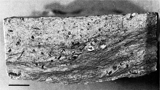
Figure 4--Thin sections of Fort Scott Limestone, Marmaton Group, Desmoinesian Stage, Middle Pennsylvanian Series, from Mid-Continent No. 1 Collins well core, Ness County, Kansas (see Table 1; Fig. 2). A, Crinoidal limestone at 4395 feet. B, Calcareous siltstone at 4395 feet with finely broken fossil debris including pieces of holothurian plates, Globivalvulina, and other foraminifers. C, Sponge-spicule micrite at 4397 feet. D, Calcareous algal mudstone at 4398 feet with ground mass dolomitized and containing tiny foraminifers. E, Same bed as D, but included to show very large Howchinia? in relation to smaller forams occurring with it. F, Biopelmicrite at 4399 feet showing evidence of pressure compaction. Pelecypod shell fragments penetrate cylindrical thallus of Komia. Bar scale in F is one millimeter.
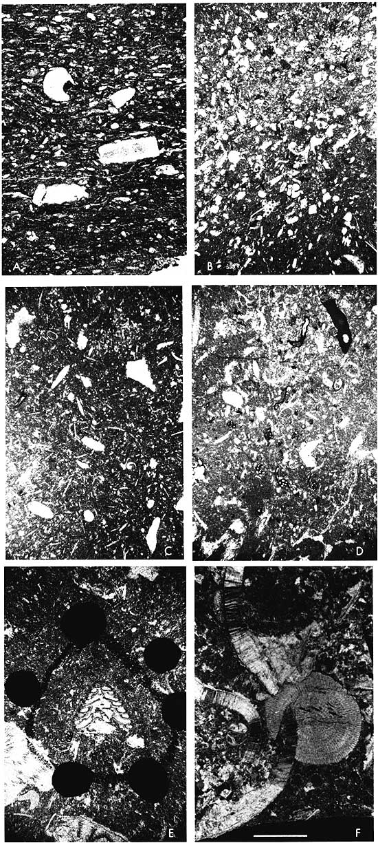
Figure 5--Thin sections of lithologic types occurring in the basal Marmaton Fort Scott Limestone (Desmoinesian Stage, Middle Pennsylvanian) in the Mid-Continent No. 1 Collins well core. A, Biomicrite at 4399 feet showing dolomitization and replacement of original fabric by sparry calcite. Large foraminifer at top of photograph is Tetrataxis. Mass of very tiny plectogyrids in lower portion is "swarm" of asexual generation of individuals. Adult tests have disintegrated somewhat. B, Spicular algal biomicrite at 4400 feet with replacement sparry calcite, showing two different species of Tetrataxis. C, Biomicrite with replacement sparry calcite at 4400 feet, showing (center) Tetrataxis conica Ehrenberg. D, Spicular biomicrite with sparry calcite at 4401 feet, showing Tetrataxis, Tuberatina, Ammodiscus, and ostracod debris. E, Spicular algal biomicrite at 4401 feet, with pyrite and silicification of some pelmatozoan debris. Algal blades lie above Tetrataxis. F, Spicular algal biomicrite at 4402 feet. Algal blades and pelmatozoan plates are replaced with sparry calcite. Groundmass is dolomitized in part. Porcelaneous encrusting foram is in center of photograph. G, Spicular biomicrite at 4403 feet. Howchinia? has secondarily enlarged walls. Brachiopod spine lies below it. Remaining fossil debris is pelmatozoan and molluscan. H, Algal biomicrite at 4403 feet, from near base of Fort Scott Limestone. Algal material and groundmass are replaced by sparry calcite. Ammodiscus in center of photograph. (Dark objects are India ink dots.) Scale is 0.1 millimeter.
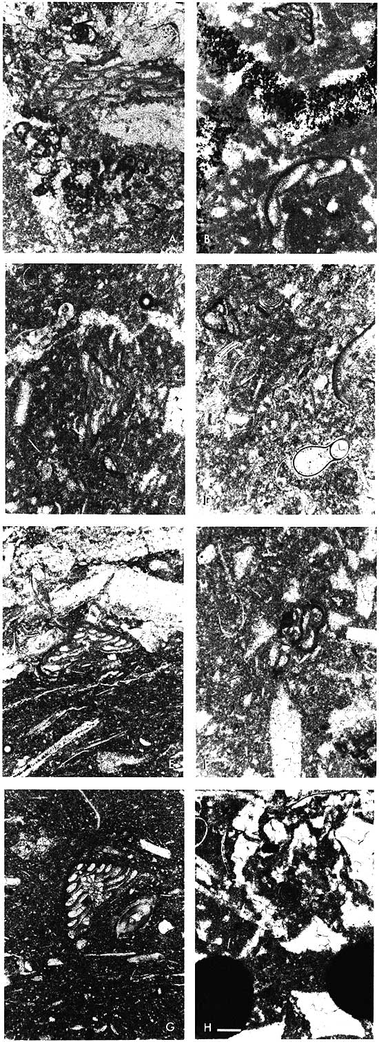
Figure 6--Thin sections of lithologic types found in Mid-Continent No. 1 Collins well core, Ness County, Kansas (see Table 1; Fig. 2). A, Biomicrite with sparry calcite at 4429 feet. Cherokee Group. Contains fusulinids, Endothyranella, brachiopod spines. B, Spicular micrite at 4430 feet with sparry calcite and dolomite. Cherokee Group. Contains Climacammina, fusulinids, Tetrataxis, and Tuberatina. (Black objects are India ink dots.) C, Dolomitized spicular micrite at 4430 feet, with fossils replaced by sparry calcite. Cherokee Group. Fusulinid Wedekindellina at center. D, Coarse-grained biopelmicrite at 4469 feet, composed mainly of pelmatozoan and bryozoan debris. At upper right is reworked, rounded "alpha coral," so far found only in Meramecian beds. E, Medium-grained biomicrite at 4485 feet, made up mostly of pelmatozoan debris. F, Biomicrite at 4490 feet, with sparry calcite replacing pelmatozoan plates. Alga Asphaltina cordillerensis Mamet (Meramecian) is at center of photograph. G, This seemingly represents the contact between the Meramecian and Chesteran beds in the area of the No. 1 Collins borehole. Highly weathered, pyritized oolite below, which is reworked into extremely fine grained Chesteran beds above, contains Meramecian endothyrids as centers. This section is from 4495-4509 feet. H, Fine-grained, high-energy deposit of Chesteran age at 4495-4509 feet. Contains some still-intact fragments of dark ooids of Meramecian age. These beds contain the endothyrid Endothyra kleina Woodland of Chesteran age. Scale in F is 0.5 mm.
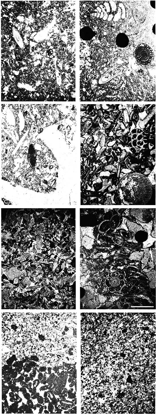
Figure 7--Beds from Mid-Continent No. 1 Collins well core from paleosol and immediately below (see Table 1; Fig. 2). A, Extremely weathered argillaceous limestone (light gray) with secondary mineralization (iron) along stylolites, calcite veins, and ochre-colored limonitic clay masses (dark gray), at 4436 feet. The Pennsylvanian conodont Idiognathodus sp. was recovered from this zone. B, Maroon, highly weathered, slickensided claystone, with cracks and crevices infilled with light-gray clay at 4440 feet. C, Sandstone/siltstone matrix beds at 4456 feet. Lighter colored masses are fine-grained sandstone with iron stain. The groundmass is coarse sand and silt with particles of white chert, glauconite, black flecks of coaly debris, and minute gray claystone intraclasts. (Core photograph inverted.) D, Indurated sandstone matrix beds at 4456 feet. This is a uniformly fine-grained deposit of the type commonly used for whetstones. It includes some larger-than-average, rounded quartz grains and an occasional intraclast of limestone (upper right). Dark masses are merely iron stain. E, Glauconitic sandstone matrix beds at 4460 feet with intraclasts of horizontally reworked sandstone beds (arrow). Differential oxidation of iron produces apparent banding effect. F, Transported, brecciated Mississippian limestone fragments infilled with sandstone and siltstone matrix beds containing irregular pieces of white chert, from 4475 feet. Darker limestone clasts (arrows) are from a different lithologic suite. Very light colored clasts are devitrified chert. Scale in all photographs is in centimeters.
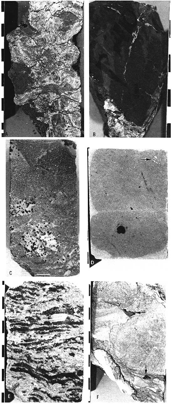
Figure 8--Matrix sandstone from breccia-conglomerate at 4455 feet. It is gray to tan, burrow-mottled, and contains tiny pieces of Mississippian limestone and white chert (see Table 1). Scale in centimeters.
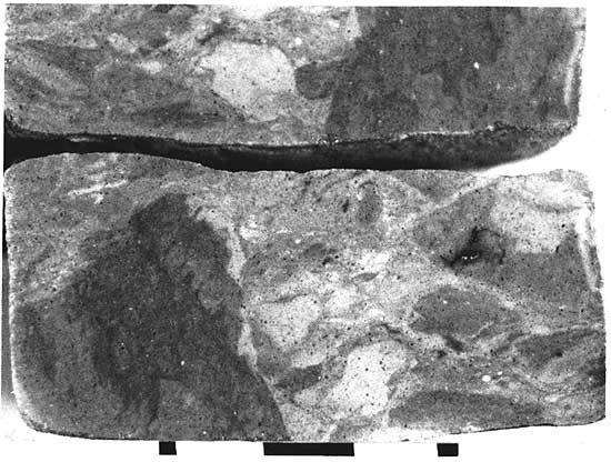
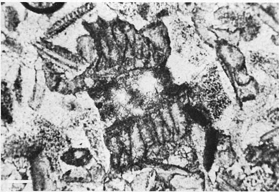
Figure 9--Beds from Mid-Continent No. 1 Collins well core from 4479 to 4555 feet (TD) (see Table 1; Fig. 2). A, Well-preserved fine-grained Meramecian limestone cobble or boulder at 4479 feet, showing cross bedding that is perpendicular to core length (rotated). B, Partially weathered, fossiliferous Meramecian limestone cobble at 4494 feet. Stylolitic at outside edge of cobble. C, Somewhat indurated sandstone matrix beds at 4501 feet, containing stringers of pure white sandstone, finely comminuted coaly debris, devitrified white chert, blebs of glauconite, and intraclasts of gray claystone. D, Glauconitic, conglomeratic sandstone matrix beds at 4509 feet. Contains sand and silt stringers, small angular pieces of white chert and mixed Mississippian limestones, finely comminuted to stringers of coaly debris, masses of and finely disseminated glauconite, and varicolored claystone clasts. E, Sandstone matrix beds at 4510 feet, fairly fine grained, argillaceous, burrow mottled?, and containing scarce very tiny fragments of Mississippian limestones. Most dark flecks are quartz grains; rarely they are coaly debris. F, Matrix beds at 4513 feet, a heterogeneous mixture of sand and silt grains, mudstone particles and stringers, devitrified white chert, glauconitic stringers, and blebs of pyrite. G, Dolomitized, decalcified, so-called "Warsaw" cobble showing oomoldic porosity at 4520 feet. Fenestellid bryozoan at left. H, Top view of core piece from 4522 feet, consisting of shaly matrix beds with disseminated glauconite, pyrite, and coaly debris and pieces of angular white chert. I, Dolomitized, desilicified, argillaceous Osagean sponge beds at 4530 feet, with enclosing matrix beds, as described above, still intact, with secondarily developed quartz masses, some with drusy quartz interiors, and blebs of pyrite. Originally beds looked like those in J (core photo inverted). J, Argillaceous Osagean sponge-bed cobble or boulder at 4549 feet, containing dark sponge debris and white siliceous sponge spicules. Some cobbles and boulders are very well preserved and show the irregular, whispy, high-angled bedding surfaces; others are severely weathered to a light tan color, demineralized, and dolomitized, with bedding structures obliterated. Scales in centimeters.
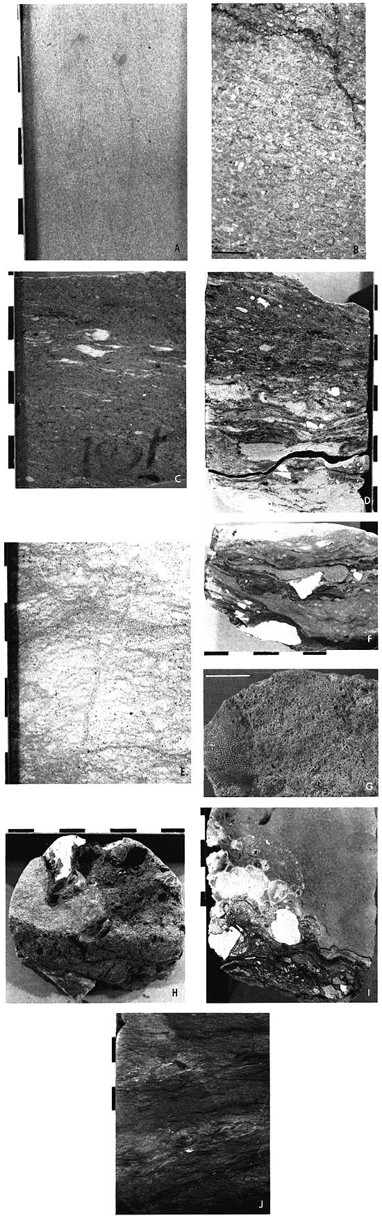
Figure 10--Fractured and weathered brownish-gray Mississippian cobble in breccia-conglomerate at 4491 feet. Cracks and crevices are filled with green clay residuum (see Table 1). Scale in centimeters.
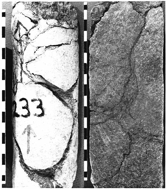
Figure 11--Matrix conglomerate bed at 4496 feet composed of residual materials derived from weathering of Mississippian rocks (see Table 1). Black material is subbituminous coal fragments; white material is devitrified chert. Scale in centimeters.
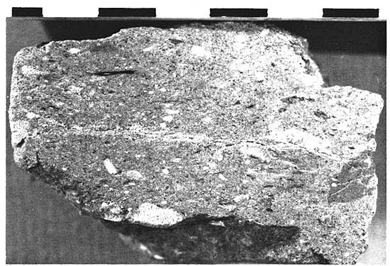
Figure 12--Large fragments of fossilized (coaly) wood in matrix sandstone at 4499 feet (see Table 1). Scale in centimeters.
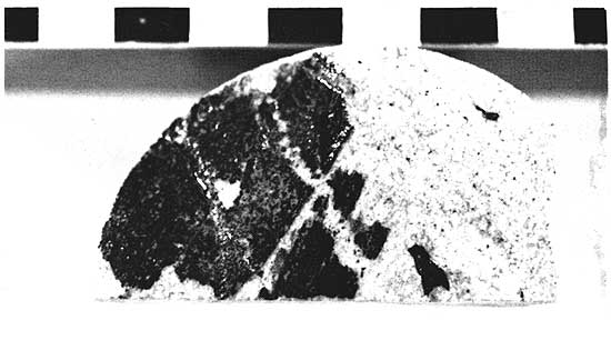
Figure 13--Matrix bed from 4500 feet consisting largely of sand and silt grains with shale intraclasts and mud balls or pellets, coaly fragments, and pieces of white devitrified Mississippian chert (see Table 1). Scale in centimeters.
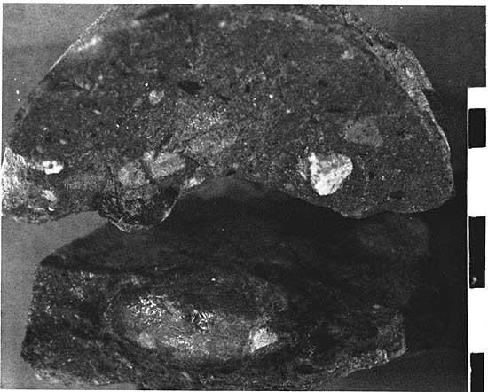
Figure 14--Matrix bed at 4508 feet (see Table 1). Sandy, silty residue deposited by fluvial action at high angle of repose around and between pebbles of Mississippian limestones derived from karst weathering terrain. White particles are devitrified white chert; dark particles and streaks are coaly material. Limestone cobble was occupying rounded depression seen at top of photograph. Scale in centimeters.
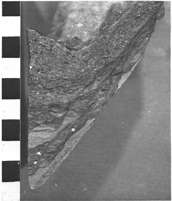
Figure 15--Shaly matrix bed at 4522 feet (see Table 1) with high clay-mineral content, much disseminated pyrite, finely comminuted coaly debris, and angular pieces of rather fresh, white chert. Scale in centimeters.
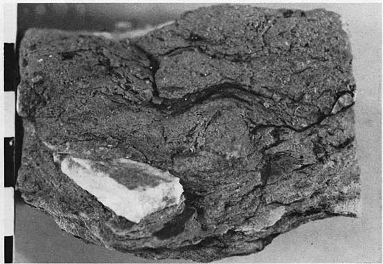
Figure 16--Thin sections of lithologic types found in cobbles and boulders in the Mid-Continent No. 1 Collins well core. Scale for A, B, C, D, E, F, H shown in B. A, Chert replacement of Meramecian limestone at 4509-4519 feet containing endothyrid foraminifers. B, Biomicrite at 4509-4519 feet containing pelmatozoan and bryozoan debris. Scale is 0.5 mm. C, Dolomitized, partially silicified Meramecian biomicrite at 4528-4538 feet. D, Sponge spiculite replaced by chert at 4528-4538 feet. Individual spicules can be seen in lower part of photograph. E, Biopelmicrite with finely broken fossil debris, mostly pelmatozoan, at 4528-4538 feet. F, Dolomitized, vuggy biomicrite at 4528-4538 feet. All calcitic pelmatozoan fragments are now voids. G, Enlargement of a portion of F showing coarsely granular dolomite in groundmass. Scale is 0.1 mm. H, Dolomitized, vuggy Meramecian biomicrite at 4544-4555 feet. "Ghost" of endothyrid foraminifer can still be seen (arrow).
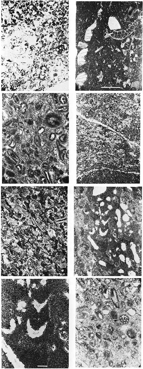
Plate 1--Microfossils in thin sections of core from the Mid-Continent No. 1 Collins well core, Ness County, Kansas. Scale for 1, 3, 5, 6-13, 15 shown in Figure 1 (0.1 mm). Scale for 2 shown in Figure 2 (0.1 mm). Scale for 4, 16 shown in Figure 4 (1.0 mm). Scale for 14, 17 (1.0 mm) shown in conjunction with photographs.
Figure 1--Ozawainella sp. Horizontal axial section, Fort Scott Limestone. 4395 feet ( 1340 m).
2--Ammovertella sp. Showing initial chamber and convoluted test. Fort Scott Limestone. 4395 feet.
3--Globivalvulina sp. Fort Scott Limestone. 4395 feet.
4--Fusulina sp. Compares favorably with type occurring in basal Marmaton elsewhere. Fort Scott Limestone. 4398 feet (1340 m ).
5--Howchinia? sp. This is a large foram. Walls have been recrystallized. Fort Scott Limestone. 4398 feet.
6, 10--Ozawainella sp. Primitive form. Fort Scott Limestone. 6, 4398 feet; 10, 4400 feet (1341 m).
7, 8, 11--Tuberatina sp. Note wall structure in 8. Fort Scott Limestone. 7, 4399 feet (1341 m); 8, 4398 feet; 11, 4400 feet.
9--Plectogyrid foraminifera. Fort Scott Limestone. 4399 feet.
12--Tetrataxis conica Ehrenberg. Fort Scott Limestone. 4399 feet. 13--Millerella sp. Fort Scott Limestone. 4398 feet.
14, 17--Komia abundans Korde. 14, Horizontal section. 17, Longitudinal section. Fort Scott Limestone. 4399 feet.
15--Endothyranella sp. Fort Scott Limestone. 4401 feet (1341 m). 16--Fusulina sp. Fort Scott Limestone. 4401 feet.
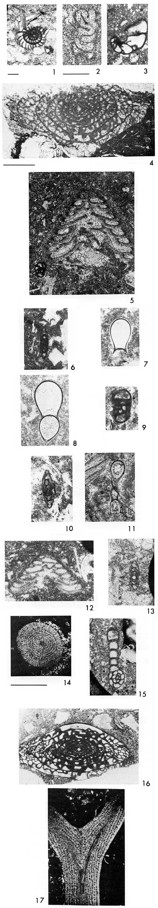
Plate 2--Microfossils in thin sections of core from the Mid-Continent No. 1 Collins well core, Ness County, Kansas. Scale for 1-15 shown in 2 (0.5 mm), scale for 16 and 17 shown above 17 (1.0 mm).
Figure 1--Tetrataxis sp. Fort Scott Limestone. 4401 feet (1341 m). Tuberatina at upper right.
2--Pyritized Tetrataxis in dolomitized groundmass with clear calcite spar. Fort Scott Limestone. 4401 feet.
3--Tuberatina sp. Fort Scott Limestone. 4401 feet.
4, 13--Howchinia? sp. A very large foraminifera with recrystallized walls. Fort Scott Limestone. 4, 4401 feet; 13, 4403 feet (1342 m).
5--Earlandia sp. A tubular, attached form showing initial chamber. Fort Scott Limestone. 4401 feet.
6--Endothyranella sp., with "neck" broken off. Fort Scott Limestone. 4401 feet.
7, 11--Planiinvoluta sp. A porcelaneous encrusting foraminifera. 7, bottom (planar) view; 11, side view. Fort Scott Limestone. 4402 feet (1342 m).
8--Juvenile Wedekindellina? Fort Scott Limestone. 4401 feet.
9--Eoschubertella? sp. a, Skewed sagittal section; b, tangential section, showing chomata; round object is small Tuberatina sp. Fort Scott Limestone. 4403 feet (1342 m).
10--Tetrataxis conica Ehrenberg. Fort Scott Limestone. 4401 feet.
12--Tetrataxis conica? Ehrenberg. Fort Scott Limestone. 4401 feet.
14, 15--Pseudowedekindellina sp., axial sections. Fort Scott Limestone. 4403 feet.
16--Fusulina stouti? Thompson, axial section. Cabaniss Formation? Cherokee Group. 4413 feet (1345 m). F. stouti has been described from the Mercer and Boggs limestones (Pottsville) of Ohio.
17--Bradyina? sp. Cabaniss Formation? Cherokee Group. 4430 feet (1305 m).
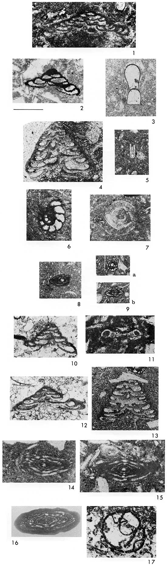
Plate 3--Microfossils in thin sections of core from the Mid-Continent No. 1 Collins well core, Ness County, Kansas. Scale for 1, 2, 4, and 7 shown in 2 (1.0 mm); scale for remaining specimens shown in 6 (0.5 mm).
Figure 1--Wedekindellina henbesti? (Skinner). Axial section. Cherokee Group. 4430 feet (1350 m).
2--Asphaltina cordillerensis Mamet. Breccia-conglomerate, probable Meramecian cobble. 4466 feet (1361 m).
3, 5--Endothyra kleina Woodland. Breccia-conglomerate, Chesteran cobble. 4481 feet (1366 m).
4--Echinoid spine in cobble. 4481 feet.
6--Eosigmoilina sp. Horizontal axial section. Breccia-conglomerate, Chesteran cobble. 4486 feet (1367 m).
7--"Alpha coral," showing single septum in central corallites. Breccia-conglomerate, highly weathered Meramecian cobble. 4495 feet (1370 m).
8-11--"Endothyra" symmetrica E. J. Zeller, beautifully preserved in chert. 8,10, horizontal axial sections; 9,11, vertical axial sections. Breccia-conglomerate, Meramecian cobble. Repeated throughout interval 4509-4519 feet (1374-1377 m).
Welch (1963) described insoluble residues from the limestone cobbles and pebbles from 4452 to 4555 feet (1357-1388 m) (white sandstone conglomerate beneath soil zone to total breccia-conglomerate cored). Throughout this interval, the residues contain rounded, frosted sand and silt grains, often imbedded in green clay. Welch commented on the persistence of gray and green clay shale, white chalky chert, spicular chert and sponge spicules, drusy quartz, white beekite rings, and silicified fossils from limestones. Sphalerite and chalcopyrite were noted at 4463-4467, 4476-4480, and 4495-4529 feet (1360-1362, 1364-1365, and 1370-1380 m), mostly as disseminated crystals or growing within drusy quartz vugs. The chert, quartz crystals, sand/silt grains, and sphalerite and chalcopyrite represent reworking of material from Mississippian formations being eroded during the time of formation of the breccia-conglomerate.
All the microfossils in the No. 1 Collins core below about 4455 feet (1358 m) are Mississippian in age (see Table 1). They carry a Meramecian and Chesteran fauna including "Endothyra" macra and E. symmtrica E. J. Zeller (Pl. 3, Figs. 8-11) (Nodine-Zeller, 1972; Ebanks and others, 1977), E. kleina Woodland (Pl. 3, Figs. 3,5), Asphaltina cordillerensis Mamet (Pl. 3, Fig. 2), Lyropora, Stacheoides?, Eosigmoilina (Pl. 3, Fig. 6), Archaediscus?, and an unnamed primitive coral (herein referred to as "alpha coral") so far found only in the Meramecian (Pl. 3, Fig. 7). This coral is found extensively reworked in Chesteran beds in Kansas (Fig. 6, D) that also contain other reworked Meramecian fossils (Nodine-Zeller and Thompson, 1977). The secondary (replacement) cherts in the pebbles and cobbles contain excellently preserved Meramecian endothyrids (Pl. 3, Figs. 8-11; Fig. 16, A).
A well-preserved dasyclad alga (Fig. 17) was found in a Chesteran cobble from 4481 feet (1366 m). Although the family Dasycladaceae ranges from Cambrian to Recent, a similar form, questionably identified as a nanoporid, was illustrated by Brenckle (1977) from the Pitkin Limestone (Chesteran) in Arkansas. Both are extremely small forms.
Figure 17--Dasycladacean alga (nanoporid?) from Chesteran limestone cobble at 4481 feet. Scale is 0.1 mm.
According to Thompson (1965), the limestone cobbles at 4435-4440 feet (1352-1353 m) (Fig. 7, A), just below the paleosol, yielded specimens of the conodont Idiognathodus, indicating either actual deposits in place or reworking of the earliest Pennsylvanian beds identified in the No. 1 Collins core. Idiognathodus ranges from uppermost Morrowan (Lower Pennsylvanian) into the Middle Pennsylvanian, but in this instance it must represent marine beds of possible late Morrowan or Atokan age, since Cherokee rocks have been positively identified from the Cherokee basal conglomerate to the base of the Fort Scott Limestone at 4404 feet (1342 m). It is possible, but not likely, that these beds could be earliest Cherokee in age. Interestingly, Idiognathodus delicatus Gunnell was found in basal Pennsylvanian beds tentatively identified as Atokan (Riverton) by Thompson in the No. 1 Swalley well core, Cherokee County, Kansas (Nodine-Zeller and Thompson, 1977).
Beds from 4430 feet (1350 m) (Cherokee basal conglomerate) and above are Pennsylvanian in age (Fig. 2; see Table 1 for faunal lists). Fusulinids were used to interpret age of the rocks in this sequence. No Eostaffella or Millerella of the type M. marblensis Thompson, occurring in the Morrowan, were found in the limestone cobbles in the core. Nor was Profusulinlla, mainly restricted to Atokan-age rocks (Thompson and Zeller, 1956), recovered from this core. Millerella marblensis has been reported (Nodine-Zeller, 1977) from the Bloyd Shale (Morrowan) of Arkansas and in core samples from the Kearny Formation (Morrowan), Kearny County, Kansas (Thompson, 1944). It is likely that the specimen of Idiognathodus, of a highly indestructible mineralogical composition, came from extremely altered, highly weathered and mineralized limestone from the phreatic zone, and that no delicate calcareous microfossils would have survived such extreme weathering processes. In addition, well-preserved remnants of Morrowan or Atokan age were probably not encountered at the particular location of the coring, since this zone of reworked Pennsylvanian cobbles (or limestone beds?) is relatively thin.
Desmoinesian (Cherokee) rocks in the core (4430- 4405 ft.; 1350-1343 m) contain Fusulinella, Eoschubertella, Ozawainella, Fusulina (Pl. 2, Fig. 16), Wedekindellina (Pl. 3, Fig. 1), and Pseudowedekindellina (Pl. 2, Figs. 14-15). The genus Fusulinella first appears in rocks of Atokan age and ranges into the Desmoinesian (Thompson, 1945). The presence of Wedekindellina indicates that these beds are lower Desmoinesian (Cherokee) in age (Thompson, 1945). The distinctive, highly inflated, and highly evolved species of Fusulina (Pl. 1, Fig. 4) at 4398 feet (1341 m) is similar to those occurring in the basal Marmaton Fort Scott Limestone. Thompson (1945, p. 41-42) stated:
Fusulina is believed to have been derived from Fusulinella and they overlap stratigraphically. In fact, forms occur near the top of the Desmoinesian that seem to be intermediate in nature between Fusulinella and Fusulina. Millerella, Pseudostaffella, Eoschubertella, "Nankinella," and Wedekindellina are associated with Fusulina in the Desmoinesian.
From analysis of the data available, it is clear that rocks represented by the sequence in the No. 1 Collins core are highly weathered pebbles, cobbles, and boulders derived from an older karst limestone terrain that was created by the block faulting of an anticline referred to earlier. These pebbles, cobbles, and boulders are intermixed with fresh, more angular talus-derived clasts, or collapse breccia, all reworked and interbedded with fluvial deposits from stream channels crossing the area. A break in sedimentation is indicated by the white sandstone conglomerate. The same materials are found as residues in this conglomerate as in the breccia-conglomerate unit below, meaning that the same Mississippian beds were still being reworked during this time. But the materials are more finely divided in the sandstone conglomerate and are dominated by quartz sand and silt. After this terrestrial unit was deposited, there was a transgression of the seas and a uniform shale bed was deposited, represented by the 10 feet (3 m) of deeply weathered red clay in the soil profile. Above this, limestones of late Morrowan or early Atokan age were deposited, represented in the core by the "rotten," leached limestone (cobbles and pebbles? or inplace weathering?) of early Pennsylvanian age containing Idiognathodus. After the marine beds were laid down, there was uplift, or regression of the sea, formation of a soil, marine transgression, with subsequent reworking of the soil zone rubble into the Cherokee basal conglomerate, and a second, and perhaps third, regression and transgression of the Cherokee seas, with reworking of previously deposited materials. Finally a stable marine regime was established, as evidenced by normal-marine faunas in the Pennsylvanian rocks encountered at the top of the core.
The existence of a karst terrain in early Pennsylvanian time is suggested by the considerable relief of the eroded Mississippian surface, the presence of the early Pennsylvanian breccia-conglomerate of variable thickness that contains highly weathered, demineralized limestone and chert; silicification of limestone beds; smooth, water-worn surfaces on the limestones, sometimes exhibiting solution fluting; inclusions of reworked cave-derived travertine in Pennsylvanian limestones; and the preservation of a well-developed soil profile at the top of the conglomerate.
Paleokarst topography has been reported in the subsurface developed on the Cambro-Ordovician Arbuckle dolomite in a number of places in Kansas (Walters, 1946); on Ordovician- Silurian rocks in the Williston Basin in Montana (Roehl, 1967); and on Mississippian limestones in Kansas, Texas, Oklahoma, Missouri, Colorado, Montana, Wyoming, and the southwestern United States (on Meramecian-St. Louis Limestone and on Chesteran beds) (Mapel and others, 1979; Clupper, 1978; Orgren, 1979; McKnight and Fischer, 1970; Merrill and Winar, 1958; Roberts, 1979; Mallory, 1979; Armstrong, 1979; McKee, 1979; Smith, 1980).
Clupper (1978, p. 44) described the irregular Chesteran (post-Pitkin) karst surface in northeastern Oklahoma:
. . . the unconformable surface is marked by solution cavities. Plate 7, Figure 2 shows a large Pitkin block, about 10 feet in maximum observed dimension, which is overlain by a Morrowan sandy limestone. Bedding planes within the Pitkin block are practically vertical relative to the overlying beds which drape over the block. [See Fig. 9, A this paper.] Large solution vugs are . . . present on the surface of the boulder. Filling these vugs is a sandy carbonate. Numerous rock burrows are present on the surface of the block, which are filled with silt and sand. All these features strongly suggest that localized areas within southern Adair County stood relatively emerged during post-Pitkin, pre-Morrowan time.
Orgren (1979) found a similar post-Pitkin karst erosional surface in northeastern Oklahoma (Wagoner, Cherokee, and Muskogee counties) developed on subaerially exposed Chesteran rocks. Cobble and boulder-sized fragments of the Pitkin are here incorporated within a matrix of calcareous sandstone. The sandy matrix material contains Declinognathodus noduliferous and Adetognathus lautus, conodonts thought to be of Morrowan age. The Morrowan sands and fragments of Pitkin limestone are found lying in solution cavities 16 feet (5 m) below the Chesteran-Morrowan unconformity surface. A fragment of breccia-conglomerate shown in a photograph (Orgren, 1979, pl. 12, fig. B) is strikingly similar to those found in the No. 1 Collins well core (see Fig. 7, F).
McKnight and Fischer (1970) described uplift and development of a karst terrain at the end of Chesteran time in the Tri-State lead-zinc district. They stated (p. 56):
In places the whole [Chesteran] series was removed by erosion before the deposition of the Pennsylvanian, in other places, near-maximum thicknesses of Chester strata are preserved in sharply defined structural basins and slumps that formed in the interval between the deposition of the Chester and the beginning of Pennsylvanian deposition.
The Chesteran in that area is a maximum of 200 feet (61 m). The thickness of Morrowan rocks is about 80 feet (24 m). They consist of sandstones with interbedded shales and some limestones. The sandstones contain fossil plants and some of them are colored black with inclusions of finely carbonaceous or bituminous material. Morrowan rocks are truncated by the overlying Atokan rocks. The Atokan, in turn, is truncated and overlapped by rocks of the Krebs Group (Desmoinesian Stage). In places, there is a thin basal conglomerate in the lowermost shale of the Krebs that contains irregularly rounded chert and limestone pebbles one to three inches (3-8 cm) in diameter. These pebbles are derived from weathered, karsted Mississippian formations. Orogenic movements affecting this part of the Midcontinent began in early Atokan time and occurred intermittently into early Desmoinesian time.
The karst surfaces exposed in recent times in Colorado and the western United States can be studied in outcrop. These ancient karst terrains bad developed considerable relief and were extensive throughout the whole North American continent. Lee (1940, p. 76) stated that in Sumner County (south-central Kansas) the weathered zone (basal Pennsylvanian conglomerate) is 163 feet (50 m) thick and extends downward to within 70 feet (21 m) of the top of the Chattanooga, cutting out the entire Mississippian section. In another well the weathered zone is 150 feet (46 m) thick and extends to within 35 feet (11 m) of the top of the Chattanooga. lie pointed out that considerable caving was indicated by the presence of dark shale with the chert and that all the wells in which there is an important development of white (highly weathered) chert are on topographically high areas near the axis of the Nemaha fault structure and, thus, would have been subjected to karsting. The relationship between white, deeply weathered chert and uplifted, extremely deeply weathered Mississippian rocks has been noted by Fowler and others (1934), Lee (1940), McKnight and Fischer (1970), and Maslyn (1977b).
DeVoto and Maslyn (1977) described a karst topography in Colorado with breccia-filled sinkholes up to 250 feet (76 m) deep and cave systems developed on top of the Leadville Limestone (Mississippian) in late Mississippian or earliest Pennsylvanian time. There, as in the No. 1 Collins core, thoroughly weathered white chalky chert and earthy limestone fragments are believed to represent material from exhumed sinkholes or cave-filling deposits reworked into the conglomerate. The 125 feet (38 m) of conglomerate in the Collins well rests upon eroded late Osagean beds. In southwestern Colorado the breccia-conglomerate rests upon the eroded surfaces of Osagean and Kinderhookian to Devonian beds. Throughout the Four-Corners area similar shales and siltstones with limestone-chert boulders rest upon a paleokarst surface of Mississippian or Devonian limestones. In northern New Mexico, Smith (1980) described karst formation on Mississippian limestone with intermittent and irregular deposition of clastic debris on the karst surface, creating a series of complex depositional episodes. Latest Mississippian or earliest Pennsylvanian time there was marked by orogenic movements, as it was in the Midcontinent area. Earliest Pennsylvanian worldwide sea-level change (Vail and others, 1977; Kerr, 1980) with regression of seas, coupled with coincident geotectonic episodes, resulted in the karsting of widespread solution-prone Mississippian formations.
The karst landforms found in the United States in the Mammoth Cave (Kentucky), Carlsbad Cavern (New Mexico), and Missouri cavern systems represent ancient exhumed karst terrains, augmented by further karstification since the time they were uplifted and exposed to surface weathering on the present land surface. Solely modern karst surfaces, such as those on the Gulf Coast and in the Caribbean, are believed to have developed since some time in the Tertiary (Quinlan, 1972).
One aspect of the breccia-conglomerate that has been puzzling is the unoxidized state of the iron in the matrix beds. None of the sandstones, siltstones, shales, or mudstones in the Collins conglomerate are red. They are either white, tan, light to dark gray, or green (unoxidized), and in no case did the drillers' log record anything but green and gray shale in this interval. Most sinkholes or paleokarst caves are filled with red (oxidized) siltstones or clays (Bretz, 1942; Maslyn, 1977; Walters, 1946; Jennings, 1971), and these would remain red even though they were reworked at a later time. Either the accumulation of the breccia-conglomerate was so rapid that in-place weathering and oxidation did not have a chance to take place, or the breccia-conglomerate was deposited rapidly in a nearshore quasi-saline site under conditions that allowed little or no oxidation to take place. It is possible that the dissemination of carbonaceous and coaly debris that is so prevalent in the section may have prevented the oxidation of iron in the breccia-conglomerate. Alternatively, it may be that red, oxidized surface deposits were stripped off by erosive action of the encroaching seas. Two possible depositional modes for the breccia-conglomerate are inferred from evidence accumulated in this study: (1) deposition in fault- controlled channels upon a karst surface and (2) deposition adjacent to prominent sea cliffs, perhaps in a quasi-marine environment. In both, additional deposits of riverine origin would be intercalated. Guinan (1966) described a well in western Texas penetrating a paleogeomorphic trap in Wolfcampian conglomerate of chert and limestone pebbles in a shaly matrix, which produces from an irregularly developed channel deposit crossing a faulted anticline. Total thickness of the conglomerate and net porosity vary rapidly from well to well, as they do in the breccia-conglomerate in the area of the No. 1 Collins.
The continuous core in the No. 1 Collins from the bottom of the basal Pennsylvanian conglomerate to well above Marmaton beds made it possible to pick with great accuracy the contacts between the conglomerate, the paleosol, the basal Cherokee conglomerate, the Cherokee beds, and the Marmaton (base of the Fort Scott Limestone) using a combination of lithology and microfossils. Because there is no electric log for the No. 1 Collins, a cross section (Pl. 4) was constructed tying in the No. 1 Collins stratigraphic units by extrapolation with those identified on well logs in the vicinity. The easternmost log, Cities Service Oil Company No. 1 E. Moore B (Schaben Field), was included because formations bad been identified previously by Hilpman (1965) and because the Fort Scott Limestone "kick" was readily identifiable and easy to correlate with that on the accompanying logs on the traverse. In analyzing data from Davies' lithology logs, top cards, drillers' logs, and electric logs, and comparing them with directly visible information from the well core, several facts became apparent:
From the paleontological and physical evidence, it is clear that deposits in the No. 1 Collins well represent a breccia-conglomerate of earliest Pennsylvanian age (or possibly early Cherokee?) in which is incorporated an inchoate mixture of pebbles, cobbles, and boulders of Mississippian limestone and chert in a silty, sandy, shaly matrix that is largely derived from end-stage weathering debris from Mississippian formations ranging from Osagean to Chesteran in age (4555-4475 ft.; 1388-1364 m). On top of the breccia-conglomerate, denoting a pronounced change in sedimentation, is a sandstone conglomerate containing very small pieces of recognizable reworked Mississippian limestone (4475-4448 ft.; 1364-1356 m). On top of this is highly weathered, unctuous red clay shale containing highly weathered limestone cobbles and boulders (4448-4435 ft.; 1356-1351 m). It is in this unit that a lower Pennsylvanian cobble was found that contained Idiognathodus. At 4435-4430 feet (1352-1350 m) is the paleosol, with "rotten" limestone, colored bright orange and yellow by hematite and limonite, and transected by calcite veins. On top of the soil zone are red and green claystone and sandstone with small pieces of Mississippian and lower Pennsylvanian? limestone and chert in a thin basal conglomerate reworked by transgressing Cherokee seas (4430-4429 ft.; 1350 m). And finally the deposition of the transgressive-regressive marine limestones and shales of middle to late Cherokee age, containing a fauna typical of the Verdigris Limestone, was begun. Lying above the Cherokee beds is the Fort Scott Limestone of the Marmaton Group (4404-4385 ft.; 1342-1337 m), the highest Pennsylvanian identified in this study. These highest beds examined contain tiny, angular clasts of Mississippian limestones, cherts, and Cherokee? shales, and travertine presumably derived from reworking of former karst-surface cave deposits.
Thanks are extended to E. D. Goebel, Department of Geosciences, University of Missouri Kansas City; A. W. Walton, W. M. Merrill, E. J. Zeller, Wakefield Dort, Jr., Department of Geology, University of Kansas; E. Pretzer Rall and R. W. Rall, Michigan-Wisconsin Natural Gas and Tenneco Oil Company; Lee Peterson, Anadarko Production Company; G. A. Sanderson and G. J. Verville, Amoco Production Company; T. L. Thompson, Missouri Department of Natural Resources, Division of Geology and Land Survey; G. L. Wilde, Exxon Company USA; and E. J. Schierling, Consultant, Wichita, Kansas, for review of the manuscript and helpful discussions and suggestions. Thanks are also due M. D. Brondos, Phillips Petroleum Company, for the many excellent thin sections upon which much supporting evidence for the interpretations herein are based; and Jennifer Sims, who drafted the line illustrations.
Armstrong, A. K., 1979, North-central New Mexico, an alternate interpretation of the Mississippian; in, Paleotectonic investigations of the Mississippian System in the United States, part 1: Introduction and regional analyses of the Mississippian System: U.S. Geological Survey, Professional Paper 1010-K, p. 187-197. [available online]
Brenckle, Paul, 1977, Foraminifers and other calcareous microfossils from Late Chesterian (Mississippian) strata of northern Arkansas; in, Upper Chesterian-Morrowan stratigraphy and the Mississippian-Pennsylvanian boundary in northeastern Oklahoma and northwestern Arkansas, P. K. Sutherland and W. L. Manger, eds.: Oklahoma Geological Survey Guidebook 18, Guidebook for Field Trip No. 5, August 5-7, 1977, preceding North American Paleontological Convention II, Lawrence, Kansas.
Bretz, J. H., 1942, Vadose and phreatic features of limestone caverns: Journal of Geology, v. 50, p. 675-811.
Clupper, D. R., 1978, The lithostratigraphy and depositional environments of the Pitkin Formation (Mississippian) in Adair County, northeastern Oklahoma: M.S. Thesis, Department of Geology, The University of Oklahoma, 115 p., 8 pl., 8 fig., 1 tbl.
Devoto, R. H., and Maslyn, R. M., 1977, Sedimentology and diagenesis of the Leadville Formation and controls of lead-zinc-silver deposits, central Colorado [abs.]: The Mountain Geologist, v. 14, no. 1, p. 27-28.
Ebanks, W. J., Jr., Euwer, R. M., and Nodine-Zeller, D. E., 1977, Mississippian combination trap, Bindley Field, Hodgeman County, Kansas: American Association of Petroleum Geologists, Bulletin, v. 61, no. 3, p. 309-330.
Fowler, G. M., Lyden, J. P., Gregory, F. E., and Agar, W. M., 1934, Chertification in the Tri-State (Oklahoma-Kansas-Missouri) mining district: American Institute of Mining and Metallurgical Engineers, Transactions, v. 115, p. 106-151.
Goebel, E. D., 1968, Mississippian rocks of western Kansas: American Association of Petroleum Geologists, Bulletin, v. 52, no. 9, p. 1732-1778.
Guinan, M. A., 1966, Coyanosa Wolfcamp conglomerate; in, Symposium on oil and gas fields in West Texas: West Texas Geological Society, Publication 66-52, p. 101.
Hilpman, P. L., 1965, Schaben Field; in, Kansas oil and gas fields, v. IV: Kansas Geological Society, p. 205-211.
Jennings, J. N., 1971, Karst, An introduction to systematic geomorphology, v. 7: Cambridge, Massachusetts and London, M.I.T. Press, 252 p.
Kansas Geological Survey, 1975, Oil and gas fields of Kansas: Kansas Geological Survey, Map M-3A, scale 1: 500,000.
Kerr, R. A., 1980, Changing global sea levels as a geologic index: Science, v. 209, p. 483-486.
Lee, Wallace, 1940, The subsurface Mississippian rocks of Kansas: Kansas Geological Survey, Bulletin 33, 114 p., 8 pl., 4 fig. [available online]
Mallory, W. W., 1979, Central Rocky Mountains and northern Colorado plateau region; in, Paleotectonic investigations of the Mississippian System in the United States, Part 1: U.S. Geological Survey, Professional Paper 1010-M, p. 207-219. [available online]
Mapel, W. J., Johnson, R. B., Bachman, G. O., and Varnes, K. L., 1979, Southern Midcontinent and southern Rocky Mountain region; in, Paleotectonic investigations of the Mississippian System in the United States, Part 1: Introduction and regional analyses of the Mississippian System: U.S. Geological Survey, Professional Paper 1010-J, p. 159-187. [available online]
Maslyn, R. M., 1977a, Fossil tower karst near Molas Lake, Colorado: The Mountain Geologist, v. 14, no. 1, p. 17-25.
Maslyn, R. M., 1977b, Recognition of fossil karst features in the ancient record: A discussion of several common fossil karst forms; in, Exploration frontiers of the central and southern Rockies, H. K. Veal, ed.: Rocky Mountain Association of Geologists, Denver, p. 311-319.
McKee, E. D., 1979, Arizona; in, Paleotectonic investigations of the Mississippian System in the United States, Part 1: Introduction and regional analyses of the Mississippian System: U.S. Geological Survey, Professional Paper 1010-L, p. 197-207. [available online]
McKnight, E. T., and Fischer, R. P., 1970, Geology and ore deposits of the Picher Field, Oklahoma and Kansas: U.S. Geological Survey, Professional Paper 588, 105 p., 11 pl., 45 fig., 10 tbl. [available online]
Merriam, D. F., 1960, Preliminary regional structural contour map on top of Mississippian rocks in Kansas: Kansas Geological Survey, Oil and Gas Investigations 22.
Merrill, W. M., and Winar, R. M., 1958, Molas and associated formations in San Juan Basin-Needle Mountains area, Southwestern Colorado: American Association of Petroleum Geologists, Bulletin, v. 42, no. 9, p. 2107-2132.
Nodine-Zeller, D. E., 1972, Endothyroid foraminifera from subsurface Mississippian in Kansas: Kansas Geological Survey, Bulletin 204, pt. 1, p. 27-28, 2 figs. [available online]
Nodine-Zeller, D. E., 1977, Microfauna from Chesterian (Mississippian) and Morrowan (Pennsylvanian) rocks in Washington County, Arkansas, and Adair and Muskogee counties, Oklahoma; in, Upper Chesterian-Morrowan stratigraphy and the Mississippian-Pennsylvanian boundary in northeastern Oklahoma and northwestern Arkansas, P. K. Sutherland and W. L. Manger, eds.: Oklahoma Geological Survey, Guidebook 18, Guidebook for Field Trip No. 5, August 5-7, 1977, preceding North American Paleontological Convention 11, Lawrence, Kansas, p. 89-99, 3 pl.
Nodine-Zeller, D. E., and Thompson, T. L., 1977, Age and structure of subsurface beds in Cherokee County, Kansas--Implications from endothyrid foraminifera and conodonts: Kansas Geological Survey, Bulletin 211, pt. 3, 11 p., 5 fig., 2 pl., 1 tbl. [available online]
Orgren, A. H., 1979, Lithostratigraphy and depositional environments of the Pitkin Limestone and Fayetteville Shale (Chesterian) in portions of Wagoner, Cherokee, and Muskogee Counties, Oklahoma: M.S. Thesis, Department of Geology, The University of Oklahoma, 144 p., 13 pl., 19 fig., 3 tbl.
Quinlan, J. F., 1972, Karst-related mineral deposits and possible criteria for the recognition of paleokarsts: A review of preservable characteristics of Holocene and older karst terranes: International Geological Congress, 24th, Montreal, 1972, Proceedings, sec. 6, p. 156-168.
Roberts, A. E., 1979, Northern Rocky Mountains and adjacent Plains region; in, Paleotectonic investigations of the Mississippian System in the United States, Part 1: Introduction and regional analyses of the Mississippian System: U.S. Geological Survey, Professional Paper 1010-N, p. 219-247. [available online]
Roehl, P. O., 1967, Stony Mountain (Ordovician) and Interlake (Silurian) facies analogs of Recent low-energy marine and subaerial carbonates, Bahamas: American Association of Petroleum Geologists, Bulletin, v. 51, no. 10, p. 1979-2032, 48 fig.
Schierling, Eldon, 1968, Origin and genesis of a structurally positive area in Gove County, Kansas: M.S. Thesis, Department of Geology, Wichita State University, 41 p., 6 pl., 10 fig.
Smith, C. T., 1980, Geology of Cieneguilla Creek drainage basin in southwest Colfax County, New Mexico: New Mexico Geology, v. 2, no. 1, p. 1-15.
Thompson, M. L., 1944, Pennsylvanian Morrowan rocks and fusulinids of Kansas: Kansas Geological Survey, Bulletin 52, pt. 7, p. 409-431, 2 pl., 2 figs. [available online]
Thompson, M. L., 1945, Pennsylvanian rocks and fusulinids of east Utah and northwest Colorado correlated with Kansas section: Kansas Geological Survey, Bulletin 60, pt. 2, p. 17-84, 6 pl., 11 fig. [available online]
Thompson, M. L., and Zeller, D. E. Nodine, 1956, Profusulinella in western Utah: Journal of Paleontology, v. 30, p. 333-337, 1 pl.
Thompson, T. L., 1965, Conodonts from the Meramecian Stage (Upper Mississippian) of Kansas: Ph.D. Dissertation, University of Iowa, p. 40-41.
Thompson, T. L., and Goebel, E. D., 1963, Preliminary report on conodonts of the Meramecian Stage (Upper Mississippian) from the subsurface of western Kansas: Kansas Geological Survey, Bulletin 165, pt. 1, 16 p., 3 fig., 2 tbl. [available online]
Thompson, T. L., and Goebel, E. D., 1968 [1969], Conodonts and stratigraphy of the Meramecian Stage (Upper Mississippian) in Kansas: Kansas Geological Survey, Bulletin 192, 56 p. [available online]
Vail, P. R., Mitchum, R. M., Jr., and Thompson, S., III, 1977, Seismic stratigraphy and global changes of sea level, part 4: Global cycles of relative changes of sea level; in, Seismic stratigraphy--Applications to hydrocarbon exploration, C. C. Payton, ed.: American Association of Petroleum Geologists, Memoir 26, p. 83-97.
Walters, R. L., 1946, Buried Pre-cambrian hills in northeastern Barton County, central Kansas: American Association of Petroleum Geologists, Bulletin, v. 30, no. 5, p. 660-710.
Welch, R. G., 1963, Insoluble residues from the No. 1 Collins well core, Ness County, Kansas: Kansas Geological Survey, Open-file Report 7, 2 p.
Zeller, D. E., ed., 1968, The stratigraphic succession in Kansas: Kansas Geological Survey, Bulletin 189, 81 p., 1 pl. [available online]
Kansas Geological Survey, Karst-Derived Early Pennsylvanian Conglomerate in Ness County, Kansas
Placed on web March 17, 2009; originally published in Aug. 1981.
Comments to webadmin@kgs.ku.edu
The URL for this page is http://www.kgs.ku.edu/Publications/Bulletins/222/index.html