![]()
Prev Page--Contents || Next Page--Stratigraphy
Geography
Location
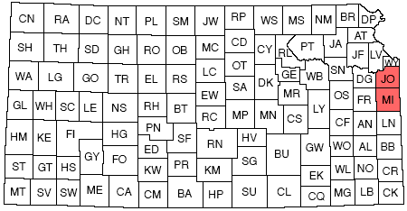
Johnson and Miami counties adjoin the eastern boundary of Kansas. Johnson County is about 24 miles from east to west and 16 to 21 miles from north to south. Kansas river, west of Holliday, is the boundary, and makes the north-south dimensions variable. Bordering counties are Wyandotte and Leavenworth on the north, Jackson and Cass in Missouri on the east, Douglas on the west, and Miami on the south. Miami County is nearly square, being 24 miles from north to south and 24 1/2 miles from east to west. It is bounded by Missouri on the east, by Linn County on the south, by Franklin county on the west, and by Johnson County on the north.
Figure 1--Index map of Kansas showing location of Johnson and Miami counties.
Topography
Johnson and Miami counties lie within the physiographic section of the Central Lowlands province called the Osage Plains. This section contains a series of more or less prominent southeastward-facing escarpments which trend irregularly northeast and southwest. The escarpments are produced by the outcropping edges of resistant formations, and in the two counties under consideration are formed especially by the Winterset, Iola, Wyandotte, Plattsburg, and Stanton limestones. The strata dip gently to the northwestIn most of eastern Kansas, away from the Ozark Uplift.
The maximum relief in Johnson County is over 350 feet, for surface elevations range from less than 750 feet above mean sea level near Holliday to more than 1,100 feet in the southeastern part of the county. The relief in Miami County is somewhat less, the elevation ranging from more than 1,050 feet in the uplands at the west side of the county to less than 805 feet at the Marais des Cygnes flood plain at the southern boundary of the county. In general, one may distinguish (1) a relatively flat upland, (2) gentle and steep slopes leading down from the upland, and (3) fiat lowlands along the streams.
The upland surface, in the greater part of the area, represents the dip slope of the Stanton or Plattsburg limestone formations, but in the eastern part it is produced on the Farley and the Argentine limestones, and in southeastern Miami County by the Winterset limestone. The upland surface above the Stanton in the western part of the area is modified by low, rolling hills consisting of remnants of soft Weston shale and sandstone of the Stranger formation.
The slopes are interrupted by terraces or benches which are produced by the unequal erosion of hard and soft rock layers. The flat upper surface of the benches is made by resistant limestone or sandstone, and slopes by the softer shale.
The lowland area is restricted to the flood plains of the various streams. The part of the flood plain of the Kansas river at the north edge of Johnson County ranges in width from one and a half to two miles. The larger streams have well-developed flood plains, but excepting Kansas, Marais des Cygnes, and Pottawatomie rivers, they are only a fraction of a mile in width. Kill creek, Cedar creek, Captain creek, Mill creek, and Turkey creek in the northern part of Johnson County have been unable to lower their flood plains so as to keep pace with the lowering of Kansas river. Consequently, these streams have distinct alluvial terraces that in some cases rise more than ten feet above the flood plain of Kansas river. Big Blue river, Tomahawk creek, and Indian creek in the eastern part of the county have well-developed flood plains.
In Miami County, Bull and Wea creeks in the northern part, Sugar and Middle creeks in the southeastern part, and Pottawatomie and Marais des Cygnes rivers in the western part are the only streams that have extensive flood plains. The largest of these, Marais des Cygnes river, has an alluvial plain ranging from about one to three miles in width, being widest where the valley is cut in soft shales.
Culture
Johnson and Miami counties are primarily devoted to agriculture, dairying, and stock-raising. The leading crops are wheat, corn, oats, and native hay. Potatoes are grown in large quantities on the flood plains of the larger streams. Truck gardens are numerous in the area adjoining Kansas City in the northeastern part of Johnson County. Dairying is a prominent industry.
The principal towns in Johnson County are Olathe, the county seat, with a population of 3,656, Gardner with 493, Edgerton with 278, Spring Hill with 566, De Soto with 384, Lenexa with 452, and Shawnee with 553. The most densely settled part of the county is the northeast, adjoining Kansas City. In this portion of the county, small hamlets are scattered at short intervals. The greater part of the population is rural. During recent years the county has shown a notable increase in the number of inhabitants. The population has increased from 18,314 in 1920 to 27,199 in 1930.
In Miami County the larger towns are Paola, the county seat, population 3,762; Osawatomie, 4,440; New Lancaster, 123; Somerset, 140; Fontana, 187; Beagle, 293; Stanton, 100; Hillsdale, 214; Wagstaff, 85; Chiles, 63; Bucyrus, 134; and Louisburg, 616. Since 1920 the population of the county has increased from 19,809 to 21,243 in 1930.
The area is well supplied with steam and electric railroads. The main line of the Atchison, Topeka, and Santa Fe railway follows the valley of Kansas river. At Holliday the "cut-off" to Emporia turns southward to Olathe and thence to the southwest corner of the county, while the other branch of the main line continues westward to Topeka. Two electric lines, the Kansas City and Olathe Electric, and the Missouri and Kansas Interurban, extend from Kansas City to Olathe. A line of the St. Louis and San Francisco railway passes through Paola to Olathe and northeastward to Kansas City. The Kansas City, Clinton, and Springfield railroad crosses eastern Johnson County to Olathe.
Branches of the Missouri Pacific extend from Paola across southwestern Miami County and a line extends from Paola across the northeast part of the county. A line of the Missouri, Kansas and Texas railroad crosses southern Miami County passing through Paola and Louisburg.
Paved roads are relatively numerous in Johnson and Miami counties. Federal highway 73 E traverses the counties from north to south in the eastern part. A paved road extends through South Park, Shawnee, and Lenexa to Olathe, and probably will be extended across the southwestern part of the county. Another reaches from Shawnee to Zarah. Part of state highway 32 in the northern part of Johnson County is paved. The highway between Olathe and Osawatomie is paved. Many of the roads are graveled so that nearly all of the towns can readily be reached in any kind of weather. A recent road-improvement campaign in Miami County has been of great benefit so that now the roads there compare favorably with those of any county in Kansas.
There are many dirt roads, but they are well graded so that they can usually be traveled without inconvenience.
Prev Page--Contents || Next Page--Stratigraphy
Kansas Geological Survey, Geology
Placed on web Feb. 18, 2014; originally published May 1935.
Comments to webadmin@kgs.ku.edu
The URL for this page is http://www.kgs.ku.edu/Publications/Bulletins/21_1/02_geog.html