Kansas Geological Survey, Bulletin 142, part 5, originally published in 1960
Back to Depositional Environment...
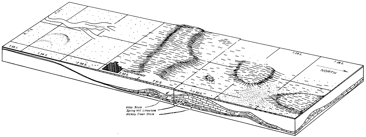
Figure 19--Hypothetical interpretation of geographic relations during deposition of Captain Creek or Stoner Limestone members. Marine banks shown as elevated areas. Localities in which predominantly calcarenites and oolites accumulated are stippled. North is toward right, south toward left of diagram. Meandering, braided scour channel is shown in southern part of area on assumption that streams flowed across broad shoal area, transporting terrestrially derived clastic material from a distant southerly source.
Back to Depositional Environment...
Kansas Geological Survey, Marine Bank Limestones of Lansing Group, Southeast Kansas
Placed on web Feb. 19, 2009; originally published in Dec. 1960.
Comments to webadmin@kgs.ku.edu
The URL for this page is http://www.kgs.ku.edu/Publications/Bulletins/142_5/fig19.html