KGS Home Library and Publications Page Catalog of Publications

Kansas Geological Survey Publications Sample


cover thumbnail from book

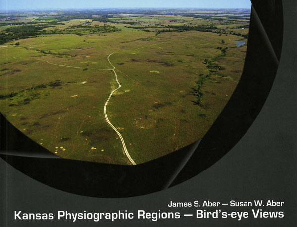
Kansas Physiographic Regions--Bird's-eye Views

by James S. Aber and Susan W. Aber

Educational Series 17
2009
76 pages, 77 full-color photos, maps, and illustrations
11" by 8" landscape pages, $12.00

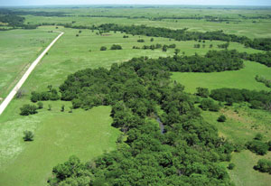
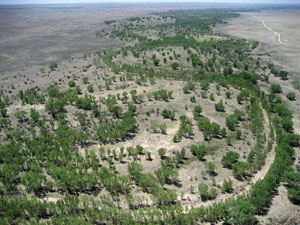
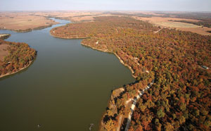
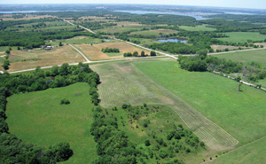
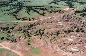
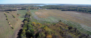
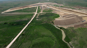
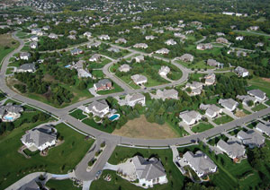
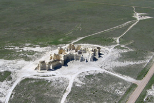
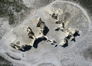
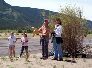
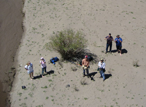
Packed with rare bird's-eye views of Kansas from border to border, this book features 60 of the authors' aerial photographs taken with a radio-controlled camera attached to a kite or blimp from the unusual distance of 100 to 500 feet off the ground--high above the trees but off limits to aircraft.

The photographs highlight the state's many physiographic regions--distinguishable from each other by differences in geology, landscapes, climate, and vegetation.

Along with the photographs, the book describes the geology and other attributes of the physiographic regions of Kansas, explaining why each region is unique and looks the way it does.

Copies are available from the Kansas Geological Survey, 1930 Constant Ave., Lawrence, KS 66047-3724, 785-864-3965, or pubsales@kgs.ku.edu and at 4150 Monroe Street, Wichita, Kansas, 67209, 316-943-2343. The cost is $12 plus shipping and handling. Inquire about shipping and handling charges and, for Kansas residents, sales tax.

Also available is an Acrobat PDF flyer (9.6 MB) on the book. A news release provides additional information.
Sample photos; click on images to view larger versions

Flint Hills in Chase County

Photo from kite; green grasslands with gravel road to left, trees following stream on right.


Cimarron River in Morton County

Photo from kite; dry country around river, dotted with trees.


Woodson County State Fishing Lake

Photo from kite; view of trees in fall color around lake.


Glaciated Uplands in Jefferson County

Photo from kite; green fields, pastures, trees, and lakes of NE Kansas.


Red Hills in Barber County

Photo from kite; red, eroded hills and gullies surrounded by green grass and brush.


Pomona Lake in Osage County

Photo from kite; fall color in trees next to harvested field, lake in background.


Construction of Horse Thief Canyon Reservoir Dam in Hodgeman County in 2009 (taken after publication of Kansas Physiographc Regions)

Photo from kite; construction site of new dam at Horse Thief Canyon.

Big Brutus, world's second largest electric shovel, in Cherokee County. (Note the standard-sized shovels at the bottom and people on road in upper left for scale)

Photo from kite; Big Brutus mining shovel with smaller steam shovels nearby.


Manhattan in Riley County

Photo from kite; modern housing development in Manhattan.


Monument Rocks in Gove County from an angle

Photo from kite; view of chalk cliffs of Monument Rocks from an angle.


Vertical view of Monument Rocks in Gove County

Photo from kite; view of chalk cliffs of Monument Rocks from directly above.


Two photos below: The Abers fly a kite with a remote controlled camera at Great Sand Dunes, Colorado, with the help of students (top photo by Greg Gantz).

Photo showing authors flying kite near stream.

Photo from kite; photo showing authors flying kite near stream.

All photographs used with permission of authors.


Kansas Geological Survey, Public Outreach Section
Placed online July 21, 2009
Comments to webadmin@kgs.ku.edu
The URL is http://www.kgs.ku.edu/Publications/Books/2009/Ed17/index.html