


Physiographic Map--Chautauqua Hills
West of the Osage Cuestas are the Chautauqua Hills, known for their thick
layers of sandstone and usually densely vegetated with oak and other timber.
During the Pennsylvanian and Permian periods, rivers and streams flowed into
the sea in this area. Sand and other sediment collected at the mouths of the
rivers, forming deltas. When the seas dried up, the sediments were buried
and formed rocks. The sands became sandstone and the muds became shale.
Uplift and erosion eventually exposed sandstone and shale outcrops at the
Earth's surface.
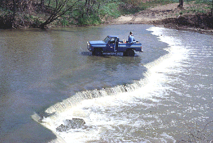
At Osro Falls in Chautauqua County, the Caney River drops over a ledge of
naturally eroded limestone.
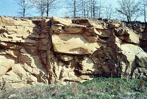
Sandstone deposited during the Pennslyvanian Period of geologic history,
about 300 million years ago, forms the Chautauqua Hills in Chautauqua County.


Kansas Geological Survey
Updated March 14, 1997
Send comments to webadmin@kgs.ku.edu
The URL for this page is http://www.kgs.ku.edu/Physio/chautauq.html